July 2024
Ny Alesund – Kongsvegen – Dronningpasset – Kronepasset – Holtedahlfonna – Viftepasset – Millarpasset Lisbetbreen Hoegdalen – Zeipendalen – Mittag Lefflerbreen – Horbyendalen – Pyramiden
I thought Northern Greenland would be my one and only high Arctic adventure. In my head I had fulfilled my mission to one day do a trek in the high Arctic. However in October 2023, just, 2 months after I returned home from Greenland, someone who read my blog post on Inglefield land contacted me. His name was Sam and he suggested to do a joined expedition somewhere in the Arctic as well. For me this proposal came very conveniently, my regular trekking companions would not be able to join this year so going together sounded like a great plan.
Everything was on the table, we discussed options varying from Yukon, to Baffin island to North Eastern Greenland. In the end we however settled for Svalbard. In Sam’s words this would give us the biggest bang for our buck. As opposed to all other high Arctic destinations, Svalbard is rather cheap and easy to get to, yet still a worthy destination with plenty of wilderness to discover.
Initially I was a bit worried about the paper work, in Greenland pretty much anything goes, but in Svalbard I feared the permits might be harder to obtain. Once we set our mind to it however quickly resolved itself. My training with riffles so far was enough to get me a fire arm permit and the individual travel permit was just a matter of filling out an online form. It looked like nothing stood in the way of our visit to Svalbard. The first ever trekking destination I had wanted to go on was now finally becoming a reality. Young me would have been quite proud. Back then I was supposed to go on an organized trip, I don’t think I could have imagined that I would one day do it as a private trip. Let alone with the ease that it was going now.
As we started planning we quickly noticed that the route options were somewhat limited. There is just 4 settlements (Ny Alesund, Pyramiden, Longyearbyen and Barentsburg) on the island providing us with 4 affordable potential starting and ending points. They are all located on somewhat of a circle around Isfjorden so there is basically just 3 route options, one of which (Longyearbyen to Barentsburg) is very short and was therefore not a real contender.
The route between Ny Alesund and Pyramiden looked to me as the most interesting one. This options was a reasonable distance and looked like it had rather varied landscapes to offer. Sam was more ambitious and wanted to do both Ny Alesund and Pyramiden and after that continue onwards from Pyramiden to Longyearbyen (and maybe even to Barentsburg). I however felt like having a shorter trip for a change because I had actually promised my girlfriend to not go on a trek in the summer for a change. Besides the trek between Pyramiden and Longyearbyen did not look like it would add a lot more to the experience, aside from distance and prestige (to which I do confess to be sensitive).
The route from Ny Alesund to Pyramiden made a lot of sense in our heads and looked, as long as we would avoid Krone breen, rather easy to execute. To our surprise though, we could not really find any information online about people who had already done it. Not a single webpage or even a sentence online was devoted to this route. We therefore ended up relying on the (very high quality) topo map and aerial imagery of the Norwegian Arctic institute to plan our trip.
The route we chose started out with a stretch of nice beach hiking after which we would need a few days to cross the main obstacle of our route, the Holtedahlfonna, ice cap. We would traverse this ice cap by contouring it’s edge. Once this was completed we would hike along the large glacial system and cross two more glaciated passes the Vifte passet and Millar passet. After this the non glaciated part of the trek would start (I really wanted to do a trek that was at least evenly split between glacial and non glacial terrain). We would traverse a few valleys and hike along the coast of Wijdefjorden to reach the start of the large Mittag-Leffer breen, from where we would finally cross over to Pyramiden itself.
The route we chose was not the shortest one possible, but I wanted to add Wijdefjorden to the itinerary in order to make sure we had a good chunk of non glacial terrain added to the trek as well. For this reason we crossed the Millar passet instead of descending Dickson dalen and reaching Pyramiden from the west.

Season
We hiked in july, the summer season. By this time all winter snow has melted and the going is generally easy. The only issue is on the larger ice caps at around 700m and higher. Due to the melt many pools are forming and you can find yourself in hip deep slush. Our trek purposely avoided long stretches of ice caps and I really recommend everyone doing a summer trek to do the same. I estimate that you can reasonably do a trip like ours from july 5 till September 30. From mid October to mid May you can probably better do the trip on Ski’s. Early October and Late May till June are probably best avoided as these transition seasons are not suitable for either foot or ski.
Getting there
There are many affordable flights from Oslo to Longyearbyen. The great thing of Svalbard is how easy and cheap it is to reach when compared to other high Arctic destinations. From Longyearbyen we booked a tour visiting Ny Alesund and Pyramiden and just informed the captain that we were only going one way. The tour to Pyramiden is twice a day and has a lot of availability, the tour to Ny Alesund is just twice per week and can only bring around 10 people. This tour should be booked well in advance.
Packing list
As all high Arctic treks, backpacks get heavy pretty fast… Of course we had to bring our riffle for polar bear protection, but this time also a flare gun as it is more or less mandated. We also brought trip wire, but ended up not using it as it was actually pretty difficult to set up in a reliable way.
There is of course nothing resembling facilities along the route so being fully self reliant in terms of food an camping gear is essential.
We brought full Alpine equipment with ice axes, crampons, screws, rope etc. However the glaciers are so well behaved and easy to traverse that one could argue to save some weight on this equipment. (For example bringing just a half sized rope, leaving the ice axe at home and bringing spikes instead of crampons.)
Videos
Day 1
Due to flight cancellation (which seems to be the norm nowadays) I had just made it in time yesterday to still be able to rent a riffle and flare gun. That was lucky as the boat bringing us to Ny Alesund departed in the morning. It was the only bookable day trip to Ny Alesund and it only departed twice a week and was fully booked til august THE NEXT YEAR…
Sam and I had packed up early in the morning and walked from the campsite to the base camp hotel in town, where we waited for our pick up. The weather was clear and sunny so we would really get to see Svalbard during this pretty long boat ride to Ny Alesund.
Once we were picked up we were transported to the harbour and boarded the boat. It was a former coast guard boat that could go with pretty amazing speed. As we exited the fjord and made our way up north we got to enjoy the many mountains and glaciers Svalbard is famous for. Especially the views of the island Prins karls Forland were very worthwhile.
The captain and tour guide seemed somewhat concerned about our plans to hike from Ny Alesund to Pyramiden as it was not really a standard trip to do. Let alone with a crew of just 2 people…

When we entered Kongsfjorden and made it to the harbour in Ny Alesund we had our lunch and packed our (immensely heavy) backpacks. The weight of our backpacks was really of the charts this trip. Last trip to Inglefield land had been pretty tough, but since we now had to carry all our stuff with 2 instead of 4, it was even beyond that. I believe we carried between 34 and 39kg. Luckily the trek started out easy, with a nice flat beach hike along the fjord eastward to the great Kongsvegen glacier.
The Krone glacier is one of the most crevassed in Svalbard, but we knew we could easily circumvent this glacier by hiking up the Kongsvegen instead.

The weather remained great the full day and aside from getting attacked by a number of nesting birds all went well. We were able to clear a little over 11km in just half a day hiking.

We decided to keep watch during the trek whenever the coast was less then 5km away. This evening this was not too hard to pull off since the weather was nice and sunny. I slept with my tent open in order for the tent not to overheat in the midnight sun.

Day 2
However nice the beach may have been, the fun was over. The end of the fjord was nearing and we had to cross a small section of moraine to make it onto the Kongsvegen glacier. We said fare well to the nice solid ground behind us as we would be on this glacial system for at least another 5 days.

We slowly but steadily hiked up the Kongsvegen. Aside from some small crevasses at the calving front the glacier was completely free of crevices, so the going was pretty straightforward.

Only at the end of the day we needed to cross a few obstacles in the form of 2 larger glacial streams. Not much further we pitched our tents near a larger glacial lake.
Day 3
We started our day with an ascend to the Droning passet. Our aerial images seemed to suggest that on the way up the ice would turn into snow. Even though this was hard to imagine when we were in camp it turned out to be pretty accurate. At around 600m high the ice glacier became a little more snowy and we roped up for the last stretch to the pass itself. We were now on the upper reaches of the Kongsvegen and had a really great view over the wide glacier and many nunataks rising up from it.
The climb to the pass was long and gradual. It was so gradual in fact that it was hard to say when exactly you were on the pass to begin with… However when on the pass (or already across it) we could see towards what we believed to be the Kronne passet. If the snow remained good like what we had seen so far we should be able to easily make it across this pass today. If we were lucky we might even be able to avoid camping in the snow.

After a somewhat monotonous climb to Krone breen we could see the 3 famous ‘crowns’ that tower above the Kongsfjorden from their rarely seen north sides. It was an impressive sight and the first major mile stone of the trek.
The Droning and Krone passet had been the two obstacles that we basically had to tackle, there was no way around them. From now on out there would be alternatives (even though is some cases far fetched alternatives) to our planned route.
From the Kronne passet we hiked down the Holmstorm breen towards the east. We knew that the Exil passet would be a shorter way, but according to the aerial imagery this route might have some more serious crevices and might pose challenges that were simply not worth the few hours that we would save.

We made it a long day, but we able to make it all the way down to the moraine where we found a remarkably flat and soft camping spot on some dried out quicksand.
Day 4
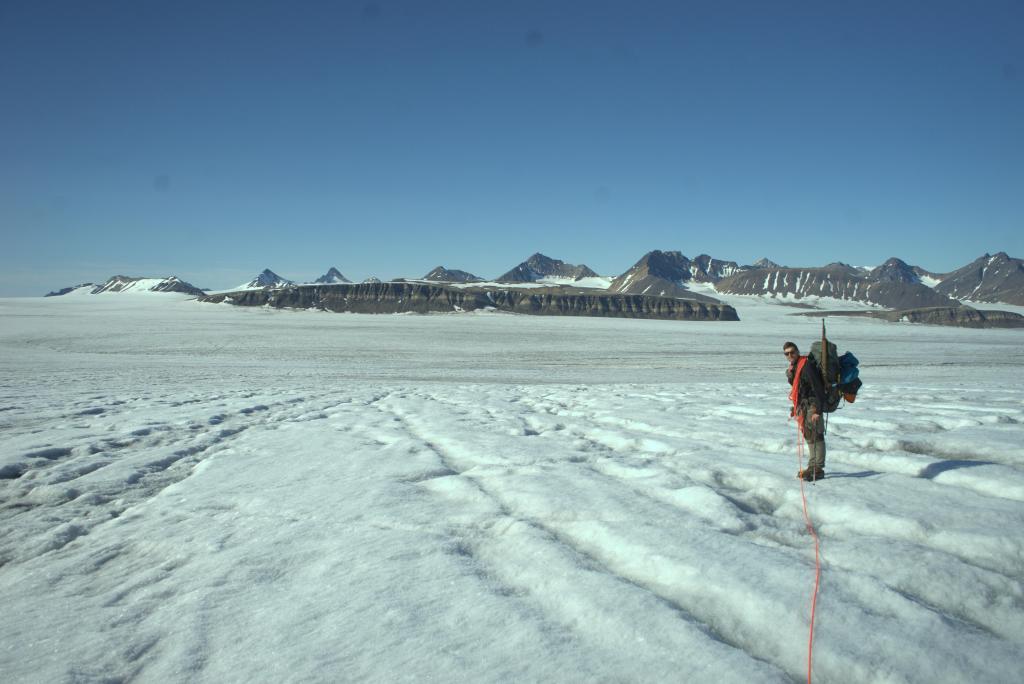
Today was the first day that the weather started to weaver. The forecast was no longer all sun and it was rather cloudy when we woke up. As we made our way up the Staur breen to get onto the main Holtedhal Fonna ice cap it got even so misty that we had to use the Garmin to navigate at times.
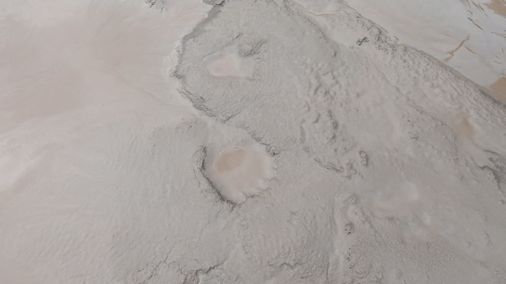
On the ice cape itself the weather suddenly cleared up and we could look over the vast ice in sunny blue skies. As it turned out we were really blessed with the weather as the ice cap was littered with large pools and puddles of water. We were in water and slush till up our knees for extended periods of time. For a few hundred meters this is no problem, but the crossing of the Holtedhal Fonna was around 8km and without this nice weather it would have been hard to keep our feet warm.

We had the good weather exactly when we needed it. When we descended down via the Orsabreen and the snow started to make way for ice again a drizzle set in. We were getting rather tired and were bend on pitching our tent on the first somewhat reasonable spot that was not pure slush. Through the clouds we could see that there was a small stretch of ice not too far from us. It felt really close and I was already imagining myself having a warm meal in my tent. The glacier was however still not quite done with us and we ran into a small creviced section (the first we had seen since the calving front.). As there was only two of us we did not want to take any chances and we had to take our sweet time to get through the last 300m of our hike.

Due to the terrain it felt like a long day, which it also was. But we had the Holtdhal Fonna behind us. This meant that the main obstacle between Ny Alesund and Pyramiden was out of the way. There was still many galciers and rivers on the way, but the ice cap now lay behind us and with that our chances of making it to Pyramiden had increased enormously.
Day 5
It was still cloudy in the morning, but we did not mind to much as we did not expect any real challenges.
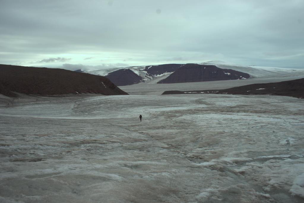
We started the day crossing the last snow patches on the glacier after half an hour the snow gave way to ice and we followed the immense ice field eastward. As we were used to by now it was the glacial streams and not crevices forming the main obstacles. We had to make our was to the north side of the glacier and kept on looking for snow bridges or jump-able locations to cross the many streams. The weather cleared up a little and we could see the small glacier east of us that we needed to climb up to reach the Vifte passet. With the ice cap behind us the trek started to feel like a hike over ice highways across the valley floors with every now and then an easy glaciated pass to get into the next side valley.

Once we got sight of Isfjorden far south of us we could start the climb up Vifte pass. It was an easy but fun climb up. To our delight there was little to no snow on the pass itself. From the top we now officially looked down into Dickson dalen, Pyramiden really started to feel close at this point. If we would take the shortest way there it would just be a matter of hiking down glacier all the way to Isfjorden and follow the coast line from there. We had however different plans. Keen to include Wijdefjorden we set up camp where the Stormerbreen and Viftebreen met. In Sam’s words ideally set up to climb Millar passet the next day.
Day 6
Slowly but steadily the weather was getting worse. Every day the clouds seemed to take more and more ground. And the clearances became less and less pronounced. It did not make the scenery in the morning any less impressive. Below the clouds a thin mist of about 2 to 4 meters high was laying over icy glacier creating an otherworldly spectacle. In Sam’s words it felt like we had just landed on another planet.

As per usual there were the glacial streams we had to cross. Lucky for us there were two nice snow bridges allowing us easy crossing points.
The final climb to the pass was a little steeper and we actually clipped on our crampons again to make the going easier. Once on Millar Passet we were back on the original route. (The going over the ice cap had been thusly miserable that we decided on the south route via the Stormerbreen, instead of the norther route via the Abrhamsenbreen). We could see the mountains of Woodfjorddalen west of us and praised ourselves lucky we cut out the ice cap crossing towards Abrhamsenbreen. The glaciers were in excellent condition, but the ice cap just sucked at this time of year.

The Millar Passet was the last glaciated pass on the program. It was now a matter of descending the glacier, making it through the moraines, climbing a small pass and then head straight south along Wijdefjorden to Pyramiden.
At least that is what we thought while descending. Once we had pitched our tents in some moraines next to the glacier I saw that my Garmin Inreach indicated that the coast line next to Wijdefjorden would be very very steep. I was suprised by this as during planning this trip using the Svalbard topo map and aerial images I had not been concerned about this. Had I overlooked such an obvious issue?
For quite a while I seriously considered backtracking over the Millar Passet. I did not want to take the risk of getting stuck. However Sam was having none of that and I realized that even if we would not be able to hike along the coast we would, if we were quick, still have enough time to go all the way back to Millar Passet and make it to Pyramiden via Dickson dalen (though it would certainly not be fun at that point).
Day 7
The first true day of poor weather. When we woke up it was not just a drizzle, it was actual rain and it went on for all some time. Only late in the evening, or actually night at that point the rain stopped.
In the rain and by times rather thick mist we descended the glacier. It started out easy, but the further we went down the harder it got. The glacier made way for pesky moraines and significant rivers started to emerge from down under the glacier.
Moraines are always demotivating places to hike. It goes up and down, you have no sense of place, most rock is loose, you cannot really see where you are or what will be next. The only upside was that in contrast to Himalayan glaciers these high arctic glaciers tend to have very short moraines. So we knew that even though it sucked for the moment we would make it out of the moraine labyrinth in hours and not days.
The most first nasty obstacles were the rivers coming out from under the glacier in rather steep icy and rocky terrain. The final nasty obstacle was a major side river that we had to wade through. We bailed on the first location where we tried to cross due to the quick sand. This was a smart thing to do. I can only imagine the nightmare of being swept under by the water with my feet stuck in the river bed.
Once across the moraines became more friendly and flattened out. Due to the constant rain and river crossing it was however still cold.
After quite some hours of hard work we finally made it out of the moraines and entered the green valley of Vestfjordalen. At last we were off the ice. This was the second stage of the trek that I had been looking forward to. When I was young I always sought the ice, but nowadays I can really appreciate nice treks through green landscapes. Though the word green needs to be taken with a grain of salt here. There were a few plants yes, but green might be a bit of an overstatement. It was however clearly a place that was, compared to what we had seen thus far, friendly to life. It also was not long before we spotted the first Caribou.

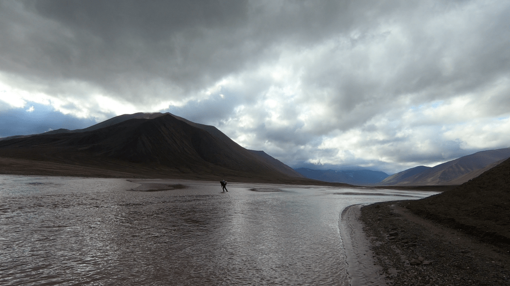
according to the map we should be at about the middle point of the valley and the valley floor should be covered by a large braided river. However the water was so high that the braides had just become one large river covering the entire valley floor. It was like we were already hiking along the fjord…
With the weather rather miserable and us being keen to see whether the coast line would be walk able we decided to press on, even though this point was clearly a natural place to set up camp. Had I not been worried about the coast line I would definitely have set up camp. Even though I had asked my sister to check out the map and photos at the location I was worried about and she had responded that it looked doable, I was still not at ease.
We pressed on over a small unnamed pass that would take us to Hoegdalen. We were tired but hiked swiftly. We were just making progress at this point. On the way up we came across a glacier that was a bit bigger than I had imagined, but thanks to the terrain layout we could quite easily cross the stream emerging from it. At this point we were so wet that another stream crossing barely felt like getting much wetter at this point…
The pass itself was very flattened out, but we knew that the first section of the descend would be the tricky part. It was a rather steep drop covered by a snow field. Had we needed to descend via the snow field we would have needed an anchor, but we could use the rocks east of the snow field to slowly climb down.
Once all the way down at Hoegdalen we set up camp. It was quite late at this point and the rain finally stopped. The last two obstacles that needed to be taken to reach Zeipendalen were now close. We already did the descend from the pass, the river looked powerful but doable and tomorrow we would find out what the coast line would look like. After Zeipendalen there would certainly be other obstacles, but at that point we had multiple route options again that did not involve multi day backtracking.
We were pretty tired and made the questionable decision to just go to sleep without someone on polar bear watch.
Day 8
The weather was improving again. Maybe yesterday would remain the worst day… With good visibility navigating tough terrain would be a lot easier.
We started out by crossing the river, we were camped at the confluence of 2 major streams with the main Hoegdalen river. So we figured it would be a good place to give it a go.

Once across we made it to the coast of WijdeFjorden over the flat grassy terrain in no time. The mountains terminating in the fjord already looked way less steep then my Garmin indicated and I started to realize that I had worried for nothing. After hiking 20 minutes along the fjord I knew for sure that the contour lines on the Garmin we just rubbish and that there was really nothing to worry about. Hell, not only could we easily hike along the fjord, we could have easily climbed the mountain itself…
With this worry out of the way it looked like we would really end this trek in record speed. What I estimated to be a 14 day trek would just be a 10 day trek (and even 1 day less than that as it would turn out). It’s not often that I complete a trek ahead of schedule, usually things always take longer… But aside from a very small stretch on the Holtefonna ice cap and a bit moraines after the Lisbetbreen the terrain had been really good.
We continued along the coastline of Wijdefjorden. For the first time since we had gotten of the ice the weather was good again and we were immediately rewarded with nice views. The eastern coast of Wijdefjorden is quite spectacular with steep cliffs and beautiful glaciers. The view over the green mountains in Zeipendalen were also a welcome change in scenery. Stealing the show however was the impressive Mittag Lefferbreen. An enormous glacier front of about 5km tumbling down from the Lomonosovfonna ice cap into wijdefjorden. It might be less famous then the Kongsbreen, but I think I liked it even more.
When crossing the Zeipendalen river I got a taste of what it was like to be swept away by a river with your feet stuck in quicksand, but luckily the Zeipendalen river was just a rather minor river leaving it at just a taste.

Our final destination of the day was a hut that should be located somewhere along the coastline according to our map. Sam was really looking forward to hijack it for a nice night without polar bear watch. Once we arrived there the door was however thoroughly locked 😦
I was too happy that my worries regarding the steep coastline had been unfounded to be disappointed by the locked door. The nice weather and great views over the Mittag Lefferbreen also really helped. We even got to see a small calving event.
Day 9
Sam and I had different ideas for today. I wanted to climb along the Mittag Lefferbreen till under the pass and cross the next day. Sam had his eyes on the price and wanted to push all the way to Pyramiden. Pyramiden was still over 30km crows flight away. A very respectable distance in rough terrain. On the other hand the weather was good and we could enjoy 24h of daylight.
But first things first, we had to make it onto the Mittag Lefferbreen. And of course there was a pesky river and nasty moraines in the way. I had hoped or dreamed that we could hike along the beach, cross the river near the shore and make it to the ice completely bypassing the moraines. Unfortunately the river was too powerful even at it’s broadest points at sea level crossing did not look very tempting. So into the moraines we went.
The moraines were not too bad and we could climb out of them pretty soon onto the slopes that would lead us to the pass. By the time we made it to the slopes it was already evening and we had very beautiful light over the impressive glacier. The glacial ice wall along the river of about 50 meters high was especially impressive.

With the moraines behind us the going was easy and we settled on pushing all the way to Pyramiden where we figured we would arrive somewhere between 1:30am and 2:30am.
We ate some dinner overlooking the glacier and went on. At the point we got to the side valley where we needed to start the final ascend we got to an interesting open meadow. It felt like a strange hospitable oasis tucked away a large and unforgiving glacier. It would have been a good camping spot, but the thought of needing to stand on polar bear watch again made it a lot less appealing. Polar bears are known to cross from Wijdefjorden to Isfjorden via this route so I did not feel like chancing it.
We followed the gentle slope up into the side valley and quickly we stumbled on the moraines of the tiny glacier that was the gateway to the final pass. However tiny the glacier looked on the map it had a larger moraine field then I had expected… It took around 15 minutes to get through and once on the ice we could clearly see the final pass. It would be an easy approach via the glacier after which the map suggested a steep scree descend.

On top of the pass the descend looked indeed steep but manageable. With Pyramiden just 10km away it felt like we already made it. The impressive Mittag Lefferbreen in the midnight sun definitely looked like a worthy goodbye view.
Day 10
With midnight in the rear mirror I suppose we should be calling it day 10 at this point…
We descended the scree slopes swiftly. By times over some snow patches and by times over loose scree. By this time we started to feel tired but the thought of Pyramiden kept our phase up.
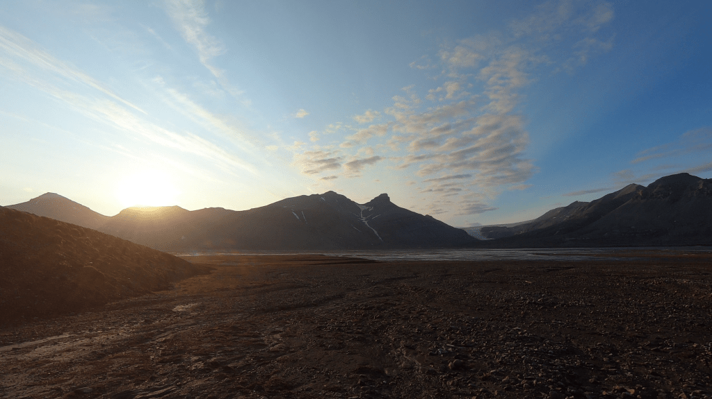
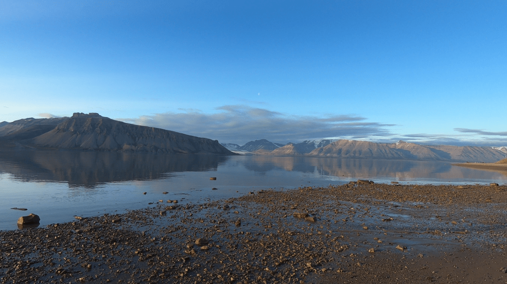
Once down we arrived in Horbyedalen. A broad valley coverd by old and overgrown moraines. It was here that we crossed our final river and made it back to the Isfjorden coast line. The weather was stunning and silent. We could not have wished for a nicer last day. The silent waters of Isfjorden reflected the surrounding mountains perfectly.

It was not long before we stumbled upon a research station populated with Poles and Czechs. Someone was still awake and offered us some tea and (most importantly) candy. We decided that we would count it as safe enough and pitched our tents next to the station. I guess our trek was not a school book example of how to deal with polar bear risk, but there is just so much you can reasonable do with two people on foot…
After a delightful night sleep we finished our trek to Pyramiden where we waited for our boat to arrive. My booking was for 5 days later, but as it was a big boat the captain had no problem rebooking us free of charge.
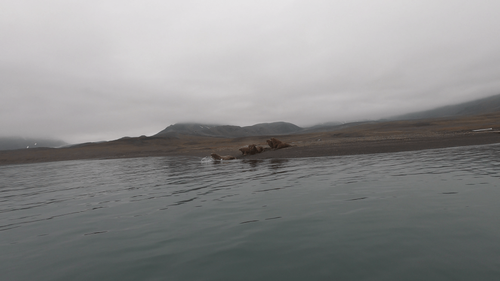
Arriving a solid 5 days early in Longyearbyen I decided to rebook my Walrus safari and flight to an earlier date. The alternative would have been to spent the time hiking to Barentburg, but we both felt it would not have added that much to the trip. By this time we had crossed a major section of the island and the hike to Barentsburg sounded more like busy work then something that would really offer something new.