August 2019
Tasiusaq – Tupasaat – Qingudalen – Klosterdalen – ice cap – Isortup Qoorua – Qolortorsuaq – Timerliit – Igaliku
My first trek ever was an organised trek in Greenland. Back then I dreamt of exploring this vast wilderness independently. I remember looking over the ice cap from the plane when landing in Kullusuk. I wondered whether and how it would be possible to climb the ice cap itself. What seemed like a far and maybe even unrealistic dream then, was now, 8 years later, about to happen.
I started planning for this trip in September 2018. I relatively quickly selected the far south of Greenland as my destination. It was relatively easily accessible, extremely varied, very mountainous and most importantly it allowed for a good one way trek over the ice cap.
The idea was to travel to Tassiusaq and hike up the peninsula along the Tassermiut fjord towards the ice cap. This peninsula promised amazing mountains (some of Greenland’s best) with perpendicular cliffs. We would take our time to enjoy the scenery and take the long way round. This meant venturing inland and crossing some passes before heading to the Sermitsiaq glacier. Hereafter we were to climb up the Sermitsiaq glacier up to a 1700m high pass granting access to the southern most tip of the ice cap. From this pass we would have an absolutely amazing view over countless steep peaks to the south and the enormous ice cap to the north. Next we were to follow the ice cap northbound and get off near Igaliku. A long but amazing walk through a white desert with steep Nunataks rising up from the ice and immense glaciers flowing down to the sea below. Another week of easy hiking should then bring us to Igaliku, the endpoint of our trek.
The Tassermiut fjord and Igaliku region are classic trekking destinations,. They are in no way crowded and you are unlikely to meet a fellow trekker, but they are relatively well documented online. I could however find no written record of someone tying a trek in both these regions together by a crossing of the ice cap. This meant that a few satellite images were all we had to prepare ourselves. We were in for an adventure!
It turned out to be challenging but possible. The most dangerous part of the trek were in my opinion the crevices in the upper Sermitsiaq and right before the pass.

Videos
How to get there
South Greenland is relatively accessible, but mind the word relatively here. It still takes you both a flight from Copenhagen to Narsarsuaq and then a helicopter flight to Nanortalik and a charter boat to reach the start of this trek. Boat chartering is quite expensive, expect to pay at least 250 euros for a fare to Tasiusaq and 400 for Klosterdalen. If you have enough time you can probably find some one going to Tasiusaq that can take you there for free.
Season
Trekking along the fjords and in the valleys isvery pleasant from mid-June to mid-September. Temperatures never drop below freezing at this time of year and during the day it can be as much as 15 degrees.
The downside of this season is that you have significantly more crevice risk once on the ice. Many crevices are laying open and the snow bridges are less stable.
Alternatives
There are more variations of this trek possible then I can even begin to mention. The only really fixed point on this trek is the pass you need to cross to get on the ice cap from Tassermiut fjord. There is not really a logical alternative for this pass. But for the rest there are many options out there to make a crossing from Tassiusaq to Igaliku.
In case you want to trek from Tassiusaq to Igaliku, but do not wish to deal with alpine terrain you could consider taking a flotation device and cross the Tassermiut and Sondere Sermilik fjords by paddling. This looked very doable and has been done a couple of times before.
Packing list
There are no facilities along the trek. Only in the last 3 days we came along a few farms where you will be able to get some food or fuel (no official shop though). Full self-reliance is essential.
A satellite phone should be carried as this trek takes you far away from civilization. In the middle of the trek it will you 5 days of walking to reach a settlement, even if you make haste.
An ice axe, harness and rope are needed on the ice. You are almost bound to fall in a crevice somewhere along the way so make sure you have everything you need to pull someone back out. You could shave off crampons as most of the sections are either snowy or sandy giving enough grip.
Day 1
We had traveled to Nanortalik by Helicopter from Narsarsuaq the day before. The weather had delayed us by a full day, but we were happy that our local contact was able to meet us at the landing site anyway. Our local contact Henrik, looked more Inuit than I had thought purely based on his name. We agreed that he would drop us off at Tassiusaq tommorrow morning.
Now it was morning and I did not feel like going at all. It had stormed and rained the whole night. The clapping canvas of our tents had made it difficult to sleep.
I got a text message from Henrik telling me that the wind was too strong to head out right now. I did not care waiting for a bit, we had plenty of time and the rain was still poring down on us. I was fine with waiting, more then fine actually. I did not get why Henrik was in such a hurry to drop us off anyway.
The rain kept on going but the wind was getting less strong. Henrik drove by to tell us that he intended to bring us to Tassiusaq in an hour. ‘Allright we will get ready’ I yelled from my tent even though I was not at all looking forward packing up in the rain.
We packed our stuff and in a hurry, purchased some petrol and last minute toilet paper. Soon after we were in the damp cabin of the boat. The wind was less intense but the waves still threw the boat up and down a few times. The rain slamming on the windows made me wander if I was going to enjoy this trek. ‘Not a good start’ Henrik remarked adding that this was the first serious rain in almost 2 months.
We fare a bit beyond Tassiusaq to shave of some time. Once on shore we immediately set course for the nearby farm to shelter for the rain. We slowly ate some breakfast in the barn. The rain got less and when we got out it was actually dry. Kind of. We hiked to the Tassersuaq lake and set up our camp there. I know, not a very ambitious distance. Adriaan had a bad knee, the weather was not so great and it was our first day anyway, so sew me.
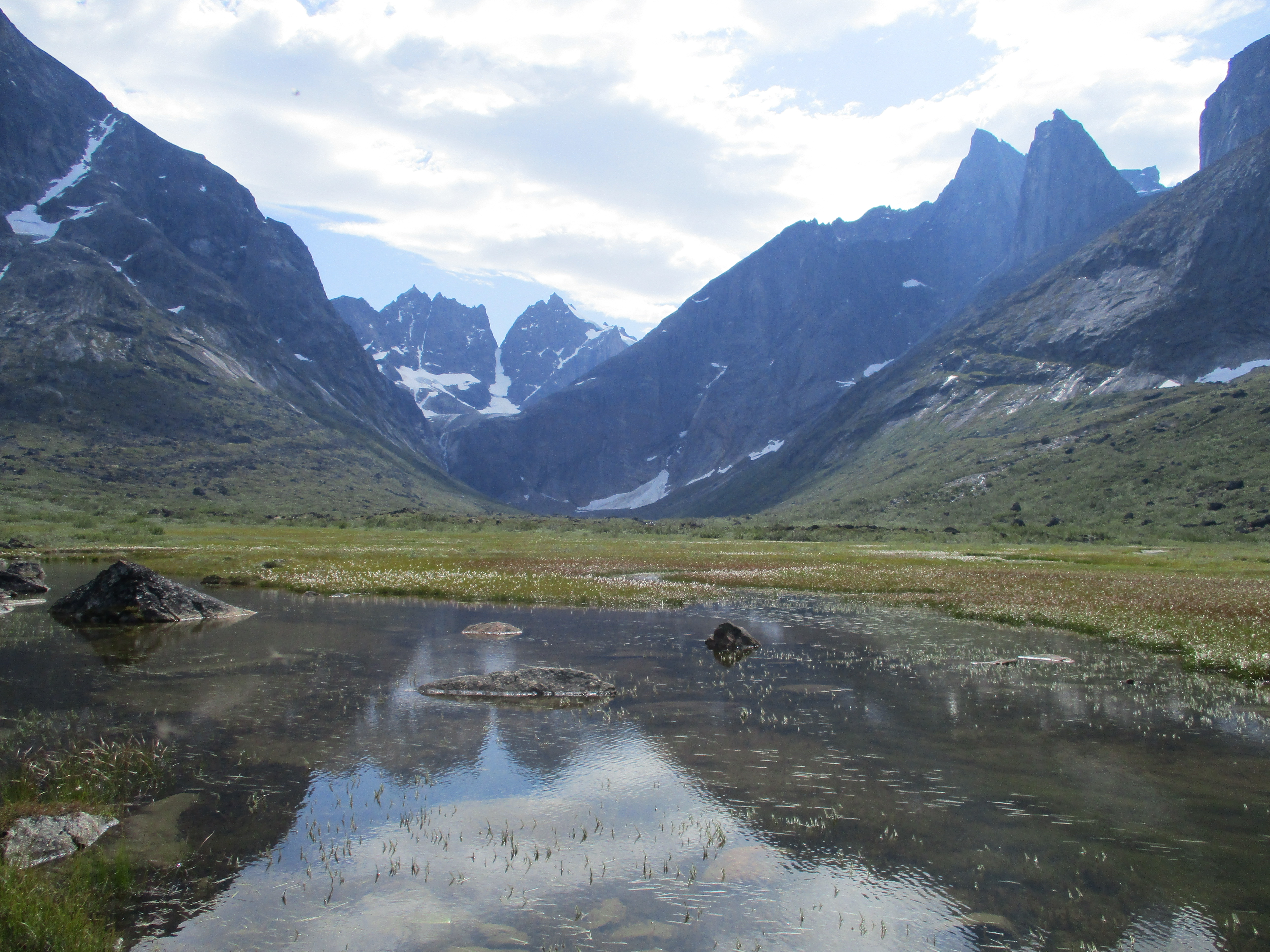
We hung and slept in our tent for a while. When I got out again in the evening I was very surprised to see that the weather had completely cleared. I really had not expected that this morning. In the distance I could see a steep rocky ridge terminating in the lake. That would be our main obstacle tomorrow.

Day 2
We made our way along the lake shore. The ridge terminating in the lake came rapidly closer. We were constantly looking at it and thinking about the best way to pass it. It seemed like we could hike around it along the shore line, but The map suggested to hike across it, this was also the suggestion that I could remember of a blog I had read over this area. Once at the foot of the hill we decided to climb all the way across to the highest saddle point.
The climb up was absolutely terrible. We had to hike op 300 steep meters through dense shrubberies. Progress was slow and it took us literally hours to climb up. All the while we could barely see a thing due to the dense vegetation. This was some of the worst bush beating I have ever done and am ever planning to do. The only one who was pleased by with the terrain was Adriaan. His knee hurt and the slow progress eased the pain a bit.
Once on top the bushes got scarce and we had an amazing view over the beautifully coloured lake. The steep mountains with yesterday’s fresh snow made the scene complete.
The way down was pretty steep but way less overgrown. We found ourselves back at the shore line in no time. Adriaan was falling behind, his knee prevented him from descending rapidly. I started to worry about his injury, if it stayed like this we would be very slow and so very vulnerable on hostile terrain. We had took some quick lunch and moved on. Hiking along the shore was quick. We primarily walked along the beach, with some boulders every now and then. At the end of the lake we crossed a very broad stream. So broad in fact that we could not even feel the current of the water.
A bit further on we camped at what would be one of our favourite camping spots. A great spot on the beach with views over the surrounding mountains and plenty of wood to build a good campfire. We ate pasta with tuna, one of the tasty meals we had bought in Nanortalik. We had only bought 4 of these ‘haute cuisine’ meals, so we would quickly be forced to start eating our instant trekking food that we had brought from home.
Day 3
We got up early as we knew our phase was, due to Adriaan’s knee, rather slow. The goal of today was to follow the stream up the Qingua valley and get as close to the pass leading to Tupassaat. We started the day by crossing the large stream. Crossing it was not difficult, but could probably not be done on narrower sections.

The bushes were not by a long shot as bad as the ones of yesterday, but still annoying. We crossed the stream over and over again to get to the lesser overgrown side of it. In sandy of rocky terrain we moved rather quick, but as soon as we had shrubs we slowed down to a crawl.
At around 11 am, it became clear that Adriaan could not go on like this. His knee hurt way more then yesterday and he could no longer walk normally. He needed an early pickup. He was probably able to sit trough the pain for another 2 or 3 days, but there was no way he could hold on another 20 days like this.
I wrote Henrik by satellite telephone to ask for a pickup in Tupassaat. In the evening he confirmed that he could pick Adriaan up 2 days from now.
We decided to hike slow but long. The strategy worked. Adriaan was in pain, but we did make it deep into the Qingua valley. We were starting to run low on Aspirin.
In the upper part of the valley we met a Danish group who warned us that the pass was more dangerous then they had though due to a very steep snow field. We did not take much notice of this warning. We continued for another hour, climbing up the boulders behind their campsite before camping ourselves. It had been a long day and we were all pretty hungry.
Day 4
Today would be another day of torture for Adriaan. The bushes were clearly behind us. Between us and the pass lay only fields filled with boulders. Not great terrain for a painful knee. The prospect of needing to climb down another 600m on the other side did not help much either.
The climb to the pass was extremely gradual. On both sides we could enjoy the steep cliffs and hanging glaciers. The weather was warm causing a lot of instability in the glaciers around us. On many occasion we saw large portions of ice and snow tumbling down.
We reached the pass with ease. The pass itself was a large boulder field with a lake in the middle. The pass was broad and made a bit of a curve, we we could not enjoy a view to both sides.
Just at the moment I was starting to wonder why that Danish group had been wining about this pass in the first place I realized that the largest obstacle was actually still in front of us. The pass may not be steep, but the lake prevented us from crossing it. We would need to find a way around this large lake. On the north side of the lake there were a couple of steep cliffs. The same thing held for the southern side. On the south side however there seemed to be a weakness near a snow field. Would this be the steep snow field that group had been talking about? According to the map we were indeed supposed to take the southern side of the lake. The norther side however still looked attractive as there only seemed to be a section of about 10 meters of steep cliff that looked challenging to traverse.
Adriaan was still climbing up towards the pass. I left my backpack behind to explore what would be the best route. I started with inspecting the northern side. There was indeed 5 meters of rock that was not easy to get across. Swimming might be an option here but it did not look very attractive. The snowfield on the other side did not look too bad and encouraged by the information on the map and the Danish group I believed that the route over the snowfield was probably the best one.
I went back to inform the rest. We unpacked our ice axes and crampons and went to the snow field. I would climb ahead to bring the rope up allowing the rest to follow using a fixed rope. When climbing up I realized that it was steeper then it had looked. Climbing this 70 degrees snow with my heavy backpack was quite scary. Once up I yelled down that this was not such a great route to follow. The others inspected some alternative routes to climb up, but nothing better came up. After a while I suggested that they gave the north side of the lake a shot. I would continue my way along the lake meeting them at the point that the cliffs got steep.
I hiked along the lake crossing some steep boulders and cliffs on the way. I left my backpack at the end of the lake so that I could hike down the northern shore more easily. Once I got to the 10 meter section that had put me off last time I realized that swimming was not needed. Having been on the other side this looked way better than I had remembered it. It was not trivial, but this part of rock could be climbed without too much effort and very little danger.
To our surprise we all got passed the lake without getting wet. Despite of what many people probably do here, the north side of the lake is without question the easier option of the two.
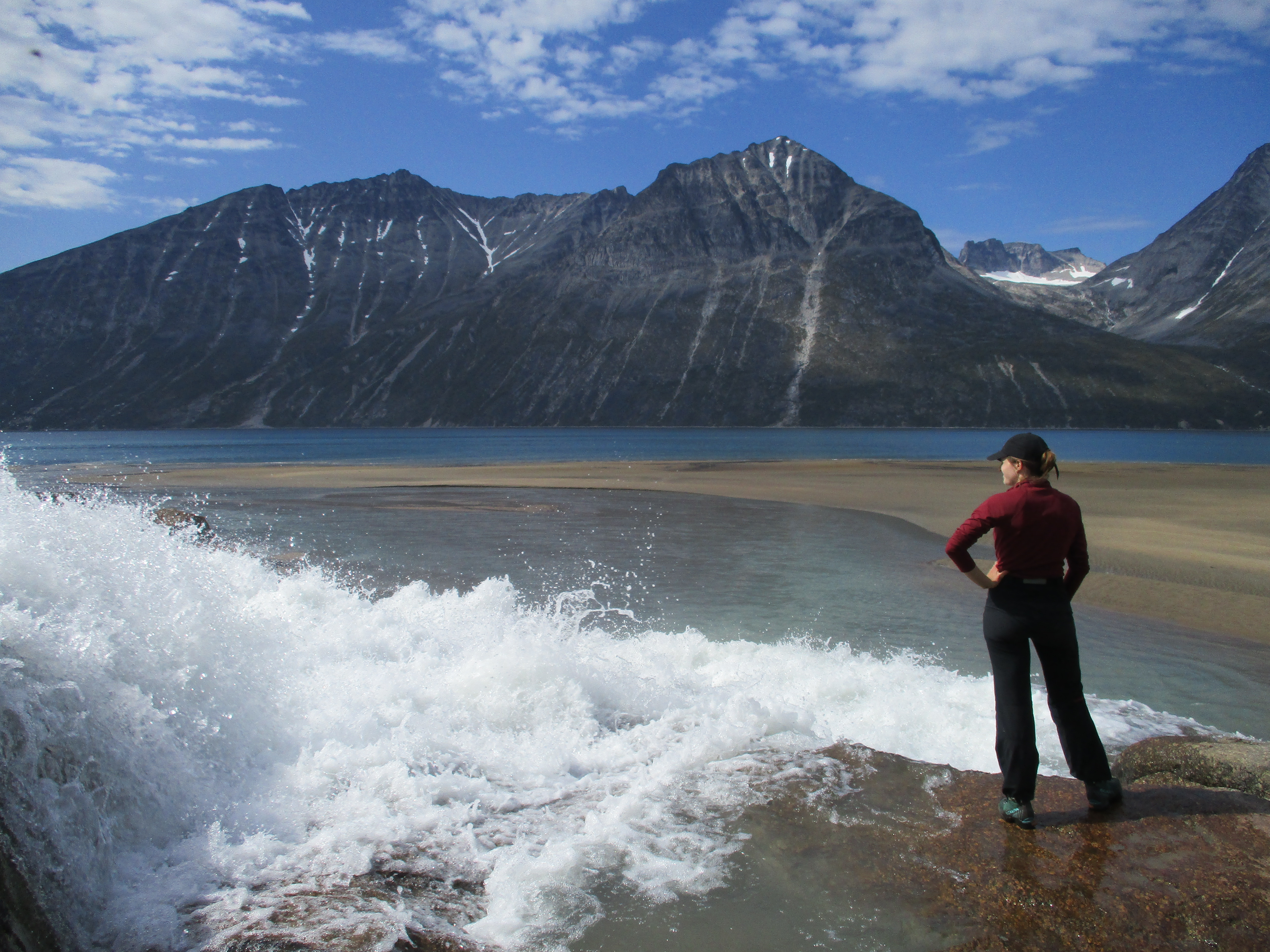
Before we started descending we ate some noodles for lunch and Adriaan even dared to take a swim in the lake. A short swim as the water was stone cold.
The descend was straightforward but rather fierce. At every step I was thinking about how bad Adriaan’s knee must be hurting.
When the terrain started to flatten out and the boulders made way for a large meadow we considered camping. We however pushed a bit further on. Tomorrow Adriaan would be picked up by Henrik at around 10 am and I did not want to be late. I actually liked to go all the way down to the fjord, but that was simply not doable with the state Adraan’s knee was in.
Day 5
The fjord was already in sight, but we stood up early anyway as we did not know how fast Adriaan could go and missing Henrik would be terrible. We skipped breakfast and planned to make up for it once waiting at the fjord for Henrik.
It was a very easy hike down. Just as we were descending a sailing ship was gliding into the fjord and anchored. For a moment I thought it was Henrik, but no, this was definitely a sailing ship.
Once down we had our last breakfast together. All the while we were terrorized by mosquitoes, which had been steadily gaining in number over the last few days,. There were so many of them that my sister could clap blindly in the air and 3 or more flies would fall dead in front of her. A good thing we had brought mosquitoes nets. This was getting unbearable.
Henrik was an hour early. For the second time he surprised me with the speed in which he got things done.
The water was too shallow for Henrik to reach the shore, but the an older man on board of the sailing ship was kind enough to row up and down a few times up and down to bring us from the shore to Henrik’s boat. As the man was rowing me across I found out that it was a British ship with 3 people aboard. They had sailed here in 17 days from their home country. This way of traveling caught my imagination for a while. When I grow old I would trade exploring the world on foot for exploring it by sailing I tought.
I agreed with Henrik that he would bring our food drop to Klosterdalen 3 days from now. From there he would pick us up and bring us all the way to Sermitsiaq by boat. This was only 8km, but would shave off a few days of trekking as hiking along the shore would be difficult or impossible forcing us over a pass further inland.
I said goodbye to Adriaan who was despite of his early departure in good spirit. The British man rowed me back to the shore. As I met up again with Roos and Eefke we looked at the boat as it was speeding back to Aapitaloq. It would be at least another 2 weeks before we would meet up again.
After this sad goodby we started to hike up valley towards the pass that would bring us to Klosterdalen. The lower part of the valley we quite confusing with enormous boulders, lakes and streams constantly blocking our way forcing us to constantly reroute.

After a few hours we met the British folk from the boat again. They were also making their way towards the pass as a return hike. They had tried to climb up the ice cap the year before and informed us about a new route that was not shown on the map but had been recommended by their guide back then. I was happy to get this information and made sure I understood them right.
We made it a slow day as we had plenty of time now that Henrik would bring us higher up in the Tassermiut fjord by boat. We relaxed in the sun and enjoyed the amazing mountain scenery around us. We set up camp at a large lake in the upper part of the valley.

Day 6
We got on our way pretty late today. We had plenty of time and without the ticking time bomb called Adriaan, there was not much to worry about. Without Adriaan our phase was significantly faster. As a matter of fact we needed to be careful not to go too fast as Henrik would only get to Klosterdalen there 3 days from now.
We slowly climbed to the pass over small boulders and rock. The surrounding made out of rock, ice and water was very picturesque. The water was by times flowing over the rocks forming small streams that would be amazing to float on. Above us hung a number of glaciers with waterfalls poring down from under them over the steeps cliffs. The wind was strong and some waterfalls got swept away by it before ever reaching the ground.
On the pass itself lay a large lake which we could (for a change) easily pass on it’s norther side. It was an annoying long way though. It took us a full hour to pass the boulders along he lake shore. By times there was not much sense op progression.
Just like the pass before this pass was broad and made a bend as well, robbing us from having a view to both sides. Once we fot our first glimpse into Klosterdalen, the Tupassaat valley was long gone. We pitched our tent right under the pass with a great view over Klosterdalen. The famous mount Ketil had the main role. This arctic brother of Half Dome rises steep up from the valley with nearly vertical cliffs. In the distance we could already see the Tassermiut fjord.

Today the good food we had bought in Nanortalik had officially run out. We had the first coucous meal this evening. It would be couscous for dinner from now on. We enjoyed it , but I wasn’t so sure whether I still would 2 weeks from now.
Day 7
With the Tassermiut fjord already in sight it promised to be an easy day. We descended through some steeper terrain to the flat swampy meadows that we saw below. After the descend came a bit of bush beating after which we were on the valley floor. The mountains around Klosterdalen are near vertical, but the valley itself if almost completely flat and one big swamp. The hike through the swamp to the fjord was easy and very pleasant. We could follow a small trail along the meandering stream. The reflections of the mountains and the blooming cotton flowers in the pools and streams made the scenery complete.
Once at the coast we met a young German chemistry student who trekked in the opposite direction. We hung out with him the rest of the day and invited him to join us on the boat the next day. This way he could get some of the views around Sermitsiaq as well. Henrik could simply drop him off here again afterwards.
We pitched our tent above the beach. It was an amazing spot. We had everything we could possilby wish for. A sweeping waterfal, a beach, a fjord, mountains and an immense glacier in the distance at the end of the fjord. On top of this there were some old remains of a viking monastery that was once here. It took some effort to localize the spot as it was really a ruin of a ruin of a ruin of what might indeed have been once a tiny monastery. Still a nice add on though!
My sister even went as far as calling it the most beautiful spot she has visited. She did have a point, it might not be a place of extremes, but the overall picture at this place had something very romantic over it.
Eefke had dropped her camera in the waterfall undercutting the joy a bit, luckily she still had her GoPro and I my own camera. We searched the beach at low tie in the dark, but could not recover it.
Day 8
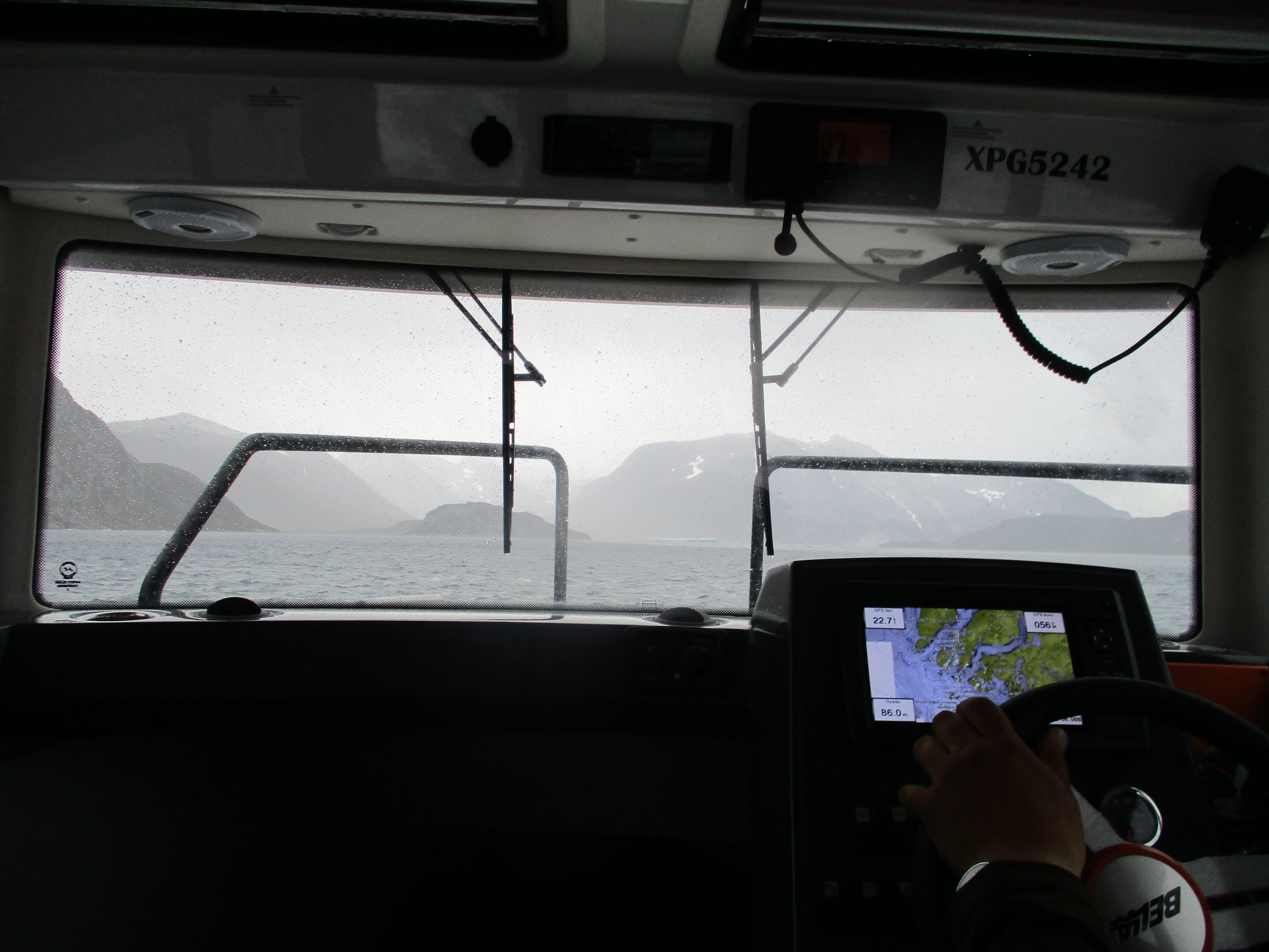
Henrik had not texted me with his ETA so in the morning we were simply hanging around the tent hoping he had not forgotten us. At 10 am we heard the sound of a moter over the fjord rapidly getting closer. He had not forgotten us! There he was! Once again very timely. I was happy to have Henrik as our operator. Without wanting to come across as too much of a racist, timely charters are quite scarce in Greenland.
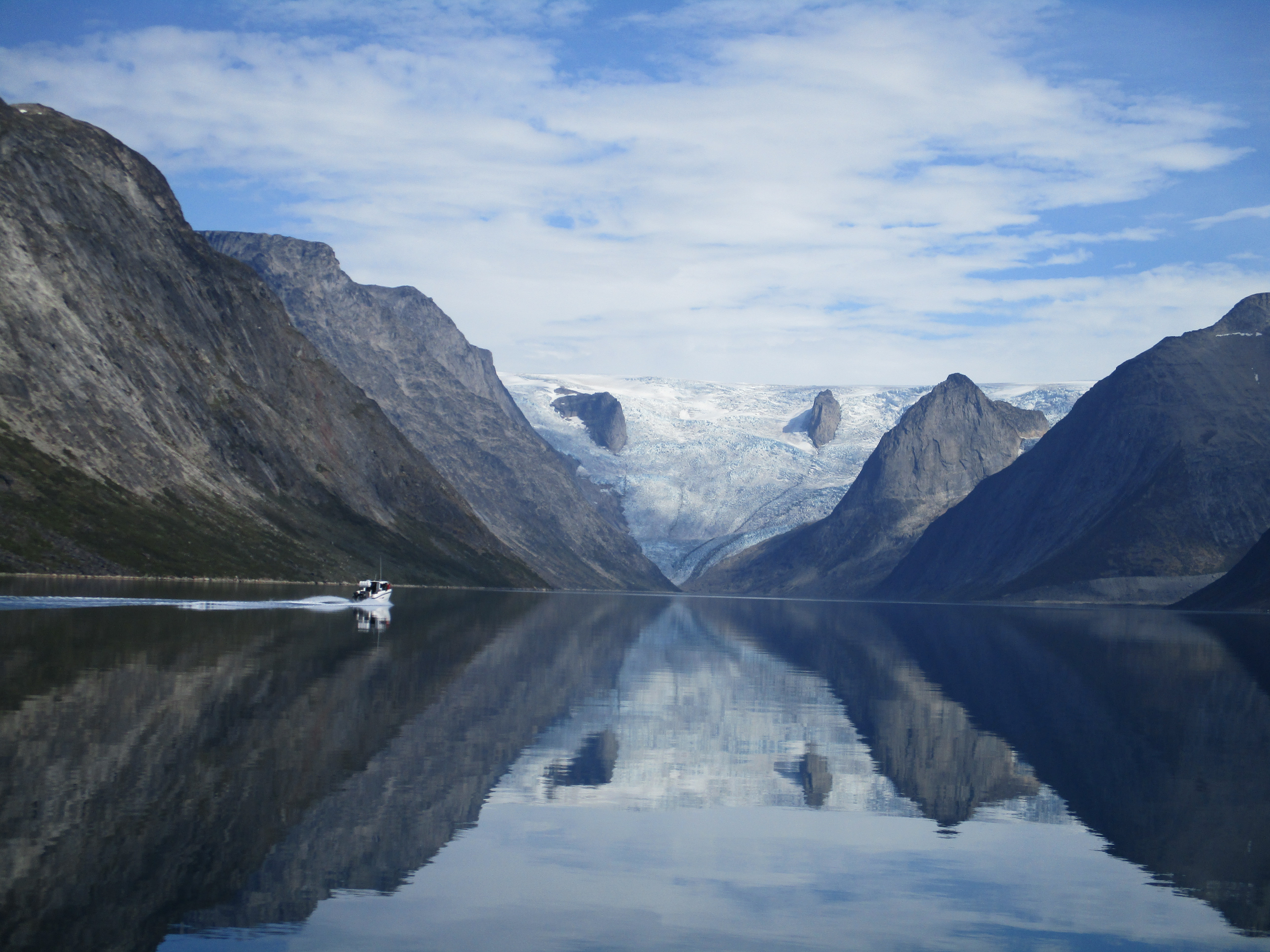
To our delight Henrik had brought Adriaan with him so he could enjoy the boat trip as well. It was good to see him again! The weather was great and the fjord a perfect mirror for the surrounding mountains. We rapidly approached the massive Sermeq glacier at the end of the fjord. When I say massive I truely mean massive. This glacier was a vertical wall of 1700 meters worth of ice. It was almost unbelievable (and pretty intimidating) that we would be hiking on the top of this very glacier just 3 days from now.
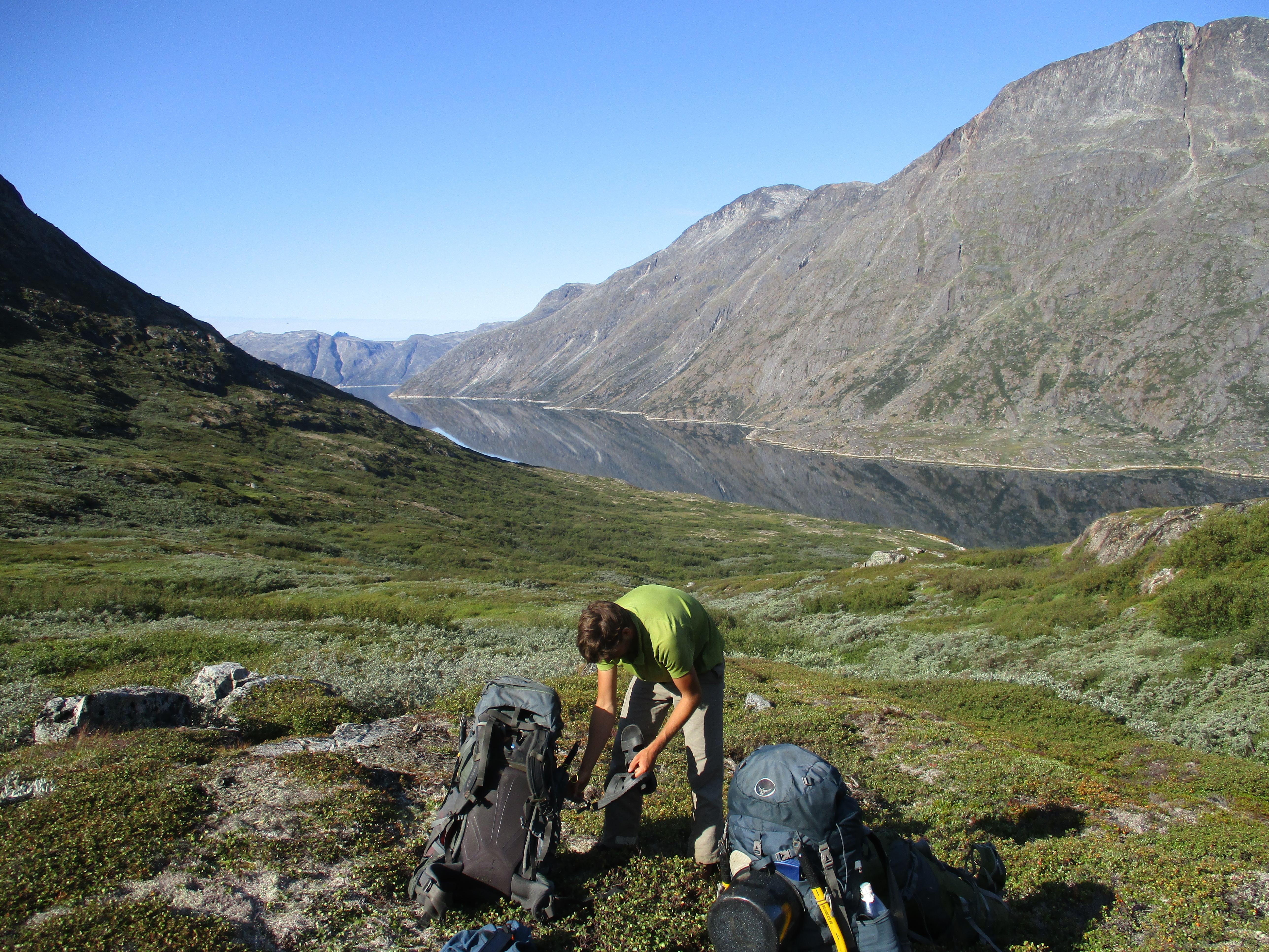
Adriaan had brought some candy to take with us. He even had bought us a beer that we could drink together. Unfortunately Henrik was an efficient man, such an efficient man that he had combined this charter with a family trip that his wife had demanded the week before. Due to this there was not much time and we were dropped of at Sermitsiaq in somewhat of a hurry. In no time we stood ashore again with an additional 25kg of food. It was a good thing that I noticed in the last minute that our fuel was missing. Had I been 1 minute later Henrik would already have been gone leaving us with too few fuel to make it across the ice cap.
We drank our beer on the beach. It was a strange feeling to be on our own again this quickly. After finishing our beers we threw the bottles in the fjord, ashamed of our litering we joked a bit about it.
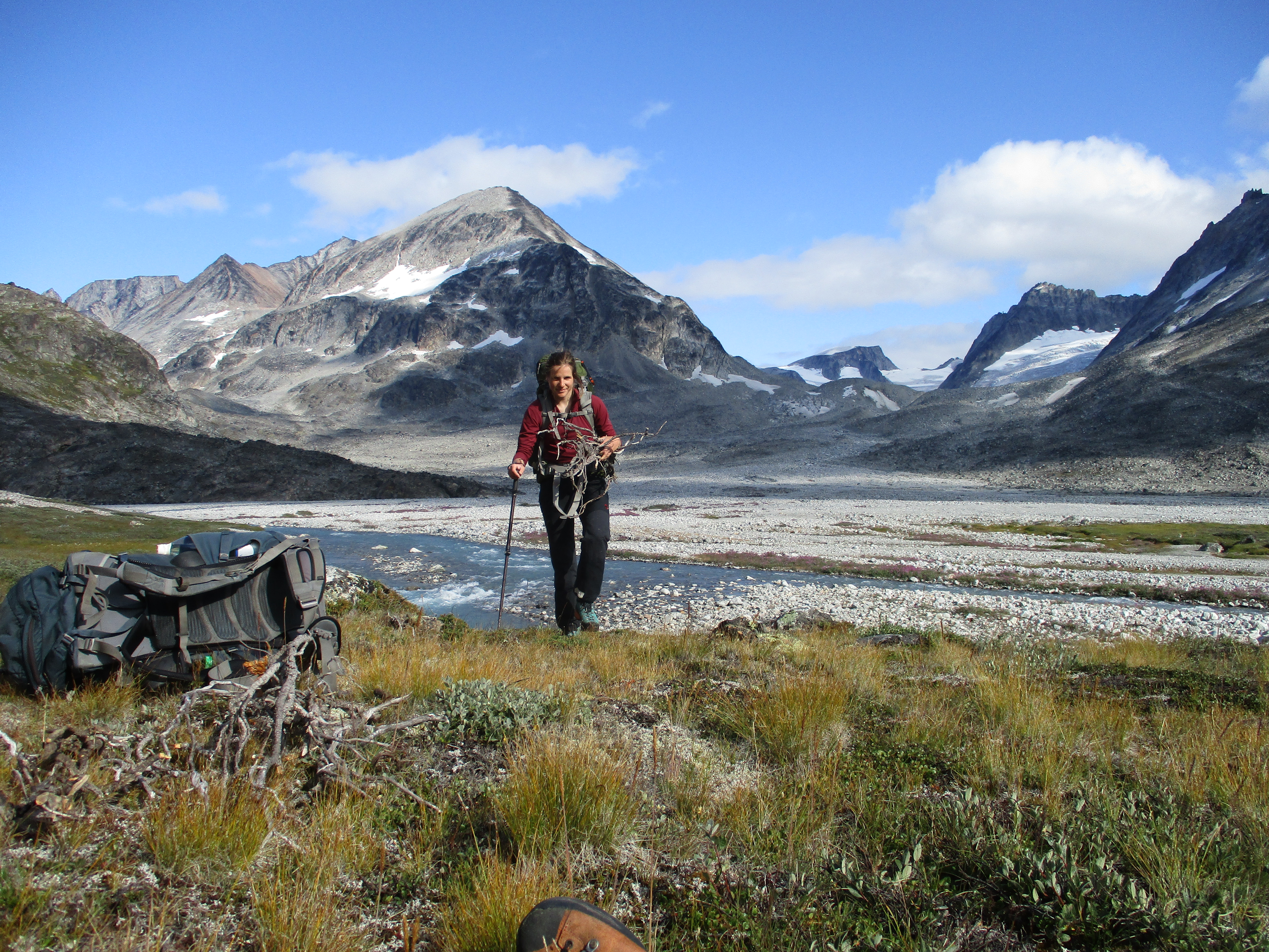
We stuffed our backpacks with all the new supplies. It barely fitted. Our packs were heavier then they had ever been. When we took them on our back my sister compared herself with the rook in a chess game. Only able to move in long straight lines. Unfortunately there would be few straight lines ahead. A thing that became quikcly clear when we got first sight of the waterfall where we needed to climb up. It had already looked pretty steep on the map, but the British folk had asured us that you could climb up near the waterfall somewhere The cliffs left of the waterfall indeed looked climbable, but just barely. Hopefully we would be able to pull it off with our 25kg+ backpacks.
As we got closer the terain around the waterfall did not look necessarily easier. We decided to drop our packs and explore ahead without to constant torture of carying these things. Eefke stayed behind to get some water from the nearby river.
It was very steep up. But as most of the slope was covered by grass of loos scree it did not take too much trouble to make our way up. After a long climb we reached a broad and long steep snowfield, the crux of the route. We climbed all the way up over the scree along the snowfield to cross it at it’s highest point where it seemed the least steep. Once on top we were bussy for 15 minutes to kick steps in the snow in order to allow an easy crossing when we got back with our backpacks. I think this snowfield was not here the year before otherwise those British people must have had said something about it.
We went down to get our packs. The way down was quick, we could almost ski over the loose scree. It was demotivating though as we knew we had to climb up with our overweight backpacks again.
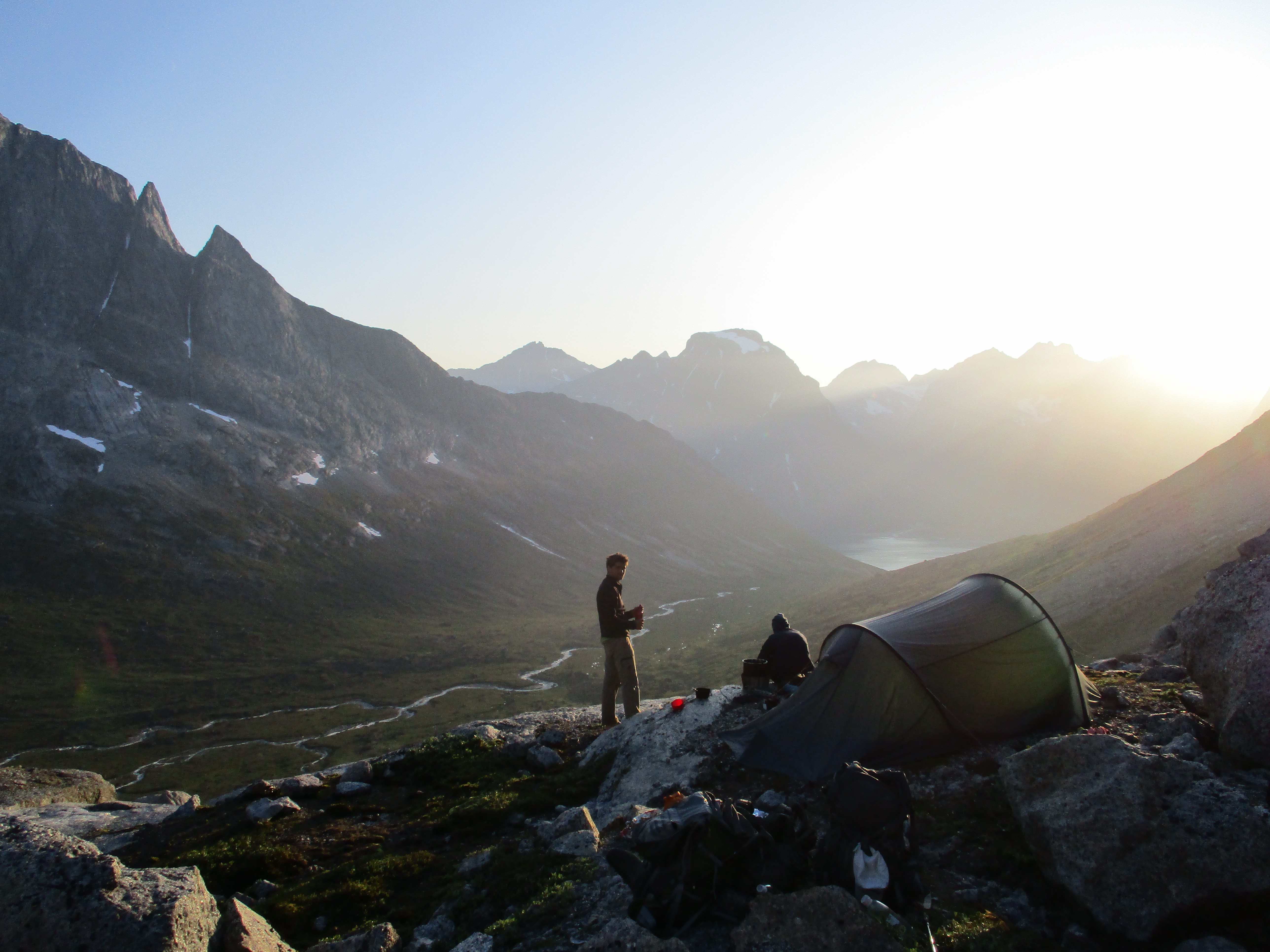
It took some sweat and effort, but in the end we and our backpack got safe and well to the top of the waterfall. There was a small lake east of us. A glacier began behind the lake. This would be the last ice free camping spot for quite some time to come.
We stood on a plateau with the waterfall tumbling down to the valley over the cliffs right in front of us. At sundown the views were simply great.
Day 9
The British folk we met earlier had warned us for weak snow bridges so we got up insanely early. At the ungodly hour of 3 am we got up. It was still dark, but we knew the sun would rise quarter to 4. We packed up and when we felt that the light was on it’s way we hid the road.
We scrambled over loose rocks and boulders along the lake. A hard job with our heavy backs in the dark. Once we passed the lake we set our foot on the first ice. The ice began hesitantly, first interspersed with large boulders and scree, but gradually the rock made way for the ice. In just about 15 minutes hiking the terrain had fully transitioned to white glacier. For the coming days we would walk on nothing else.
We followed the gradually ascending glacier up following the left turn it made towards the pass. After about 30 minutes the glacier became very creviced and we needed to slalom our way across. Overall the snow was strong, the British folk had been exaggerating a little. There was only one shallow snow bridge raised my heartbeat a bit.

After the crevices we could see the pass west of us. The snow looked good all the way till the pass. Only just under the pass there seemed to be 3 large crevices, but for the rest the snow was perfect. The sun was rising over the ever more peaks we could see.

It was an easy climb till right under the pass. In the last 50 meters however, a large crevice blocked our way. There was no way around, it covered the full length of the glacier. We would need to cross one of it’s snow bridges. None of them looked all to great. We could almost touch the rocks rising up from the ice that formed the pass itself. We had gotten way to far to turn back now, we had to find a way through.
We tried the largest snow bridge. My sister was hiking in front and carefully treat on the bridge. She had barely made the first step or she fell through the snow. It was a scary sight. She fell till her chin in through snow. Her feet hung loose, but her upper body and backpack had enough friction to keep her in position. Eefke and I held to other side of the rope. Stuck in the snow my sister could not move, we had to help her. First I tried to pull her out throwing the other end of the rope. It was of no use as the snow held her firmly in position. I had to make my way to the crevice and get her out. All the while, being extremally careful not to fall in myself. I dug some snow away, I was careful not to remove too much causing here to fall further. Having done this I could pull her out.
We were happy to be all standing up again. We had gotten quite cold playing in the wet snow though and even though we were standing upright, we still stood on the wrong side of the crevice. The happiness did not last long.
We tried another snowbridge. Having learnt our lesson this time in crawling mode. After the first few seconds my sister already retreated as she felt the snow would almost certainly collapse. Uggh, the pass was so close and yet so far away. Well the third attempt had to be the charm.
We looked around and my sister saw another good point The crevice was not too broad and there was a snow bridge that was quite sturdy on both sides. The middle part had already collapsed, but it looked jumpable.
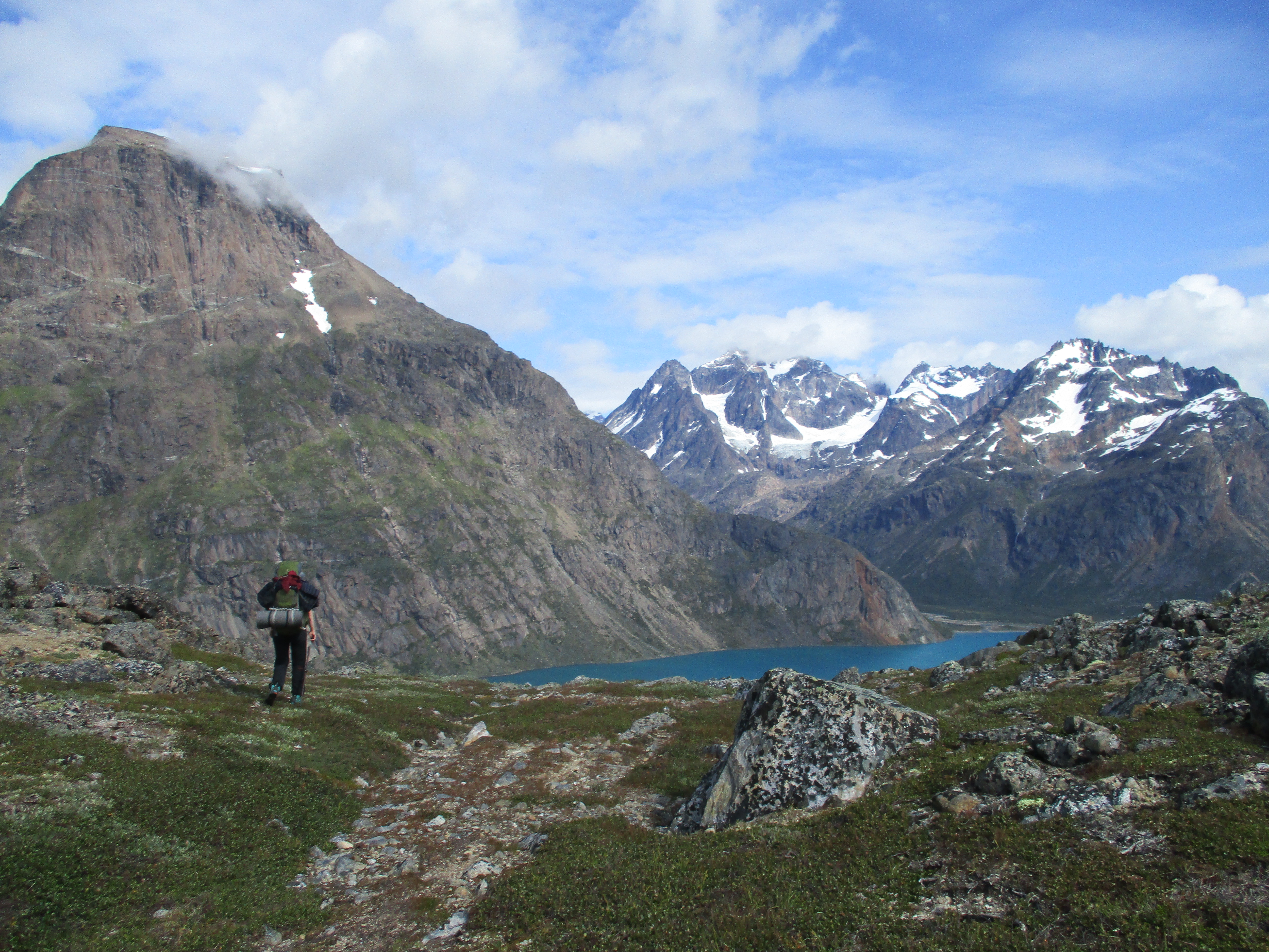
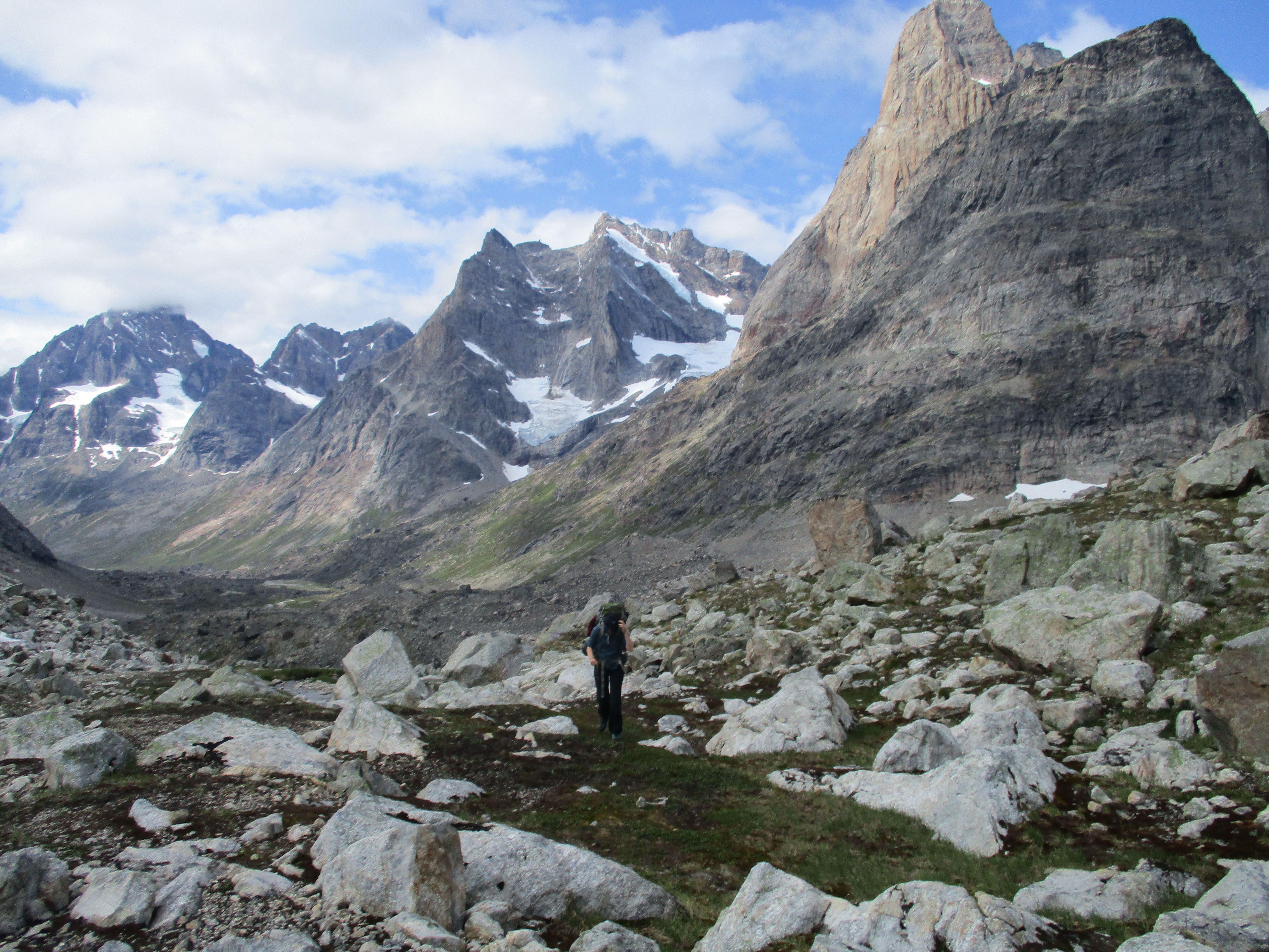
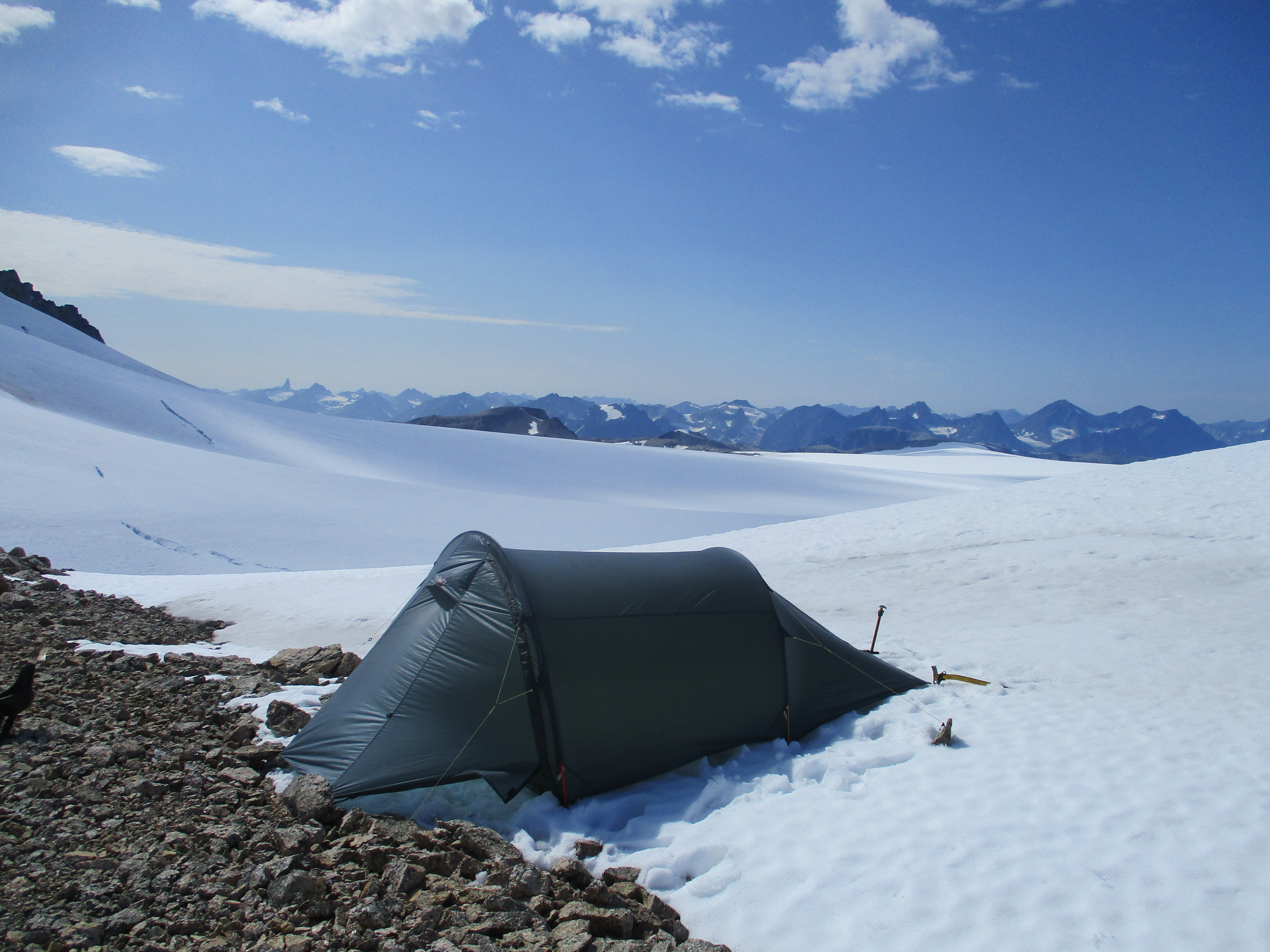
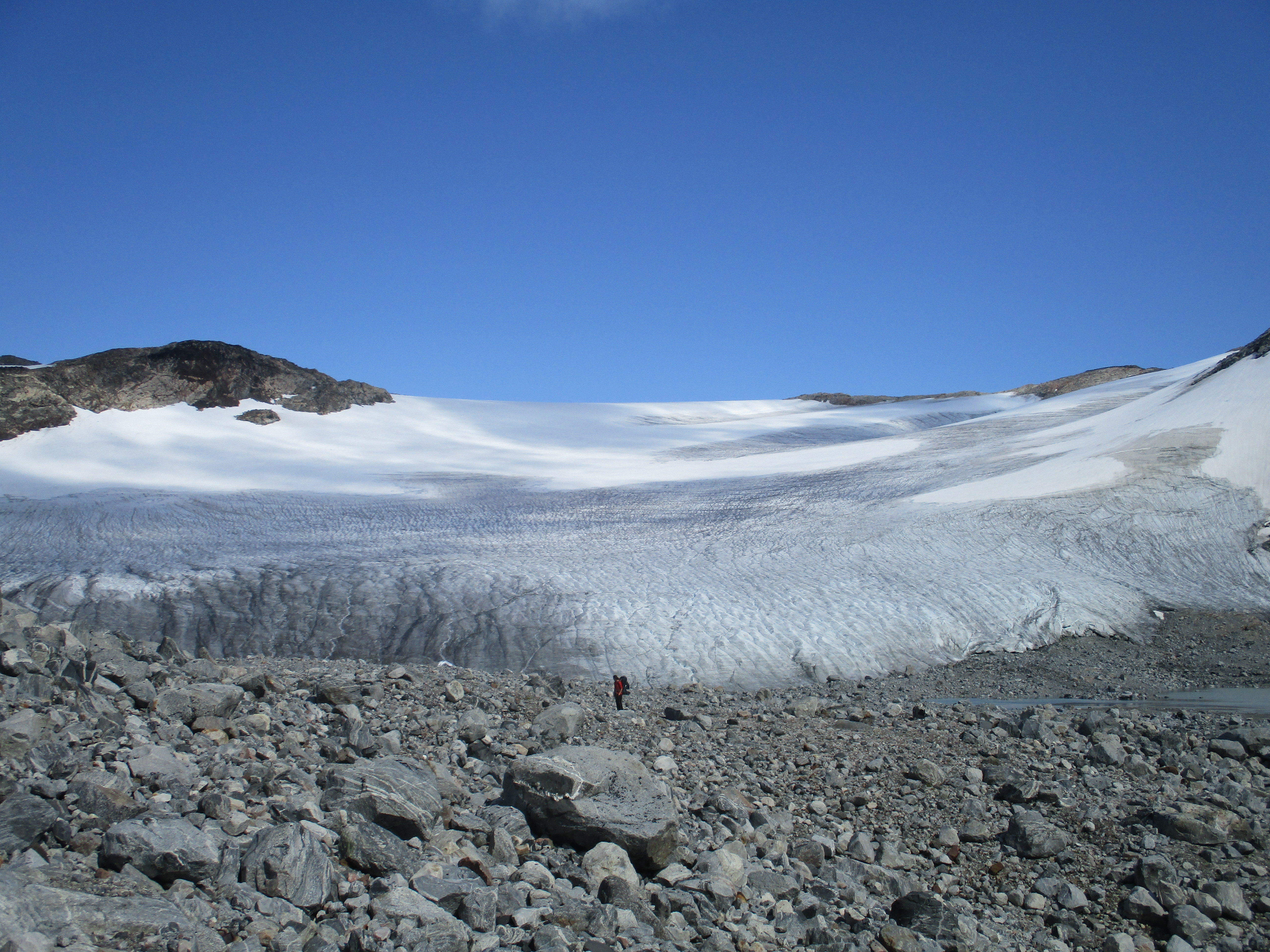
My sister went first without her backpack. After that it was Eefke and my turn. We had backpacks, but the rope was on the right side this time so Roos could help pull us up. We made it all across safely, though we did need the rope. Three people and 2 backpacks across. Roos went one more time up and down to get her backpack across as well. We climbed the last stretch of steep rock. Exhausted and cold we lay down in the sun on the pass. As we started to recover we could see the amazing view around us. West of us lay the most southern tip of the ice cap. East there were the nearby icy peaks of east greenland and south the countess steep rocky peaks around the Tassermiut fjord.
We pitched our tent on the pass itself. It was 2pm and we relaxed the rest of the day. The crevice incident had made us a bit uncomfortable with hiking on the ice. West of us lay nothing but ice for at least another 60km. An unsettling fact that did not make me sleep all too well that night.
Day 10
The fall in the crevice yesterday had put us on high alert. We got up at 3:30am in the hope that the snow would be sturdier and with that safer. Unfortunately I don’t believe the trick worked. It had not frozen that night and the snow was only marginally better then yesterday. Luckily there did not seem to be all too many crevices in front of us.
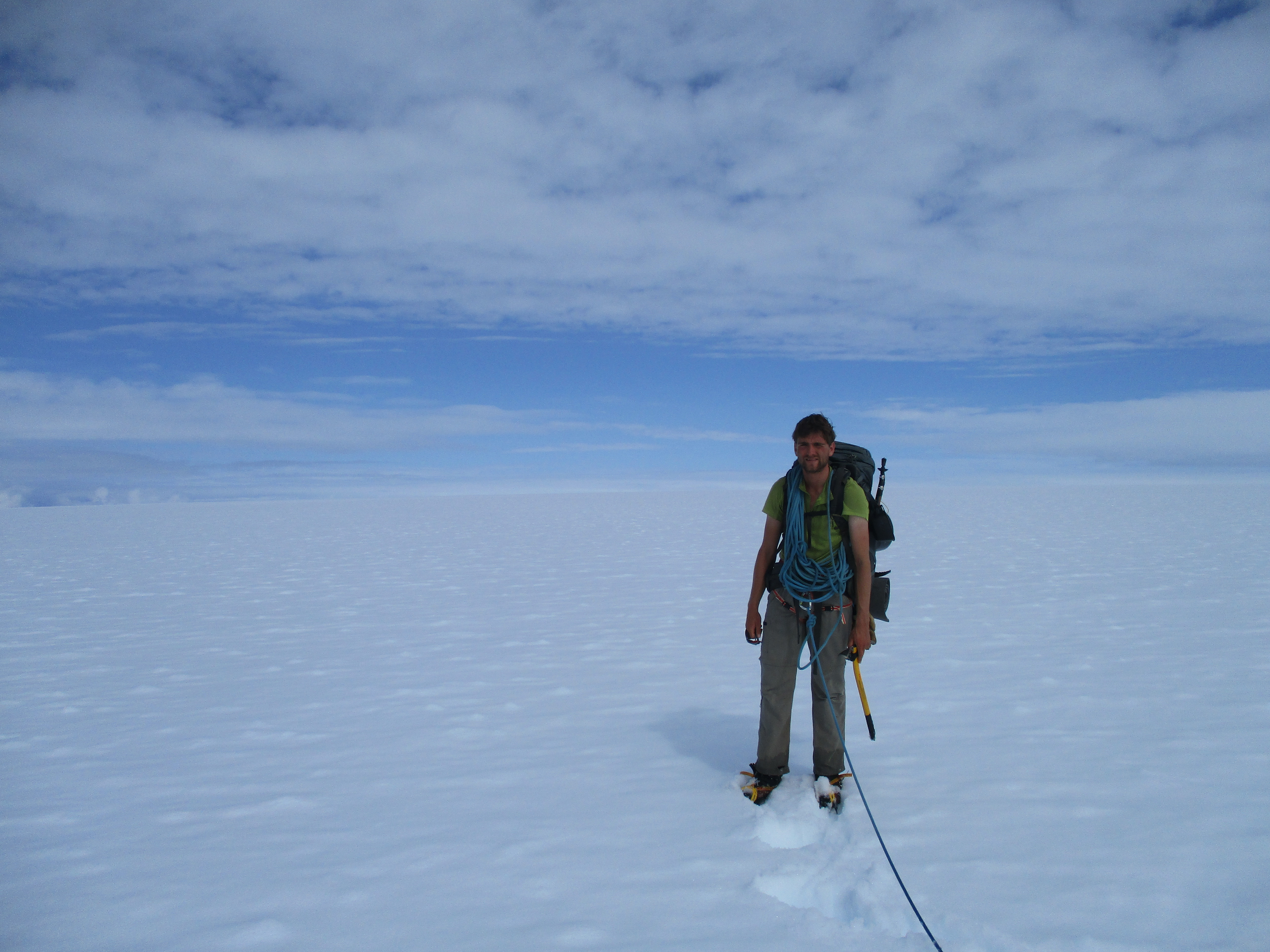
We were on the tip of the ice cap. The cap here was very narrow. Only 5 km wide. We hiked on the highest point seeing the glaciers tumble down into the fjords on both sides of us. I had never seen anything like it. The first glacier we passed was the Immense Sermeq glacier on our south that we had seen from the boat just 2 days ago. Unbelievable that we were now hiking right on top of it! We had a good view over the sharp mountains that we had been trekking along the week before. I immediately recognized mount Ketil in the distance.

Despite the impressive sights the walking was not much fun. Nearby there was nothing but snow. The peaks in the distance did not seem to get closer or further away and even though we hiked with a quick phase it seemed like we were standing still. The fact that we sank 20cm into the snow with each step made the hiking not only mentally but also physically demanding.
As the hours passed by we started to see that we were in fact gaining ground. At 11am we came at the point where the ice cap start making a dip. The cap was very narrow here, only about 1km broad and turned more glacier like. We had to hike 300 meters down and up again. After this the ice cap would broaden out. This stretch was littered with crevices and we got worried whether we would be able to traverse here. We could not yet see the whole scene, so there was no way of telling yet.

We were tired and wanted to camp, but as we did not want to camp not knowing whether we could continue tomorrow. We decided to press on. The ice cap started to descend. But we could not yet see all the way down. This was bad news as it meant that the last bit of the descend would be very steep and so obstructing a clear view down. Tore between the feeling of wanting to camp and wanting to know whether we could get down we made the compromise of Eefke setting up the tent and Roos and me hiking down to explore the route.
While hiking down I held my fingers crossed. The ice got steeper and steeper. Only at the very last moment when we were almost all the way down anyway we could see the end of the descend. Luckily there were no difficulties in reaching there. A few small crevices, but no more then that.
We hiked back up in good spirits. There seemed to be a good way through the mess in front of us! It was only noon so we had a lot of time to kill. We camped and hung in and around the tent for the remainder of the day. Sometimes in the tent to warm up my feet that got cold wearing slippers on the ice and then back outside the tent again to cool down from the sun heating the tent.
From our tent we elaborately studied the ascent of tomorrow. There was a large stretch of creviced ice that seemed to be the best way up.
Day 11
We woke this morning with low hanging clouds just above us. Or should I say we woke this night? It rose at 4 am so it can go both ways…
I got out of the tent and looked west. The clouds were hanging about 50 to 100 meters above us and it looked like they would come down. I could only see a small part of the climb on the other side, most of it lay hidden in the mist.
It was a good thing we could follow the track we had made in the snow the previous day. The clouds were indeed coming down and we could only see the very first bit of the large ice patch ahead. We hiked to the ice patch and started following it up. By now our sight was limited to only 150 meters. So following the ice was the only viable strategy, the ice patch was long but not too broad and lead in the right direction.
As we continued the crevices got larger and the sight lesser. At some point we could only see 50 meters ahead. We could no longer navigate the crevices effectively this way. We were forced to make camp between the cracks. Better that this weather not lasts. Further on we would be on flat snow with no landmarks at all. If we got mist there, we would have no way to tell which way was which.

It was only 10 am, so we had a long day of rotting in our tents ahead of us. It seemed to start raining a little so we all got inside and settled in for a long wait. We all tried to get some more sleep.
Later in the day I woke up. The tent was getting hot. A good sign I though as I got up to look outside. The clouds had risen a bit and were thinner. I would not go so far as calling the weather good, but at least there was hope of improvement. I took my slippers and went out of the tent to have a better look around. Just 150 meters north of us I could see the sudden end of the crevices. The cracked ice made way for smooth snow again. Well things were better then expected for a change.
Day 12
We woke at 5am. We were getting tired of getting up early. Evey day we got up 30 minutes later… The weather had completely cleared up. Based on the weather in the evening there really was no telling of what the weather would be like the next day.
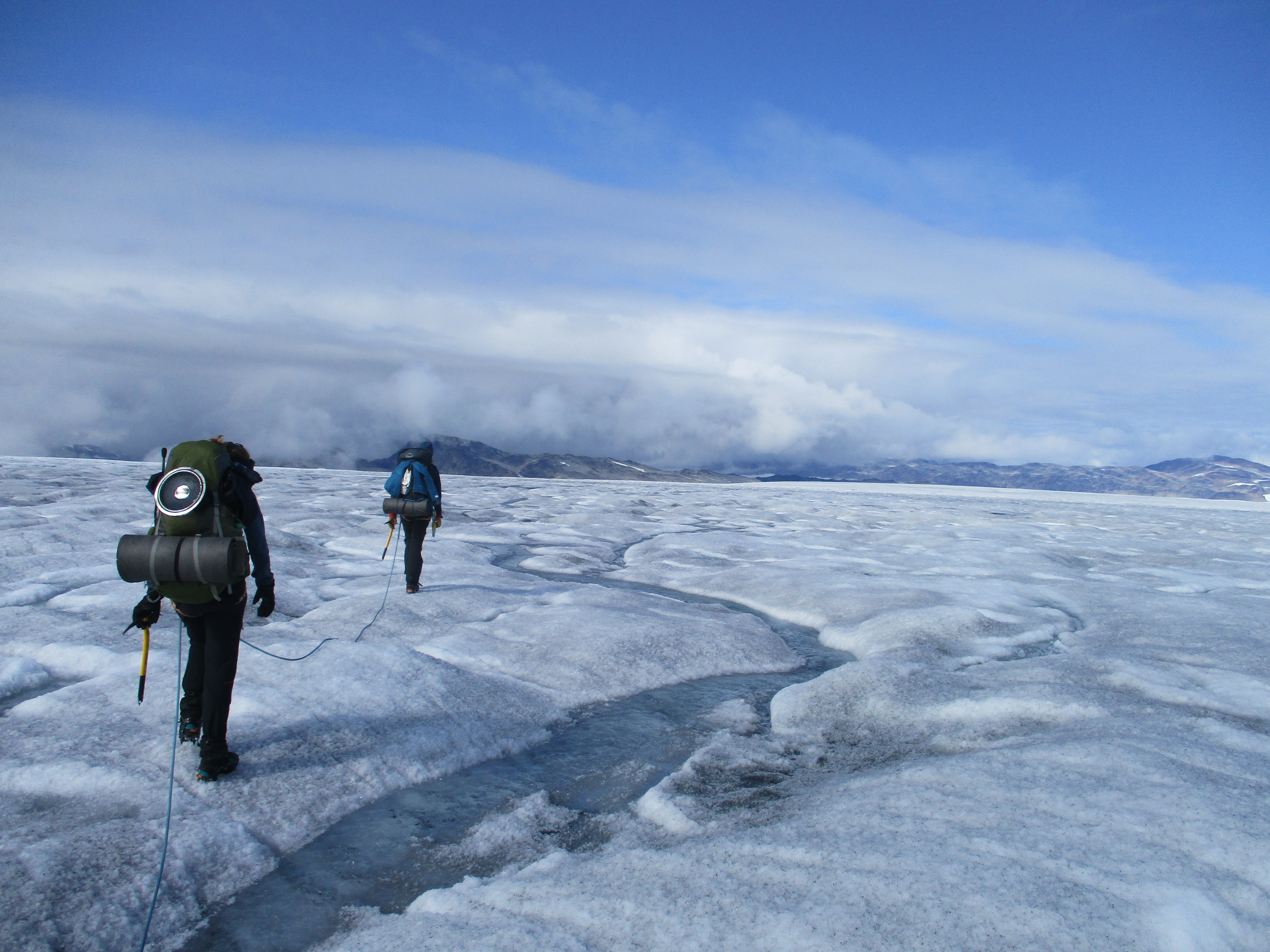
We hiked north east enjoying the sunrise in front of us. The terrain had flattened out and the ice cap was free from fuzz. The going was quick. The ice cap got broader and broader. North of us was nothing more than the white horizon.

Of course things could not stay this way. Greeland never made it too easy on us. The snow got a bit deeper and we came across a serie of hidden crevices. They were fully hidden, but the subtle ribbles in the terrain gave away their position. My sister fell through with her legs. This time however she could easily get herself out. It made us however once again careful and we crossed the other crevices in crawling mode.
We kept hiking towards the white horizon north of us. Again we did not have much sense of progression. After a couple of hours we finally got sight of the large glacier falling down in the Sondre Sermilik fjord. Once we passed this glacier we would bo on the right peninsula and leave the ice cap. Especially me and Eefke looked forward to getting off the ice. The feeling that you could fall through at any moment and the continuous walking without long breaks was exhausting. It was still a long way to go though. The crevices caused by the glacier continued in the ice cap for another 3 kilometers. We were forced to take a wide detour to avoid this rather dangerous stretch.
The weather was hot, but the terrain not difficult so we could hike till late in the day. When we stopped to make camp it was already 3pm. A new record. After 10 hours of non stop hiking we were pretty tired. The feeling that the great whitheness north of us stretched out for 2500 kilometers all the way to the arctic sea energized us a little.
My mother had sent me a warning that heavy wind was on it’s way. This gave us a nice afternoon activity. We built a wall of about 80cm high all around the tent. In a way we hoped that the weather would indeed turn bad. Catching a snow storm in this place would be no fun, but still the experience was attractive in some way. Besides we did not build that wall for nothing!

That night I slept remarkably well. The end of our hike on the ice was near and we had passed most of the tricky sections.
Needless to say that it was wind still that night…
Day 13
There had absolutely been now wind in the night, not even a little. When I stuck my head out of the tent the clouds hung low. I could however still see the nunataks south of us so we started hiking anyway. As long as we could see something to navigate on we could press on.
We had risen late. Well relatively late, 5am. We were in no real hurry. The point where we were getting off the ice cap was just a little too far for one day and too short for two days. As long as we hiked about 2 hours today we would get off the ice somewhere tomorrow.
As we made our way west the clouds now and then came further down, every now and then obscuring our sight. There was not much view to be had and the today’s walk did not leave much of an impression on me. At around noon the clouds came down without a seeming intention to clear again. We were tired anyway and pitched our tent. Pitching in the snow was routine by now. Digging in, melting snow for drinking water, we were getting very effective at it.
Once again we had a lot of time to kill. We built a snowman, made all lame jokes one can think off and tried to doze off every now and then.
Day 14
For the first time I woke up at night because I was cold. The wind had started to blow from the north and even inside the tent I could feel the temperature drop. I put on my sweater, sleeping in a T-shirt was no longer comfortable. Expecting some crevices at the edge of the ice cap we had set the alarm at 3:30am. But it was uncomfortable cold due to the wind and more humid air. We decided to make it 5 am.
When we woke up we could see it had indeed been colder. The snow was firm. I think it had finally actually frozen at night. In principle a good thing.

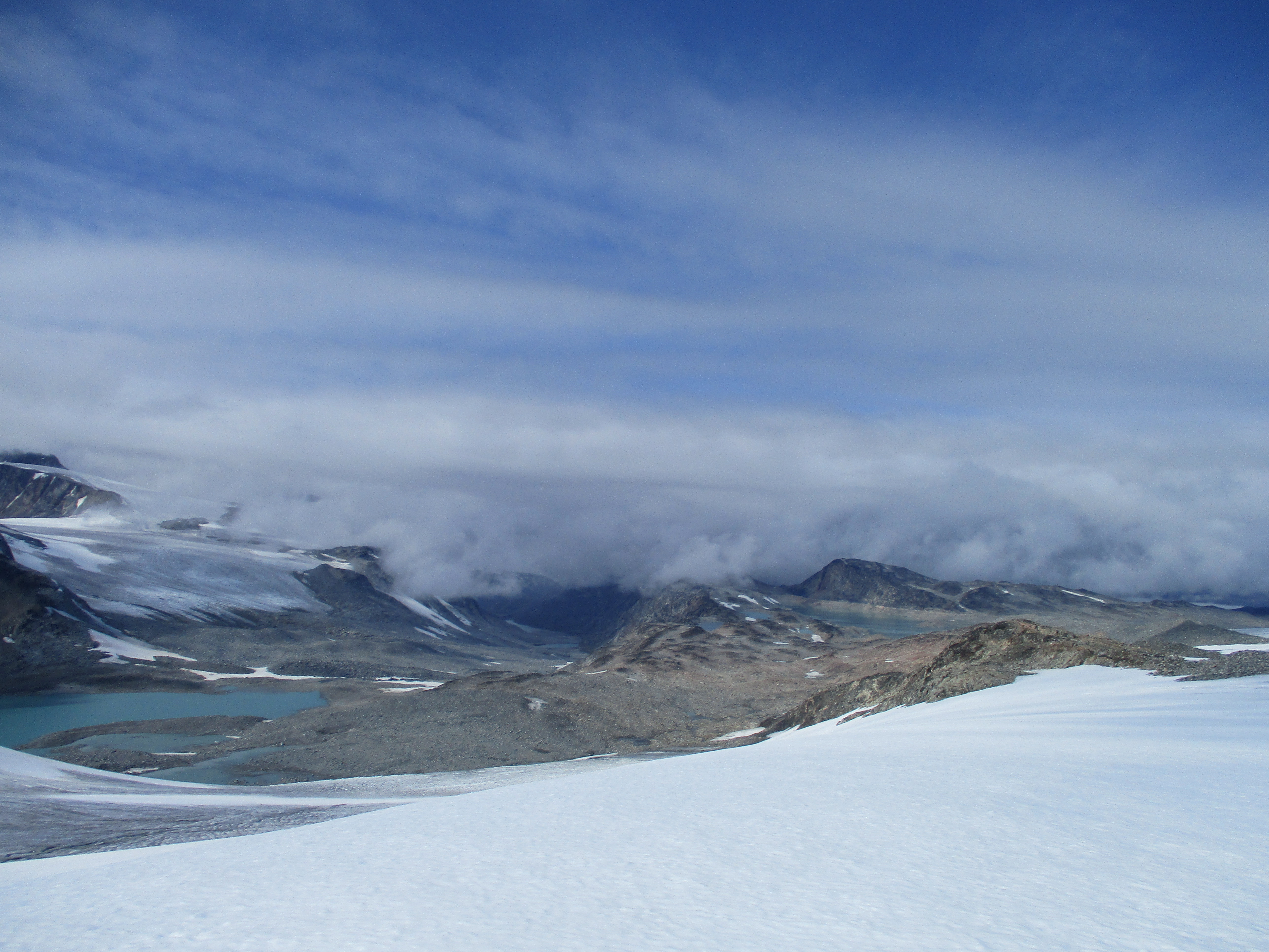
We hiked straight to the point where we needed to be. It was only 7 more kilometers and the terrain was easy. We closed in quick. The snow made way for creviced ice, we knew we were getting close to the edge. Deep down I was still worried that something would still go wrong at the very last moment, but on the surface I was very pleased that the end of the ice was in sight. Aside from an improvement of my mood the border of the ice brought an improvement of the scenery. There were some small melting streams and open crevices that were very beautiful in the morning light.
We aimed for a large snow covered saddle between two minor mountains. From there we followed a small glacier steep down. We could see the end of the ice! In fact we could see deep into the valley we were supposed to descend. We especially enjoyed the beautiful lake right below us. Non-frozen water for a change.
I kissed the ground as we officially touched solid rock. We immediately started relaxing. We cleaned, burnt some of our waste and cooked a good oatmeal dish. The little things that are simply harder to do when everything around you is frozen.
We continued a bit further in search of a good camping spot. It took about 2 hours to cross the moraines and gentle snowfields to another broad lake. Here we could find a small sandy spot where we could camp. We had of course preferred camping on grass, but it was already 6pm by now and no indication of any serious meadows any time soon.
Day 15
Man that slept well the first night off the ice. I was looking forward to an easy day. The valley seemed easy enough so we would probably get what I hoped for. But as I did not have any source of people hiking in this valley I wasn’t completely comfortable. The valley was 25km long and It only takes a steep cliff and a large river to really screw you over.

As we hiked down over the last moraines and got to the first meadows large rivers and cliffs luckily seemed far away. The hiking was as easy as off trail hiking could reasonably be. There were no spectacular sights but the clear water, purple flowers and sunny mountains were enough to make up for a good day.
We had plenty of days left so we could permit ourselves the luxury of camping early. We made sure we stayed somewhere we could built a good campfire. We did not get to enjoy our fire a lot, a strong wind started to blow from the north in the evening.
Day 16
The sky was gray and the wind had grown stronger. The gravel making up the valley floor that had blinkered in the sun yesterday were now part of the rather depressing gray scene.
We got the first kilometer for free. The flat gravel made it almost feel like hiking on a road. It did not last. A glacier comming from a side valley terminated east of us and the whole valley was filled with large boulders again. We bypassed the steepest boulder field by taking a rather mysterious gorge at the west of the valley that ‘tunneled us past.
When the boulders made way for meadows again we took some lunch. The weather had cleared up. I washed my T-shirt for the first time since Klosterdalen. It did not help much, but it still felt good.
After lunch it was decision time. In about 2 kilometers our valley would merge with the one west of us. If the stream from that valley would merge with the one of ours we might not be able to cross it. In fact we might not be able to cross that stream even before it would merge. The other valley had a large glacier that especially with the hot weather lately might cause it to loose a lot of ice. We could cross the easy stream we were hiking along right now and hike down at the eastern side of the valley. We cross over the the valley west of us and cross the river there and descend on the western side. Laslty we could just follow the stream down and see what to do when the streams met. The last option did not sound great as the rivers seemed to meet at a rather narrow and steep spot. I remembered that the western side of the valley had looked easiest on google earth I decided to cross over to the valley west of us and try to cross there. The map showed that the river would be very broad there so we could probably cross.
We could easily cross over, as a matter of fact I don’t think we needed to gain more than 20m altitude. When we got a glimpse of the river we started to worry a little. The river was very broad indeed, but way more powerful than I had thought. We could easily cross the first two meanders, but when we got to the main stream it was a solid 50 meters of raging water. My sister and I tried to cross. The current was not very strong, but the water quikcly got to our hips. We looked to the other side and saw we were only quarter of the way. God only knew how deep it would get. Having almost drowned last year in Pakistan I was not very eager to try it out. We would hike up to the glacier instead and cross the river via the ice. Crossing here simply looked too risky.
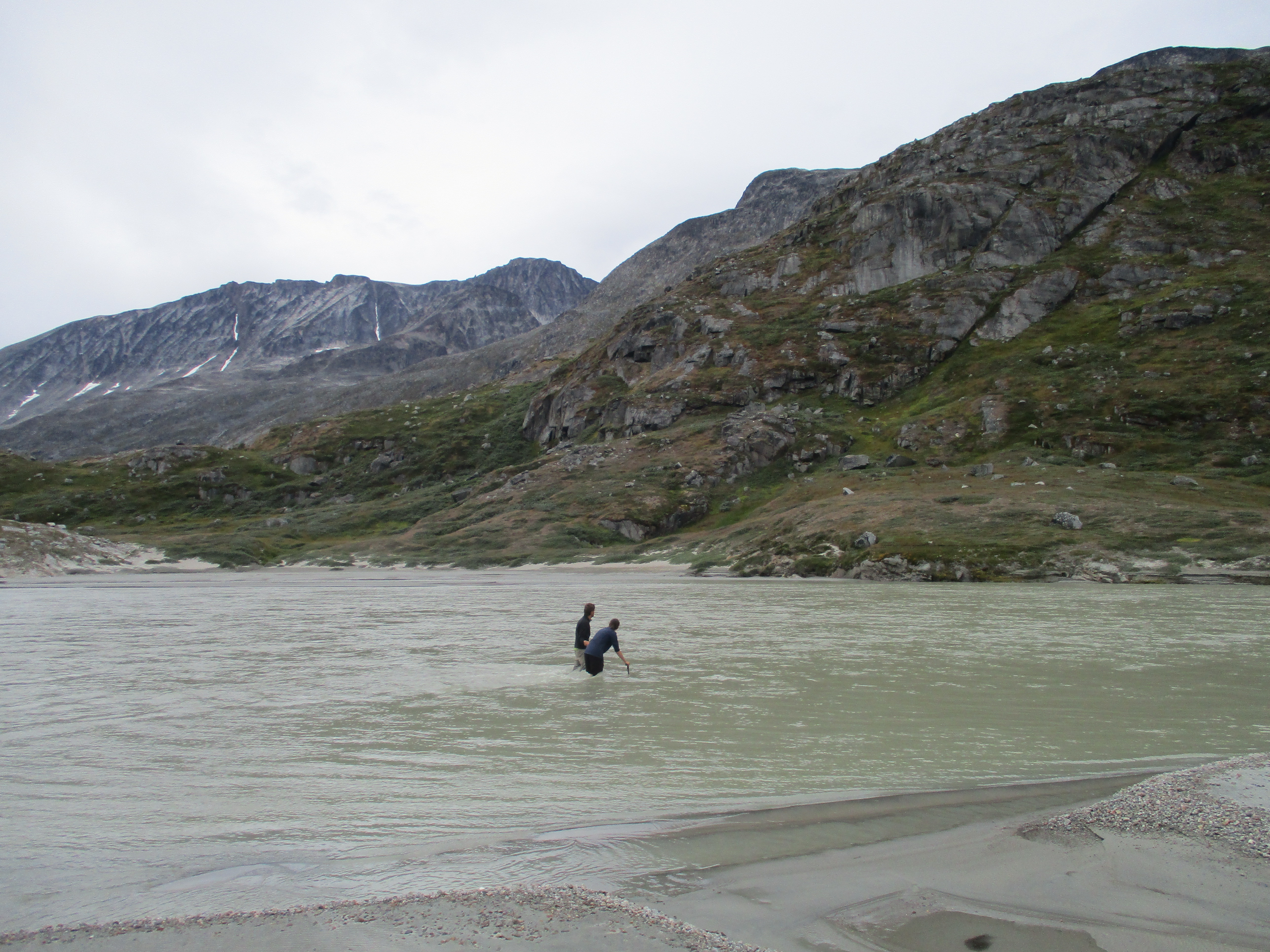
The glacier was a solid 12 km. 12km that we would also need to hike back down again. Needless to say that we were not exactly thrilled. However after having just another 10 minutes we got to an even broader section of the river. After having been pressed together through a raging waterfall the water once again meandered through a broad valley. This time the water was better distributed over the different meanders. Maybe we stood a chance here. I got into the river. The current did not feel too bad and the meanders further on actually looked not much worse. My sister and I decided to try to and get across. We were not sure whether it would work out so left our backpacks behind to check first.
The wind was now blowing strong. It swept over the water splashing water in our eyes. Oftentimes the wind got me more of balance then the water itself. We could get to the last meander without much difficulty. However this last one, as always, looked the trickiest. I was getting a bit cold and tired and wanted to cross immediately from the place on the sandbank that we were standing. It did not work out, the water quickly came till over our hip. Then my sister suggested a spot further down where the stream was significantly broader. We gave it a try but after a few meters the water already came to our hip. The current was less strong though so we dared to go a bit further. Surprisingly enough it quickly got less deep and we could easily make it to the other side.
We were pretty pleased with ourselves. We had come across via a route that was in retrospect not that difficult or dangerous. We crossed back to Eefke waiting for us on the other side. The crossing was a solid 500 meters and our feet were getting really cold in the icy water. By now the wind was blowing like crazy, seemed like we were going to get that foehn after all… Once back we quickly energized by eating a Mars. I thought for a moment of crossing the next day in the morning when the water might be lower. But Roos argued that the crossing had not been difficult. She was right and it was better to do it while it could be done. We got to the other side safely, but stone cold. We quickly marched further to warm up.
Once we could all feel our feet again we sought a place relatively out of the wind and made camp. Even in our relatively sheltered place the wind blasts could blow you out of balance. It was hard to sleep with the wind cracking down on our tent.
Day 17
The wind had lost some of it’s strength, but it was still blowing strong. When we hiked it was alright, but as soon as you stood still the cold wind cooled you down. It was no good weather for sitting around. My mother had warned via the satellite telephone for the steep cliffs in the last section of the canyon. I was a little worried. Strong rivers and cliffs are a real deal breaker walking down valleys. However the fact that there were some sheep around our tent gave me hope that there was probably some route out.
It started out easy, we could just follow the river down. Only at the very end when we could almost smell the fjord the cliffs got too steep. There was no other option then to climb up the steep valley wall and hope that we could somehow bypass these cliffs once higher up.
Our way kept on being blocked by perpendicular cliffs. Each time we got blocked we solved it by climbing ever further up. I was seriously concerned whether this was going to work out. I had seen pictures on google earth of people hiking in this valley but still. It remained unclear all the way till the end. Once we could see the fjord the valley ended in some steep cliffs, but we could traverse slowly down the northern flank of the valley below us.
When I looked to the western side of the valley, I thanked the gods that I had chosen the eastern side. There was absolutely no way to get out that way. Not even with a 50m rope to abseil.
In the morning we thought we would have to climb 200m up from the fjord to the saddle, but now it turned out to be a 200m descend instead. After having a quick lunch (well lunch, it was already 4pm) we hiked up the remaining kilometer to the saddle. The terrain was mostly marshland, without much views. My sister did not deem the place satisfying enough to camp. We pressed on 20 minutes further and made camp once we could see the small and silent fjord on the other side.
We could not yet see any building, but we knew civilization was now near. Maybe we could reach the first farm withing 4 hours tomorrow. As usual we could not wait to get into the wilderness when we started and could again not wait to get out of it at the end.
Day 18
The wind had finally stopped terrorizing us. Unfortunately we immediately paid the price. You had to be careful not to swallow mosquitoes as you breathed. On our way we needed to do some advanced bush beating. It had been a while and it was almost fun, almost…
As we got down we could see the dam in the distance. Finally, civilization! As we made the easy hike along the fjord it felt like we were already finishing the hike.
At the end of the fjord we met up with a fisherman who brought us to the other side of the river. That was nice of him as the dirt track was on that side making it a lot easier for us. We came along a few farms where we took a long break. Unfortunnaley the locals did not speak any English, so communication kind of did as go as far as just staring a bit at each other.

As we could not find anybody to hook up with at the farms we decided to hike a bit further. We climbed to the dam and started to hike around the southern side of the lake. We quickly came in thick shrubberies. We were afraid that the terrain would remain like this till the next farm about 10km further away.
We quickly got tired of the bush beating. We had plenty of days left and wanted to enjoy the nice weather before the sun would set. We took the first reasonable campingspot there was. For the first time that trip Eefke and I tried out swimming. Within 20 seconds I was cold as hell, but still at least I had swum! There was a lot of dead wood on the lake shore and we made quite a bonbfire.
The camping spot was not as great as it had looked. Overgrown terrain always looks way flatter than it actually is. This was no exception and I could reflect on that all night. The sharp plants under our tent didn’t help much.
Day 19
After just 10 minutes the shrubs started to make way for more grassy terrain. If we had just hiked a little further yesterday we could have had a normal night sleep… Well at least it seemed like we did not have to bush beat our way across the Vatnaferfi.
The first obstacle was a large hill right behind the lake. We climbed up and actually lost each other in the large and monotonous landscape. Luckily we got sight of one another after about 10 minutes of searching…
Once on top we had a better view then we had anticipated. We could see the mountains behind which we had walked a few days back, Jespersen breen north of us and even the ice cap far east of us. On close range there was the typical Vatnaverfi landscape. Rough hilly tundra with lakes scattered all over the place.

We had already hiked for 18 days and the difficult stretches were way behind us. Today this really began to reflect in our phase. We were constantly resting and sitting around. Despite of this we made a good chance of crossing over all the way to the farms east.
As we got further we saw more and more sheep. Even some horses. When it was almost time to descend from the Vatnaverfi to the road my sister noticed a ruin a 100m to our right. After closer inspection it seemed like an actual viking ruin. I checked the map and there was indeed a structure indicated round here on the map. On this trek we had passed a dozen of these indicated ruins. We had actually grown used to not being able to see it. But this was an actual structure. Good to have seen at least something vinking-like standing up…

The sun was already setting when we made the final descend to the road. The weather was great and the few agricultural fields in the valley were a welcome sight after two weeks of wilderness.
Day 20
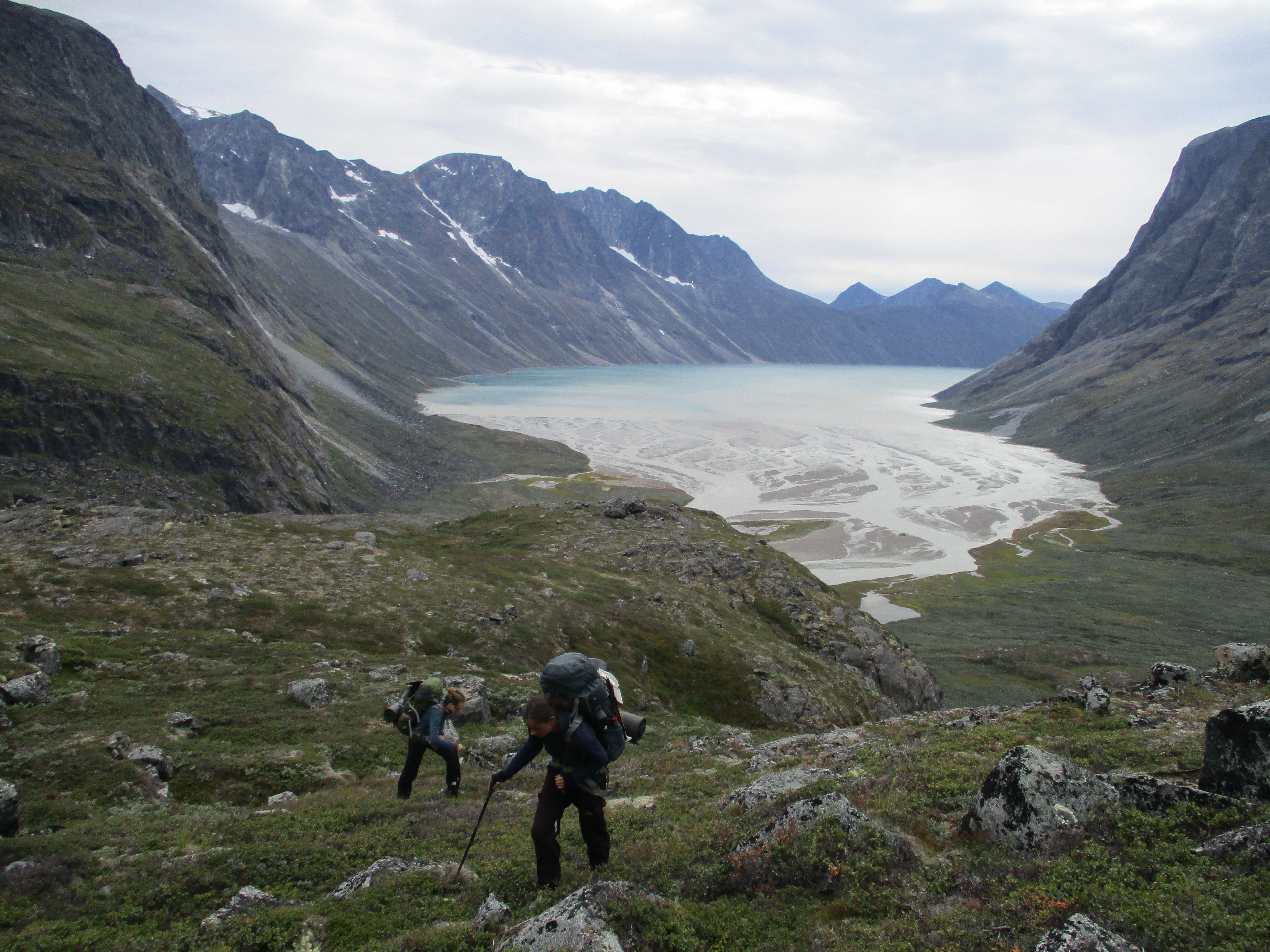
Today we would tackle the last obstacle. We still had to cross the river coming from Jespersen breen. This would be by far the largest river we had seen this trek. We were however not concerned, we would cross it all the way where the river flowed in the fjord. Besides if it turned out not to be possible we could simply ask somebody in Sondre Igaliku to bring us across by boat.
The river was still 5km away though. First we had to follow the dirt track north along 3 other farms. At the first farm we were greeted and boy oh boy there was a woman who could speak English! We were invited to have some lunch and talked a bit for an hour. We learnt that she was living there with her boyfriend and 3 children. In the other house lived her parents. In contrast to what I had thought the sheep did not return to their stable once the weather got colder, they had to force them back themselves. Ouch in this kind of landscape that must be quite some work… The farm had over 600 sheep and they intended to make it 800 sheep in two years time. I don’t know anything about sheep farming, but it sounded like a lot of sheep.
After about an hour we got on our way, we wanted to cross the river at low tie so we did not have that much time left. Luckily hiking over a road goes quick and we got to Sondre Igaliku in no time. It seemed like we got there in just the right time. The fjord had retreated way back and the tidal muds stretched for hundreds of meters along the shore. It seemed this was more or less the lowest point so we quickly started crossing. The low tie allowed us to shave us easily 2km of coastline.
My sister was hiking ahead and had already started crossing the river. Well that was a good sign, if she could do it alone it was apparently not too difficult. Indeed the crossing turned out to be very easy. The river was pretty large, but was spread out in 4 very broad meanders that had already been slowed down by 1km of flat mud.

Once across we noticed the nearly fully intact viking church north of us. It was about 2km away and we could not motivate ourselves to check it out. But it looked like one of the best preserved ruins in Greenland.
Just 30 minutes later we got to a deserted farm. The door was no longer in place, so of course my sister and Eefke went to check it out. When I followed him I was stunned. It was as if the people who lived here had gone in a moments notice and had dropped everything on the spot. There were still photos hanging on the wall and there lay dishes in the sink. Judging by the expiration dates on the food items they must have left around 2006. Almost 15 years ago! We could not help ourselves but robbing some souvenirs from the house.
Eefke deemed this spot way too spooky to camp so we climbed up the slope behind the farm and set up camp on top. A good decision. This was a worthy last camp of our trek. We could see Igaliku in the distance. Behing Igaliku we could already see Eriksfjord with some icebergs floating on it. Even further away we could see the ice cap.

Day 21
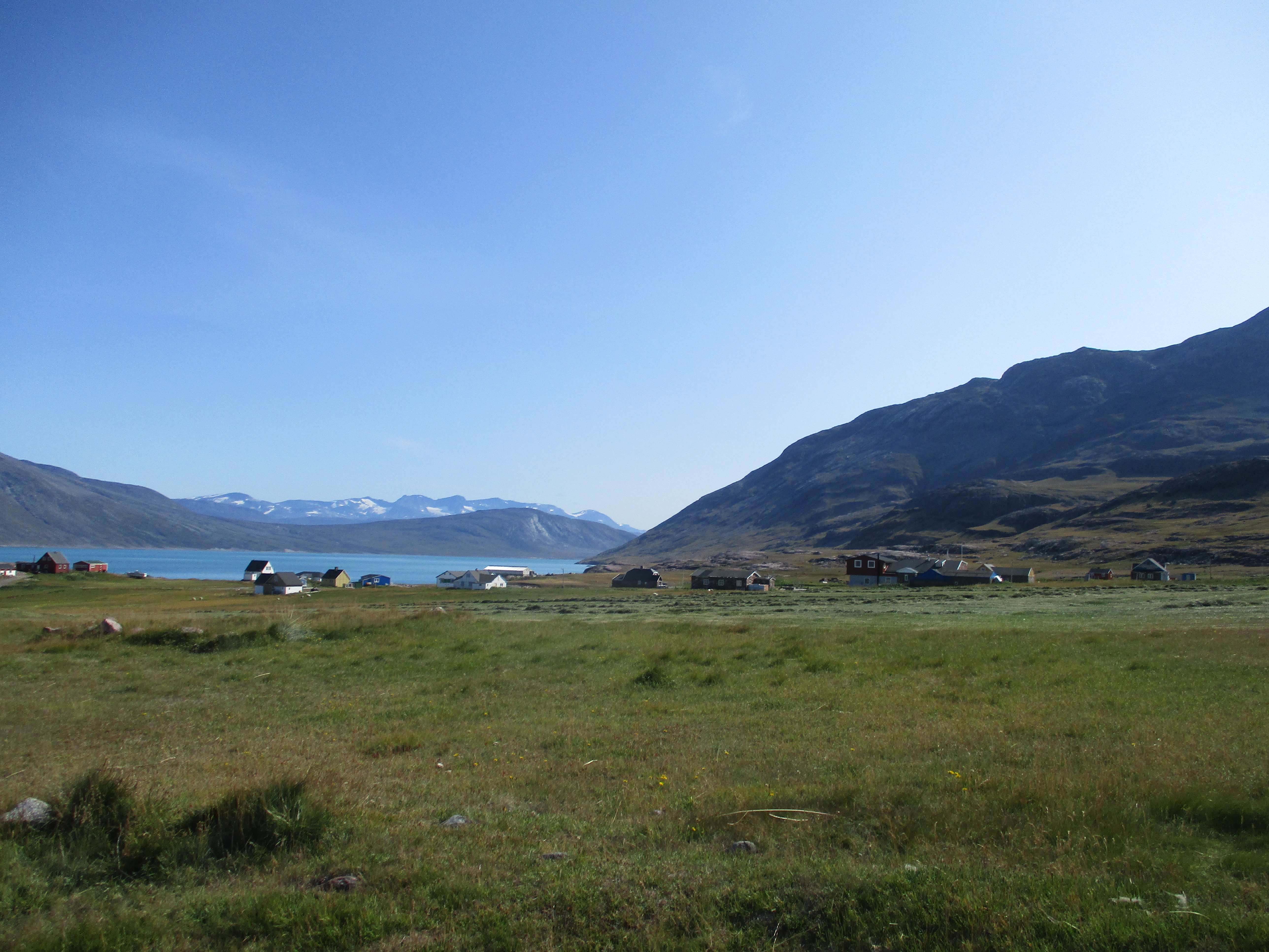
With our final destination already in sight, this day was more a victory lapse than a hike. We reached the sleepy village Igaliku in about 4h. We hoped to meet up with Adriaan, but he wasn’t there yet.
We sat down on the terrace of the small hotel and ate lunch. It seemed like Adriaan would get here the next day. Our flight was still 3 days from now so we had quite some time to rot round here. We would need to do our best not to get bored.
We pitched our tent above the village. The supermarket was only open a few hours a day and closed on Sunday. We would need to wait till the day after tomorrow to buy the chips we had been craving for. Till then we had to rely on the hotel. They served excellent food so it wasn’t that bad. They even made the mistake to make dinner self service. With 3 people that just came back from a 3 week long cross country trek that was a big mistake…