

December 2013
Lukla – Namche Bazaar – Puki Tenga – Pangboche – Lobuche – Kalaa Pathar – Phortse – Gokyo – Renjo la – Thame – Lukla – Karikhola – Nunthala – Phaplu
My first ever trek in the Himalaya. An all time classic pilgrimage to the highest mountain on earth. I was excited, for long I dreamt of visiting this legendary range. I admit trekking to Everest was not the most creative thing one can come up with, but it is a destination I just could not resist. In order to keep thing adventurous I planned to include an a climb of Nangpa la and a side trip to Dudh Kunda. I bailed on both of those plans though…
Even though most of my more ambitious plans were not executed, partly due to the season partly due to my lack of experience, the trek through the winter landscape was amazing. The trails were relatively silent due to the season and the skies were clear blue almost constantly.
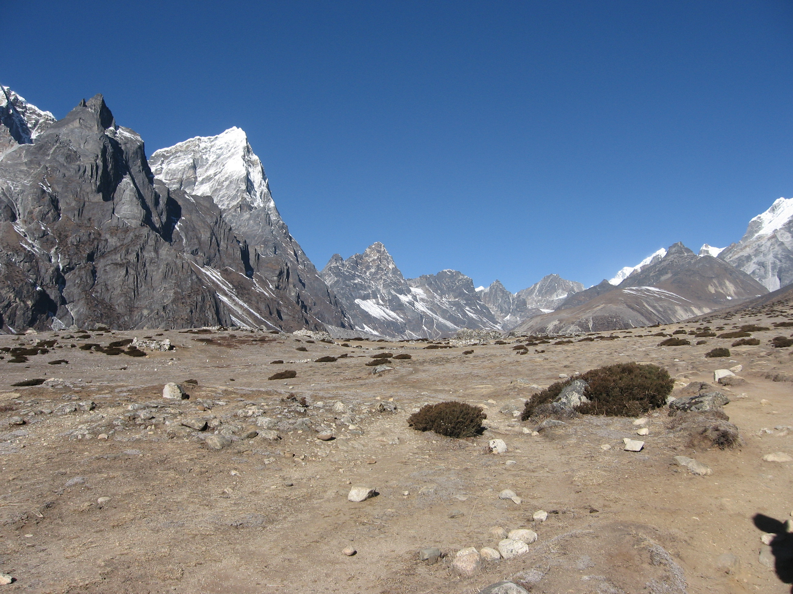
The trail through the Khumbu valley to Everest was the first and most classic part of the route. But no matter how many pictures of Amadablam the internet holds, nothing prepares you for the actual view of the mountain itself. This pointy archetypal mountain draws your attention the entire way through the Khumbu valley.
After having visited the Everest base camp we wanted to cross the Cho la and Renjo la. Due to sickness we however hiked around the Cho la to Gokyo and crossed the Renjo la from there. The Gokyo valley and crossing of the Renjo la were the absolute highlight of the trek. The view over Eversest, Makalu and Lhotse from the Renjo la is still one of my favourite views ever.
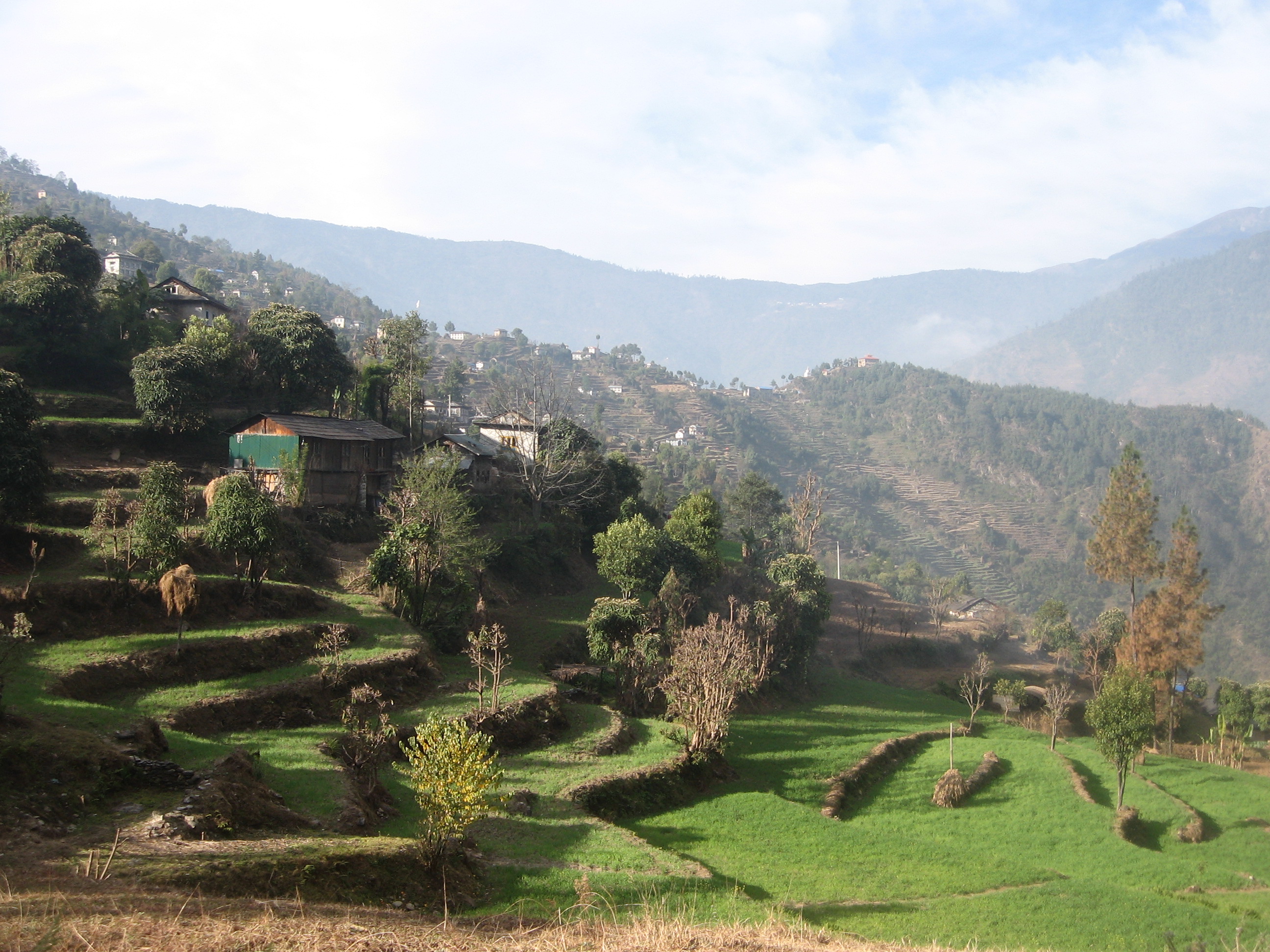
Instead of flying out we trekked all the way back to Phaplu in order to leave the region by car. This route through the rural hills of Solu were an entirely different experience. This more cultural trip really added to our overall experience of the region.
Season
The trekking trails in Khumbu are well trodden and maintained, so well that trekking in mid winter is not that much of an issue. Sure, there is a risk of snow blocks on passes but trails over the valley floor remain accessible and supplied all year. Winter sees very clear skies and few trekkers.
Autumn is the classic season to be out here, rumor has it that crowds become unbearable though. Spring is a good alternative, but still crowded.
Monsoon might be an underrated season. Poor skies, but the consensus seems to be that occasional good views can still be had. In return you will have the place for yourself and pleasant temperatures.
Packing list
This is probably the best catered trek in the world. Just pack your underwear and hid the road.

How to get there
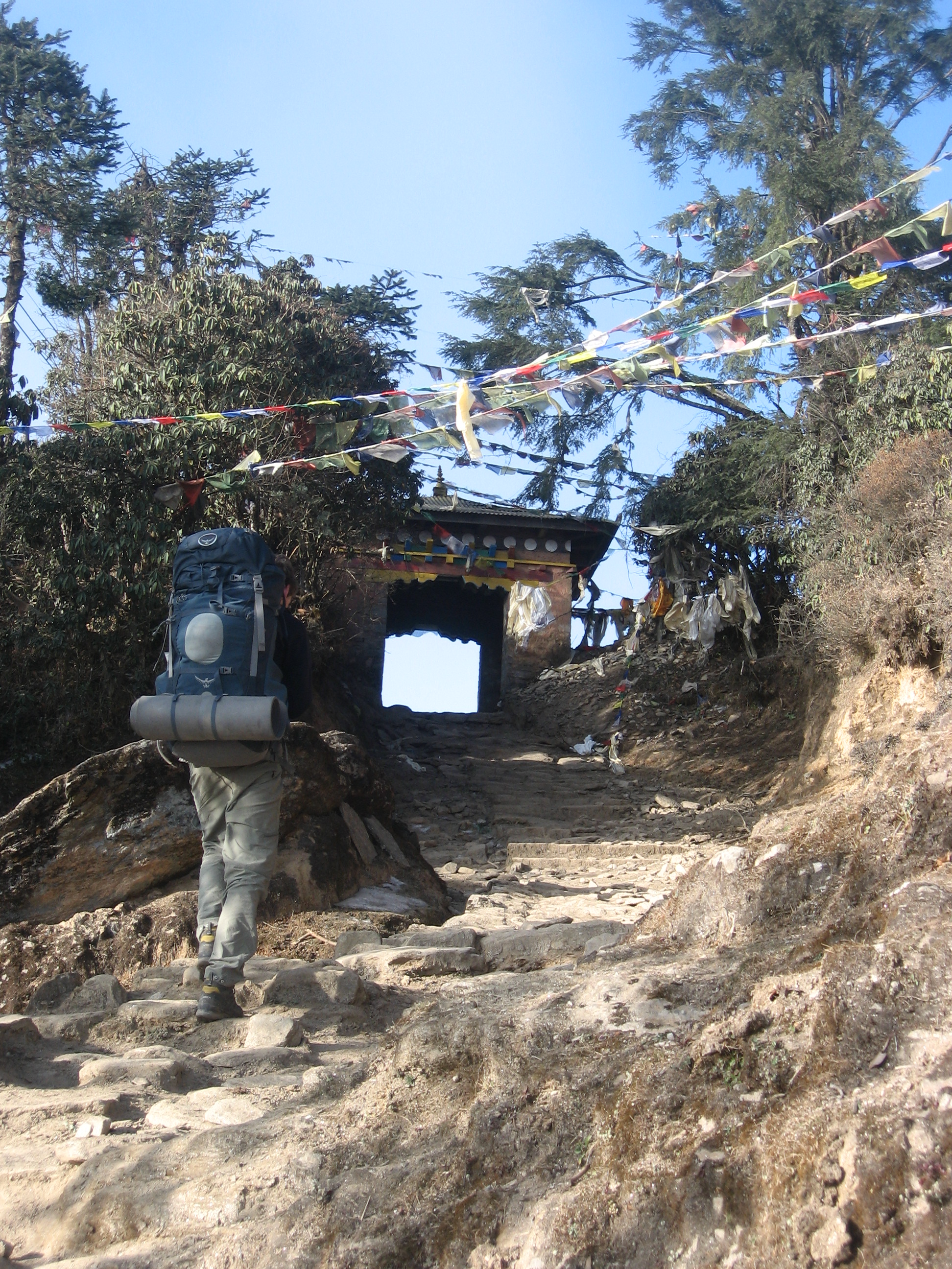
The only way to reach Khumbu is by plane or foot. Many daily flights are flying up and down to Lukla from Kathmandu each day.
Alternatively you can hike in from Phaplu in about 3 days or undertake the week long trek from Jiri or Tumlingtar.
Alternatives
Hiking in From Tumlingtar instead of Phaplu or Jiri is a great lesser visited trek through the middle hills that I wished I had chosen.
Day 1
When my travel companion Eefke and I got the the Tribhuvan airport in Kathmandu, it was not clear whether we could leave in the morning. Our plane got delayed two hours due to the morning mist and we had had to board and exit the plane once as the weather was just by not good enough. Knowing the stories of people being delayed by weeks, so we were very happy once our plane got of the ground.
The flight was spectacular. From our window we could see the high Himalaya and Everest waiting for us. Once the plane landed on the small Lukla airstrip the mountains however felt quite far away. The weather was pleasent and we were surrounded by children and farms.
Lukla was rather crowded and a little stressed. We got right on our way and rested a bit outside of town to enjoy the fact that we had made it to Khumbu. It felt great, the mountain air, the sun, I was finally in the Himalaya.
Locals laughed when they passed by. A little while later we found the reason. We had taken a wrong turn and had to walk back for a minute. We made it a short day and stopped a little before Phakding in order to beat the crowds. (which were due to the season not too bad anyway.
The lodge we stayed overnight was very cute and colourful. We had a tiny room with a cozy window looking out. We had taken a lot of camping stuff with us that we left behind. We had a tent, fuel and food as we planned to head up Pikey peak and Dudh kunda. It was way to heavy (rooky mistake) and we were glad we could dump it.

The late afternoon we spent at the Khumbu river. Enjoying the weather and simply the fact that we were there.
The evening got really cold for how warm the day had been. And we sat around the fire with a Canadian group that was also heading up.
Day 2
We filled our water bottles with water and got on our way. The first part went up and down over the valley floor all the way till the entrance of Sagarmatha national park where we bought our entrance ticket.
Just after the entrance lay a large lodge town that formed the usual lunch spot of trekkers. We had brought a sandwich for lunch from our lodge and ate it along the road. We checked our pulses for altitude sickness (as newbies we were quite nervous) and decided to climb trough to Namche Bazaar.

We first walked straigh for about a kilometer next to the river bank after which started a long and constant climb up through pine forest all the way up to Namche Bazaar 600 meters higher just above the tree line. It was a rather boring climb which never seemed to end.
It was rather cloudy and already getting late we immediately went to the first lodge that was open. It was off peak and most lodges were actually closed. Our lodge was more like a hotel with actual flushable toilets and what not.
The flushable toilets were a good thing as we got ill beyond imagination that night. Just drinking normal water was apparently not that great of an idea. We threw up or pooped water the entire night.
Day 3
We were pretty ill, but had not antibiotics with us (another rookie mistake). There was a doctor’s office in town. I mustered all my strengths and got out of the door to look for anything that could get this stomach pains over with. My friend Eefke was even in worser shape than I was and stayed behind. I asked around for the doctor’s office and the locals pointed me to highest building in the village. Great, I could climb 50 meters up. Why do they build a doctor’s office in the hardest to reach place in town?
It took me a bloody long time to get up there. I had to take a rest after each 10 steps. Once finally up there I could sit in the waiting room with a woman who had hurt here feed and was already waiting in Namche Bazaar for over a month in order to continue here trekking. Wow.
The doctor did a quick examination and gave me some antibiotics that I brought back with me. We both swallowed our tablets and hoped for the best. I quickly started to recover, but Eefke had another bad night ahead.
Day 4
We both felt a bit better, but not way by wel enough to hid the road again. We ate rice with water like last day and only sat a brief step out of the door in the afternoon sun.

- Facing of a fearsome local.
Day 5
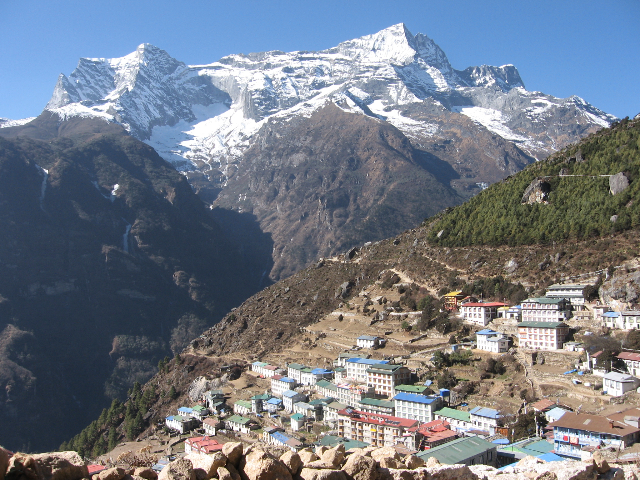
I was getting impatient and really wanted to head further up today. Eefke had felt worse than I, but was able to begin hiking again. We would just see how far we got. Our first task was to climb out of the lull in which Namche is located. We had barely been outside and this was actually the first time I consciously hike through Namche. Most of the places were closed and I started to get an impression of how ridiculously buzzy this place could get in the season.
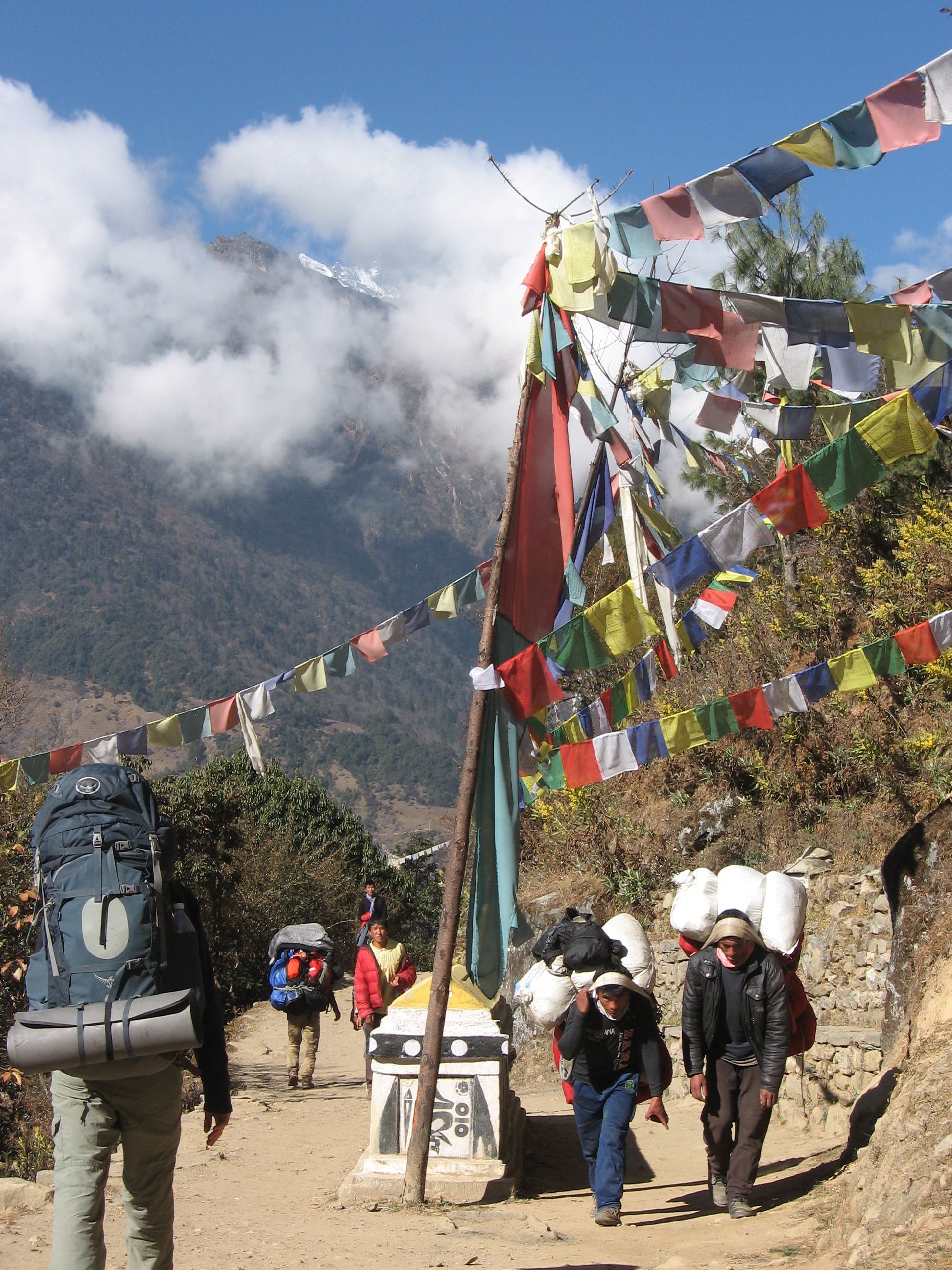
Just out of town we got our first true mountain view. Ama Dablam and Everest just over the Nuptse wall. Everest itself only played a minor role. It took me a full minute to even explain Eefke which one it was. The broad trail kept altitude for a while allowing us to enjoy the magnificent views east and north. The large white stuppa’s fitted perfectly in the landscape.
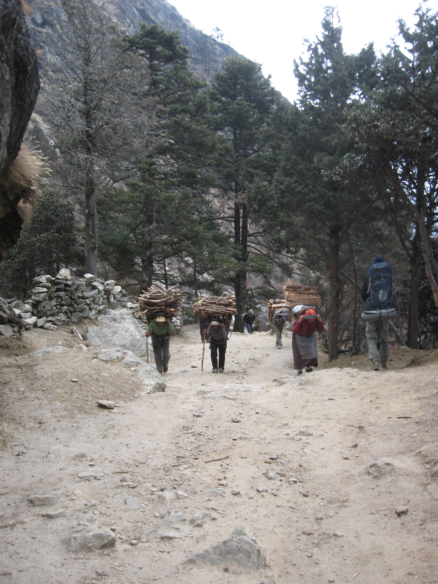
After a while the trail started to descent rapidly down to the khumbu river. Soon after we were in sparse forest again. We met countless locals carrying firewood in the opposite direction.
Once all the way down at the river Eefke did not have the energy yet to make the climb all the way to Tengboche. As we just recovered it was best not to press on to much anyway, so we stayed over at tiny Punki Tenge all the way down in the valley.
Punki Tenga is a strange place to stay overnight, but there was a smal lodge where we spent the rest of the day eating noodles and playing cards. When the lights went down due to the lack of solar energy we went to bed. It was way less insulated then our hotel in Namche and our bottles froze completely over in the night.
Day 6
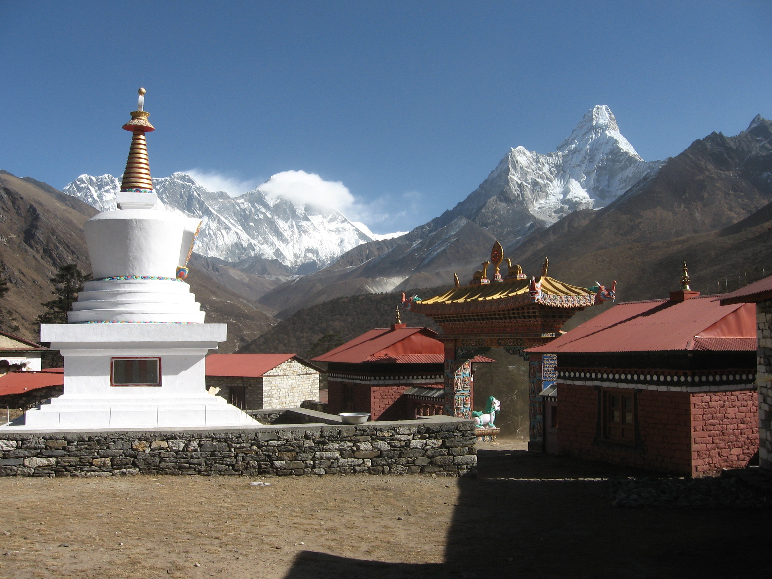
Tengboche is a long, dear I say boring, climb up. It is about 600 meters of zigzagging through Rhododendron forest. The view from the top made up for the climb however. North of us we could see the Amadablam and Nuptse wall once more. The mountains formed an amazing backdrop to the monastery itself. It was very quiet, but we could find a hotel that served lunch.
At lunch we met two germans who were on their way to Dingboche to head on to Lubuche next day. They had only stayed one day in Namche so alcimatization wise it was quite a risky itinerary. Luckily they were reasonable enough to adapt it a little.
Eefke and I were very coservative and did not go further than Pangboche this day. Pangboche is a small lodge town right at the food of Amadablam. The fireplace and restaurant was located on top of the lodge with 360 windows granting views over the surrounding mountains. There was music playing and I think this is quite as relaxed as trekking can get.
Day 7
Our final destination Dingboche lay only three hours further. The by acclimatization forced short days were really getting on my nerves, but I did not want to take chances on my first ever trip to altitude.

We hiked over the valley floor. It was very windy. We could literally lean into the wind. The mountains south of us started to show. They were worthy rivals of the ones in the direction of Everst itself.
After a short while we could start I climb to Dingboche where we arrived just 30 minutes later. It was cold outside so we once again spent the entire rest of the day inside and hurdled around the fire as soon as our host lighted it.
Day 8
Another acclimatization day. God the complete lack of tempo really started to get to me. Luckily the side trip to Chukhung was really worth our while. The weather was once again crystal clear and the distant mountains behind us as well as the might ice wall ahead of us were simply stunning.


It was a short hike to the lodges of Chukhung and the terrain was as flat as you can reasonably mountainous terrain to get. We shortly hike up the glacier behind of the lodges, but as I got a small headache and we were afraid of altitude problems we retreated to the lodge in Chukhung and ate some disgusting canned soup. We met the Germans we had seen in Tengboche again, they went all the way to the glacial lake a few kilometers up the glacier.
Day 9
Today we could at last do an actual full day hike. The first stage of the trek went straight across the flat valley. It was a real wind tunnel down here and it did not take long or we were wearing rain gear. Once more I noticed how silent this valley was during this time of year.
There was no clear path, but many small spurs instead. After about an hour the path started to climb the valley side increasing our view back south.

We had lunch in Dughla right under the mighty Khumbu glacier. During our lunch we could look over the trail zigzagging up the glacier. A total altitude gain of about 300 meters.
It was already getting dark by the time we arrived at Lobuche. Lobuche is located right next to the glacier and has only a few (though very large) lodges. The rooms are quite luxurious and well insulated. After dinner an older German man came in requesting help for a Japanese guy he passed along the way. The poor man was exhausted due to altitude sickness and could not make it to Lobuche. Our host volunteered to go help and about an hour later the the man came in gasping for air.
Due to the excitement of seeing Everest face to face tomorrow and altitude I barely slept that night.
Day 10
The Japanese guy of yesterday had recovered a bit, sleeping at a lower altitude had apparently helped. Eefke did not feel to well but decided to give it a go. Unfortunately she returned after having hiked up for about 30 minutes. I was on my own. Well as alone as one can be in the Khumbu valley.

The way along the glacier was easy only just before Gorakshep the going got a bit tougher. Here you need to cross a large glacier merging with the main Khumbu glacier. It was my first time above 5000 meters ever and it felt starnge being out of breath after each mini-ascend. Having Eefke, the Japanese guy of last night and my recent illness in mind I was a bit cautious not to get caught by the altitude.
After having crossed the glacier it was a short descend to Gorakshep. Gorakshep is a small lodge settlement on a remarkably flat gravel area surrounded by glacier and peaks on all sides. Right behind Gorakshep lay the black unappetizing looking Kalapathar. The symbolic endpoint of the Khumbu valley.

I did not stop for lunch and instead immediately started climbing up KalaPathar. At about half way the top of mount Everest started to show. An impressive sight, but not entirely worth all the fuzz made about it. (This sight of Everest might be the most widespread photo in Kathmandu. It greets you in the arrival hall of the airport and is printed on all paper money.)

When I was a bit over half way I felt I had a nice enough view and decided to go back. Due to all the recent events I was just getting a too worried about altitude sickness. Besides I was only by myself now.
The way down to Lobuche went quickly. On the way I greeted and encouraged many people who were still heading up.
Once back in the lodge I found Eefke who was angaged with the German. This older man had been coming to Nepal ever since his younger years and had many stories to tell about his adventures around Khumbu and beyond.
It was still early in the day and we decided to hike all the way back to Dingboche. Eefke was not feeling like climbing over the Cho la so we would start hiking around it. On our way to Dingboche we were granted one of the best I had till than ever had. Clouds were just rolling in from down the valley. The soaring peaks above the clouds with Amadablam in the main role was simply amazing.

Day 11
In the mornging a thin haze hung right above us. We could still feel the warmth of the sun, but it was the first morning without clear skies. As we walked further down valley to Pangboche the weather worsened. The mist now lay thick and we could barely make out the trees right in front of us. From Pangboche we parted with the trail from which we came and headed to Phortse.
The road contoured high along the valley side. We only met one other man on the trail and we were starting to wonder where in this thick mist we were heading. The haze and snow made the mountainous terrain quite mysterious.
We only saw the first houses of Phortse when they were right in front of our noses. It was bloody cold outside, even though it was barely noon, we decided to stay here for the night. We entered the first lodge in town and ate fries at the fire for the rest of the day. Our host spoke fluent English and was extremely chatty. Latter in the day two Americans also cam in, making it a real social event.
Day 12
Last night we could see some stars shining promisingly through the clouds. When we woke however the weather was shit again. It snowed just a little, but the it was freezing cold and very misty.
Discouraged we took all the time in the world to have our breakfast. If the weather was not enough of a bummer, my stomach hurt as well. Together with the Americans we sat around the fire stalling our departure. At 11 am when it had stopped snowing we at last left. Our host explained the way. Go down to the river he said. From there hike up again. You will think you took the wrong way, but at that point think back of what I now tell you. ‘It is the right way’.
Not long after we were indeed following a very small trail through dense Rhododendron forest. We thought back of him and climbed further up till we came to a larger track leading up valley towards Gokyo.

The weather mist did not clear up and it remained cold. We passed many frozen waterfalls. After about 4 hours we passed Dole where we wanted to grab lunch. Lunch however quickly became staying over all together.
It was quite buzzy in Dole and I played cards with an Indian group for the rest of the day. I thought them Hearts and they taught me a kind of poker game which I today still do not fully grasp.
When I went outside for a moment in the evening the mist finally seemed to start wading.
Day 13
The weather was clearing up, no doubt, it was clearing up. Great, the rumours of the beauty of Gokyo were to good to get ruined by the type of weather we had suffered for the past two days.
It was still cloudy, but it was no longer mist. Encouraged we hiked further up valley over the broad track. As we continued the clouds rolled back towards the south in the way they had rolled in just three days ago. We had forgotten how beautiful the mountains were now they were revealed again.
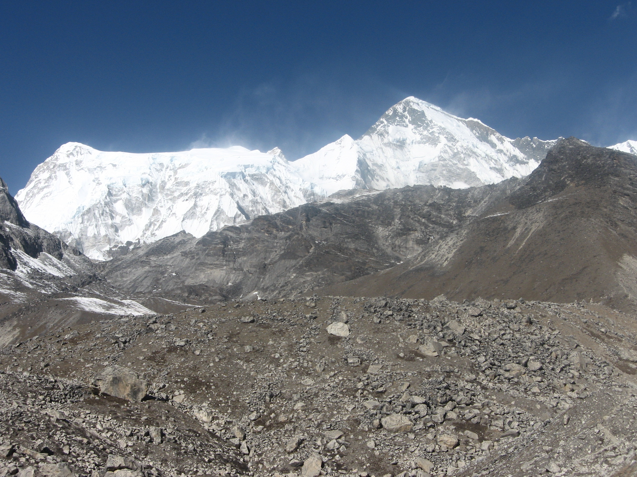
On the other side of the valley we saw a rather severe avalanche, lucky to have chosen this side we. North of us we saw the Cho Oyu rising up. This 8200 meters high mountain marked the end of the Gokyo valley. Stories of the beauty of the Gokyo valley are widespread but from up here we could not see anything more than the the mountain rising up in the distance.
We hiked slowly, enjoying the surrounding and weather. Once we arrived in Gokyo village the sun was already setting. Gokyo village is a rather large lodge town right next to the glacier. Only two lodges were open, we chose the one that had been recommended to us a few days back by the older German man. Nice people and ‘the best pasta’ in Nepal he had said. Indeed he was right it was a meal with basil and everything. The people were friendly as well. It was a family owned lodge and they were very proud to have the good reputation that they hold.
Day 14
Today we were to set course to Schroundlers viewpoint of Everst and some of the higher up lakes. Eefke had not slept well and was not in the mood to hike above 5000 meters, she decided to stay behind.

The hike up valley towards the foot of Cho Oyu is very underrated in my opinion. This must be one of the most beautifull places on this planet. Unearthly shaped peaks to the south east. The massive Cho Oyu in the north. The scenic lakes. And to top it all off the massive Gokyo glacier and Everst in the far east.

I felt for Eefke as she had not come with me, but when I returned she had had a perfect day as well. She had decided not to cross the Renjo la tomorrow, but instead go back to Namche Bazaar. I decided to do the Renjo la on my own in that case. The scenery and weather were simply too good to let this famous pass slip away.

When people in the lodge and Eefke objected it slowly dawned upon me that hiking solo over an 5000meters plus pass in mid-winter was not the most responsible thing ever so I struck a compromise and asked a Nepalese staff member of the lodge to accompany me to the top of the pass, where we would part ways again.
Day 15
We left as soon as morning broken and hiked as lightning. My guide was not kidding around. We hiked passed the lake and up the bouldered slopes. Half way I really needed to take a break in order to catch a breath. I did hurry along, the weather was perfect and I wanted to reach the pass under these circumstances.
East of us mount Makalu, Nuptse, Lotse and Everst already started to rise over the valley ridge.

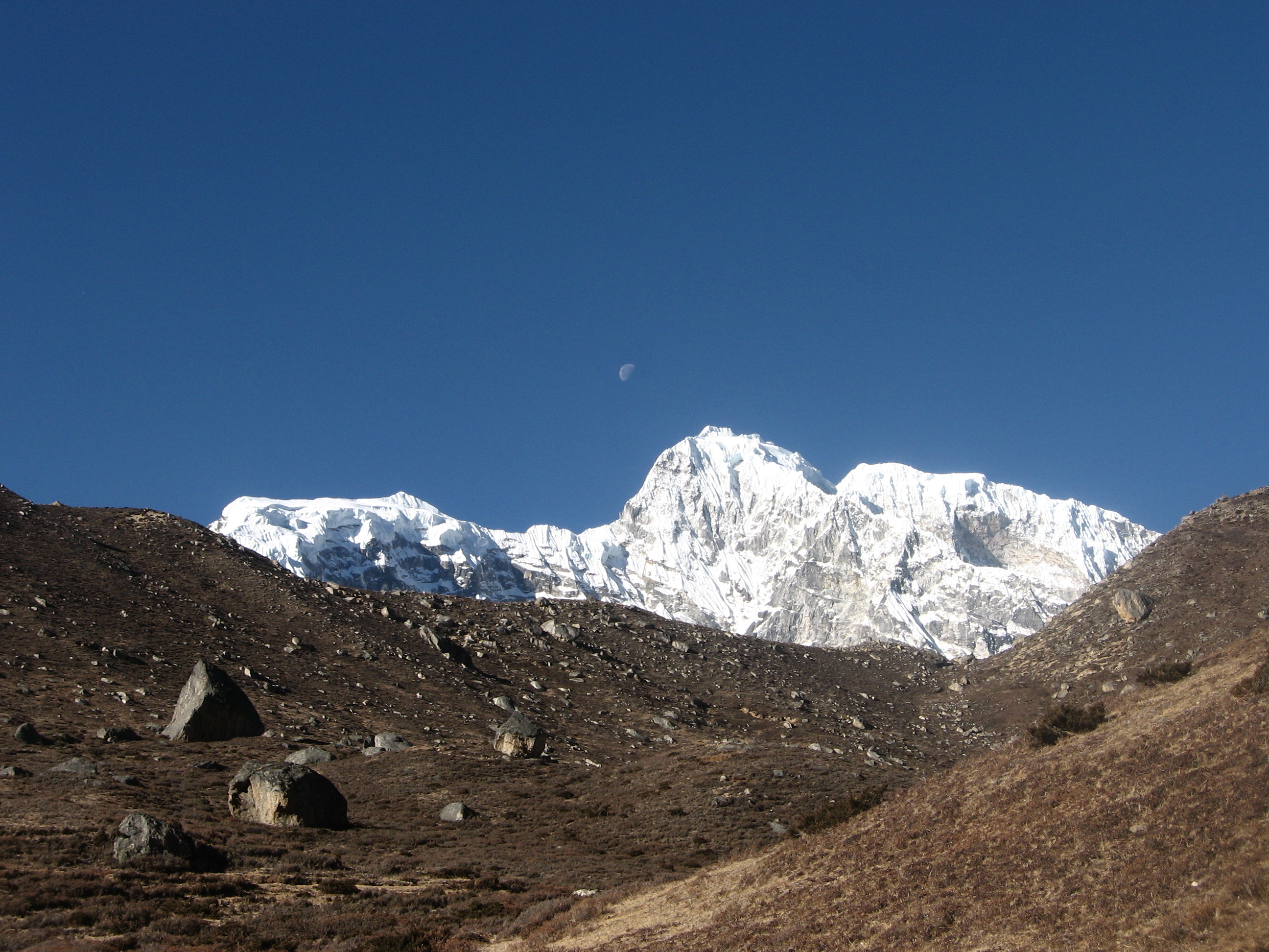
Right under the pass the slopes got snowy and more slippery. A couple passed us on their way down. They had chosen a different route and did not see us. Soon after we reached the pass. The view from Renjo la towards the east was simply mind blowing. Here it truly felt like glancing over the roof of the world.
Me and my guide parted ways. He went back to Gokyo and I crossed over to Lungden on the other side. I joked to him that he could be back for breakfast, as it was only 8:30 am.
The way down was a lot longer. First came a steep and slippery stairs after which I needed to traverse some rather deep snow. I was all by myself and hoped that I would not get stuck in the snow.
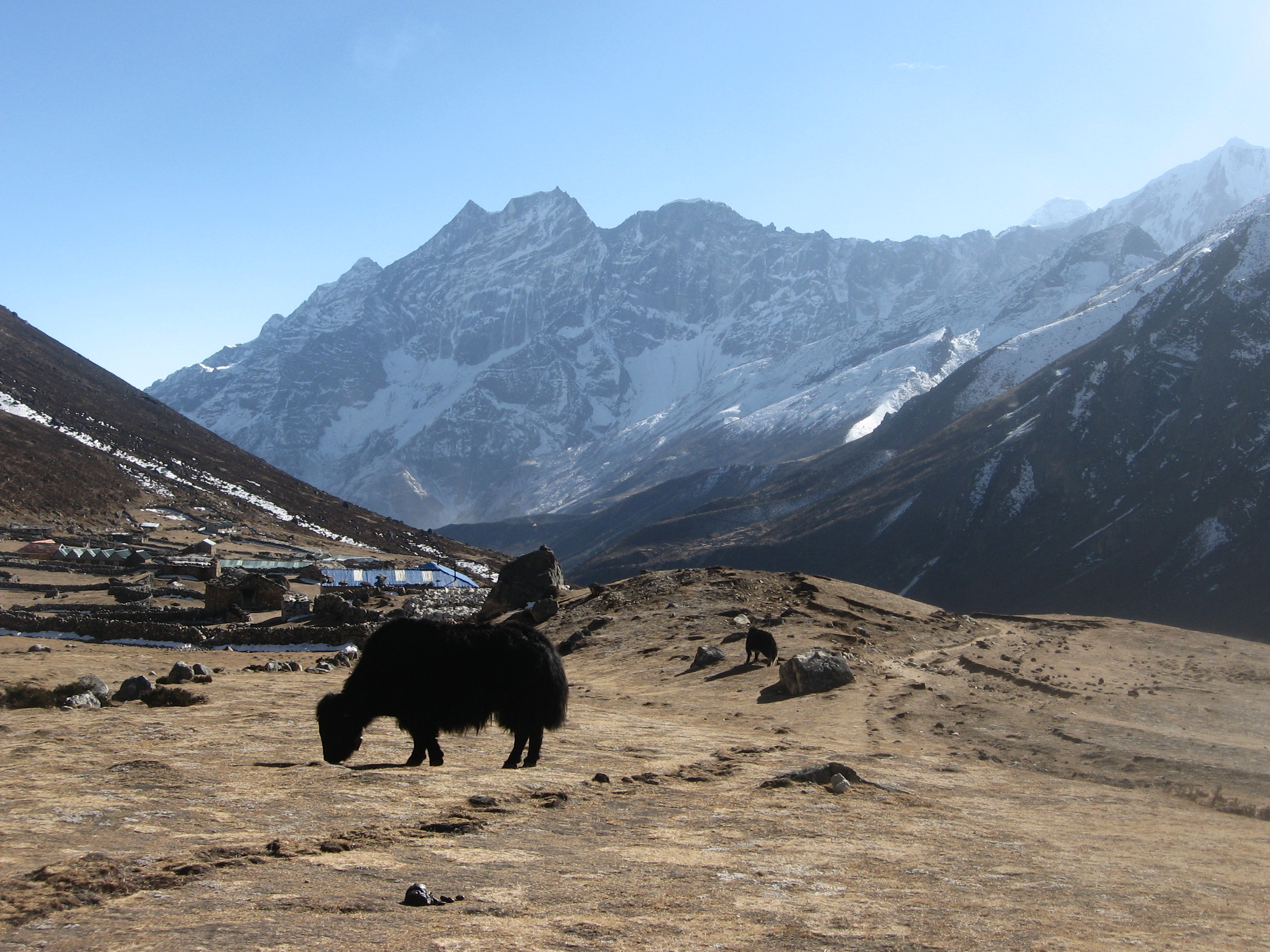
I was happy to reach Lungden in the afternoon. There was only one lodge open and I was their only guest. The Khote valley where I was right now is very quiet when compared to Khumbu and Gokyo. I sat outside the lodge thinking back of the unbelievable views of that morning and looking at the impressive Kongde rock face south.
Day 16
Today I would meet up with Eefke in Namche Bazaar. The bhote valley was quite a bit different for Khumbu and Gokyo. It lacked the steep mountain cliffs, but it was way more quiet than one would expect from a valley in Solukhumbu. There was no real trail, more a bunch of intertwining sheep tracks aiming down valley.
I came by a few abandoned yak hearding stations on the way. In about two hours I arrived in Thame. I also cam across an information sign about Nangpa la, the pass I had dreamt to climb, but dropped as soon as I had gotten here. A large settlement that was, unlike Namche Bazaar not been completely taken over by lodges.

I hiked up to monastery of the village which was scenically located on the steep valley side. I did not spent too long as I wanted to reach Namche Bazaar at around lunch time.
The trail to Namche Bazaar was easy, but had many ups and downs. I met Eefke in the hotel we knew so well by now. First I had thought to immediately descent to Phakding, but Eefke had already booked a room and besides we would have another night to say goodbye to beautiful Khubmu.
Day 17
On the way down to Phakding we realized that we could have already seen the Everest on our way up had the weather been better. It was our final goodbye to the Himalayan peaks, from here we would explore the Mahabarata, the green foothills of the Himalaya.
The way between Namche and Lukla was rather crowded and full with large American groups wearing Christmas heads breaking the mood. It turned out that weather had been bad down here and this was the first opportunity for people to get into the region.
We picked up our camping gear that we had left behind. It was heavy, we now had to carry easily about 20kg each. Dried food, tents and all kinds of stuff we really did not need.
After Lukla the tourists disappeared. Not every house was a lodge anymore. It was a different experience and we were thrilled with it.

We ended the day early as usual. (I honestly do not think I have ever been on the road for so long covering so few kilometers.) We were the only tourists in town and settled in a small lodge overlooking the farms downhill. Food was twice as cheap as upstairs so we decided to treat ourselves and order some sides.

Later in the day a couple came in that were dropped by helicopter, apparently they were sick of waiting for a plane. In the evening lights came down the hill south of us. One of the many donkey trains supplying the upper regions in Khumbu.
Day 18
From our overnight place it was around 300 meters up to a ‘pass’. From on top we had some amazing views over the green hills around us. Hills that would count as mountains in any other region, but here.

The rest of the day we hiked high up the valley side, with the Dudh Koshi almost a thousand meters below us. The valley side was steep and we encountered only a few very small settlements on the way. Most of the route went through mixed bamboo, pine and Rhododendron forest. A remarkable amount of plants were in full bloom in December.

It was a long day for us with our overweight backpacks. We were glad when we saw Bupsa. This was the first major settlement. Terraced fields as far as one could see, loud school children and countless shops. We stayed in the first lodge we came by and with that the one looking over the rest of the town.
From the grass field in front of our lodge we could see the Taksindu la we needed to cross tomorrow as well as the famous Pikey peak, that we by now had decided not to climb.
Due to some crazy coincidence the we met the doctor who helped us back in Namche Bazaar. She turned out to be the daughter of our landlady.
Day 19
Even though we could see Nunthala and the Taksindu la on the other valley side just about 4 kilometers away it would be a project of a day getting there. We hade to descend 700 meters all the way to the Dudh koshi river and than it was another 1500 meters up to the Taksindu pass.
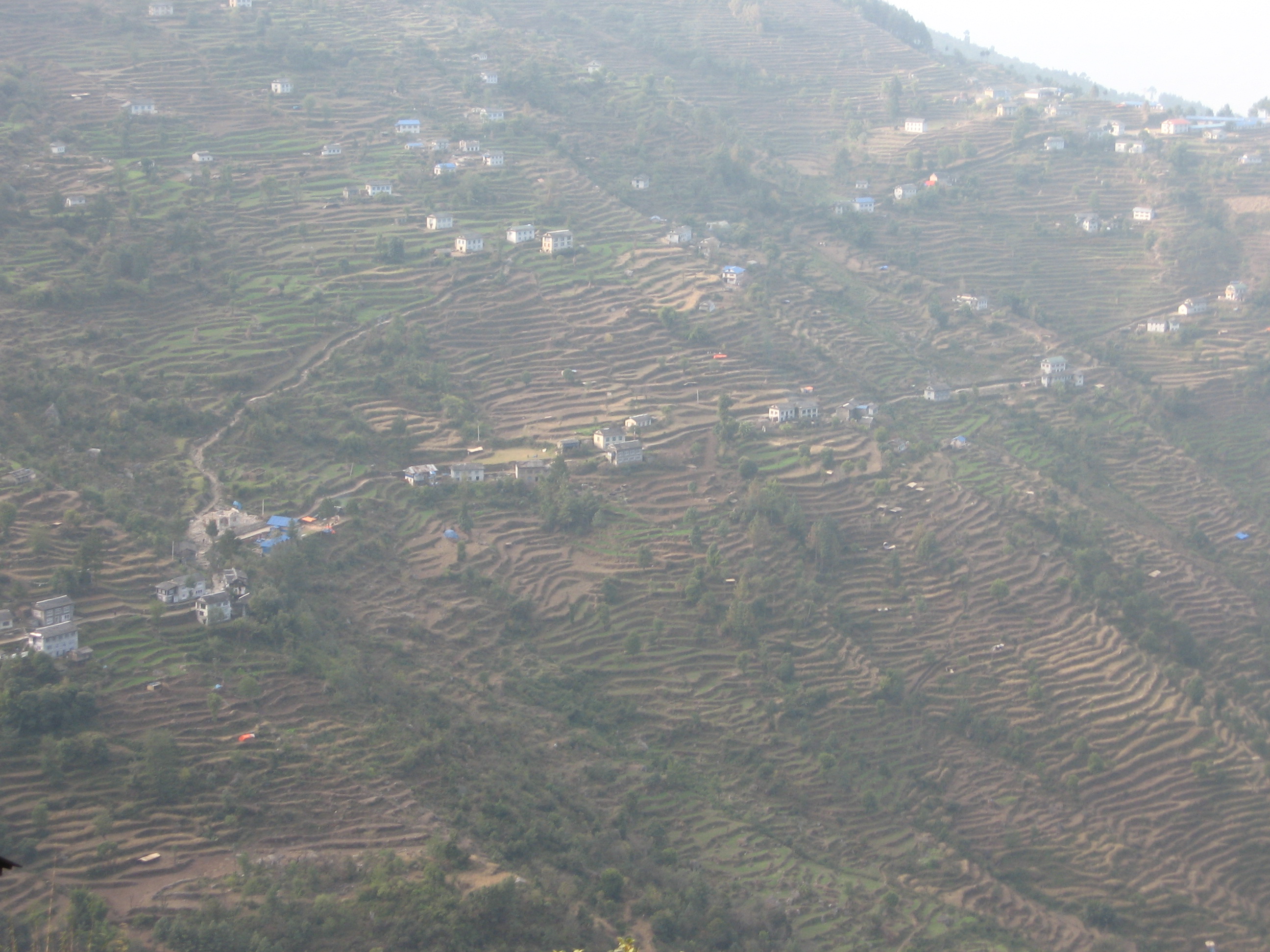
In contrast to yesterday the trail was buzzy with locals, children and traders. Here at the lowest point of our trek nature was still in full bloom. Cozy gardens and full farms. The contrast with Khumbu was striking.
Down at the Dudh Koshi lay the longest suspension bridge of Nepal. At least so I have been told. From there the ascend began. For the first time it was too hot. The sun shone, we had to climb and we were at only 1600 meters.
Once in Nunthala we were happy to catch a break and ordered some fries. It took well over two hours for them to prepare it… We got restless and started to wander around. Nunthala is kind of a western town. It is built in a long line along the road and it’s houses have predominantly flat roofs.
After finally getting our tiny portion of fries we went on. We hiked till the sun started to set and stayed over at a large hotel still under construction. We were the only guests and a father and his young sun took their job as hosts very seriously. Prices were cheap and we ordered a lot of sides and apple pie. From our window we could see the sun setting over mount Number.
Day 20
It was only a tiny bit further up to the Taksindu pass. We passed the famous Taksindu monetary and about 150 meters further up we were on the pass itself. Or well pass, it was a broad hill with an entire lodge town right on it. On top we also saw a sign pointing to dudh Kunda, a glacier lake that I had planned to visit, but had given up upon. Due to sickness, cold, heavy packs and lack of experience some of my plans were simply too far fetched. (yet).
A short descend brought us to Ringmu. We met a man who had been to Nepal many times before. We told him that we wanted to got to Chitwan next and planned to take a jeep from Phaplu to Kathmandu first. He told us that we might be able to reach Chitwan directly as our jeep ride would take us all over the Terai anyway. That might be a nice idea.
From Ringmu we left the classic trail leading from Lukla to Namche Bazaar and set course to Phaplu. A road was under construction and the magic was broken. We walked through rather monotone pine forest towards the district head quarters. I marked the Taksindu pass as the mental ending point of our trek.
Phaplu was a noisy and large town, with surprisingly few hotels in town. This town is more your standard Nepalese town. We stayed overnight in a shabby looking hotel and acquainted ourselves for the first time with classic Nepales Dal Bhat. Yep till than we had only eaten the touristy shit.
I got a bus ticket to Katari from where we, in theory, would be able to transit to Bharatpur near to Chitwan. The next day we left on the most arduous and fun jeep drive I had ever been on. A flat tire, countless stops and sinkholes. This drive had it all! On top of that I was now completely of script. I had never used Nepalese public traffic before and all I had was a vague idea of where Chitwan lay.
