August 2025
Kolti – Koltigoan – Bichye – Puli – Lampata – Rani Saun – Sakya Lagna – Jarkholsi
The valleys in Nepal that I had yet to explore were starting to run out… However in the far west of Nepal were still a few large valleys I had never been to. Initially I started looking at combining the Limi and Kora valley crossing a 5500m unnamed pass between them. It however looked like a long way to get out there, with only a small trek as a reward. When researching further I however discovered that I could combine far west Nepal with visiting Tibet and that it was in fact even possible to enter Tibet via Hilsa and travel back to Kathmandu again via Gyirong. When I also saw that the valley leading up to the Saipal was still free of roads and hosted lots of interesting looking villages I knew this would be my next destination.
The plan was to trek from Kolti to Rani Saun at the foot of mount Saipal. Instead of taking the usual route we would cross a small hill pass (deurali) via some rarely visited villages. Once at Saipal we were to cross the Sakya Lagna to Humla from where we would make a circuit hike from Dojam along the Kora river to Limi and trek back via Halji and Til. Due to time constraints we scaled back our ambition and skipped the Dojam part of the trek. Instead we drove to Traktse in Limi and made our way to Hilsa via the picturesque Halji and Til villages.
The deep forests and jungles leading up to the Saipal and the rarely visited villages built from wood and clay are the most appealing factors of the Saipal trek. Even more so than the meadows at Rani Saun and the views north from Sakya Lagna. In this valley we still got to experience the echoes of the trekking haydays in the nineties.
Limi valley is geographically and culturally linked to Tibet. It is the only place in Nepal I remember being greeted with Tashi Delek instead of the regular Namaste. Especially Til and the ‘Grand Canyon of the Himalaya’ that we had to traverse to make it from Til to Hilsa made a lasting impression on me.
Day 1
After a brutal bus ride of around 35 hours we had made it to Martadi the day before. As per usual the drive took longer than I expected, but here we were with (hopefully) only a short jeep drive left to bring us to the start of our hike.
We woke early morning so that we still had a long day ahead of us. When in the jeep I understood why the bus did not go further than Martadi. The road was in poor condition and we had to change jeeps twice in order to walk across the worst landslides. After about 4 hours we finally reached Kolti the start of our trek.
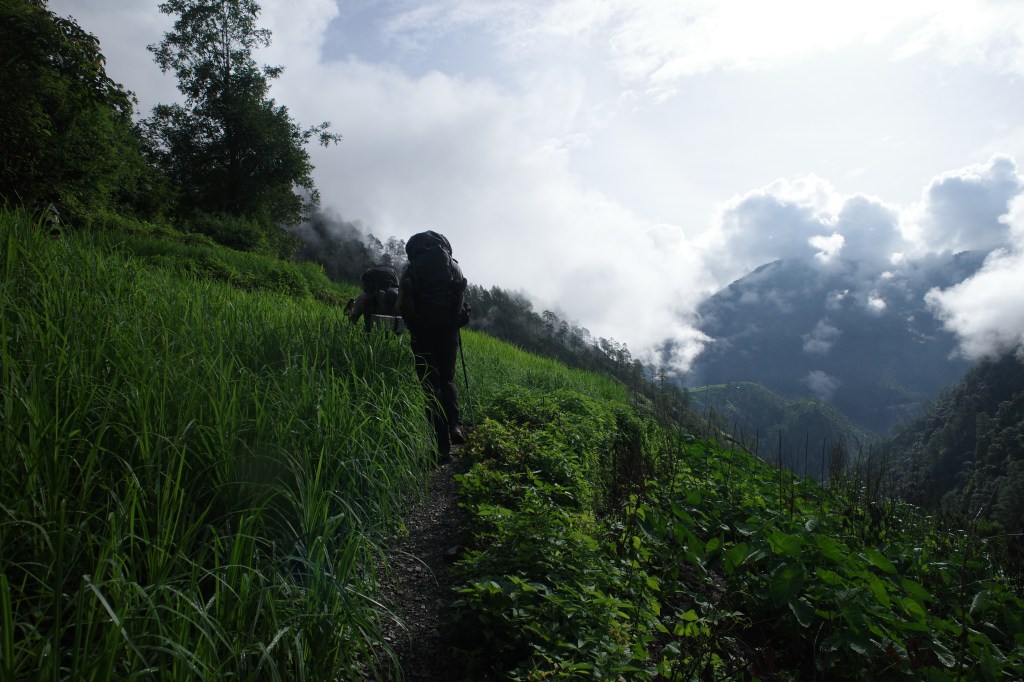
The Bajura province in Nepal is rarely trekked as it lacks the spectacular mountain views of central and eastern Nepal. But despite that the terrain is just as relentless. Around us were green though steep mountains covered with deep forests and large pastures, characteristic of this region of Nepal.

We did not dwell in Kolti as we still had a long day ahead of us, climbing up over 1200m. We slowly started the very first steps of the trek. After climbing about 50m we already found ourselves in quite an enchanting place. We followed a small stream into a canyon with steep walls on both sides of us. We crossed the water regularly and came across a nice waterfall.
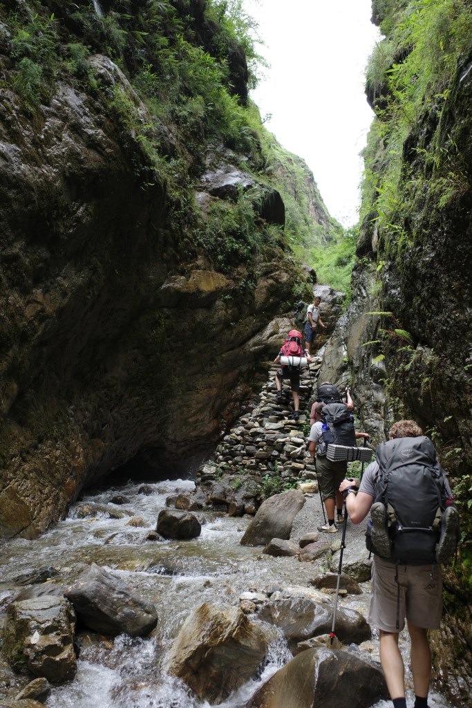
Our guide worried whether we would reach our destination in time as the progress through the canyon was slow. But soon the canyon gave way to a broader valley and the first agricultural fields presented themselves. We had to climb quite a bit further up over good trails along a few picturesque villages.
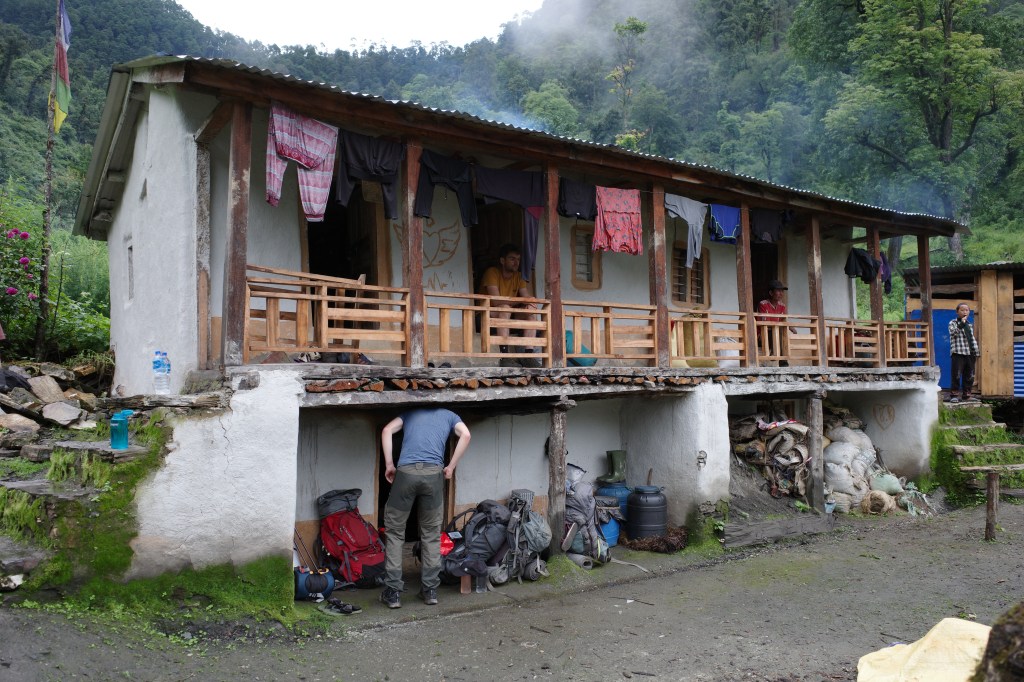
Once in … it took some time to convince a local family to host us. We were welcome, but she was doubting whether they had accommodation suitable for us. We persuaded her that we would be grateful for anything she could arrange for us. Apparently we were the first foreigners to visit the village aside from some people from an NGO a couple of years back.
Day 2
From … we hiked steeply up through the forest and pastures to the nearby pass. Leeches were rampant and it was a constant battle to keep them from your shoes. We had gotten some salt from our hosts the evening before which helped, but there were literal hundreds of the beasts on our shoes and there was no holding them… They just won out by sheer numbers. Only at around 3200m the leeches started to disappear and we could sit on the ground again. We made it to the pass at around midday. It was a typical grassy hill pass, making route finding a bit difficult, but luckily we quickly found a broad trail descending steep down through the thick forest.

the way down was broad, but steep and slippery. Progress was excruciatingly slow. It was around 2:30pm that I seriously started to worry whether we would make it to Koltigoan before sunset. The terrain remained difficult for quite a while, with now and then dense vegetation. We could see a village in the distance, but it looked far away. In fact it also was pretty far away…
After the steep slopes came some thick jungle slowing us down. It was clear people had been on this path frequently, but in monsoon the vegetation grows so quick that even regular foot tracks are not able to keep it in check. All things come to an end though and eventually the trail climbed out of the forest and became a well carved out sandy trail following an extremely steep grass slope. We hiked swiftly, but nonetheless it was already nightfall when we descended the last hill. As per usual during the monsoon the rain was poring down in the evening making things even harder to see.
We felt pretty happy when we finally made it to Kotigoan and a friendly family took us in. We dried our clothes, ate some Dal Bhat and hoped that better times were now ahead of us.
Day 3
We planned to go to Bichiya today and it promised to be an easier day today. The day started out with what would turn out to be a hallmark Bajura specialty, way to dry smoky Chapatti.

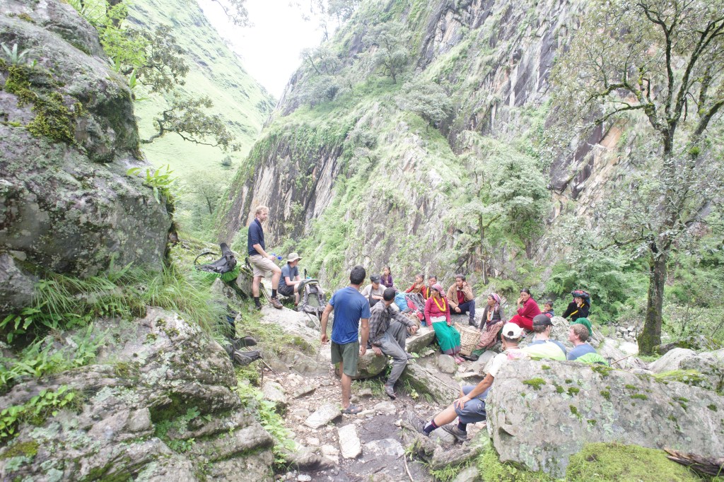
We started the day be descending to the bridge and than climbing up via small agricultural fields to the next village. Once there we were treated to some nice farm fresh apples and got some more instruction regarding the route ahead. We probably should have listened better to those instructions as not soon after Our guide opted for a trail going straight down, this trail was smaller but better trodden that the one we were on.

The trail remained good for a while, but soon got steeper and steeper. At some point the trail terminated at a small grass plain that had a few cows on it. Darn… We had just followed a trail to a grazing pasture in the middle of nowhere. A rather faint trail continued further down. As had gone so far we decided to try our luck and see if we could get down all the way to the river below. The trail got ever fainter and just when we were starting to doubt whether we would make it all the way down we got to the water point of a village that had to be close. From that point the trail got better defined and we could make it to the secondary trail below.
When finally down everyone was feeling pretty exhausted. It was even suggested to just camp right there and go to a village the day after. But we hiked for another hour or so till we got sight of the village. They told us we should cross the log over the river to get to the village sooner, but it looked like a total death trap and our guide was having none of it. In the end the bridge was just 15 minutes walk, so I’m glad that we took the time instead of risking our lives by crossing a raging river over a slippery log.

We were once again treated on a wonderful, this time even rather spacious home stay. Staying overnight in these traditionally built villages in the middle of these forested mountains was definitely the highlight of the trek.
Day 4
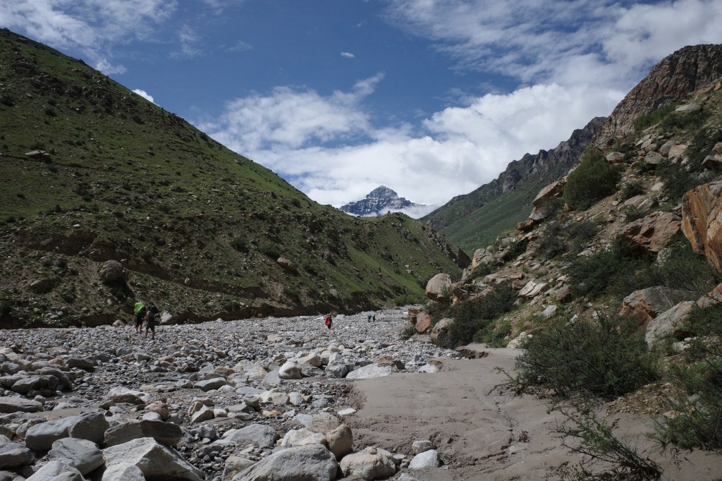
Today was finally that easier day we longed for. We started out with a nice leveled hike along the valley slope, with some nice views over the main Saipal valley east of us. It was not long or we could hike down to Bichiya where we could have some early lunch. We were now on the ‘official’ Saipal trek and it seemed reasonable to expect that trail to get easier from here on out. We had to do one more steep climb up and then we could follow the main river all the way up to it’s source Rani Saun, at the foot of mount Saipal.
Of course, for tradition’s sake we did end up taking a wrong turn and having to a mad of track descend, but it was a modest one this time. We arrived at our ‘hotel’ at around 3pm and could for a change relax a bit next to the gorging river.

Day 5
It had rained like crazy during the night. Even for monsoon standards it had been a downpour. When we woke up the river had swollen to roaring proportions even getting me worried whether the trail to Gumba would still be accessible…
The weather did not do well for the moral, which was already low after a few long days on the trail. After the first hour we decided we had enough and hired a two local porters at our tea break. The porters helped enormously, the lighter weight made us speed up a lot and the group could enjoy the hike much better.
After our tea break the valley got quieter. The trail was smaller and there were no villages along the way. We continued our way along the raging river through deep forests. The trail stayed close to the river with only a few ups and downs. At some points we had to get our feet wet due to the overflowing river.
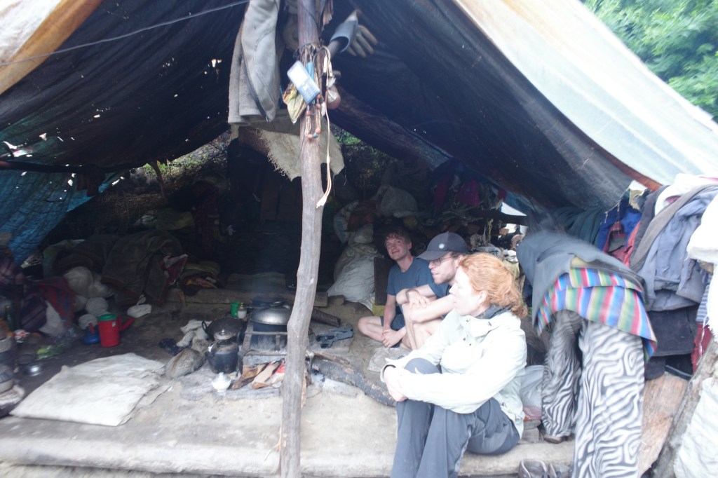
We had intended to go to Gumba today but decided on staying in Puli a small Kharka with a wooden hut and some shepherds. Puli felt, as Martijn descibed it, like a ‘National Geographic Last Uncontacted Tribe’ experience. The hut was too small to sleep in so we slept like the locals under a plastic tarp that was set up for us on the spot. Nick was rather perplexed that staying overnight here was even an option… The further we went up valley the more basic the accommodation got. The food however did not weaver, the morning chapatis were as drained with ash and smoke as they always were in this valley.
Day 6
Our tarp had kept us remarkably dry during the nightly rains. We had slept with the 6 of us side by side under the plastic wondering whether we would remain dry. It turned out we would. As we got ready for breakfast we got to enjoy some sun again, a nice change of tune with yesterday. It would be a long day to Rani Saun, but we had porters to carry much of our luggage and who knew the local terrain, so we had good reason to feel optimistic.
As we said goodbye to our hosts we set course north ever further up valley. At this point the valley was getting rather narrow and the forest thicker. After a few hours it felt like the valley would be uninhabited, but we knew the small village Gumba had to still lay ahead of us.

After around 4 hours the valley started to get a little broader and the forest gave way to a few meadows. The river that had at this point in the valley lost a bit of it’s power flowed along the meadows and pine forest through the valley floor. It looked like a silent fairy tale forest.
Of course Nepalese being Napali, not an inch of flat land shall be wasted and the village Gumba got in sight. Gumba consisted of just a few houses, one of which runs a tiny teashop where we stayed for some noodles. As the sun was still going strong and the ground less muddy than most villages along the trail we could relax outside for a change.

After an hour or so we went on, we still had quite a lot of daylight ahead of us, but we wanted to make it to Lampata before the rain would set in again. By leaving Gumba we left behind the last permanent settlement in the valley. It took us a few easy going hours to reach Lampata. A small hut hosting a lot of Nepalese bringing supplies to and from Rani Saun (the large kharka at the foot of Saipal). Space was a real issue and we had to squeeze in to find a place to sleep. Martijn and Ayla pitched their tent.
Day 7
Lampata lay around the tree line and today would be a short hike along the river over the green meadows to Rani Saun. Unfortunately the weather was not on our side, clouds kept rolling in from down the valley and were trapped at the valley end. As we approached Rani Saun we could only see some of the bottom of Saipal and even that got hidden from view as more clouds started to role in.
When we already got view of the first tented camps the rain began to fall. And not just some rain, but a real monsoon downpour. There was a medium sized hut with a large room for visitors to stay. This was probably the best room we had gotten so far. It fitted all 6 of us with backpacks and we could all stand upright (the bar is low).
We spent the rest of the day laying in our sleeping bags hiding from the hideous weather outside. I sometimes looked outside in the hope to get a glimpse of mount Saipal, but it seemed unlikely the thick clouds would lift up any time soon. In the evening it got a bit drier, but the clouds did not give way. I even stood up a few times at night to check if I could see the mountain, but each time there was a thick mist.
Day 8
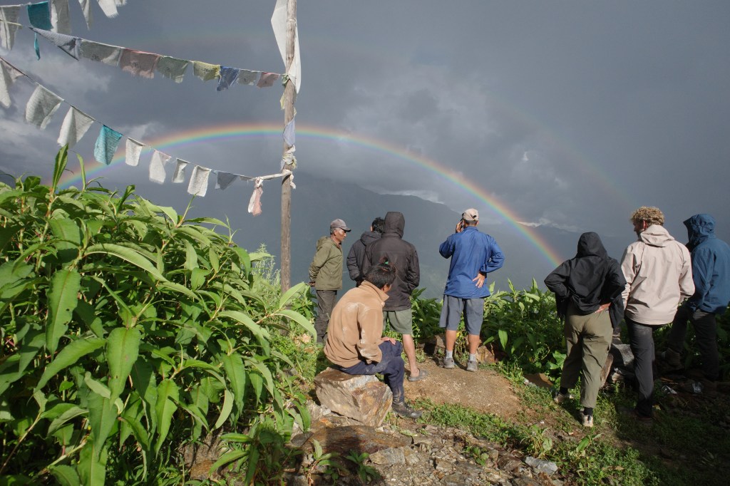
I had started to loose hope seeing Saipal at all, but in the morning, out of nowhere, the clouds did ease a bit and the top of mount Saipal showed itself. Later in the morning a rainbow even got through.


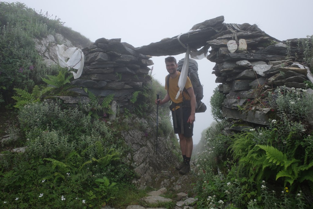
The weather kept improving over the next few hours as we slowly made our way up to the 4750m high Sakya Lagna. A moderate twin pass we had to cross to reach Humla. We slowly but steadily climbed the slopes till the pass. As we inched closer to the Sakya Lagna the clouds moved in again. It was not the heavy rain of the day before, but the high winds made it pretty miserable on the saddle of the pass itself. It was very foggy at this point, but sometimes the fog blew over and we could see the Kharka down where we would sleep and the other saddle point of the Skaya Lagna. Due to an optical illusion the way up for tomorrow from the Kharka to the pass seemed insanely steep.
Once donw at the Kharka the sun had started to shine again granting us a relaxed afternoon. This was the first place during the trek where we had to camp, but we could sit and eat in the larger tea tent of our host.

Day 9
Today could go two ways. We would need to cross the second part of the Sakya Lagna and descend via a non jeep-able track Jarkholsi. The locals informed us that it might or might not be possible to order a jeep from there. If not it would be a very long way to reach the Humla valley, if so it would be a rather manageable day.
The weather was quite clear today and we had a nice view over the Chang la himal mountains north of us. We could even see the almost 8000m high Gurla Mandathi in China.

It was a short but steep climb to the Sakya Lagna, where we took a small rest after which we began our long descend to Humla. We would have to descend over 2700m to make it all the way down to the Karnali river.
During the descend Peter’s shoes, that had been rapidly degrading over the past few days, reached the breaking point. His shoe sole got loose completely. Using some of Nick’s duck-tape he managed to fix them up just about reasonably enough to get down all the way to Jarkholsi…

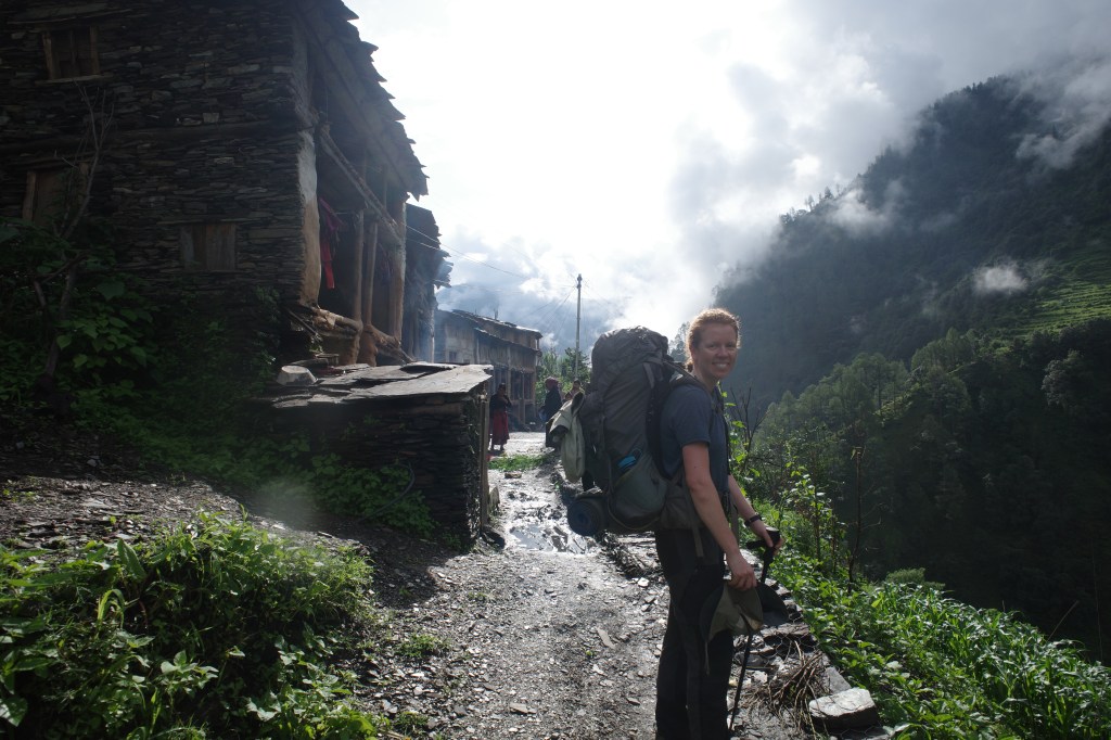
Jarkholsi village was very tiny and looked over the broad Humla valley, dotted with villages. The last time I was in Humla, almost a decade ago there had been no roads here, but now a jeep track was clearly visible down near the river. there was even a jeep-able track all the way up to the village itself. Meaning that we could order a jeep and relax a bit in the village.
The locals invited us to rest at the Gompa they were constructing. It were mostly elderly as the youngsters they said were currently with the cattle at Rani Saun.
Day 10 to 12
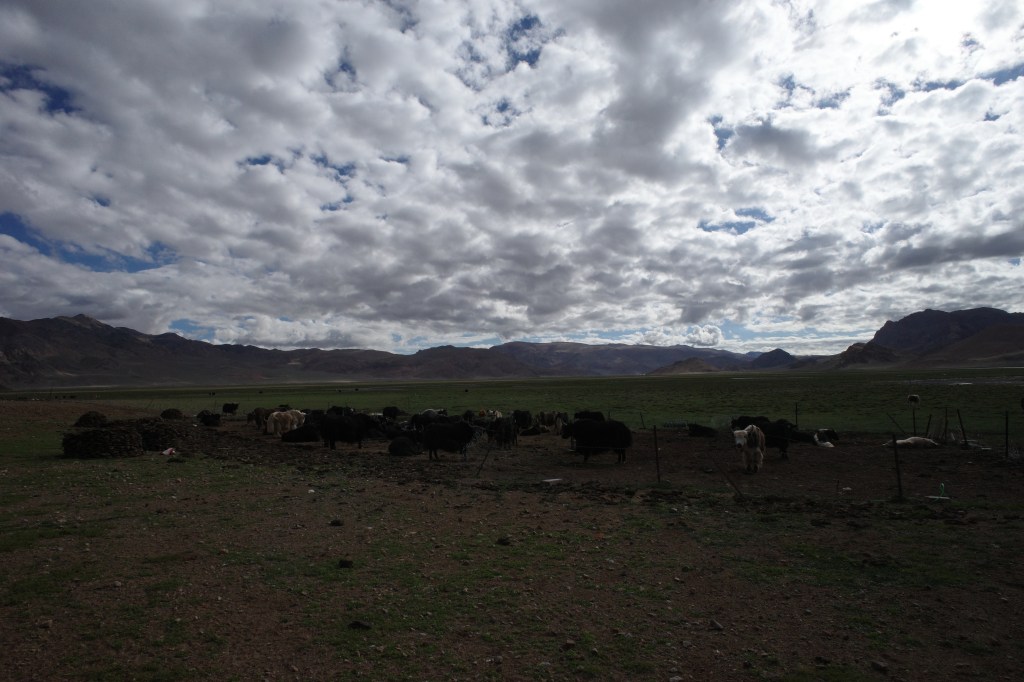
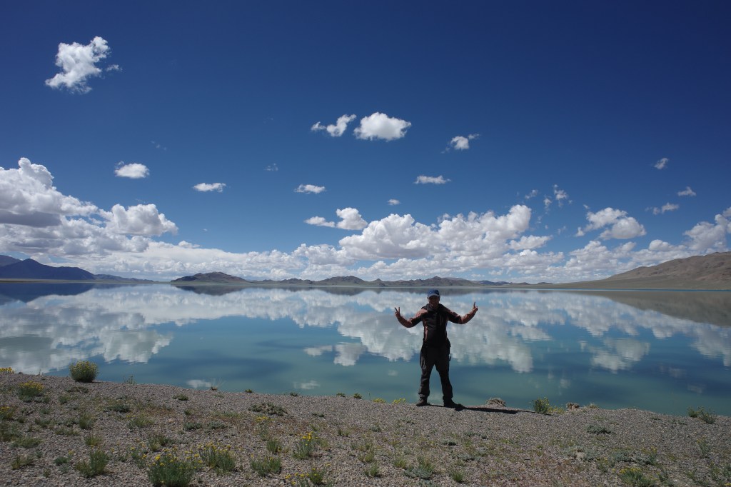
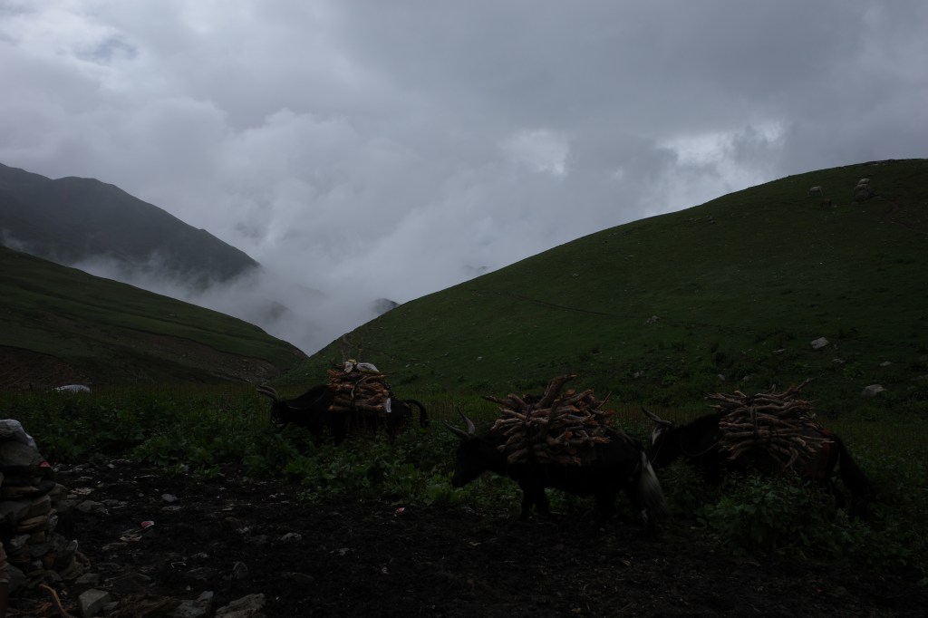
We took a private jeep to Limi valley crossing the high Selma pass on the way. Crossing this pass landed us in a completely different world. We left the cloudy green valleys behind and descended in the broad desert like Limi with it’s typical rolling brown Tibetan mountains. After driving along the yak pastures our ‘resort’ came in sight at the confluence of two rivers.
Since we decided to reach Limi by car instead of hiking in via the Koran valley we had a few extra days on our hands. Peter and I decided to spent those 3 extra days trying to climb a nearby mountain. Our initial aim was the Changwathang, but as we made our way there it turned out to be too far away to reach it’s base camp in a single day. the canyons leading up there were simply too wild to traverse quickly. Instead we setup camp at the foot of a 5992m peak that looked easy enough to climb. Unfortunately the weather had turned back when we woke up and we had to return empty handed… It was a disappointment for us, but Eline and the rest were pretty happy to see us back a day early. There had not been much to do back in the Limi ‘resort’. The main attraction in Limi resort had apparently been observing the staff fixing a jeep that constantly broke down every few meters.
Day 12
The plan was to take the jeep to Halji and continue to Til on foot. Til is the last and most remote village in the narrow Limi valley and the last place where we would be able to arrange a home stay.
We entered the very jeep that we had seen breaking down again and again the previous day. The owner told us not to pay upfront but instead wait to see how far we would get. Not great signs so far…
The first and main obstacle to reach Halji was the rather wide river on the backside of the hotel. Due to the heavy rain the previous day the water level was pretty high and the water flooded into the cabin in no time. With wet feed the jeep took us slowly but steadily through the river. On the last stretch however the jeep, of course, broke down…
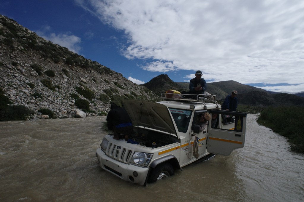
There we found ourselves stranded in the middle of the strong stream. Not an ideal place to fix up a car. We tried to push the jeep back onto an island within the stream but to no avail. The jeep was simply to heavy to be pushed up hill on rocky terrain. After some time, when I already started thinking of backup plans the driver somehow got the motor to work again and we were on our way. The road was rough and clearly not used a lot, but it was not far and there were no major obstacles, so we reached Halji in just an hour or so.
The main attraction of Halji is it’s old Tibetan monastery. It has escaped the cultural revolution by being just across the border and has a rich history and colorful design. It’s definitely one of the finest monasteries I have visited.

There was a jeep track to Til, but the bridges on the way were not reliable enough to actually be used by jeeps so we continued our way on foot. It was easy going at the start, but once we reached the side valley in which Til was located, it was quite a tough climb up to the village along the cliffs and steep valley walls.
Til itself is build in typical Tibetan style. Square houses built from cut stones built again each other in such a way that the village itself looked and felt like a fortress. The big difference with villages as I knew them in Mustang, Ladak and Dolpa was the fact that the inside and outside were not plastered with white lime. All in all it was a rather picturesque village surrounded by green fields with the high Kangdum in it’s backdrop.
We stayed overnight in the local monastery and got some last instructions regarding the trail to Hilsa.
Day 13
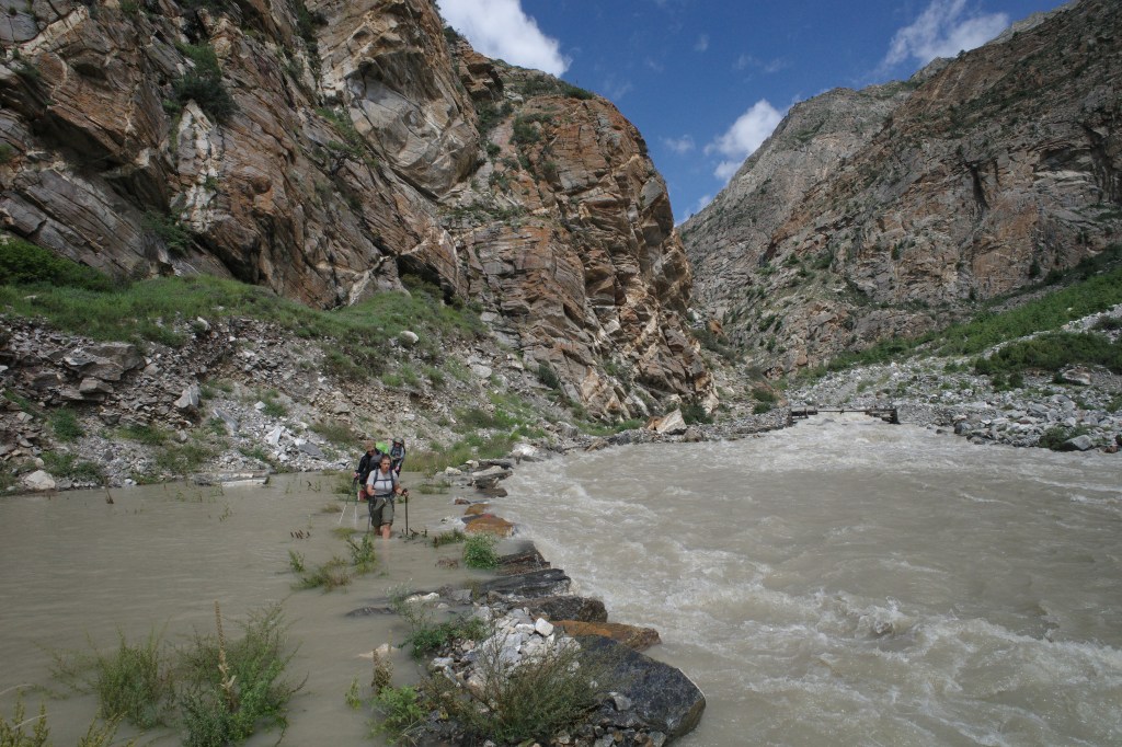
The bridge across the river had been swept away in spring so the river had to be crossed the hard way. To make our crossing as easy as possible we left early in the morning, before the bulk of the melting water would come rushing down.

Once across the river we descended the valley for a short while after climbing a few hundred meters up to follow the main valley to Hilsa. We had some nice last views over the Kangdum on the border and the Gurla Mandathi in Tibet.

The trail along the main valley was rather spectacular. The valley turned into a canyon with very steep cliffs tumbling down into the depths below us. We spent hours contouring the cliffs without making much progress in terms of kilometers. Sometimes it looked like it would be impossible to go further, but each time the winding trail found a way through.
The nicest thing we came across was an unexpected monastery built on the cliff side. It made a very spooky impression, the prayer seat made of pure hard wood had worn off by repeated kneeling. I don’t even know how often you need to kneel on hard wood to leave the traces of your knees, but I’m going to guess it is a lot.
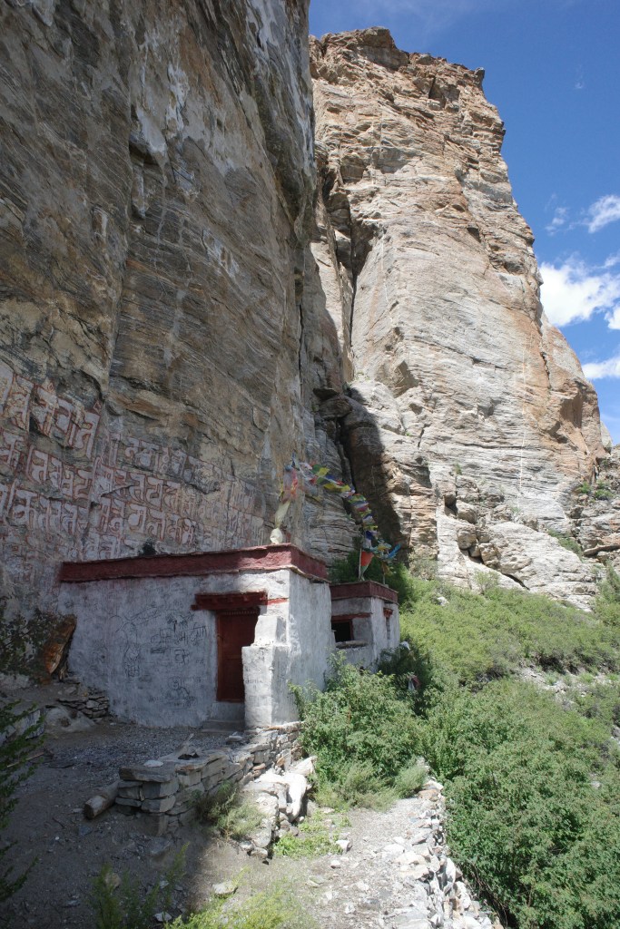
Our guide did not want to stay too long near the monastery as he found it a haunted location where maybe an important Lama was once buried.

It was getting later in the day and our camp spot was still a bit away. Though we would need to only cover 8km bird flight from Til, the constant contouring really took it’s toll. We tried to look for alternative camp spots along the way, but there was simply no reliable water source. It was only at the end of the day that we finally made it to the campsite.

Day 14
It was time for the very last stretch of the trek. We followed the large track down valley with some last ups and downs. We could already see the main road in the Humla valley comming down from the Nara Lagna. The border town Hilsa however remained out of sight. It was only at the very end after about 2.5 hours of hiking we finally got it into view. Situated in the steep barren valley it really looked like a desert town. The Chinese had built some gate way to heaven like structure as a border giving the whole town a rather unearthly feel. The way the modern Chinese buildings on one bank of the river contrasted the Nepalese shacks on the other side gave it an even stranger feeling. Somehow the modern Chinese buildings managed to be even less appealing than the structures on the Nepalsese side…
We spent the rest of the day and the next in this rather unappealing town. Hilsa is the main gateway to mount Kalaish for many Indians making this town a real transit point, somewhat comparable to Jomsom in Mustang. No one really wants to be here, yet many people are forced to spent one or two nights here.

Day 15 and onward
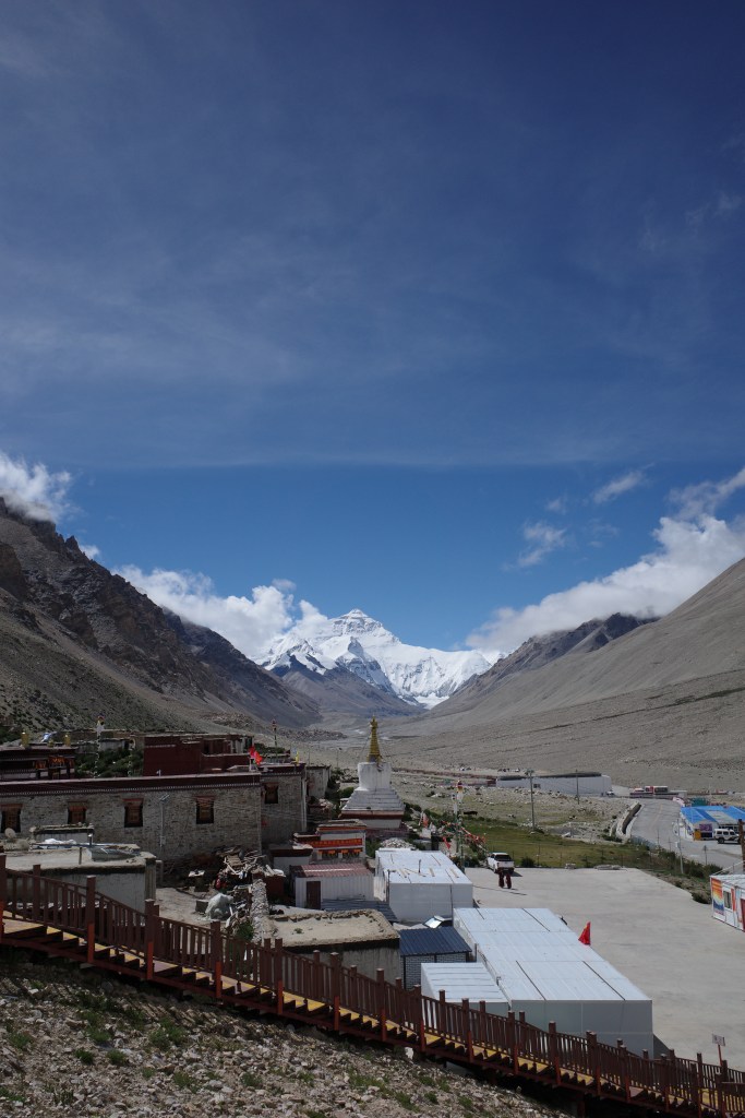
After our trek through western Nepal we crossed the border into Tibet where we did a large over land tour to Kailaish and Ali and then via the Northern route to Everest base camp and then back to Nepal via Koldari.
I have rather mixed feelings of our tour through Tibet. The landscapes were undoubtedly rather astonishing. But the total lack of freedom and the strange atmosphere of surveillance and theme park that somehow the Chinese always manage to create made it not too appealing. I’m glad that I have always spent my time exploring Nepal, India and Pakistan. I would not return to Tibet again.