

August 2017
Noatak River-Mystery spot pass-Skinny Bou pass-Alatna River-Unakserak valley-Agiak lake-Anaktuvuk-Peregrine Pass-Oolah Pass-Dalton highway
When I first heard of the Brooks Range, 8 years ago, I knew this was a place I would one day visit. That day was finally here. This wonderful mountain range in the far north of Alaska promised a trek redefining wilderness and solitude. The Brooks comprises an area of almost 900 by 200 kilometers and is home to some of the most, if not the most, varied tundra and taiga landscapes the world has to offer.
The only road in the entire region is the Dalton highway. This road traverses the range south to north, connecting Fairbanks wit the northern oilfields. The only other sign of humanity are a couple of small Inuit settlements. It seemed I was to visit some true wilderness at last.
I took the logistics and dangers of this trek very seriously. Especially the crossing of rivers and streams could become an issue. At the start of the trek, the source of the Noatak, I would be almost 200 kilometers away from the nearest settlement, Anaktuvuk without a single trail or established route in between. A supply and navigation challenge I had not faced before. At the start of planning this trek I even doubted the feasibility of it. Over time I however found sources like Buck’s ‘Alone across Alaska’ and the stories of Roman Dial. These stories assured me that it was definitely possible and gave me some insight on how it was done.
Based on these testimonials, some gps tagged photos and google earth’s satellite imagery I planned my route. I wanted to do it right, 250 kilometer birds flight right across the hearth of the Gates of the Arctic National Park. The route consists of, more or less, three parts. The first part of about 8 days leads from the Noatak river to our food drop at the Alatna river. This was the shortest but toughest section. It was quite mountainous and contained 90 percent of all anticipated obstacles. With 4 passes, a couple of streams and a major river it was definitely the crux of the route. The second part would take about 10 days and bring us from our food drop to the settlement Anaktuvuk. This section was, with its 120 kilometers birds flight, extremely long, it however predominantly lead through open tundra with rolling hills making the going easier. The last part of about 7 days would bring us from Anaktuvuk to the Dalton highway. This would probably be the easiest section so I spiced the route a little up here by choosing to cross the high Peregine pass and maybe even climb a nearby mountain.

Packing list
Hiking in the area means being fully self reliant. Blueberries are omnipresent and you can fish in the areas down stream of the larger rivers, but that is really about it. Resupplying is possible in Anaktuvuk.
Even in summer you will need some warm clothes and a good sleeping bag. Summer or not, night temperatures can drop below zero regardless. Since you will spent each and every night in a tent, a high quality spacious tent is worth the additional weight.
You do not need much gear only a static rope of about 25 meters is advisable to assist crossing rivers. An axe can prove valuable, but is not necessary. Satellite communication is essential do not venture here without.
On usgs.gov you can download amazingly detailed topographic maps.
You do not need to bring any bear resistant food containers. It is safe to keep it all in your tent. Everyone seems to do that around here and it hasn’t caused any problems till now. The bears in the Brooks Range keep, unlike their relatives in the lower 48, their distance.
Take good rain gear, even though they call it an arctic desert there are few days free of precipitation.
Bring some bear spray, you are bound to see a few grizzlies on the way and it is nice to at least have the feeling you got something on you in case you need to ‘negotiate’ with one of them.
Season
I trekked here in late July and August of 2017. September and June are more difficult, but possible as well. Trekking in other months should be considered with great caution. It is possible for sure, but it is an entirely different experience. My bush pilot told me that winter ski-trekkers almost always call for an early pick up.
How to get there
The only way to reach the Brook Range over land is by driving over the Dalton Highway. As the region is enormous getting to where you actually want usually involves an air taxi. There are three main flying off points Kotzebue, Bettles and Arctic Village, servicing respectively the west, central and eastern parts of the range. They operate outside their usual regions as well, but they will be less familiar with the terrain and charge a bit more.
I myself flew into the region by bush pilot from the peninsula Kotzebue. Flying in from Bettles would have been a bit cheaper, but flying in via Kotzebue felt more like a round trip as we would be leaving the Brooks as hitchhikers via the Dalton Highway. Alaskans are very warm and welcoming people, but hitching a ride is not very easy. Most cars are commercial vehicles and are not allowed to take passengers. However, if you are patient someone will pick you up at some point. We had only been standing next to the road for about 2,5hours when somebody picked us up. Alternatively there is an express bus, but as public traffic is not something Alaska does, it is both expensive and not very reliable.
Alternatives
The tundra and taiga is tough hiking, but it is traversable almost everywhere. Only at a few places the rock faces are too steep to reasonably negotiate. Keep in mind that you will likely be carrying a heavy backpack, which will greatly influence your ability to deal with challenging terrain.
The rather open terrain means you can plan pretty much any route you want. It is pointless to try and list possibilities here.
Day 1
Yesterday, Jannes, Frits, Ava and I had arrived in Anchorage. Frits was a former school mate of mine and he had suggested his friend Jannes to join the venture. Ava was by now a usual expedition member. Unfortunately, we were one bag short. Frits’s bag was lost by Icelandair. There was quite some essential stuff in there so we swore little and very much hoped that the bag would be found and sent after us. Today, we were supposed to take the early morning flight to Kotzebue so they would have to transit the backpack. Well, let’s just hope for the best.
My sister and her girlfriend flew in from Chigaco and met us on the airport. The airlines continued to disappoint us , the flight was overbooked and my sister had to stay behind and try again on the evening flight.
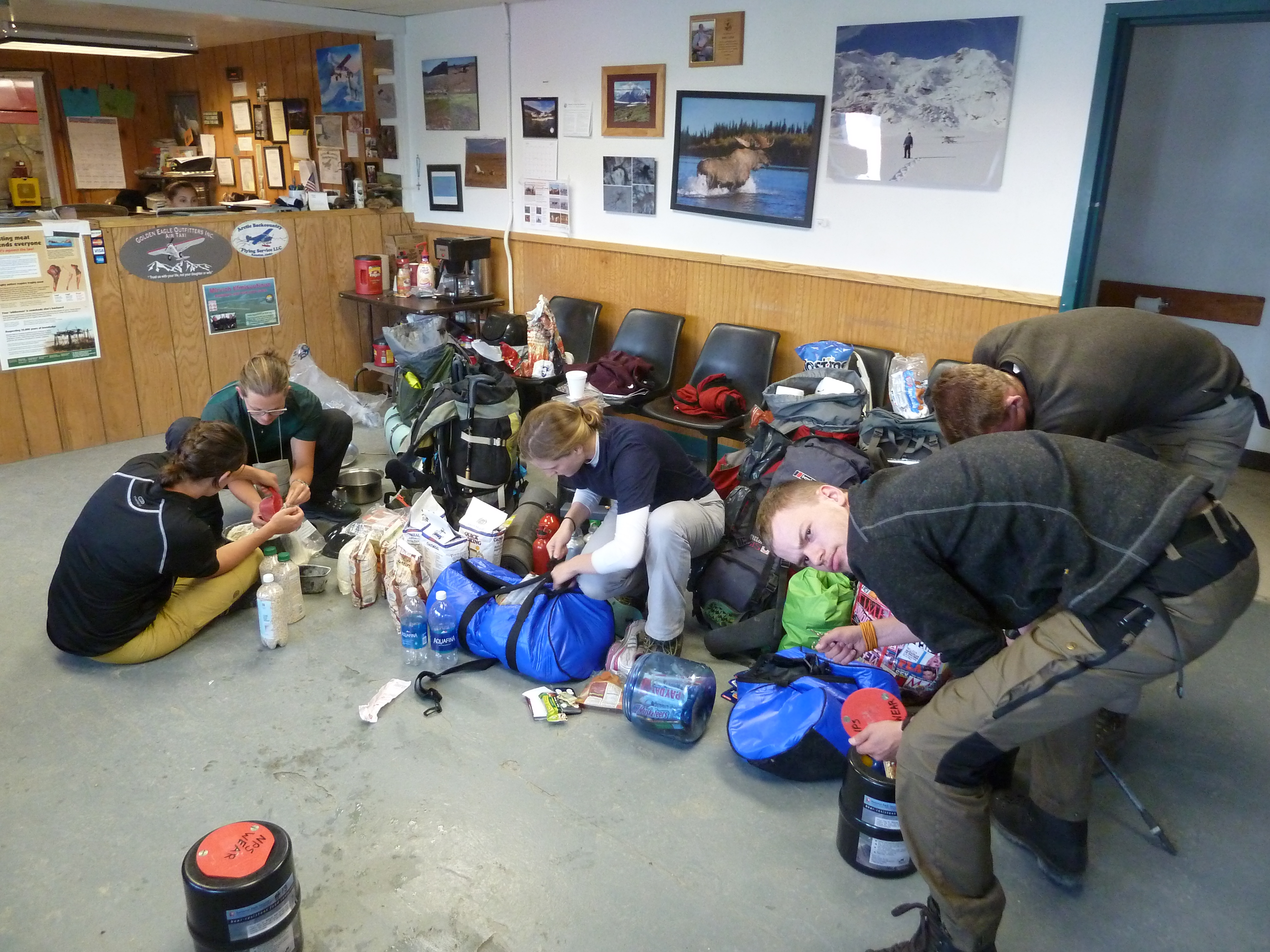
We landed in Kotzebue at around 8 am, the town did not make a great impression. Outstretched and a bit dirty. The fact that it was a bit rainy and no one was on the street did not help. With one person and a bag missing it was probably best to start finding a base here, this was going to take some time. The outfitters with whom we flew were probably the best choice. Unfortunately they were closed and we had to wait outside for a bit. No one wakes up early in Kotzebue in summer. It is light all day and people go to sleep only when they actually drop. Supermarkets were open till 23 pm, but only opened at around 10 am. The Kotzebue clock they called it

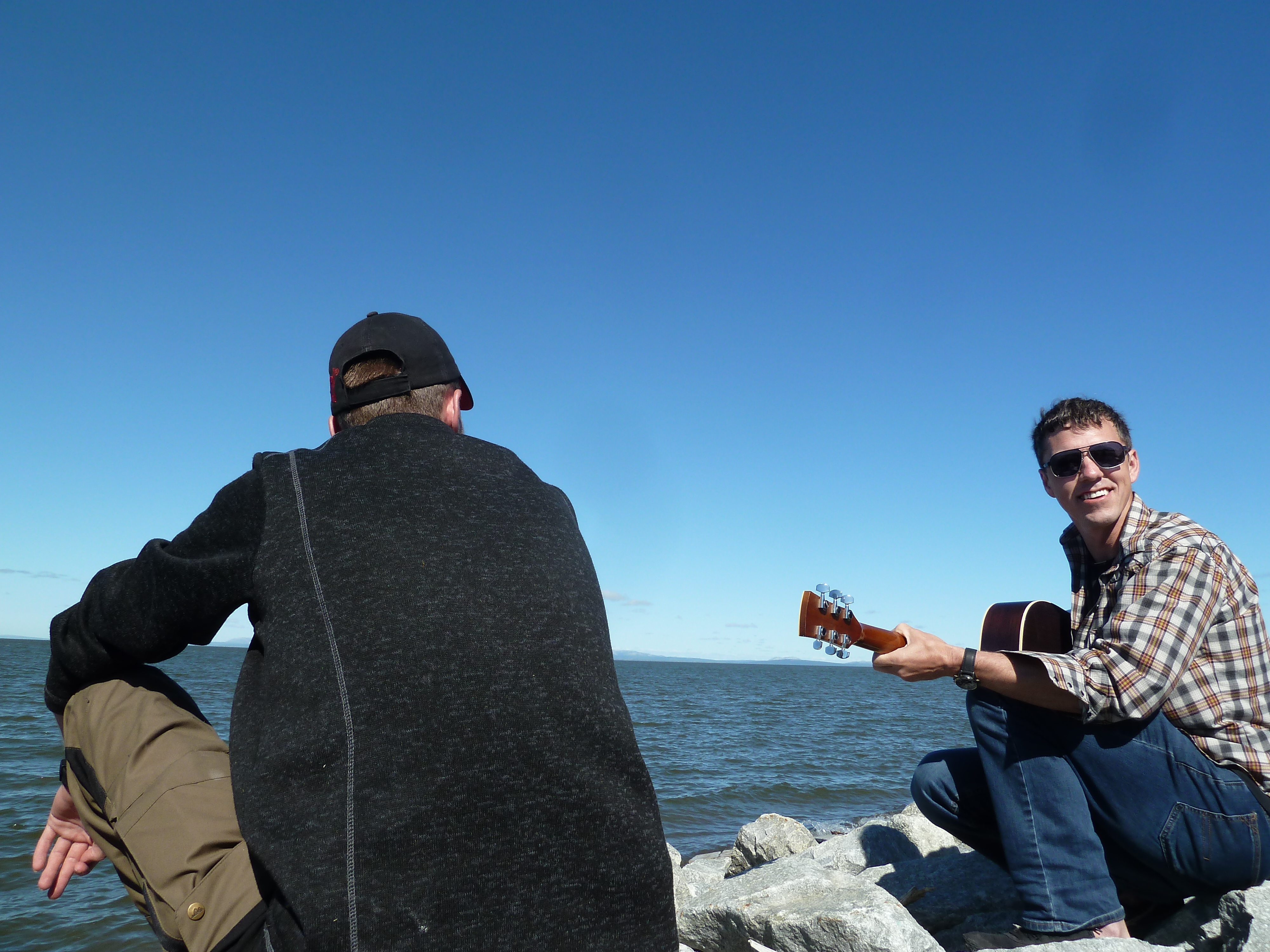
The rest of the day we spent getting bear barrels from the national park service, hanging around the outfitters and doing some last minute shopping. The two supermarkets in town were abhorrently expensive. 12 dollars for a bag of chips… It was clear that most peoples hunted most of their food. In the evening my sister arrived, we were all together for the first time. Only one missing bag remaining. In the evening the meteo improved and we went out to pitch our tents a few hundred meters outside of town between the airstrip and arctic sea.

Day 2
Today the weather was absolute shit. In this way I do not even want to go out trekking. Take you time with that bag Icelandair! The missing bag turned out to be still in Reykjavik so this could take a while.
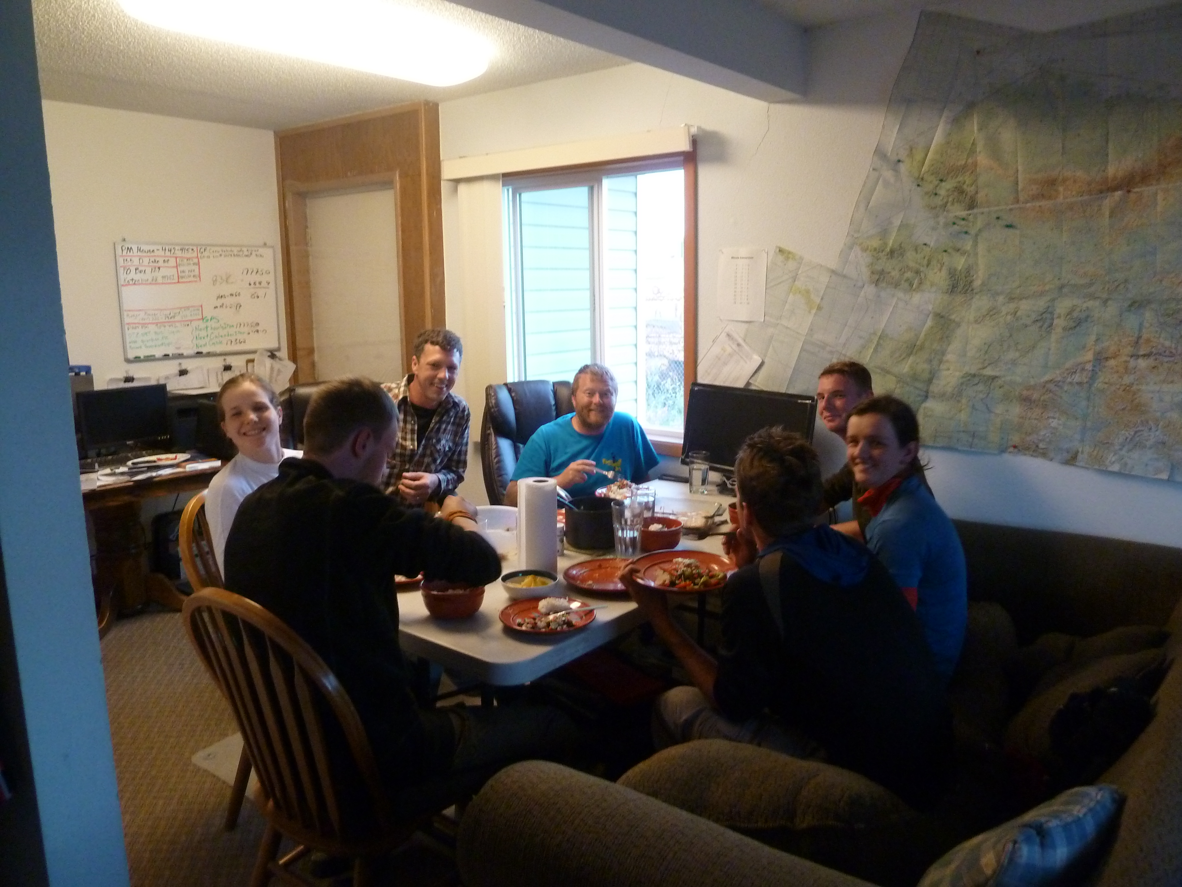
The none stop heavy rain drove us inside the National Park Service office. It turned out to be an amazing time to kill our time. There was a small museum, an Ipad and a small cinema where we could request documentaries. This was thé way to beat this rainy day. We met some of the locals, started to kow our way around and had some places to hang out. Kotzebue started to get fun. In the evening we met with two pilots who took care of emergency hospital flights. They were clearly a bit bored and invited us over for dinner. Kotzebue started to get real fun. At dinner he invited us to visit his house in Anchorage on our way back. He had a jacuzzi there we could use. Well, we had something to look forward to. We would take him up on this in about 25 days.
It was all great fun, but I still would like to leave for my trek at some point though. We had more than enough time, but I was weary about the opaqueness of the whole lost luggage process of Icelandair. Had they even found it? They refused any direct contact with us.
Day 3
Today the weather was great. What do I say, the weather was amazing. That is apparently that is how quickly it can go We watched another documentary about food in Alaska, but most of the time we spent outdoors. We were not the only ones, now the weather was nice the Kotzebuens took the streets as well. Kotzebue was getting real fun. In the evening there was community evening at the National Park Service with another fun documentary. In the night (yeah Kotzebue clock) we dined again with our favorite pilots Matt and Dave. Our lost bag had arrived in Anchorage and they would put it on the 6 am flight to Kotzebue tomorrow. Things were going well.
Day 4
The early morning airplane was on time and started its landing. There was some very local mist that had come up early. The plane flew right over and started heading back. Sigh, well on the bright side our missing bag had never been so close before. Of course within 30 minutes the mist disappeared completely making the situation even more sour. The weather was amazing and I really wanted to depart now.
It was still possible to depart today in the evening. The food drop flight was longer, since it went further in and needed two landings. We decided that I would leave in the afternoon to make the food drop where after I would land at the Noatak and wait for the rest to arrive.


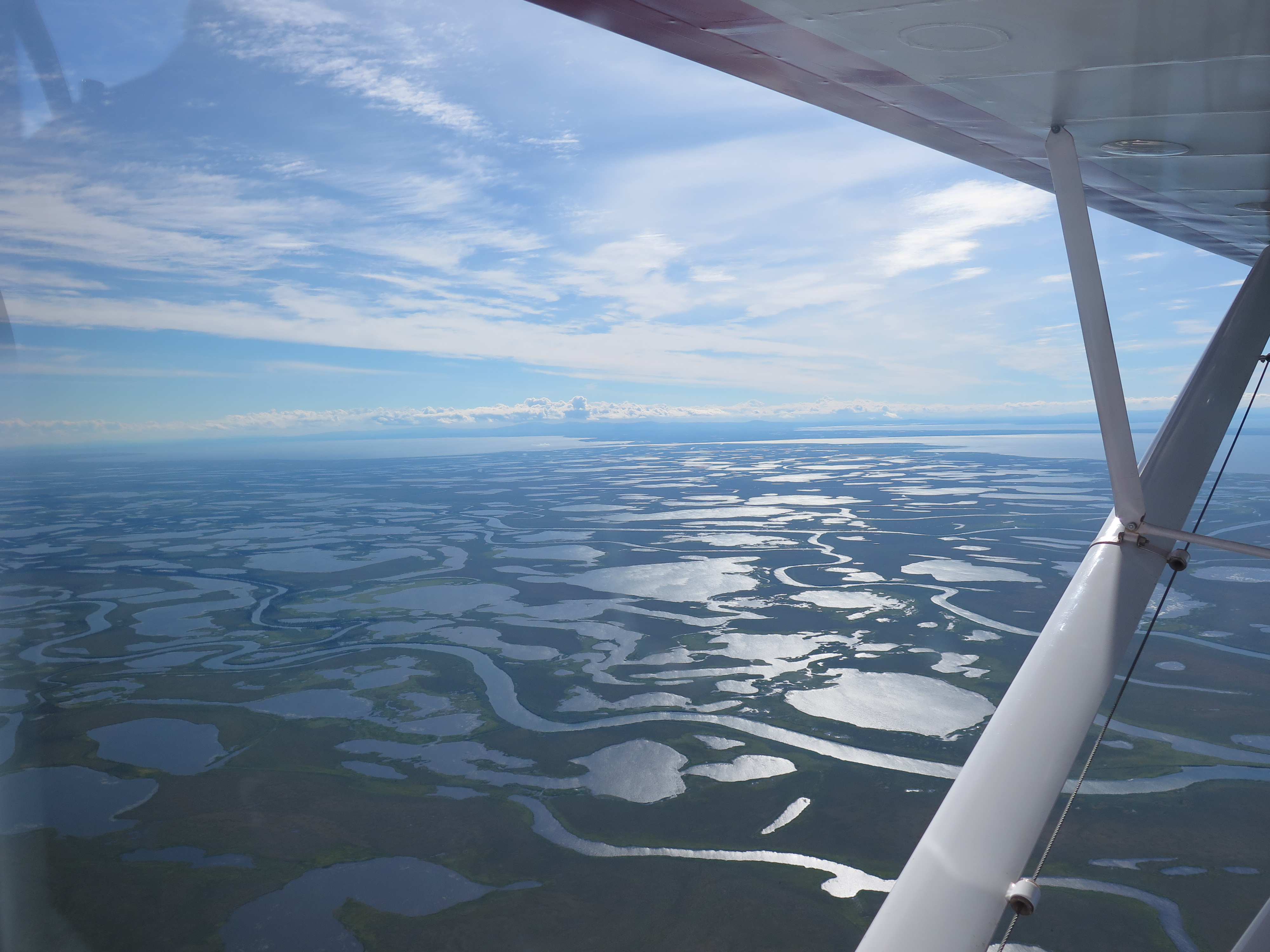
The flight was marvelous. We followed the Kobuk river and at Walker lake we headed right into the mountains. The plane flies very low, I could even spot a Moose and a bunch of Dal sheep on the way.
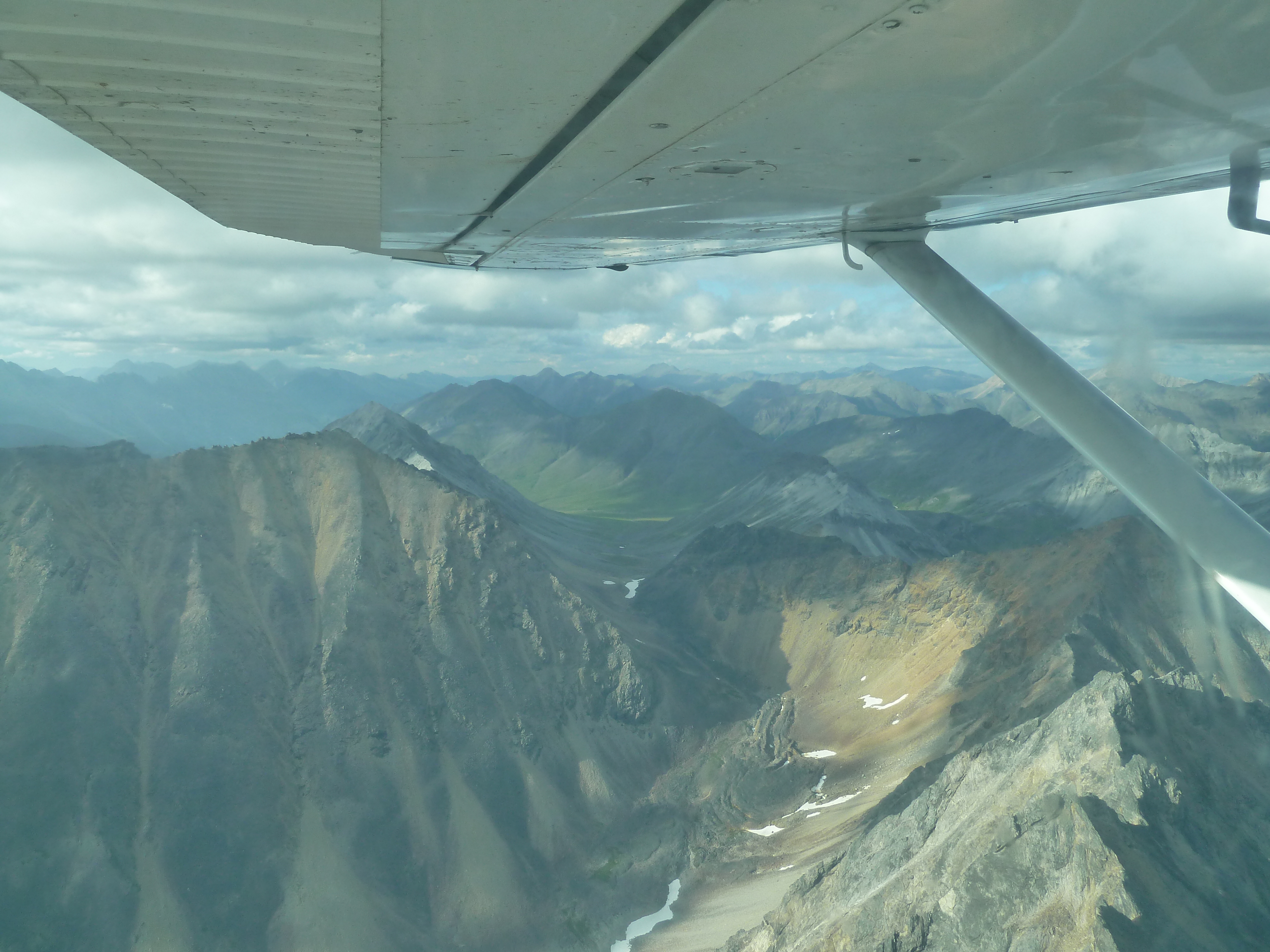
We landed on the banks of the Alatna where I dumped our bear barrels in the bushes. I memorized the spot carefully, made a few photos of the particular spot and marked it in my GPS. In this kind of landscape a few bear barrels can disappear easily if you are careless.
We took off for the Noatak, another spectacular 30 minute of flying. There was already an American couple camping on the river banks. They had flown in from Bettles and were a bit bewildered when my pilot departed and I stayed behind. The sight must indeed have been strange. I landed solo with nothig more than the sweater I was wearing, a tent in my lefthand and a bag of Doritos I hadn’t finished back in Kotzebue in my right. What on earth was I thinking, right? I explained that the rest of my group would arrive with our gear at any moment.
That any moment turned out to take another 4 hours. Way longer than I had anticipated and I was a bit worried that the bag had been delayed once more. Or worse that they would have been dropped somewhere else in the area. I had only a few candy bars and a tent so I could really use the rest of my group… It was nice to have the company of two fellow travelers here. The very last people we would see till Anatktuvuk 18 days later.
The American couple was to paddle down the Noatak for a few days. A relatively popular trip in the Brooks Range and also one I had considered myself. I was however happy I had chosen for the trek. The Noatak is a bit of a cliché and of course only by hiking you can really get high up in the mountains.
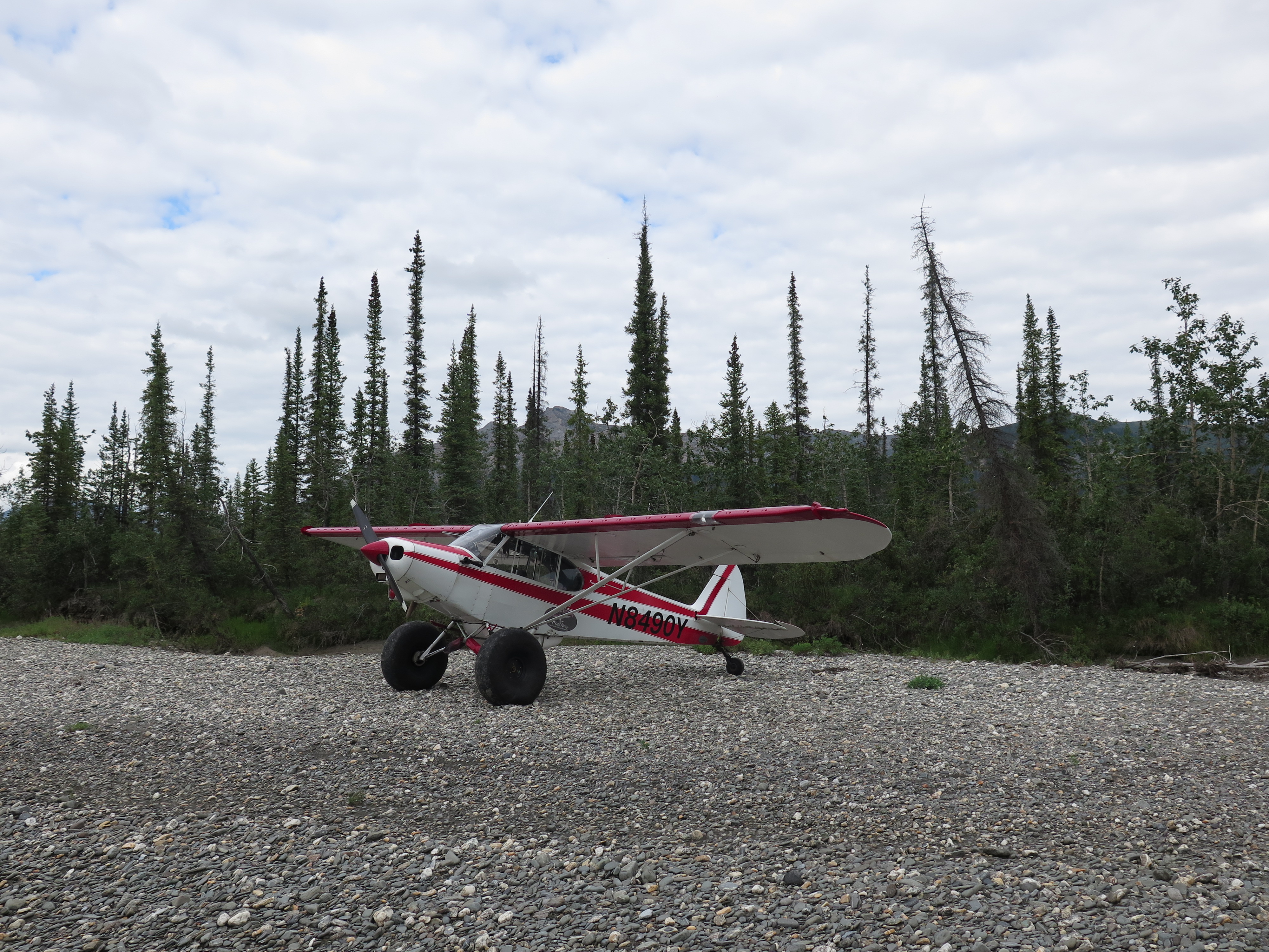
At around 7 pm I finally heard the sound I had been craving for. The roaring of a motor. My group arrived. Two planes landed on the bank. It was fun to see the landing from the ground for a change. They land in only 60 meters, really impressive. The Americans joked that with this kind of traffic they might very well built a traffic control tower here. For the first time all people and packs were together.
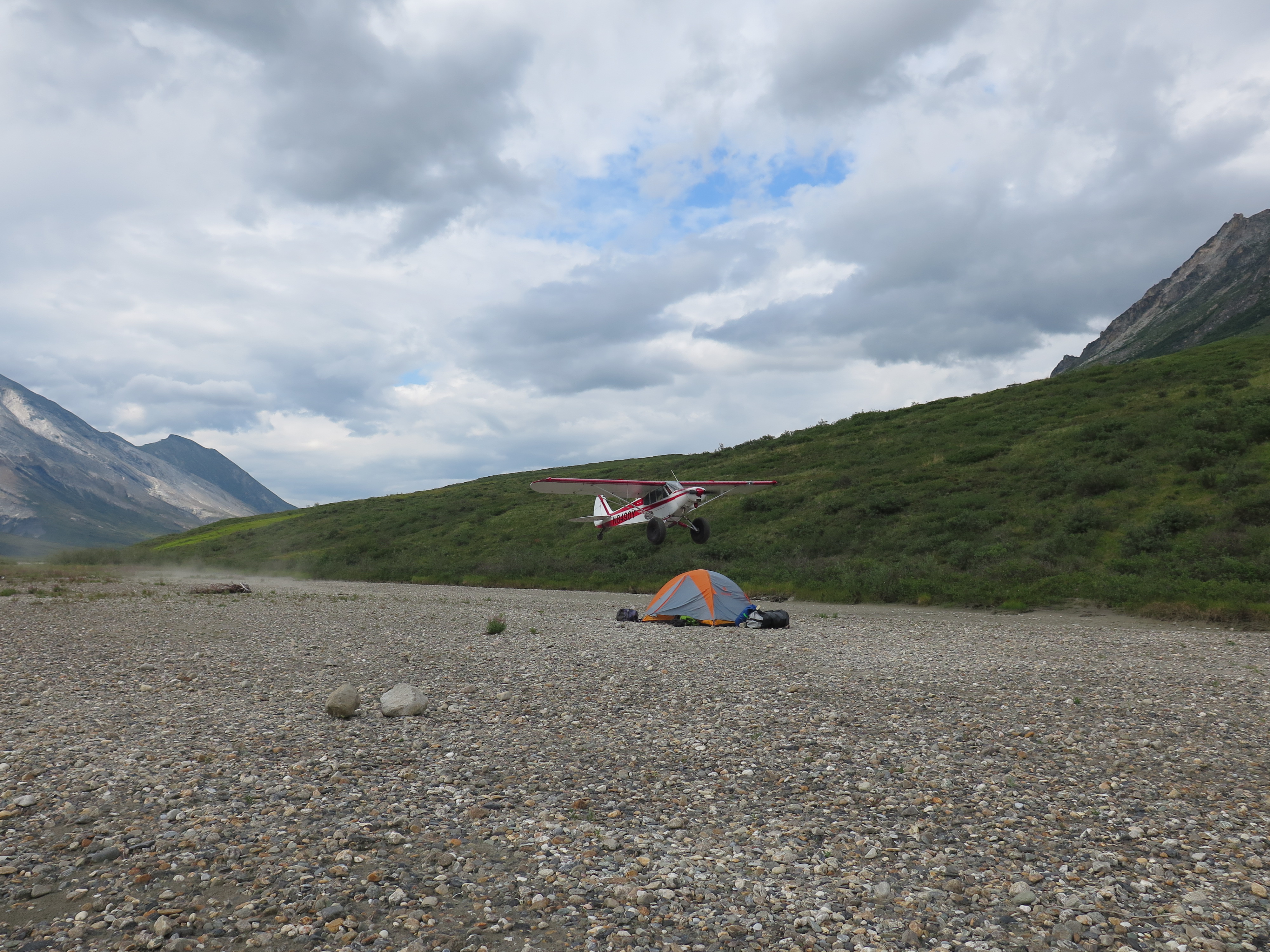
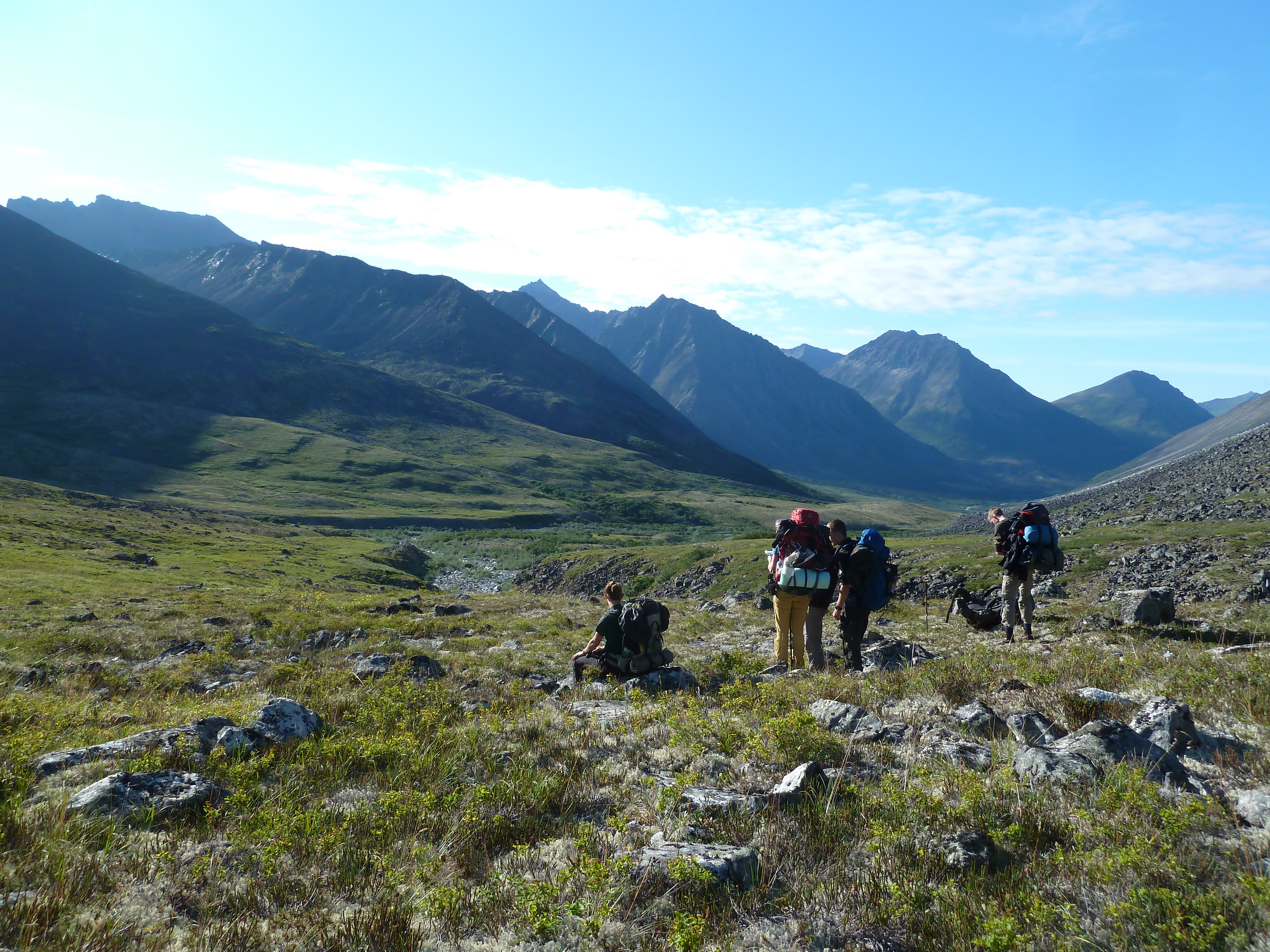
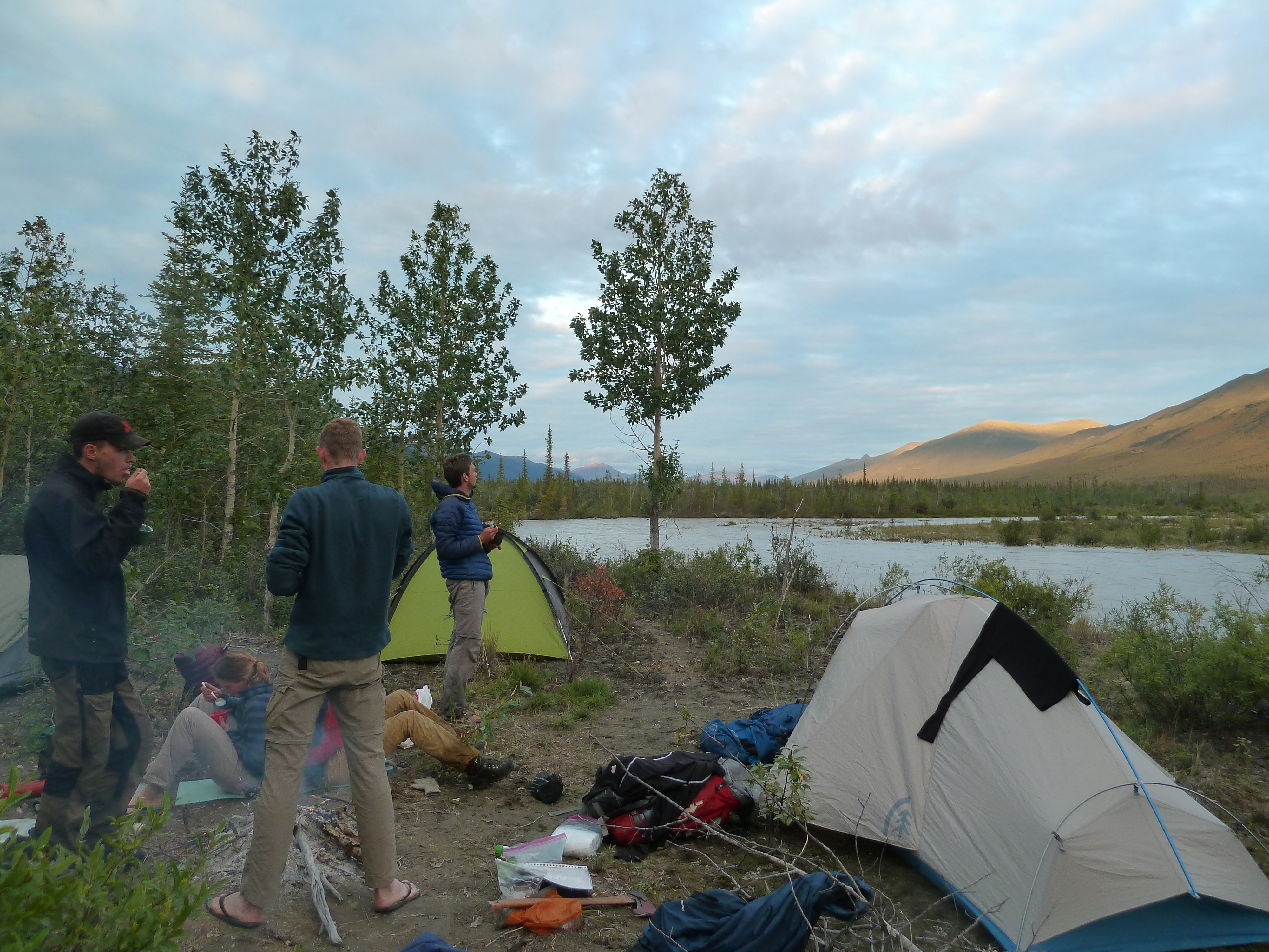
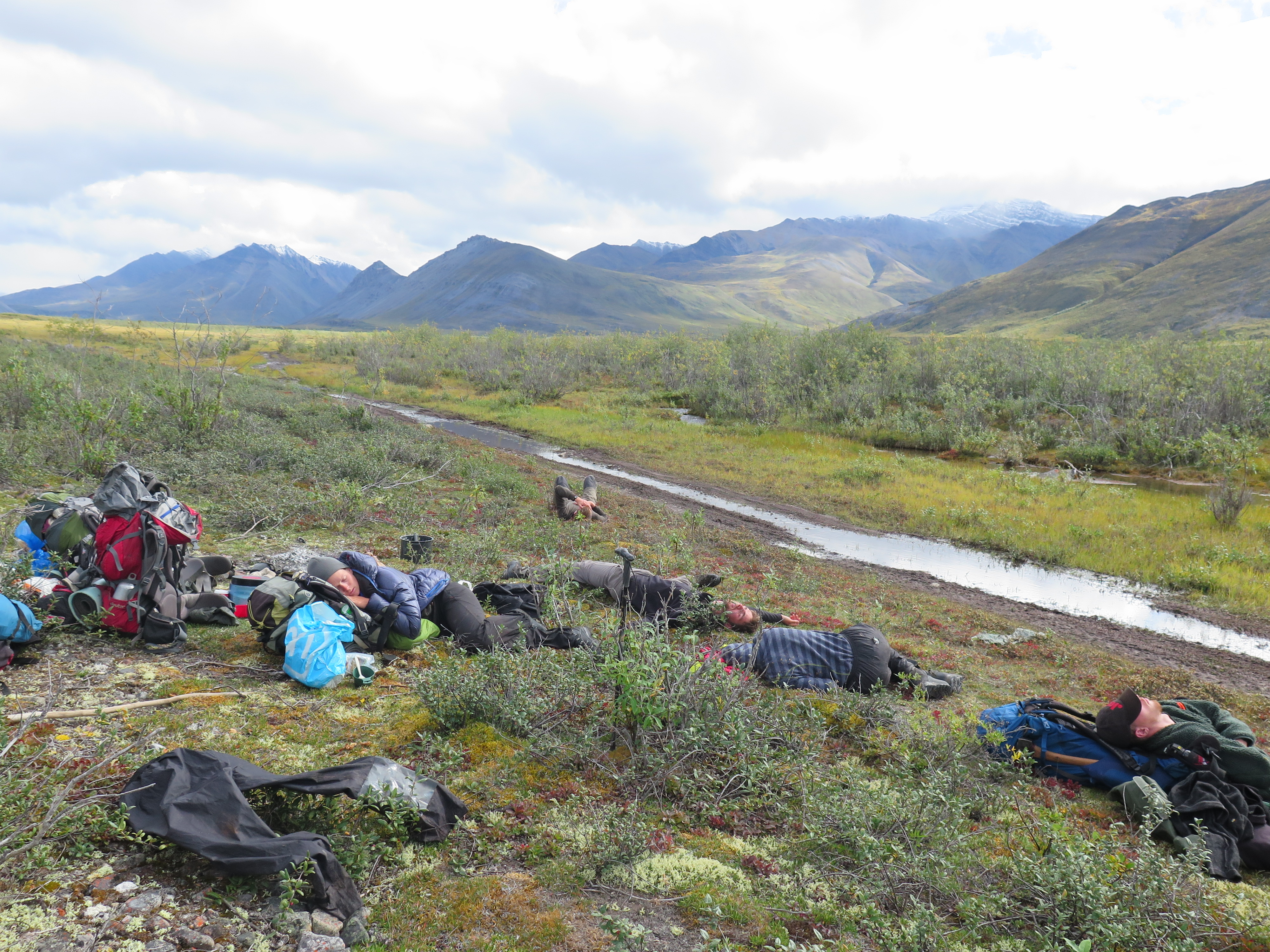
It was already quite late so we just made camp right away. The surroundings were amazing and the weather nice. A great first night around the fire, we were all looking forward to the route ahead. We were on our way at last!
Day 5
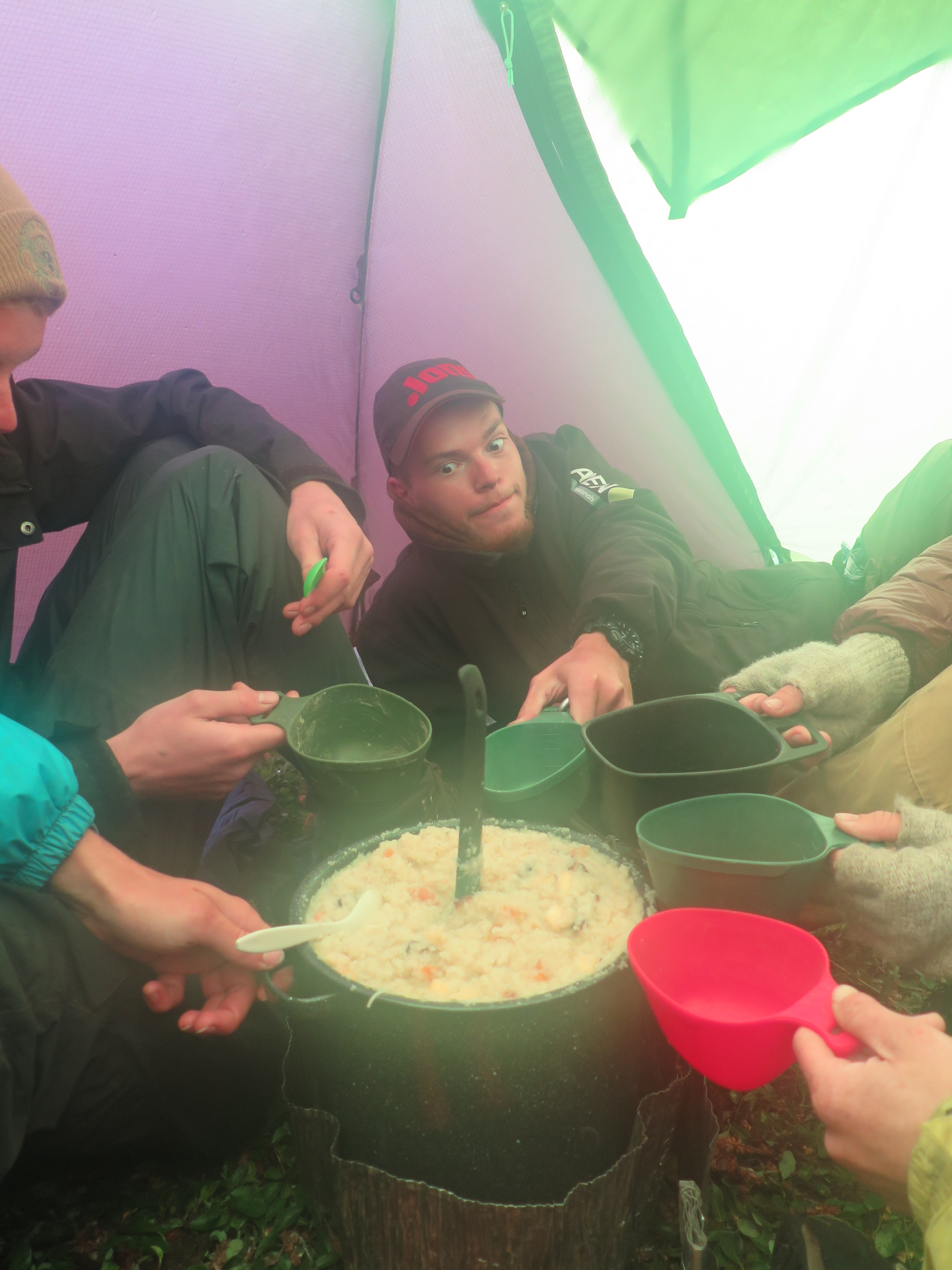
The first day on foot could begin. In the morning I ruined our breakfast, I burnt the oatmeal and cooked the milk powder making it completely inedible. We all had two bites and threw away the rest . Hopefully I can do better, we can’t swallow this.
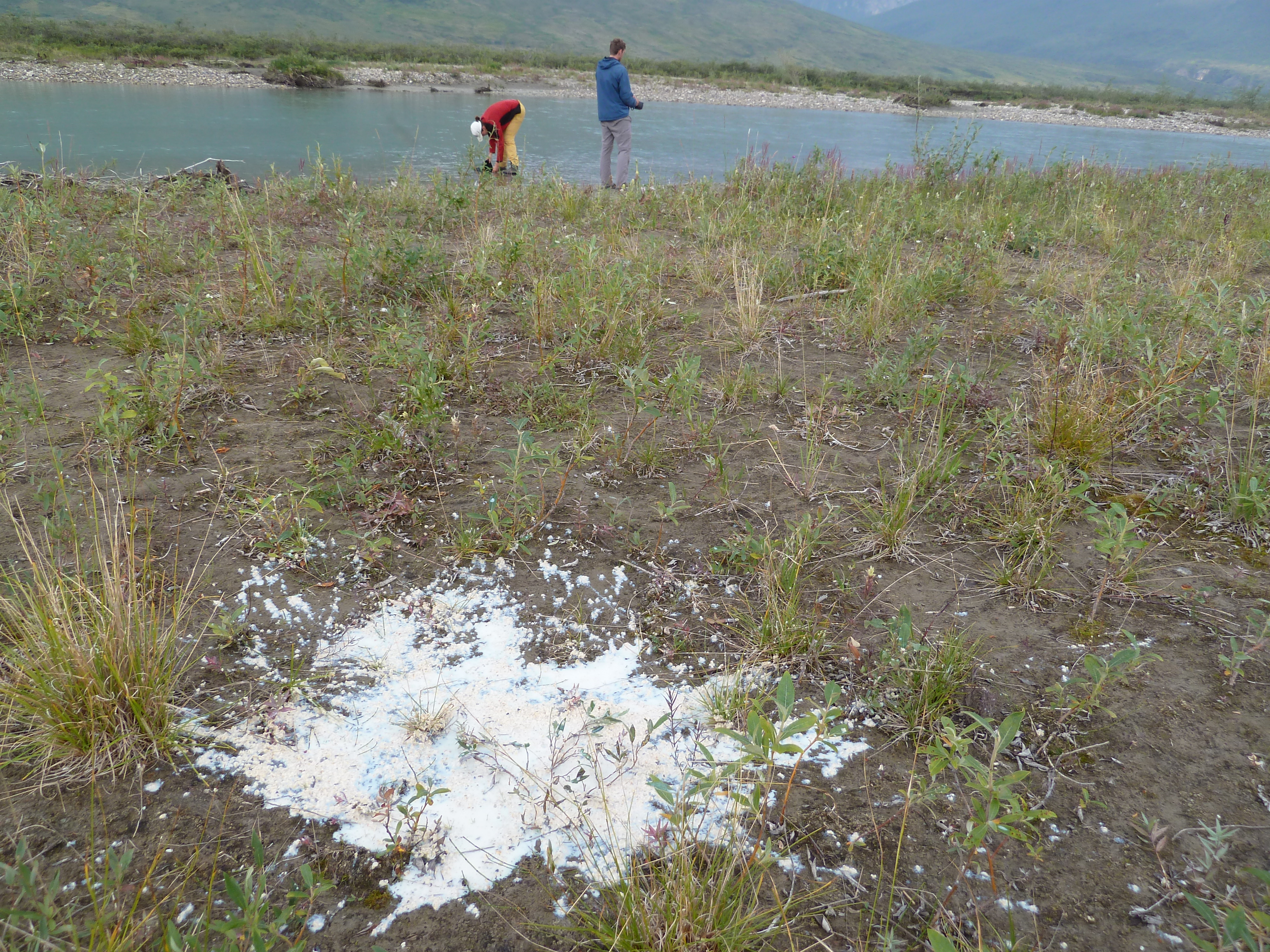
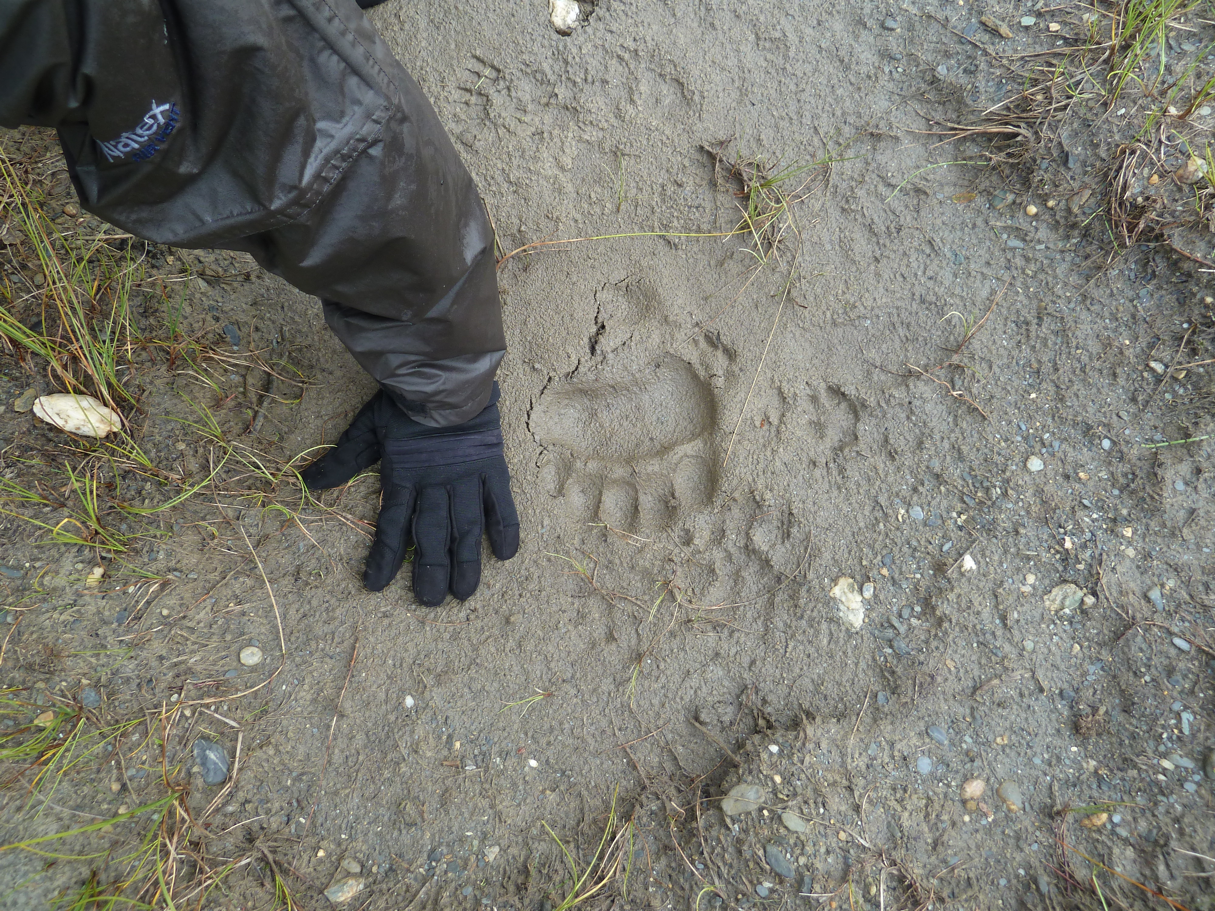
In the first hour we had a bit of sun, but soon the rain took over. The rest of the day sun and rain alternated by the hour. We trekked the banks of the Noatak river towards the start of the ascend of the first pass. Within the first hour we already spotted the first bear and wolf tracks.
We called it a day pretty soon. Late in the afternoon some new rain was moving in and we decided to pitch now it was still dry. In the evening we made our first culinary discovery. Boiling the blueberries with sugar! An excellent three star outdoor desert. Camping was really pleasant, the tundra ground is more or less a mattress itself.

Day 6
The oatmeal was made by Jannes this morning. I wasn’t allowed to get near of it for a while… The dish was a a lot better this time, but it still needed some work if it was to get us all the way to Anaktuvuk. The plan was to cross ‘Skiny Bou pas’. This seemed feasible, we could see the place where the ascend would begin not too far ahead.
The first part of the ascend of the pass was rather steep up over grassy terrain, after that the ascend became very gradual. It was misty and rainy and we only got sight of the pass when we were more or less already there. The last few hundred meters were a bit steeper and went over some loose rocks, but nothing to write home about.
The pass lay a bit in a corner so there was no real view to be had and if there would be we wouldn’t have seen it through the mist anyway. When we looked down the other side we were very surprised by what we saw. The terrain went a bit down and then terminated in steep moraine slopes. This felt more like how an ascend should be looking, I had never seen something like this while descending. Did I make a mistake, are we climbing towards another pas? There was no stream so there was no way of telling whether we were actually going down or up.

We went down and climbed the steep, rather dangerous moraine slopes. It took us well over 2 hours to cross the lose moraines and we were happy to see a grassy meadow marking the end of it. Tired of all the loose rocks we immediately set up camp.

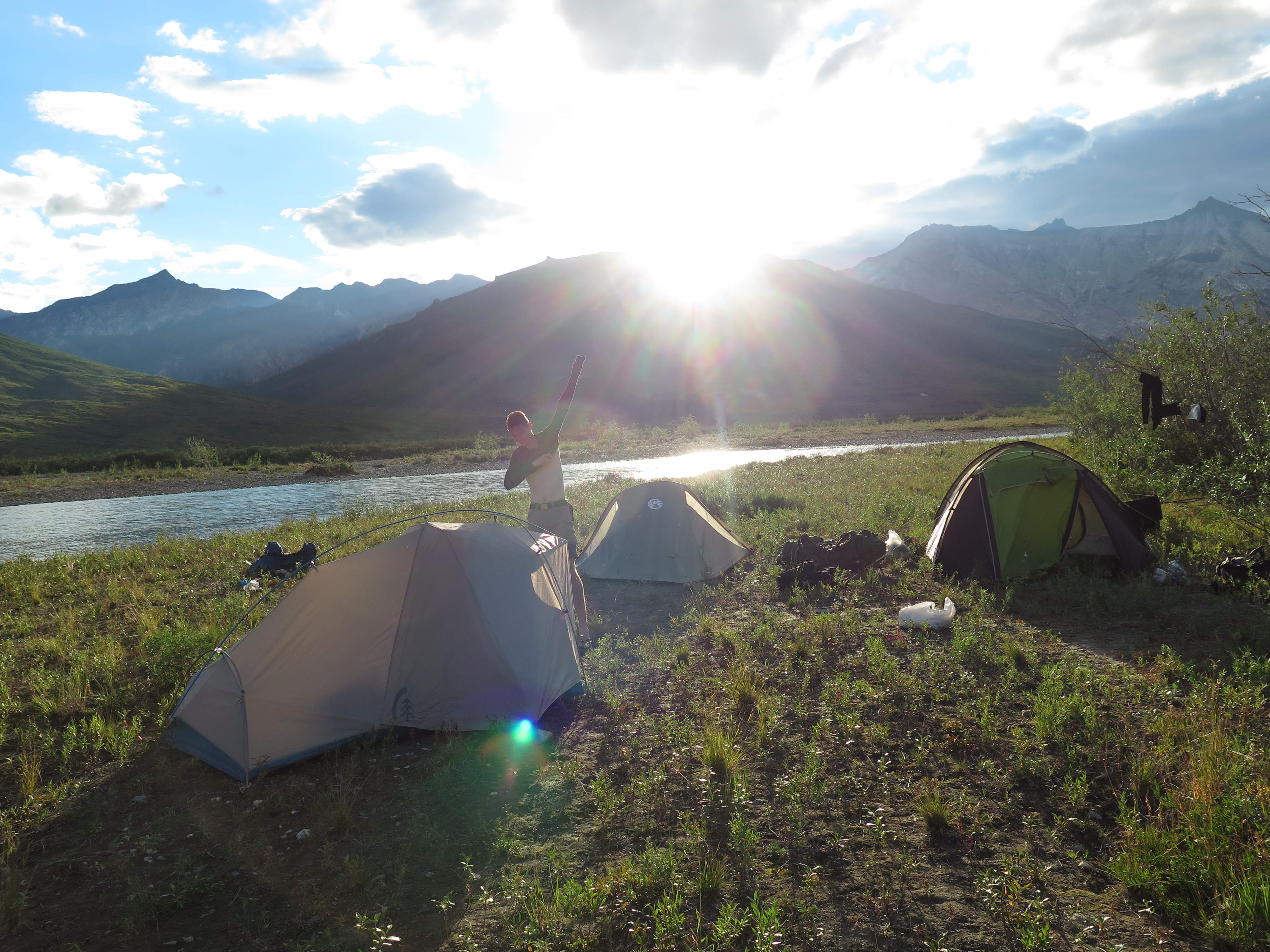
The view from our campsite was great, better than the view from the pas. Especially at sundown the view towards the mountains north was rewarding. It seemed like we could expect some good weather tomorrow.
There was ambulant evidence that wolf hunts ended in these moraines. Skeletons all over the place.
Day 7
The weather was amazing, clear blue sky. For breakfast we ate the leftover mashed potato of last night, avoiding the oatmeal. It was an easy descent all the way down to the main stream. The mountains to the east looked pretty steep and I wondered a bit where the actual pass was located. At the spot I expected it there seemed to be no lull in the cliffs. I had the coordinates of the pass from Roman Dial so as long as the GPS indicated the distance to that point decreased I held faith.
The ascend began steep, but soon became very gradual. For the first time it got a bit too hot. The cliffs came ever closer without really showing a way across. I started to worry a little and started to walk ahead of the group. The gradual meadows terminated at a beautiful plateau with a blue lake and great views towards the mountains south of us. Though still no trace of a pas, only steep cliffs. The group was split, part of us wanted to continue right away the other half wanted to camp here, enjoy the weather and sent two people to explore the way to the pass without backpack. I broke the tie and chose to stay here for the night.

My sister and I hiked over the moraines in search of the pas. It was only 1 kilometer away now, but the rock faces did not seem climbable anywhere. There was a small part of the ridge that we could not yet see, so it had to be there or nowhere. The GPS seemed to agree with that assertion so we went there. The climb was steep and slippery, without backpack no problem, but we better be careful tomorrow. It remained a mystery whether the pass was feasible all the way till the moment that we were actually there.


The pass is only about 5 meters wide and really the only place were the ridge can be easily crossed. The descend seemed easy enough. The next pass however looked a bit worrisome, but that was a matter for tomorrow. We descended back to our campsite and had a relaxed sunny evening.
We made our second culinary discovery. Bulgur is great as a main dish, but with a bit of sugar you can eat it as desert as well!
Day 8
Weather rapidly changed in the morning and threatening clouds ran in. Yesterday’s weather would not last. On the bright side we did not fuck up the oatmeal for a change.
The backpacks made the climb considerably more demanding compared to yesterday, but we had done it before and could take a very efficient route. At the top the view was a cry from what it had been yesterday. We climbed down over a large boulderfield, which took forever.
The other pass was only 4 kilometers further up and after about 2 kilometers of flat retain the other ascend started. The ascend went straight up over large boulders. The slope was around 45 degrees, which is a steepness to be reckoned with when wearing 25 kg+. It was an actual climb, hands were needed for most of the way. The weather started to get really poor making the climb even harder. Hopefully the descend would be a bit better. (of course it wouldn’t).

On the pass the weather became downright shit. The wind and rain made being here torture. The view to the north was, despite the clouds, quite impressive. The rock faces reached a whole new level at the Arigetch further up east.

The way down was steeper than the way up and went predominantly over bare rock face and slippery grassy areas. We descended very carefully and were glad when we reached the plateau under the pass safely.
The climb of the two passes and especially the descend of the last one had us worn out and we could not wait to pitch our tents. The winds made it however impossible to pitch anything and we were forced to break up and walk further down. We almost lost a tent in the razing winds here.
Half an hour further down the wind calmed, but the rains grew ever heavier. We quickly pitched our main tent and all crawled in. We waited for a break in the rain to pitch the rest. This break did not come about, in fact it started to poor even harder. I briefly went outside to fix a loose peg and that had me completely wet in a matter of seconds. Arctic desert my ass. We were only using the outer tent and even with some dry clothes and the six of us together it was cold. The saving grace was the music we brought. Thank god we had allowed ourselves the extravagance of carrying a 300 gram boxes with ipod.

Day 9
The next morning it was dry-ish again. A bowl had spent the night outside. By now it was completely filled with water. Wow, that meant it rained about 6 cm that night. That is the amount it is supposed to rain in a month. Well, hopefully we had it over with than. (Of course we hadn’t). The small stream we had camped next to had developed into a roaring stream, which we could only cross with three at a time and even than with difficulty. Hopefully the main stream down in the valley would be easy to cross. (Of course it wouldn’t). We hiked down through the fog and rain. It was a rather depressive hike with a lot of shrubberies and not too much to see.

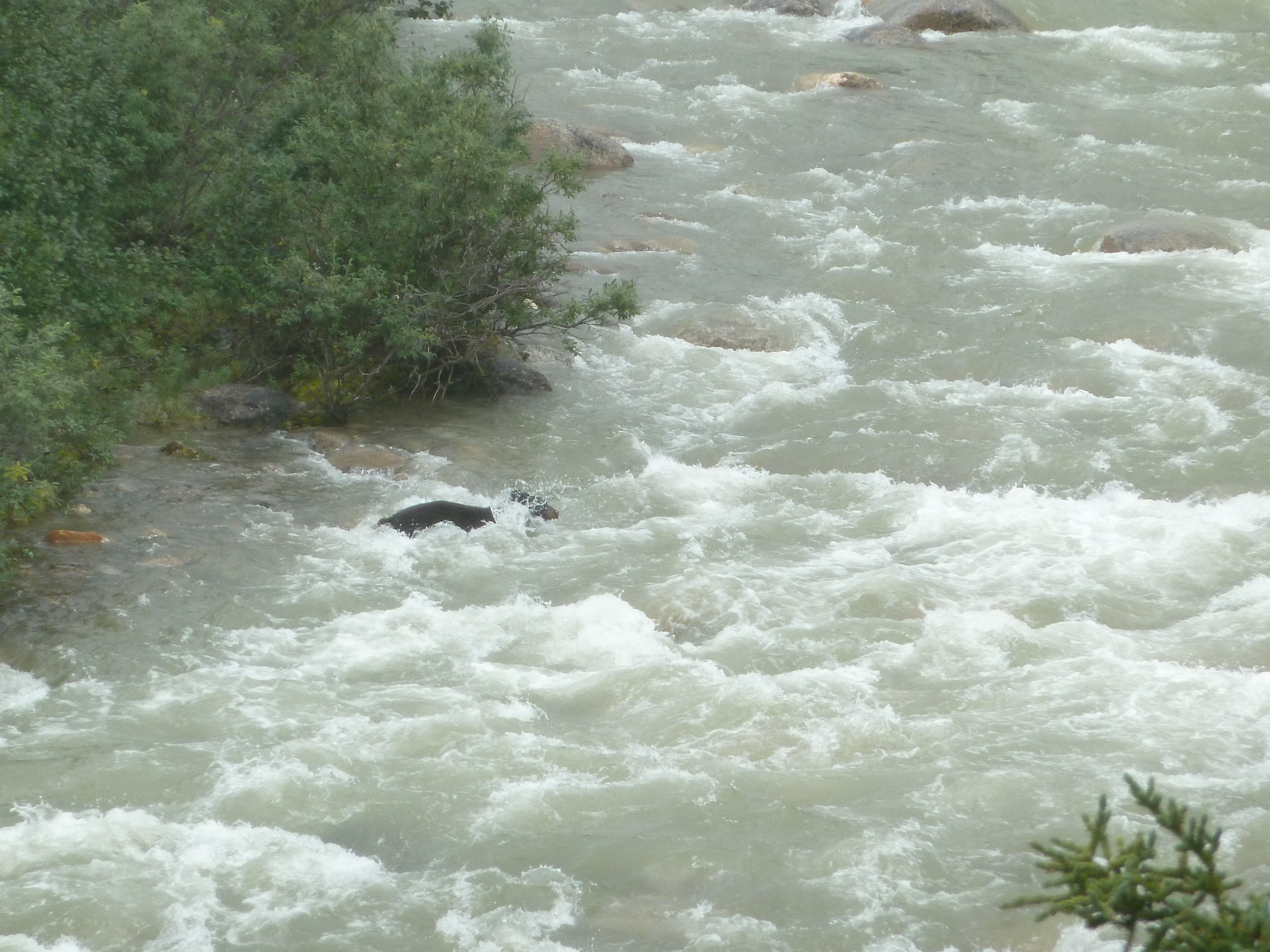
Once down it became apparent that there was no way we could cross this stream right now. It had swollen to a raging river and the water swirled wild over the rocks. There was no other possibility than to set up camp on the plateau above the river and hope for the best. We had brought an axe and ropes with which we started to MacGyver ourselves a way across that afternoon. We chopped down a few trees and started to throw them into the water in the hope that they would stick. We succeeded in making a bridge to a small rocky island at about 20 percent of the way. It all seemed futile. We called it a day and hoped the water level would normalize tomorrow. (Of course it wouldn’t). I made a few measurements that day, the water was about 5 cm lower in the evening than it had been in the afternoon. For a crossing we would need way more.
In the evening we saw a bear on the other side. A black one. Well safe on the other side we thought in our hubris. A bear however is not such a wooz as a human and it just crossed the river full frontal. The river took him 100 meters downstream but he made it to our side perfectly fine. I was jealous. We quickly grabbed our bear spray in case the situation would get unpleasant. There was no need for it though, as soon as the bear got our scent it ran for it.
Late in the evening my sister and I walked up stream, we knew the river would break up into three tributaries not much further up. Maybe we could cross more easily there. In my experience it usually quite disappointing how much better a stream gets after it splits, this case was unfortunately no exception. The situation was only marginally better.
Day 10
In the night I heard way more rain than I was comfortably with and when I woke in the morning the water levels had risen to monstrous proportions. The start of the bridge we had built yesterday had gotten completely washed away. We started to get worried, we had a lot of food but not enough to last us forever. When would the situation normalize? There was no other way than heading further. There was no place to return to.

We decided that we would skip the Arrigetch from our itinerary and hike downstream to the Alatna, where our food drop was waiting for us. This route bypassed the Arrigetch pass (a shame) but made the need to cross the river in front of us obsolete as we could keep walking on this side of it. We hiked down stream for a few hundred meters to check out the ‘small’ side stream we had to cross in this case. To my amazement, even this side stream was not crossable anymore. The river was way to wild, even for a roped crossing. The stream was however way less broad. Only about 8 meters. Maybe a bridge was feasible this time.

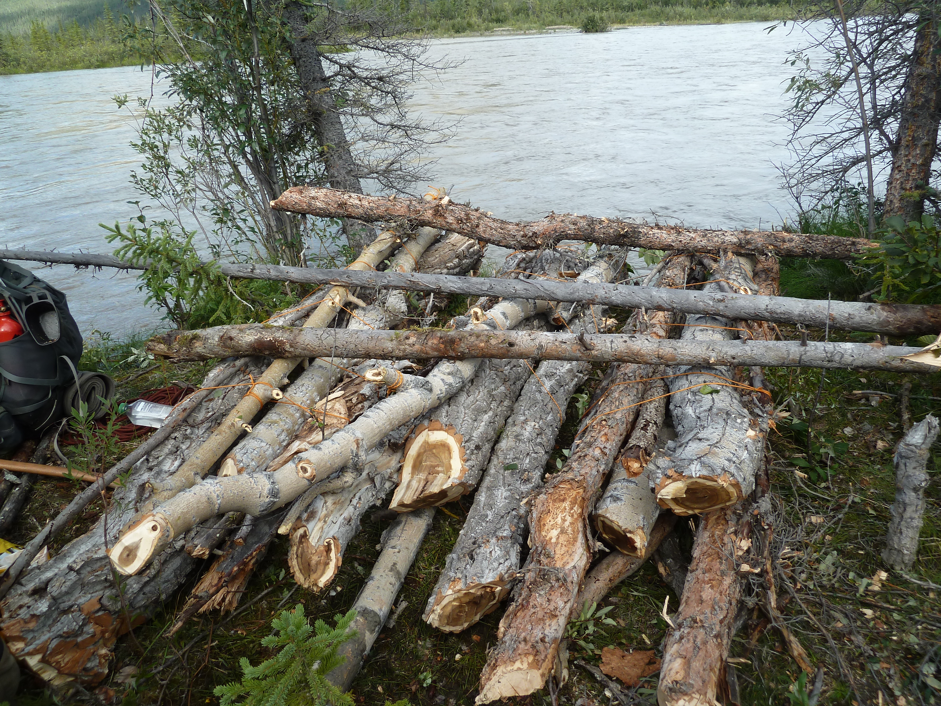
We explored the riverbank and found the best location to build our bridge. There grew no trees next to the river so we had to chop one down, carry it to the bank, sat it upright and throw it over. A challenging task to say the least. We first tried it with a small tree, we just threw it in to see if it stuck. (Of course it didn’t). The tree was swept away and digested by the current in no time. If we wanted to do this, we needed to do it right and throw over a tree all the way not touching the stream anywhere. Jannes and Frits started chopping down one of the tallest trees (the trees were a little pathetic here as we were just under the tree line) and Eefke, Roos and I started working on a ramp. While working on the ramp it really became apparent how fierce the current was. Some of the heavy rocks I threw in, rocks I could barely lift myself, were taken away by the current in the blink of an eye.

By the time Frits and Jannes were done chopping down and cleaning the tree we had a large ramp built. The tree was way to heavy to lift, so we needed to shorten it further. Even after shortening it we could just barely lift the tree. We were tired and had eaten too less that day (we were rationing as we did not know how long we would be delayed). We went back to the tents to eat for a bit and decided to leave it for that day. We had few faith in our bridge construction anyway. Mind to self, unless you can chop down right over a stream, building a( bridge is way harder than you think. I work for the ministry of infrastructure so you would think I would know that…
We would continue tomorrow if it was still needed.
We again saw a bear from our camping spot on the exact same spot as the one the day before. Apparently there is some kind of meeting up valley.
We discussed the possibility of hiking back the way we came and crossing the stream further up. I voted it down as with the many streams coming up it did not seem like an effective strategy. Better to just wait for the situation to improve. This kind of extreme water levels could not last. Only problem with the reasoning: we could not last forever either. I however estimated that the side stream would probably quickly normalize when it stopped raining. During the day we had closely monitored the water level of the side stream and indeed observed that the water reacted very quickly to a few hours of drought or rain.
In the evening we moved our camp to the side stream so that we could cross as soon as an opportunity presented itself. In the evening my sister and I walked along the banks and observed that the water was still wild, but without question less wild than last afternoon. If it would keep dry tonight we might be able to cross tomorrow…

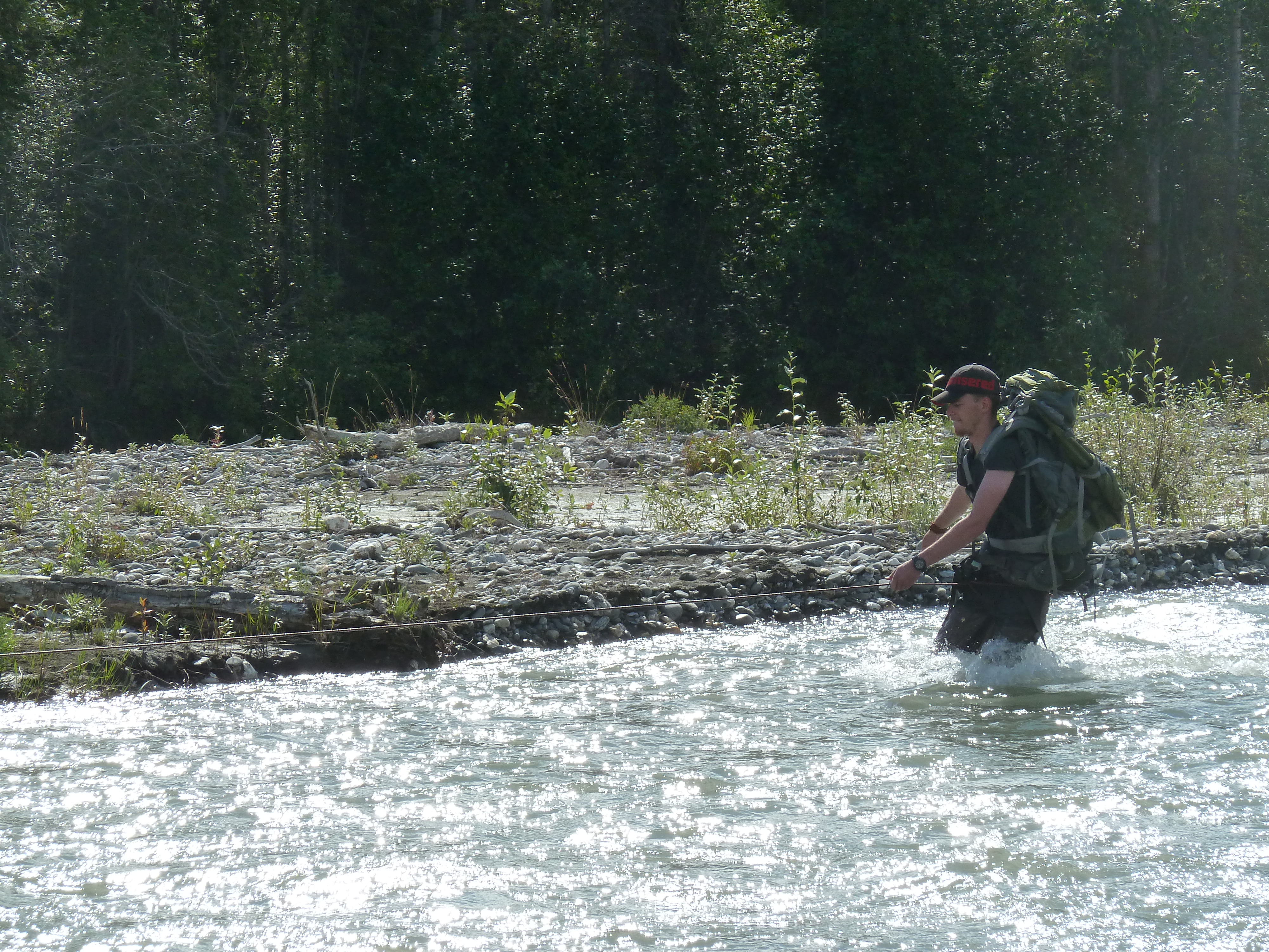
Day 11
As usual it rained in the night, but not too much. In the morning the water had gone down another 10 centimeters and a crossing seemed possible. The rain was growing heavier again so it was now or never. I quickly roped up and my sister took position behind a sturdy rock holding the me. I was out of my sleeping back for under 10 minutes and aleardy in the ice cold water. To my surprise and great relief the crossing wasn’t too bad. Once across I put up my thumb and my sister went to the others to break up camp and follow my example. .
It was a race against the clock. It started to rain more heavily and the water level began to rise. In the time my group crossed the water level had increased by 5 centimeters and increasing. But we were all safely on the other side, stone cold, but on the other side nonetheless. Firts and Eefke had fallen and were the wettest. Thank god we had the rope, otherwise a crossing would not have been possible without losing some folk.
We did not take too long to celebrate and immediately started walking to get warm again. A celebration would be premature anyway as there would be three more side streams we had yet to cross.
After an hour walk we had breakfast around a large fire. We could light this fire despite of the rain, thanks to the magic of a royal amount of camping fuel and some dead wood we found under a tree. Our clothes steamed like hell next to the fire. Oh, if it could only stop raining.

The side streams did not cause us any problems, they were way broader than the one we had crossed this morning and had less hinterland. We did not even need a rope to get across. Aside from a lot of annoying bushes we had to fight a way through it went remarkably smooth for a route that we had not planned to take.
Late in the afternoon the rain stopped. It actually stopped, not just for a short little while, but the meteo seemed to be durably improving. We pitched tents on a scenic plateau overseeing the river that had caused us so much trouble below. We lighted a large fire and spread out all our gear to dry. Haha, when it rained our camp was very compact, but as soon as it was dry it always started to stretch out.

Even though everything seemed to be getting better we had thought of something new we could worry about. What if our food drop had washed away? That might very well be the end of our trip. (Or the end of us). We figured it was probably fine, the barrels lied between the trees, but still I had an uncomfortable feeling about it.
In the evening the sun broke through. Like the actual sun. Two moose with a young emerged on the other side of the river to graze in the evening sun. A fantastic ambiance. Who would have thought the day would take this turn?
Day 12
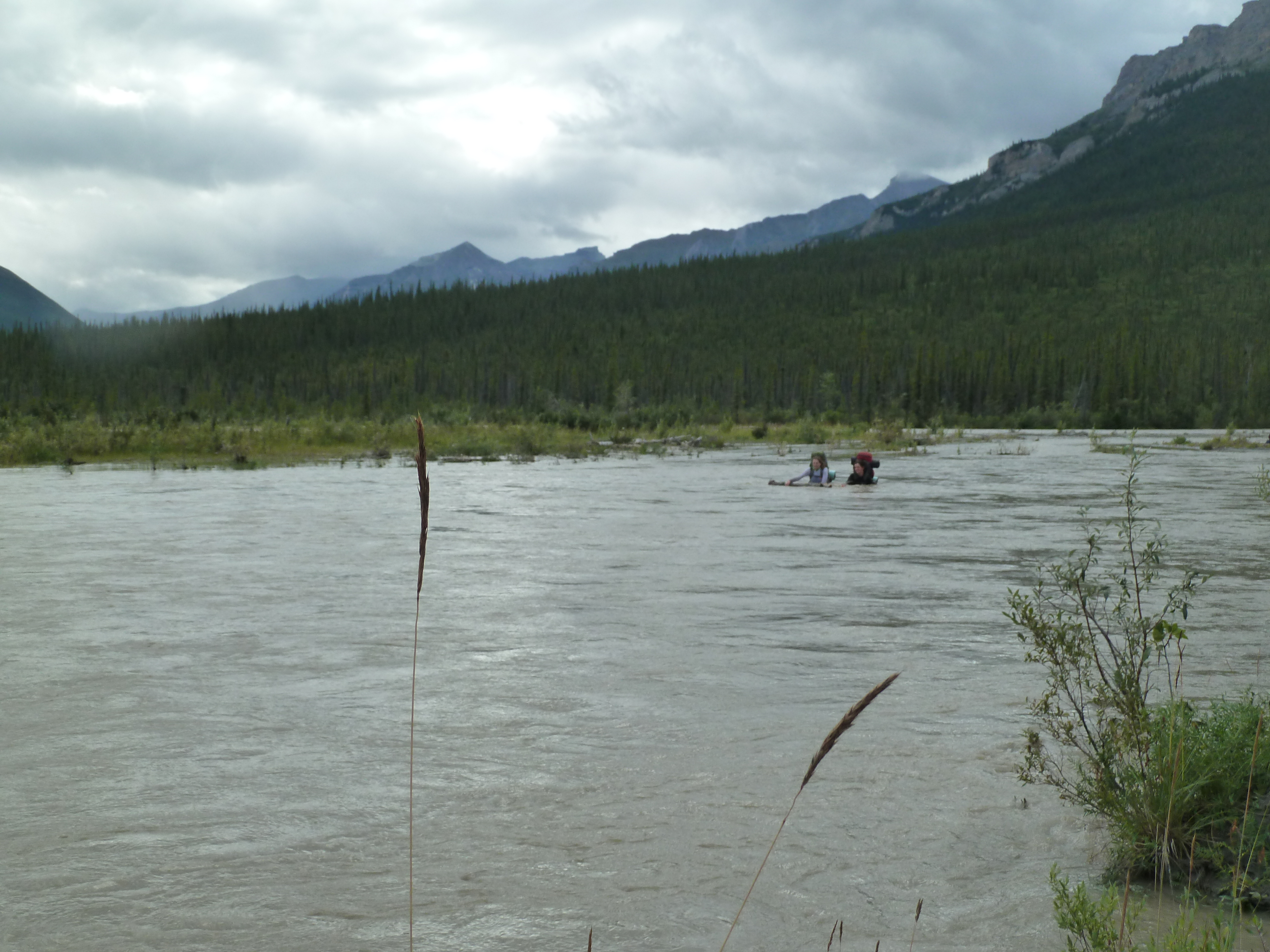
There were only 4 kilometers left to the Alatna river and after a little bush beating we got to the banks of it. I had seen the river before when I made our food drop a mere week ago. At that time it was a minor stream not more than knee deep. Now however ,it had grown to a serious river, over a hundred meters wide and with a strong current. It seemed we could do some more tinkering this afternoon. We sought a place where the river was very braided and started chopping down trees for a raft. Our first attempt was building one raft with 3 drivers for all six of us. This soon became way to heavy and inconvenient so we decided to make three small rafts out of it and cross in pairs.

The word raft might give our construction too much credit, it was just a bunch of wood bound together, allowing us to keep stable in the water. In no way you could actually float on it. The weather was nice and sunny, which made this whole field trip a lot more pleasant. After a few hours and a lunch we were ready for departure. Ava and I were to cross first. The river was less deep than we had thought. Most of the way our feet could just about touch the ground. We only had to swim the last 10 meters.
Once across Ava walked a bit inland to make sure we were not on an island. There was no new branch of the river in sight. Great, we dismantled our raft, time for the next group. I roped up and went as far as I could in the water to assist Jannes and Frits who were next in line. They crossed flawlessly as did Roos and Eefke.

We were pretty content with ourselves and called it a day. Our food drop was only 1,8 kilometers south, Frits, Jannes and me were to pick it up and the rest would set up camp in the mean time. Frits and I had just walked about 300 meters south when we came got to a river flowing into the Alatna. The river was a bit broad for the Unakserak and also a bit further north than I had thought. I tried to cross it, but the water was too deep. Damn it, why can’t anything be easy in this country? We returned to camp, this did not seem right.
Back at camp my sister asked whether the water of this supposed side srtream was just as muddy as that of the Alatna. This got us thinking, we remembered the water of the Unakserak to be quite blue when we saw it from the other side of the Alatna. We slowly started to realize that this side stream might very well be the Alatna itself, meaning tat we were camping on an island. Still not ready to accept reality I walked straight westward while my sister studied the map. After 200 meters I hid the Alatna again. Shit, it was an island. I went back. Yep, ‘it’s an island’ I said to the rest. I know said my sister pointing at an island on the map that we were probably on.
It was a pickle, the next part of the river looked a bit harder than the part we had already done. We needed to repeat all of the work we had done this morning. As Jannes put it: ‘Alaska does keep you buzzy’.
Till late in the night we were bizzy exploreing the island and planning our escape. We already chopped down some trees to make more rafts and sought a good jumping off point. My sister found the perfect spot on the northernmost point of the island. She threw a stick in the water and observed that it almost made the other side just by using the current. If we would swim a little we could make it.
As if matters were not bad enough I found that my satellite communication (a spot gen3) had not survived the crossing. My sister had put it in her pocket to keep it close. It should be waterproof, but apparently not very waterproof. This was a huge problem. On the one hand we would not be able to call for help if shit hid the van and on the other hand, even worse, my mother would not get any updates from now on. With still 10 days to go to Anaktuvuk that was almost bound to give trouble.
A long day with many setbacks, in which we had only covered 5 kilometers. Despite of all this, it was a good day and we felt confident we would make it to food drop tomorrow.
Day 13
We woke early and finished the rafts we had started to building yesterday. In contrast to yesterday there was no sun this time, making the whole venture a lot colder. Once again Ava and I would be the first to cross. The first 80 percent of the way we could simply walk, it was almost like we were already there. The last 20 percent was however the crux. It was the outer corner of the river and was ingrained very deep. The current was swift, you could only swim in a direction that the current favoured. This meant we had to be accross before the river would bend the other way again drifting us back to the shore from which we came. We swum real hard, it did not went flawless, but we could grab the shrubs on the bank before drifting off.
Roos and Eefke were up next. I again roped up to try and catch them. It was a good thing that I did. The river pushed them face downstream making it hard to swim in the right direction. They raced downstream stirlessly. I put out my hand, my sister reacted quickly and manged to reach it and hold on to the raft at the same time. They came in hard and I was swept of my feed. There we were a chain of Ava on the shore, I on the rope, Roos on my hand, the raft held by Roos and Eefke holding the raft. If anyone would let go now we would be screwed. Luckily no one did. Wet and cold Roos and Eefke climbed on the river bank. Phew, made it. We could not celebrate, Frits and Jannes had yet to make it.


Frits and Jannes had observed what we had done and chose their own strategy. A great strategy as it turned out. They got across while only drifting downstream half the way that I and Ava had done. Great we were finally all across the Alatna. This time for real.
We hiked south in the direction of our food drop. We were still rationing in case the bear barrels would have flushed away by the floods. If that were the case it would be a very very tough 10 days to Anaktuvuk. Our stomach and strength were already feeling the rationing and we were dreaming out loud of the treasures that awaited us.
It did not go quick. Within 1 kilometer we were caught in a swamp. The area was ruled by beavers that had flooded everything. Annoying, but we had had way worse by now.

After a small hour we stood next to the very last horde we had to take before claiming our food, the Unakserak river. The river was, go figure, too high to just cross. There was a long dead tree on the river bank. Roos lead the construction of a bridge with help of that log while I hiked down river to make sure we really needed to cross it. When I came back the bridge was in place, the construction holding it on our side of the river was however not strong enough and the current washed it away.
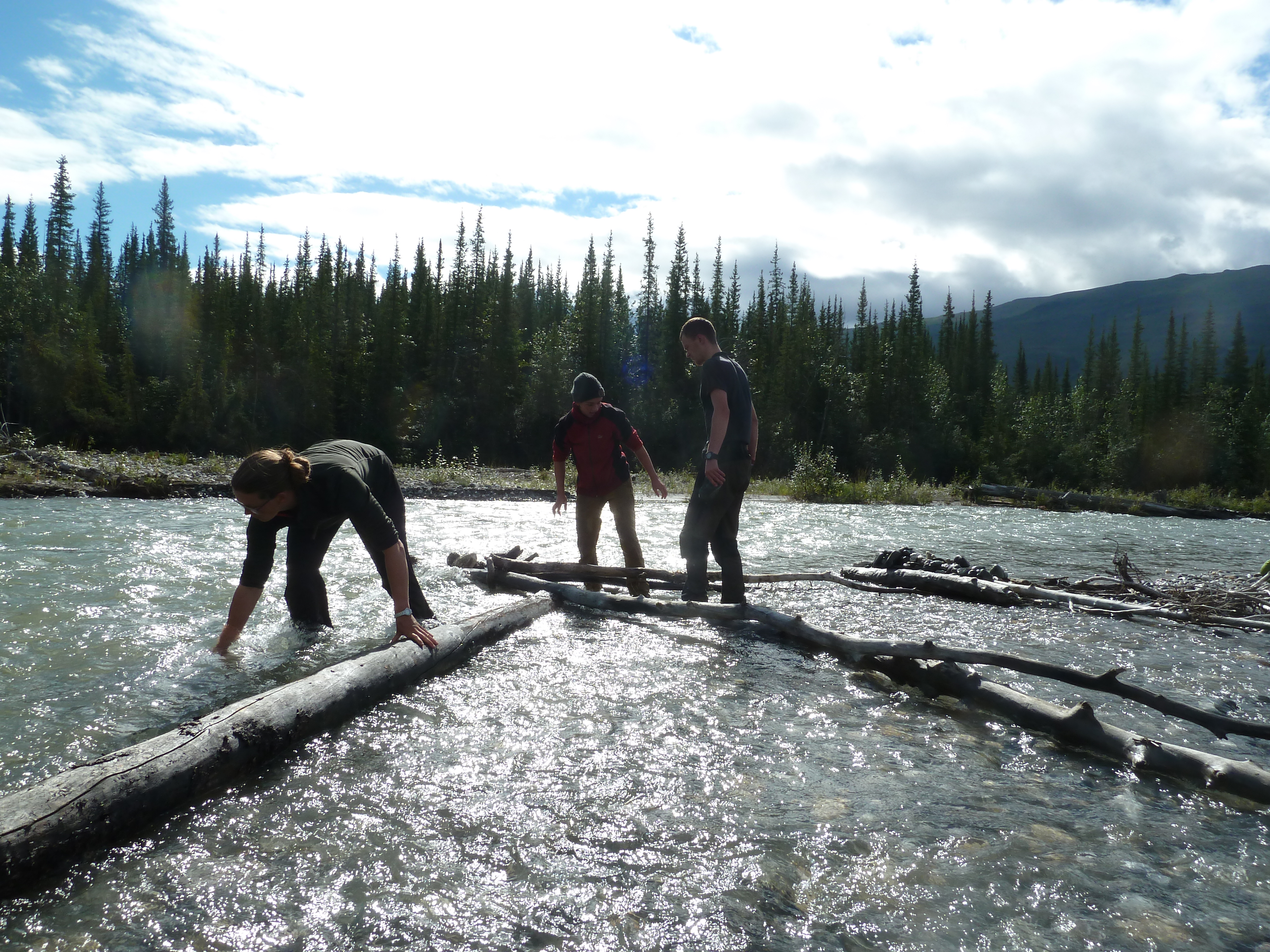
Well than we just do a roped crossing. The water was quite deep, all the way to the hip, but the current was not too bad and Frits and I could work our way across without any trouble. It was now only 800 meters to our food drop.
We geo-cached our way to there and to my great relief and happiness all barrels lie there intact. We packed them in and in a euphoric mood we returned to the river where the others were waiting for us. Cheers greeted us when they saw we were walking with full packs. We immediately started unpacking. What a great celebration! It was like Christmas. To make it even better my satellite communication seemed to be working again. I sent an OK message home. We decided that we had done enough for that day. Hey, we did have way be enough food now and our communication was back, why hurry?
I counted that we were one barrel short. Sigh, in our excitement we had left one barrel standing. My sister and I crossed the river once more to get the last one. We didn’t mind, it was a nice field trip.
When we got back the others had made camp next to the river. Bravo, we had covered under 2 kilometers today! A new record. We were all in a great mood. We had all the food we could wish for, the weather was great and the toughest part of our route lay finally behind us. We even made a small evening stroll. On the downside my satellite communication died permanently that evening . Late in the evening we saw a small plane fly over very near to our camp. The first plane we had seen so far. It would not be the last.
Day 14
Today marked the second part of our trek. We had covered 45 kilometers birds flight so far (sigh) and had still a stunning 120 kilometers to go (double sigh). In regard of the phase in which we had done the last 45 kilometers this sounds ludicrous, but there were no more great obstacles ahead. Despite the distance would tell you otherwise, we were ‘almost there’. My group believed shit of what I told them and assumed the worst. I don’t blame them.
We followed the river upstream, by times on the northern bank, by times the southern bank, by times right across. The water level had dropped dramatically and crossing was in most places no longer an issue.
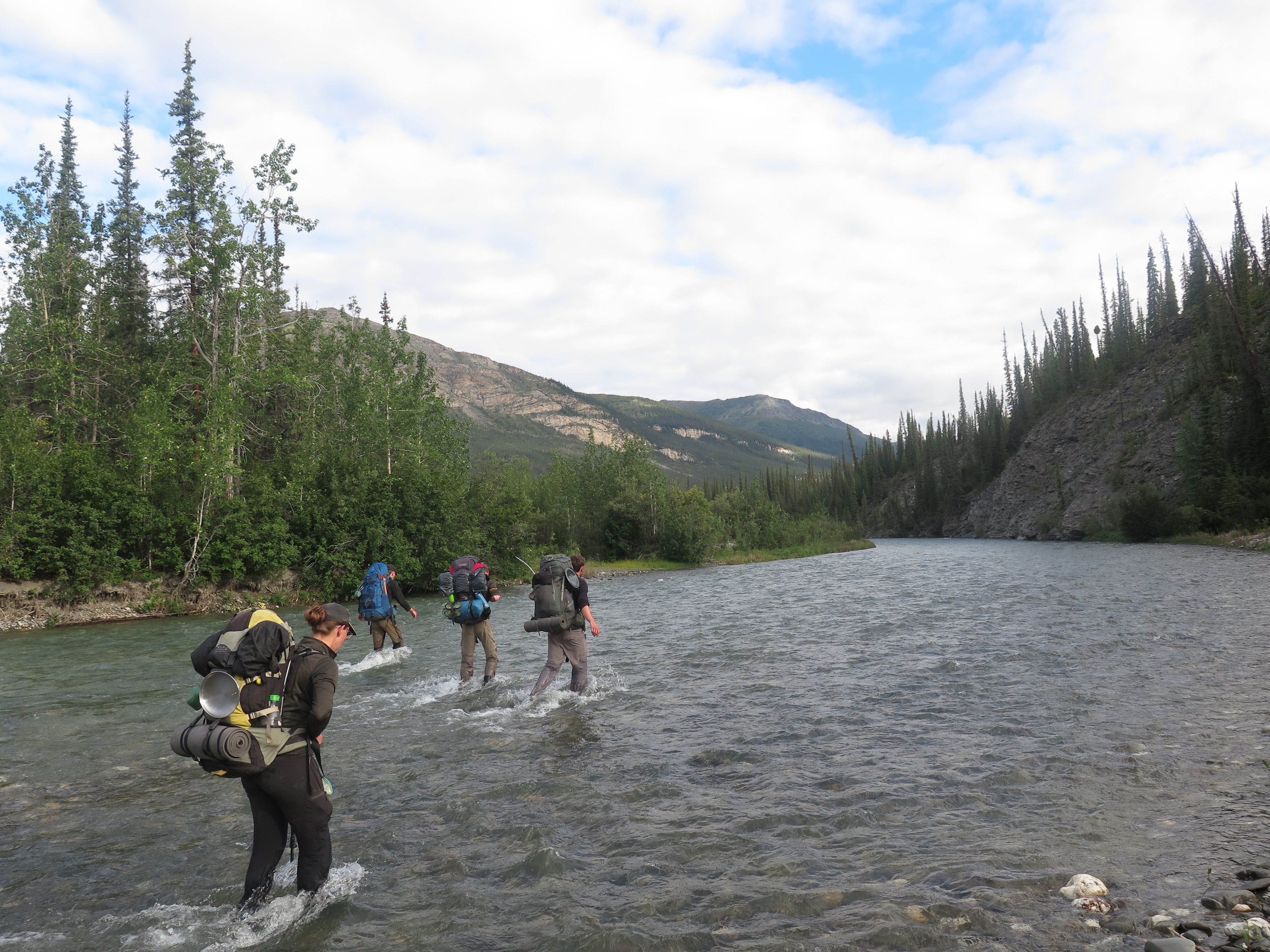
Our backpacks were top heavy with all our new cherished food and we took many breaks. The strength we had to put in made us drowsy and I even fell asleep a few times. The scenery was not spectacular today, but the open taiga in the sun made up for a nice day.
Once again we stopped very early in the day, when was the last time we actually made a full day hike? This time the excuse were our heavy backs and that we had to refuel a bit from all the rationing. We camped on a nice soft spot with an ambulance of blueberries.

We spotted an airplane going up and down the Unakserak. Maybe it dropped of some other tourists that would float down the Unakserak in the coming days. We should keep an eye out. If we meet them we might be able to use their satellite communication to tell our parents not to worry.
Day 15
The weather was on a streak! Once again great skies! The taiga grew opener and opener as we went further up valley.
In the morning we once again spotted that same airplane as yesterday. This was getting strange. A few hours later we saw a state troopers helicopter. What on earth were they doing here? We waved, but they did not react. All this air traffic gave me an unpleasant feeling. I could no longer find another plausible explanation for it than a deep dark fear that had slowly grown inside me. What if they are looking for us?

Later in the day the plane cam over once again. This time we were hiking in plane sight on the riverbanks. The airplane started to circle around us and drop objects. Oh god, they were looking for us… I picked up the box the plane had dropped, it contained a letter that asked whether we we alright. We signaled we were doing just fine. He dropped down a radio and we had contact with the pilot. Roos did the talking and heard that our satellite communication had sent a distress signal three days ago. That stupid machine had broadcasted an SOS while it broke down. How worried must our parents have been??? An SOS from a flooded river and then three days nothing! Fuck you spot gen3, fuck you.
As soon as he heard we were doing just fine the pilot flew back to Bettles, asking us to mail him the radio back once we were in Anaktuvuk. As he flew away he left us silent and pretty down. How were our parents doing? How much would this joke cost us? How well insured are we?

It would turn out that the answer to the firs question was ‘terrible, worse than you can imagine’. That to the second question was ‘not a dime’, the National Park Service carried the costs’ making the third question obsolete (long live the NPS!).
We made camp as we had way by enough to think about that afternoon (Once again a short day). Since leaving our camp on the western side of the Alatna we had only trekked a pathetic 20 kilometers. We anticipated that we would go exponentially faster due to our backpacks getting lighter and us getting better fed, so I wasn’t worried by our slow phase.

Day 16
Ok, today we planned to finally have a normal full day of walking. A day without any unexpected difficulties and especially without unwanted rescue parties. That was just what we got. Great, it was my birthday today after all.
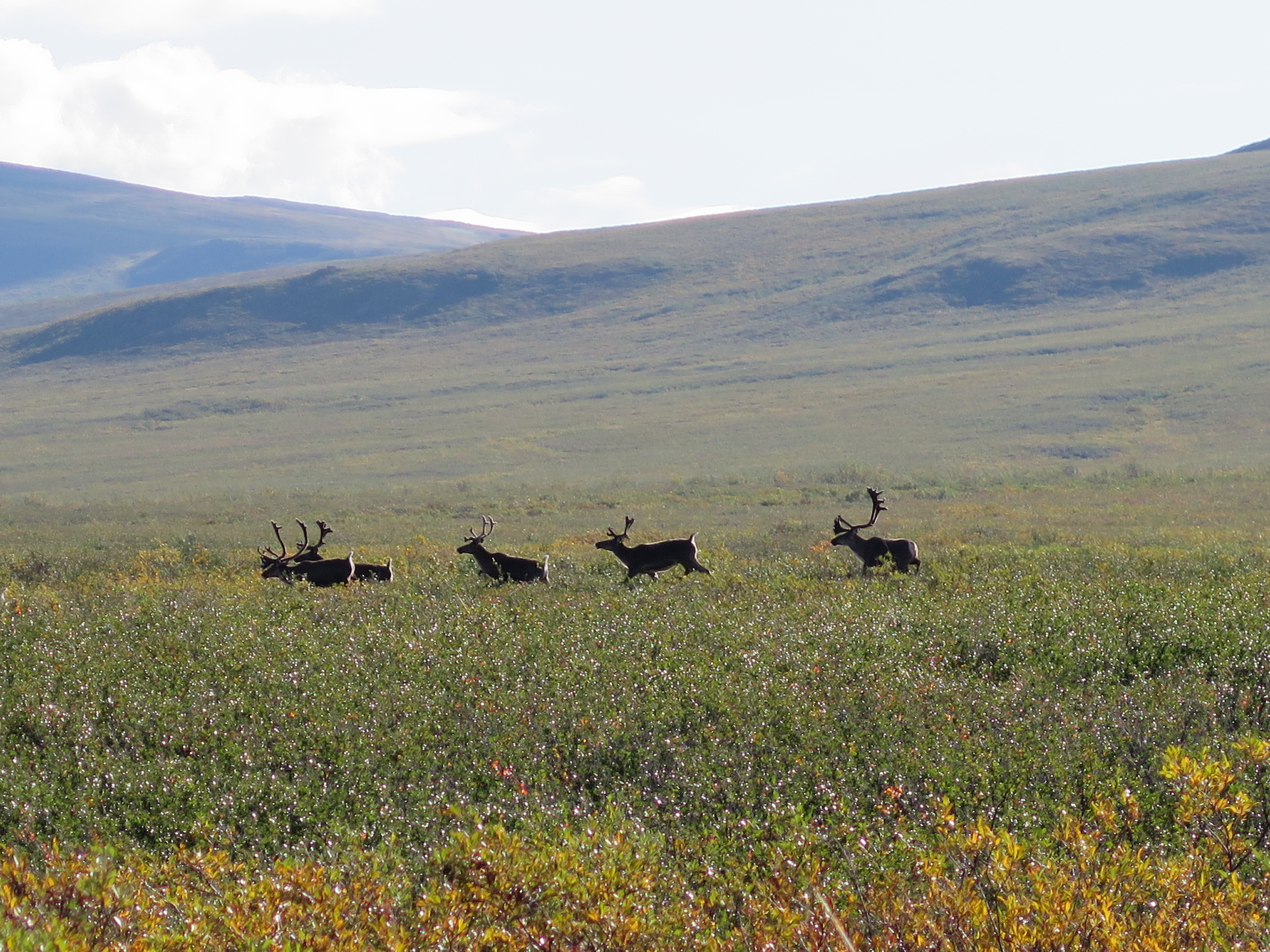
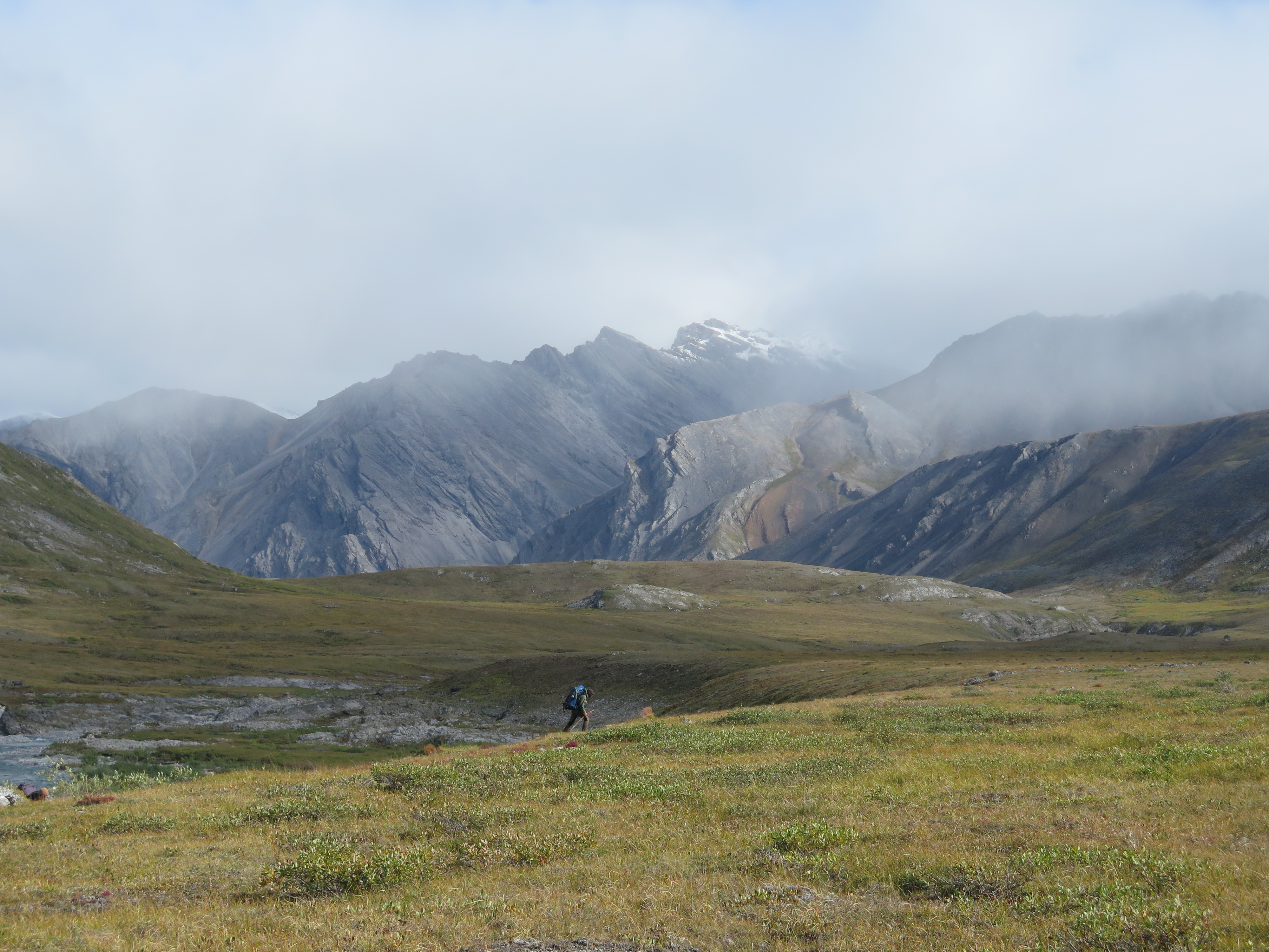
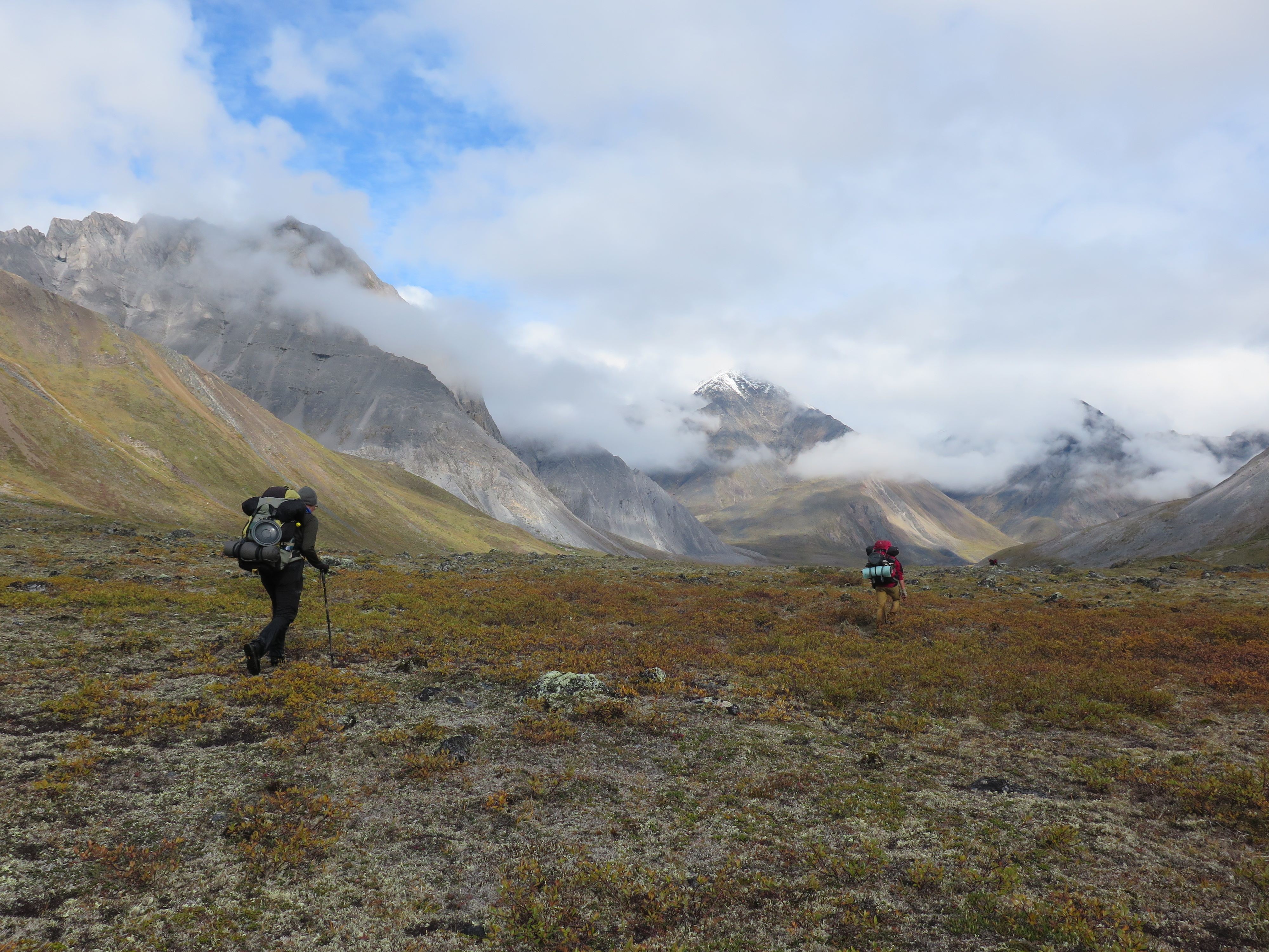
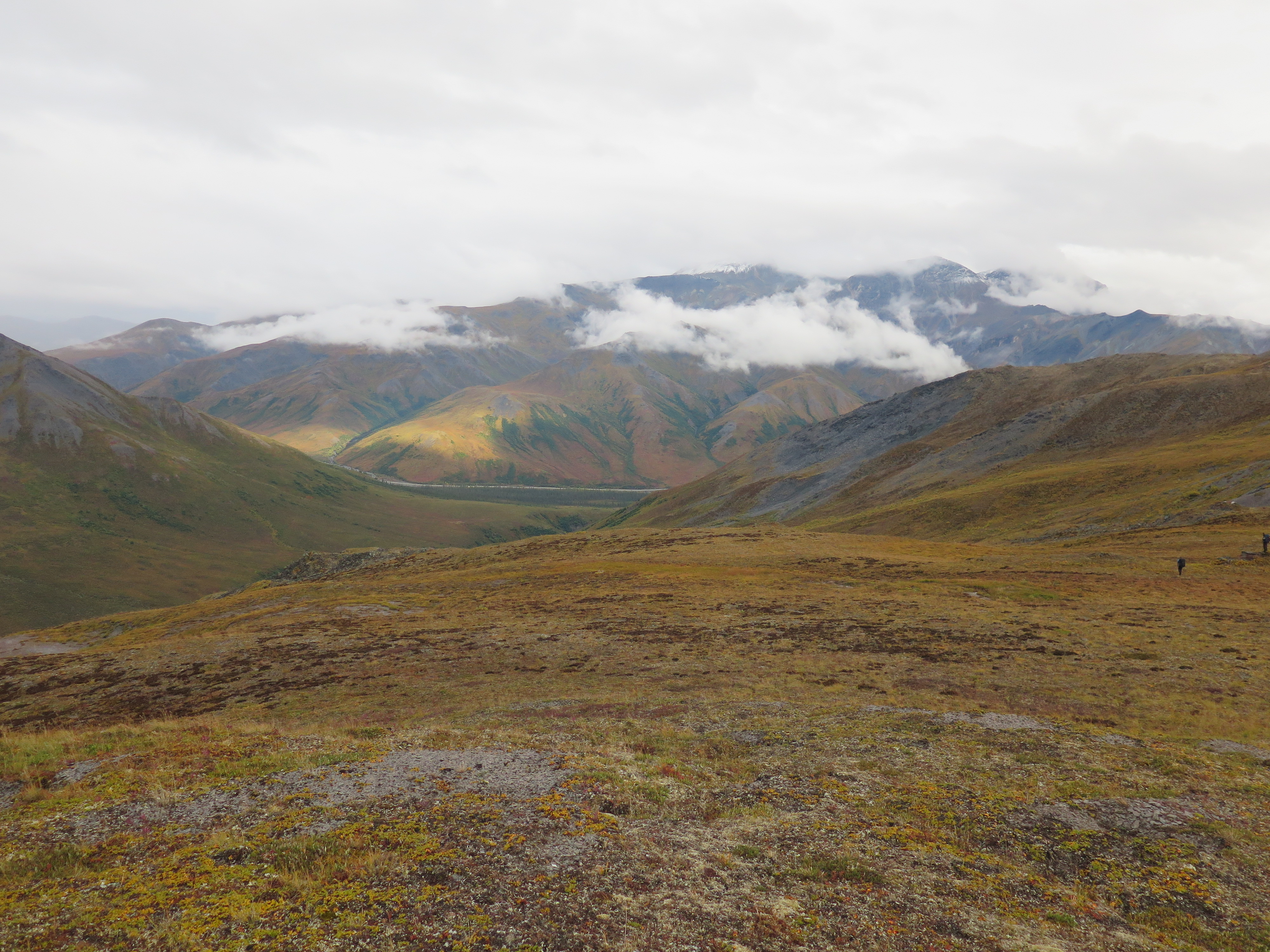
Soon after we had started walking the trees disappeared completely. The landscape as a whole started to change as well. The mountainous terrain we had found ourselves in the first part of the trek was now completely gone. We were now surrounded by grassy and hilly landscape and could see large distances. It was an indication of the outstretched tundra plains that I knew lied in front of us. This meant that wildlife was easy to spot and it did not take long for us to see our first caribou. This kind of area was also our change to finally see that Grizzly we had all been craving for.
We reached a milestone! Anaktuvuk was now ‘only’ 100 kilometers away.

We pitched our tent close to the end of the valley. For the first time since forever it was actually evening at the time we pitched. We enjoyed a good meal. We were eating as much as we could as that would make our packs lighter. I would start rationing again the day after tomorrow I figured. Once we were so close that unexpected delays got very unlikely we would increase our daily ration again.
Day 17
Today and the next I wanted to cover some very serious distance. Our packs were no longer unholy heavy and the terrain was easy, really easy.
We hiked up to a wide saddle point that formed the end of the Unakserak valley. The terrain was now wide open, true tundra. There were a quite a lot of caribou grazing the fields around us. We made a lot of photos of them, not knowing that the day after tomorrow they had grown so mondain that they were not even deemed worth mentioning.


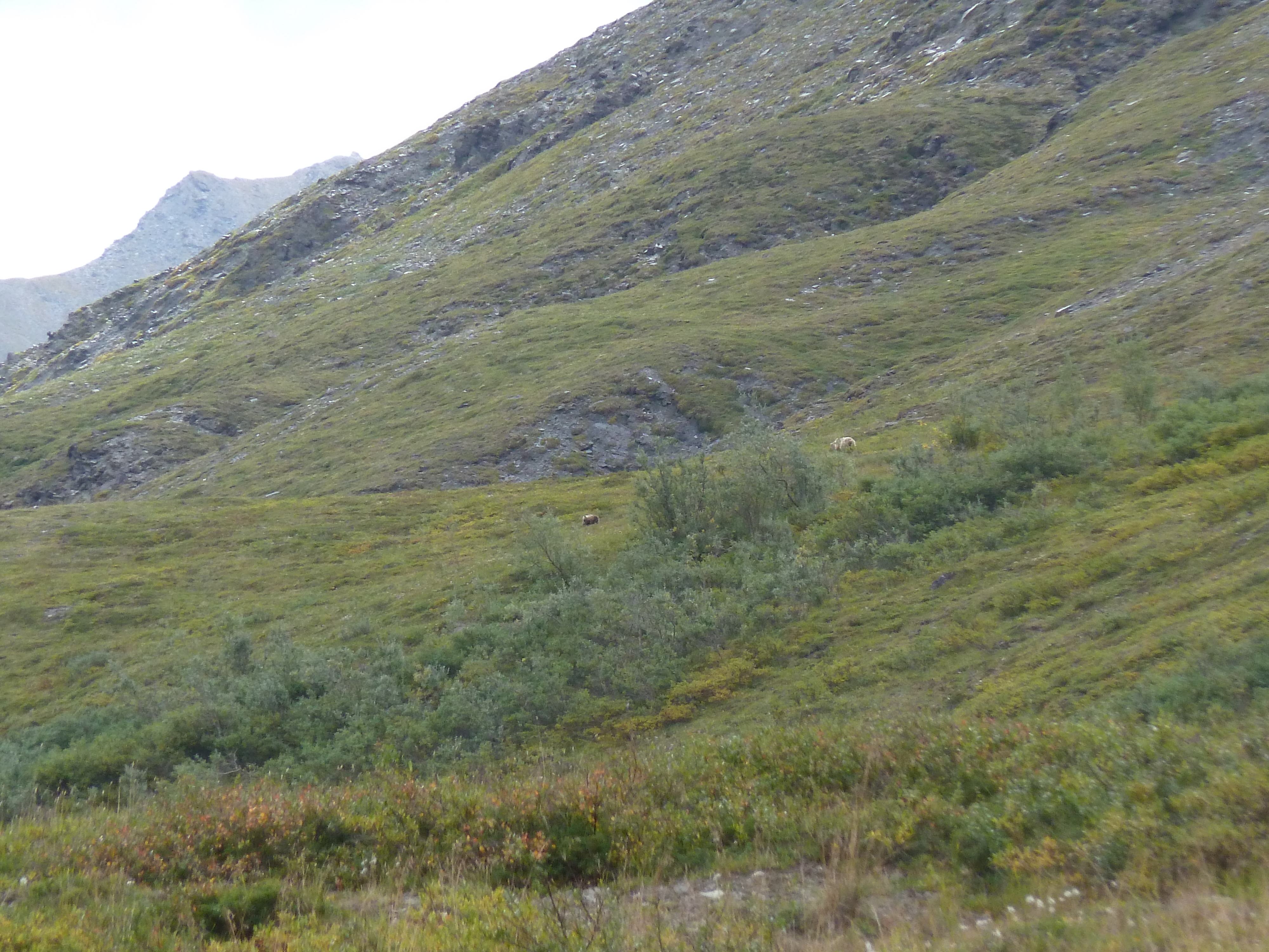
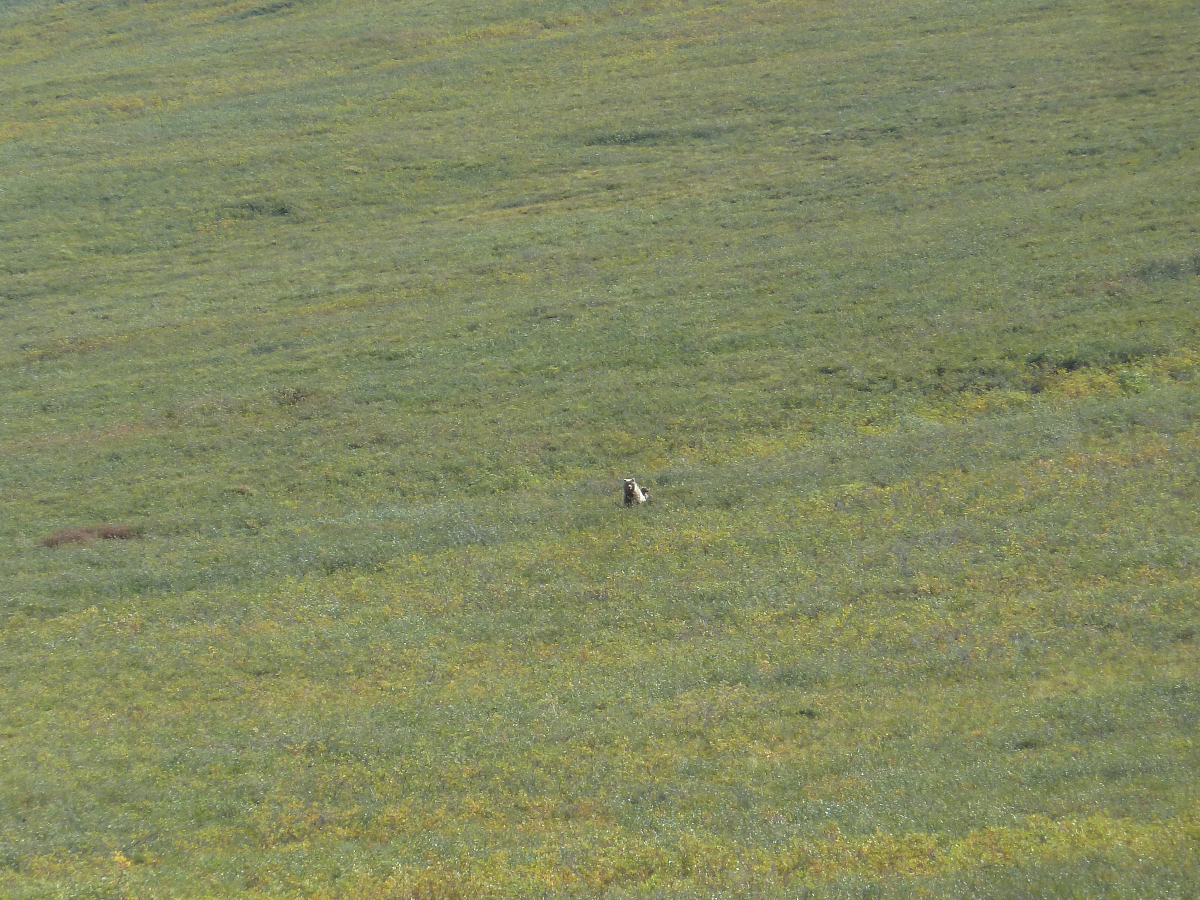
We headed east and climbed down the saddle. On the way down I spotted the very first grizzly. At last, I was starting to get worried we wouldn’t see any. It was a mother bear with two cubs. At first she didn’t see us. When we came down wind of her she spotted us and stood upright. Even though we were with six it was still quite intimidating.
The rest of the day we could follow the a caribou track which made the hiking laughably easy. The landscape was a little less interesting for a moment, but on a small level we could see many ‘Yellowstone’ style rocks around the river. We camped on the plains an impressive 18 kilometers birds flight from our previous camping spot. The weather was still good and gave no sign it would turn any time soon.
We made our third culinary discovery. Mashed potato with cooked blueberries! After a while the caribou lost their shyness and got closer to our tents. We could watch them from up close during dinner.
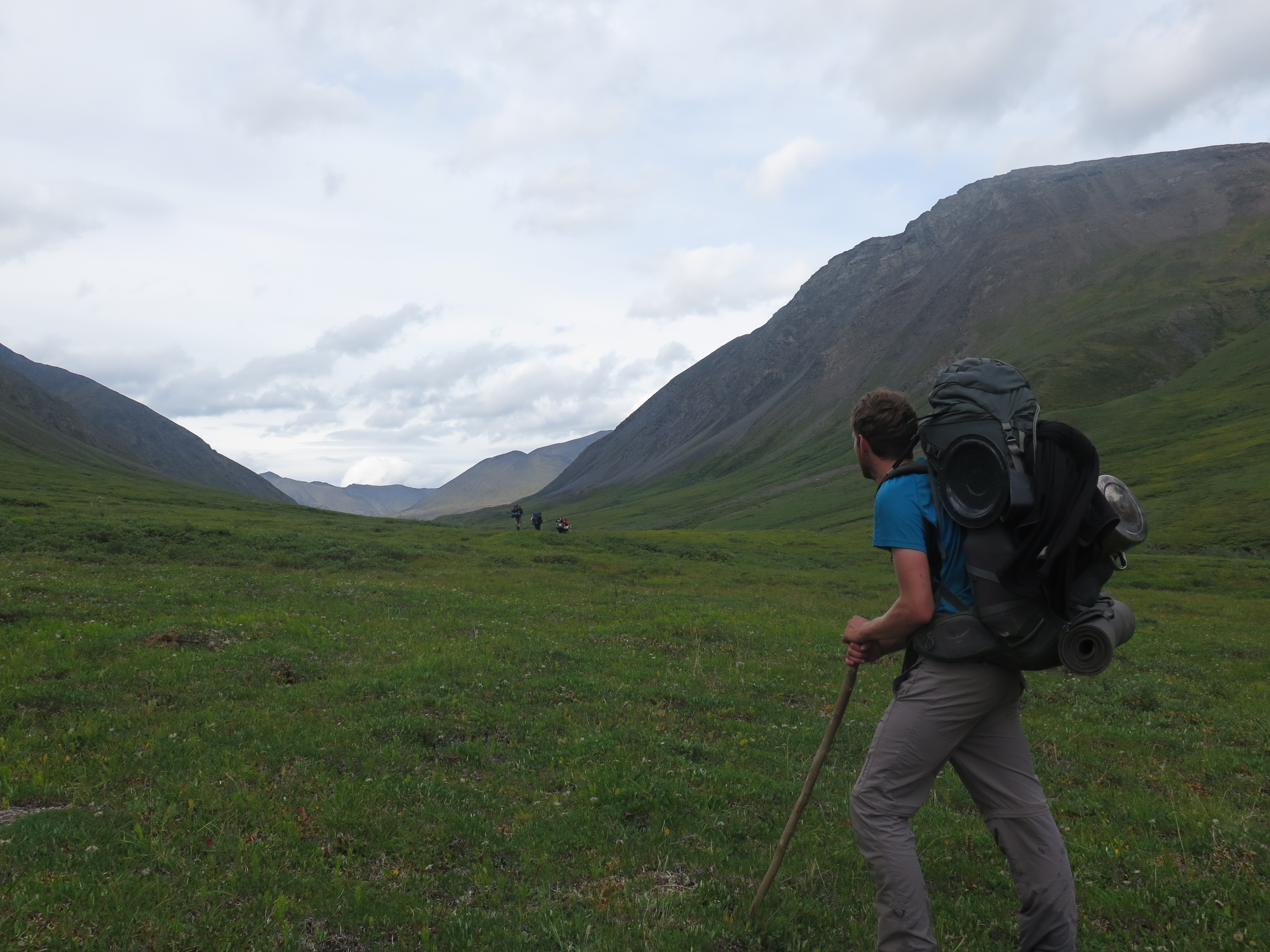
Day 18
We hiked straight north towards the ever broader plains. We set course for a mountain right in front of us. It took us 4 hours to reach it. The terrain was so vast that there was few sense of progress. The going went a bit slower than anticipated, the grass tussocks formed a constant torment for the ankles. You could barely walk without spraining your ankles. That everyone started grazing for blueberries as soon as they saw their chance clean didn’t help speeding things up either.
On the way we saw our second grizzly. Once again a mother with two cubs (does that count as three?). This encounter was a bit scarier than last time. The grizzly was further away than last time, but approached us very quick till about 150 meters. It checked us out for a moment before retreating again.
The sky was clear blue and it was pretty hot on the shadeless plateau. Westward a river unsprung that slowly descended north towards the arctic sea. A very nice sight. The open tundra did not get boring as I had feared while planing this trip. We hiked till quite late in the evening. In the evening we noticed that it started to get dark again. At the beginning of our holiday we had had light all day long, but now it was clearly dusk at around 9 and at night it was actually dark.
Day 19
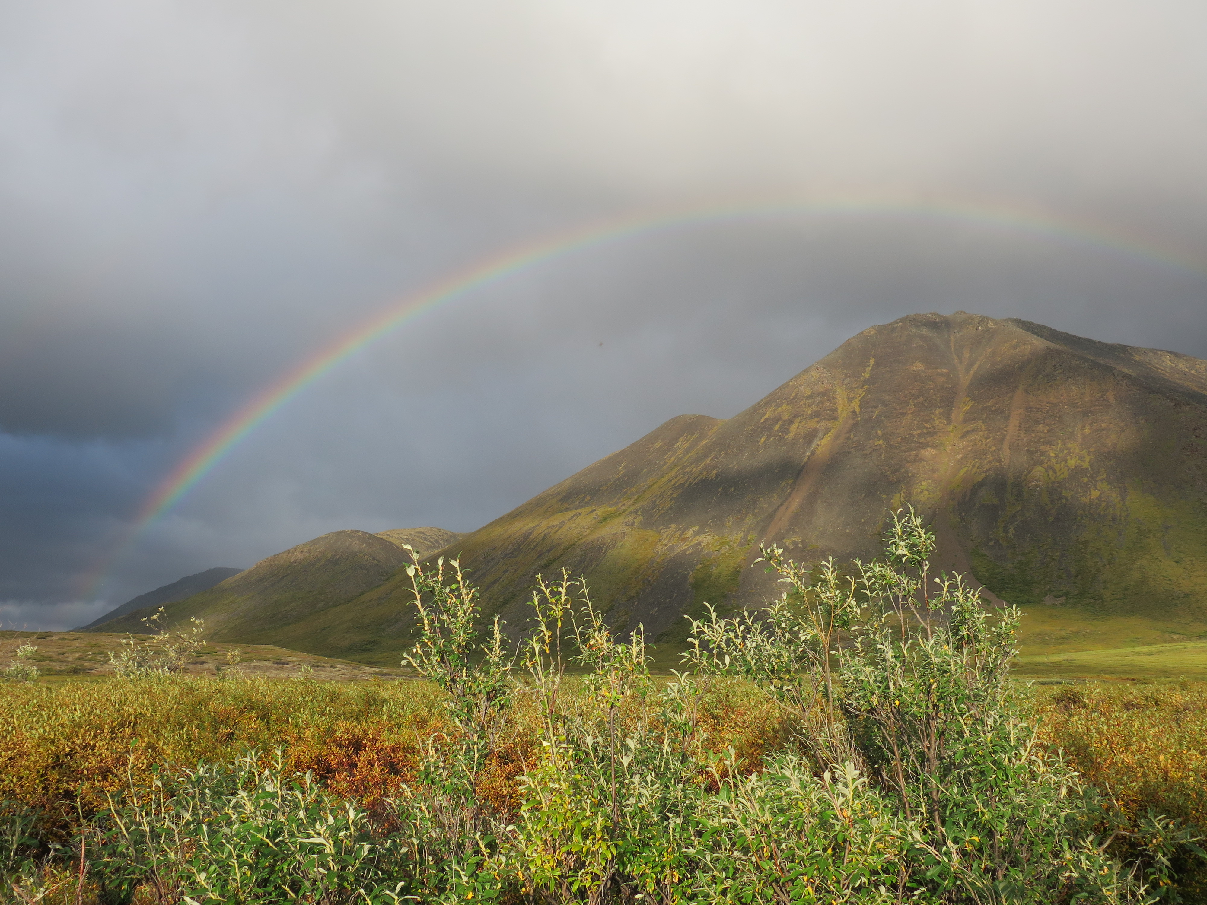
It had rained tonight. Or at least so I have been told. In the morning the weather was a bit depressing. It was not bad, but the great weather days were seemed to be behind us. We hiked through squishy ground eastward. Directly towards Anaktuvuk, only 70 kilometers away now. For the first time the distance seemed manageable. We passed a lot of lakes, rainbows and caribou. We had grown so accustomed to caribou that we paid as much attention to them as to the grass we were walking on.

we saw quite some wolf tracks today, but never the wolf itself.
Day 20
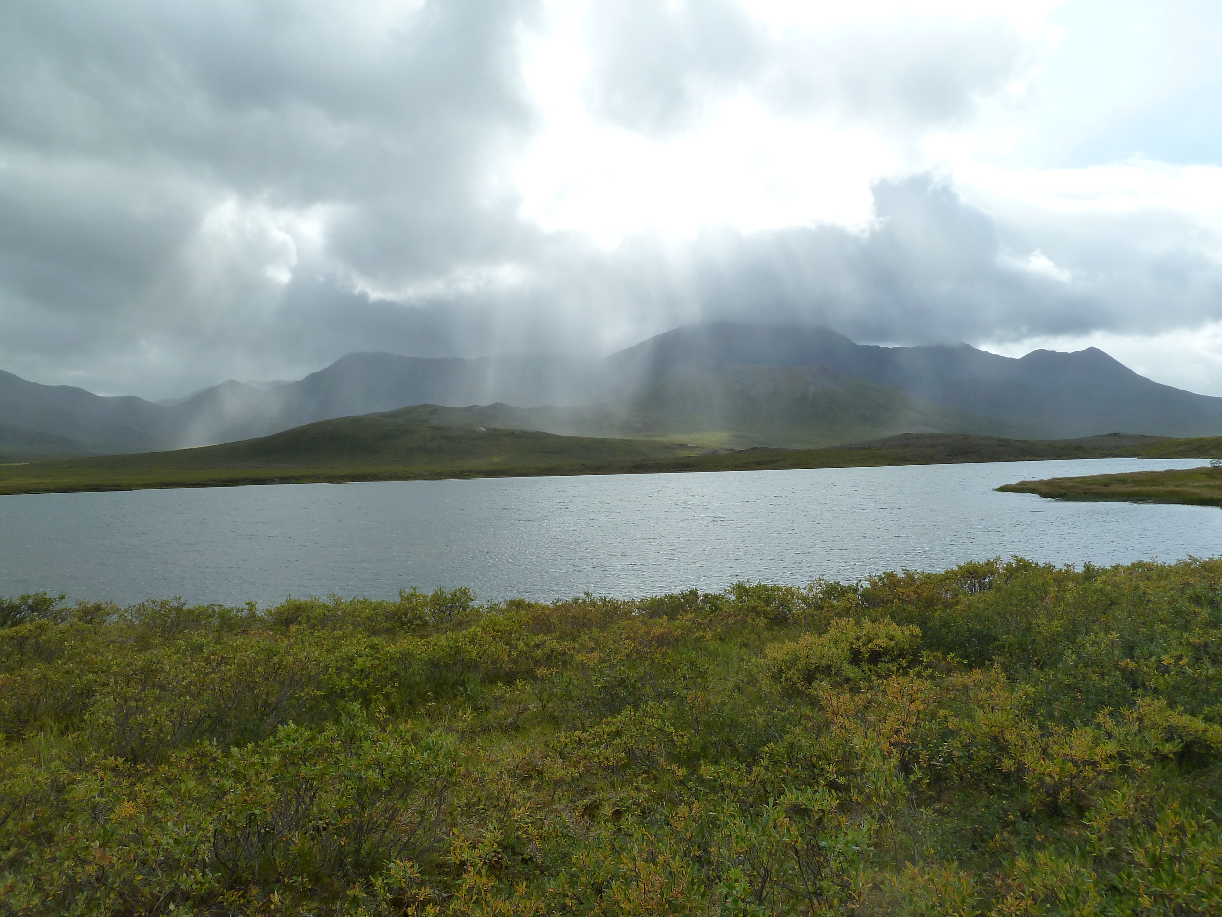
The good weather streak was definitely over, there was no sign of bettering meteo. All morning long I could not find out for the life of me whether or not it was actually raining. We hiked through the narrower getting valley to Agiak lake. This lake was our que to take the eastern side valley.
A bit up valley we saw two grizzly bears at the same time on both sides of us. Wow, we were Pumping those bears! We hiked up valley towards the saddle (you can not really call it a pas). On the saddle there was a medium sized lake and a good caribou trail. It was clear we followed the caribou migration. The number of caribou we saw however quickly decreased so we must be getting to the edge of the migration.

On our descend the weather worsened and we wanted to camp. We had to suspend that idea, just when we were about to we had to abort due to yet another bear. Wow, even spotting a grizzly was getting a bit mondain… There was a discussion on the wiseness of setting up camp close to a bear between Frits and me and we decided to hike down another 2 kilometers down valley before setting up camp.

Day 21
There was no denying it. Autumn was setting in. Tonight was pretty dark and cold and the tundra was getting an unmistakably red taint over it. We hiked down towards the colorful mountains east of us.
Except for some bushes the terrain was easy and Anaktuvuk was rapidly nearing. Around 11 am the wind turned to the north. Northern wind for the first time and man did we feel that. The wind chill plumed the apparent temperature easily by 15 degrees. We almost immediately sought shelter in a slump in the terrain to wait it out. It did not pass, so we would just have to deal with it. We put on some more clothes and of course our rain gear to shield us from the wind. In the evening the strength of the wind increased and it became even stormy. We paid a lot of attention to find a camping spot shielded from the strongest winds. Broken tents was not what we were waiting for. WE found a nice place in the bushes near the river and pitched there. There were only 29 kilometers to Anaktuvuk remaining and the terrain ahead looked pretty easy to traverse.

Day 22
We could already see the main valley east of us and it would not take long before we would get sight of the John river. In the very first minutes of the day we got caught in very swampy terrain. Having dry feet in Alaska is a pickle. At the point the side valley terminated we found an old campsite and not much further some jeep tracks. Actual jeep tracks! It seemed like we could hike the last 25 kilometers over a simple track. This really speeded things up by a factor of 2. It might be possible to reach Anaktuvuk today.

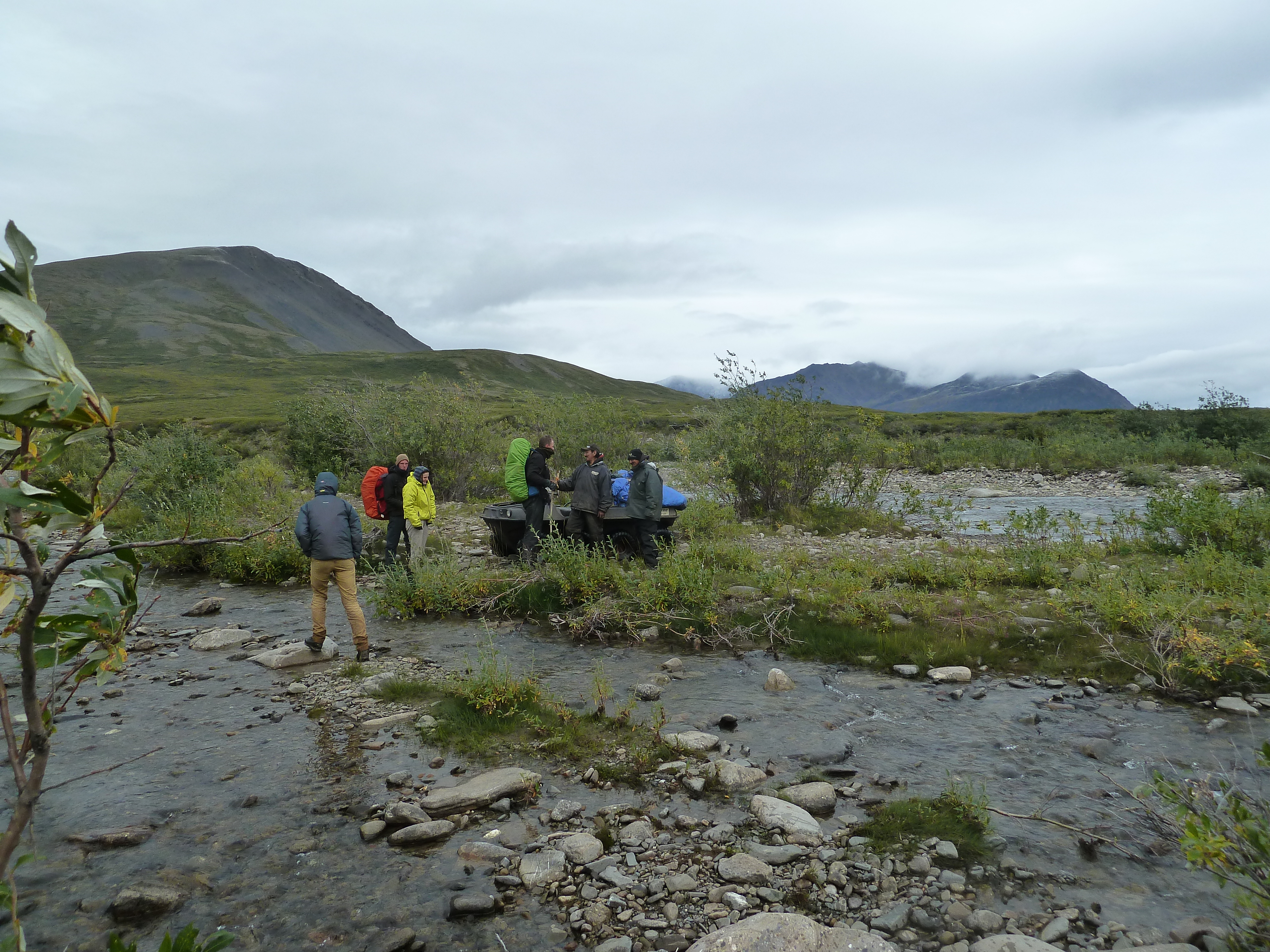
At our lunch break we met a few locals with their boat-like vehicle heading south. Ah, so it were these vehicles tat made these tracks. It were quite funny crafts, I had never seen something like it before. It had 16 wheels, quite small and could be used as a boat. They told us they were heading out to set up camp at the end of the track to shoot some caribou that they knew would arrive soon. They asked if we had already seen them. We said that we had. It felt a bit like we betrayed the animals, and were complicit to the death that was awaiting many of them here…
We continued in a rapid phase. Yes, we would try to reach Anaktuvuk today. There was no confusion about the main industry of Anaktuvuk, there lay countless antlers all over the valley.
At 9 pm in the evening we finally arrived in Anaktuvuk. We were just in time, the shop was about to close right at the moment we raced in and bought all the candy we could lay our hands on.
We set up camp next to the airport and ate till our stomachs could take no more.
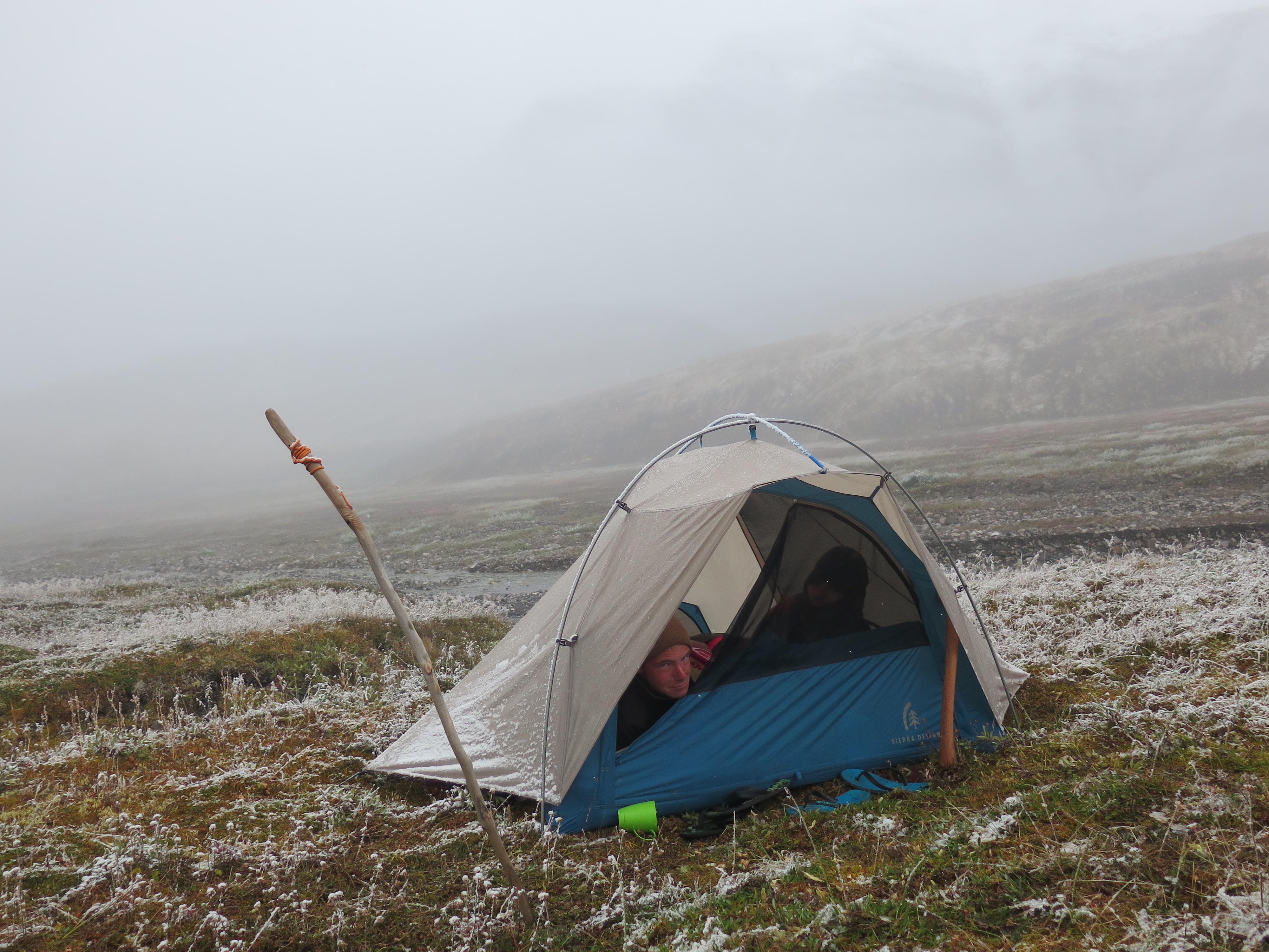
It snowed that night around 5 centimeters. The very first snow of our trek. A good thing we had trekked all the way to Anaktuvuk today, packing in snow is not my favourite pass by.
Day 23
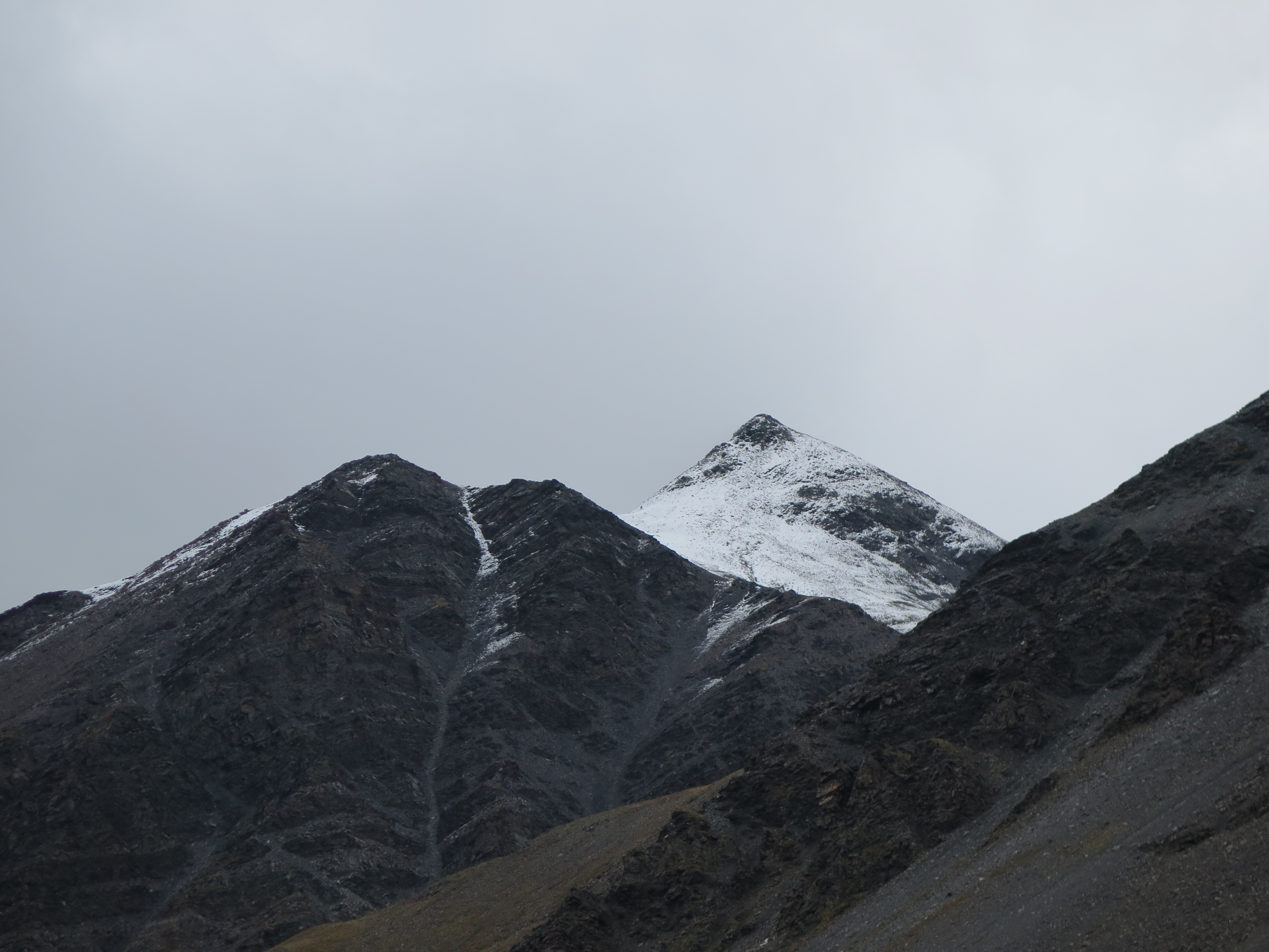
In the morning we woke with a pack of snow waiting for us outside. Snow in the middle of August, Glad I’m not an Alaskan. Once the sun was up it all melted away fairly quickly. Higher up in the mountains it however remained and by the looks of it quite a bit more than the mere 5 centimeters that had fallen around here. The fresh snow made the mountains look way more threatening than in the days before. Hopefully the passes on the way to the Dalton Highway were still crossable.
It was nice to be in civilization again. But before we could enjoy the luxuries of modern life it was high time to take care of some practicalities first. At the very start of the list was of course contacting our worried parents that, as we heard still hadn’t fully recovered from the blast of our missing. We could use the wifi of the local school make a Whatsapp call to them. After this all we went to pick up the new satellite communication our parents had shipped to the post office. While we were at it, we also mailed our bear barrels back to Kotzebue and the radio back to Bettles. That was going to save us some weight! We postponed buying food for the rest of our trek till tomorrow as we had decided to stay here another day. We had the time and wanted to eat a bit more. The weather was terrible anyway.

The rest of the day we hung around the cafeteria. We ate a lot of big fat Alaska pizza till we really couldn’t swallow any more. These white sauce bacon pizzas were a complete middle finger to Italian cuisine, but exactly what we had been craving for.
In the evening the weather was reasonable and even the northern wind waned a bit for the first time in 50 hours. We made a fire and sat outside without rain gear for a change. The nice weather drew out the locals as well. A pickup truck with the trunk full of children of around 12, all armed with a military grade arm, drove by. It was America after all…
Day 24
All that was left was buying food for the rest of the trek. We were hungry and so bought a very royal amount for the, probably, only 8 days we still had to trek. We even bought 8 bags of marshmallows. Best buy ever!
After having done this we went back to the cafeteria to eat even more over sized fat pizza. Many of us had had pretty unsettled stomach during the night, but we couldn’t resist. We ate for the rest of the day, marshmallows, brownies, pizzas, fries and so on. In the evening we all lay in front of our tents nauseous and barely able to walk. Next day we must leave here, this can’t go on. The snow had moved up quite a bit, but not way as far as I had hoped. I didn’t worry about it too much, I had crossed snowy passes before and there was a, less scenic, route around the passes anyway.

In the snack bar we had seen the forecast, it promised to get a little better, but not much. In the Alaska extremes section we saw that, of all places, Anaktuvuk was the very coldest place of the entire state. The rest of the news seemed, of course, rather Donald Trump dominated. The Alaskans are very warm and heartily people, but despite of that there seems to be an enormous support for that egocentric clown around here.
Day 25
On the road again! We hung over our heavy packs and followed the Anaktuvuk river upstream. We could follow a jeep track the rest of the day. It was easy going and we hiked about 18 kilometers birds flight that day. On the way we saw a young grizzly that ran for the mountains as soon as it got sight of us.
With all the food we had brought the trek was rather Burgundian and we had plenty of luxury food all day. A bit too much in fact… As usual my strategy was to eat a lot at the start and end of the trek and ration in the middle. The philosophy is that you want to lighten your pack in the begining and that in the end you know quite well how long it is still going to take you.
Light drizzle and sun took turns a lot that day and we had some of the greatest closeup rainbows we had ever seen. If there is indeed a pot of gold under each rainbow we should have been able to see it. (Sorry to say that there apparently isn’t)

Day 26
The jeep track terminated early in the day, so it was off track as usual. The shrubs grew sparser by the minute. Slowly but steadily we ascended. After lunch we arrived at the point that we needed to take a sharp turn north, leaving the main valley behind and starting our climb up to Perigine pas.
We had just turned north or we were stopped by an American in sport shoes running past us. He halted. His camp was down at the river and he had seen us passing by. He was on holiday with a friend and had walked down here from Anaktuvuk to run up some mountains as day trips. Yeah you heard it right, running up mountains. We had a nice chat for a minute and went our separate ways. He lived in Boulder Colorado, my sister told me she could tell that very well. Modern hipster ITer startup kind of guy.
The side valley that were following quickly narrowed and steep cliffs started to rise above us on both sides. A moose heading down valley got pinned by us. At first he tried to hide behind a rock about one third of his size, when he saw that this was futile he nervously hiked closely passed us. Seeing this clumsy behavior I had no high regard of the intelligence of these animals, but it was nice to see one from close by. Glad it was a moose and not a bear as I first thought. Had it been a bear the situation could have been kind of a pickle.

The grass made way for small boulders, it was time to make camp now we still could. The pass was about 3 kilometers east of us. We could not see it as a mountain ridge lay in front of it. It all looked pretty snowy up there. This climb could be a toughy.

Day 27
Very early in the morning we went for it. It had snowed again and our camp lay just around the snow line. After 15 minutes we were traversing the snow covered moraines. It was recent snow and it was melting by the minute. The weather was alright, but worsening. We pushed further rapidly.
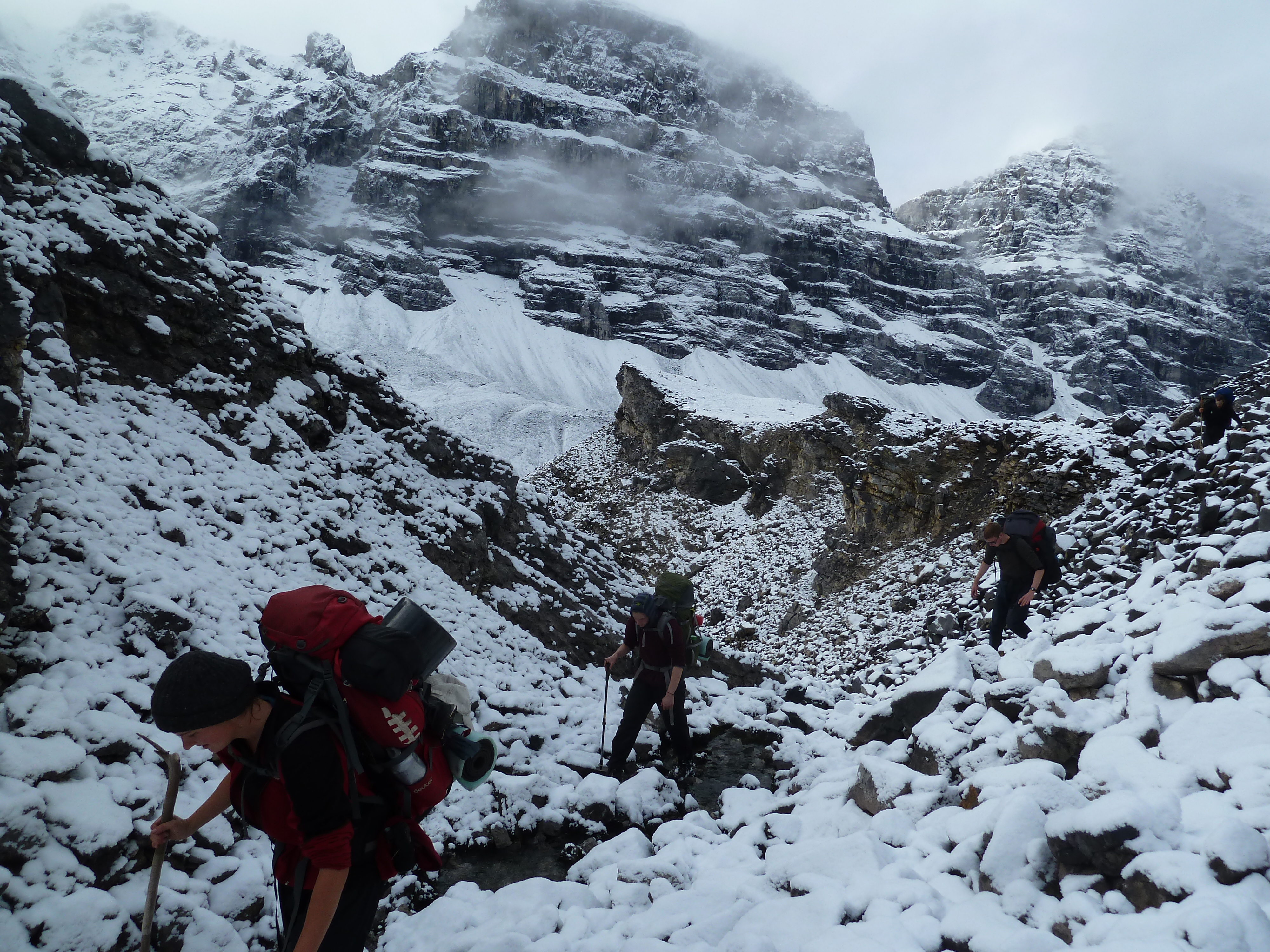
Once across the boulders we came to the first proxy-pas, from here we could see the main pas right east of us. Yep, there was quite a bit of snow on that one.
We hiked down 50 meters, traversed the large moraines of the glacier right south of us and started the steep climb up. Half way up we reached the snow line. This time the snow was old. It even held our weight in a few places. The last part of the climb was rather steep and the snowy conditions made it a bit difficult, but it was not too bad.

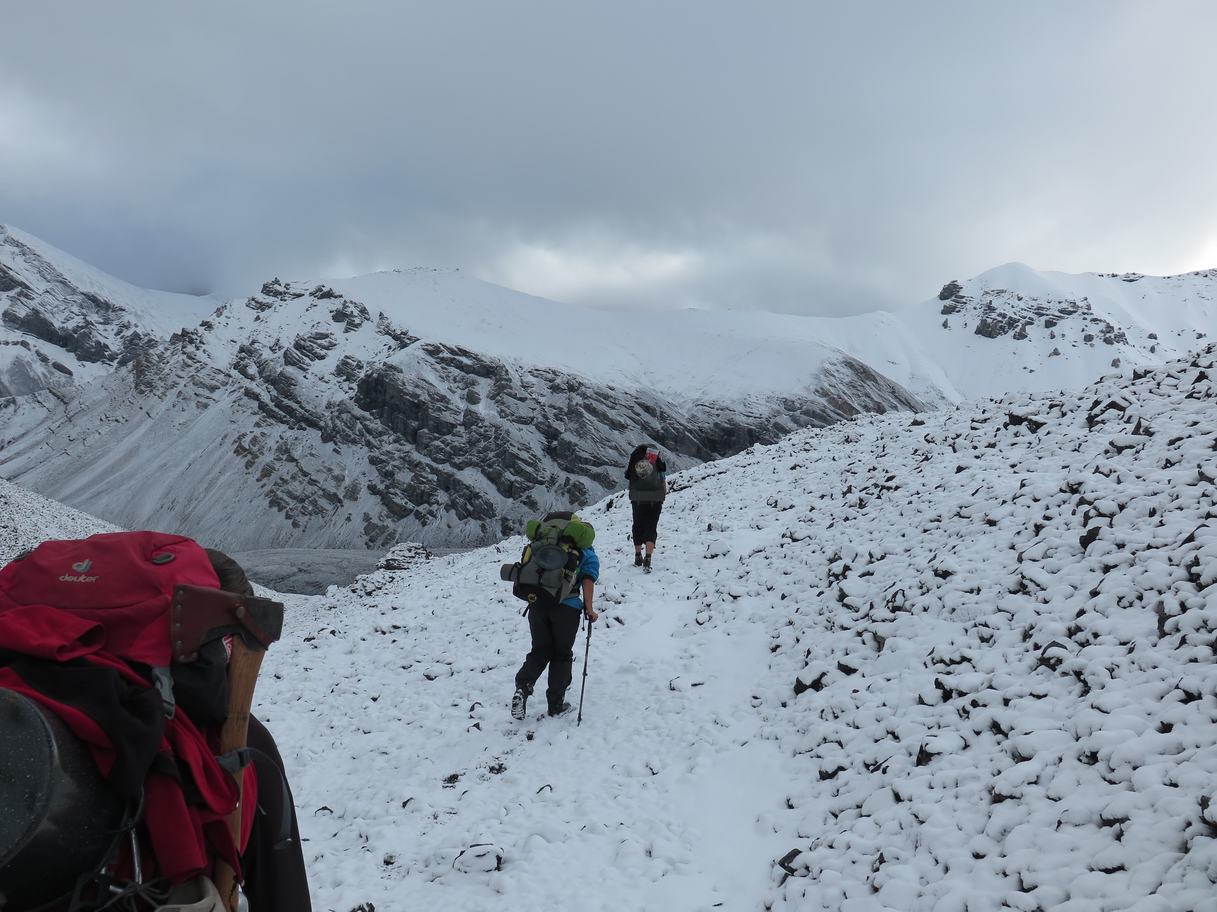
On Perigine pass we had despite of the clouds, that had started running in quickly now, a nice view. We had the possibility to climb one of the highest peaks of the Brooks Range from here. We didn’t take the opportunity as the top was completely hidden in the clouds.


We would camp down in the valley and climb it tomorrow, given that weather conditions would improve. We spent quite a long time on top of this beautiful pas. Even though the wind was cold and we were in knee deep in the snow the view kept us up there. The descend was very snowy and quite steep, this allowed us to slide down the first part of the descend. Not much later we could setup camp in the valley. With Perigine pass now behind us it now was smooth sailing to the Dalton highway.


Day 28
I had set the alarm to 5:30 am in order to climb the mountain. I looked outside, thick mist. I could barely see Jannes and Frits’s tent just 20 meters further. I lay down and went back to sleep. Pointless to climb in these conditions.
I woke again a little later in the morning. Weather still sucked, but a little less than earlier. We had breakfast and procrastinated as much as we could. It took another 2 hours for the last snow to melt and the mist to clear up a bit. Higher up conditions were still bad. No peak climbing today.
Fine, we will try another peak at Oolah pass. We started our hike down. On the way we were treated to some nice rock formations. We also found a Dal sheep skull. We hadn’t seen any Dal sheep yet. Well from the plane, but that doesn’t really count. I scanned the rock faces for sheep the rest of the day, but in vein.
At the end of the valley the river got very broad. Easily over 300 meters wide. and less than ankle deep in most places. We hopped stones for about a kilometer right through the middle of the river and set up camp. The Dalton highway felt really close now.
Day 29
The first warm night in 10 days and no snow upon waking up. I wanted to reach the foot of the Oolah pass today, this meant covering 16 kilometers birds flight, so as opposed to yesterday we did not linger.
We hiked into the broad Oolah valley. We crossed over till the next side valley, which we could already see from our side. The Oolah river was easy to cross (that’s nice for a change). Things were going well. We hiked up towards Oolah pass. On the way we came across a wondrous rock formation. The valley wall had collapsed and the fallen rocks had eroded to giant molehills. We could not quite explain what we saw.
A little further I at last spotted those damn Dal sheeps I had been waiting for. It seemed we only would have to miss out on the wolves.
The valley split up and we followed, the less inviting looking northern part of it. You can easily take a wrong turn at this point. About 1 kilometer before the pas we set up camp. From down here Oolah pas looked very tame, may I say boring. We decided to spice things up a little and climb one of the mountain tops we saw around. The top right south of Oolah looked interesting and doable so we settled for that one.
Day 30
We woke at 5 am to start climbing. The weather was reasonable for a change and we wasted no time to get on our way. We headed towards Oolah pas and started the long and steep climb over loose gravel and rocks to the main ridge above us. Once on the ridge it was an easy climb up. The view was rather nice, we could already see the Dalton highway from up here.

The mountain a bit further south along the ridge seemed to be higher and tougher so we decided, now we were on it, to climb that one as well.
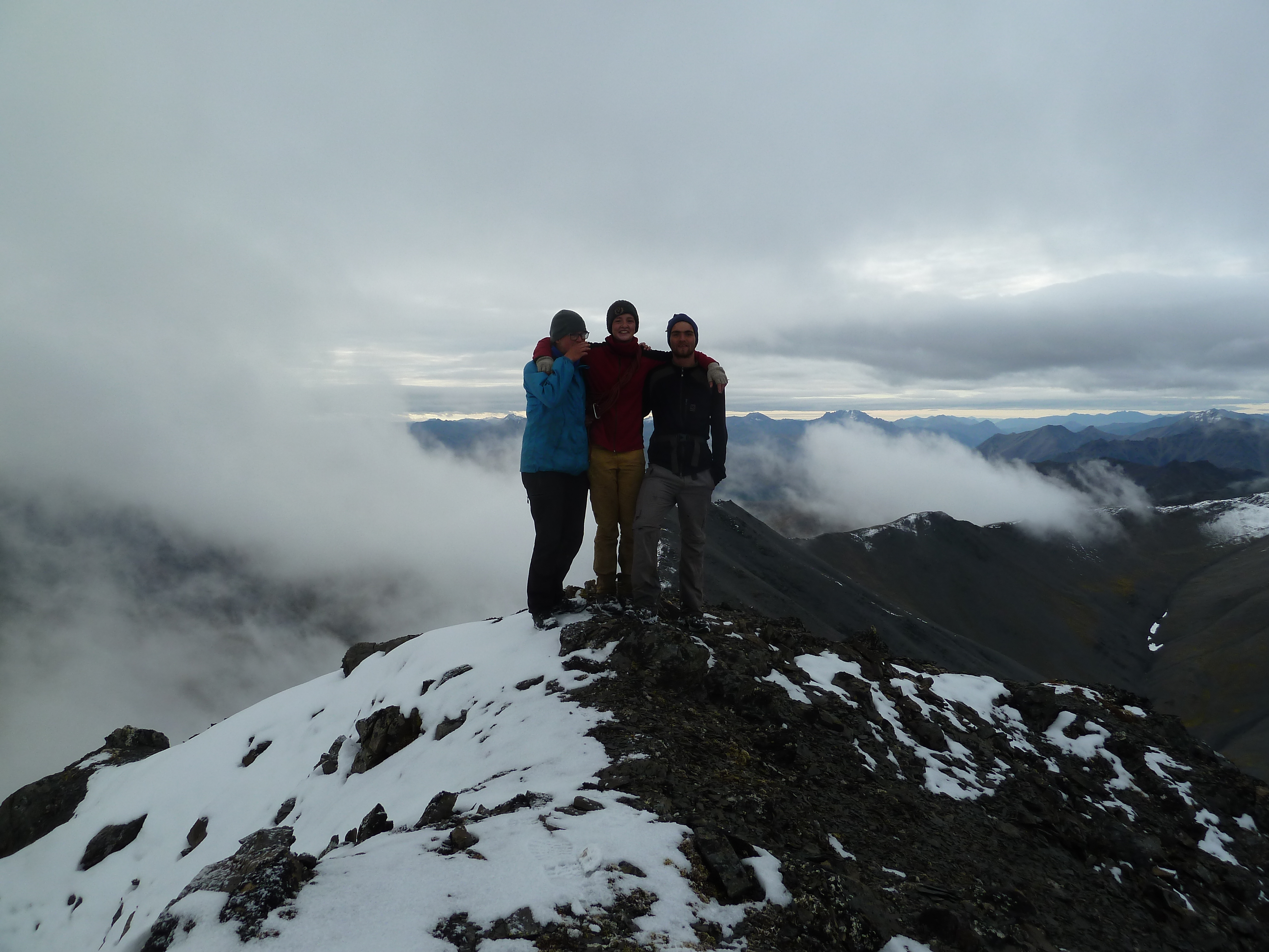
My sister and I found the climb still a bit too tame so we decided to try and climb along the entire ridge in a circle back to the campground. The others were less eager and returned the same way.

It was a nice climb along the ridge. Exciting, but not dangerous.
Back at the camp we packed up and walked up Oolah pas. The pas was boring, especially now we had climbed the top next to it. The descend was however beautiful. One last treat of Alaskan nature before we left. The autumn colours were really coming through now and it did not even feel like summer anymore.

It was getting late and we deliberated about what to do. The Dalton highway was too far to reach today, that was clear. We could camp down here or climb up to the saddle between us and the highway. The advantage of the last option was that we could arrive at the Dalton highway early, making sure we wouldn’t miss the bus that went that day. The only bus of that week (well done Alaska) On top of that it would be a nice last camping spot, partly already there, partly still in the wilderness. The disadvantage would be the probable lack of water.
Our solution was to have dinner here, fill up our bottles and hike up to the saddle to camp. That is what we did. On our way up we snatched some moose and caribou antlers as souvenir. Once on top we pitched our tents. We could see the enormous lorries driving the Dalton from up here. The sight of the road we had walked towards for over three weeks gave a great sense of accomplishment.
Day 31
It rained quite heavily, but we didn’t care. We were as good as there. We hiked steep down to the river and followed it till we hit the road. We had to hike through the river a few times and were soaking wet when we got there.
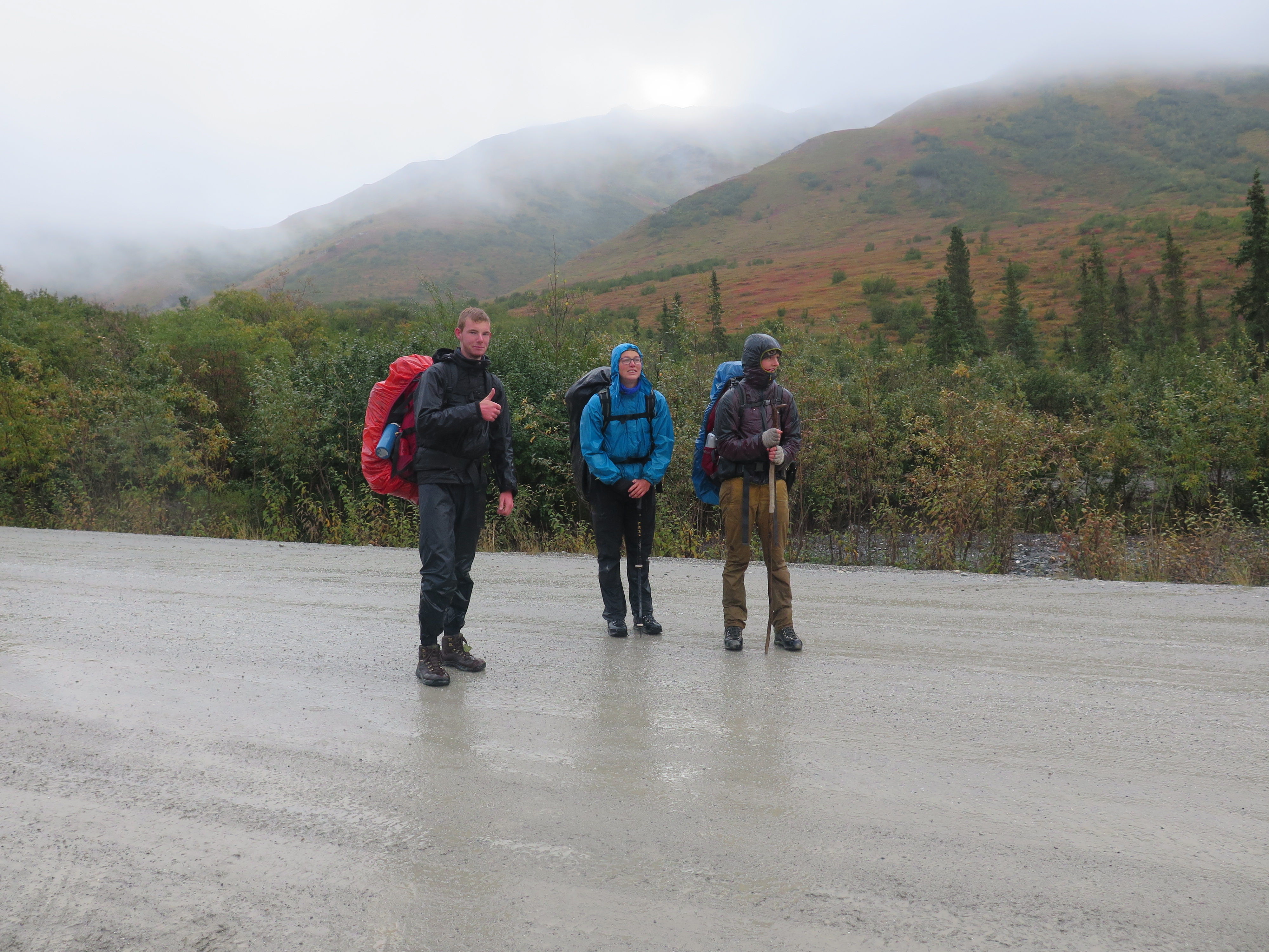
There was no building in sight, so we just sat next to the road. It was freezing cold with our wet clothes on and we split up. Two people would try to hitch a ride while the others would try and build a fire. Everything was soaked and I did not get anything burning. At the end I just put all our remaining camping fuel into two plastic bottles and sat it on fire under a pile of wood. That and only that got the fire slowly starting. I switched places with the hitchhiking party as they could use some fire as well by now. I had only stood there for about 15 minutes or a car stopped over. It was heading in the wrong direction so I had no high hopes of it. He said he had seen us standing when he past by just now and had returned to pick us up. God had told him to go back, he later said, he could not leave wet hikers standing next to the road. I asked him how many people he could take. To my amazement he replied he thought he could fit all of us. That was great, we were lucky with this guy as it was not easy to get a ride here. All vehicles here are commercial and are usually not allowed to pick people up. I gratefully accepted his offer and he took us all down south to Fairbanks, where we had dinner with his family. Roasted moose!
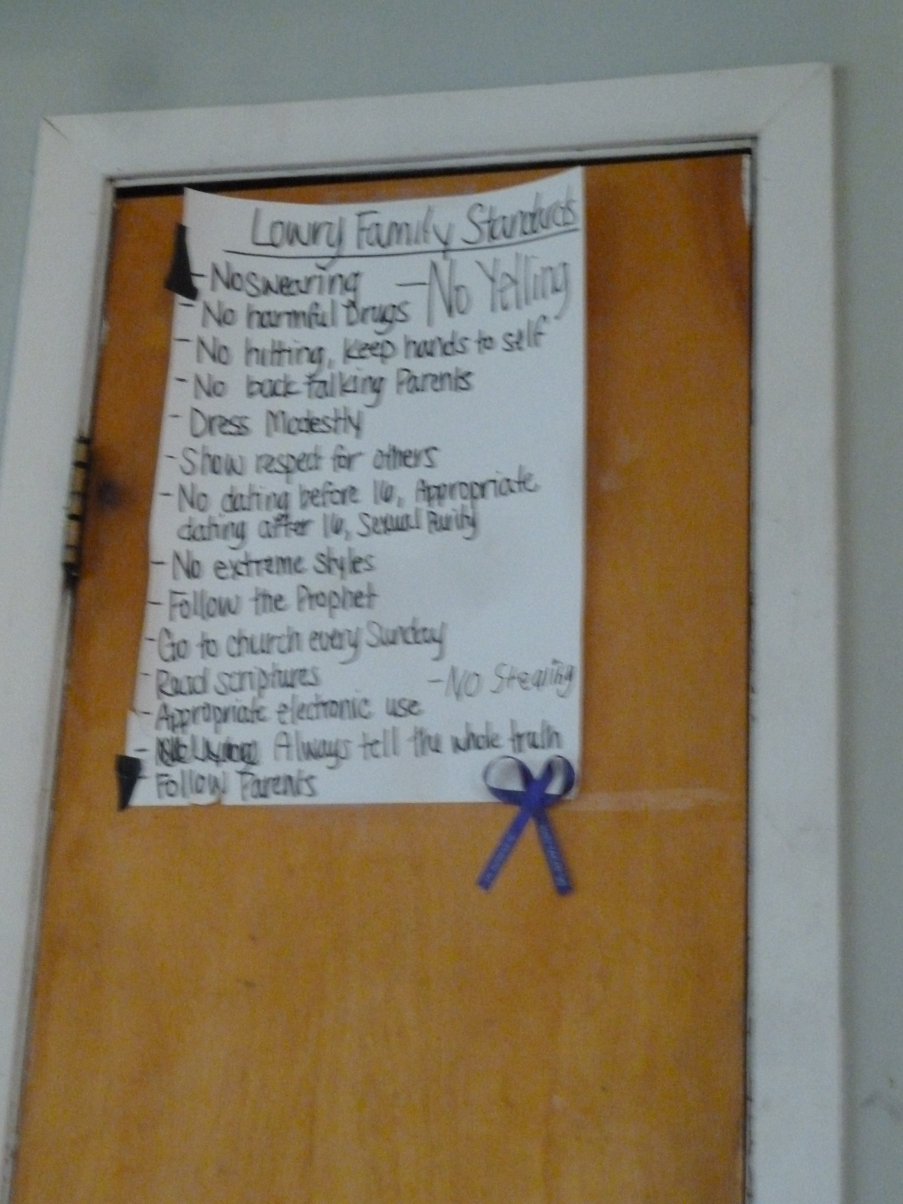
He lived in north pole, a rather conservative and Christian part of Fairbanks (even by Alaskan standards). They were indeed a bit judgmental people, but good hearted without a doubt. Before he took us back to the campsite we planned our way back to Anchorage via Denali. We had some time left and decided to spent a day in the park. We thought of taking the bus, but there seemed to be none. Are you kidding me? the first and second city in this state are not connected by bus??? This is one of the strangest things I have ever heard. After a lot of searching we found a company that operated some kind of bus service for tourists. That would work.
We had a second dinner at the camping and went to bed. The temperature here was nice, even during the night. What a difference with the Brooks just 350 kilometers further north!
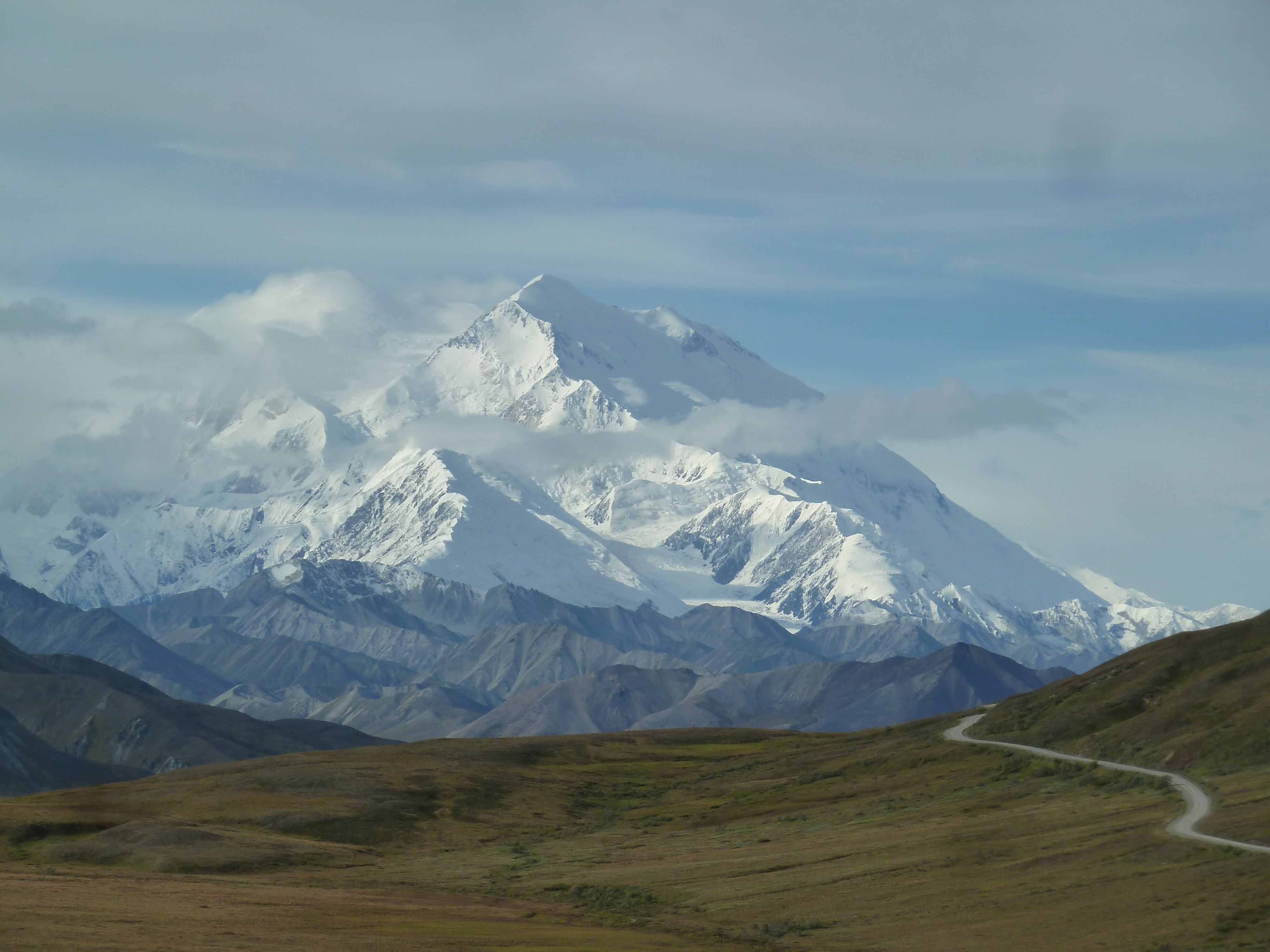
Day 32 to 34
We traveled back via Denali. The mountain was quite impressive, but the rest of the park was more of the same what we had seen in the Brooks. The park is only accessible by public tourist bus (very unamerican, but nice for us as we had no means of transport ourselves). The group travel on this bus quickly got on my nerves, cliché dumb Amercians and even more cliché tourist Japanese. Especially now I had just spent almost a month off the beaten track this was hard to bear. In the evening we had a BBQ, which easily equaled or even exceeded the experience of the park itself.
The next day we hopped on the bus again and traveled back to Anchorage. Of course we took up David on the Jacuzzi promise he had made over three weeks earlier and went by his house. David was on duty in Kotzebue, but his wife welcomed us and we could camp in the garden. I spent the rest of my time in Alaska baking and eating cakes in the kitchen.

The day after we left the country, with an amazing trek to think back of.
