December 2017
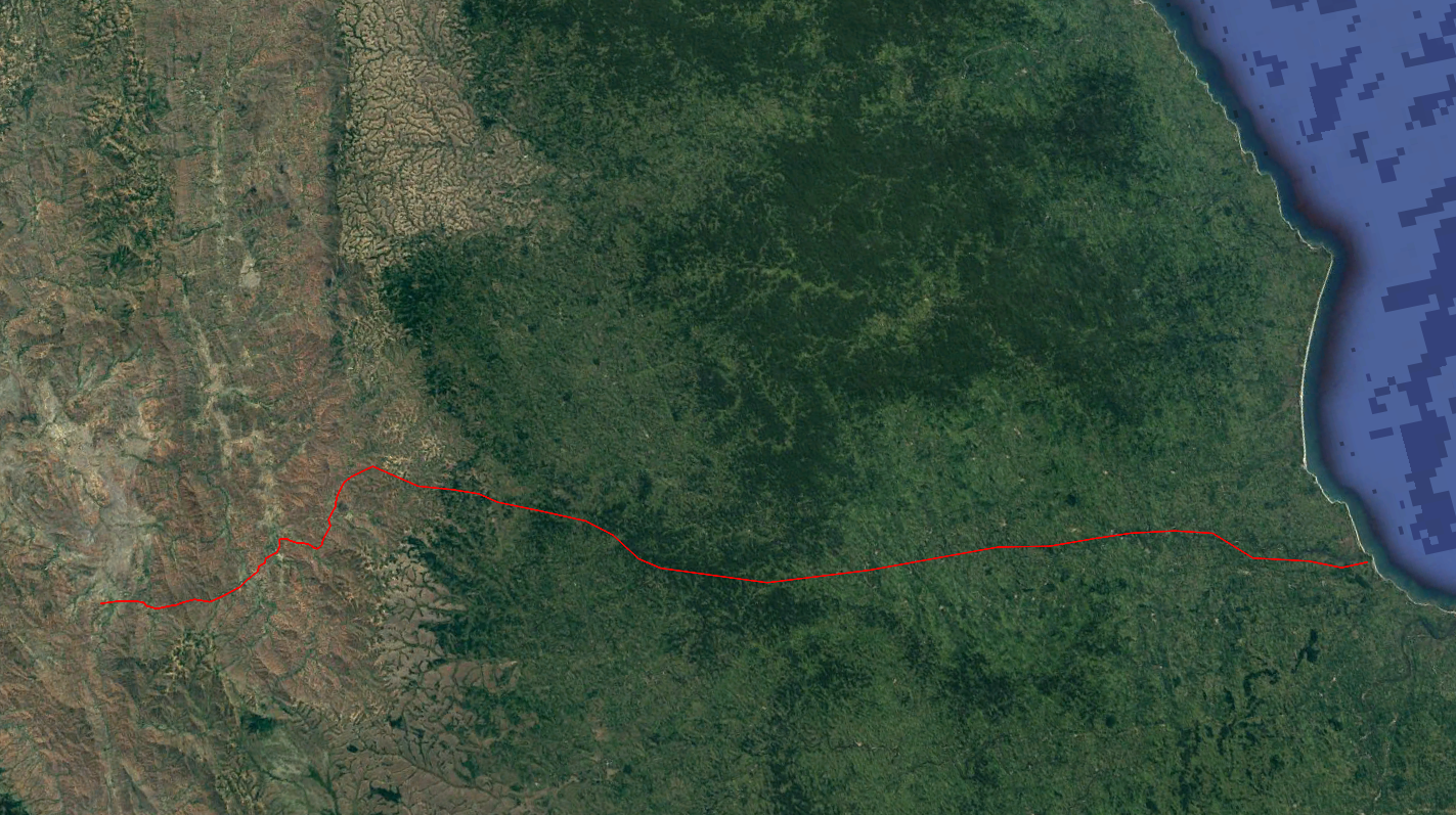
Mandritsara – ? – ? – ? – Mananara
For my very first trek in the tropics I chose the northeast of inland Madagascar, a true blank spot on the map. Really, I challenge you to find ANY information or photos on the internet of this rather remote place. The only thing to go on I had, were satellite images that showed many interesting looking hills, forests and villages. The unavailability of information and interesting looking satellite imagery pulled me irresistibly towards this area. The objective I chose was to find a route from Mandritsara in the interior to the coast city Maroantsetra.
I hiked here without knowing the names of the villages on the way, in fact without even really knowing where the trail would lead me. All I had brought with me were the coordinates of the villages that I could spot on the satellite imagery of good old Google Earth. I figured that villages that lay less then 5 kilometers apart would be connected with some kind of trail, an hypothesis that strangely enough proved to be wrong. I was forced to abandon my initial plan to hike to Maroantsetra and settled for Mananara instead.
Most locals have never seen a tourist before, making interaction and the hunt for food and accommodation very difficult. For all these uncertainties and challenges I was, however, rewarded with an amazing sense of discovery and varied landscapes.
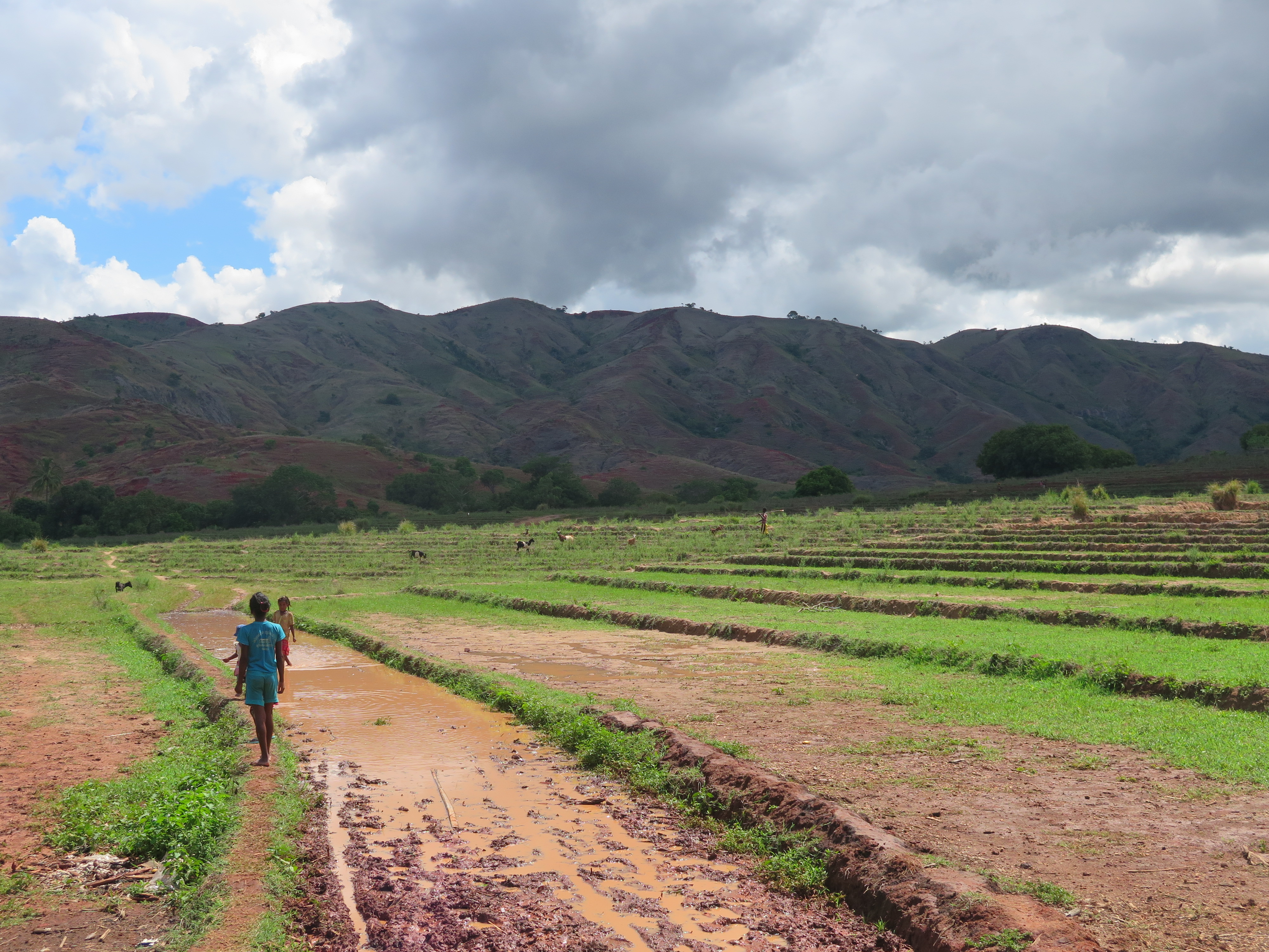
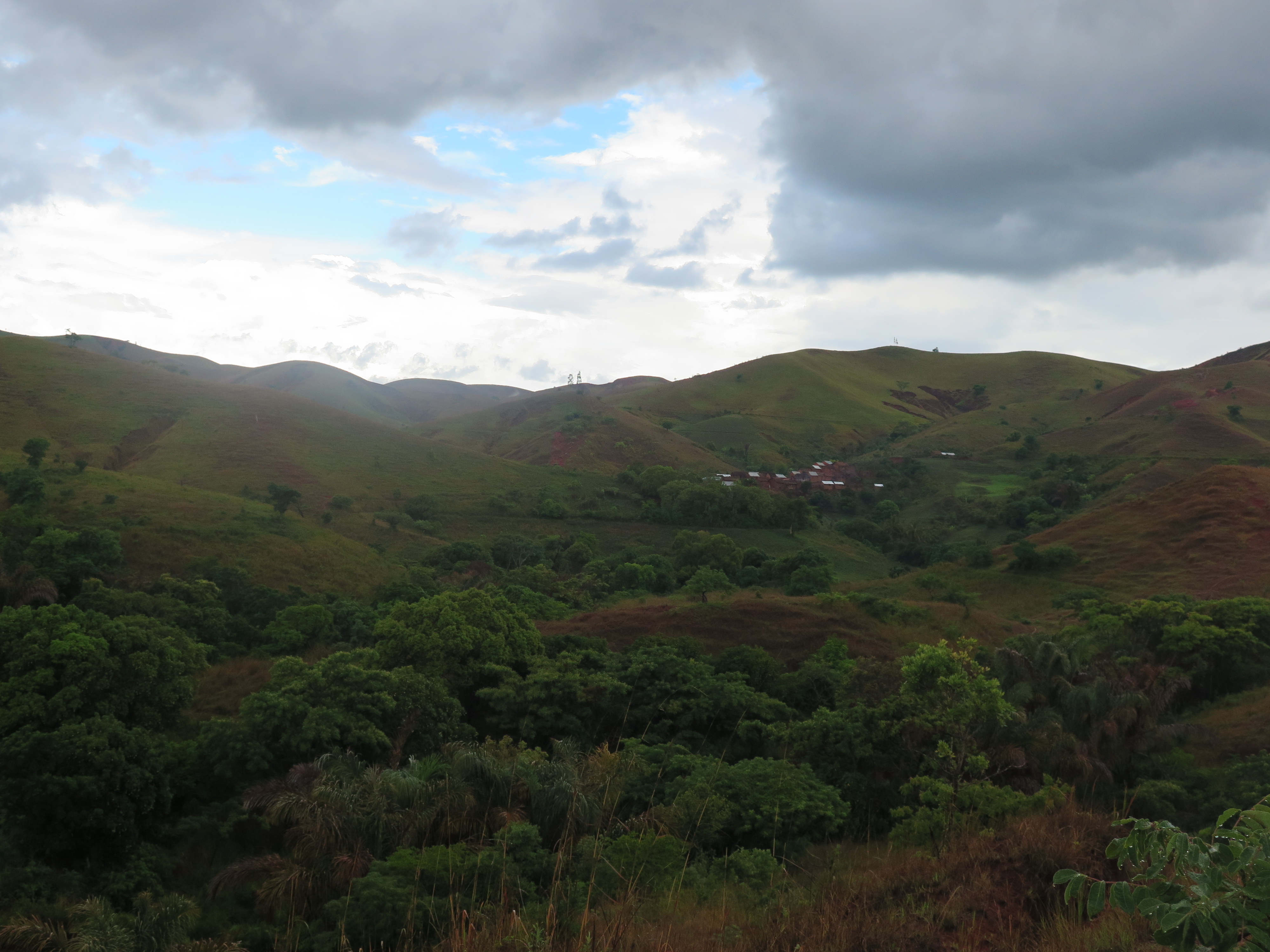
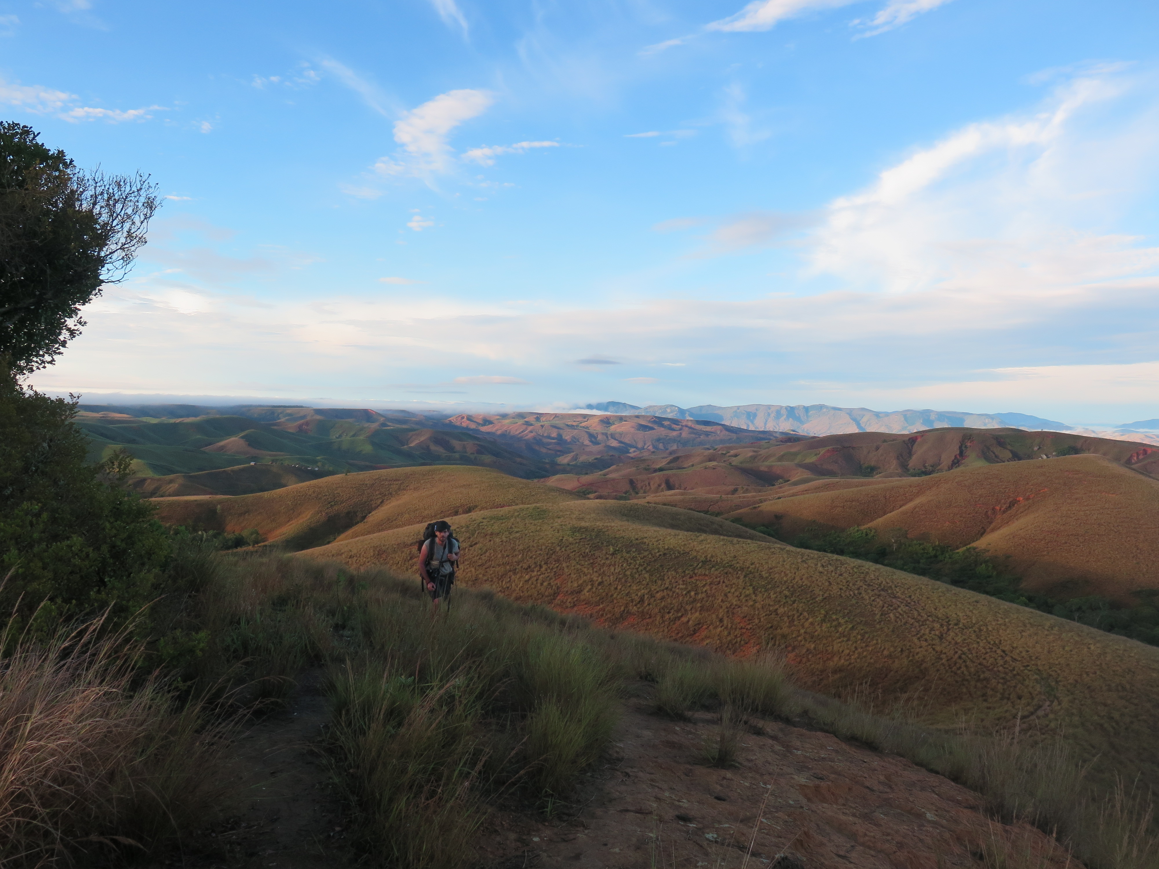
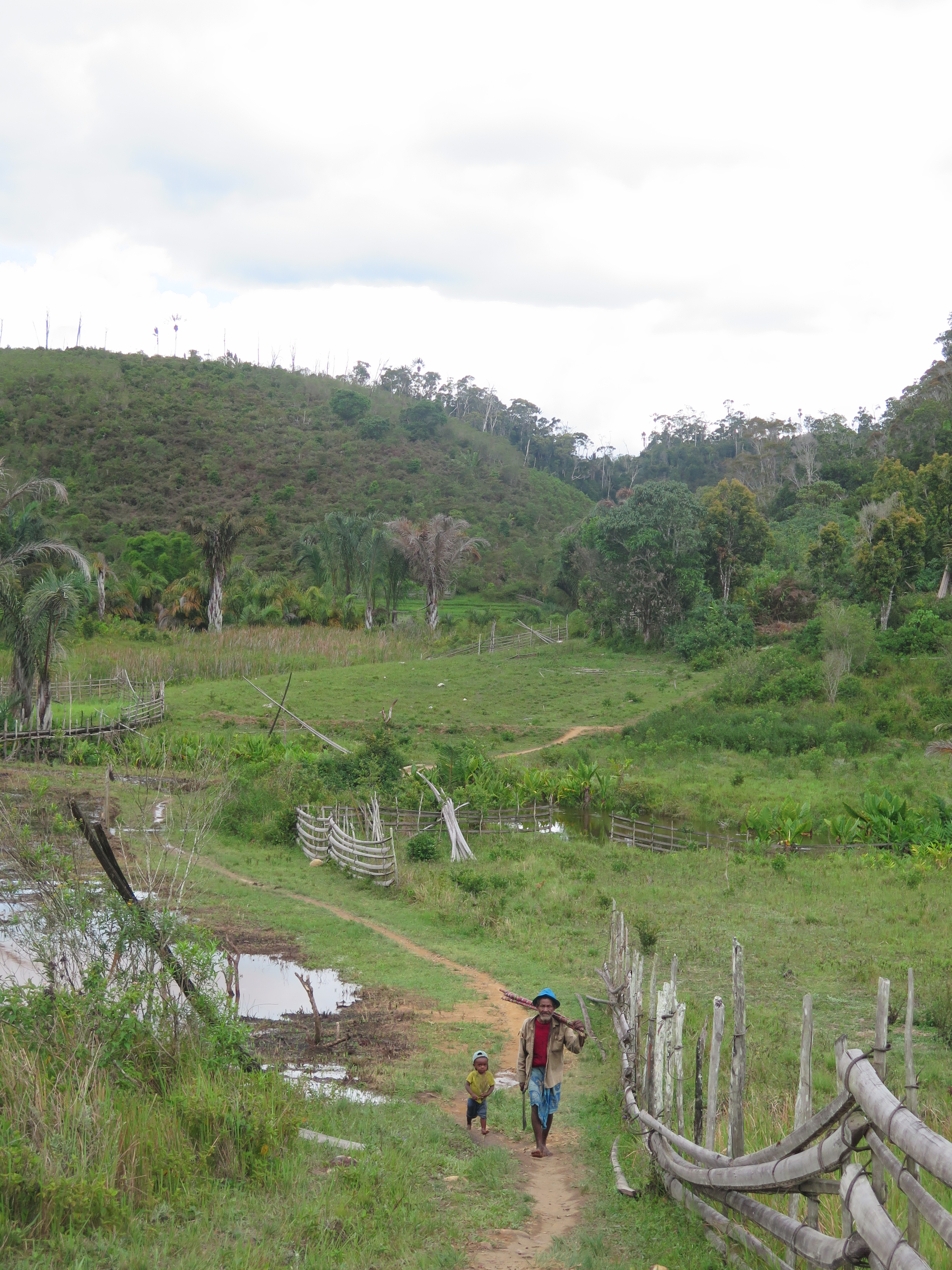
The trek comprises three types of landscapes. The first part of the route goes through arid hilly grassland. In day three the jungles come up rather suddenly, slowly building up to some of Madagascar’s finest rain forests. Here I could find ample of amazing tropical swimming paradises! In the last days I found myself in increasingly larger villages and rice fields. The entire trek goes through rather populated area, villages were never more than 2,5 hours apart. These villages on the way are rather picturesque. In the jungle you find tiny wooden settlements, whereas in the arid hills you encounter settlements made of clay.
The third day and the last two days of the trek follow a trail that, in good conditions, is also accessible for motorcycles. The rest of the hike follows tiny jungle routes or farming paths, both of which can be hard to find from time to time. There are however always enough locals on the trail to help you out (if you manage to get them to communicate with you).
Packing list
Bring only the bare essence and not even that. It is bloody hot around here and more up and downs than you would expect. This is not a place to carry dead weight around. You can rely on the locals for many if not all of your daily needs. A bottle of water, a sleeping bag, a few clothes, sunscreen and a GPS should really suffice. Take into account however that it takes a bit of effort to get food and accommodation in the villages on the way.
In the rainy season you can drink the rainwater that fell on the roofs, outside the rainy season you might want to bring a microfilter or some other purification method.
It is pretty warm, a simple sweater is enough to keep you warm at night. In winter you might want to pack a bit more clothing. A small sleeping back is handy to bring, it is not easy to get sheets in the villages.
Bring some antibiotics as well, you can’t get these along the trail.
Pack a bit of French skill, English will get you nowhere in this place.
Season
This trek can be done year round. I myself did it in December 2017, the rainy season. The advantage is that the trek feels even more remote due to the fact that even motorcycles often cannot drive on the trails during this time of year. The downside is that the heat is rather relentless between 11:30 and 15:30. Coming here around September probably makes more sense.
How to get there
Mandritsara and Mananara both have airports, but no daily flights.
To get to Mandritsara it is easiest to take the taxi Brousse from Antanarivo. It leaves at around 4 pm, transits in the morning in Mahjanga and arrives in Mandritsara at around 6 pm.
From Mananara you can take the taxi-brouse to Tamatave and transit to the nightbus to Antananarivo, where you will arrive very early in the morning. Alternatively you can hitch a ride on a boat in the harbour of Mananara. There is no regular ferry, but it easy and great fun to hitchhike with a transport vessel.
Alternatives
There must be dozens of undiscovered trekking routes in the quadrileteral Andapa-Mandritsara-Mananara-Maroantsetra. The whole area is virtually unexplored by trekkers, whereas it harbours the most interesting remaining rain forests that Madagascar has to offer. In particular I would recommend to try and find a trekking route from Mandritsara to Maroantsetra (A mission in which I failed, but of which I still believe that it can be done).
Trip report
Day 1
My friend and former schoolmate Wico and I had spent over 22 hours in a taxi brousse, the day before, so were very content we could finally start walking this morning. Well, actually, our hike started 10 kilometers to the south, so we were technically not there yet.
We guessed it was probably best to try and hitch a ride or take a tuctuc to get to the starting point. The tuttuc drivers told that the road was way to bad to drive for them and finding a truck proved quite difficult. Well, we will just start walking then…
The road was indeed way too poor for a tutuc. Even though a sturdy 4WD should be able to drive here, we did not see a single one, so it was a good thing we had given up on the idea of hitchhiking.
The surroundings were what I always imagined as typical African. Red desert like savanna, with clay huts and many colourfully dressed people on the road carying goods on their heads or driving cows. We hadn’t filled our water bottles in the morning and soon paid for our reluctance. We hunted for water in a village on the way and got some very dirty water from a bunch of locals. I filtered and drank a tiny bit. I only filtered a tiny bit as the water was so muddy that I was afraid my filter would cloaked in no time. Wico felt more bold (or more thirsty) and just drank the water right away. Later on we obtained a bit of clear water. It had taken so much effort that I decided to learn the Malagasy word for it. ‘Ranu’.

At around noon we came on the spot where we needed to leave the main road and start our actual trek. We hiked over some dry grazing fields towards the mountains east of us. Once we climbed up a tiny pass. It was getting insanely hot and we still had no water. Oh, I could not wait for the next village! On our descend we came across a few trees. Some welcome shade! And than the best thing happened, we stumbled on a large mango tree. We immediately sat down and ate as much as we could. This fruit is amazing against the thirst. I think I easily ate 6 of them. A little further lay a village where we bought a random bottle of juice that we saw lying around and sat down in the shade. No way I would set another step before it would cool down a little.
At first the locals ignored us, but after 5 minutes their curiosity overcame their shyness. We asked if we could buy some food and after some hand gestures and highly confusing dialogue we could sit down in a house and a meal was prepared. Rice with mango. Yeah, they really just cook whatever they find here. I got some extremely nice and clear water. Raining water of course, I figured. From time to time it easily rains 10 centimeters in 15 minutes so you can capture more than enough this way. I was glad that there was some quality water available, this had me worried a little.

When the sun started setting we started our climb over a bigger pas, about 300 meters up. It was significantly cooler. Had we done this during the mid of day it would have mentally broken us. We saw a snake about half way up. This made me a little nervous as we were hiking pretty much off trail through long grass. Once on top of the pas we had a pleasant view over the surrounding grasslands and hills. We could see a small village not too far away on the other side.
We were only just on top of the ridge or, BANG, thunder, rather close. We ran down the mountain In our hurry we lost the faint trail we had been following and now we had to make our way through the long grass. Further down in the valley we caught up with the trail again. The rain had not really come through and it was still pretty hot. Each took each occasion we crossed a stream the throw myself wet.

Once in the village we started to ask for accommodation in the best of French we could muster. It took a long time, but eventually we managed to explain ‘notre mision ici’ and we got a nice chamber. As usual we had a plate of rice for dinner, this time with leafs from a certain kind of tree we had seen growing just outside of the village. I had not eaten this kind of plant before and till this date I do not know what it was.
We realized that we needed to optimize the obtaining food and accommodation procedure a bit further. In the way that we did it now it took over 40 minutes. I had refreshed my French a bit before I came here, but they only speak it sporadically.
Day 2

Having learnt from our mistake yesterday we left that morning at first light and with 3 liters of water in our packs. A good thing, as today the sun already shone mercilessly at around 9 am. For the first 20 minutes we followed a vehicle accessible road. The road did not seem to be in a hurry to start heading in the way that we wanted, so we simply diverted from it and started to hike over the farming fields. We climbed over a small ridge and on the other side we found the village that we were looking for. It was scenically located on a rock towering above the green agricultural land around. It formed a nice oasis in this otherwise red and arid land.

A large but scenic trail took us further to the village where we intended to have our lunch break. This village was located next to a dirt road again. There was a small store where we bought and cooked some noodles. A convoy of cars passed by. We had already seen them on the way here, while they were trying to pull one of their vehicles out of the mud. One of the people traveling with the convoy spoke a bit of English. We had a small chat with him. I asked him to write us a letter that stated that we wanted to buy food and accommodation. hopefully this will make the quest for food a bit more efficient in the coming days.

The afternoon was rainy, which was actually a good thing as it cooled things down a little. We had still had quite a long way to go that day and it was nice that we did not have to wait till the late afternoon for it to cool down. We followed the road further up, but it did not seem to take is closer to our destination, it even started to ascend the hills in the south, the opposite direction we were going. We returned back to the village and started to follow an alternative trail along the farmlands on the valley floor. The trails are extremely confusing, the next village in my GPS is just 5 kilometers away and I can’t for the life of me tell which trail would lead there.
We were already hiking for over an hour and the village we wanted to reach was barely 200 meters closer. We knew it lay behind the hill ridge north of us and we scanned for trails that climbed the hill ridge north of us. At the first indication of a trail that seemed to start climbing up, we took it. It lead steep up and merged with a larger trail a little further up. This part of the day was really nice, pleasant temperatures (long live a bit of rain) and scenic rice terraces in the barren landscape. When the village was only 3 kilometers away we left the trail as it once again seemed to be chasing another destination than we did. We hiked over the farming fields over the valley floor, right towards our goal.
This was way more difficult than anticipated and soon we were fighting shrubberies, streams and steep slopes. How on earth can it be that we are so close and the route is still so shit? We had to hurry a little by now, there was only 2 hours of daylight left and we went like snales.
Once we arrived in the village we were completely fatigued. We presented our note, which was studied for a while by a dozen of people. It took a while, but once they understood what it said we were invited in and got some rice. Great, the magic of the note seemed to be working!
The village chief transfered us to his own house later on and took care of us the rest of the day. As a side dish at dinner we ate a honeycomb. I did not know you could actually eat the comb itself, but apparently you can, it isn’t nice though…
In the evening we slept on the floor with the village chief. It promised to be a good and silent night, up until he put on some of the most horrific music that probably ever had touched the human ear. My friend, the lucky bastard, was already asleep, but I had to wait the music out for another half hour. Radio Mandritsara is a rather acquired taste I guess. The rains were once again torrential that night.
Day 3
The same hideous loud music of last evening woke us up in the morning. If this does not get you out of bed and on your feet, nothing will. Our host walked with us for the first 30 minutes to bring us to the motorcycle road a bit further north. He was clearly hoping we might give him some money for it. It was a very pleasant morning walk over the red grassy hills. In the distance we could see the start of the jungles starting on the hilltops. Within two hours or so we will be in the forests. We said goodbye to our host and payed him a little. He gestured us that we had to follow this road eastward. So we did.
The road lead us eastwards, the next village we wanted to reach however, lay north of us. Not wanting to start hiking off trail again we just followed the road hoping that it would turn northwards soon. A strategy that so far hadn’t really worked, but hey.
We came across a nice ‘trailside restaurant’ where we ate some rice and chicken with the locals.

The road did not seem to be in a hurry to turn north any time soon and we were forced further and further east. Hiking off trail was no longer possible as the jungle had grown way to dense to even consider that. The motorcycle road was by times quite broad and by times nothing more than a small jungle trail. We diverted from the route a few times to follow a side trail north, but we always hid a dead end forcing us back to the main trail. Our destination village did not get further away, but it was not getting closer either, very frustrating. We were walking in an almost perfect circle around it. We did not know the name of the village so it was very hard to get help from the locals, with whom it was extremely hard to make even the simplest form of conversation anyway.
Around noon my friend lost hope and decided to return Mandritsara. According to the locals you could make it to Mandritsara in two days if you followed the motorcycle road in the other direction, shortcutting much of the route as we had taken it. Wico had a point, there seemed to be absolutely no guarantee whatsoever that we would reach Maroantsetra or even the east coast. Everyone was vague at best in giving directions and for all we know we would run into a dead end in a few days. I was however not ready to give up, maybe I would not be able to reach Maroantsetra, but the east coast really should be feasible, right? Returning, no way.
We said goodbye, wished each other luck and went our separate ways. I kept the tent, GPS and satellite phone in my backpack and he kept the sunscreen. Losing the sunscreen was a real pity, the only thing left to protect me from the sun now were the straw hat and an umbrella I had bought a few days earlier. I would use these items faithfully for the rest of the trek, but got burnt nonetheless.

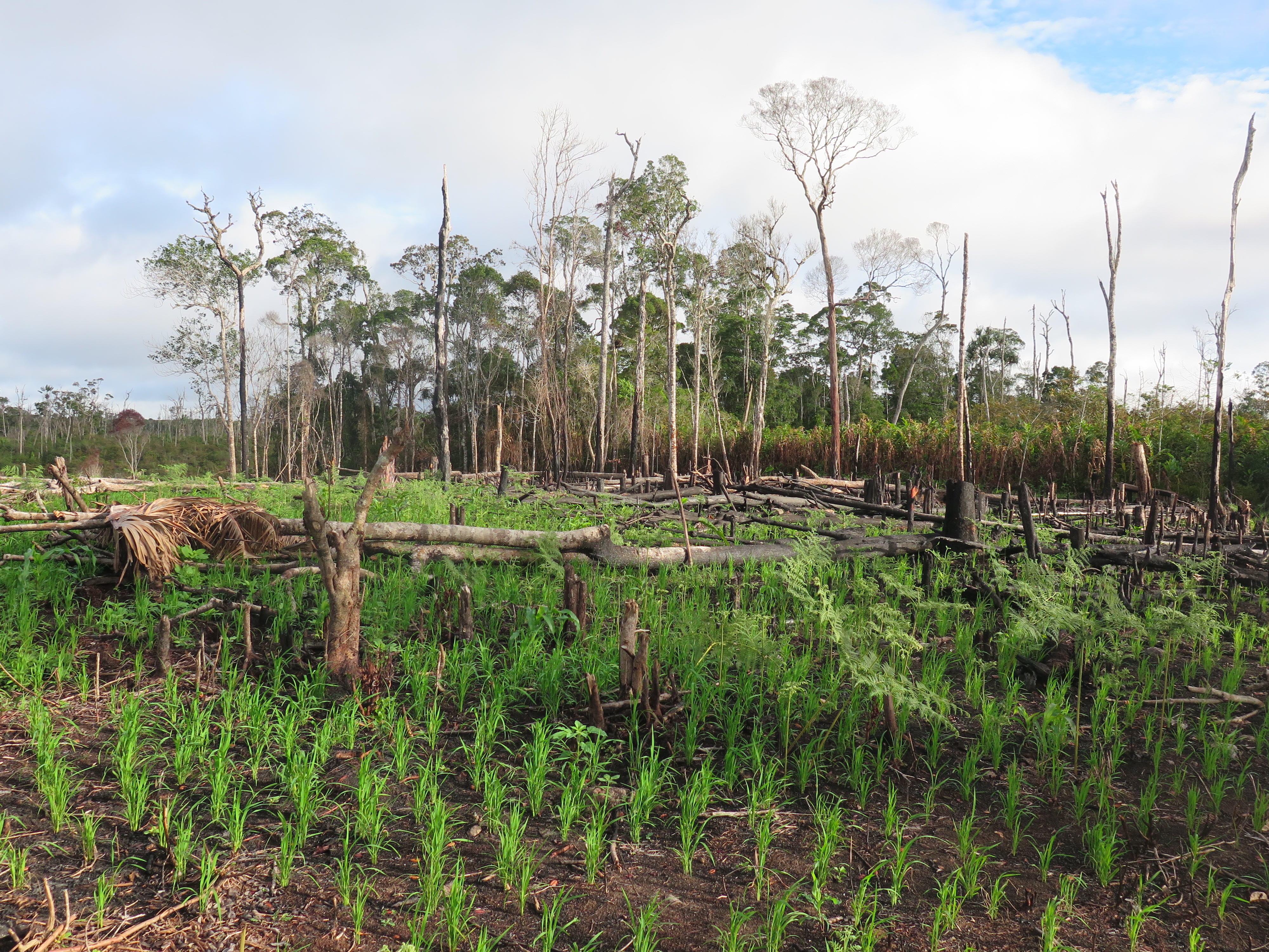
The country through which I now walked solo was far from untouched rain forest. The Malagasy people often burn down large stretches of the forest in order to get fertile agricultural lands. Once the fertile ashes have been rained out they move on and burn the next stretch. The resulting scars in the landscape were visible everywhere. It is rather impressive how so few people can make such an enormous impact on the environment. Most of the land was overgrown with young forest or shrubberies. Only few old forest remained. The area is nevertheless rather beautiful, with many small villages, farms, forests and shrubs.
After an hour walk there was a large side trail leading straight north. Al last! A chance to start hiking in the right direction again. According to my GPS I now walked straight to my destination that lay only 4 kilometers away now. After I while I came across a village after which the trail grew smaller. With a hand gesture I informed with a local woman whether it was a thoroughgoing trail or not. The woman nodded and I continued. The trail got smaller. And even smaller… After 20 minutes the trail had was completely vanished. A mere 3 kilometers away from my destination and a trail was nowhere to be found! The trail just seemed to terminate at a few old farm grounds. Only 3 kilometers and no way to reach there, how can this be?
I returned to the village and soon I had to take out my GPS to be able to reconstruct the route. Half way back a local was waiting for me gesturing that this was going nowhere and that I had to return to the main route and try heading north again at a later time. Darn, it was almost 40 full minutes of hiking back to the main route. The hope to reach the village that I had planned to reach that day was pretty much gone. The rest of the day I simply followed the main route hoping that I would be able to divert north at some later point. Maybe I could find another way to get to Maroansetra. It would be tough as I had no waypoints in my GPS for this alternative route wishful. I would walk completely in the dark.
Around 2 pm the main motoracyclable route terminated at a village in a broad forested valley. I informed for the way to Maroansetra. This lead once again to some extremely confusing conversation. Truly record breaking confusion this time. After much deliberation it seemed like they confirmed that there were three trails leaving the village. The one over which I came in the direction of Mandritsarea, one towards Mananara and one towards Maroantsetra.
After lunch they sent me out to follow one of the trails leaving the village. After about a minute I however noticed that I was hiking the exact same way that I came. Sigh, these people are so confusing… I returned and asked why they had sent me back there. Haha, their recommendation was to go back to Mandritsara by motorbike and take a motorbike there all the way to Mananara via some other way and then take a taxi brouse to Maroansetra. I said that I wanted to walk. They didn’t get why, but told me the trail I had to take in that case.
The trail north went to Maroantsetra and the trail east to Mananara. Both trails were difficult, but the one east to mananara was, as I understood, by times taken by some locals. Nobody could really tell me whether the route north actually really went to Maroantsetra or just went in that general direction for a while.
It was already getting dark and the trail was very tiny now. For this reason I spent the night in the very first village I came through a mere 20 minutes further. It was very hard getting them to understand my need for food and accommodation. Even my note in Malagasy did not seem to work. After a while an old man arrived who spoke quite a few words of French. This helped a lot and I could stay overnight. He asked what I was doing. I said I tried to find a route to Maroantsetra. He laughed, and kept laughing for the rest of the evening. Very encouraging… ‘C’est posible?’, I asked. Oui, posible, he said. Well let’s just try and see than…

Day 4
I felt sick during the night and in the morning I did not feel much better. I woke thirsty, when I asked for water I some horrific brownish water that tasted like burnt rice. I couldn’t drink it. So to sum it all up: I left with fever, diarrhea, thirst, empty bottles, no gps way points and a confidence that had plummeted… Today is going to be great.
The trail twisted and turned through the jungle, quickly I went southeast instead of north east. Later on it even became south west for a moment. There were many smaller side trails that added further to the overall confusion. After two hours of hiking and no other village in sight I decided to head back and take the easier route to Mananara. I do not know if it was me being sick or just simply the voice reason. After all, I had nothing more than a GPS waypoint at Maroansetra about 70km further up, a halfhearted comment ‘oui posible’ and a vague recollection that there should be quite some villages around.

I returned all the way back to the end of the motorcycle road, that I had left the day before and started hiking in the direction of Mananara. The next village was less than 15 minutes away and I informed about the route. They brought me to the school teacher. A young man who spoke excellent French. Better than me in fact. For the first time I could have some rather complex conversation with a local. He knew the route very well and had taken it himself many times. He deemed the route very difficult.
It rained like hell outside and I stayed a while longer to consider my options. Would it not be best to take a guide here? If the trail was indeed that confusing and tiny? There were many villages on route, besides I now had a guarantee that it was done before. I had more than enough time to get lost a few times. In hind sight I should have just gone alone, however I asked the school teacher if he could accompany me. If I had felt fit I had probably not done it. It was about 3 to 4 days to get there and I agreed to pay him the (way too high) fee of about 130 euros. The rest of the day I spent strolling around the village, visiting the rapids down valley, eating farm fresh litchi and visiting the school. I was still bothered by diarrhea and fever. I had enough of it and took some antibiotics.

I saw quite some children with hunger oedema, they have more than enough food, but I guess that they eat predominantly rice and not much more, causing a shortage of proteins. The widespread myth that rice would be extremely healthy for children is widespread in sub Sahara Africa and south Asia. It would be good if some food education would be given on this matter. I have a hard time thinking of a food with less nutrition value than plain white rice.
Day 5
At 5:30 my guide and I hit the road. We walked fast and indeed, as he had told me after 5 minutes the trail got pretty tiny and there were quite some side tracks that could just as well be the main trail. The scenery was amazing. Once again much of the forest had recently been burnt, but there was also quite some old forest remaining here. The hills grew taller and steeper.

After about 3 hours the small trail terminated at a village alongside a larger route. We ate some pineapple for breakfast here. The large route continued and there were quite a few people on the trail carnying goods. It was still a small jungle trail, but now it was quite clear what the main route was and what the side trails. I quickly began to realize that I could easily find this on my own. As I’m not a person who can really stand having a guide for too long and since the antibiotics had done it’s job, refueling my confidence. I told my guide that he could return. At 11:00 we said goodbye. Haha, this guy just made 130 euros in under 6 hours! There are IT consultants making less… I asked whether we could exchange email or facebook, but he did not seem to know what any of these were. I tried to explain the concept, but he had never really heard of it. Wow, I did not think that was still possible in 2018 (or technically it still 2017, new year is the day after tomorrow).

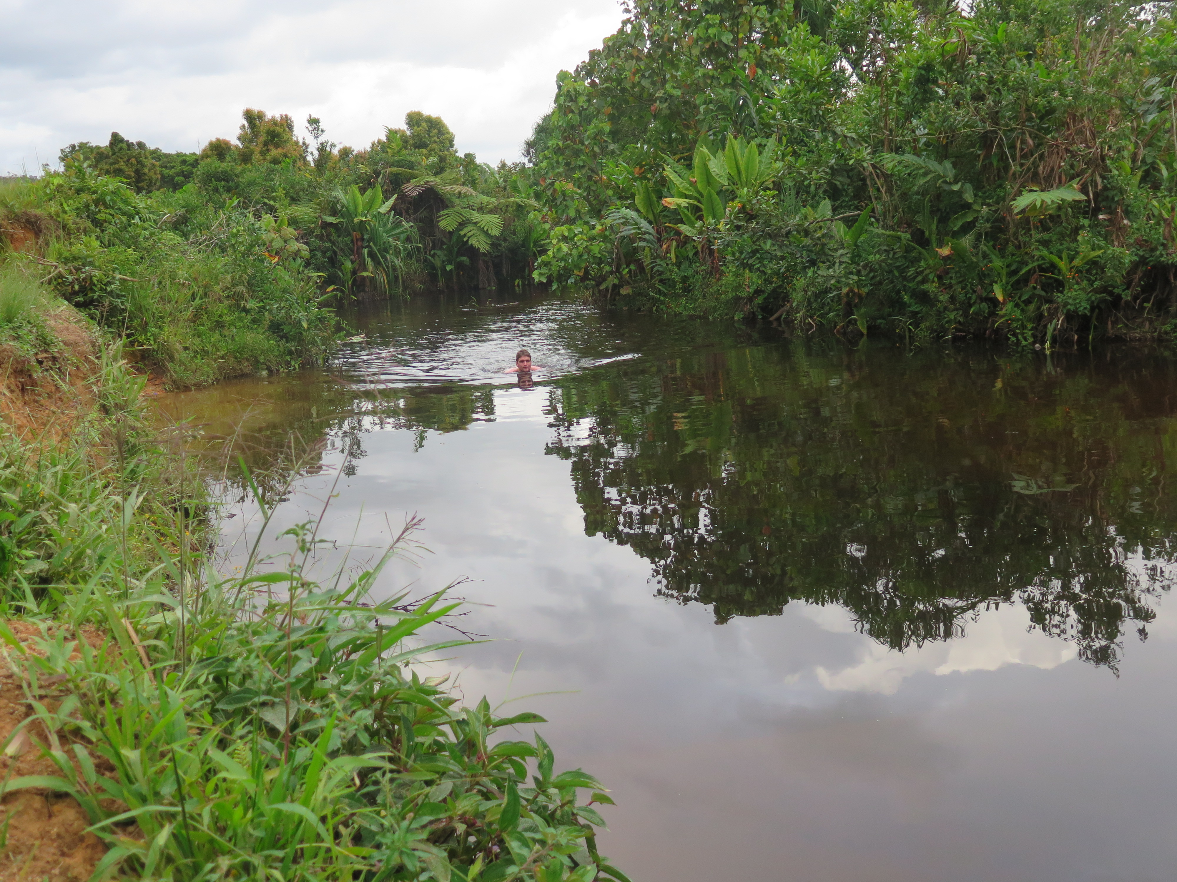
I continued solo. I enjoyed the hike enormously. The rainforest is rather undisturbed in this area. Nature wise this is most certainly the best day. The trail follows the river which forms from time to time an amazing tropical swimming paradise. I swam four times that day, beating much of the afternoon heat.
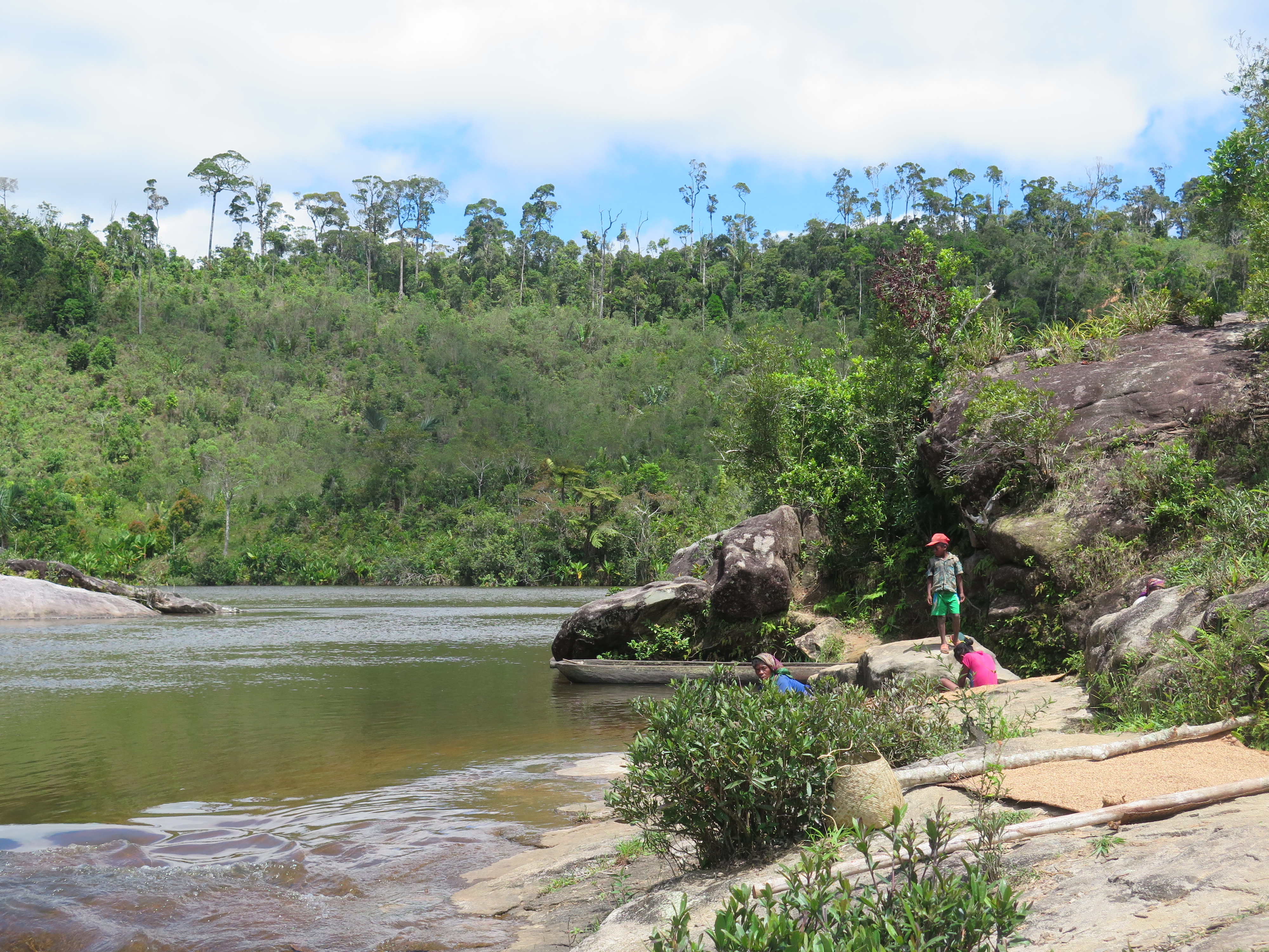
The villages were spread rather thin here. After about 3 hours on the trail without having seen much people I arrived in a very tiny village. An older woman was the first to spot me. She hurried here children inside the house and drew an actual knife at me. Wow, take it easy, I come in peace! I took of my hat and gave here a nice smile, ignoring the knife completely and asked in my best Malagasy for some water. I got a bit to drink, tension eased, but did not resolve. I sat down in the shadow a little further and as usual, the locals started to come out after me sitting there for about 10 minutes. I decided that I wanted to stay here overnight. It had been a great day, this was a beautiful place and there was no reason to keep pressing on. People had now lost all there shines and every child wanted to have a picture with me.

After lunch a doctor arrived from a village nearby. He wanted me to stay with him. He spoke a bit of French so it made sense for me to agree. His village was about 1 kilometer further south and a little bit larger. Unfortunately for me he had an extremely annoying brother who bothered me for the rest of the day to buy him all kinds of stuff. A turkey, a liter of honey, bonbon Anglais. Man, have some self respect! I did buy the turkey for them to prepare for diner, but a liter of honey just went to far. In the evening I still saw the turkey running around, so I guess I have been cheated a little here. We had however a lot of chicken. Of course cleaning and preparing an entire turkey on such short notice is not possible. God, I was annoyed by this doctor’s brother! I went for a swim just to get rid of him for a while, but he followed me down there. Even when I went out to take a piss he was not far behind.
While sitting around I observed an interesting business model. Children brought saffron to the doctors wife, who in turn paid them in candy per spoon of saffron they brought her. It worked pretty well, children were swarming in all day and she had already collected I think about 60 liters of the stuff. All for export via Mandritsara.
Day 6
Oh yeah, of course, this annoying bagger wants to come with me. Seriously, how do I get rid of this guy? I tried to sneak away unnoticed, but he caught up with me just a bit later. The surroundings were very beautiful. The forest grew even taller and thicker than the day before, but it was very hard for me to enjoy it with this guy around. I stopped for a washing, toilet and biscuit break and told him to go along without me. He actually left and I was alone to enjoy the trail on my own again.

After about an hour I came to a village and aaarrrrgghhh he was there again. Of course he immediately started out with ‘vendre pour cinq mile ariary’. I said to him: ‘monsieur achette, would you mind pissing off’. The message was clear and he left me alone.
Later in the day the jungle stared to get less thick. Further on the hills were completely deforested and only thick and high shrubberies with some bamboo and banana trees populated the high hills. The villages got pretty large and there were some larger shops.

I took a small stops in each village to drink coke or eat a pine apple. I had to be careful not to stay too long, otherwise people would start approaching me. In principle it is nice if people want to have a talk, but at this point it was getting a bit annoying to constantly be ‘the white attraction’.
Late in the afternoon the path became accessible for motorcycles again, though no one was driving at the moment. I took another swim near a village, once again a great tropical swimming paradise with even a small rapid via which you could float down. The police officer of the large village nearby waited me up on the shore and invited me for lunch. He also wanted me to meet the mayor, but he turned out not to be in town.

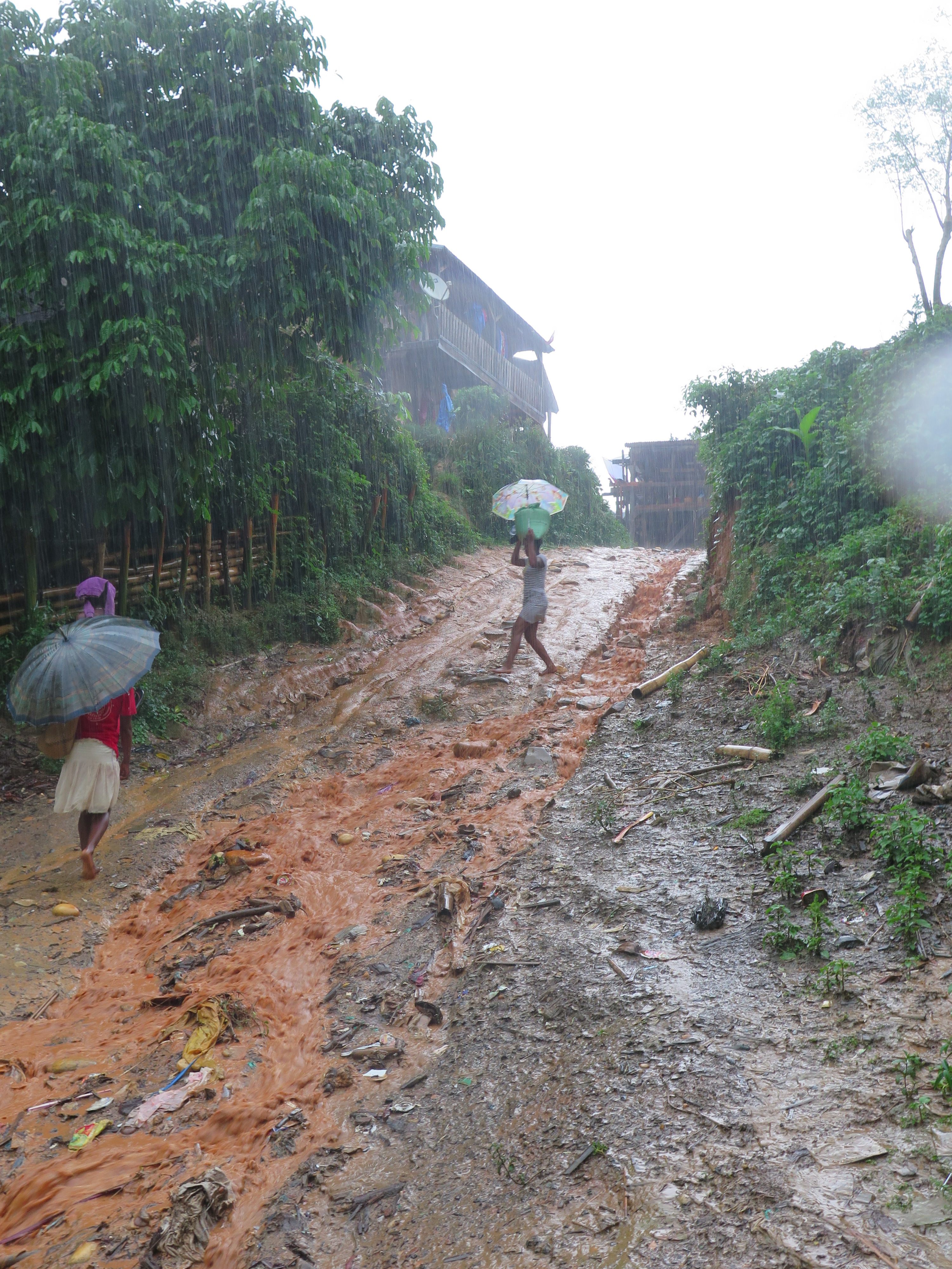
Late in the afternoon in began raining heavily again and I started to seek accommodation in a pretty large village. I followed my usual strategy of just sitting around to wait what happens. Boy did that backfire… The first man to approach me was a completely drunk man who insisted that I had to sleep him. I had made the mistake to stay over with an attention hungry drunk before and I did not intend to make it again. The man was however extremely persistent, as only drunk people can be) and more or less pulled me to is house. Or well house, it was more like a shack completely stuffed with clothes and shoes that he, I guess, sold? I never seen such a mess. I better leave everything in my backpack, whatever I drop here is instantly lost forever.
His wife came over, in contrast to the expectation, she was a sober and sharp woman, but even she could not make up for the nuisance that was here husband. When he was out for a moment I grabbed my chance, hung on my backpack and sprinted away. The road went steep down and crossed a river. At least I thought it did. The river streamed very hard due to the rains that evening and the water came till over my belly. Once I was across I realized that the road hit a dead end at the river and I had taken a wrong turn. Oh darn, I need to return via the house of that man again. I thought I could get away quickly and quietly, but once I started to cross the rive again, half of the village was staring at me from the other side. To make things worse the drunk guy returned and started to actively help me crossing, in the aggravating way that only a drunk can. Completely shamed I reached the other river bank and took, this time, the right way out of the village. The drunk man let me go, the point was made.
About 20 minutes later I saw a man with glasses who looked rather educated. Well, that is what a glasses does right? The cliché held true, it was a retired doctor who spoke quite a bit of French. I stayed with him overnight and had what could actually classified as a good conversation with him. To most common export products, where his children lived, what kind of snakes there were around here etc. As a true Malagasy I slept with him and some other guy in a way to small bed that night.
Day 7
Today I woke up with a large red, itchy and vesicle filled stain on my belly. Beats me what it is, but hopefully it will disappear soon. Are it flees?
The road was quite broad for most of the way and not very inspiring. Villages were becoming more like towns. Streams were getting rivers and many times there was a raft to help the crossing.
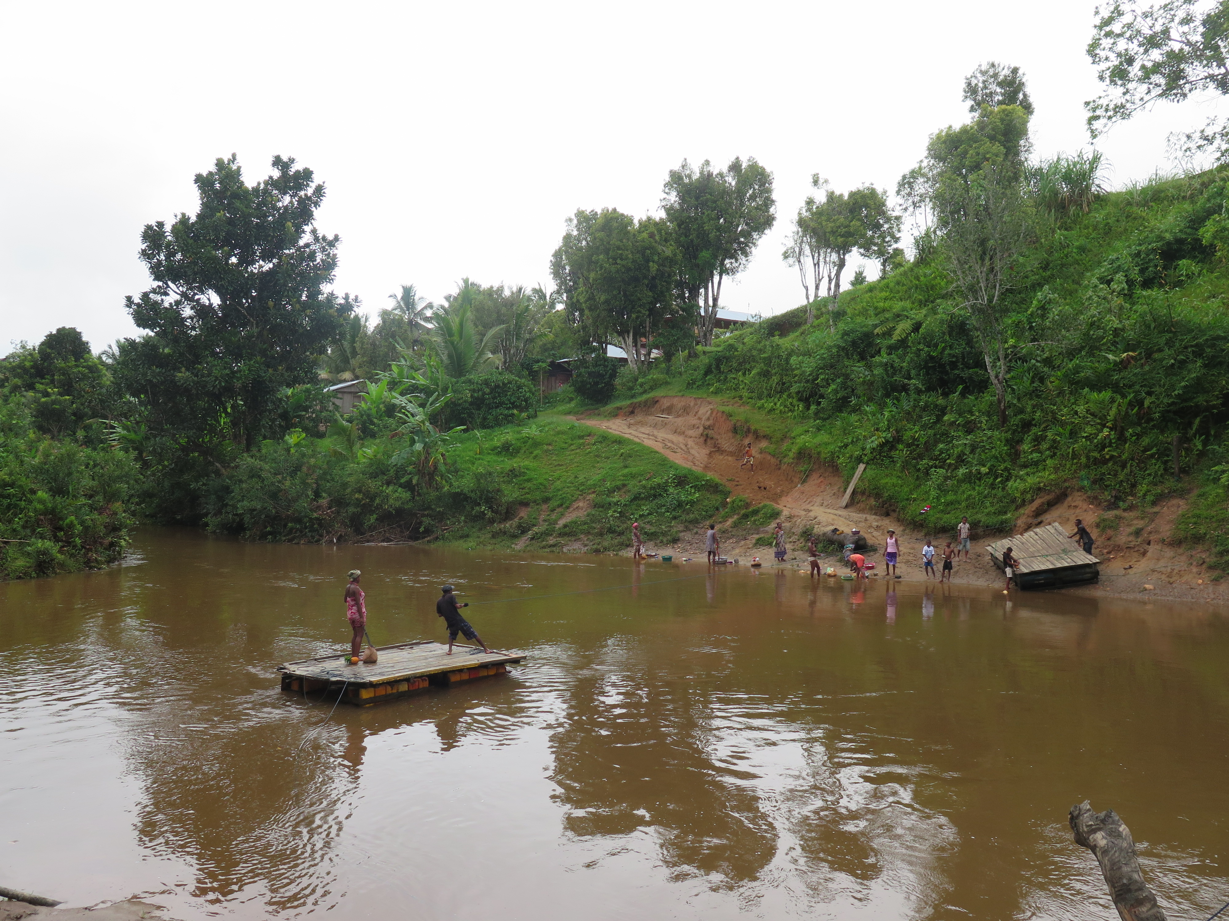
Around the afternoon I came across an especially beautiful town. It lay in the bend of a river in the bamboo forests, surrounded by rice fields whose water formed a mirror reflecting its green surroundings. There was ferry to help people getting across the river. I would love to spent a bit longer here, but the teenagers were too screaming too loud for attention, so I took a break right outside the village and enjoyed it from a distance. While sipping on my coke I saw a man running away from a shouting woman waving a stick above her head. So, yeah, with the emancipation it is going just fine around here.
I continued further and in the next town, I was invited in by the school teacher who was celebrating new year with his family. That is right, it was new year today! I did not realize, I lost my sense of time quite a while ago. It was quite funny, the normal bread like item they eat for breakfast here, some kind of fried cake (In Dutch Oliebol), is in the Netherlands a typical new years treat. I could pretend I was home.
The sister of the school teacher asked me, using her brother as interpreter, whether I was looking for a wife in Madagascar. I said, quickly steering the conversation away from this topic, that in the wife department I’m more thinking in the direction of people who speak the same language as I do.
In the night I slept with the school teacher. It was hot, it smelled of Saffron and I had actually hoped to be able to sleep alone tonight. My belly also itched like hell. It goes without saying that I slept for shit and was glad when I could wake up again.
Day 8
Today would be the day I reached Mananara. The school teacher told me that I would arrive there around 1 pm. After each new hill I climbed I expected to see the great Indian Ocean, but each time there was another green hill lying behind it. This last portion of the hike was not interesting at all. The villages had become towns right now and a bit dirty. The trail was a track and no longer a footpath.

I ate a little ‘fried cake’ at a small shop and pressed on for a couple of hours, till the inevitable happened. The Indian Ocean! The path had lead up just a little higher over the ridge of a hill and I could see far enough to see the hills terminate in the ocean about 3 kilometers further ahead. I felt really close to Mananara now.
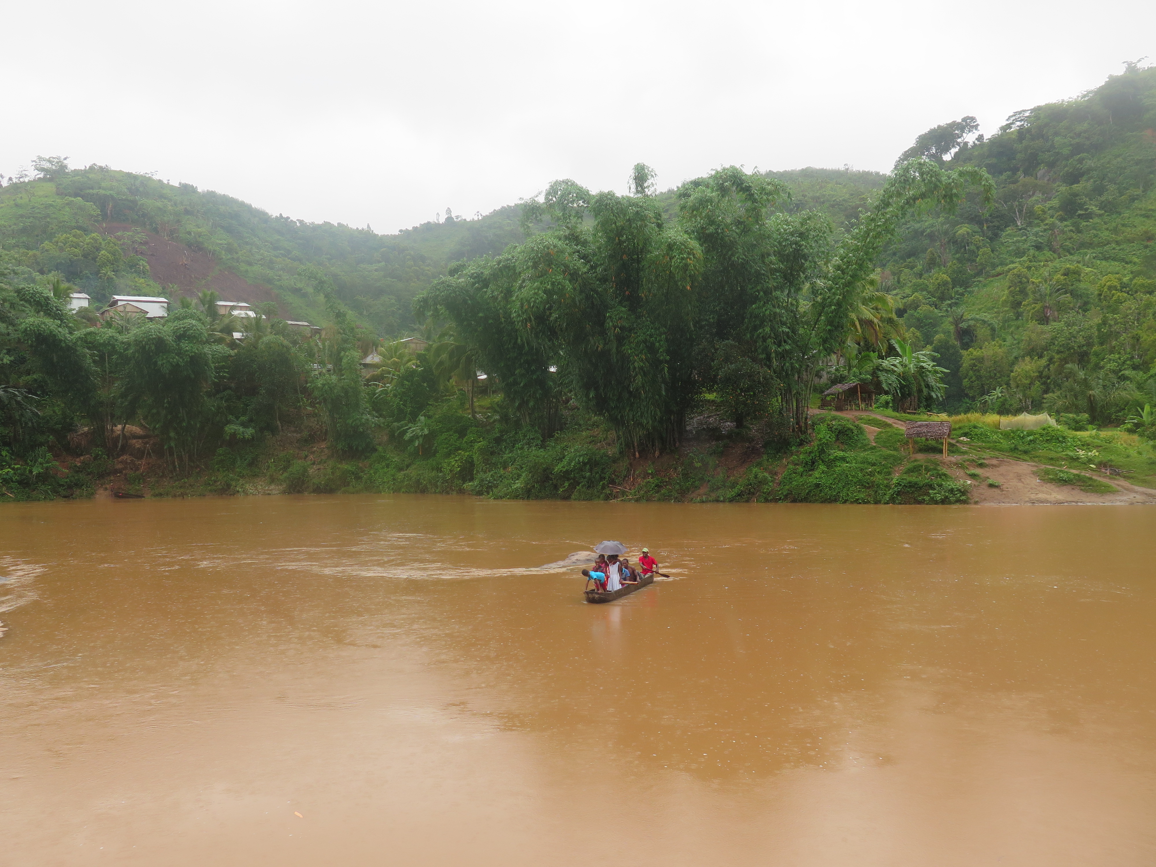
I walked fast deterined to stand with both feet in the sea. Due to all that hiking with wet and sandy shoes my feet were completely molested and I could not wait to relax on the beach of Mananara. From there I could also start planning the rest of my trip. Due to the fact that I changed by destination from Maroantsetra to Mananara meant that I had quite some days to waste in Madagascar left. What was I to do with them? Maybe a trek from Maroansetra to cape Masoala or maybe a trek from Maroansetra to Andapa? Pondering about this question I arrived at route 5 the notoriously poor 4WD road along Madagascar’s east coast. The road was extremely muddy and at one moment I literally sank away knee deep into the mud.

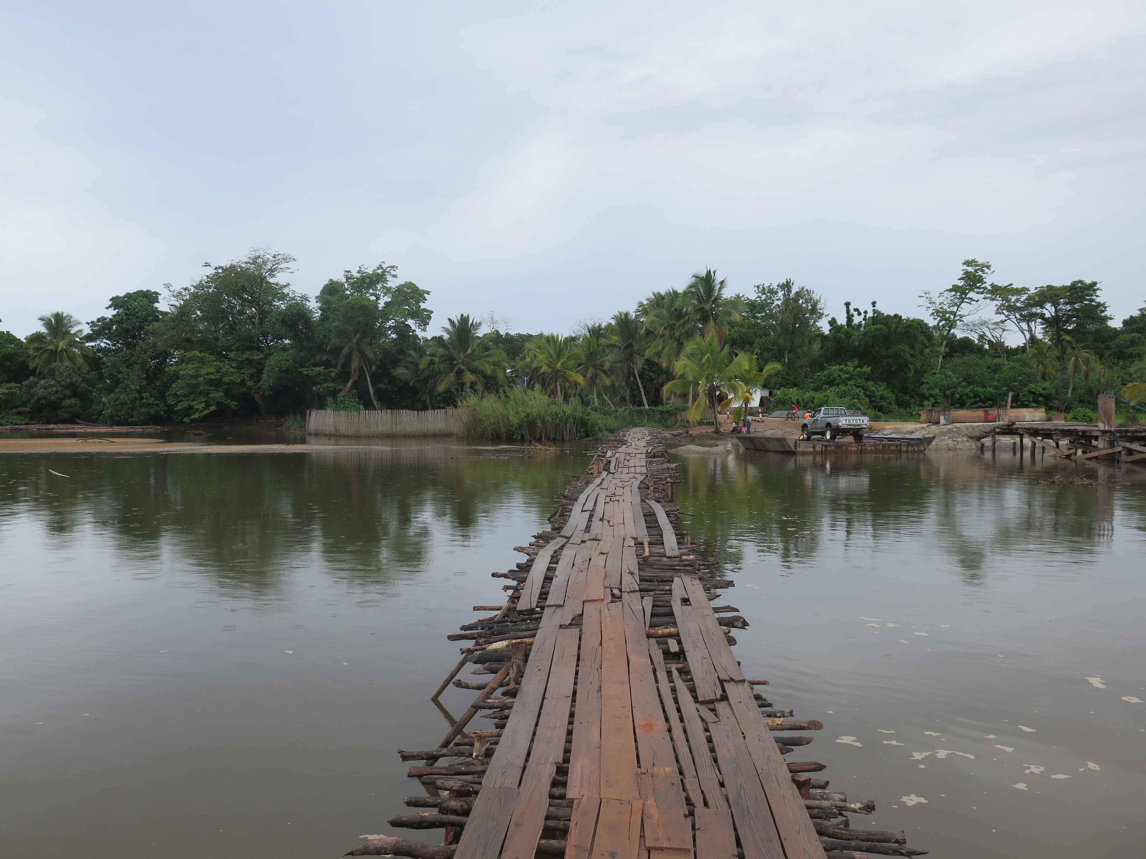
At last I stood at road number 5. The road, well route, let’s not exaggerate, was built right alongside the beach. I started following the road south in the direction of Mananara. Somebody asked me whether I wanted a ‘taxi-moto’ . I declined, I came so far, I could as well hike this last bit as well. A bit further I came across an overgrown milestone, I scraped away some of the plants and saw Mananara was another 13 kilometers away. Boy did I wish I had taken that ‘taxi-moto’. My sandy shoes were scraping the skin from my toes and the walking was rather painful these last kilometers. On the way I had to wait a few times for ferries, or shall I just call them rafts. Bridges is something they do not do much around here.
In Mananara I took a room in a large and fancy hotel in centre ville. Mananara is located right next to the beach, but I spent the rest of the day trying to connect to the Internet to contact home and plan the rest of my trip. In vein, no cybercafe had connection. They blamed an upcoming cyclone for it. A cyclone that would, as it turned out, cost me the rest of my trip.
I wanted to make another trek in Masoala. Due to the weather there was, however, no traffic going up to Maroantsetra. The hotel manager recommended that I try to find a boat there. I went to the harbour and within a few minutes I found a boat that would leave for Maroantsetra tomorrow at 6 am. At least so they claimed.
Day 9 to 13
As a good boy I arrived in the harbour that morning at about quarter to 6 with high hopes. But no ship left harbour that day, the sea was too wild I was told, tomorrow if the sea was calmer they would leave. No worries, I can wait another day. My feet still hurt like hell anyway.
I befriended one of the sailors and moved to some cheaper accommodation that he recommended. A great switch, for less then 25 procent of the money I now had a hut right next to the sea on the beach. The rest of the day I spent trying to get money from the bank, which was a real pickle as they did not accept mastercard and getting online, which also formed a struggle, only at 8 pm in the evening I could finally get online. I sent my regards home and asked whether they could transfer me some money via Western Union. I changed my desired destination from Maroantsetra to cap Masoala. This way I could hike to Maroantsetra and return from there. This would be easier than the other way around as Maroantsetra has daily flights and ferries going out.

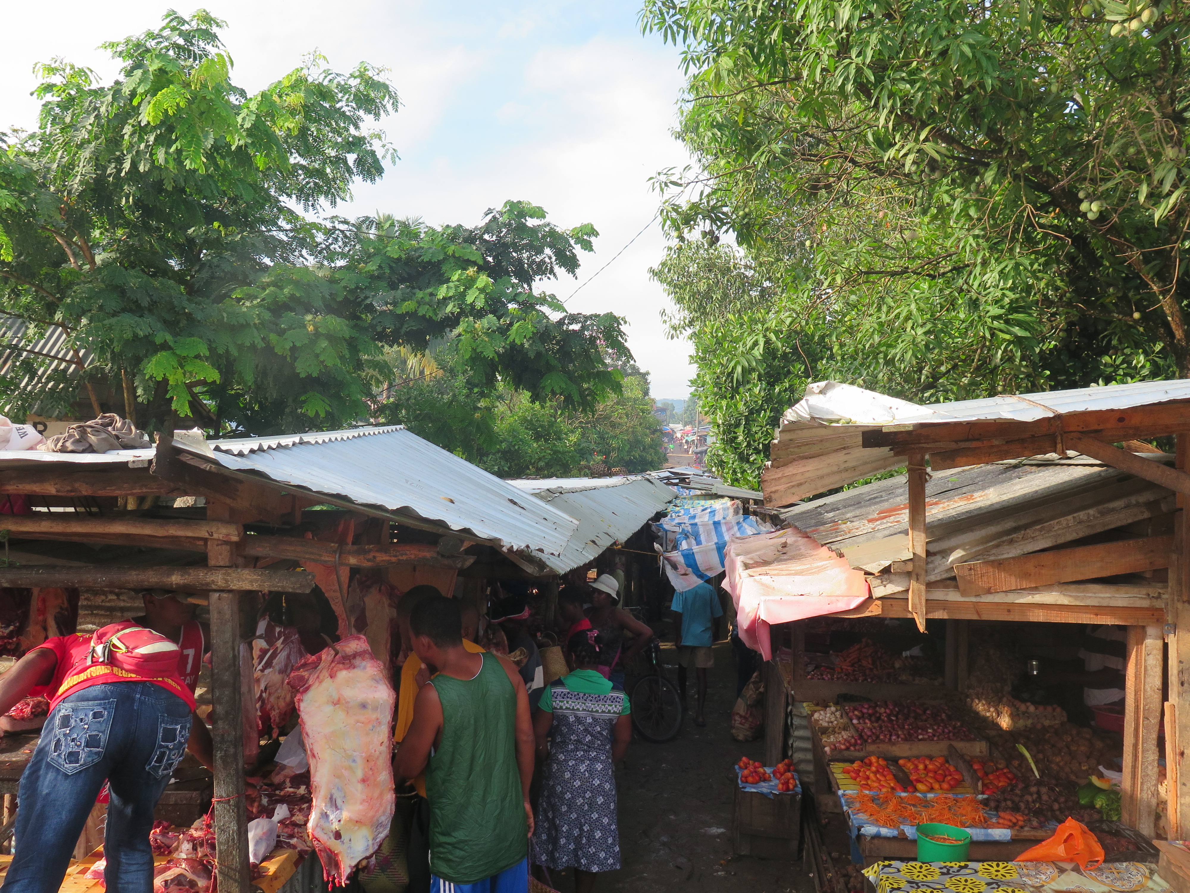
The next morning the pattern repeated itself. I came to the harbour early in the morning, but again the sea was deemed to wild. They added two days to the waiting time. I was getting a bit annoyed by this as the sea looked, at least for Dutch standards, pretty calm. Apparently the sea is here normally flat like a mirror. They added another 2 days to the waiting time. I went to the market with my befriended sailor, who prepared me lunch and dinner on his ship.
The next day went by without much evidence of time actually passing by. Just like yesterday I went to the market with my befriended sailor, looked if the internet was working, had lunch, swum in the sea, slept for a bit, looked if the internet was working had dinner and went to bed. In the evening a cyclone hid the coast. We were far from the center so it felt just like a regular storm. In Tamatave 200 kilometer south hell was breaking loose as I later heard. Well at least we had it gotten over with. Tomorrow we could finally leave for cap Masoala.

It goes without saying that no boat left this morning again. So I went to the market, connected to the internet, had lunch, swum, had a nap, and ate my dinner at the boat just to go to sleep again. God this is groundhog day. Tomorrow another chance.
Nope no boat today. So, shop, computer, swim, sleep, eat and sleep once again. I may not complain, for many people such a wonderful spot at the beach is the goal of their holiday. Nevertheless this was really getting on my nerves. To have something to do I hiked to Mananara national park. I hiked quite a bit inland, but could not find anything out of the ordinary.
The sea was calmer, but the small boats to cap Masoala do not want to take any risks. The larger boats however started loading. Bastards! they are loading just now, so they know darn well they would not leave before. If the boats to Masoala are still not leaving tomorrow I will board a larger boat and just head to Tamatave in order to return to Antananarivo. Some shipers said they would said sail to cap Masoala the day after tomorrow, so I kept hope.
I once again woke and prepared to repeat the usual activities. First of all of course going to the harbour to inform about leaving ships. the shippers estimated their departure again as the day after tomorrow. That was it, this was the fifth time they had delayed their estimate. I spoke with a Malagasy girl who studies in Sydney and was back here for Christmas holiday. She was the daughter of the patron of the fleet in the harbour. At least patron was how the sailor referred to him, I think he was the owner of the ships. The girl urged me to just go back to Antananarivo, this waiting could take ages and with the amount of time I had left it was quite dangerous to head all the way out there. On top of that she told me a second cyclone was coming. Ok that’s it I return.

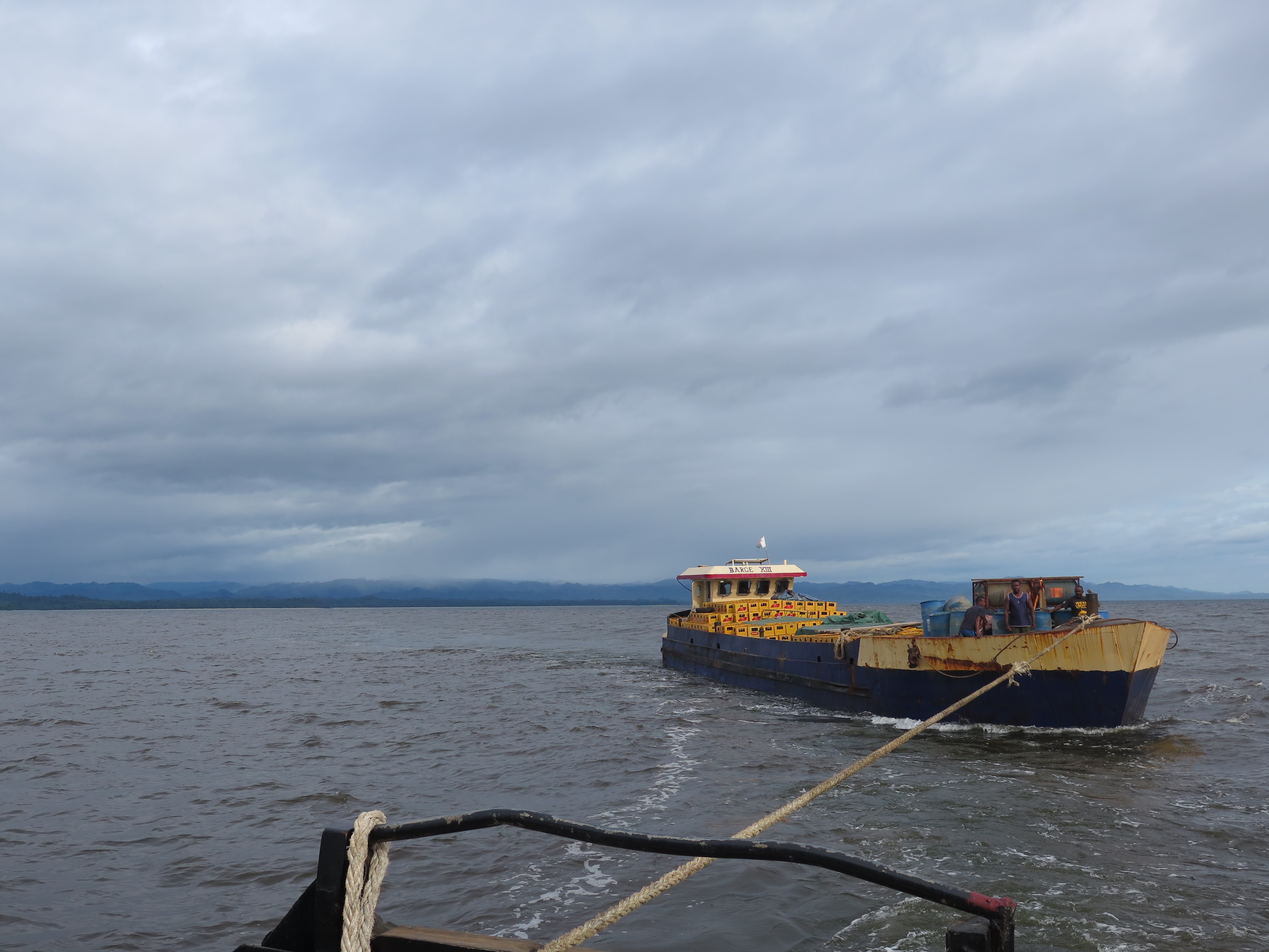
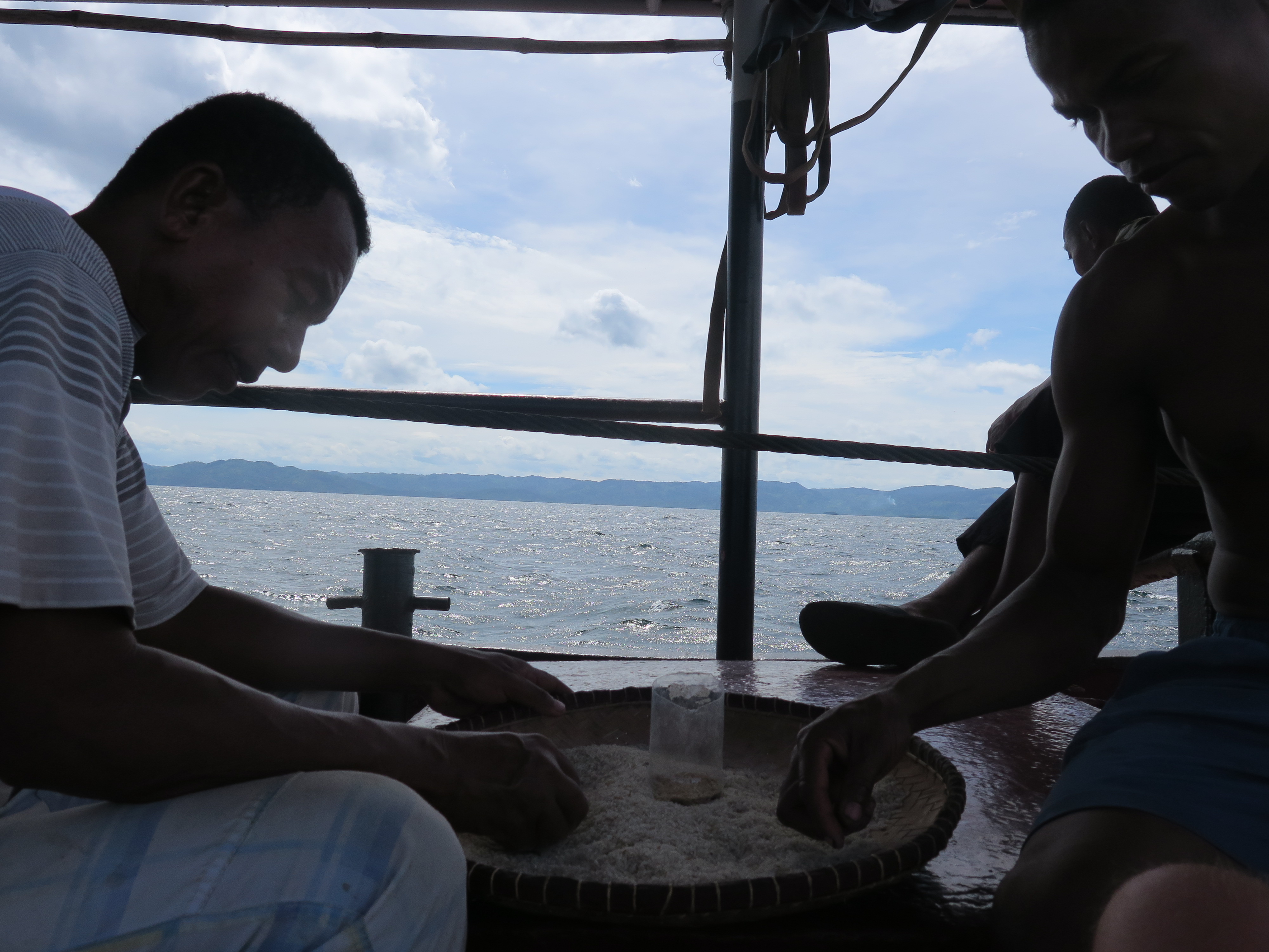
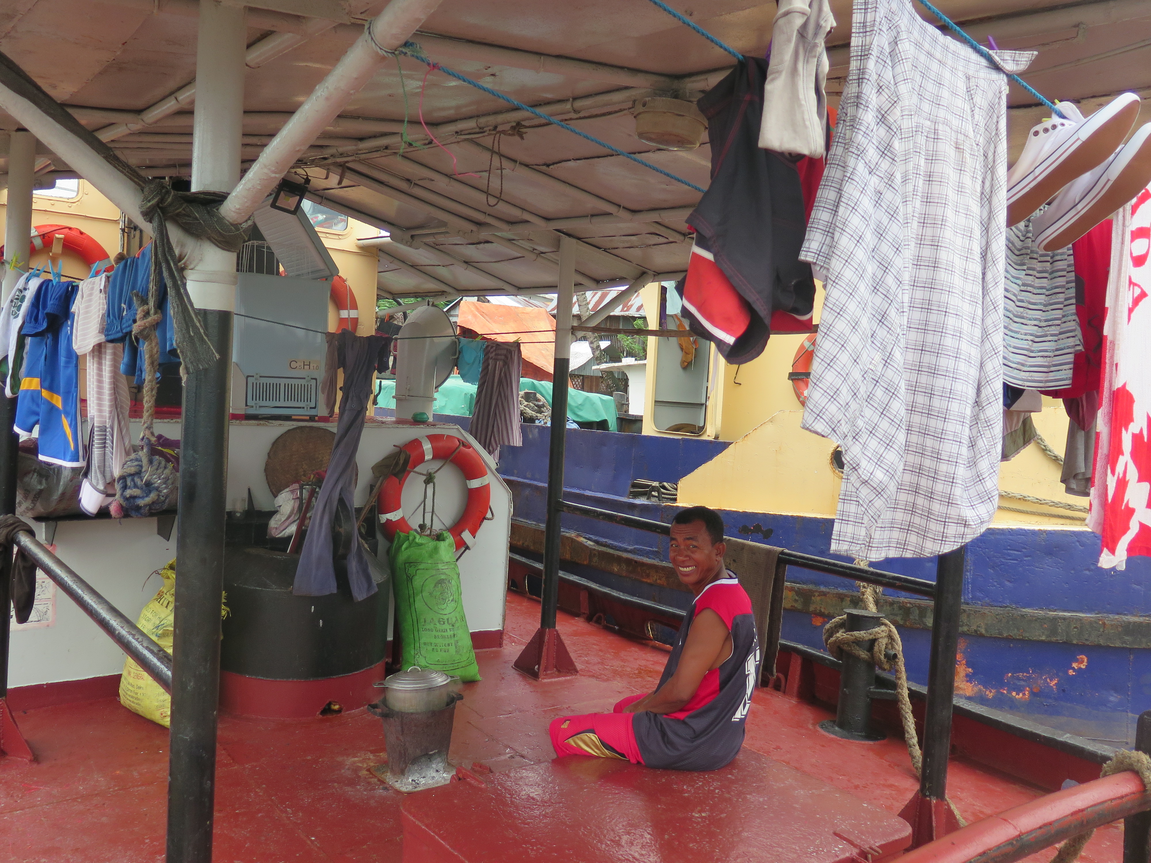
The ship of my befriended sailor was now fully loaded and they told me they would leave for Tamatave tomorrow. Yeah I heard such things before, but this time it felt different. They would actually depart. I could sleep that night on the boat.
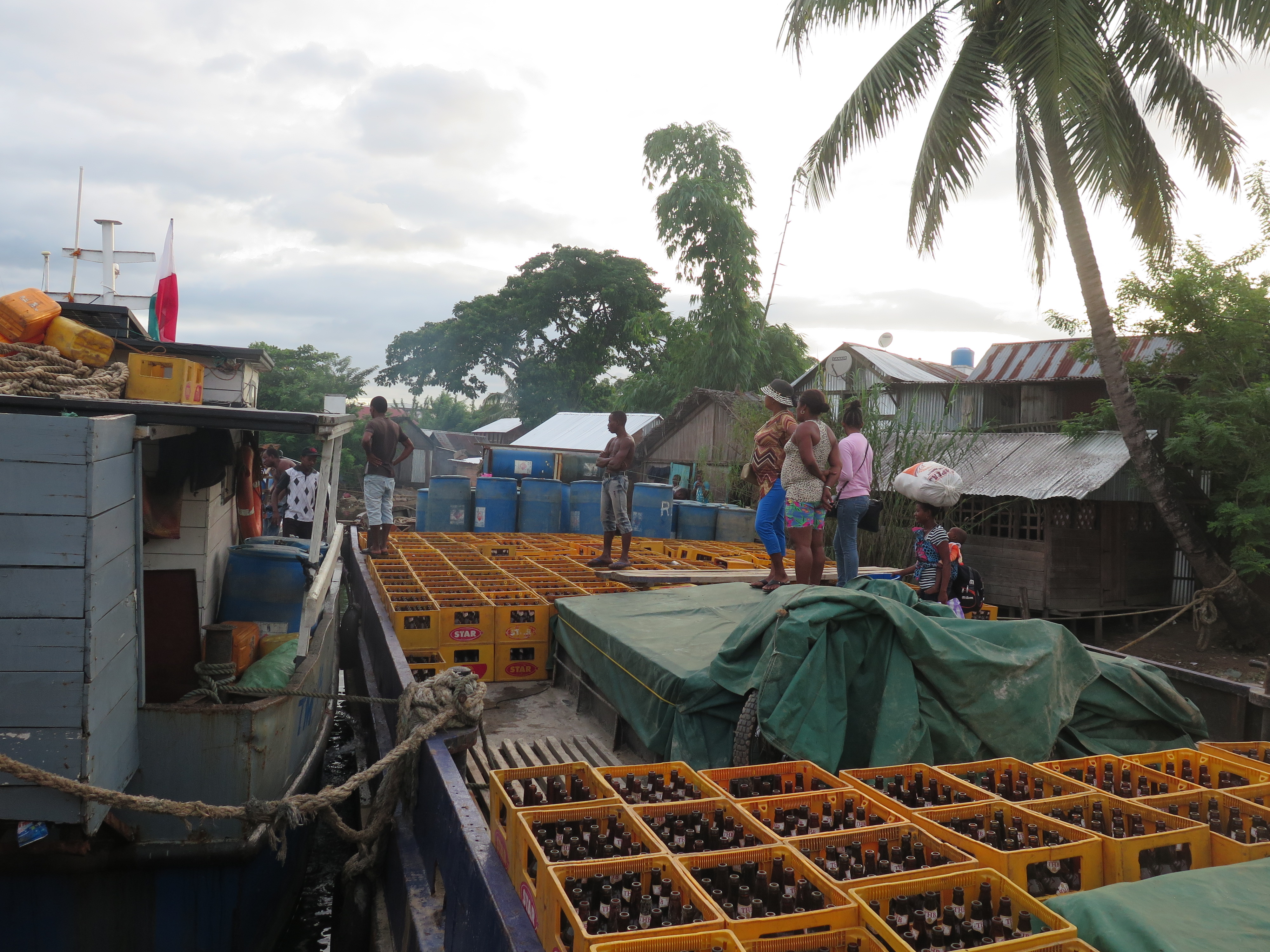
When I woke up that morning the great moment was there. We set sail! Well not to the destination I had initially hoped for, but at least I was going somewhere. We had to drag another, not so seaworthy ship, all the way so we went incredibly slow. It took us 36 hours to reach Tamatave. It did not matter much, traveling by ship is nice and sleeping on deck under the stars was very pleasant.