

May 2024
Philim – Lokpa – Nile – Lokpa – Deng – Shyalagaon – Samdo – Larkye la – Bimthang – Dahrapani
One last gap was remaining. Whenever I looked at a map of Nepal I knew there was really only one trekking region left… I had always deprioritized it as I thought it would be a bit too easy and touristy, but now it looked like the only place left where I could still make a long distance trek. On the one hand it made me happy that I had been able to see so much of the Nepalese Himalaya in my life, but on the other hand it made me sad that I was running out of places to go…
Since the Manaslu and Tsum region make up for pretty easy going trekking with excellent lodges all along the trail it was ideally suited to make it a family holiday. The first family trekking holiday (and probably the only one in my life). My mother, sister, her wife and my girlfriend all came along to explore these beautiful valleys. The idea to do so was already quite old. In 2020 we already had plans to do so, but then, COVID came along. Now in 2024 it was finally time. Though my mother, now she had gotten older was growing ever more skeptical on whether she would be able to complete the trek.
The Manaslu and Tsum valley trek is actually a combination of both the Tsum valley and Manaslu circuit. The Manaslu circuit is of these two by far the most famous. It is the true successor of the Annapurna circuit (which is truly dead nowadays). A long distance circuit trek around an 8000m mountain crossing a high and scenic pass in the process. The Tsum valley is lesser known and takes you up and down the Tsum valley. The Tsum valley trek appears less appealing at first as you need to hike the same way there as back and since it lacks famous mountains and high passes. The Tsum valley however really surprised. It was culturally interesting and had way better views of the Ganesh Himal than I had expected. The narrow passages really made it feel like a ‘hidden valley’. I would have loved to spent a few more days in this valley.

Season
We made the trek in late spring, but any time of year is a good time to do this trek. A friend of mine made the trek during monsoon and really enjoyed it. An attempt after mid january could be successful, but in case of heavy snow no guarantees can be given. Tsum valley does not go to high altitude meaning that even mid winter is just fine.
How to get there
In terms of accessibility this trek is one of Nepals best. A simple drive of just 5 to 6 hours brings you from Kathmandu to Arughat the gate way of this trek. Due to road construction it is nowadays possible to drive all the way up to Philim and start the trek from there. Road construction in this extremely steep and narrow valley is tough, but after over a decade of work the managed to connect Philim. Unfortunately they are still digging. It makes me sad to think that one day this trek will, like the Annapurna circuit, be dead as well.
The trek used to end in Dharapani, but due to road building you can now already stop in Karche and fetch a jeep to Besisahar from there. I don’t think they will built this road further any time soon as there is no village or real destination beyond Karche. From Besisahar it is easy to get a bus back to Kathmandu which should take another 7 hours.
Packing list
Leave everything but your money at home. You can consider bringing a sleeping bag, but even that is not really necessary.
Videos
Day 1
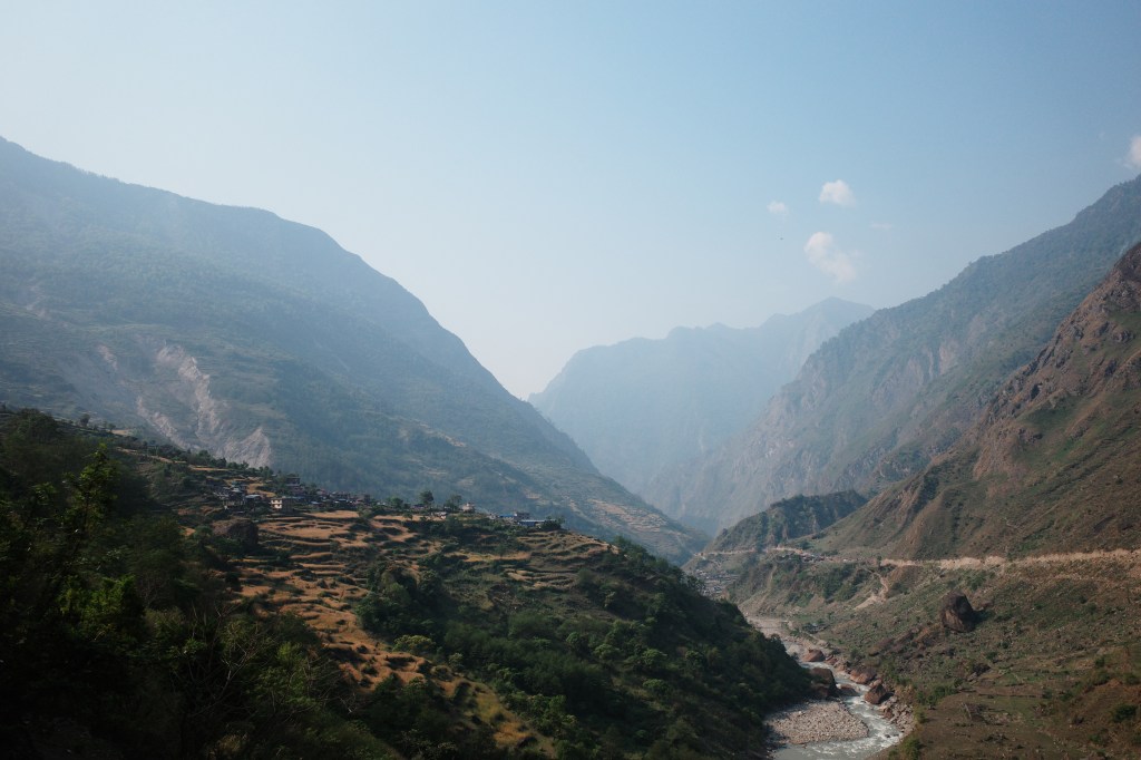
We had limited time and wanted to do both the Tsum valley and Manaslu circuit. We therefore wasted no time and left Kathmandu with private transport right the day after we arrived. We were driven to Soti Khola where we transited to a local jeep that drove us to Philim. That is to say, near to Philim. We had to hike up the last 130m up ourselves.
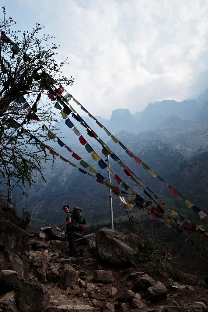
After having been on the road for hours this last stretch of hiking did not go over well. As we were hiking up my mother was already losing hope of ever completing this trek. However when in our hotel our courage quickly grew back. The only thing left was devising a strategy to keep our guide of our necks. Even during this first hour we already saw he had an annoying habit of keeping a bit too close of an eye on us.
Now we were in the mountains the sky has cleared up somewhat, it was however still hazy and dusty. Hopefully that would improve as we made our way further up in the coming days. Apparently it had been dry in Nepal for almost 5 months and the dust and smoke of the many wildfires had clearly built up to unprecedented levels. I have seen dust in spring more often, but this was truly on another scale.
Day 2
The first real day of the trek. Today we would discover whether my mother would be up to the task. If today went over well, we believed everything would go over well.
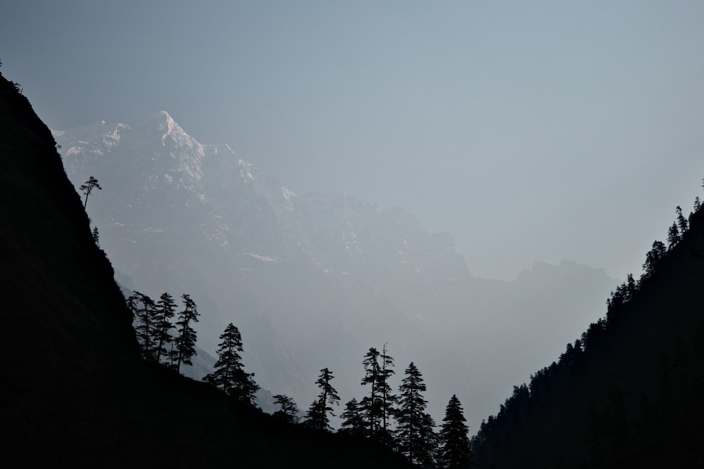
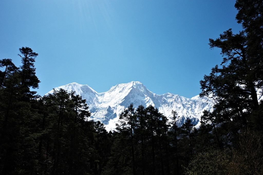
It had rained in the evening and that had done wonders for the sky. It still was more hazy then I was used to, but at least it was blue again. We even got to see our first snow capped peaks! (most likely the Chamar)

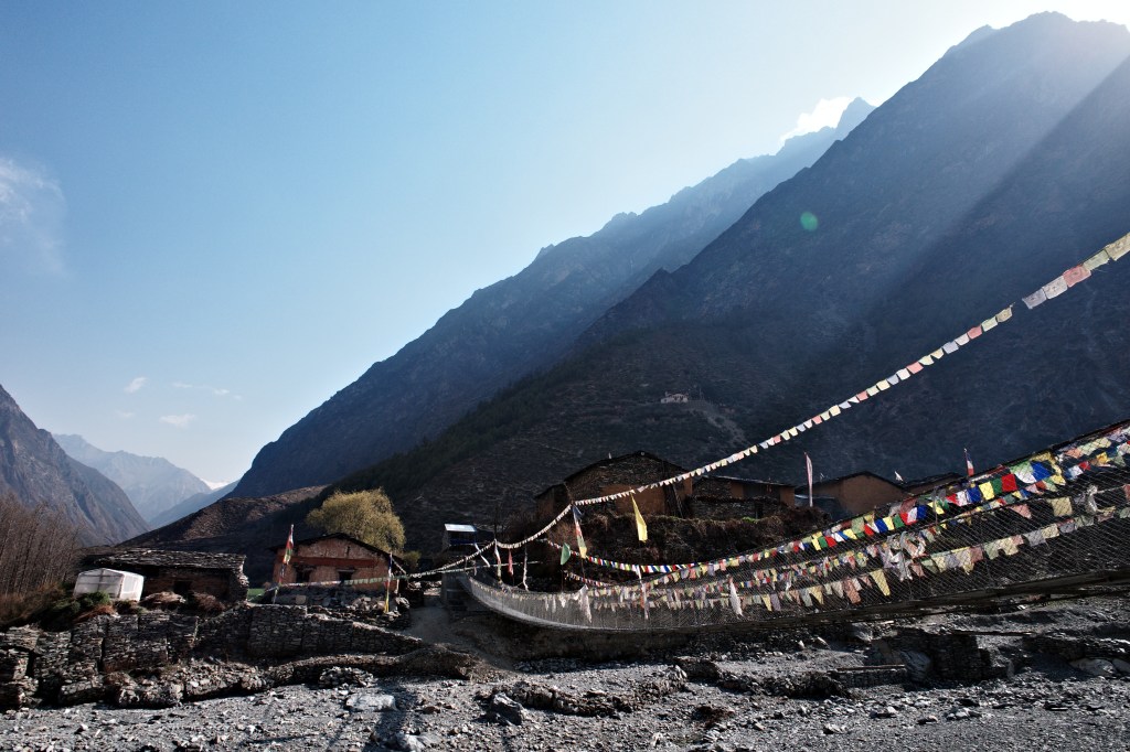
We followed the gentle slopes along some smaller villages till we reached the large suspension bridge that marked our turn into the Tsum valley. One week from now we would return here to cross the bridge and start the Manaslu circuit, but now we turned north east into the Tsum.
The weather remained very nice as we hiked up through nice bamboo and Rhododendron forest. We arrived in Lokpa much quicker and with a lot more ease than we had expected. Pushing furhter then Lokpa however was not possible, the next place, Chumling, was 6 hours from here.
Lokpa had a really nice and cozy hotel, the only downside was a large group of Russians that for whatever reason were giving each other massages and playing dress up for hours on end in the middle of the village for reasons that were beyond me. I was determined to push a bit further then Chumling tomorrow to avoid them.
Day 3
The day started with navigating a small landslide. Eline and I walked ahead and barely noticed it, but later I heard that my mother was not too pleased with the narrow and uneven trail.
The weather was once again quite clear and in the still relatively cool morning nature was at it’s best. We got to enjoy the steep cliffs, Rhododendrons and far away peaks. Beautiful as it may be it was also tough. We had to climb up several hundred meters using concrete stair cases of which the steps were constantly just a little to big… By the time we reached our lunch place, a small wooden teashop, we could already see Chumling on the other side of the valley. It was close, but we had to hike down to the valley and then up again for what looked about 400m.
Eline and I had been walking ahead and my mother and the rest were due to the steep ascend way behind. We waited for well over an hour and a half on this nice spot to wait for them. We were worried that my mother would find it quite heavy, but when they arrived they did so smiling.
We had some noodles before continuing on. The day so far had gone quite well, but my mom was not too pleased when she saw the way up to Chumling. We could see over the long suspension bridge after which we could see the trail zigzag steeply up all the way to Chumling.
We had meant to press further then Chumling, but my mom put that out of the question immediately. We would not go a step beyond the first hotel we would reach.
Slowly but steadily we made our way up to the picturesque village where we took the first hotel on our path. Once again a really nice and authentic feeling hotel with really nice views to an array of rock formations and mountains towards our north. By this time we could also get our first glance of the impressive Ganesh himal to our north east.
From this point onwards the Tsum valley would become more inhabited again. between here an Lokpa there had been nothing but forest, but as we looked up valley we could see many small villages with their field around them.

Day 4
As per usual the morning skies where clearest and we could see the Ganesh himal really well. We had left early to get some kilometers in before the heat would set in. The day would consist of two parts. The first part would be following the lower Tsum valley along many smaller villages and in the second part we would need to climb rather steeply up a very very narrow and steep section of the valley to reach the gateway of the upper Tsum valley Chokang Paro.
We followed the easy trail north all the while enjoying romantic views over golden fields, forests and waterfalls. We made it to the end of the lower Tsum valley in no time. The lower Tsum valley end on an 4 way intersection of valleys. One heading to the Ganesh Himal base camp (a side trip we unfortunately would not have enough time for), one heading into the wilderness and one to the upper Tsum valley. We took some tea at this nice spot, with some of the best views of the many peaks that make up the Ganesh Himal. I was surprised by the views of snow capped mountains. I thought Tsum valley would be mostly a cultural trek.
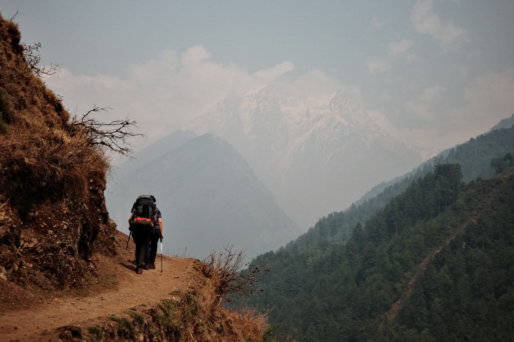
The second part of the day went over less well. It was a rather relentless climb up. First a long zig zag through the pine forest after which the trail started to follow the valley side. Following the valley side or not the trail kept going steeply up along a steep ravine. Maybe it was even steeper here then the section we had to navigate after Lokpa. If you would ‘jump’ 5 meters of trail you would easily fall 300 hundred meters down…

After several hours we could see the valley broadening above us. That must be were Chokang Paro was located! It was close yet very far away. The trail made countless zigzags steep up to reach the plateau around 300 meters above us. Luckily there was a tiny teashop at this point where we could get something to drink and a few biscuits to put some courage in our stomachs.
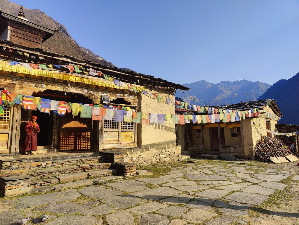
As it was getting later in the afternoon we finished the last steep climb and made it to Chokang Paro. A pretty large village, built in classic Nepalese style, but clearly inhabited by people culturally more linked to Tibet. We stayed overnight in a small lodge owned by a young mother who spoke a bit of English.
Day 5
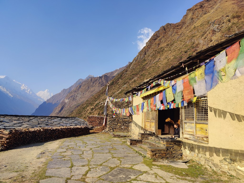
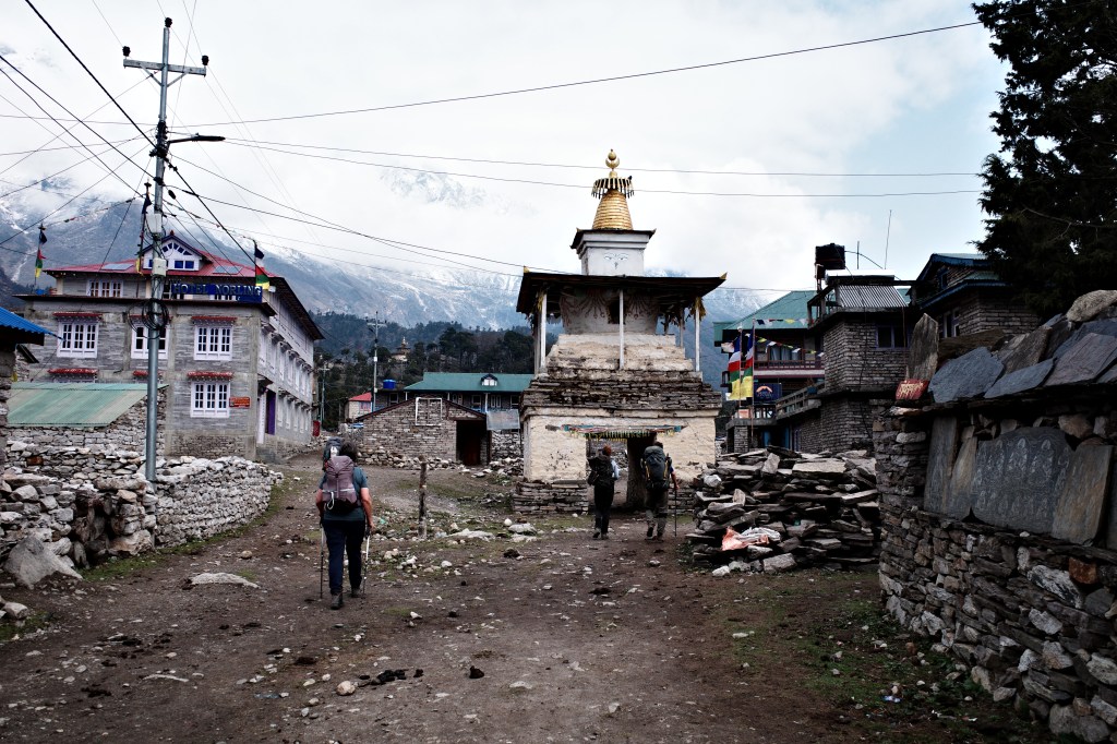
Our last day up valley! Today we would reach the last village in the valley, Nile. It would be an easy day over rather flat terrain. It promised to be a very different day then the days before. The very first kilometer was still gently uphill, but after that we found ourselves in a very broad and almost flat valley. The villages were quite large. Built from natural stone and very colorful. The flat terrain allowed for very large fields and we passed some of the largest mountain monasteries and stupas that I had ever seen.


After a few hours we reached the twin villages Nile and Chule. Located next to an impressive waterfall. In the distance we could already see Mu gompa.
We arrived early in the day and could spent the rest of the day resting and exploring the village and deserted monastery.


Day 6
Rose and I woke up at 5am. We would make the side trip to Mu Gompa while the rest of the family would wake up a little later and hike back down to Chokang Paro where we would meet up for lunch.
Rose and Ik hiked up quick and reached the monastery around sunrise at 6:15. A beautiful time to arrive. The light was stunning and the monks had just lit their icense. We looked at the morning prayers and enjoyed the view of the Ganesh Himal II. We felt bad that we had not taken the rest, but as it would later turn out they had had a great side trip to Rachen gompa later that day.
It was a beautiful but long march down to Chokang Paro. The yaks, mani walls, villages, monasteries and large fields really make the upper Tsum a unique place. Due to the very narrow trails and steep ravines that end up in a rather broad and populated valley it really feels like a hidden valley. If only there would be a way to make this trek into a circuit this valley would have the potential to become one of Nepals classic treks.
To our surprise we reached Chokang Paro before the rest did. We did not mind as our feet could use some rest before descending further down to Gho. When the others came we had a good lunch and said goodbye to the upper Tsum. I did not know what the Manaslu circuit would be like, but my mother was already sure that she had seen the highlight of the trip.


It was a long way down and I was pretty tired when we finally arrived in a dusty teahouse in Gho. It was quite a bit dirtier than the other places we had stayed so far, but I was thusly tired that I did not want to descend all the way down to Tumje.
Day 7
This would be our last day in the Tsum valley. I was looking foreward seeing the the Manaslu circuit, but also felt sad that I would leave the Tsum behind. A valley that had really surprised me. To imagine I initially had not even planned to include this valley to my trek!

From Gho we first hiked back to Chumling. Again through the forested lower Tsum. The villages here were much smaller and culturally different from the ones in the upper Tsum. We had tea in Chumling and after that navigated the isolated section of the valley through the dense forests. This around 5 to 6 hour section is the reason why th Tsum feels quite so remote.

Back in Lokpa we took the same hotel as before. One of my favorite hotels on the trek so far.
Day 8
The Tusm valley trek was already at it’s end. When I was in Lokpa it felt like our trek would take forever, but here we were, already half way our trek. No sad faces though, some of the best mountain scenery was probably still ahead of us 🙂 The weather forecast was not looking too promising, but I figured that by the time we would arrive at higher elevation again in Sama three days from now things might look very different again.
Deng was not too far and most importantly, the route held no big up and downs. That was a good thing as Roos was not feeling too well and as we hiked further it was only getting worse. Luckily we had antibiotics, the worlds 8th wonder. When it kicked in Roos quickly improved. Even though we were moving very very slowly we made it to Deng early in the afternoon.
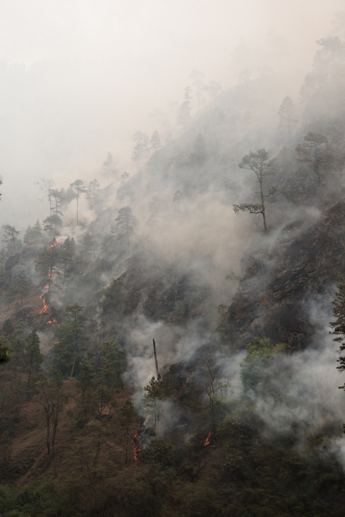
The new valley we were in was very different from the Tsum. We hiked through more jungle like terrain on the very bottom of the steep canyon. Along the way we saw a substantial wild fire on the other side of the river that no one really seemed to worry about. It might very well be fires like this that caused the haziness of the air we had been experiencing so far. It had not rained for 5 months I was told and wild fires were running rampant all over the country.

The hotel in Deng was also a completely different atmosphere. Even though the Manaslu circuit is not super crowded, it definitely sees a lot more people than the Tsum. Deng therefore felt more like a backpacker destination then a a village along a remote trekking route. The difference between One or two other trekkers and around 12 makes a big impact on what a hotel feels like.
Day 9
Initially I had thought to hike to Sama in 3 days. 2 days seemed, considering we had brought our mother, like a bit of a stretch. However we were keen on gaining an extra spare day and our guide insisted that it was the standard itinerary to do it in 2 days.
Doing it in 2 days meant we had to hike to Namrung, which was quite a distance. The day started in the same fashion as the day before. Following the valley floor while occasionally crossing the river. However pretty quickly we started to hike up avoiding the steeper section at the river. The villages were very tiny and quite messy compared to what we had seen in the Tsum. Junkville is what my sister called them…

We had many ups and downs without gaining any real altitude. Our lunch place Ghap seemed to always be just around the corner, but once we got close it turned out to be just another Junkville. The cloudy weather further tanked our motivation that day. We did what we could and, pretty tired I must admit, we arrived at our lunch place (what for our part could have been our overnight place).
After a long lunch break we could motivate ourselves to head further. This time we at last could gain some actual altitude. Finally some ascending without just immediately descending the same. The environment also got more interesting we were treated on some beautiful forests and a raging river that had leveled with us again since Ghap.
It was not long or we arrived at the ‘master ascend’ of the day. 400 meters straight up till Namrung. Eline and I went ahead as my mother wanted to take her time. The trail went up and up through the forest. After a while we came across a large hotel, but it was not Namrung. Ugh, my mother will be pretty dissapointed… It was a nice hotel though with some good apple pie for sale. till this day my mother still says that we should have taken more time at the Manaslu circruit so that we could have stopped at places like this.
The actual Namrung was about an hour further. Our guide checked us in at a nice hotel with private two person huts. My mother arrived just an hour or so after us and was in a better mood than we had thought. That was a big relief.
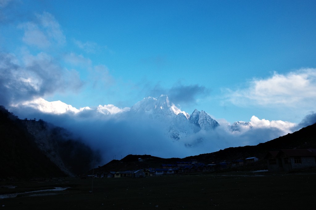
The weather still sucked and the forecast was still not improving. This made Namrung feel, despite of the nice hotel, like a bit of a depressing place. I was starting to worry whether we would even get to see mount Manaslu in the coming days…
Day 10
The clouds were slowly starting to lift in the early morning. Who knew, maybe we would get to see our first glimpse of mount Manaslu today. I had been particularly looking foreward to see the famous viewpoints from Lhi and Sama. As the day progressed the meteo indeed improved further. The first point from where you could see Manaslu was Lhi and I hiked up speedily up front. Maybe if we made it early enough we could still see it.
However even though the sun was shining the Manaslu massif remained largely hidden in the clouds. We did get to see himal Chuli, but for the rest the mountains remained firmly hidden.
As the day progressed the weather got worse, We could still sit in the sun during lunch, but after that it became more and more clear that we would get a downpour sooner rather than later. And indeed just when we arrived in Shyalagoan the rain started falling. Falling hard and without pauses. It rained for almost the entire rest of the day.
The choice to stay in Shyalagaon and not go further to Sama was easily made…
Day 11
We woke up early as we knew the weather to be best in the mornings. The high mountains were still well hidden, but we did get to see some of the mountain scenery in our more immediate vicinity, which was compared to last evening already very welcome.

It was a nice walk to the rather unappealing town Sama. Sama was a rather large city with a lot of rather large concrete buildings. We had some early lunch/late breakfast in town and continued on to Samdo further up valley. In fact the last village till the end of our trek.
The view up valley looked quite nice with it’s sharp mountains on the east side. After lunch however the clouds had already taken over the full valley. I was really hoping that we would even get to see the Manaslu at this point…
The bridge behind the village had been swept away by a flash flood caused by an avalanche earlier in the month, but nothing we could not handle.
The way to Samdo felt quite flat and the going was pretty easy. We arrived in Samdo rather early again in the rain. A drizzle this time however. The village itself failed to impress. Compared to the Tsum valley the villages on the Manaslu circuit kept feeling unappealing. Too many large concrete lodges had been built on a bit too large of a scale. The ‘old Samdo’ was still there, but the ‘lodge town’ that had been built next to it almost fully overshadowed it.
We decided to stay 2 days in Samdo. For acclimatization, but mostly to wait out the bad weather. Tomorrow would still be bad, but 2 days from now (the day of the pass) some pretty good weather was predicted (at last!)
We spent the rest of the day in the dining hall. Playing games and eating away our budget that by now we had faith in to be enough.
Day 12
In the morning I was woken up by Roos. She said the Manaslu was visible! I quickly woke up. I had woken up at 4:30am but then it was still raining so I had given up and not put the alarm again. All of us went to the hotel rooftop and got to enjoy a nice unobstructed view for a change. To our east was the Samdo peak, only 6300m but due to it’s proximity the most commanding mountain around. South of us we saw what we thought to be the Manaslu, but was actually a smaller side peak in front of the Himal chuli.
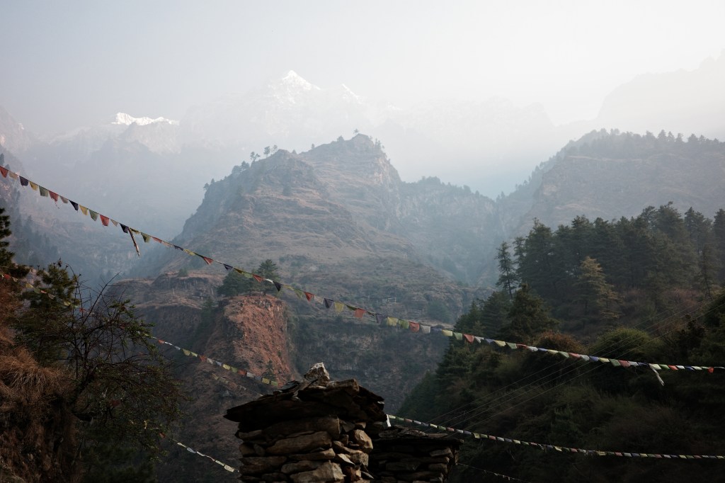
We grab our stuff and started to hike towards the prayer flags on the slope right behind the town. The clouds were already starting to role in via the valley floor so we hiked as fast as we could. We made it to the prayer flags just in time for a few nice photos. But after just two minutes the clouds rolled in and we found ourselves once more in the mist. Rose and I nevertheless decided to hike further up. Our initial plan had been to climb the Samdo (5100m) and enjoy the view from there. We still had a bit of hope that if we would hike fast we could still climb till above the clouds.
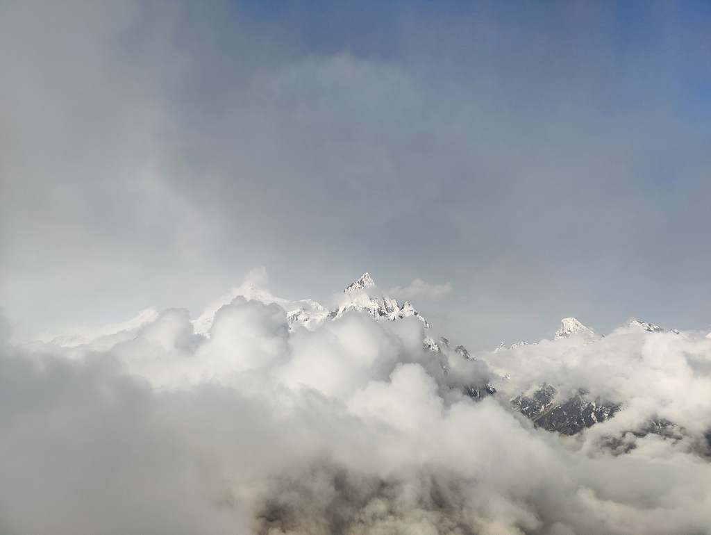
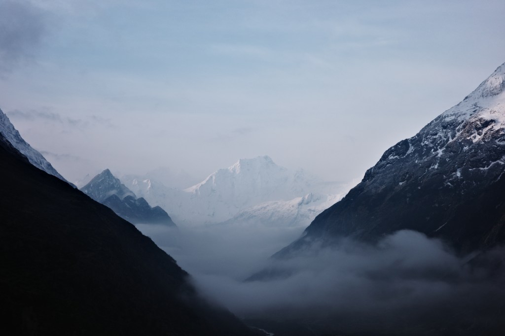
We hiked swiftly, as Rose and I can. But after ascending for the better part of 30 minutes I started to loose hope that we would rise above the clouds. However just 5 minutes later, we could all of a sudden see some peaks again. The snowy peaks were like islands in the clouds. Their peaks towering over a vast ocean of white clouds. It was one of natures finest spectacles I had ever seen. I have seen mountains many times. But this type of view I had never seen and is quite rare.
As we hiked up we quickly learnt that we had been mistaken about the Manaslu. The side top we had looked at from our lodge was completely overshadowed by the bread Himal Chuli peak behind it. The actual Manaslu we could now see was west of us. I was quite disappointed as this meant that Eline, Eefke and my mother still had not seen the Manaslu…
The view did not last long and in another 15 or 20 minutes all was gone and we found ourselves in a disorienting silent mist. We made it so far so we did climb all the way up till 5100. The way down was not easy to find. The samdo hill is not steep and you can basically walk almost anywhere, so in the fog we lost our way almost instantly. Nevertheless we made our way back to our lodge at around 10.
Eefke made some local friends in the village and we went for a small acclimatization hike towards Tibet, but most of the rainy day we spent indoors in the large dining hall. I was quite happy with the morning we had had, but I still really hoped that my family would get to see the mountains around us as well. The morning forecast for the day after tomorrow kept looking promising. So all hope was not lost.
Day 13
We woke up with good weather, clouds were already building up down valley, but it was already a big improvement with yesterday. The weather was clearly in the lift.

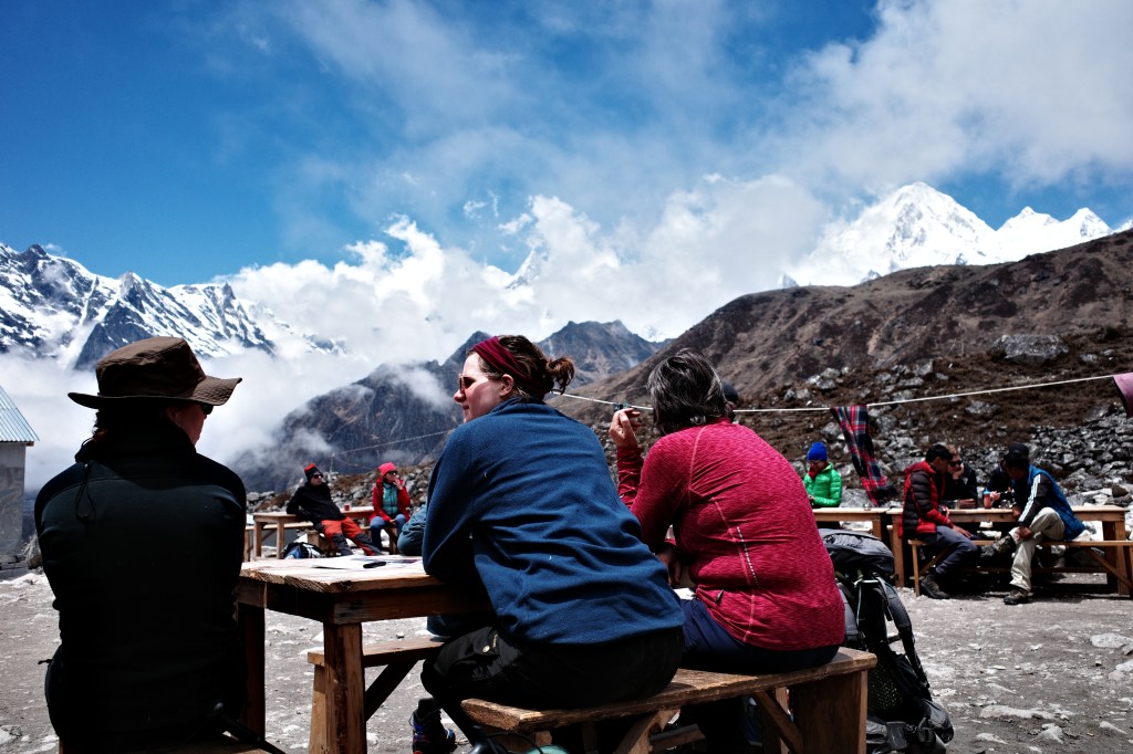
It was an enjoyable and easy hike to Dharmsala, with some nice viewpoints along the way. The best one of which is the side valley towards the south where you can see a large glacier come down from the Manaslu north. We arrived here just at the moment the clouds rolled in permanently. From that moment on we continued through the mist and a light snowy drizzle. Due to the thick mist we only got to see Dharmsala when we stood right in front of it. Dharmsala is just a small hut with some tents and containers around it. We got assigned a tent and a container, but decided to use the container with all 5 of us. That just about fitted us all and felt a lot more comfortable then the tent.

We would not be spending much time sleeping anyway. I calculated that it should be around 7 hours to make it to the pass. Since I wanted to reach the pass between 8 and 9 (to maximize our changes of good weather) this meant we would need to leave around 1:30 in the night. Our guide Thakur was not a fan of this idea, but as it was ‘up to your choice’ he would go along with it. It would indeed be cold and uncomfortable, but leaving at the recommended time of 4am would with our speed mean that we would reach the pass at around 11am, by which time the clouds probably would already have crept in.
Now all trekkers were confined to such a small hut we really started to notice how many other Dutch people there actually were on this trek. This was definitely the most Dutch trek I had ever been on.
Outside the snow kept on falling, it was hard to believe that tomorrow morning would be clear again.
Day 14
I did not sleep well during the night. I think no one did. The prospect of waking up at 1:30am and the excitement of climbing the pass made it hard to fall asleep. On my toilet break around midnight I could see that the skies had completely cleared. The weather system in the Himalaya is really something of it’s own. Clear morning skies transition to misty evenings and vice versa and it leaves you wondering how the weather can change so rapidly back and forth in just 12 hours. It’s like clockwork.
The alarm went off at 1:30. I went to wake up our guide. We were ready to go in a matter of minutes and with our headlights on we started our climb through the cold night air. The stars were bright and there was no moon so we really needed our headlights to find the trail through the moraines. The snow capped mountains were however clearly visible in the night sky. It was a truly amazing sight in the clear and quiet night sky. We could not wake for the morning light to break so that we could start to make some photographs.
The way to the pass was a very long but steady climb. My mother clearly did not have it easy, but this would be the last roadblock to clear, which gave hope.
We gained quite some altitude during our first hour battling the cold. It was 2:30 at this point and still deep in the night. We saw a satellite constellation fly over us. A very peculiar sight, it was around 50 objects passing right over us in close equidistant formation.

At 4:30 when the first hint of the morning light started to appear in the east we were already at 4900m. The pass felt really close at this point. However my mother was at this point pretty exhausted and was wondering in what state she would make it to the pass.
As the sun rose the stars slowly disappeared, one by one from east to west they faded away as the sky turned blue. Eefke could finally make her first photos.


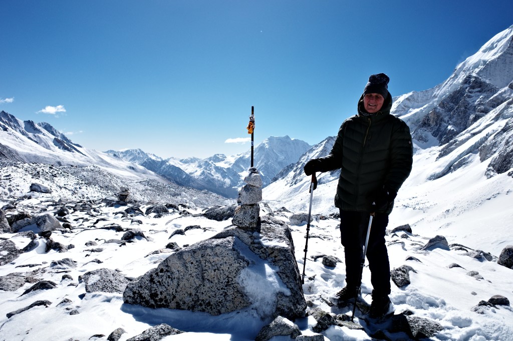
I knew the Larke pass would be broad, but it was even broader than I could have imagined. One we reached 5050m we were altitude wise pretty much on the top. But the moraines seemed to go on forever. Our phase slowed down to a crawl and the first porters of the other groups were already on our tails.
Slowly but steadily we managed to reach the final ascend to the pass however. Just 25 meters more up and we stood on the pass itself. We arrived at the same time as the fastest groups that had left at around 4:30.
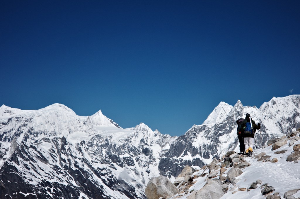
Larke pass was marked with a lot of prayer flags and had some nice views towards the east and the Larke peaks south and north of the pass. The best view however could be had around 100 meters after the pass (at an actually bit higher point) at which you could look west. You could see the Annapurna ||, Himlung, Purbang and the famous sharp peak I remembered seeing with Dennis from Bimthang, maybe 10 years ago…

The view took me back to my trek across the Saaribung with Eline 2 years earlier as well. Back then we had also had great views over the Himlung and from Larke it felt like we could see all major peaks that had marked our experience there.
The way down from the pass seemed endless. We could already see the trail down in the valley and it did not look that far away. But the trail made so many zigzags that it took forever to actually get there. That we were all tired from the early start and climb did not help much either. We took many stops as we were not in a hurry and the view over the upper Bimthang valley was truly something special. It felt like the “Naar Phu valley” somewhat Peruvian in term of the style of the mountains. The valley was surrounded by sharp peaks with three large glaciers rolling down and meeting in the main valley below. The most beautiful were the two large blue lakes that had formed between these large glaciers.
As the clouds rolled in I felt really happy that we made such an early start, it would have been such a shame to miss out on what we had seen so far.

As we finally got down we reached the first tea house. I was surprised to find it here. I had though that Bimthang would be the first place. We had some well deserved lunch and actually wanted to stay around. But tomorrow would be our last day and Dharapani was still far way… So we had to keep walking…

Bimthang was not that far away, but since we were really tired at this point it did feel like it was very far. Eline and I went ahead, but my mother took over an hour more to reach it. She was exhausted and a bit ill. But we made it. It was only downhill from here. The Manaslu was hiding away in the clouds. The group had still not seen the Manaslu on it’s own circuit, but it felt very very likely that tomorrow in the morning we would finally get to see the mountain.
I had already seen it with Dennis from this place about 10 years ago and I knew it to be a spectacular sight. Most photos of the Manaslu circuit that are shared online are usually made around Sama, but the Bimthang valley might actually be the best part of the entire trek. I guess people are tired at this point and less prone to share photos…

Day 15
My mother was ill. The day after tomorrow we were already scheduled to fly back to Amsterdam so waiting around in Bimthang was not really an options. Luckily however she was able to hike and it would only down today (ok granted sometimes a few meters up, but a Nepalese down hill nonetheless). Though downhill Dharapani was quite far away so we made an early start.

The weather was superb and we finally got to enjoy great views over the main Manaslu massif itself. The Manalsu looked really impressive from this side. The peak felt like it was completely flat. My sister vowed to call the peak stumpy instead of Manaslu from now on. However high the Manaslu and Manaslu north may be, it was the steep and rugged Thulagi Chuli that stole the show.
As we hiked down we quickly found ourselves in the Rhododendron forests again. We could get our last glimpses of the manaslu through tree tops. As we descended further we found ourselves in thick pine forests and the mountains were already starting te feel far away. It is remarkable how empty this valley is compared to the valley we ascended via.
We made slow progress and had lunch at Yak kharka. When we arrived in Karche we already met the road head. Much to my surprise. I had expected they would have constructed a road to Tilche, but Karche is basically just one tea house, so it did not feel like a worthy destination to built a road to…
We however could not make use of any transportation as there had been no bridge placed at Tilche yet… We would at least need to hike till Tilche before we could get transport.
We continued on and had some tea in Ghoa. Once in Tilche I pressured my guide to override the plan and to stay overnight in Tilche and have the jeep start from there. He was however committed to go to the hotel in Dharapani where he was probably a regular customer. He came up with another solution and had that hotel pick us up with a jeep instead.
As we drove the last stretch to Dharapani I felt really happy that we did not have to walk all that way. It felt way further then I remembered it to be when I was here with Dennis so many years back…
