

August 2018
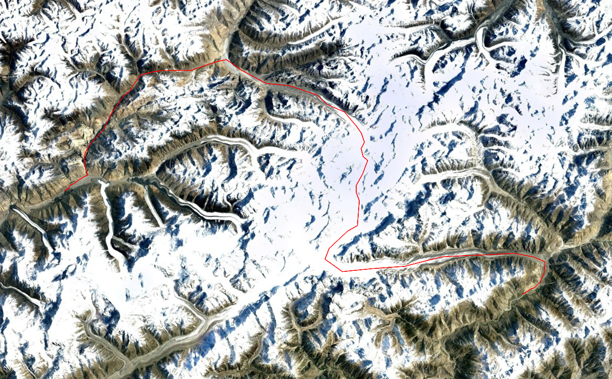
Simshal-Pamir Pass-Braldu valley-Lupke La-Snow Lake-Hispar Lake-Askoli
A visit to the famed Karakoram mountains was long overdue. Over the past 5 years I had visited numerous places in the Indian and Nepalese Himalaya, but Pakistan always put me off. It had a reputation of not being safe, it had even for south Asia standards a rather vague bureaucracy and due to the long glacial traverses it was just too difficult I thought. The threshold had simply been too high. In the summer of 2018 I finally stepped over my prejudices and made a bold plan to traverse this entire range west to east. The first stage would be the crossing of Lupke la. A long trek over world’s largest glacial system outside the polar regions.
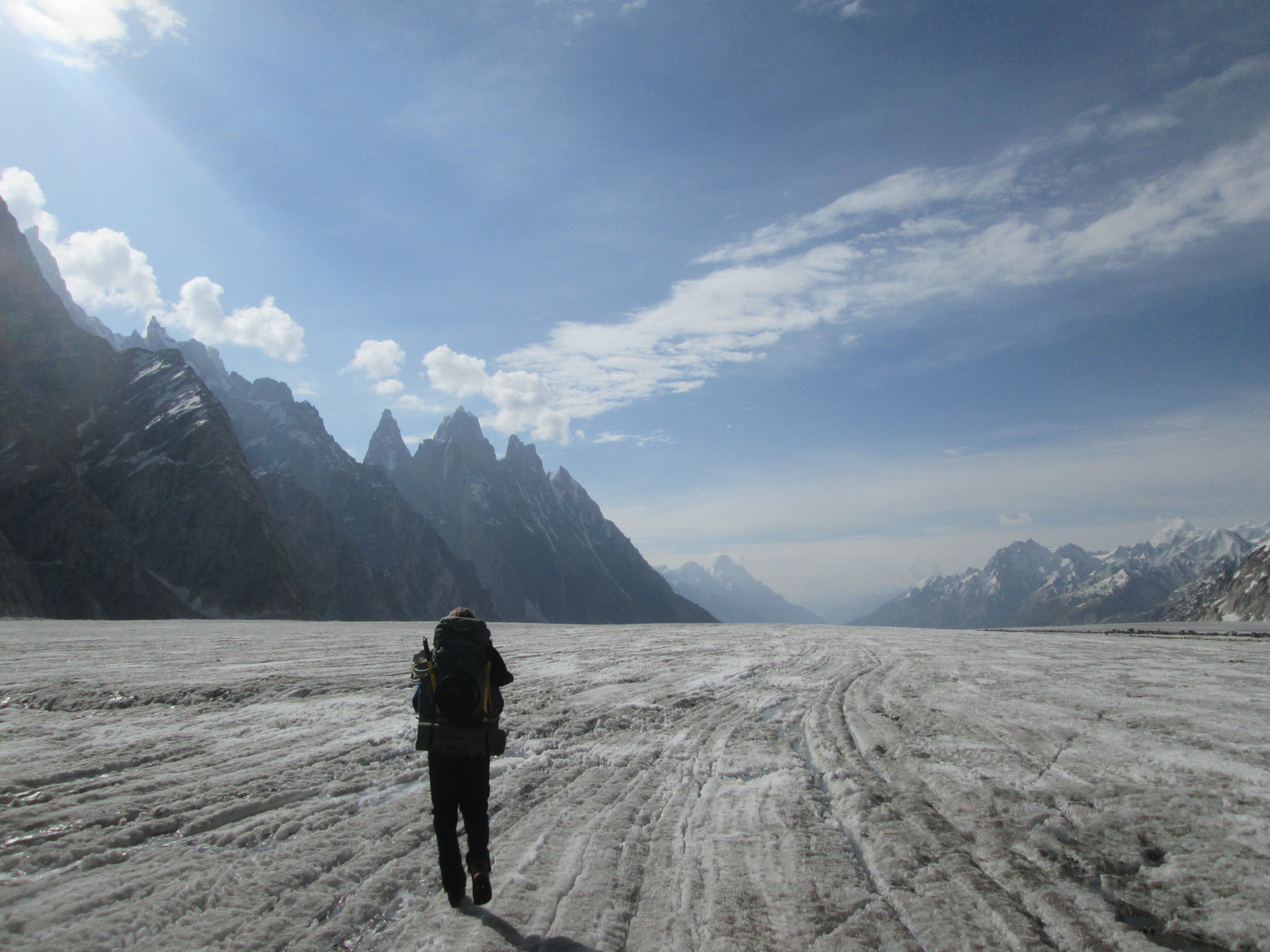
This must be one of the best treks in the world. The roughness is exhilarating, perpendicular cliffs, arid rocks and glaciers without compare. The mountains rising steep up from out the flat endless glaciers are unlike anything I had ever seen.
The trek consists out of roughly two stages. Leaving from the tiny village Simshal the first part took us through an arid canyon to Pamir pass. A broad pass with numerous yaks grazing the summer pastures. The second part is dramatically different. Making our way south we had to climb out of the arid valleys up towards snow lake. In this stage there is nothing but ice and rock. The going is tough but the views over the sharp peaks rising up vertically from the enormous glaciers are unbeatable.
Due to it’s remoteness, only a handfull of people have attempted this pass. I estimate that about 1 or 2 groups a year give this pass a go. Our group was the first to do it alpine style, without the support of any porters.
Packing list
From Pamir pass onwards you are on your own. Few people take this route so you need to be fully self reliant. Full camping equipment and food for about 10 days is a must.
The glaciers around Lupke la are somewhat crevassed from time to time. Roping up is highly recommended. Bring enough rope, harnesses, some carabiners and prusik rope. An ice axe can come in handy, but is not absolutely necessary. Crampons are under normal circumstances not needed.
Bring sunscreen and a hat, in sunny weather the glacier will burn you alive!
Season
The usual trekking season is June to September. July and August are best suited as temperatures peak. June and September can see quite serious snow.
Trekking in winter is almost unheard of. Only very few brave groups have made it to snow lake in winter.
How to get there
Simshal is connected to the Karakoram highway via narrow jeep track. The track starts at Passu. You can reach the vilage in about 6 hours from Gilgit. There is a daily bus between Passu and Simshal as well, so hiring a private vehicle is not necessary.
The trek ends in Askoli. You can reach Skardu by hiring a private vehicle in about 6 hours. The road is in poor condition all the way,
Alternatives
The only other pass crossing from Simshal leads you over the shorter but more technical Khurdopin pass. This trek should offer you a true climbing adventure, but you would miss out on Pamir pass.
Instead of descending via the Biafalo glacier one can also leave snow lake over the Hispar la or chalanging Sokha la.
Day 1
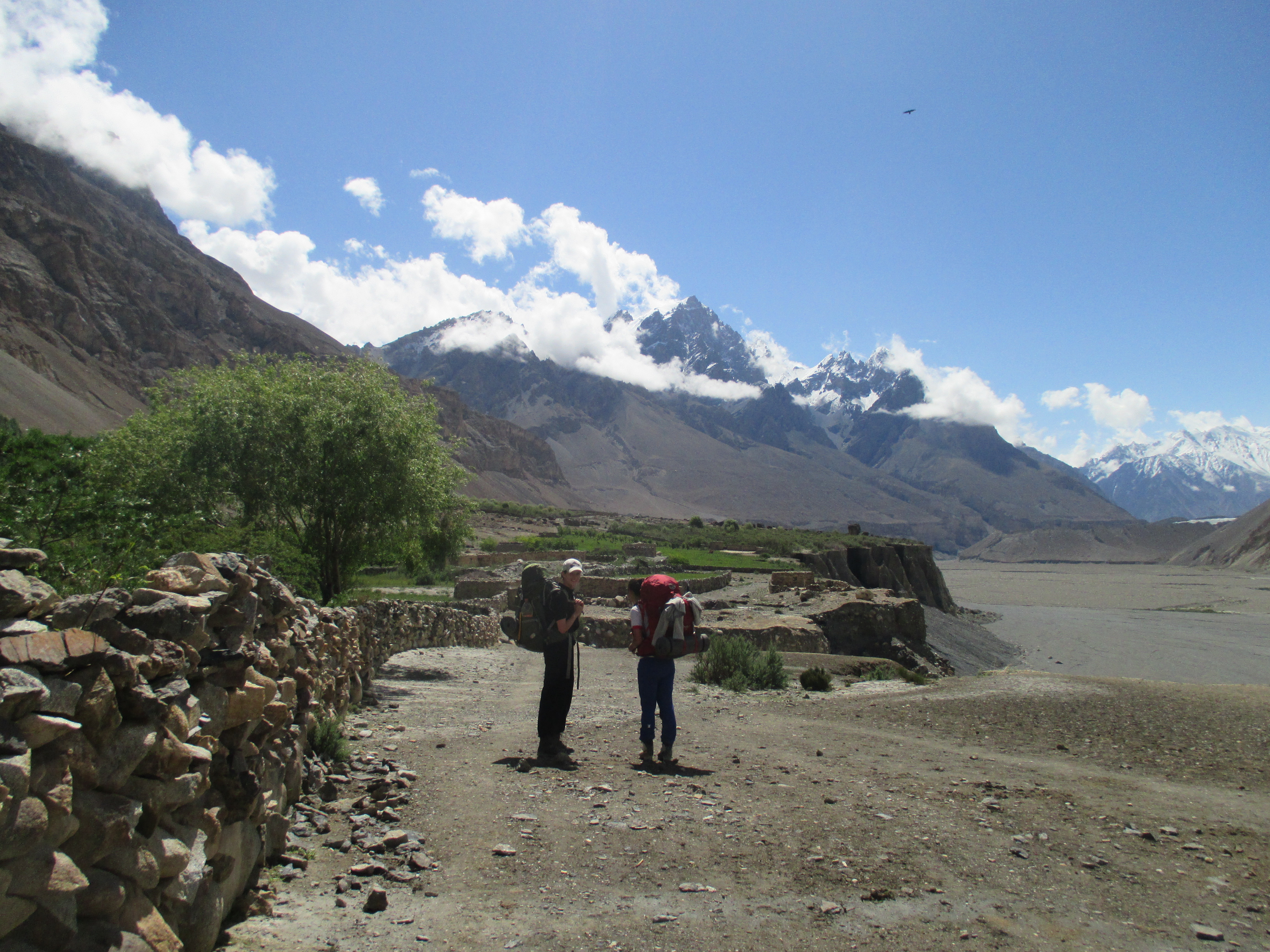
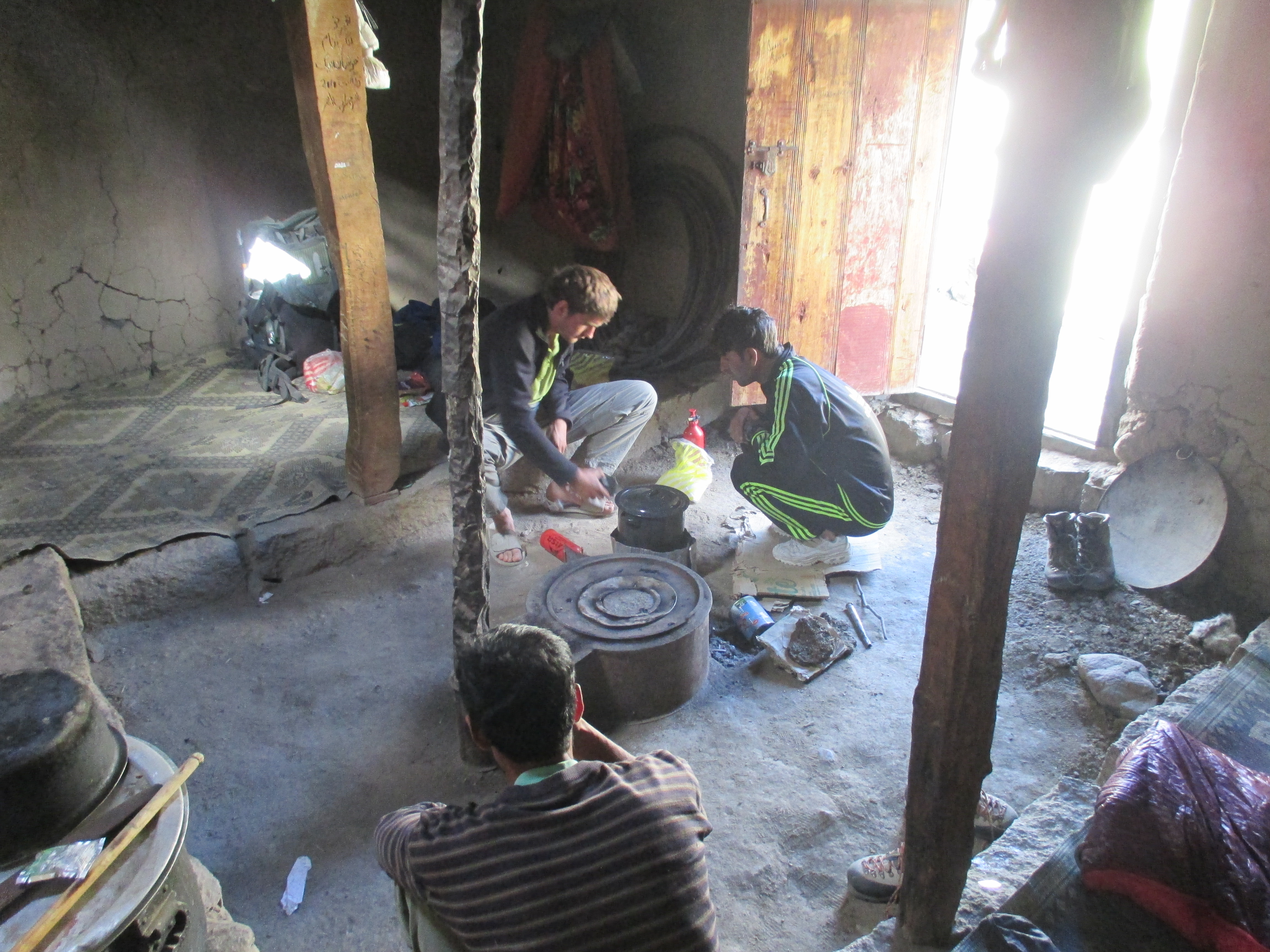
Yesterday we had driven to Simshal from Gilgit. Me, my sister Roos, her friend Jamie and our guide Wahid. The last section over the Simshal valley road had been particularly impressive and maybe a bit dangarous as well. The initial plan had been to start our trek today, but police had come by our guesthouse and complained about our missing permission from the local government in Hunza. This wining over this permit pissed us off a little, after all we already gone through Hunza so it was a little after the fact. The police however refused to let it go and we had to spent the day in Simshal while our agent arranged these dumb permits.
For acclimatization and time passing purposes we hiked a little up valley and walked over the nearby glacier. weather was poor hopefully this would improve somewhat the coming days.
Day 2
We took a good breakfast at our guest house and set out for the first day of trek. We brought one porter named Hassan from the village to escort us to the Braldu river. In case any of us would fall out, he could accompany the person in question back to here. The first part went along the flat valley floor. The intense green cultivated pastures formed beautiful contrast to the barren plains and arid mountains around.
After a while we started climbing up the side valley north of us. First steep up and then keeping altitude in the canyon like valley we entered. The weather was good. Too good actually, we were sweating all over.
Jamie had quite some problems with the altitude this day. A little worrisome as we were only on 3500 meters and would need to ascend all the way till 5700 meters… We split most of her luggage between the rest of us and hoped for the best.
We reached our camp at around 6pm. It was a small gravel area with some bushes next to a stream poring down into the canyon.
Day 3
Our next campsite was only 6 kilometers away, but the canyon got a bit wilder and with our backpacks of over 25kg it would take us 6 hours to reach there.
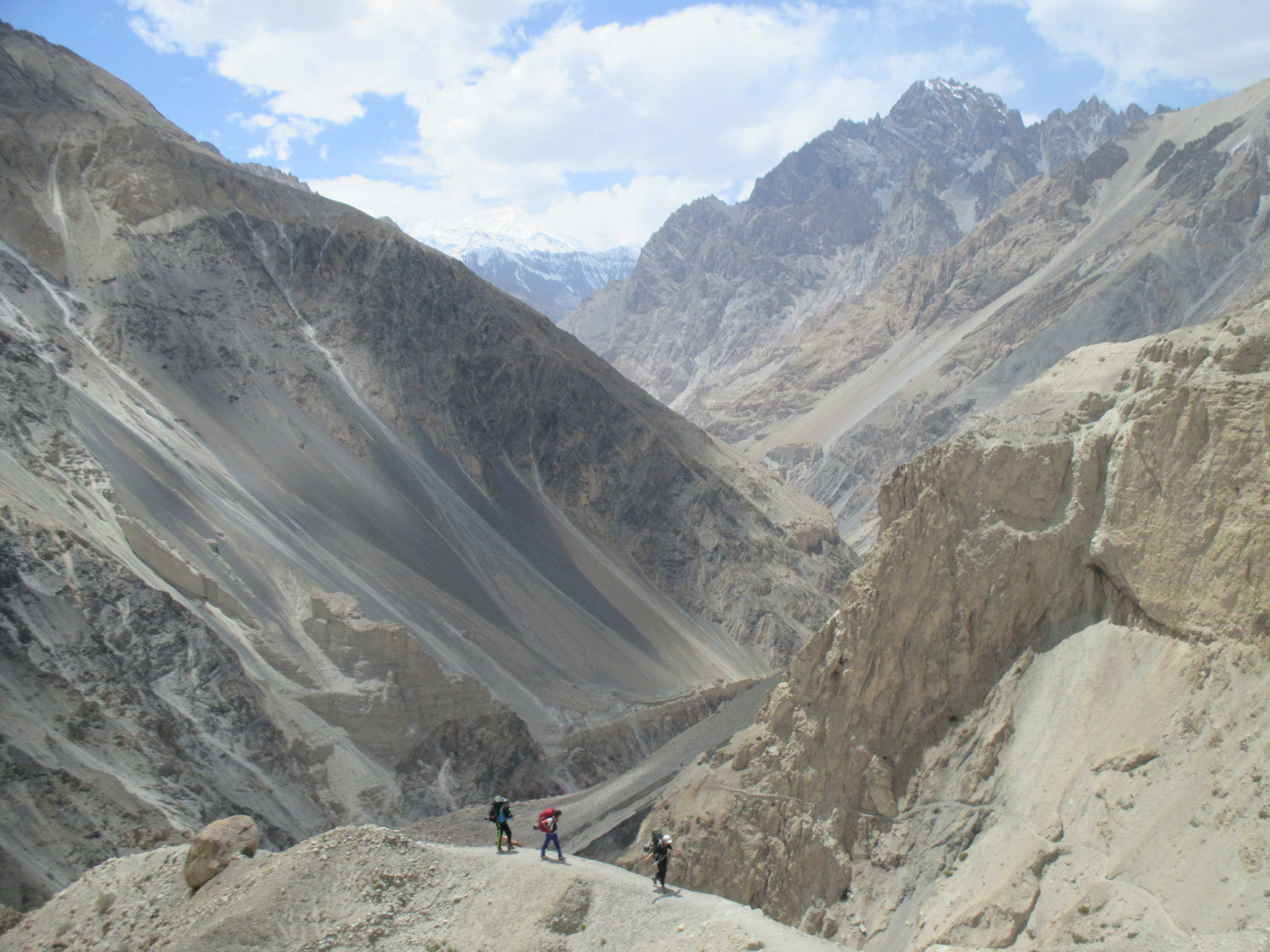
In the first few hours we lost altitude descending to the river in order to cross to the other side. In the second part of the day we started climbing steep up for about 300 meters till we reached a large stone hut.
After the steep ascend the terrain had suddenly flattened out and the hut was situated on a beautiful plateau overlooking the high canyon and the high mountains west of us. Especially in the evening the colors and view were simply amazing.
The only downside of the spot was the lack of water. the pipline that normally provided this place with the necessary water did not function. Our porter Hassan spent 3 hours to find the place the tube was clogged. In the meantime we had no idea what he was actually doing and we were somewhat surprised to see him returning without water after having been gone for all that time. The water through the pipe arrived later than he did so for a moment we thought he had simple gone out to find a water source and came back to tell the location while not having brought any with him.
Day 4
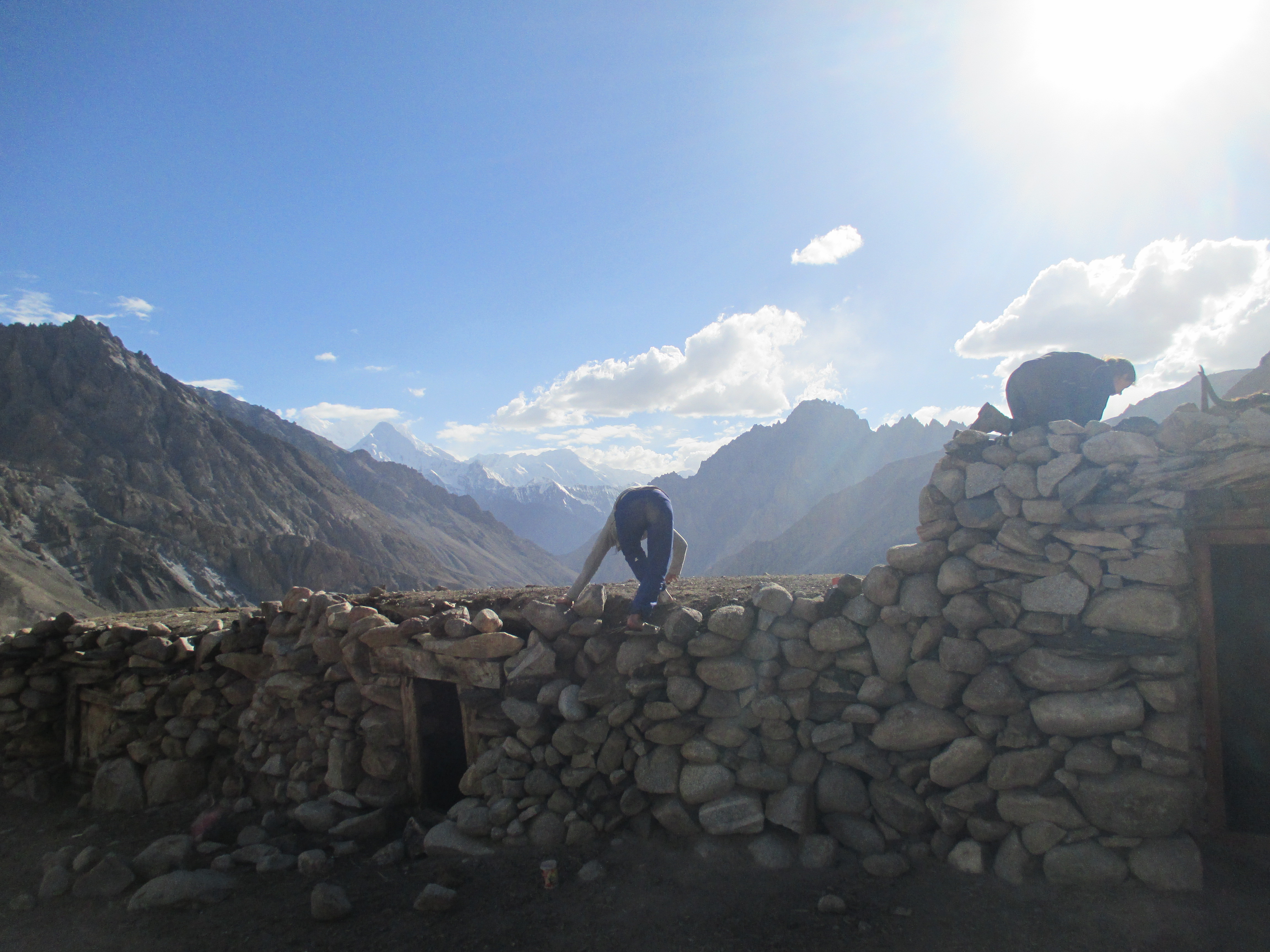
An easy day along the river took us to the base of Pamir pass. Once again we could stay overnight in a large and comfortable hut made by locals who traveled between Simshal and the summer pastures at Pamir.
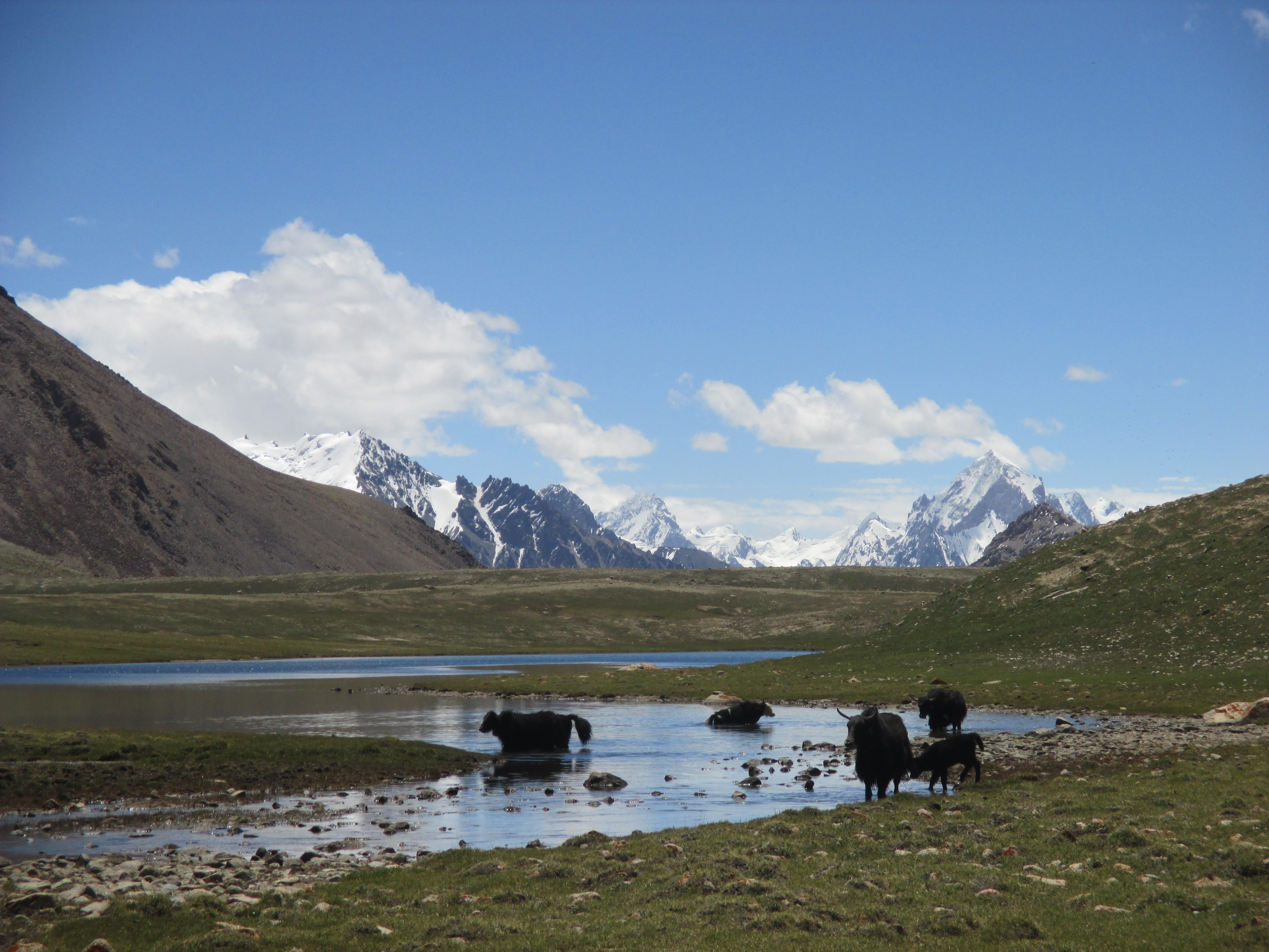
There was not too much to see this day, but the couple of hundred yaks grazing the area around the hut were a nice sight. Jamie seemed to cope with the altitude a bit better today, but it was still very worrisome. To further add to the list of worries Hassan and Whaid started to doubt about the Braldu river we needed to cross. The river was not to be underestimated, we were with too few people and many people in the past had turned their back on it once there. Sigh, why do people round here only start to worry about something is getting physically close.
Day 5
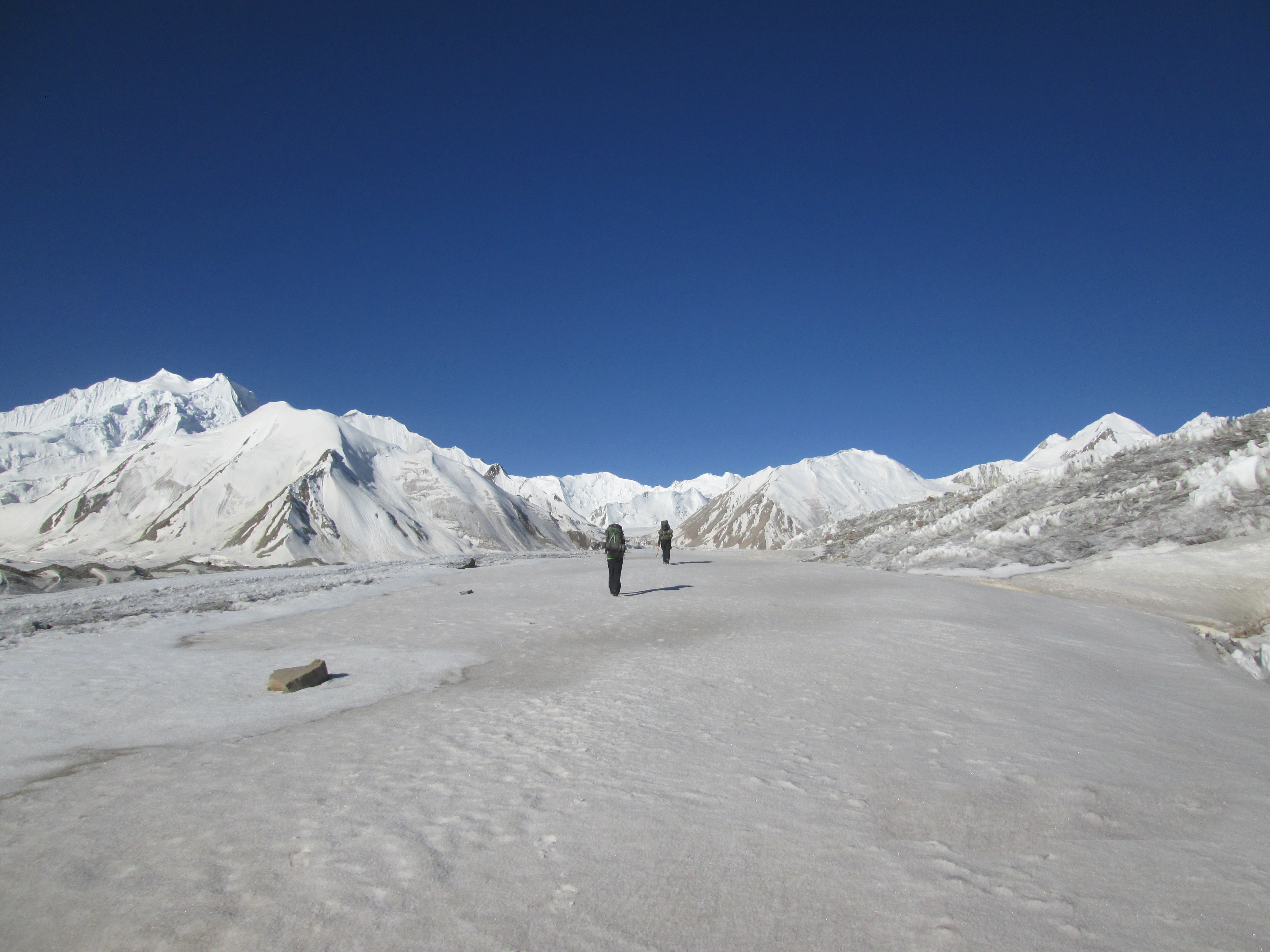
A climb over some moraine filled grassland brought us to Pamir pass. The pass is over 5 kilometers long and about a kilometer wide. Hundreds of yaks greeted us once on top. On both sides of the pass are some impressive rock palisades rising up. We walked over the pass along these rock made monuments towards the small settlement we knew lay on the other side of the pass.
As we went further the view towards the east became visible. High and sharp alpine mountains. Pamir pass surprised me with it’s beauty. I had considered it as just on the way, but it turned out to be a true destination in itself.
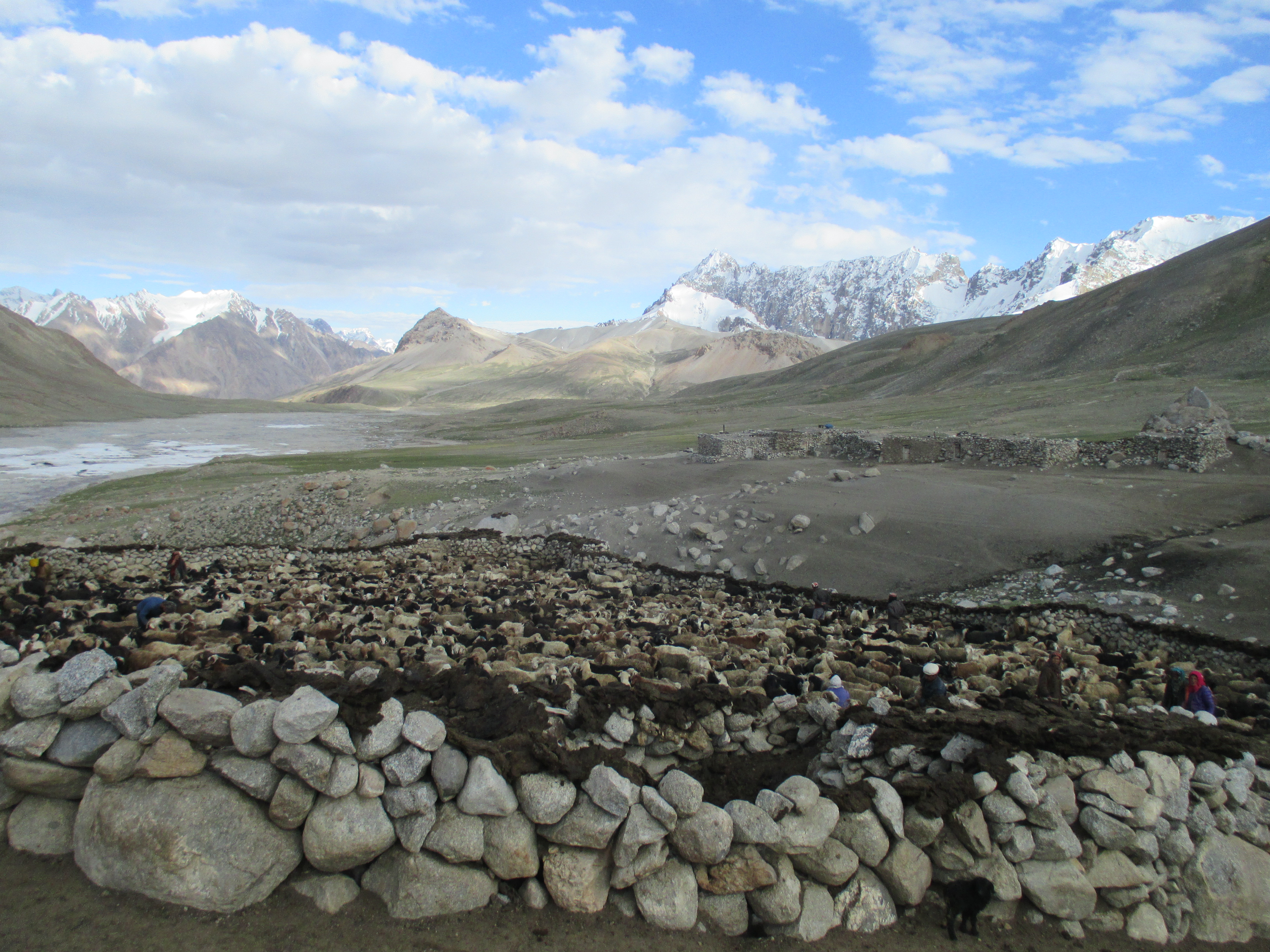
We were greeted by the shepherds. Mostly old people in there seventies spending their old day here. We ate as much yogurt as we could and started to make preparations to cross the river the next day.
Wahid introduced us to an old man who had been on K2 and broad peak several times. He agreed to bring us to the river for a fee, if he could get us across we would pay more. We had a bad feeling about it. The man was old, did not seem quite right. He could just escort us to the river and head back cashing the money without really doing much. Wahid however stood firm that he wanted additional people so we had few choice.
Jamie fell ill in the evening. She had serious altitude sickness. She would return the next day with Hassan. Leaving only 3 of us plus an old man to cross the Braldu.
Day 6
We left at 3 am in order to be down in the river when the melting water was still low. The descent down the Braldu valley was quite far. I was anxious to get to the bank of the river so much depended on. If we could not get across it would mean returning via the same way. We hiked fast and at sunrise the valley floor was already in sight.
The valley was maybe well over a kilometer wide and completely flat and gravel filled. The Braldu meandered through, we could already see the glistering of the water in some places. I was optimistic. There had to be a place where the river would be brought enough to allow a crossing.
Since water levels would rise during the day we were in a hurry. As we came down we immediately set out for the river, which was still quite a walk as it was flowing at the easter most end of the valley.
First we crossed some minor meanders, nothing more than knee deep. The local man followed us till we came to the main stream. The water was rather wild, but if it would remain under the hip it should be crossable. The local man asked for his money. I gave him the agreed upon 6000 rupees, but he wanted the full amount. I disagreed, we were not on the other side of the river and even if we got there he hadn’t helped us. He protested a while but I stood firm. I was sure he had understood the arrangement, but was now acting dumb in the hope that he could claim more. The last thing I could use before crossing a challenging river was a dispute about money.
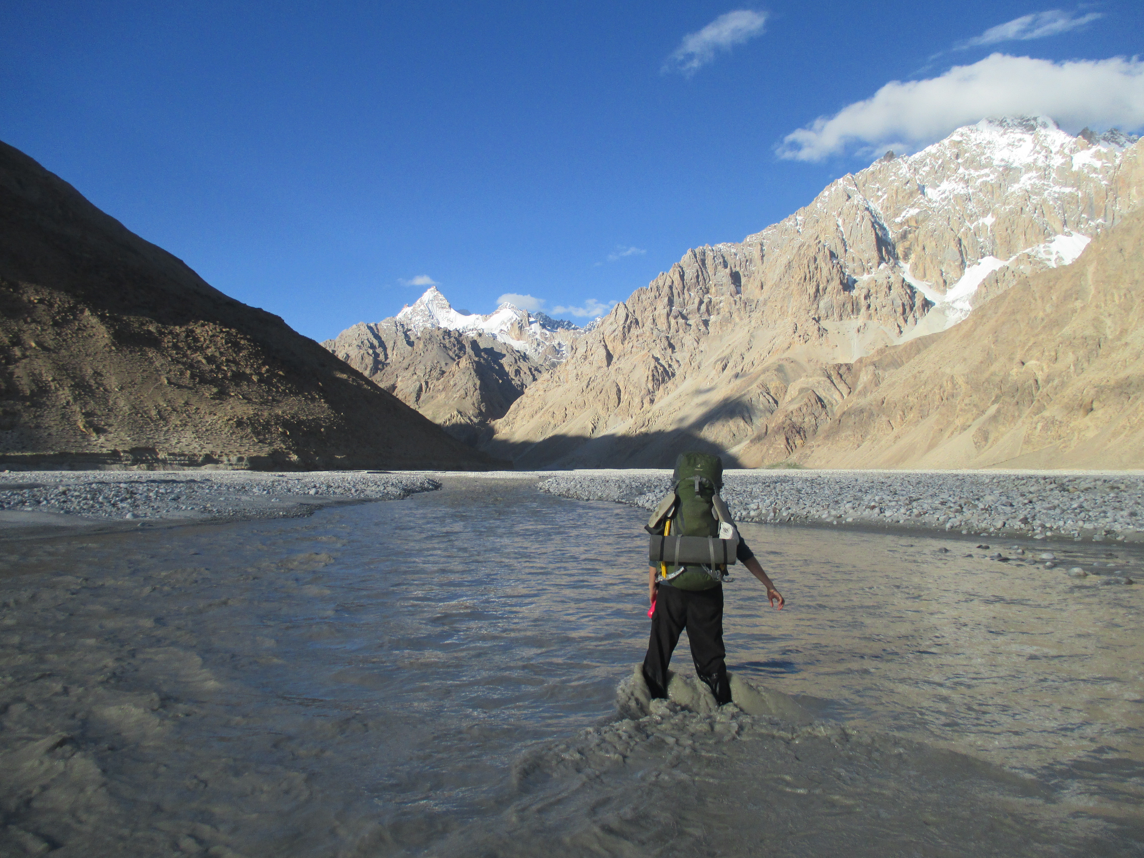
I roped up in order to make the attempt. The first half to the sand bank went smoothly. The second part however was a completely different story. The current was stron and the water came to my belly. I had gone in to deep and could neither continue nor return. I tried to head back but when I rose up my foot the water swept me away. Wahid and Roos could only baraly hold the rope and started to get pulled into the river as well. I was head under water and fighting the current. It was hopeless, I needed to let go of my backpack just in order to survive. Once I had dropped it from my back te current lost some of its power and the others got back control of the rope. I washed ashore completely out of breath. From the corner of my eye I saw my backpack drifting away towards China.
For a minute I was simply glad to be alive and well. After that minute I however slowly started realizing what was in my backpack. Everything from my satellite phone to our tens was in there. I had lost thousands of euros worth of equipment and all gear that we would need during this trek. We started to hike/run down stream, but I had very little hope of finding it back. Wahid was fastest and went ahead. After having hiked about 1 or 2 kilometers I saw him on a sandbank in the river. It was a complete miracle, but he had found my back. I cannot believe how lucky I was. Everything except for my camera was still operational.
We set down in the sun and dried my stuff. After this accident none of us were feeling like giving it another attempt. Disappointed I returned back to Pamir. Many times looking back behind me to see if I could spot a solution.
We decided to try and catch up with Jamie and so continued from Pamir onward to the hut at the base of the pass. We passed a shepherd who asked us why we returned. We told the story and he nodded. We almost continued when he said. ‘and the wire was probably to far as well’ I could almost not believe what he had said. ‘a wire?’ and we are only just now hearing about it? I convinced the others to head back the next day in order to find the wire. Wahid and my sister ware not feeling much for it, but they agreed to come along for me. We returned to Pamir to give it another try the next day. The Sheppard joined us to help finding this now legendary wire.
Day 7
We left Pamir late in the morning, no need for rush now we could simply cross using a wire after all. We took the same way down to the Braldu river. This time we made less haste and it took us way longer to get down there. It was extremely hot in the valley. As we made our way downstream towards the Chinese border the temperature, soil and vegetation made us feel like we were walking in the desert.
After having hiked about an hour downstream we came to a place where the river looked very crossable. The river splited up in about 5 streams and was well over 500 meters wide. I still felt more for hike to the wire, yesterday was still fresh in my mind. The local Shepherd and Wahid however really felt like giving it a try and I was persuaded. The streams on this side would be the major ones the shepherd assured me.
We crossed with three people at once giving us more weight and feet. This meant that this time we only used the rope for safety in case we would get washed away, not to hang in to. The first 4 streams were easy. Nothing more then knee deep. The last one was however more serious. I was doubting whether it was worth the risk, the wire was only 2 hours more. Wahid was however optimistic. We crossed the broadest section of the stream. The water came till just under our hips, but the current was soft. we made it to the other side. The shepherd who had been holding the rope on the other side returned. We were all happy to have made it safe to the other side. Who would have thought this yesterday.
We hiked up the other side of the river for about 3 more hours. Some sections were quite difficult as the river pressed us all the way out of the valleys onto the neighboring cliffs, but nothing that we could not manage.
Day 8
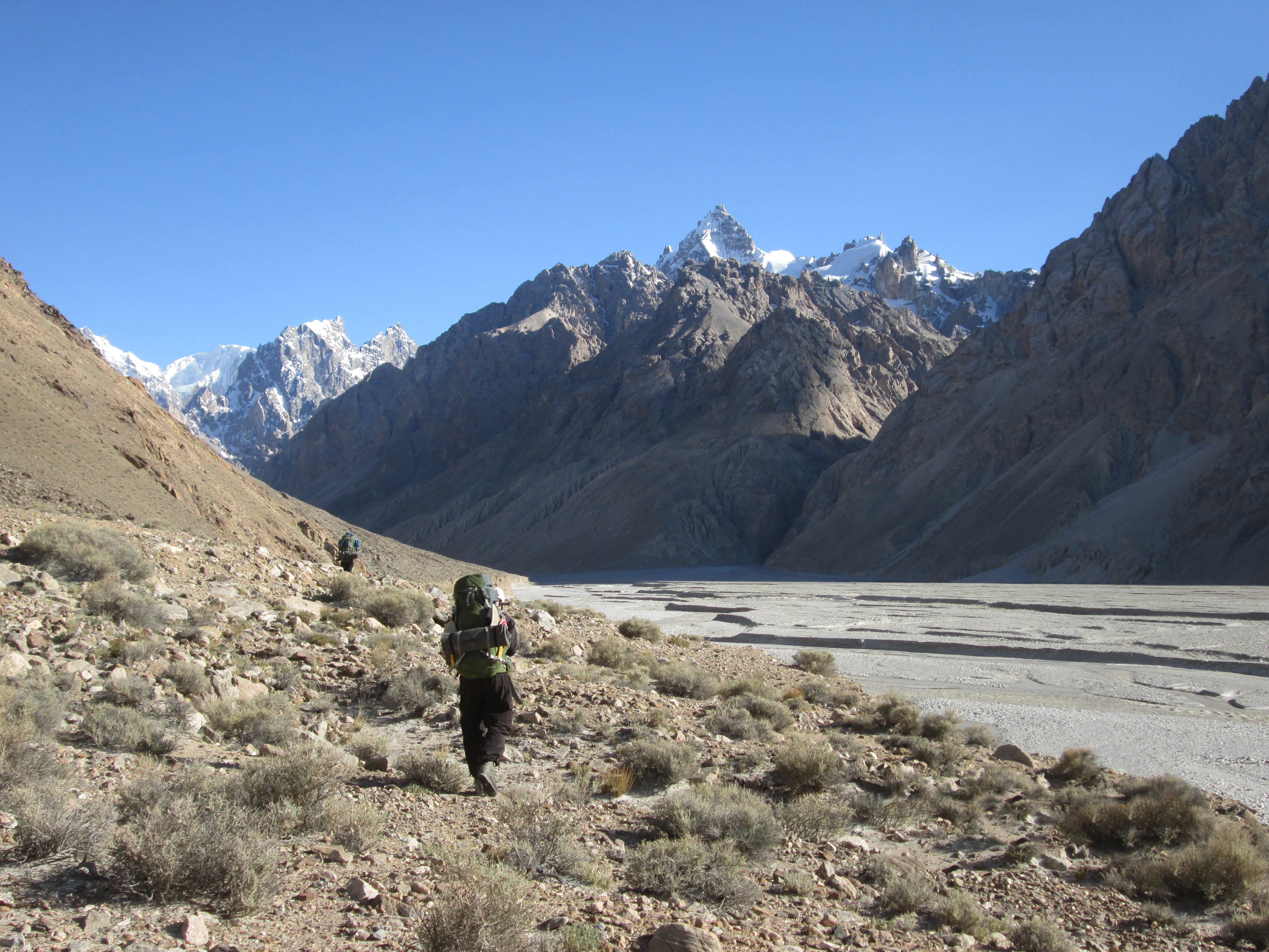
Shit, I had gotten ill during the night. Bad moment for that to happen. The weather was perfect and I had rather pushed over Lupke la as soon as I could. I felt terrible. I moved incredibly slow due to my fever. The extremely hot temperature and my diarrhea quickly made me feel completely dehydrated. Unfortunetely there was nothing to drink except for the dirty river water of the Braldu itself.
We only hiked 6 kilometers over flat terrain before we pitched the tent right before the start of the Braldu glacier. I collapsed on my matras. Roos made me some bouillon in order to keep me hydrated and I just lay in the tent hoping that the antibiotics would cure whatever this was soon.
Day 9
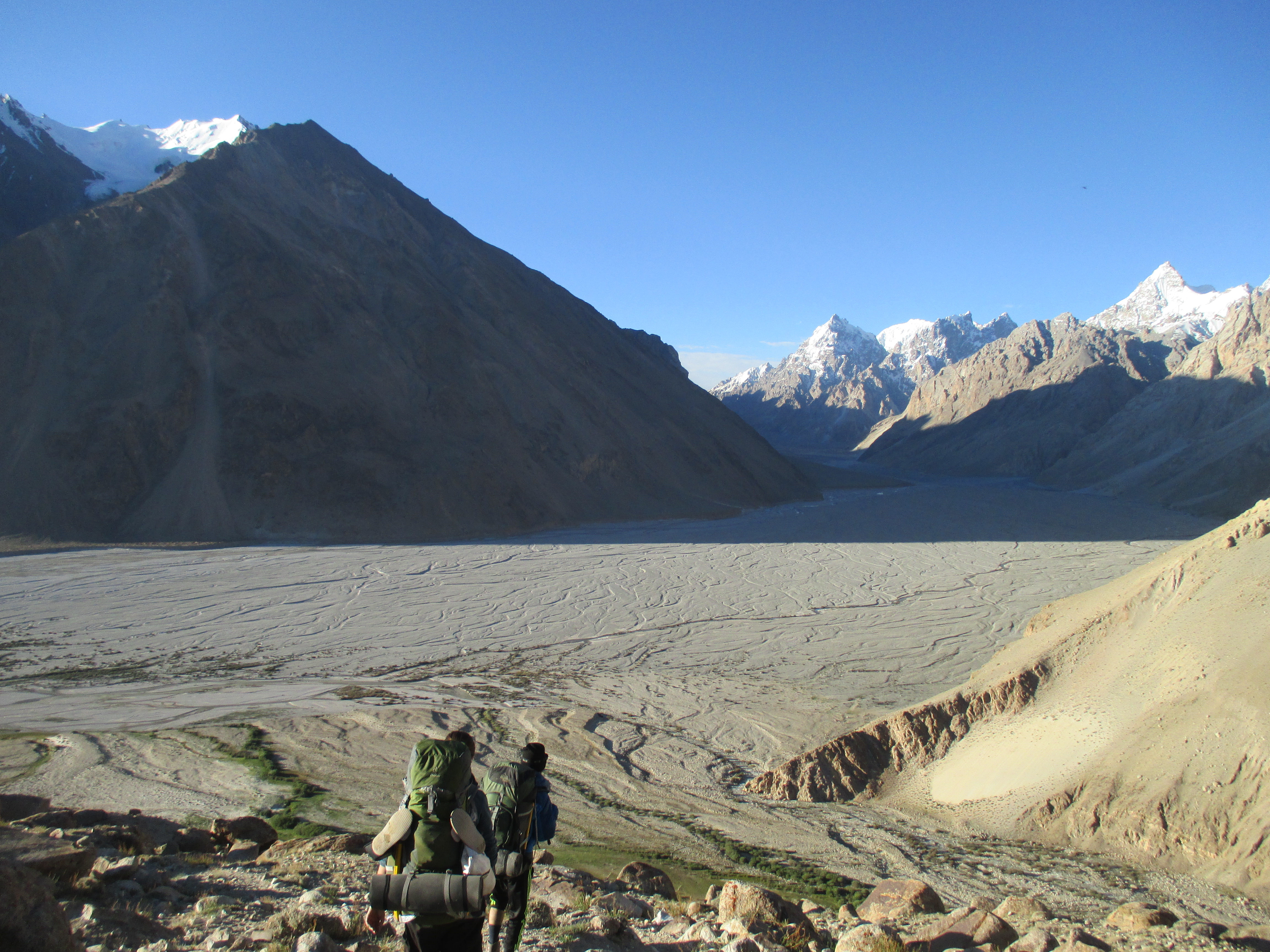
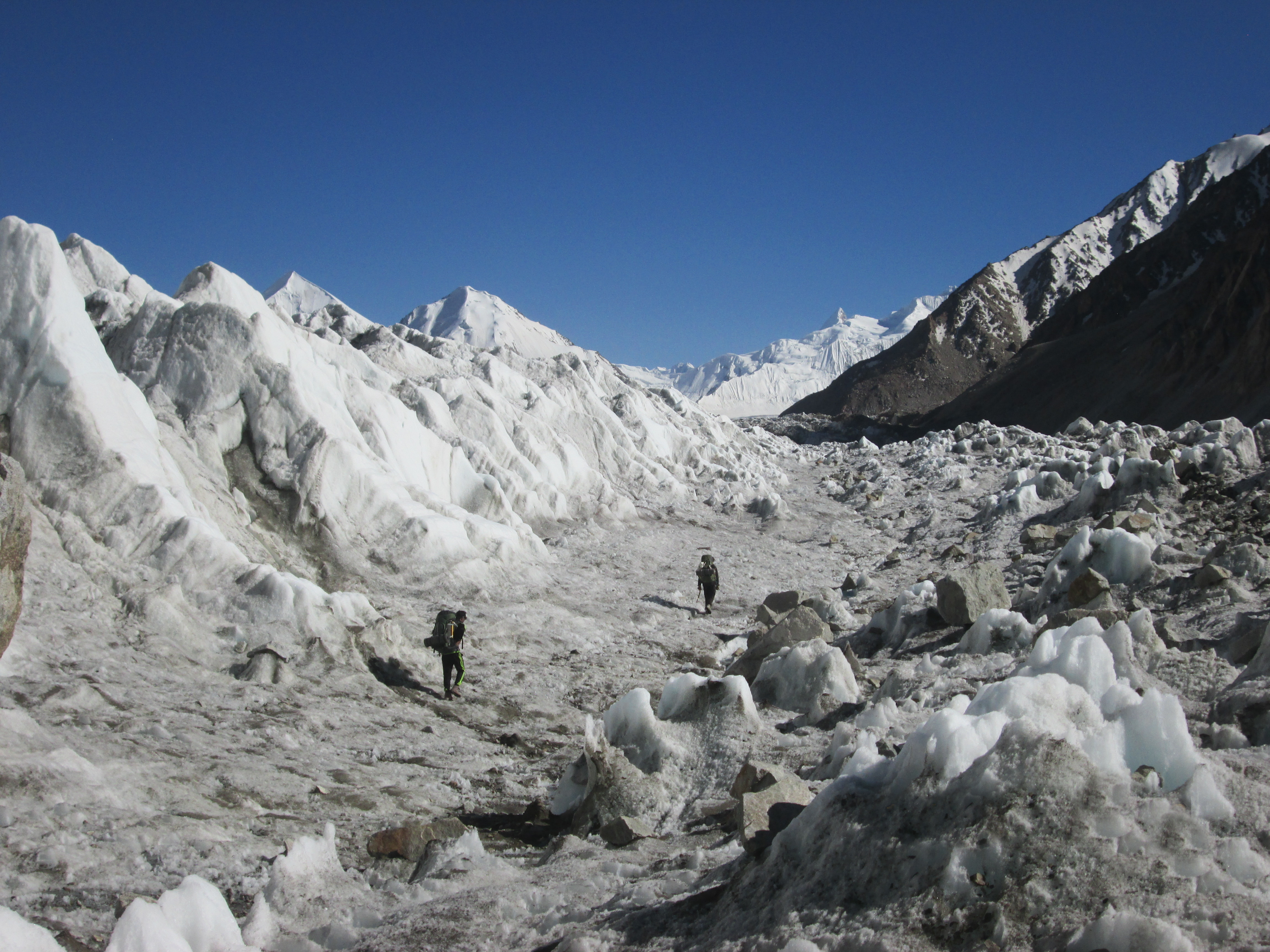
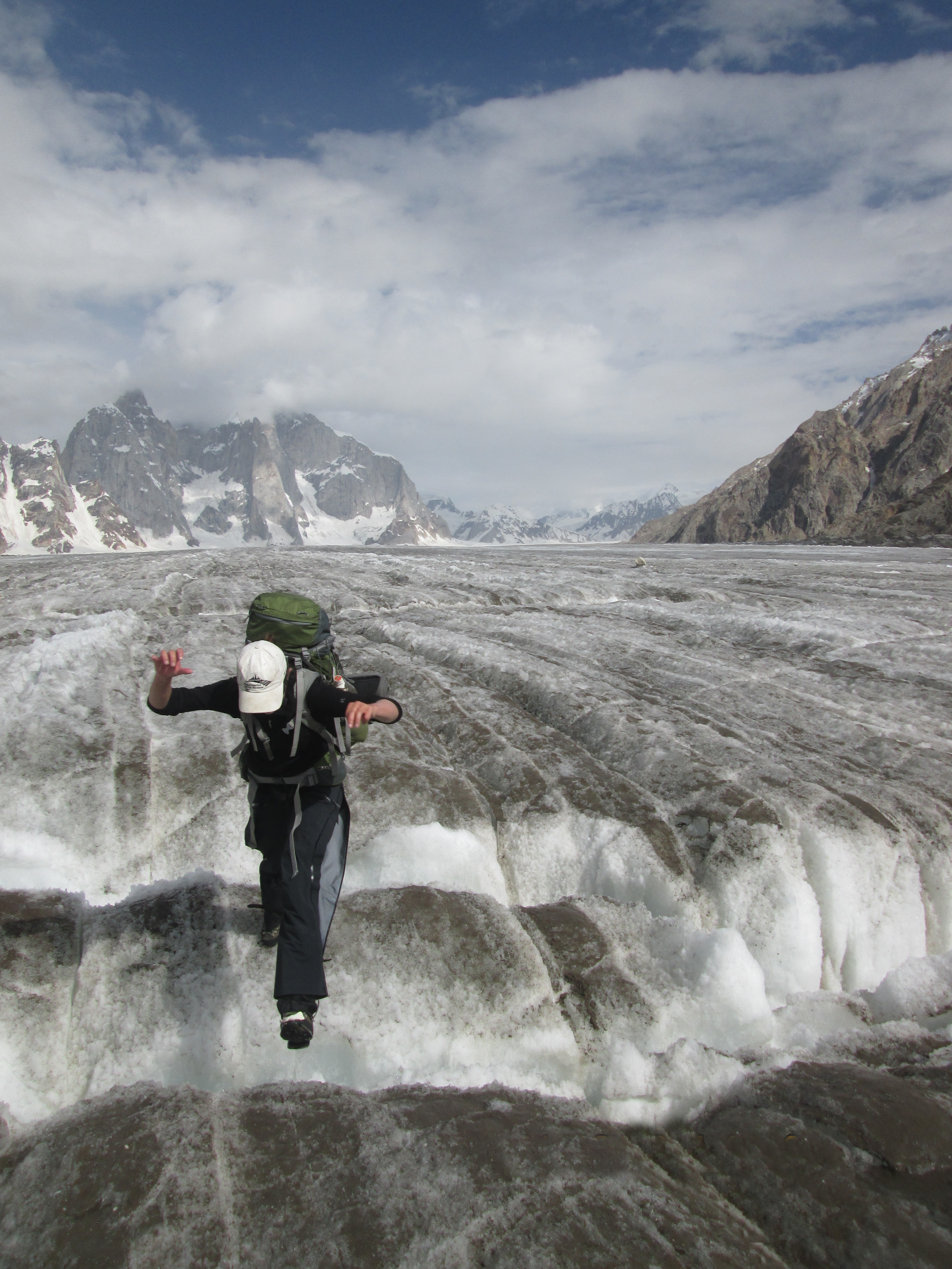
I still had a small fever, but the diarrhea was gone and I felt a lot better. We climbed up the moraine filled glacier. It was nice to finally see the roaring Braldu river disappear under the ice.

The boulders on the glacier were extremely unstable. This combined with the endless ups and downs made up for some very unpleasantness walking. We barely seemed to make any progress at all. Today we again had to stop early due to my poor health.
Day 10
In the morning my fever had almost completely gone so we could at last make a long day. Our goal was to get as near to Lupke la as possible so that we could cross tomorrow. The weather was still amazing, but my mother told via our satellite phone clouds and rain would roll in about three or four days.
Yesterday the boulders had annoyed us, but today was downright torture. The glacer kept going steep up and down nothing, truly nothing lay stable. We all fell a couple of times and especially my sister was getting in a bad mood.
After a while the glacier turned more white and the hiking got flatter. We at last arrived in the upper reaches of the Braldu valley. We had only covered 5 kilometers in about 7 hours thus far, but now we could hike another 10 in the last 2 hours of the day.
We pitched our tent on a gravel filled hill on the glacier an enjoyed our amazing view over the upper part of the glacier. The glacier had turned completely white and the mountains south of us rising up from it were simply stunning.
Lupke la was another 13 kilometers away, quite far. I wondered whether we could make it tomorrow. If the way would be like the last hour of today it should be no problem.
Day 11
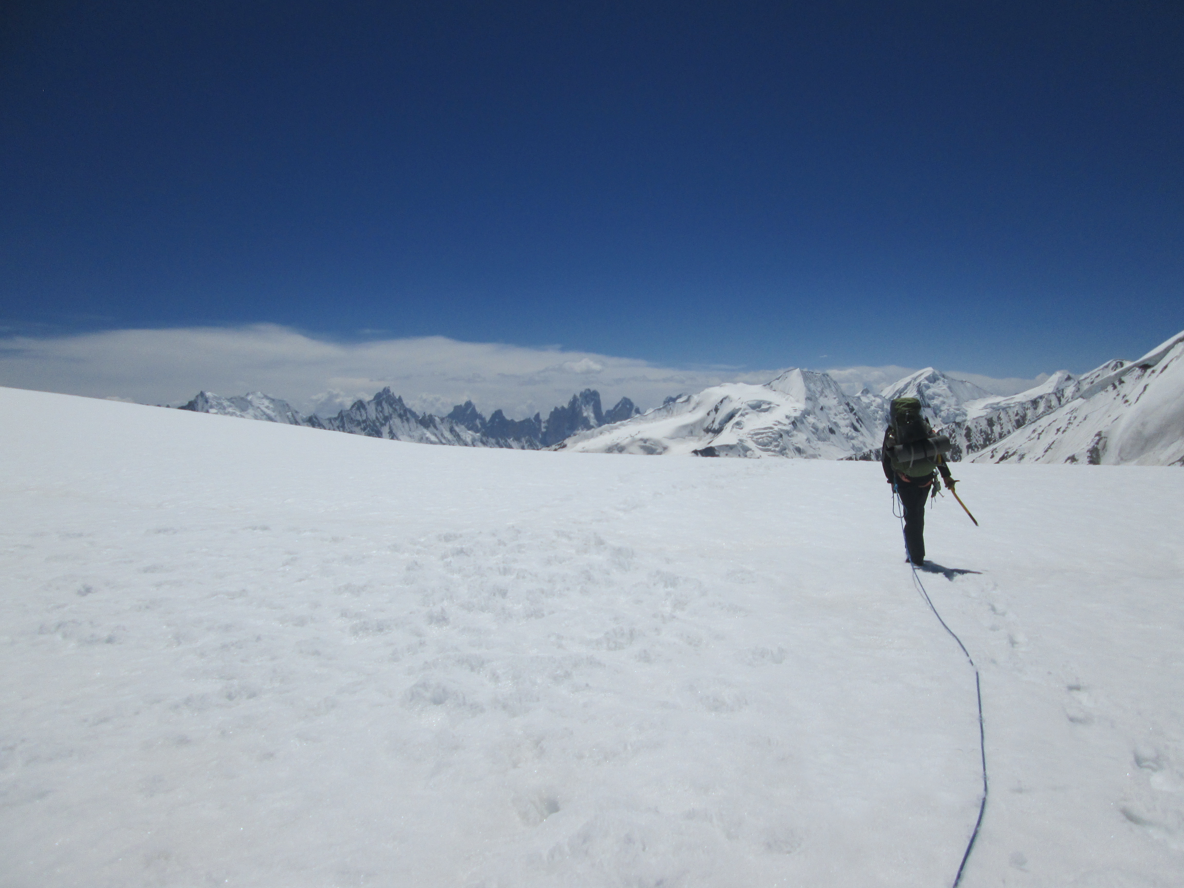
The weather was near perfect when we rose at around 5. We quickly packed up our tent and started hiking south. We could not yet see the pass so we just had my gps and Wahid’s fuzzy memory to lead the way. The first part went over flat pistrine glacier and we could hike 5 kilometers an hour straight ahead. A rarity in the mountains.
The pass kept out of sight, just behind the mountain right south of us if I read the map correctly. We had to pass the mountain south of us on the eastern side, gradually ascending the glacier till Lupke la.
It was an easy climb. It was however high and I still felt I had recently been ill. At the start we had gone with an impressive speed by any standards, but in the final stage of the climb I could just make one step every three seconds. I arrived on the pass completely exhausted. Roos on the other hand got there as if it were nothing.
Looking north and south, Lupke la feels extremely high. Most mountains have a very comparable height. South of us we could already see the sharp mountains that I knew bordered snow lake.
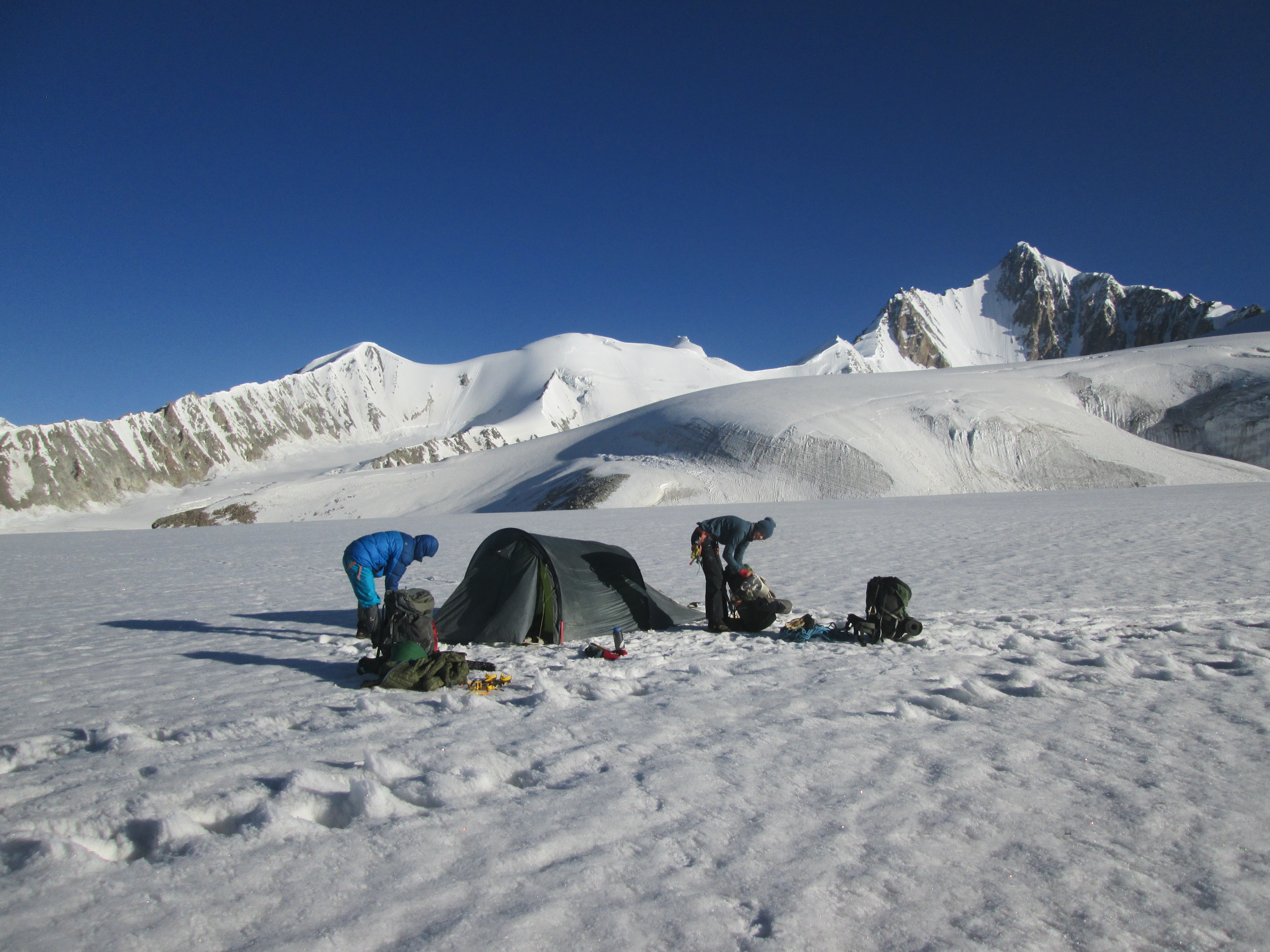
The descent was a lot steeper, but went over soft snow and did not provide any challenge. It was now 3 pm and the snow was melting. Our feet landed deep in the snow each step and once in a while somebody fell through till the hips. It was getting annoying and we decided to camp. Tomorrow when things would freeze over again we could
Day 12
We woke at first light in order to take full advantage of the hard snow. It had been cold that night. We slept on the ice at 5300 meters on a pretty thing matras. Our shoes were completely frozen and it took us about 40 minutes to melt them a litte and put them on.
With everything frozen over the going was very easy. We quickly hiked down the glacier towards snow lake. The glacier seemed endless the sharp mountains in the distance indicating snow lake was only very slowly creeping closer.
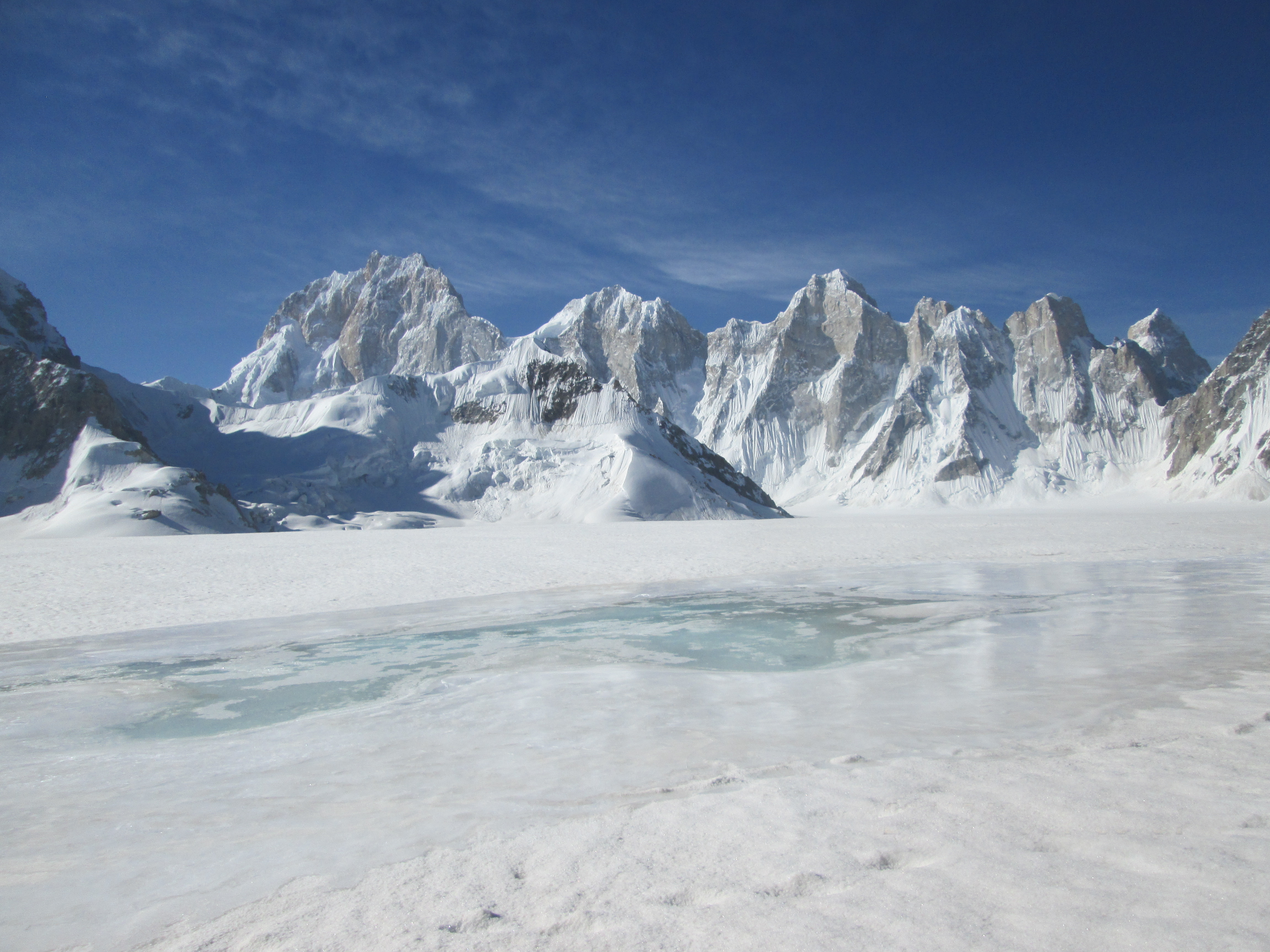
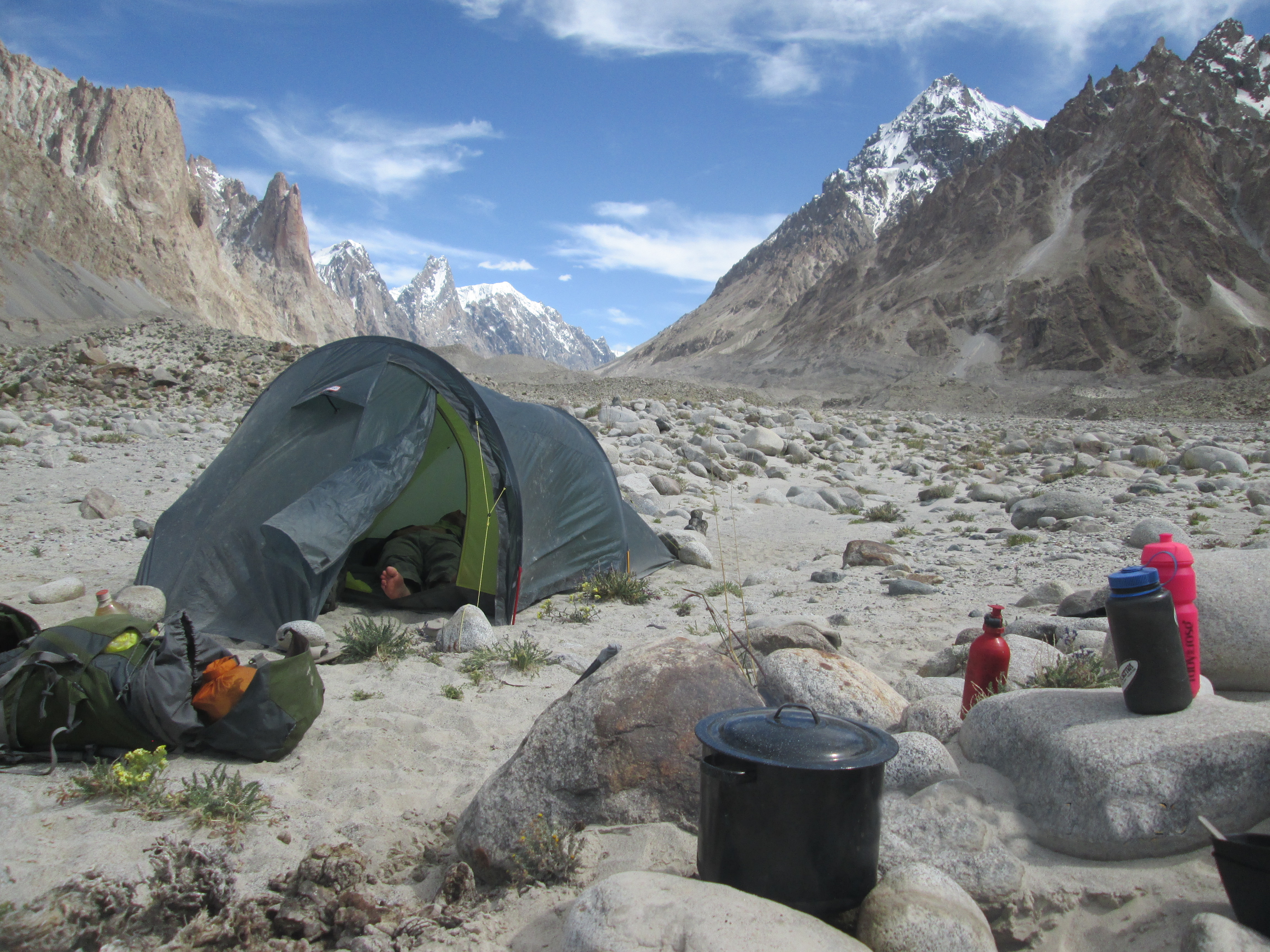
At around 10:30 we arrived at snow lake. As we had ample of time left we decided to pitch our tent here and spent another night on the ice enjoying the view. I was also happy with a short day. Yesterday had been a bit too long for me and I still felt it.
The rest of the day we leisured and took photos of this beautiful place.
Day 13
In the morning I doubted whether maybe I wanted to cross the Sokha la and return via there. But once we got eye on the broad Biafalo glacier we decided to descend this impressive runway of a glacier.
In the distance we could already see the first green patches on the mountain sides. It was a beautiful morning. The Biafalo has many small horizontal crevices. I think we may have jumped 200 of them.
During the afternoon the weather clouded up masking the pointy mountains from view for a moment. We caught the first rain of the trek, luckily we were on the way down. Due to the poor meteo I was glad when I guide indicated that there was a nice camping spot just of the glacier.
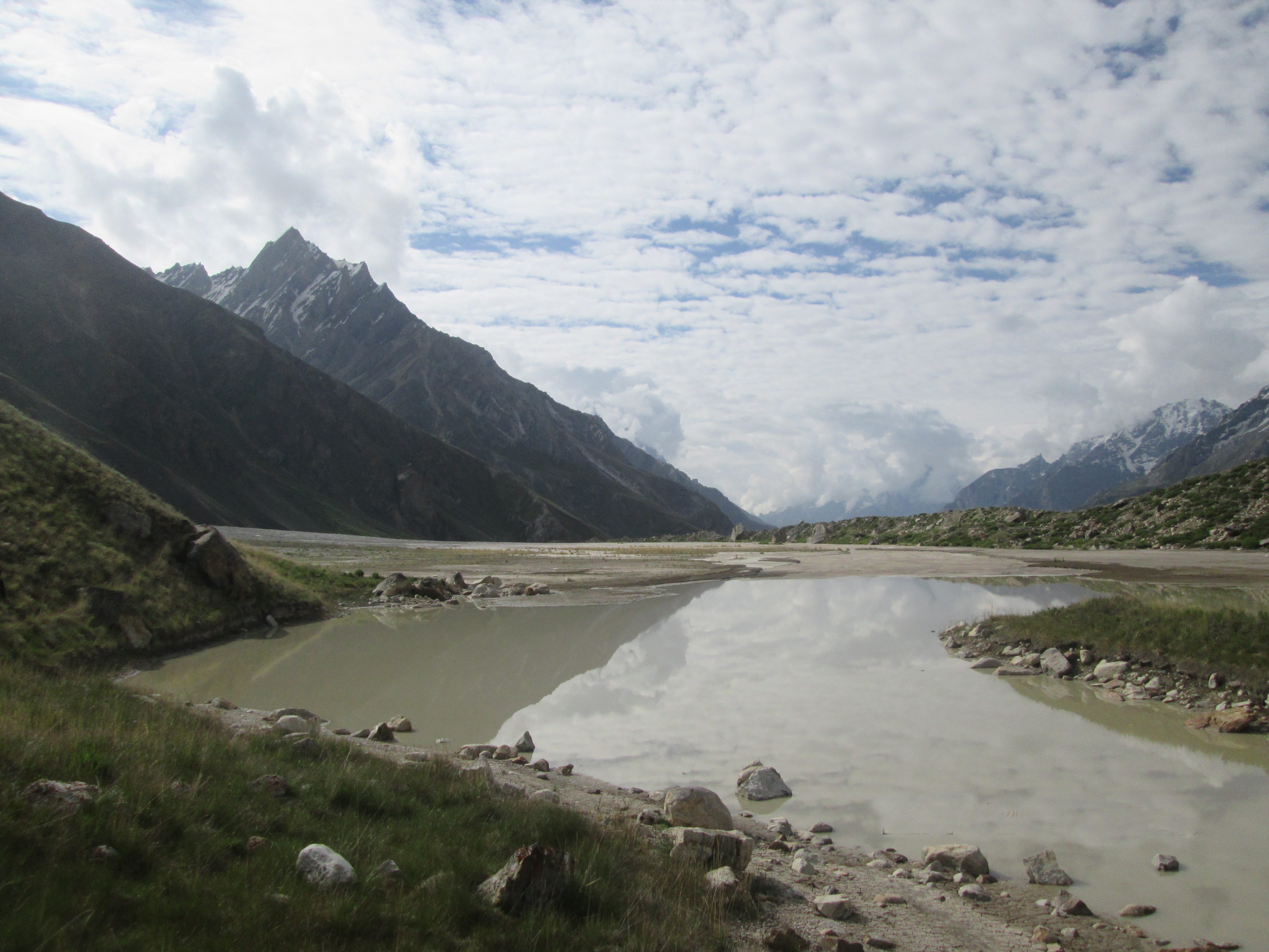
We climbed the moraine walls to get off the glacier and came to a small pistrine meadow, by a lake, surrounded by some small bushes. It was a little surreal to suddenly be in this oasis after desolated rock and ice that had dominated the last few days.
There was a small group of Pakistani camping here. They were on their way to Snow lake. We arrived early and had a lot of time to get to know them. They generously shared their food and we preformed some song to one another during the evening.
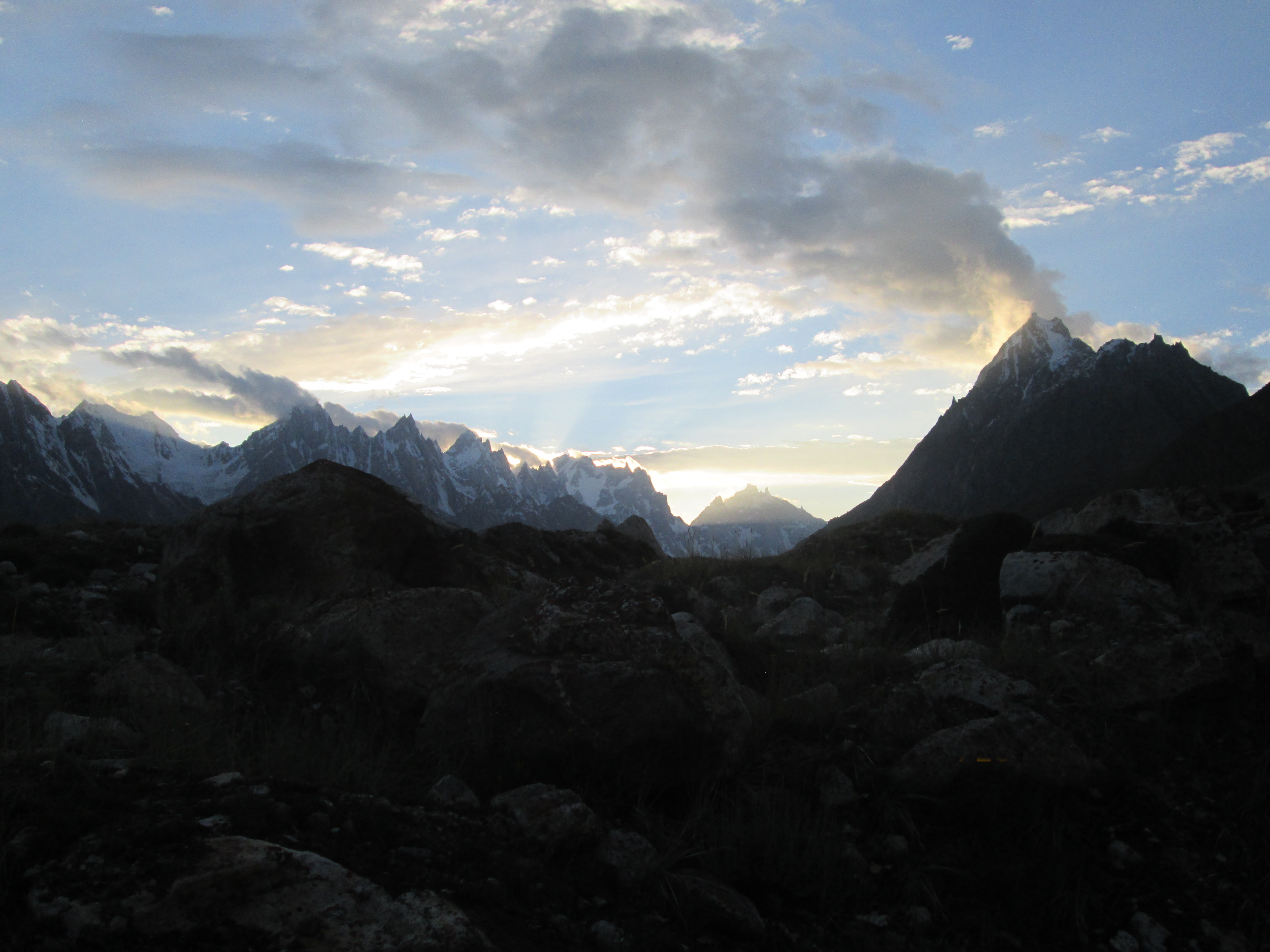
In the evening the weather started to clear up granting us a last view over the pointy peaks dominating the sides of Biafalo.
Day 14
Askoli was very far, but we wanted to reach it today. We simply wanted to have some decently cooked food for a change and the road ahead did not seem too difficult. The first hour we could follow a small trail along the glacer after that we had to find our way over the glacier as usual.
The glacier got more and more filled with moraines and the weather deteriorated. Naturally our moods went down as well. I was happy Askoli was within our reach, I could really use a coke by now.
The slippery moraines seemed endless. The lack of view added to the feeling that this would probably never end. Lucky for us it did. At around 4pm we were off the glacier.
We took a little rest and drunk some. We had gotten really thirsty, the last section of the Biafalo has barely any drinkable water. We reached Askoli after dark. We fell down in a restaurant emptied two bottles of coke and ate as much chicken curry as we possibly could.
There was a large but dirty hotel in town where we would rest for a day before continuing to K2 and the Gondogoro la. This also gave us some time to enjoy the village and the hotel’s garden (the redeeming factor of the hotel). On top of that a washing day was very much wanted for.
