

December 2014
Shyupra besi – Kanjingompa – Tserko Ri – Shyupra besi
My shortest trek ever. In a mere 3 days in the Langtang valley. I hiked up the Yala peak from Shupra Besi and back.
After my failed attempted to cross Selele and reach the Kanchenjunga base camp in late December the week before I chose this trek as my fall back plan. To be absolutely honest Langtang is not worth calling much more than a ‘fall back plan’ either. It is a pleasant national park, no question, but it vastness, remoteness and splendor it just lacks, when compared to other places.
Langtang is located right north of Kathmandu. In clear weather you can even see these mountain when you are north of Thamel. The valley is rather narrow. The lower parts are covered in dense bamboo and Rhododendron forests, in its upper reaches there are a couple of large glaciers and a few 6000 meter peaks. There are quite a few passes crossing into the valley ranging in difficulty from ‘wheel chair accessible’ to technical. Unfortunately neither of these passes were feasible after the amount of snow that had been fallen.

Season
The Langtang valley is accessible year round. Under normal circumstances the same goes for the route over Gosaikunda. Due to the excellent lodges even the most fierce weather conditions can be coped with. October is rather busy and can better be avoided. Monsoons forms a nice month for people wanting to dodge the crowds an willing to deal with clouded weather. Winter is for them other crowd shied people who rather face cold than clouds.
How to get there
There are daily buses heading from Kathmandu to Shupra Besi and back. Most of them leave at around 7 to 10 am. The buses leaving Kathmandu do, for whatever reason, not depart from the main bus station, but instead from a smaller bus top north of Thamel.
The distance is quite short but it takes 5 to 6 hours to reach Shupra Besi. This is in part due to the poor road, but the 10.000 checkpoints in which every tourist constantly needs to register does not help either.
You will need to show your TIMS an pasport time and again. Tot he police, army, armed police and what not. They also love to receive copies of your passport, but if you don’t have them it does not seem to be much of a problem.
Packing list
Unless you have set your mind on crossing either the Tilmann or Ganja la this is one of those treks you could do in you underwear. You really barely need anything. Even a sleeping back is not required. Take a lot of money as prices are a bit steep.
Day 1
After a way longer bus drive than I had anticipated I arrived in Shupra. After having queued in countless checkpoints I was glad to be on my feet and on my way. Shupra is quite a large town, with Shupra Besi 500 meters east at the river as a small outskirt.
I looked around to find the start of the Langtang valley. Right east of town I saw a small side valley starting. That should be it. Funny how insignificant the valley head seemed. Nothing signaled the impressive upper reaches of this famous valley.
As I rebooked my ticket in order to leave earlier after my failed attempt to reach the Kanchenjunga base camp I was rather short on time. I had only 4 days so I had to make some haste. And making haste I did, I hiked till passed nightfall and stayed overnight in some unofficial teahouse with some local folk.
Day 2
To keep my schedule I had to make it to Kyangin today. Quite a day as most people I passed planned to hike there in three days time. I hiked without stopping and three days quickly became two. When people started to say one I finally started to get close.
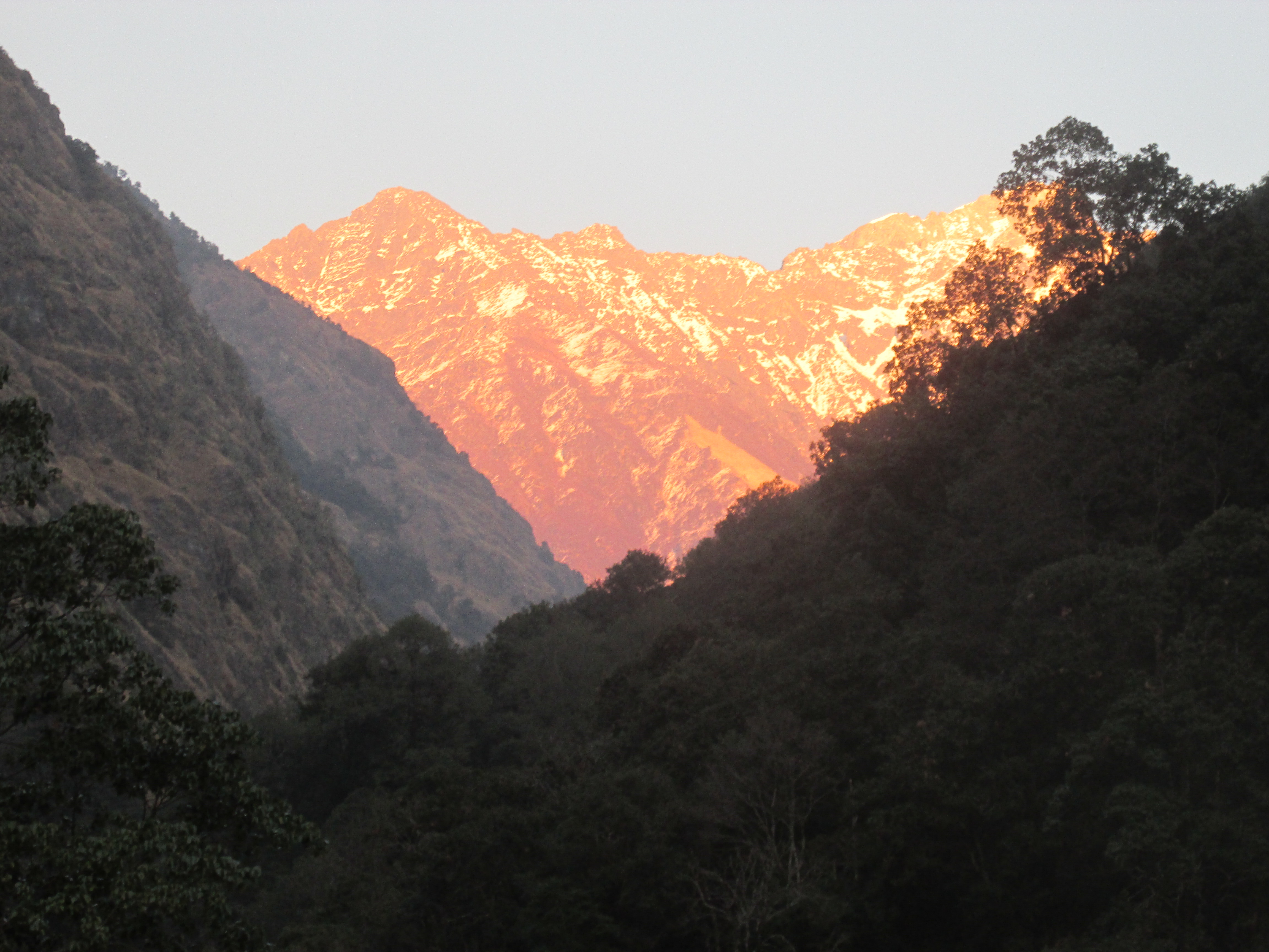
The hike over the broad trail over the forested valley floor was not too interesting. Only at the tree line at around Langtang village the landscape started to get more impressive. Mount Lirung, rising up right behind the village was the eye catcher.

From on Langtang things went fast, no more ups and down, simply a straight beeline to Kyangin. In the distance I caught the first glimpse of my objective: Tserko Ri. It was completely covered in snow, that would become a pickle tomorrow.
In the last kilometers I met a communicative older lady who quickly persuaded me to stay in her lodge tonight. I tried to tell her something about my trek around Kanchenjunga in the weeks before, but it got confusing due to the resemblance of the words Kanchenjunga and Kyangin gompa.

The lady told me that climbing Tserko Ri under the current conditions was quite a chalange, but that a person who could make it up here in one day should be able to do it. I decided to give it a try. I came so far…
Day 3
I stuffed a few chiapatis and an egg down my throat and left at first light. The top seemed very close, but the snow was hip high up there. This could get harder than it seemed.
At first I could follow a trail, but that quickly vanished under an increasingly large layer of snow. At 4600 meters it was just a matter of climbing in the direction of the top and hoping for the best.
At 4800 meters, right under the top the snow started to flow in my shoes and my hands were getting cold due to contact with snow and ice. I ignored it as I was way to buzzy trying to find an efficient way to the top and fighting the deep snow. The view started to get pretty awesome. From this point onwards I could wee many peaks to the east, south and west.

When I stood right under the top the snow levels simply became to much. I needed to climb 30 degree slopes while being in the snow up to my waist. Do not ask me how but I somehow fought my way up to the top. Once on top I quickly ate one of my boiled eggs before I returning again. The sun was shining bright, but the wind chill was fierce.
On my way down I started to realize how cold my fingers and feet were. I quickly put on my gloves. Too late, the feeling in my fingertips was already gone. The snow in my shoes had frozen over and was now hurting my feet. I made haste descending, back to the nice fire at Kyangin.
Once back in my lodge. I started to examine the damage. My fingertips were frozen and had lost all feeling. My feet were bleeding. Hiking unprepared through deep snow turned out not to be a good practice. The old lady took care of me. She had seen these signals before. Nothing to worry about she said. It will take a few days and a lot of blisters, but they will recover. It sounded comforting, but I was a bit frightened about the lack of feeling.
At night I woke with tears in my eyes. I could not see, it was like I had sand in my eyes. Fuck, snow blind… can this get any worse?
Day 4
In the morning I felt miserable. My feet hurt like hell, my fingers were completely swollen and though I could see again, I was still crying constantly. I ate some breakfast and licked my wounds. I must have been a sad sight there at the fire.
There was no way around it though. If I wanted to catch my plane I would need to make it back to Shupra today.
I hiked the entire day with only a small lunch break around half way. Standing still was something to be avoided. Each first step after having paused for a moment was very painful. My feet had barely recovered from yesterday and were still bleeding in many places.
It was already dark once I arrived in Shupra. Once I fell down on my bed in my hotel I had significant difficulties getting to the dining room or toilet. Funny how you can suppress pain while on the move whereas it comes in double once you take rest.
It took over three weeks but both my feet and fingers fully recovered. I never lost the last remaining scars on my feet. A good reminder to never stop thinking of protecting your body, no matter how focused you are on getting somewhere.
