

August 2022
Urgos – Kang la – Padum
8 years back in the summer of 2014 Himchal Pradesh and Ladakh was my first independent long distance trek. Back then I had no glacier or serious mountaineering experience and I circumvented all major glaciers. However, the high glaciated passes crossing the Himalaya from Lahul and Pangi to Zanskar captured my imagination. Even years after my visit, Umasi la, Poat la and Kang la kept catching my eye on the map.
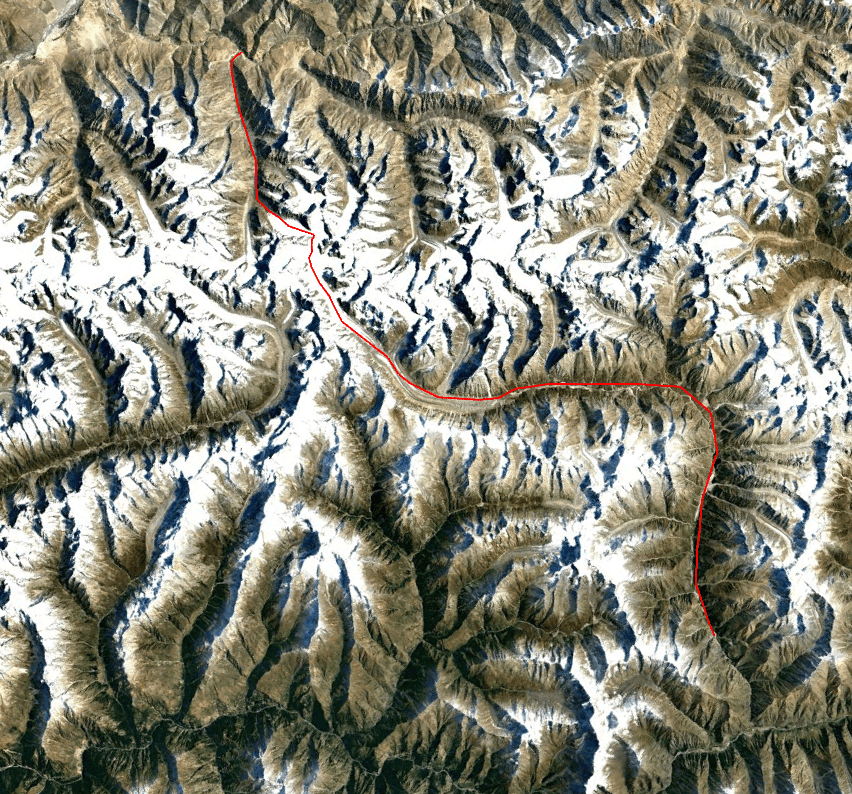
Now 8 years and countless glaciers later, these passes that once seemed impossible now looked pretty doable, even easy… I planned a trek with Eline and Wico to cross all three of them and after that, if I had the time left, also Kanji la in Zanskar. After having crossed Kang la however Eline was kind of done with glaciers. She did have a point… Kang la is 22km of ice and 6km of moraines (which does not sound like a lot, but it certainly feels like a lot when you are traversing them). So after crossing Kang la we did not press on towards the Poat la, but instead went down to Padum and added the Dibling – Kanji la trek.
Unlike many other places in the Himalaya, where route options are limited due to tough terrain, supplies and red tape, changing our plans here was easy. Himchal Pradesh and Ladakh cover a vast region with countless of relatively easy passes to be crossed, none of which require any special permits or any of the such. I now spent a little over 3 months in this region and I could easily spent 3 months more exploring new valleys and passes. The charm of this region is not the height of it’s peaks, but the sheer number of them. The ranges keep stacking up. Dhauladar, Pir Panjal, Himalaya, Zanskar, Ladakh and the Karakoram. I don’t think there is another place on earth with so many major ranges meeting.
Season
July to September is regarded as the best time to be out here. Even though we experienced poor weather around Kang la, this is usually this is not the case. The Pir Panjal and Dhauladar shield this region from the heavy monsoons, Ladakh is even fully in rainshadow.
How to get there
We took a night bus from Delhi to Manali, many are going each day. It is around a 14 hour Drive. From Manali you can take a bus to Udaipur from where you can take a Taxi to Khanjer or Urgos, but we decided to take a taxi all the way.
From Padum public transit is limited to non existent, you will need to arrange a shared taxi or continue your trek.
Packing list
The south side of the Kang la glacier is very easy and you could actually cross this without any technical gear. However on the descend on the norther side the glacier has many crevices. You will find yourself slaloming and jumping like crazy. Rope, harness and carbines are a must. Crampons are not strictly needed, but recommended.
Videos
Day 1
We had had a crazy journey to Manali behind us. We had taken the train from Amsterdam to Ede and from there my mother dropped us just over the border with Germeny at Elten. From there we had taken the train to Dusseldorf to fly to Delhi. Due to my, how to say it, general adversity of that city, we immediately took a taxi from Delhi airport to the bus stop. (Goes without saying that the cab driver tried to rip us off, as the ancient tradition of taxi drivers requires.) After a 3 hours in the wet heat our bus departed for Manali. Of course nothing can ever be completely smooth, so we had to change buses once out of Delhi. (Probably because our bus was too empty to make the drive worthwhile.)
So yeah after 48 aredous hours on the road we made it to Manali around noon. As we got off the bus we immediately felt we were in the place we wanted to be. The clean mountain air and quieter streets were a warm welcome after spending so much time on crowded transit points. Better temperatures, way less moist, fewer people and the promise of great mountains around us. This was the place I remembered from all those years ago in my first large independent trek. I could not wait to hid the road. But before we could set off, we really had to catch up on our sleep for a bit.
We stayed in the Moustache hotel and after a few hours of rest we set out to explore the town around us. Wico had already gone out and warned us that there was not much to see. And in principle he was right. There is lots of nice shops and restaurants, but Manali lacks any real sights. But sights were not really what we were there for. Our main objective was to find transport to Urgos, a small mountain village in the Miyar valley from where our trek would begin.
Since the bus system in Himchal Pradesh and Ladakh is not very well developed we decided to arrange transport ourselves. That was easy enough, we just went into one of the many trekking and hiking tourists shops and asked for a ride. The tour operator asked whether we were sure that we could Kang la by ourselves, apparently we looked confident in our abilities as he responded with ‘ok you guys are pro’s, than you can do it’.
Day 2
Our driver picked us up from our hotel and we left Manali behind us. The Atal tunnel was finally finished so we did not need to cross the Rohtang pass (shaving easily 3 hours from the journey). The Atal tunnel takes you right through the steep Pir Panjal range to Lahul. The road took us down to Udaipur, the largest town in Lahul and Pangi.
I had traveled this route before and it brought back many fond memories. From the car we could see the many cauliflower fields, small villages and occasionally some peaks in the Pir Panjal south of us.
In Udaipur we left the main road and entered the Miyar valley road. The first part of the valley was pretty narrow and had steep rock faces on both sides. It was quite unbelievable that this was the start of one of the longest side valleys in Himchal Pradesh.
After 30 minutes or so we hid a road block. A side river had washed away a small bridge. People were working on it, but the road would not be fixed the same day. The valley looked quite beautiful and we were looking forward to hid the road, so we decided to just put on our backpacks and hike the remainder of the way to Urgos. Urgos should be about 2 hours from here the locals informed us.
Our packs were extremely heavy, over 20kg, and the sun was hot. After just 30 minutes we were already resting in the shadow. I was wondering how this would go when the terrain would get tougher…
Hot or not we slowly but steadily made our way towards Urgos. On the way we passed a few villages. There was not much around. Not even a shop or small restaurant. The relative shortage of facilities around trekking trails is rather typical for many places in the Indian Himalaya when compared the the Nepalese Himalaya.

In each village we hopefully asked whether we were in Urgos already, but each time they said we needed to head a little further. In Urgos we arrived in the middle of a wedding. The hotel keeper did make the time to bring us to our room and serve a little food. He had lived in Urgos for all his live and operated this hotel since 1980. He could remember the time they ploughed the fields with Yaks and the arrival of the first trekkers.
I had worried a bit about authorities forbidding us to cross Kang la from the start. Due to my experiences in Garwhal Himal I don’t think I can ever go to India again without the fear of random regulations making a difficult trek even harder. But now in Urgos I felt save enough to just tell our host of our plans. He was quite surprised and asked whether we got permission from the police in Udaipur. Yes of course I lied quickly, beating myself up that I had told him about our plans. From that moment on I spent the rest of the day and night worrying that he might inform someone jeopardizing our trek. Wico and Eline were not worried, ‘these people really do not care’ said Wico. But I could not help to be concerned.
Day 3
In the night someone was at our door. Of course I immediately feared police who would sent us back to Udaipur, but they were just lost wedding guests… When morning broke I was happy to hid the road again. I wanted to leave the villages behind as soon as I could preferably without anyone seeing us. I was not going to take any chances again.
Once we left Udaipur we crossed the bridge and followed the road via the eastern river bank up. This was the wrong side as it turned out. The road stopped and we had to walk through a few boulder fields till we met a trail again. Despite being a bit more difficult we still reached Killar.
In Killar I spotted a tented camp down the village. Fearing an army camp we pretty much sneaked through the village, swiftly silently and hiding behind rocks each time we took a bit of rest.
The trail behind the village took us steep up for about 100 meters, after which we arrived at a large grassy area where we set up camp. The weather was really good and we could see the never seen tower (mountain top) in the distance. The valley looked broad and grassy, easily to traverse. Which was really great as our backpacks were still out of this world heavy. We had ‘invested’ in good food anticipating easy terrain for the first few days.

Day 3
When we woke up there was good news and bad news. The good news was that no authorities showed up, the bad news was that the weather turned bad. The weather had taken a 180 degree turn. The clouds hung low and it did look like the weather would improve any time soon.
We waited in the tent for a small lull in the rains and then quickly packed our stuff and started our day. We had no real goal in mind we just wanted to make some way up valley.
The middle section of the Miyar valley consists of large grass areas dotted by herds of sheep. I suppose there are mountains around as well, but we could not see much of that.
After an hour or two we stumbled on a small shepherd hut. The rain was getting worse so we decided to have lunch indoors. As we were preparing our food we saw a large group of Indian trekkers coming down valley. It would be the one and only group we would meet during our trek over the Kang la. We welcomed them into the hut. It was now a full house, with over 25 people standing in the small hut.
The group had trekked to the start of the glacier and was guided by ‘India hikes’ one of the larger trekking organizations in India. Their guide warned us about the difficulties we might face on Kang la, but we shrugged it off. The trekkers told us that the forecast for the next 5 days was extremely bad, so it seemed like todays weather would become the norm.
When the rains eased a bit (we gave up on hoping for it to get dry) we hiked further up valley. Our final destination for the day would be the small lake, just 2 more hours ahead.
Once there the ‘lake’ turned out to be more of a small mud pool, but oh well, we came for the mountains not the lakes. We were lucky enough for it to get dry for a bit and tried our best to eat our heaviest food. Next day we would probably already make it to the start of the glacier.
Day 4
Another easy day slowly following the grassy meadows along the river. Again we saw many herds of sheep and the occasional yak. The weather was the same as the day before but we had gotten used to it by this point.
We setup our camp next to the river once we saw that the moraines started just a bit further ahead. It would be the last nice and grassy campsite for some time to come.

Day 5
In the morning we woke up with a dog next to our tent. We had seen him lurking in the shadows the night before when we went off to bed and apparently he had spent the night laying next to our tent. I played with him a little not suspecting that he would be our unwanted companion for the rest of the trek.
We hiked the remainder of the way to the start of the moraine. It started out easy. There was a small trail leading over the boulders. Every now and then you would lose it as there were larger sandy areas in between the boulders. But generally it was fine. However once the actual moraine filled glacier started the faint trail disappeared and we were just ploughing through what seemed to be and endless pile of loose rocks.
The dog was still following us and it was at this point that I started to realize that maybe he intended to keep following us around. Usually these kind of dogs follow you around and have some point from on which they suddenly turn back to their actual homes. But if for this dog that point was still to come it was quite a bit further than most dogs put it.
It was at this point that Eline started to doubt whether she had made a good decision on joining this trek again. Traversing moraines is psychologically quite heavy. You can never see much further then about 50 meters and you can never walk in a straight line. Oftentimes you find yourself walking just 500 meters in the hour. The boulders at the start of the Miyar glacier easily made my top 5 least favorite boulder beating experiences.
When we were tired and set up camp we saw we had just made 3km progress in a full day. And there was much more to come…
As the sun was coming down we saw three shepherd far above us making their way down the valley side, they must have come from some side valley. Jealously we looked at how they covered the distance that we had fought for a full day long in just about an hour.

Day 6
The weather was pretty bad again. What made things worse was the fact that the tent had half collapsed due to ‘our’ dog basically just sitting on it. So there we sat in a wet half collapsed tent with the meteo showing absolutely no sign of clearing up any time soon. Honestly it was quite a miserable camping experience… Wico went outside, reasoning that standing outside makes you feel way better then hiding away in an uncomfortable tent. He was right on that, as soon as we stood outside in our rain gear it felt a lot better. We however did start to worry about the dog at this point. The dog had caused the tent to half collapse and we feared he would make a hard journey even harder. How would he even behave when we would be on the ice in a few days?
We tried to get rid of the dog by aggressively waving to him and throwing rocks. But he was not to be deterred. He just peeped and looked at us sadly yet hopefully. We stepped up our game and started to throw heavier rocks. One of them hid his paw and he peeped and started to limp. At this point we gave up, if not even this can get him to turn back we guessed we were stuck with him.

Today’s hike over the moraine was slightly better then the day before. Yesterday we had followed the eastern side and then slowly but steadily made our way across it to the western side. Today we could just keep on the western side. It was still a fight for every kilometer though and no step could be taken for granted.
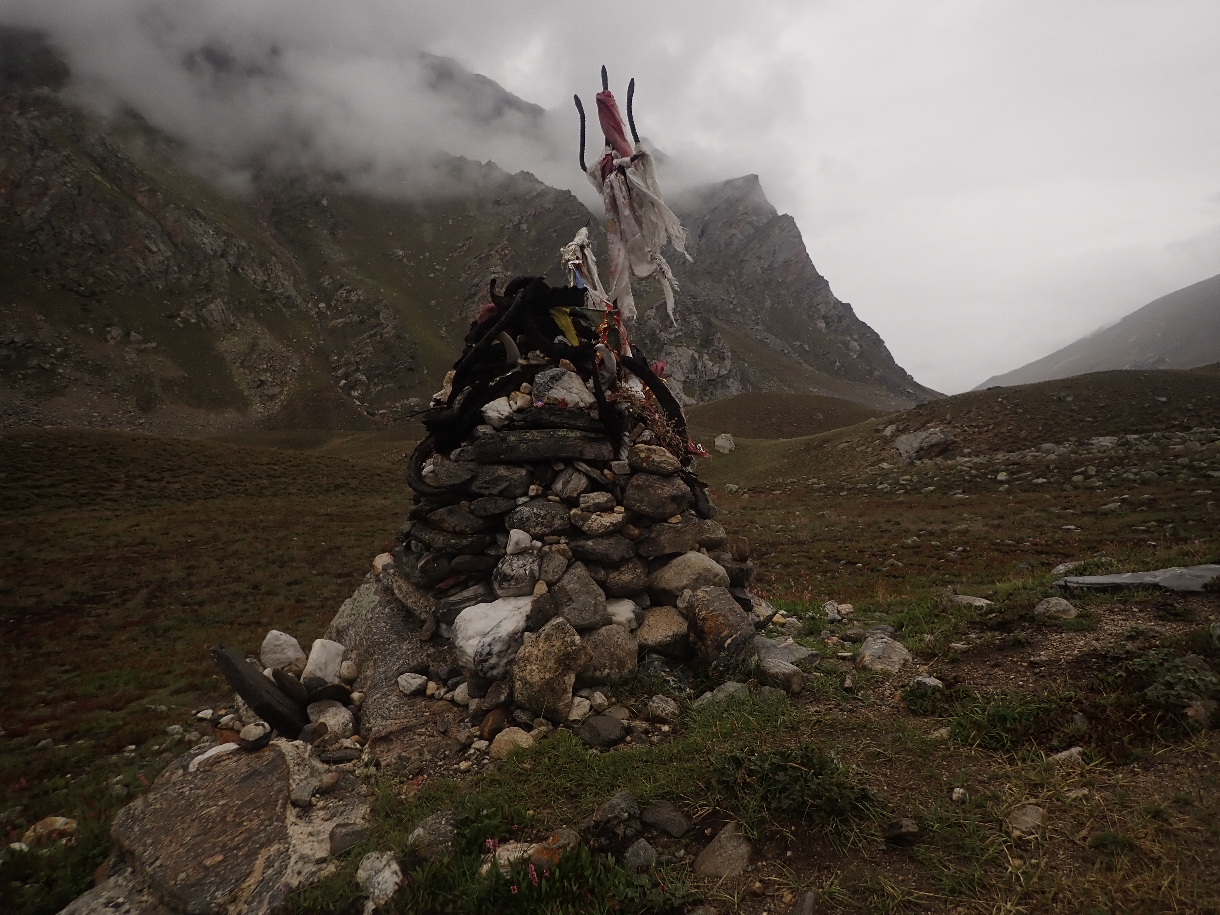
Around noon we came across a location where it was clear people had camped before, a nice boost of our confidence in the otherwise desolate rock with no traces of any previous groups.
Around 2pm we hiked under a small waterfall coming down the valley side. It was a very good camping spot. Though it was early and my GPS told that the actual campsite was about 1 kilometer further ahead. I decided to hike a bit further as up until this point the distance we covered in a day was really small and I did want to keep making progress.
1 kilometer further however there was nothing that resembled a campsite. There was no water available and even with the utmost creativity I did not see how you would even pitch the smallest of tents here. 1 kilometer does not sound like a lot but it would be at least 40 minutes back to the waterfall, so I decided to push through to the next waterfall about a kilometer further. As we came closer it started to rain. The closer we got the less likely it seemed that the terrain would be good for camping. We decided to turn back to the waterfall again. We had no water and were getting pretty thirsty, especially Wico had it tough time.
When we were almost there I went ahead to grab some water from the waterfall and bring it back. This at least made the last 15 minutes a bit of a better experience. We arrived at the campsite at around 6. A lot of wasted energy and time had been spent to get to the exact same location that we were in 4 hours earlier. It was at this point that I promised Eline and Wico we would descend to Zanskar once we crossed Kang la and would give up the ambition to cross the Poat and Umasi la.
Luckily enough the weather improved a little and we had enough daylight left to celebrate my birthday a bit. Eline had brought me a giant Marshmallow with some candles to put on top of it. Yummy 🙂
Day 7
Today our one and only hope was to get off the moraine filled glacier and onto the ice. Just anything that was not balancing over endless piles of rock would be greatly appreciated.
After just 2.5 hours our dream came true. Not far after the point we had returned from yesterday we saw a little bit of ice below us. A narrow ice sheet continuing up an broadening out to form the glacier proper. A magical moment! At last out of nowhere the valley had decided that the time for the glacier proper to start had begun. We wasted no time and rushed down to the ice in a bee line. We would not do a single meter more over the boulders than absolutely necessary.

Once on the ice the going got easy. The dog did not like it as his feet hurt on the sharp ice, but we could finally just set one foot in front of the other without worrying of sliding down or toppling over some rock Jenga tower. It was at this point that I started to feed the dog as I had given up all hope that he would return home. The rest of the trek I would mostly give him oatmeal, tortillas and mashed potatoes.
In just 3 hours we made more progress then in the previous 2 days combined. Our luck however was coming to an end. The glacier met a large wall of moraines. This boulder filled wall blocked the whole valley from left to right. Rather strange, I had not really seen this before, usually once on the ice you only meet the boulders again once really on the way down again. But here we saw the glacier going under a high and impressive wall of stone coming from the side.

We decided to camp and cross the boulders the next day. The weather was nice and we had learnt our lesson about skipping good campsites the day before. I went a bit further to explore the way ahead. Once on top of the moraine wall I realized that this would go on for all some time. There was no real end in sight.
For the first time since we left Khanjar the sun had free reign. Eline was doing some laundry on the melting streams (I think the first time a group I was in was actually washing on a glacier).
Later in the day the weather turned bad again. As clouds started to roll in we prepared our tent. Once the rain started in earnest we were already nested in our cozy tent. We were making soup and tea, but forgot one fatal factor. The dog. As the rain started poring down the dog panicked and tried to get into the tent. We kept him out, but after that he started to break down the tent from the outside again. We just barely could keep hold on our stove. The weather and dog really made the journey a tenfold harder than it should have been…
Day 8
Our mission today was to get near enough to the pass to cross it the next day. As we climbed the boulders behind our campsite we hoped we would be on the ice soon again. Luckily for us the moraines were just 1 kilometer wide and we reached the ice again in about an hour.

The weather was good and we enjoyed great views over the alleyway of peaks on both sides of the valley. The mountains were sharp and covered with many smaller hanging glaciers making their way to the immense Miyar glacier below.
Due to the relative heat the glacier was covered with melting streams. We regularly had to jump one or two. Despite of these streams there were no real obstacles and we made quick progress. Though the progress was hard to measure in the vast white surroundings. Due to the lack of details things seemed way closer then they were in reality.

There was a cold wind. A typical glacier wind that gives you a headache. We took lunch out of the wind and hiked for another hour till we met a large side glacier coming in form the south. The pass was now ‘just’ 5km from where we stood. The map indicated that we were near the ‘official’ camping spot. It seemed like further up ahead there were no more occasional rocks on the glacier on which you could sit or take shelter behind so we decided to look for a place to setup camp.
Finding a camp spot was remarkable difficult because the glacier was quite literally smelting away from under our feet. We looked to find a dry spot, but ended up with a semi dry place that we dried further up by cutting a small canal with our ice axes around the area.

For a change the weather remained good for the rest of the day. Would we finally have had the bad weather days behind us? As the sun went down the water around us quickly turned back into ice.
Day 9
we woke at 5am when it was still dark. Can we please lay down for a bit longer Eline asked. I layed down again, but 10 minutes later as the first signs of daybreak started to show I began cooking our breakfast. It would be a long day and the longer we could hike over sturdy ice the better.

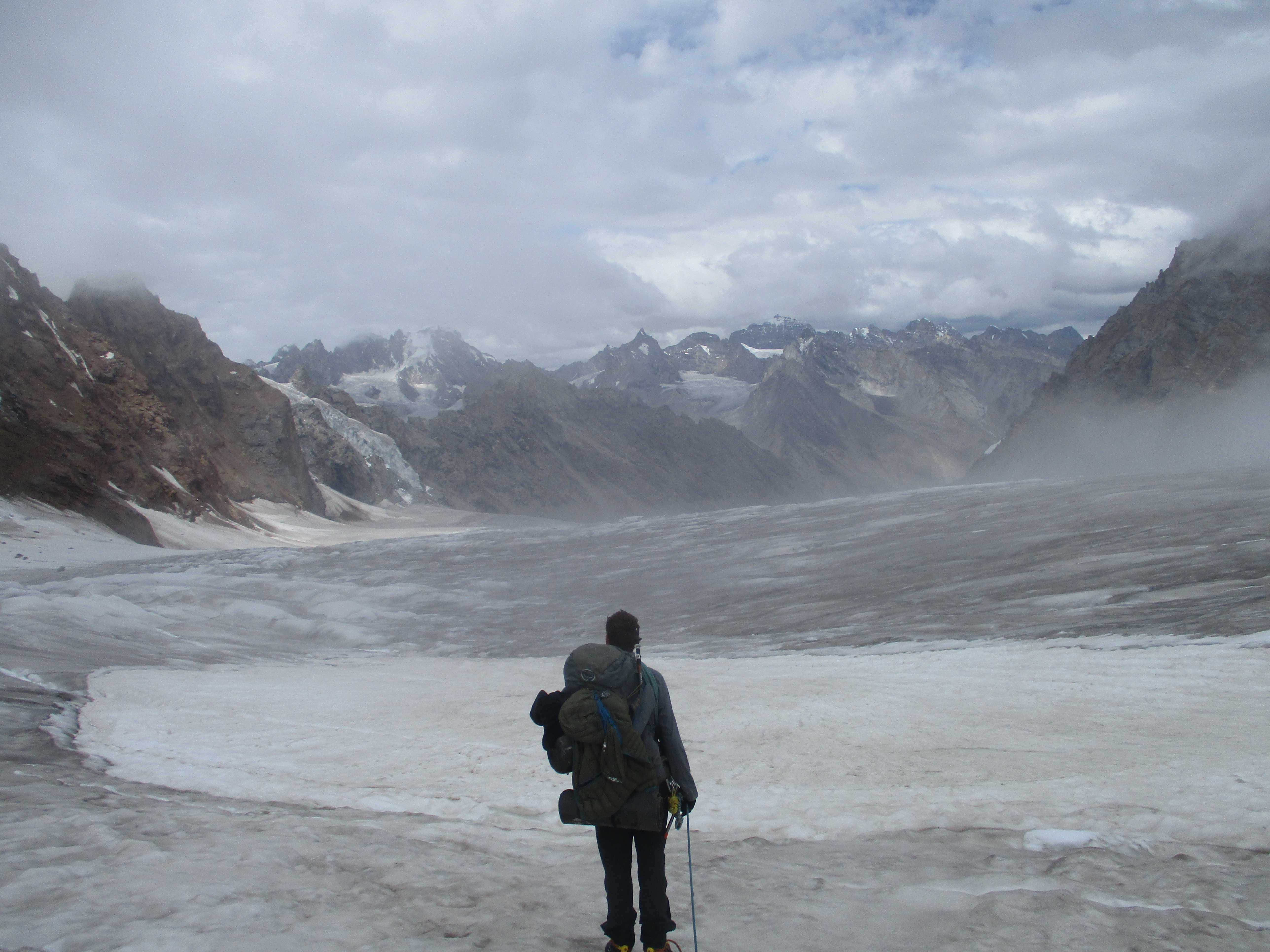
After a quick but big breakfast we went further up glacier in the early morning light. The glacier was hard and frozen during the cold night. As we went up ahead we arrived at the impressive amphitheater of three glaciers merging to become the great Miyar glacier. This location marks the end of the Miyar valley and we knew we got close to the pass at this point. However the last 2 kilometers to the pass would undoubtedly be the toughest ones. We had to first climb up the middle glacier. A two staged rather steep climb that we had seen coming during our approach. There were quite a few crevices at this climb, the second stage of the climb was less steep but had a lot more crevices. It was a good thing we brought our crampons and rope.
At the foot of the climb it was rather obvious that we would need to climb along the left side of the glacier. This route was steeper then the other sections but went over an easy looking ice slope with no crevices. It took quite some time for us to complete the first stage. Slowly we moved up, due to the white vastness it was hard to say how much progress we were actually making. The view back over the Miyar glacier was very impressive. We could see three enormous glaciers merging into a large ice field that made it’s way down as far as the eye could see.
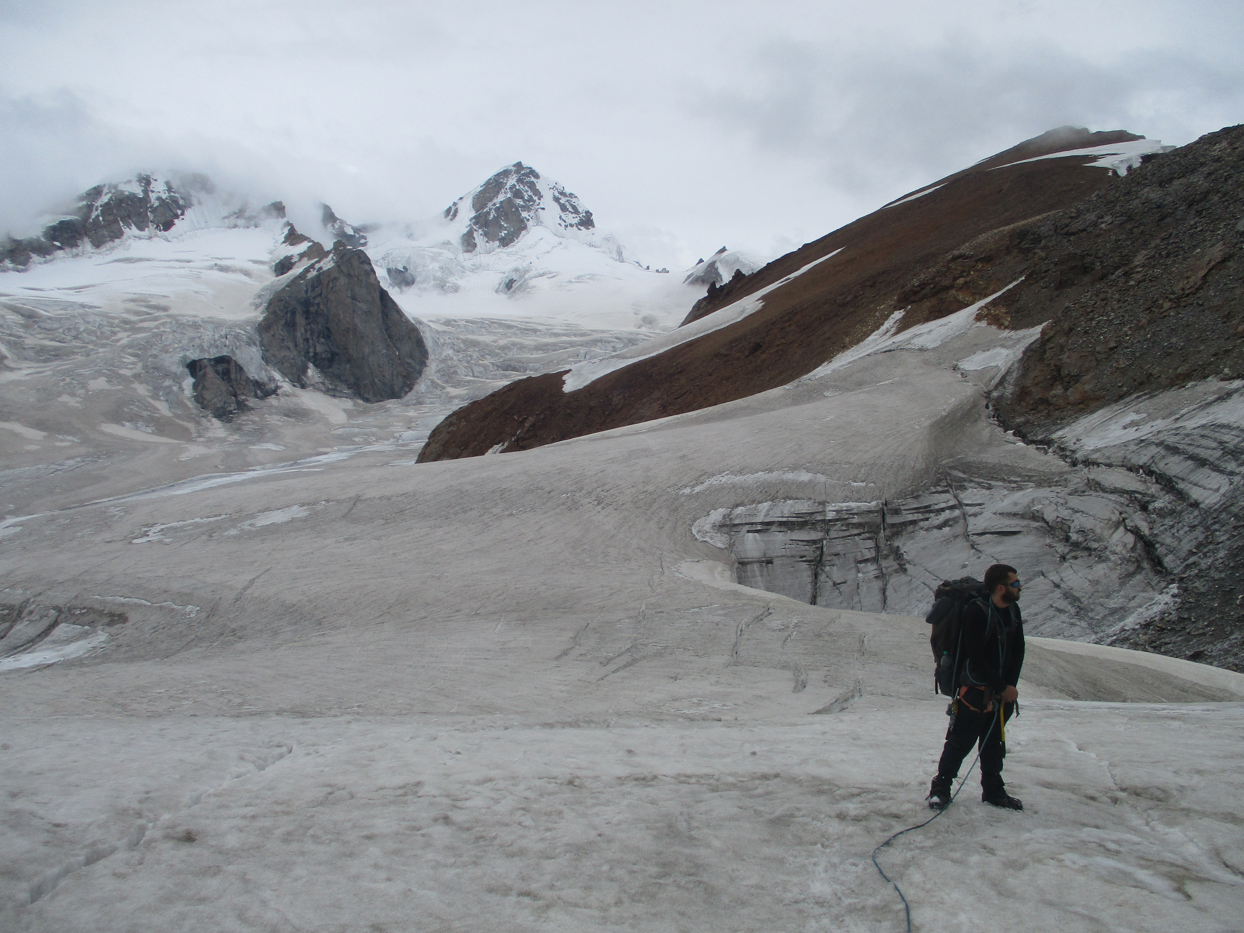
Once the first part of the climb was done we found ourselves on a small straight section after which we could see the second shorter climb. We were on the very edge of the glacier and below us the glacier dropped steeply till the rock that rose sharply from the end of the glacier. The pass was now just a few hundred meters away. I was weighing our options. Should we climb between the rock and ice or should we follow the glacier further.
I decided to go for the later, though I still do not know what would have been best. We had to zigzag around quite some crevices and crossed a snow bridge or two. It felt like a very short time or the pass was directly on our right hand. Surprisingly enough the pass was located below us. Kang la is not located at the very end of the glacier, instead it is located at a place where the Miyar glacier comming down flows towards both sides of the Himalaya. The markings of the pass are situated on the western side on top of the rocky peak.

We climbed down to the pass (first time I have ever needed to actually climb down to a pass.) We were pretty content with ourselves with reaching the pass and took a few moment to rest and celebrate. The views from the pass are not great, since it is situated below the glacier and is located in a corner. But it is a very significant pass as it marks the transition of two entirely different geological zones. North of us we could see the colorful Zanskar mountains which fall withing the Tibetan geological region, and south of us we saw the glaciers and peaks of the Himalaya.
Clouds started to roll in quick and we decided to descent down quickly again. As we had put on our climbing gear again a thick mist was already upon us.
The way down was a lot harder than we had thought and hoped it would be. The norther side of the Miyar glacier is way smaller than the southern side, but there are way and way more crevices. The thick mist did not help at all. Making a bad situation worse was the fact that it was now already later in the afternoon meaning that the ice had gotten soft and with that a lot less reliable.
The western side of the glacier looked like a complete mess so we made our way towards the middle of the glacier first before descending. We tried to avoid weak looking snowy parts of the glacier. If we had to traverse these parts I carefully probed the ice with my ice axe before actually placing my foot. The last thing I wanted was a crevice rescue on 5400 meters.
As we were very slowly descending, trying to avoid all possible booby traps, the dog did not seem to give a care in the world. He ran over the soft snow and around the crevices as if it were nothing.
At some point we got at the edge of a very deep crevice. It ended 50 meters to the east of us, but that region was full of soft snow and it was not clear whether the glacier would actually hold us there. If I probed with my ice axe there was no hard ice to be felt below the snow. I decided to jump the crevice instead of taking my chances on the softer snow. It was quite the jump, but helped by the fact that the other side lay a lot lower. Eline and Wico did not want to jump with their backpacks on so we used the rope to get the backpacks to my side first, after that they made the jump, vowing they would never set foot on a glacier again…
I thought that after this crevice we had had it, but I wished… Further down there was a crevice that could almost fit a skyscraper. There was one ice bridge on the fart eastern side allowing us to cross it, but I really wished we would have had harder ice at this point.
Due to the stress and fatigue Eline got migraine, taking away part of her sight. Pretty much meaning that we were crossing the last crevice with someone who could only partly see.
All difficult thing however come to an end and at around 3pm we had made of off the ice fall and were on flat and rock solid ice again. It softly raining and we were tired, so we decided to hike down and take the first reasonable camping spot we would find.
Lucky for us this would not take long. Just half an hour further down there was a rocky hill rising up from the glacier that had some sandy flat areas. It looked like there would be a good comping spot there. The sandy places were muddier than they looked but we found a good spot.
We were pretty tired and even I had to push myself to pitch the tent. We rested the rest of the day. I only left our camping spot to fetch water from the melting glacier below us.
Day 10
Mist blew over the Kang la, but up north in Zanskar the weather seemed better. We were really looking forward to have some better weather and now finally in the rain shadow we just might get that.
We descended the glacier. An easy but rather steep hike down on sturdy ice. At the end we had to plough through 300 meters of moraine and boulders. It was quite the balancing act, at some point I even jumped a meter or so. But luckily it was short and it was not long or we were standing on solid rock and sand. And that meant that at last we set foot on a trail again. The trail was very faint, but it was a relief to hike on a trail for a change.
The trail winded down to the main valley where we had actually planned to camp. By the time we got there 3 hours had already past, so it was a good thing we had made an early stop the day before. It did mean it seemed unrealistic to make it all the way to the Zanskar road today. We decided to just continue on and see how far we would get.
Turned out we would not get too far. After an hour or 2 we stumbled upon the first side stream. Or stream, more like a powerful rapid. After noon small side streams in Zanskar can grow into powerful rivers forcing you to stay overnight to attempt the crossing in the morning.
The thing with this stream was however that it was spread out over multiple meanders. Of course the first ones the smaller and the more powerful as last. So by the time we found out that the stream was pretty intense we were already half way. So turning back was psychologically difficult… I could have known as when I put off my shoes I could see Wico in a middle island waiting hesitantly. As I caught up with him I saw the problem. The stream was knee deep and really powerful. I Went ahead to scout a good route and placed my backpack on the other side. Then I came back to help Eline and Wico. We got unlucky and both Eline and Wico fell into the water. It took a lot of strength to get up in these currents but wet and all we made it to the other side.
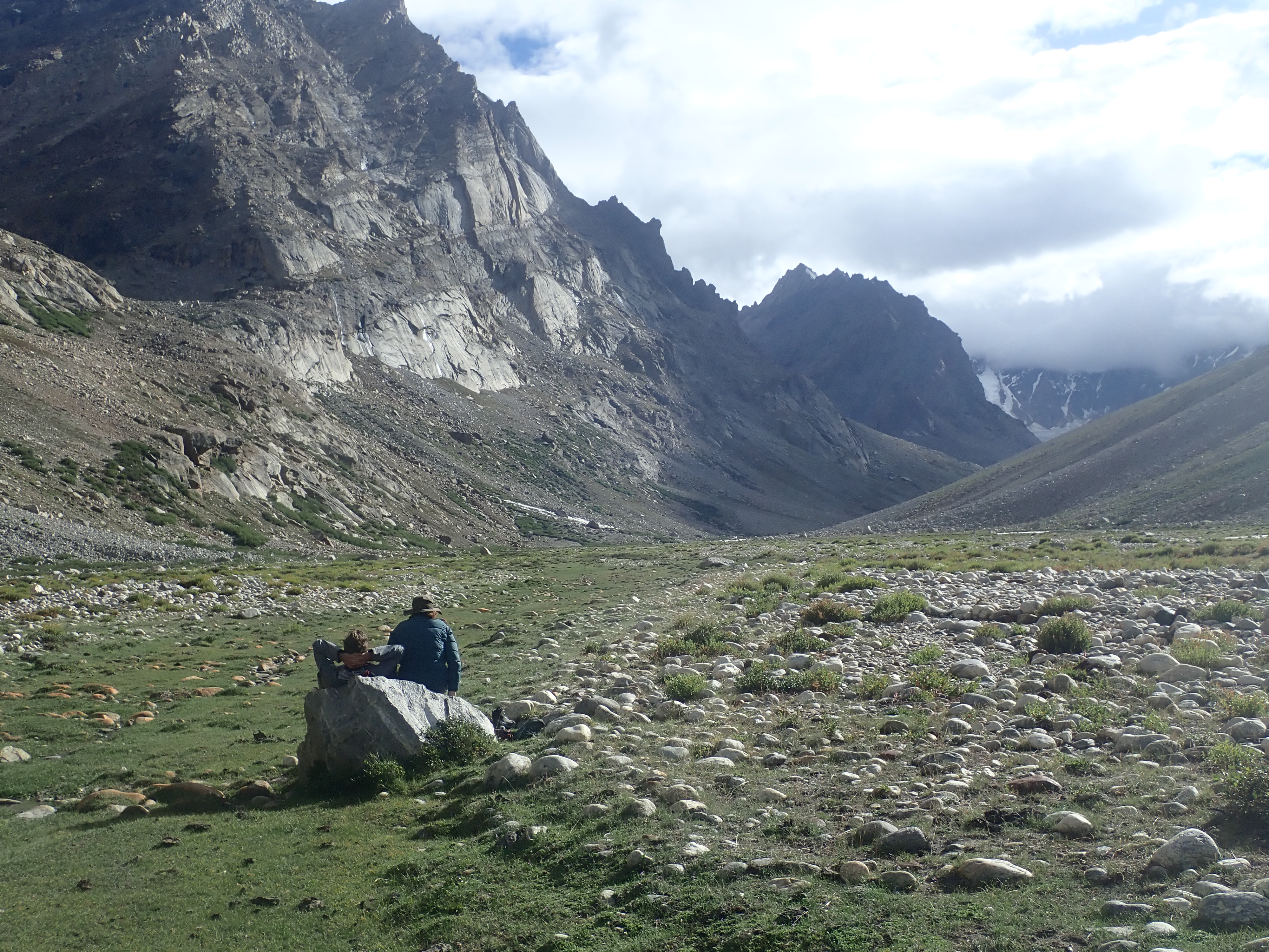
There was a harsh wind and especially Wico was really cold. He put on some warm clothes, but we camped just 15 minutes further. The sun was warm so we all got dry pretty fast. It was our first camp on a grassy in over a week. Especially our canine companion was extremely pleased with this. He wagged his tale as he explored the bushes around us. In the evening he got to chase some yaks as they moved in to our campsite from further down valley.
Day 11
It would be a long but easy hike down into the Zanskar valley. The sun shone bright and mercilessly. The rocks, vegetation and heat made it feel like a dessert hike. What a stark difference with the other days on this trek… The first thing I would buy once we would arrive in Padum would be a hat I promised myself, as I placed my head under each rock I could finde to give some shade.
As we headed further down the trail got better defined. But it took some attention to keep on the trail as there were multiple sections in which the trail suddenly disappeared. I wondered whether maybe it was an effect of Covid that not many people had trodden here for the last 3 years. I had expected this route to be a lot more popular. It is one of the great classic treks in Himchal Pradesh and Zanskar, but I got the impression that it could easily have been weeks since anyone hat traversed this terrain.

Our final destination, the road remained hidden from view till the very last moment. Here we had to make a steep descend of about 250 meters down. It was not immediately clear how we would need to descend as the trail got fainter and even vanished here. Luckily the route was in my satellite phone and we could descend without any trail and error. Which was really nice as our water was finished and the heat had gotten pretty intense at this point. The last thing I wanted was to climb up and down the hills here to find a way down.

The last 30 meters of the descent were over a very steep gravel slope straight down to the road. A rather weird place for such a renowned route to end. There was nothing here that indicated the start of a trek. If you were to start from here, you would need to get out of your car here and just start to randomly ascend a steep gravel hill next to the road…

Eline was not even down and we already found a car willing to drive us to Padum. That went fast! It was a local company with two cars. They drove us to Padum where we got before 3pm.
It took quite some time to find accommodation in Padum many hotels and guesthouses were fully booked. It was also way buzzier than I could remember. Really a lot has changed here in the last 10 years I thought by myself. But the next day I found out that the Dalai Lama had visited Lingshed the day before and that many people were here in transit back home.
When I did the shopping for our next trek to Dibling and Kanji I realized that not much had changed at all. I ended up buying the exact same things as I had a decade ago. Even at the same shops I think.
