April 2015
Taplejung – Ghunsa – Kachenjunga base camp – Ghunsa – Nango la – Olanchungola – Lumbasamba – Thudam – Chyamtang – Hongon – Molun Pokari – Kalo pokari – Makalu base camp – Keke la – Tashigaon – Narbochaur – Num
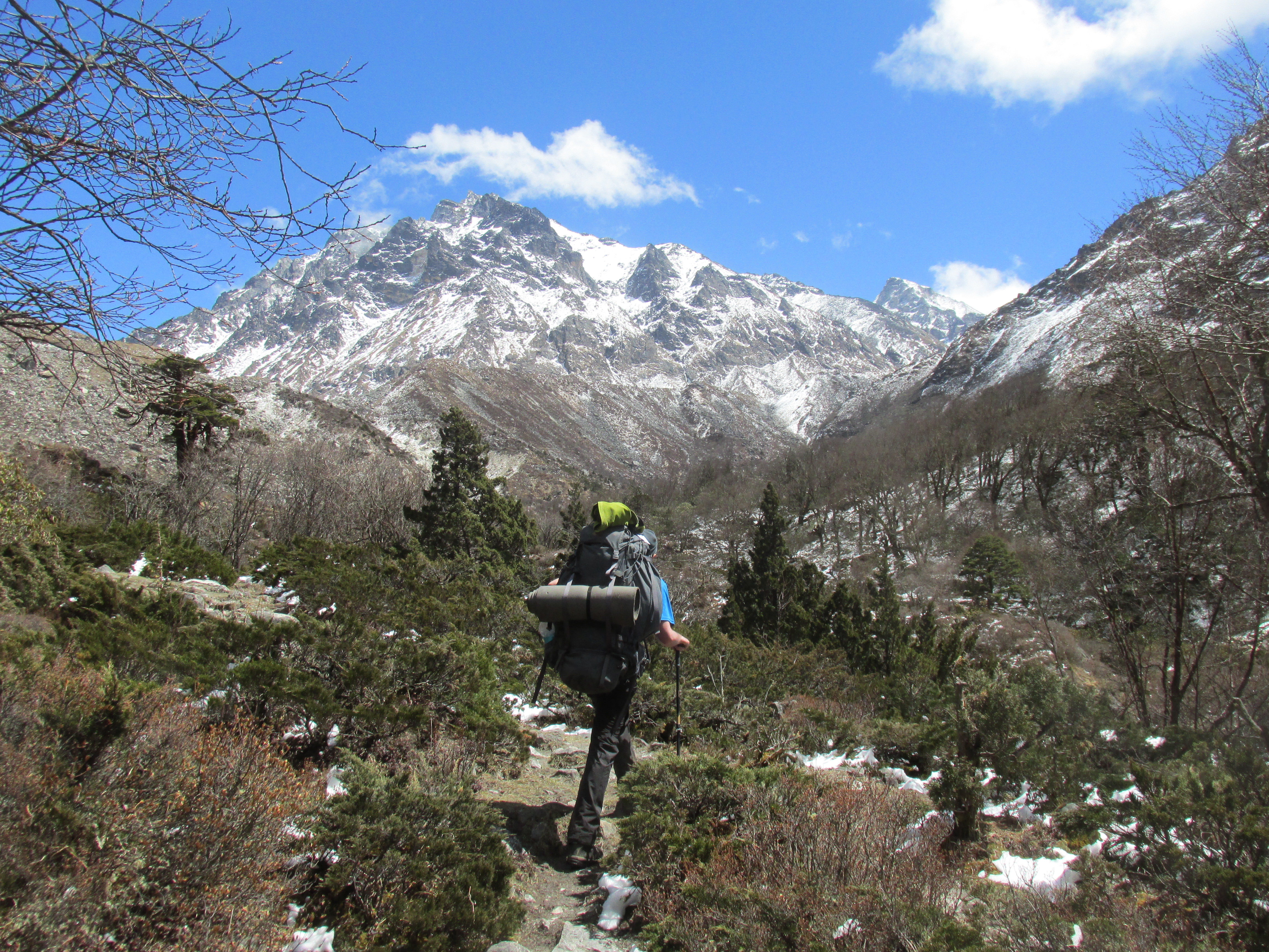
Last winter I had to turn my back on the Kanchenjunga base camp due to excessive snow fall. This spring I planned to take revenge and I intended to do it right. I chose what I ought to be the ultimate route through east Nepal. I was to hike from the 8600 meters hight Kanchenjunga to the 8500 meters high Makalu.
Initially I was even more ambitious and wanted to hike all the way to Lukla via the Kadum and Mera la, but the 2015 earthquake in Nepal combined with the snow condition forced an early stop.
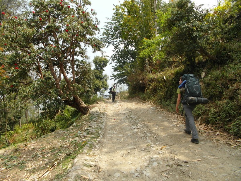
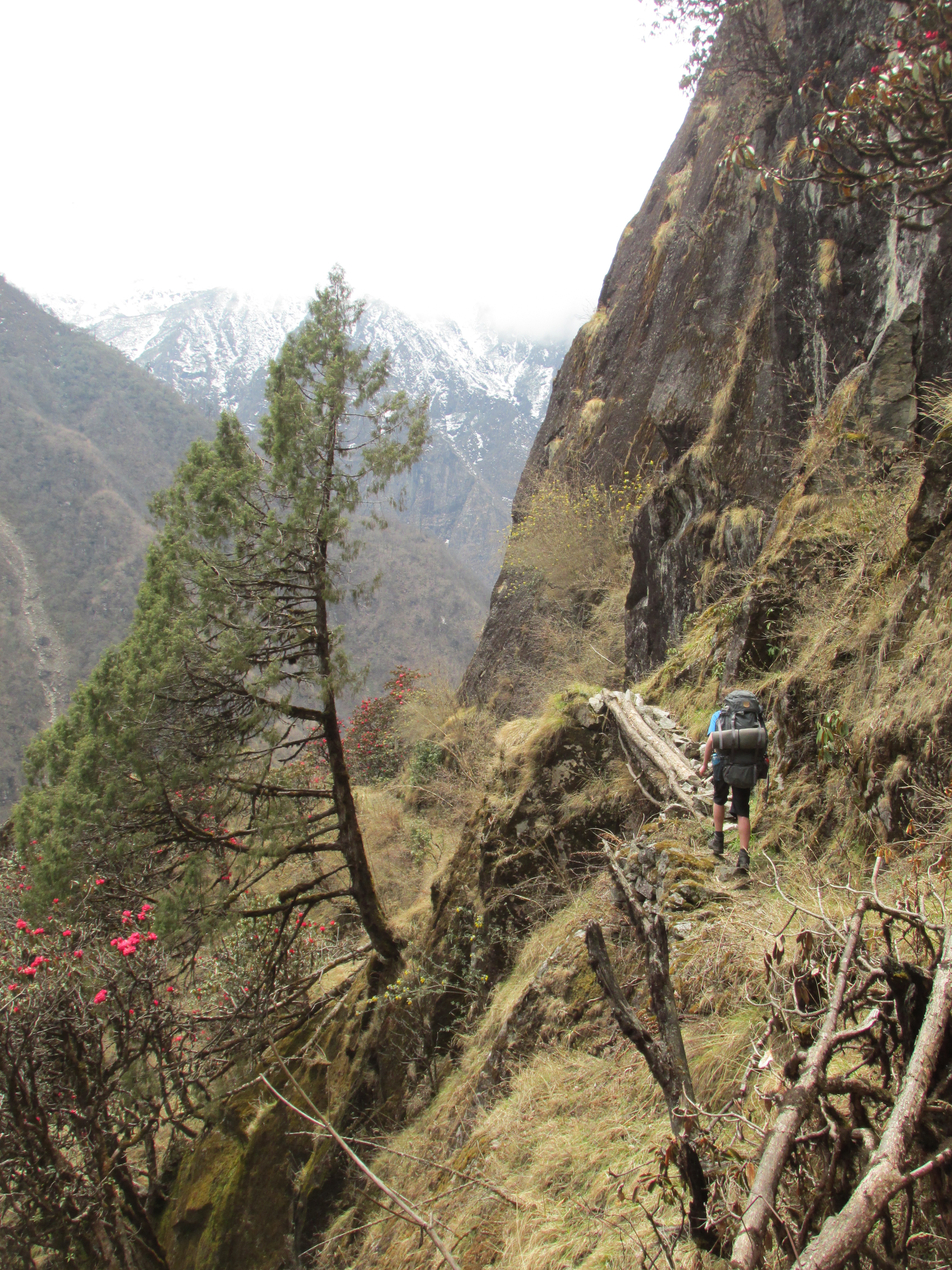
The trails around the base camps are well established and see a bunch of tourists nowadays, the traverse between the base camps consists of two sections. First up is the panoramic Lumbasamba pas, one of the most beautiful passes around. In the lower regions you hike across colourful wooden Buddhist villages yo The second part crosses over from the Arun to te Barun valley, a remote wilderness trek with many minor passes to cross. It is easy to get lost in the forests and meadows on the way.
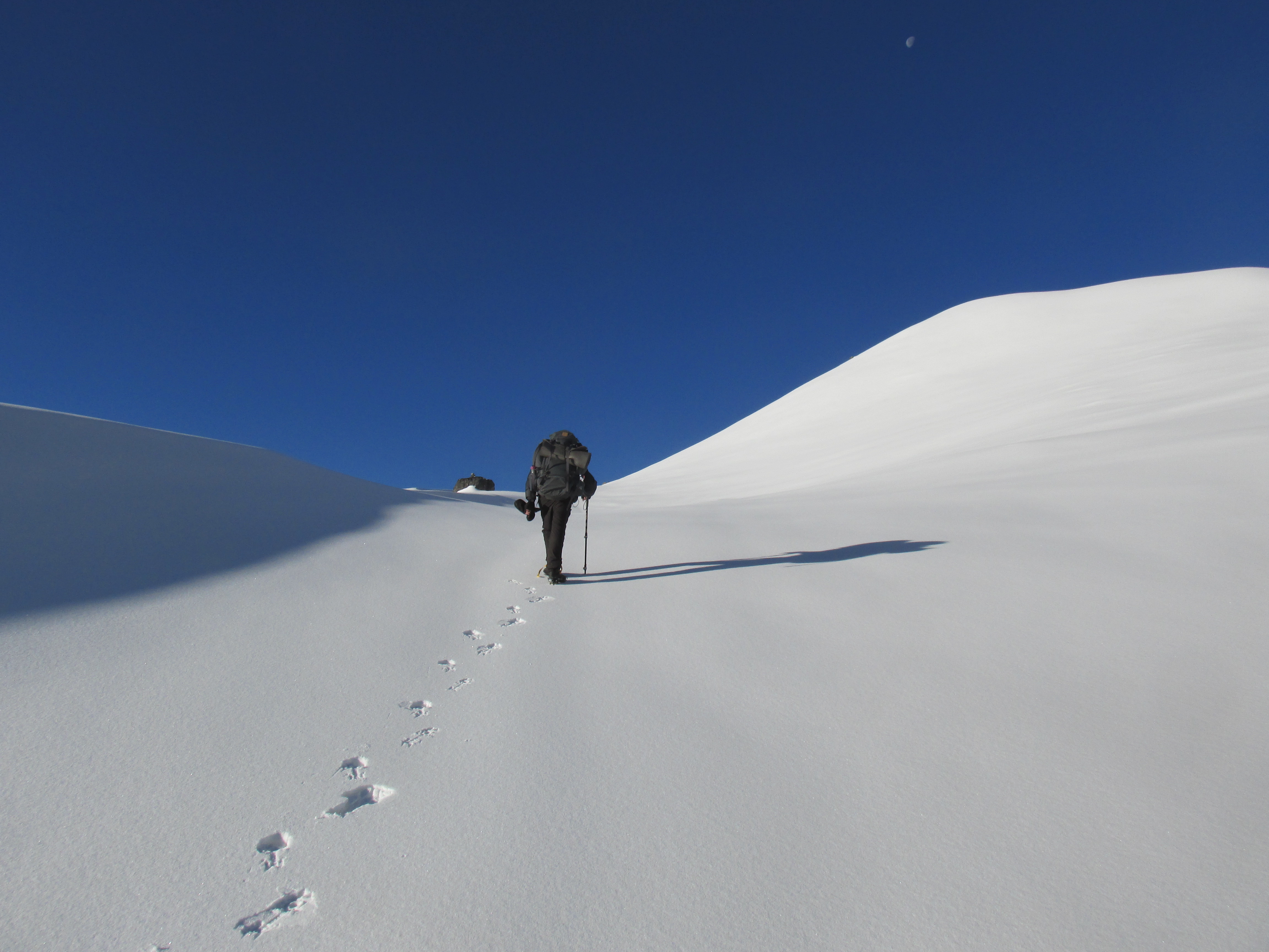
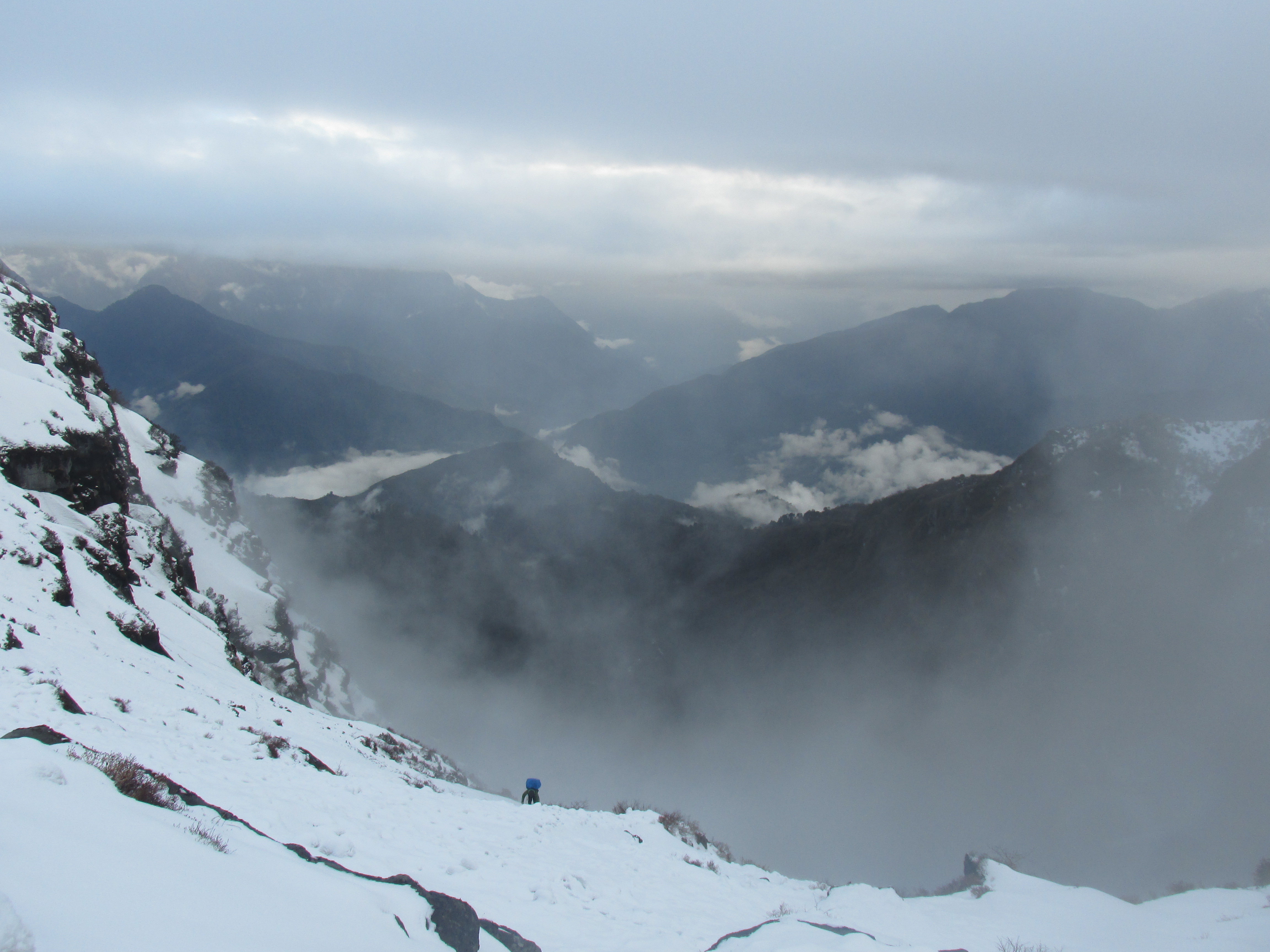
It had snowed outrageously that winer and the snow from 4000 meters onwards easily came to the chest. All the sinking into deep snow made this trek the most exhausting one in my life. For days we ploughed through deep snow, not seeing any kind of trail. At the end of the trek this tempted us to divert from the actual route leading to a crazy 6 hour steep descend down the cliffs of the Barun valley.
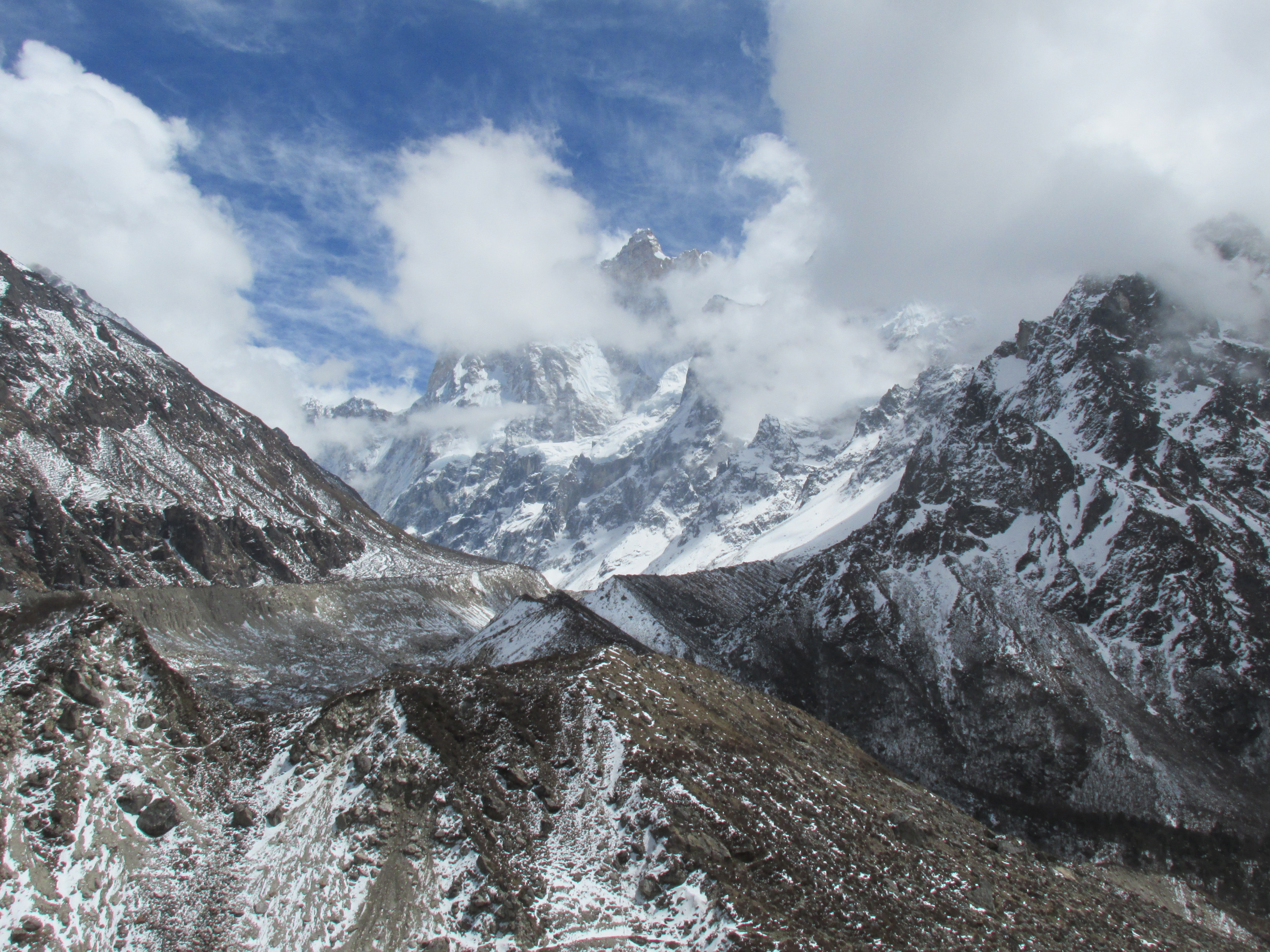
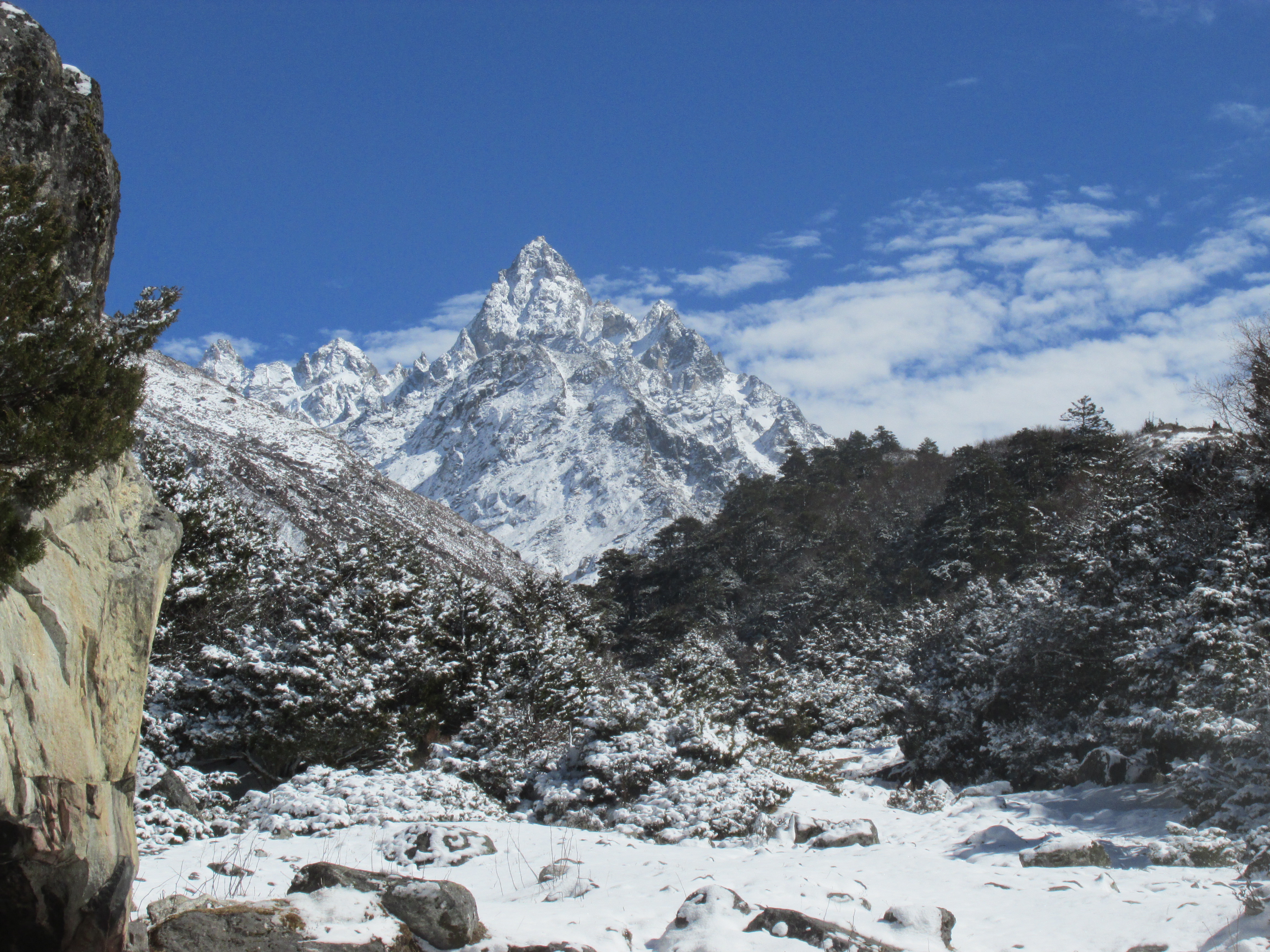
It was worth every bit of the effort. I still rate the alpine scenery on this trek as the best I have ever seen. It just keeps on going, the amazing base camp of the Kanchenjunga, the panoramic Lumbasamba, the fields around the villages, deep forests, and the impressive cliffs of the Barun valley.

Packing list
You need camping equipment. There is no way to do without.
An iceaxe is handy if conditions are poor. As in our case it turned out to be.
Season
I trekked here in April. If the winter snow would have been less extreme, which it usually is, spring is a good time to be out here. Autumn is also fine, a bit colder and busier around the base camps though.
Trekking between December 20 and February 30 is not wise, a sudden snowdrop can screw things up for you.
Summer is perfectly possible, but you are unlikely to get much views and you need to cope with the rains. East Nepal is prime monsoon region.
How to get there
The starting point of this trek, Taplejung, is quite a struggle to get to. Even by air it will take you some time. To reach here by air you need to take the morning flight from Kathmandu to Badrapur. Due to the unfortunate schedule of flights you will need to stay overnight before taking the flight to Taplejung.
For some cost saving it makes sense to use the bus for one or both of these section. Since the bus to Badrapur is a nightbus and since you can immediately transit to Taplejung in Badrapur it hardly takes more time.
The bus for Badrapur leaves Kathmandu at around 4 pm and arrives at around 8 am. The ride to Taplejung takes another 13 hours, if you transit immediately you need to split the journey in Phidim or Ilam.
Heading back from Num to Kathmandu is less of an enterprise. From Num you need to take a jeep to Basantapur a bit south. From Basantapur you can take a 40 minutes flight directly to Kathmandu or take the night leaving at around 2 pm.
Alternatives
There are numerous variations and short cuts. The Lubasamba or either of the two base camps each form a nice shorter trek in themselves.
The Lumbasamba is the only mountain pas connecting the two base camps, the only other way is hiking all the way through the middle hills (Mahabarata).
Day 1
It was the second time I had taken the Kathmandu-Badrapur night bus and it was as bad as I could remember. Just enough twists and turns to deprive you from sleep. The very loud Hindi music all around the night was a new annoyance.
In the morning we transfered in Badrapur. This part of the ride was more enjoyable. It was day and, even though I drove here for the third time now, the green surrounding hills were still as pleasant . We drove all the way to Phidim, leaving only 4 hours more to go, tomorrow.
Day 2
Wico, me and our ‘guide’, Iyam, took the very first jeep leaving for Taplejung. If things would go swift we could already cover some distance today.
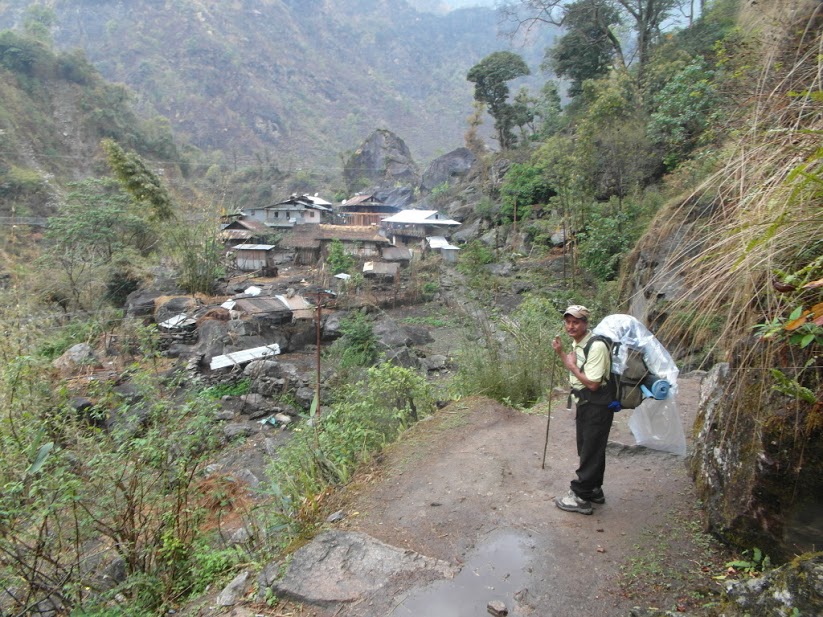
‘Guide’ is between quotation marks as he had never been around any of the passes we were around to cross before. I had trekked with Iyam last winter to the Kanchenjunga base camp. Due to his lack of confidence, level in English and general competence I had explicitly requested for another guide than him. My tour operator had assured he would provide a better one this time. But of course he didn’t.
Around noon we arrived in Taplejung. Grabbed a quick lunch and started hiking. It seemed we would see the Kanchenjunga for the first time when we would be right in front of it.
We did not take the usual route down the valley, instead we hiked the jeep track keeping altitude merging with the trail further on. I had been here before and wanted to do something different for a change.
Wico still needed to adjust to the feeling of having a back to carry, so we after 3 hours we called it a day in one of the many teahouses.
Day 3
In the night we had heavy showers, it felt like the monsoon had already started. Last winter I had to return because of heavy snow showers, so these April rains worried me. To make things worse Wico got sick. The nightmare scenario was unfolding at the very first night of our trek…
In the morning the rain had stopped. Wico was still sick as could be though. After about an hour he could no longer take it. I gave him some antibiotics. It would take some time to start working so we were in for a very tough day. Right at the moment, Wico was getting on his feet again, we got very lucky. A jeep passed by (the only one we had seen thus far). Wico hopped on it and we would see each other at the roadhead.
Me and Iyam slowly hiked further. A nice hike through typical Nepalese steep countryside, not spectacular, but nice.
In the evening we had our rendez-vous with Wico. I felt for him, he said he was already starting to feel a bit better though. Long live antibiotics.
Day 4
Wico had made a miraculous recovery and was on his feet again. We left the jeep track behind and hiked further over a large trail that slowly descended into the valley. The weather was marginally better, but nothing to write home about.
The last part went steep down to the village Thiwa. We would stay overnight here. A short day, but we did not want to press Wico’s health too much.
In Thiwa our trail merged with the main route heading for the Kanchenjunga base camp and we met a few trekkers on their way there. Thiwa is a nice village with many overhanging rocks which are often used as roof or wall for the houses. I slept in the hotel I had also slept a few months ago. I thought back of that time. How sad I had been that my trekking plans had been ruined by snow. In retrospect it might have been for the best. Otherwise I might not have engaged on the trek I was on right now…
Day 5
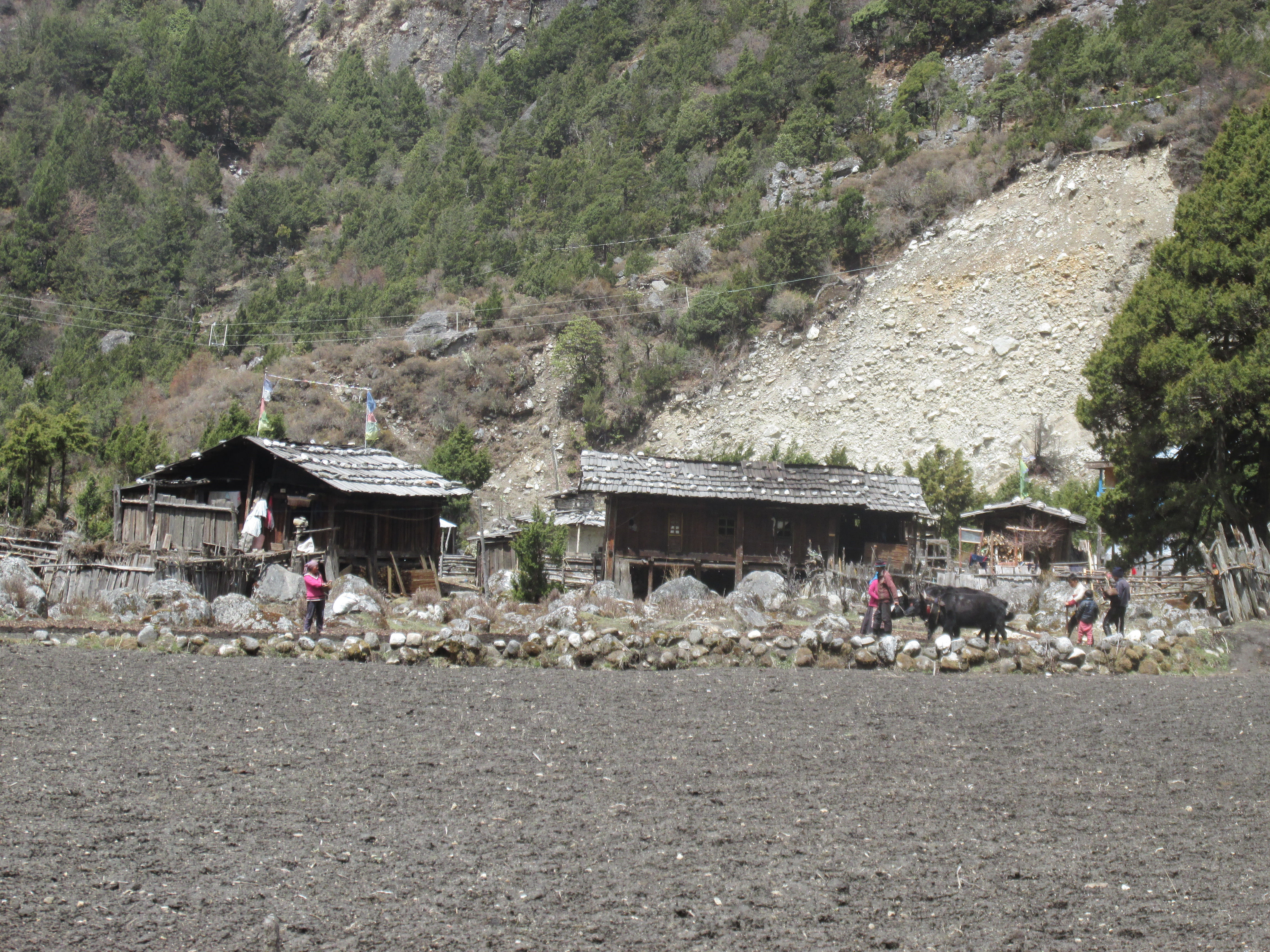
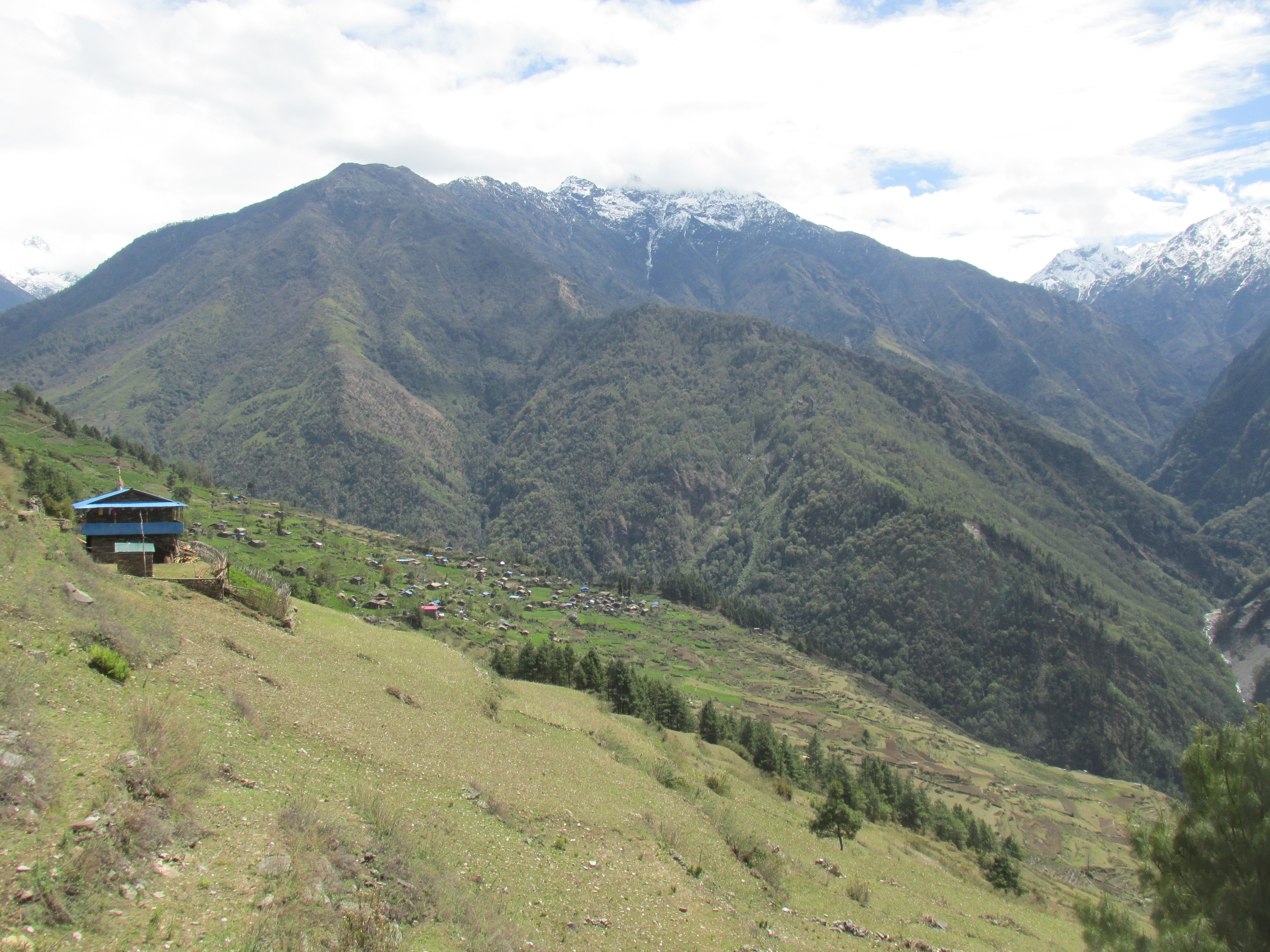
Wow, clear blue sky. When did this happen? The trail lead over the broad valley floor. By Nepalese standards very flat terrain with only a few ‘bumps’. The main attractions were the colourful clay houses and rice fields.

Wico still had to get used to carrying a heavy backpack. He asked some unsettling questions about the difficulty and length of the days that had yet to come. Well, ehmmm, an other order of magnitude of difficulty I expect. Hopefully we will be used to it by then…
We came across a checkpoint where we had to wave our permits. This was probably the only checkpoint we would see. I considered sending Iyam back immediately, but I decided not to.
At Lelep we saw a nice sign indicating the Lumbasamba pas and the Kanchenjunga base camp. Very handy this one sporadic signage.
We met a solo trekker hiking in the other direction. He told us that the Selele pas was a mess and could by no means be crossed. He had tried but returned after getting into hip deep snow. I got very nervous. It had snowed that winter extremely heavy, it had forced me back then, would it force me back once again? That would be a big blow.

We stayed overnight in Sekhatum. A small teahouse right before the ascend to Amjilosa. It was only 1 pm, but if we were to continue we needed to climb all the way to Amjilosa at least 4 hours further. As Wico kind of had already had it anyway we stayed overnight. Once again an overnight place I had been before.
Day 6
Today I would finally get to the part of the route I had not been before. Amjilosa had been my turn around, so the afternoon hike would be new to me. The trail follows the river for a moment after which it ascends 500 meters straight up to Amjilosa, the first serious ascend.
In Amjilosa we had lunch and continued over a rather flat trail through steep grassy area. The trail continued in this manner for quite some time.

The trail kept altitude, but the river down in the valley came ever closer. After about 2 hours we were walking right next to it.
It was already getting late at the point that a rather fierce ascend started. We left the river under us and climbed up for some time. We hoped we would soon reach Gyabla as we were getting tired and the evening was falling. The ascend became steeper till all of a sudden we came to a small plateau on which Gyabla was situated.
From the plateau we had a nice view around. For the first time we could see a few rocky mountains. ‘That is nicely designed by God’ Wico said to me. ‘Just when you have had enough of the ascending, you arrive in a village with a scenic view’.
It was quite chilly in the night. Our host told us of an alternative route which we could use to bypass the Nango la. The Nango la might not be crossable due to deep snow. That was not really a solution, we had to cross the Lumbasamba afterwards regardlessly. The Lumbasamba was higher and undoubtedly more snowy. I already saw that Iyam was starting to crawl back. His constant suggestions to not cross the Lumbasamba were already getting on my nerves.
Day 7
Weather was shit again. This was not helping for the snow above. From Gyabla it is an easy and rather flat hike through Rhododendron forests to Pale. Most inhabitants of Pale are Tibetan refugees that do not speak too much Nepalese. There were a few ‘free tibet’ logos. The village was pretty quiet. Maybe due to the weather most people were inside.
We had some dal bhat for lunch and continued to Ghunsa.
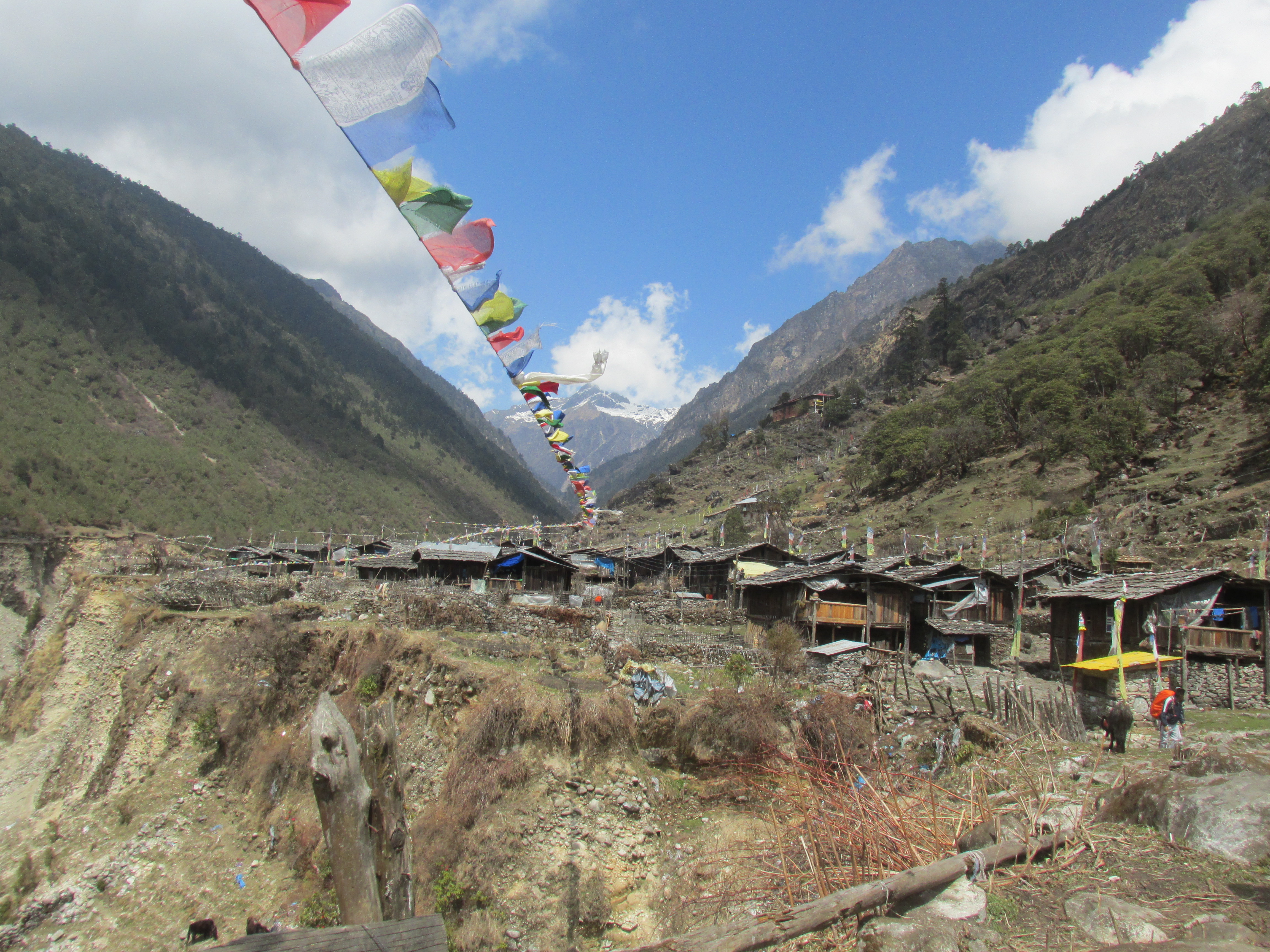
Ghunsa was only a tiny bit further. Ghunsa is just as Gyabla and Pale a wooden Buddhist settlement, differentiating it form the clay Hindu settlements in the lower areas. The weather was poor and we immediately entered a teahouse to warm us by the fire.
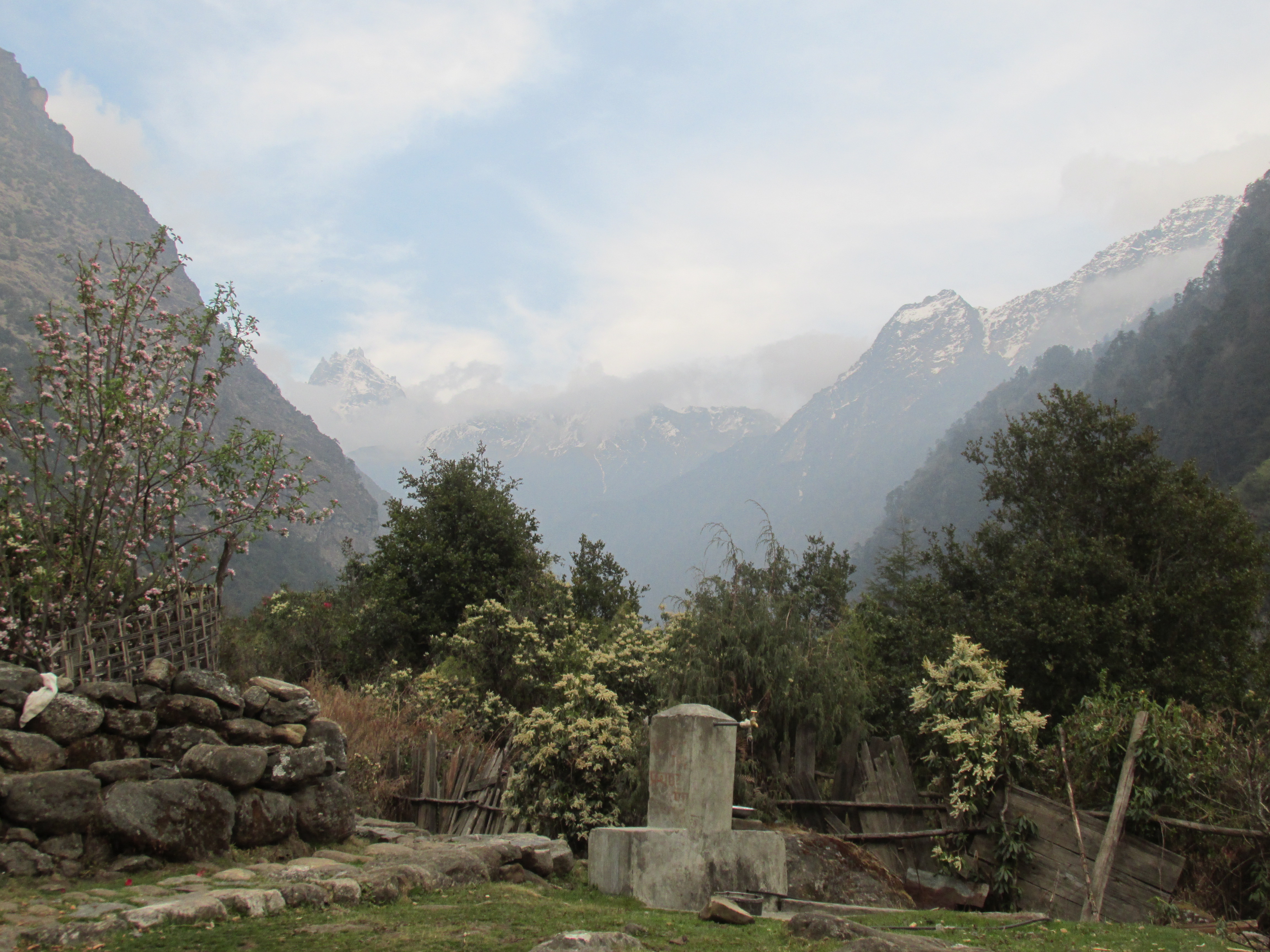
At Ghunsa the mountains started to feel nearby for the first time. The village is surrounded by a few rocky mountains, foreboding what was yet to come. We had left the hills behind us.
It was a very expensive teahouse. I must say prices around here are high in general. They are really wringing the money out of you. 800 roepies for dal bhat makes no sense at all.
In the evening it snowed through the roof. We heard that no one till now had crossed the Selele or the Nango la. This got my already on edge guide even more nervous. I was not willing to give up like I did last winter though.
Day 8
In the morning I thought I heard someone working on the roof. Once I was fully awake I realized that it was melting snow that I heard. I looked outside. Yep, it had snowed quite a bit tonight.
The weather was nice, but rapidly worsening. We wanted to climb a bit towards Selele pas today. Both for acclimatization as well as for the view. We went immediately after breakfast as the clouds started to roll in fast.

We hiked up quickly. It was of no use, the clouds caught up with us. After having ascended only about 200 meters we were already in snow. Wico asked how much more snow would be on the Lumbasamba. I feared that it would be over knee deep, so nothing compared to the ankle deep snow we had here.

A bit further on our sight got fully blocked by clouds. The wet snow was also getting annoying. This was of no use. We called it a day and returned.
The rest of the day we hang around Ghunsa. We had a look at the old Gompa, but there was not too much to do.
Day 9
Our final destination Kanbachen lay only 3 to 4 hours further. For acclimatization purposes we would stay there another two nights. The lack of phase was a pity, From Gyabla to Ghunsa had only been half a day, yesterday we had rested, today once again a very short day and tomorrow once again an acclimatization day.
As the Kanchenjunga base camp is the main destination of almost everyone traveling here and since everyone takes some acclimatization day around here the trail was quite buzzy, I think there were easily 10 groups on the road.
The trail leads slowly up through some pine forest after which the climb up the moraines of the immense Kanchenjunga glacier begins.
Once on the moraines we found ourselves in high mountain country. The valley is an alleyway along the snowy palisades paved by the large glacier. The Jannu, or Kumbakarna steals the show. The south face of this 6200 meters high mountain rises straight up from the valley floor. I simply cannot imagine how one would climb this 1500 meters rock face.
Kanbachen is not much more then a bunch of lodges welcoming tourists and a small pasture for growing potatoes next to it. The lodge was pretty luxurious and we could order some improvised fries, which was a nice addition to the usual dat bhat.
Day 10
Today we would make a short day trip to the base camp of Jannu. The weather was quite clear, but while we were crossing the moraine filled glacier it clouded up quickly. We slowed our phase and practiced a few rope techniques hoping it would clear up before we would reach the actual base camp.
It didn’t. There were however occasional gaps in the cloud cover granting us some peeks of mountainous world around us.

It was just a little more than an hour to return to our lodge, where we could get back to the fries. The lodge owner told us that a large group had crossed the Lumbasamba two weeks ago. He did not know about Nango la, but it could very well be that the situation would be better than on Selele.
Day 11
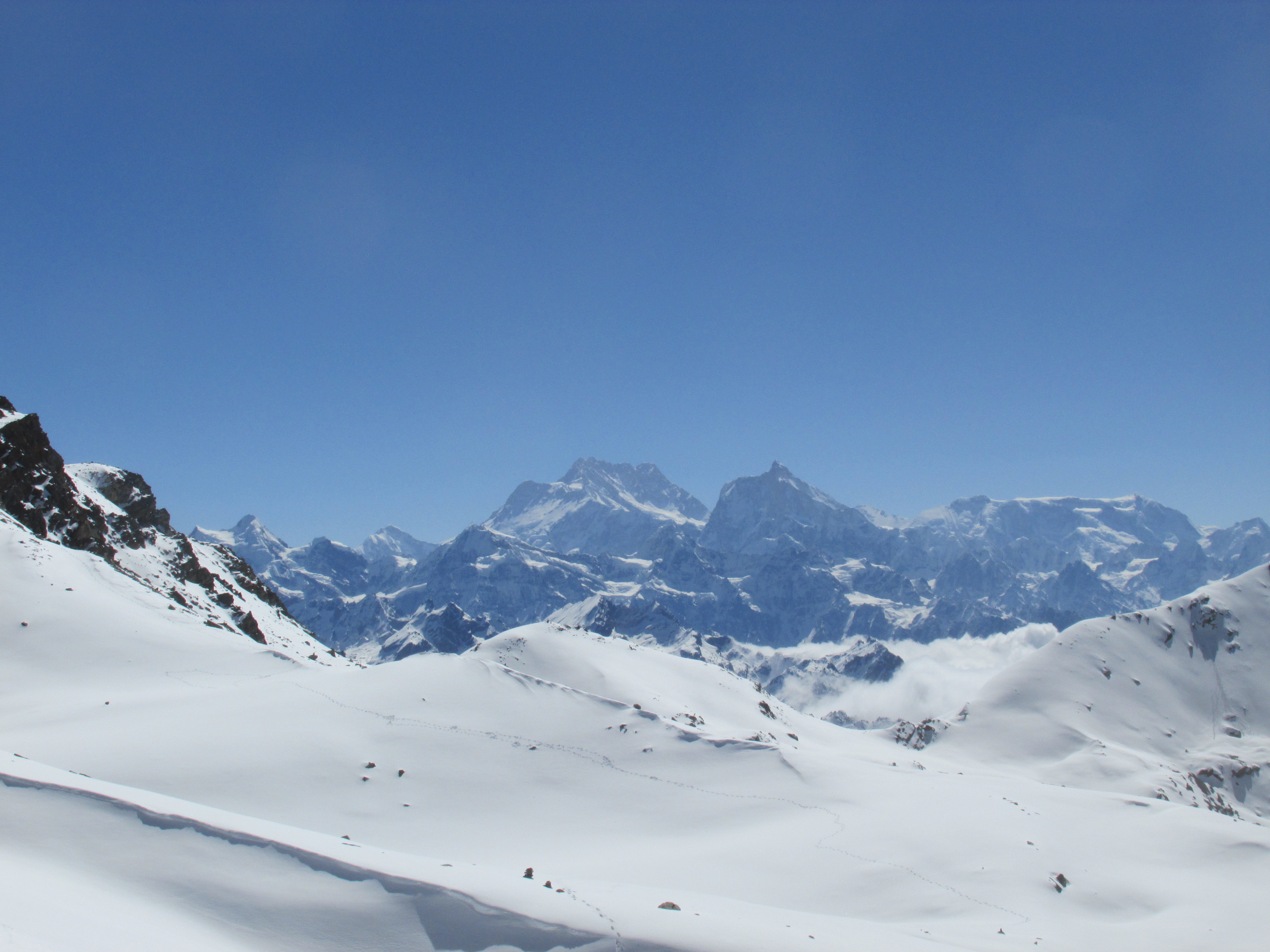
The skies were clear, good, as a spectacular day lay ahead. We hiked along the eastern side of the glacier very slowly ascending up valley. Around us some of the most beautiful alpine scenery I have ever seen. The valley itself is almost completely flat whereas the mountains rise straight up on both sides.

It was a very easy day and we arrived in Lhonak early in the afternoon. Lhonak is nothing more than a small hut and some ground on which you can camp. We ptiched our tent and sat around the fire in the hut with the other trekkers.
We met a large group of Czechs, they were also about to cross the Lumbasamba. We decided to meet again in Ghunsa and team up for the Nango la and maybe for the Lumbasamba as well. This teaming up finally got my guide to stop wining about crossing the Lumbasamba.
In the evening the weather worsened. We all clammed together covering ourselves with the sheets we could find. It snowed through the roof. When we went outside to go to bed we saw that the land was snow covered and the sight was limited. This was going to be a cold night. If the weather was like this tomorrow we better wait another day before going to the base camp. Sources have described it as the most beautiful place on earth, so it would be worth the wait.
Day 12
It was as expected a cold night and I was happy when I felt the sun shining on the canvas. I peeked outside and saw that the sky was completely clear. Could not get bluer. We quickly rose and went for it. We did not have breakfast, we had no time to lose as we knew how cliquishly it could cloud up again.

I hiked as fast as the altitude allowed me to, by times waiting for Wico to catch up. There was still no cloud in sight so it would probably stay clear. The impressive steep rocks on the other side of the valley had a beautiful light brownish colour.

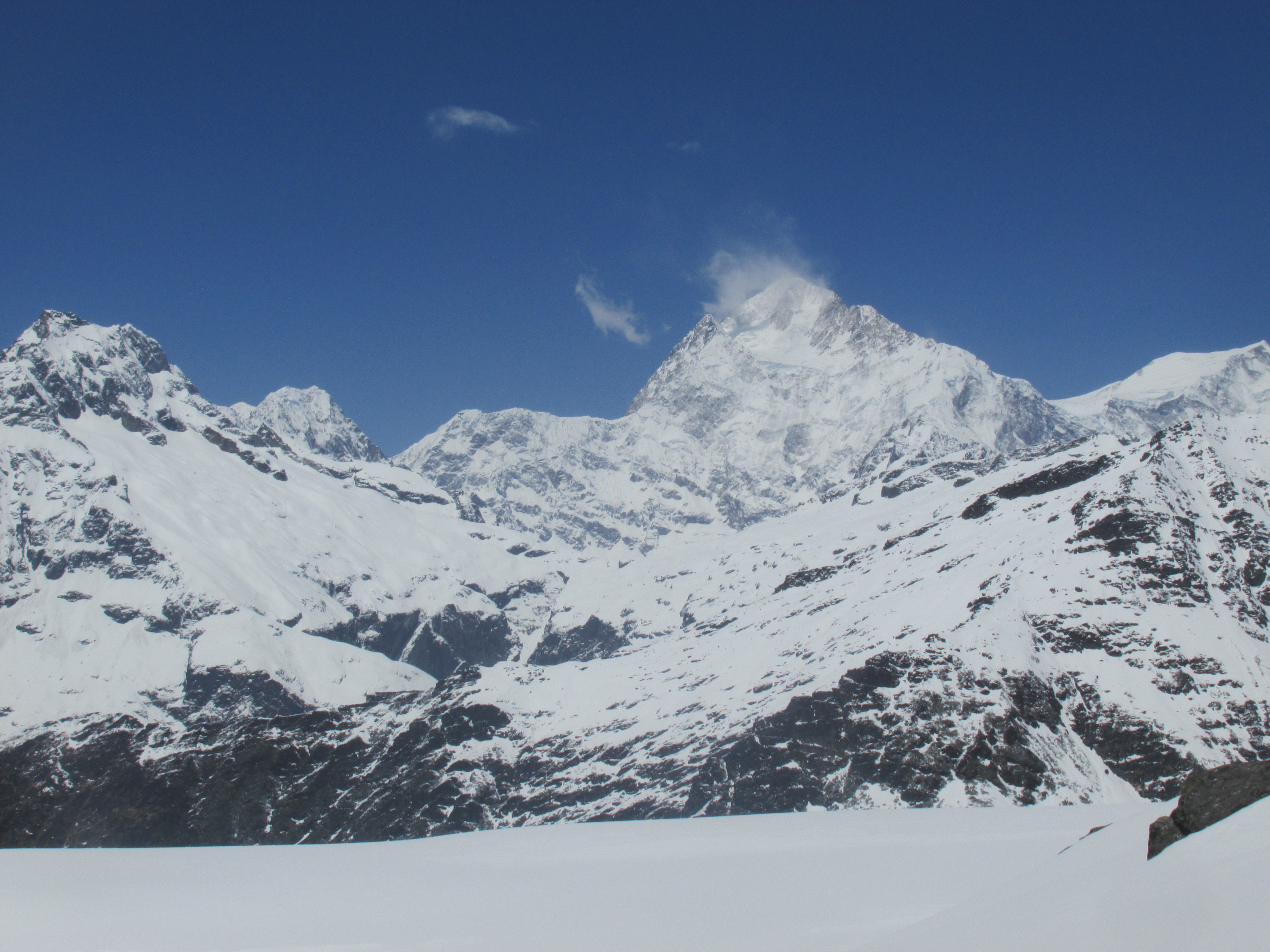
It was still morning when we got to the base camp. There were no climbing expeditions, maybe they would arrive later in the year. I had to admit that describing the scenery as the most beautiful place on earth was not even that big of an exaggeration. As far as base camps go it can probably only be rivaled by the K2 base camp.

We made maybe a hundred photos but our cameras were not able to capture it. We considered hiking the high hill behind the base camp, but decided not to. We hung around for quite a while and returned to Kanbachen that same day.
An older German fellow arrived at around 9 pm in the evening. He had climbed the 5900 meter hill behind the base camp and returned to Kanbachen that same day. Well, I applaud him.
Day 13
As we were supposed to meet up with the Czechs, who had stayed in Lhonak, we could hike no further than Ghunsa. This would be an extremely short day of only about 3 hours. We still had to depart early though. The route traversed a steep rocky slope that was notorious for falling boulders around noon.
We hiked very slowly down valley leaving the alpine scenery behind us. No matter how slow we went we still arrived in Ghunsa in under 3 hours. The weather was great and people had started to plough their fields and plant their potatoes.
I bought food and fuel for on the way. I did not buy a lot as I could resupply again in Olangchungola before crossing the Lumbasamba. The weather was beautiful and I played with the idea of just leave immediately. It was only noon and we could easily make it to the base of the pas today. My guide Iyam however really wanted to wait for the Czechs. If you are so fain hearted why are you a mountain guide? I aske myself, but decided to wait anyway. I agreed with him that he would take us to the base of the Lumbasamba where after we would cross and he would return. That way I would be rid of him.
Later in the afternoon the Czechs arrived. They were a very nice people, a large group of 8 people, almost all family. They had one guide but were lead by a medical student of around my age. He made me think of me. He had also planned the route carefully more than a year in advance.
In the evening we met two Germans who trekked with the same agency as I did. Their guide gave us their tent as they would not be able to cross Selele anyway and he did not want to carry the weight. I hesitated, but agreed. My guide would return by himself I could just give him the heavier tent and this way make use of a more spacious tent for a few days.
Day 14
We left early in the morning. The guide of the Czechs knew the way, this was nice as the part where we needed to start ascending was not obvious. Later on the trail however grew broader. We hike up through the forest. The mountains east of us around Selele were a nice sight through the trees.

We camped among some low Rhododendron shrubs. We could already see the pas not much further up. It looked rather easy… We did not head further as we could make a nice fire here.
The fire was nice for warmth and also nice to save some fuel for cooking. In the unlikely case there would be no fuel in Olangchungola it would be best not to use too much right now.
In the late afternoon is started snowing. I stoked up the fire and managed to keep it burning during the snowdrop.
In the evening I was glad we had brought the larger tent. My own tent was already pushing it for two people, let alone three.
Day 15
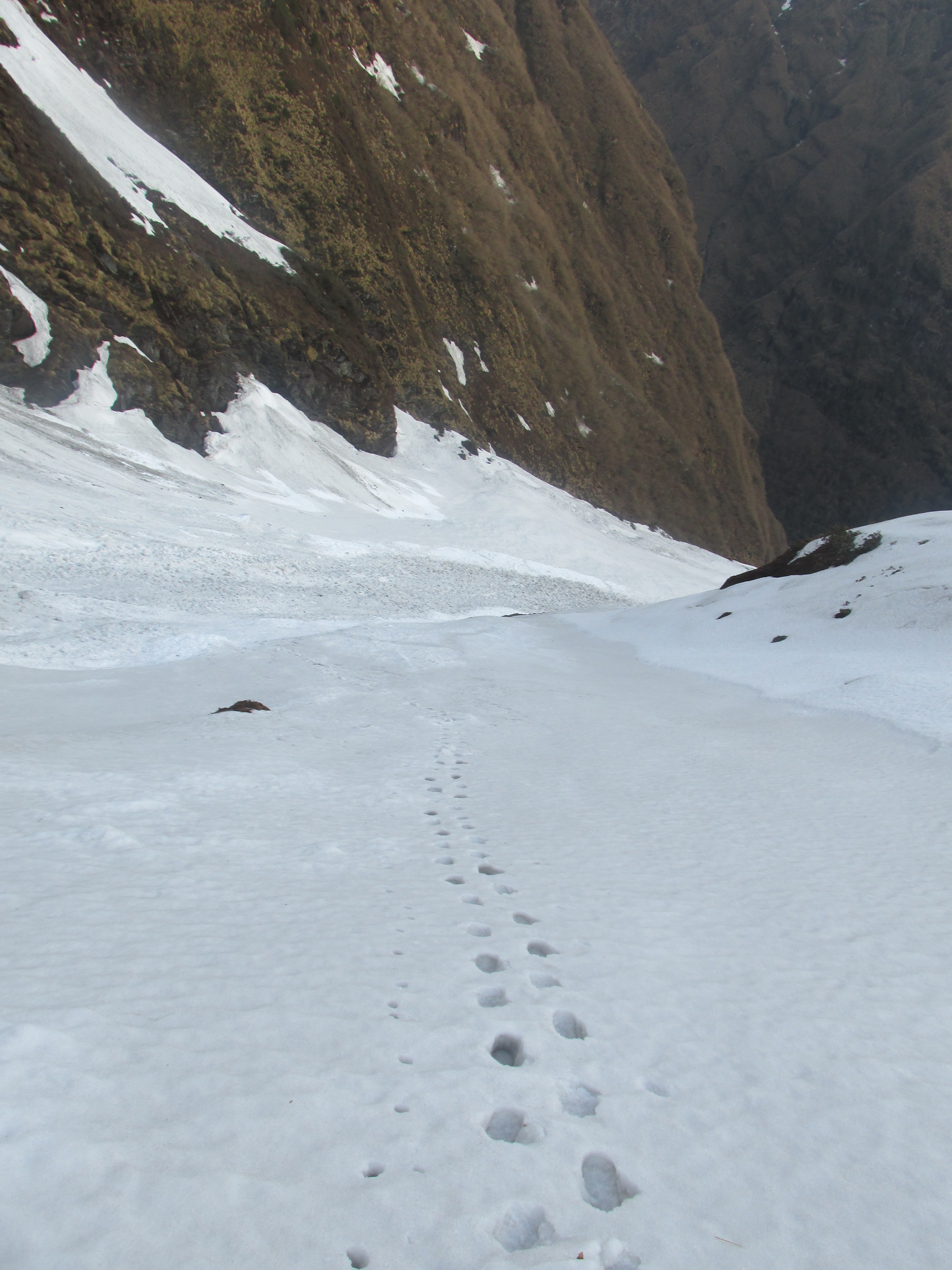
We left at first light. After a while the slope became a little icy and we put on our crampons.

The snow lay thin, but once on the pas we started to fall through till our knees. One of the Czechs dug with his ice axe, but could not find the end of it. This could very well be 3 meters thick.
Our guide Iyam asked the guide of the Czechs whether this was the Lumbasamba. We all had a good laugh, this guy really didn’t know what he was doing. As the snow was pretty deep me and Wico decided to rope up. The rest followed in our footsteps.
This side of the pas was way and way more snowy than the other side. Once we got lower and the sun higher we started to fall through. If we had to ascend this way under these conditions I was not sure whether we would have made it. A valuable lesson, we had to ascend the Lumbasamba as early in the day as possible. It would be full moon once we were there, so leaving during the night was probably best.
The going went slow. The last moraines in the snow were a true pain in the ass, as you could not trust the underground anywhere.
Once we got of the snow the way was easier. We came to a small glacier that we had to cross according to the map, there was clear visible trail as well. The guide of the Czechs however knew it was way faster to keep on this side of the glacier. He turned out to be right.

The Czechs, who had quite some older folk with them, wanted to call it a day, I however wanted to head further. We decided to split up. I doubted their stamina and willingness to start hiking at 3 am. The conditions on the descend had learnt me that if we were to stand a change at the Lumbasamba we would have to leave in the night and hike swiftly. This Czechs group just went to slow ans lacked the willingness to push it to the limit.
Me and Wico descended all the way down till the valley floor. The last part was damaged by landslides and not too clear.
Some Rhododendrons were in bloom, but not too many. It was a weird season with way too much snow. Normally the Rhododendrons would be in full bloom right now.

Once down we found a patch where we could camp. I decided to keep heading further. This was unwise as this turned out to be the last reasonable camping spot all the way till Olangchungola.
We pressed on and on. There were places that we could camp, but nothing great. We were in a bind, we were tired so on the one hand we wanted to stop and camp, but on the other hand was the tempting thought of some well cooked dal bhat and a roof above our head in Olangchungola. The night fell. Wico and Iyam were completely fatigued. Iyam proposed to just lay down next to the trail. I however still had some energy in me and saw that Olangchungola was just too close to let go now.
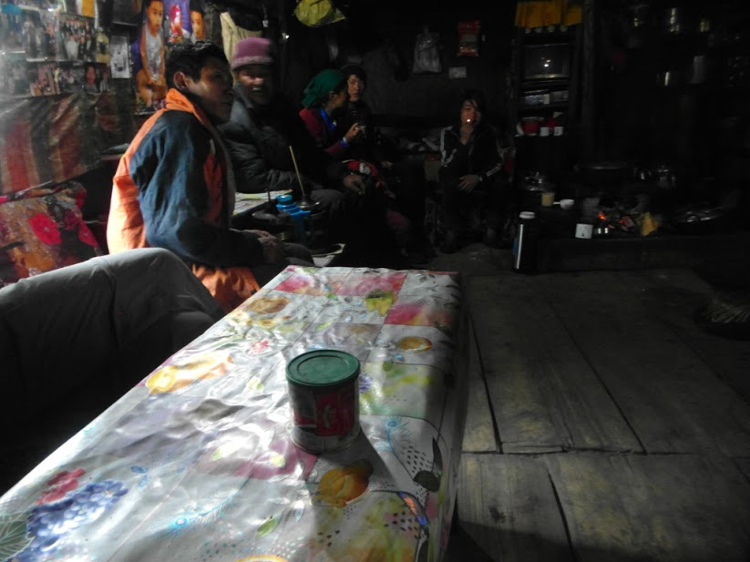
Late in the evening we arrived in the village and sat down with a well English speaking guy of about my age and his mother. Wico and Iyam were almost too tired to eat.
Day 16
After the hectic day yesterday, I was forced to allow a resting day. We hang around the village for a bit and visited the old monastery. The monastery was open and had some traditional Buddhist masks on display.
Our host spoke excellent English and had studied in India. He proposed he could guide us over the pas, but I felt confident enough to find it myself. The idea of hiring a second guide to make up for my incompetent one was not a road I wanted to go down. I had already done that last winter and it did not work out well. I would be outnumbered. It is never a good idea to give away the initiative of your trek to others.
My host described the way I had to take very carefully, this turned out to be of great help. I had to follow the trail till an extremely large grassy area, as big as an airport. Than climb up a steep rocky narrowing of the valley. After that I had to hike for about 20 minutes where after I would need to climb steep up. The climb would flatten out a bit. After the first pas I had to keep altitude and climb towards the second one. Than it is just a matter of following the water down.
Later in the day the Czech group arrived. They were tired and wanted to take a resting day tomorrow. Of course Iyam wanted to wait for them, but to his dismay I refused. I told him that he only had to go along with us till the base of the pas after which he would return with our tent. I did not split up yet as it would be a nice advantage not needing to pack up the tent if we rose at 3 am.

Day 17
We left quite late in the morning and followed the trade route with Tibet north. I had a good feeling about our chances of the Lumbasamba. The ancient trade route, flowers and distant mountains made up for a great ambiance. We slowly made our way deeper into the mountains. This was trekking the way that it was meant.

After about 2,5 hours the route to the Lumbasamba diverted from the larger trade route. We crossed the bridge and followed the now smaller trail in northwestern direction.
The weather clouded up and here and there the first snow started to appear. The trail was pretty vague and by times simply not there. After a while we got to a yak herding pasture with some stone structures that would probably be in use later in the year once people started to drive cattle up here.
We climbed to the moraines. I wanted to hike till the grassy area as big as an airport our host had described. Once up the moraines we however found ourselves in knee deep slush. Unless we wanted to break our ankles we had to camp.

We had to pray for a cold night, if this slush would not freeze over we would have a big problem. My friend Wico was not feeling confident about it. A thick mist started to roll in plummeting his moral even further. Our guide was however more optimistic. He even asked if he could join us. The way back all by himself would be dangerous. I declined and made up some pretexts.
We pitched our tent and I made some nice and warm dal bhat. This boosted Wico’s confidence again. If it would freeze tonight we would go for it!
I wanted to wake up at 2:15 am and be on my way at 2:45. Iyam said that this was unnecessary the snow would be fine till noon. I did not want to take chances and only compromised a little putting the alarm on 2:30 am.
Day 18
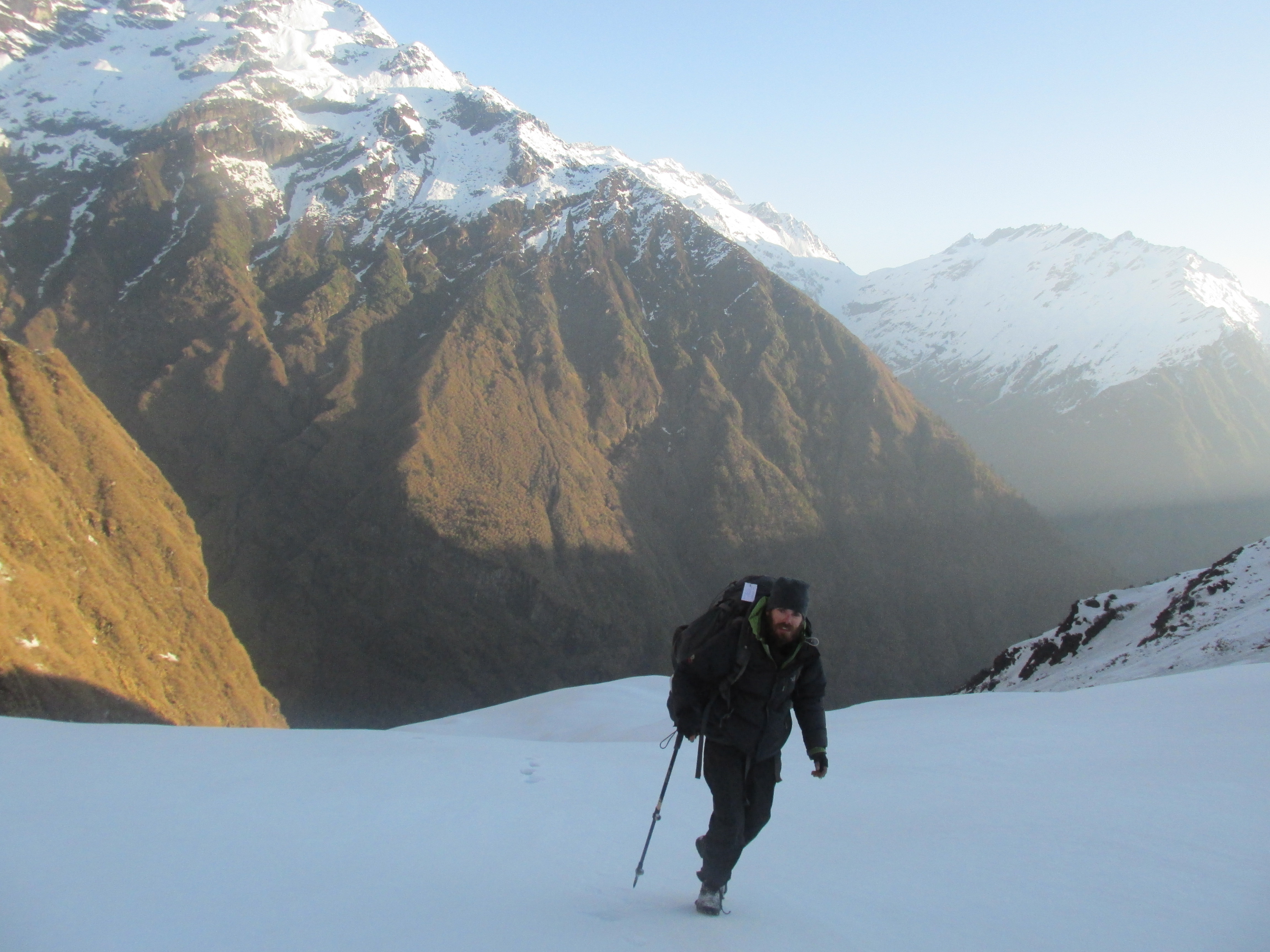
When I got up and looked outside I saw that the sky was clear. It was full moon so the visibility was reasonable. We got up battling the cold. God was I happy we did not have to pack our tents in the night. I sat my first steps outside. Unbelievable the ice held!
We got on our way. We fell through a lot of times in the beginning, but further on the ice held firmly. It was completely flat and we hiked the first 2 kilometers in just 40 minutes. This was probably the airport our host in Olangchungola had talked about. Only with the grass covered under a deep pack of snow.
The valley narrowed and we had to climb a rather steep and dangerous slope. Once on top the way flattened out again. This was probably the steep rock we had to climb. Now if my directions were right I had to turn sharp west and climb steep up in about 20 minutes.
It started to get light. At the first point a turn west seemed reasonable I made the turn. Wico was rather surprised by this move, but both my gps, directons and memory of the satellite imagery seemed to be in accordance.

Our crampons and ice axe proved their worth on the slopes. After a while, as expected, the climb flattened out. We found ourselves in a completely white world. The Kanchenjunga massif started to show south of us. The full moon on the horizon made the enchantment complete.
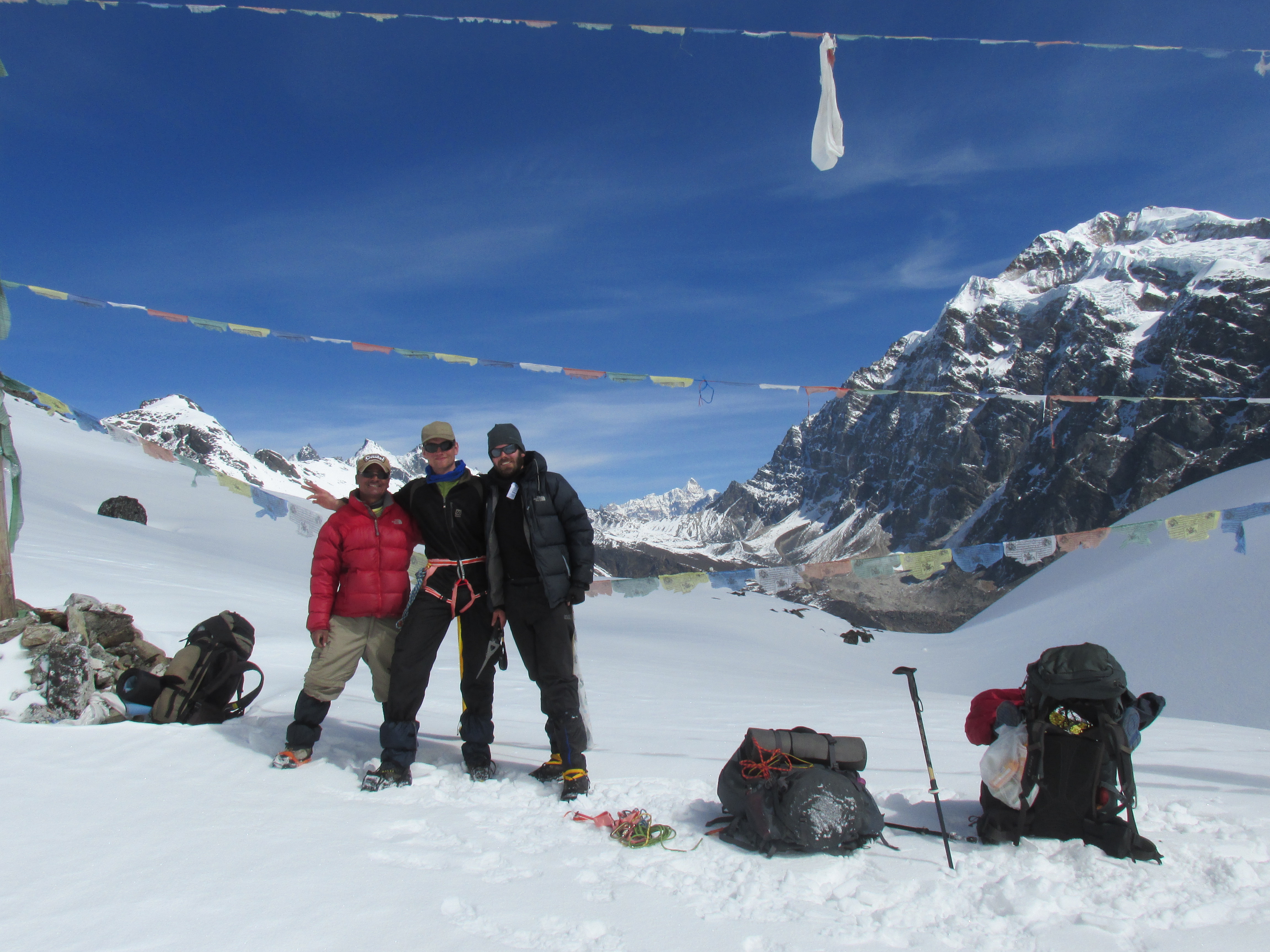
The snow still held firm and we approached the pass rapidly. It seemed we had to choices. The ridge seemed to show two passes. One in between two mountains and the other one a bit further south on the edge of the souther mountain. I remembered that the Lumbasamba was not located between two tops and climbed the southern option. In retrospect I think this was indeed the right move.

We made it to the pass and were treated by a spectacular panorama to the west, south and east. This easily rated as the best view I had ever had. We could see the Makalu all the way in the west, where we would reach in another two weeks. In the east we saw the spectacular Kanchenjunga en Jannu. To the south we could see all the way too the green middle hills. The view was stunning, but we did not linger too long as, though the second pas was nearby, we saw that the snow started to melt.
We pushed on. The other pas seemed in reach. It was only 800 meters further. Despite of that it took us a long time, the snow had lost its strength and we started to fall through at every step. We were lucky that we had started early, I don’t think we would have made it otherwise.
On the second pas we took our time. We had made it. Descending through deep snow is not as much of a problem as ascending and we could already see the end of the snow below us.
From this pass the view was even more amazing. The majestic Makalu towered above everything else in the west. What a mountain… Wico and I congratulated one another. This was quite an achievement and an forgettable view.

We descended through deep snow. By times till our knees, by times till over our hips. At the first patch of green we pitched our tent. We had made it just in time. The snow was getting unreasonable and the mist started to roll in. I felt extremely lucky. I really doubted whether the Czechs would make it.

Day 19
Another cold night. We woke late as the next village Thudam was nearby anyway. Our shoes had frozen over and we had to unfreeze them while walking. We still fed on the victory that was yesterday so we did not care.
The other side of the valley was covered in snow whereas the norther part was completely free of it. Nice what a little sun can do to a slope.

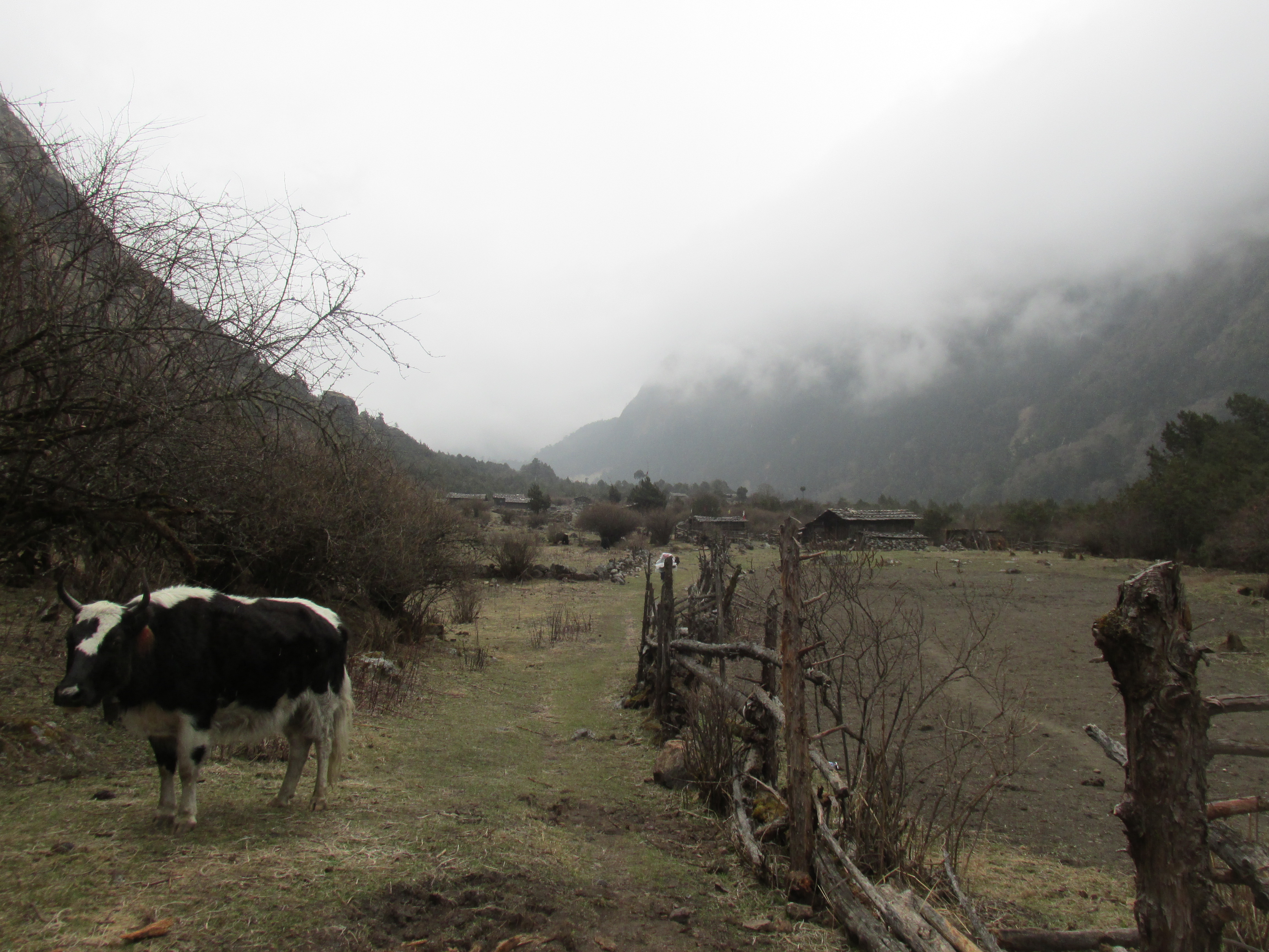
After about 4 hours we hid a main trail again. This trail lead to the Umbak la crossing to Tibet. I intended to trek up this trail tomorrow and climb a mountain on the border with Tibet the day after. It did not take long before we met the first yak shepherds and not much later entered the village Thudam.

Thudam is an extremely remote village that has only recently seen some tourists passing through. Resources are very limited. Their diet consists of meat, rice, wheat and potatoes. This is the first place in the Himalayas where I was not able to buy dal.
The people were vague and I could not get anywhere with them. It took quite a while before someone finally took us in. A funny older guy who made us some rice and bread. Later on we met two Nepalese who spoke a bit of English, they turned out to be development workers, that were here to address the issue of the complete lack of a toilet.
Day 20
Today we would hike towards the Umbak la, tomorrow we would climb the 5800 meters mountain. The weather was great and I felt optimistic.
On the way we passed a few Yak shepherds, one of which warned us about the high snow levels on the pas. Well we will just see.

The mountains around us started to get a little Tibetan style. Brown and a bit more hilly. At around 3 pm we made camp.

Day 21
When I woke up a thick pack of snow was waiting for us. The visibility was very poor, we decided to head back. This was pointless.
The way back through the snow was a lot tougher than yesterday. We lost the trail quite a few times, but around noon we were safely back in Thudam. We again stayed overnight with the same man as before. He actually wanted to go to Gutighumba, but had waited for us to make another penny. Conveniently the price to stay overnight had risen by 500 rupees.
That night we discussed whether the Czechs would have crossed the Lumbasamba or not. We had exchanged emails and on our return home we would find out that they had been forced to turn their back on the pass due to the snow.
Day 22
We had some bread and left down valley for Guthigumba which lay 2 days down valley. Our host would leave that day as well and told us that there it was possible to stay with a bunch of yak shepherds on the way. At least that is what we thought he said as we did not speak a word of each others languages.
The route lead through a ever steeper getting gorge. We were back in the hills, no high peaks to be seen. After a few hours the trail started to ascend to a small pass shortcutting the steep cliffs down at the river.
On the pass we had a small lunch break. In the distance we could already see Guthigumba. We saw that the snow lay very low there as well. Probably as low as 3500 meters.
We hiked further till the evening was falling. We had not yet encountered any yak shepherd and there was no place to pitch a tent in this steep country. After a while we found a cave in which I wanted to sleep. Wico did not like the idea that much. There were quite a bit of mosquitoes around and the cave was not exactly clean. He continued without his backpack to explore a little further. When he returned about half an hour later he said he had found the Yak shepherds further on.
We continued an arranged shelter with the Yak shepherds. We got some amazing yak/cow meat for dinner plus actual milk.

Day 23
Guthigumba was close but we had to descend and ascend 700 meters into the Arun valley to reach there. Typical Nepal. It was hot for the first time since a very long time.
The landscape opened up and the many houses and terraced fields looked very inviting in the sun. After having been high up in the mountains for over two weeks the habited countryside was a welcome change.

Guthigumba is a Buddhist town that trades a lot with nearby Tibet. The border is only 8 kilometers away, without even a pass in between. Of course the hotel was the highest building in town so we had to ascend another 50 meters to get there. It was however a comfortable and well priced establishment and worth the climb.

The hotel was directed both to locals and tourists. We had the pleasure of meeting an Nepalese engineer from the university of Pokhara. He was here to investigate the possibilities of building a hydro power plant down in the valley. The engineer told us that evening about how unprepared he found Nepal to be for an earthquake.
Clairvoyant words as it would turn out just two week later…
Day 24
We woke up very late and left even later. The engineer from Pokhara had already completed his sight survey. Unfortunately it had turned out that the area was too geologically active to consider a power plant.
The weather was amazing when we left. The surrounding countryside with its farms, school children, stupas and shepherds was quite romantic and not threatening for a change… As Wico put it: ‘It’s nice to hike through park Nepal’.

On the way we met a German woman working with a Nepalese team at a hospital. We had a nice chat and Wico bought some Vaseline. The Vaseline was called for, Wico had used up all his Vaseline, which he needs due to his skin condition. The mountain air had a harsher effect than expected so we had run plain dry on the stuff.

It was already getting dark once we caught sight of Hongon. Hongon is a large village with a good hotel where we immediately settled. Tomorrow we would take a spare day to resupply and rest before embarking into the next remote section of our trek.
Day 25
We had a relaxation day. I bought food and fuel for about 5 days and that was pretty much about all I did that day.

A guy dropped by who asked if we had already bought our entrance ticket to the Barun conservation area. We hadn’t and said we would buy it as soon as we could. He told us that we needed to go to a town 4 hours south of here. I said that I would do so tomorrow, knowing full well I would never take an 8 hour detour in order to get these tickets.
Hongon is plagued by landslides which threaten many parts of the village. If you walk the village from north to south you need to descend and ascend into over 5 deep gullies.

Day 26
We went into the wild again. From here until Yangle Kharka about 5 days hiking further we would need to be fully self reliant again. We followed a large trail leading straight up the hill behind the village. If I read my map right it was 1600 meters up to Molun pokhari (lake). This seemed like a feasible destination for today.

The trail lead through thick forests. After two hours of walking I had lost the trail for a moment. We were completely stuck in the shrubs, this could not be right. The trail had began rather big, but was now very faint. It took us quite some time to find the route again and even than it was questionable whether this was the real deal.
About one hour further up it turned out that it was. There was a small abandoned hut, so we were on the right track. It had started to rain, so we had lunch inside the hut. It started to rain pretty hard and it was tempting to stay here for the rest of the day. We however did not have enough food for that kind of lingering and went on.
After about an hour further up the time was again there… Snow. Deep, wet snow. God had I hoped that the situation would have been better here. Of course we immediately lost the trail. The going got tough, but we decided to push further.
On the bright side the weather miraculously cleared up. The mist made place for a nice view over the hills south of us. Hopefully this would be a good sign for tomorrow.
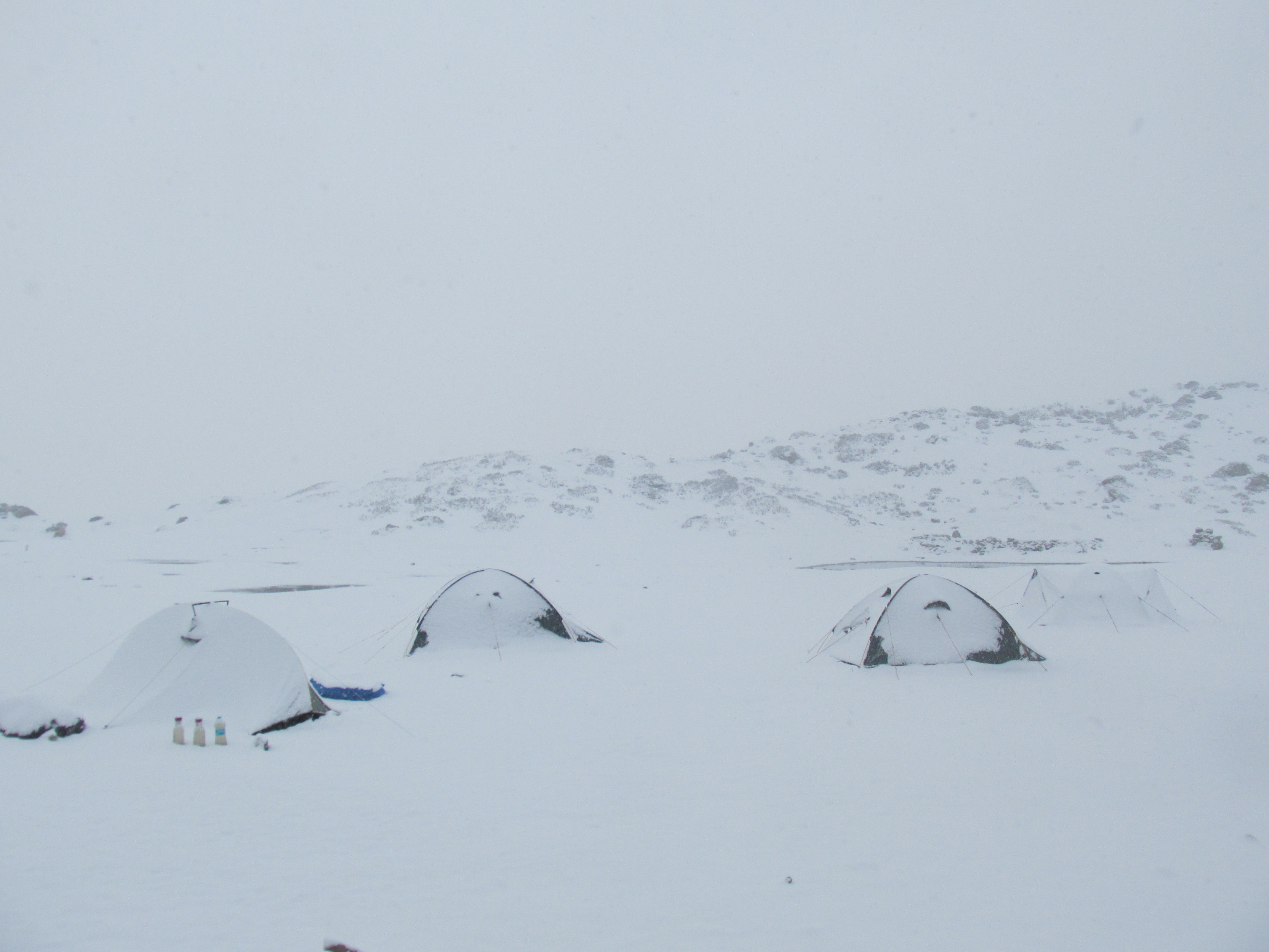
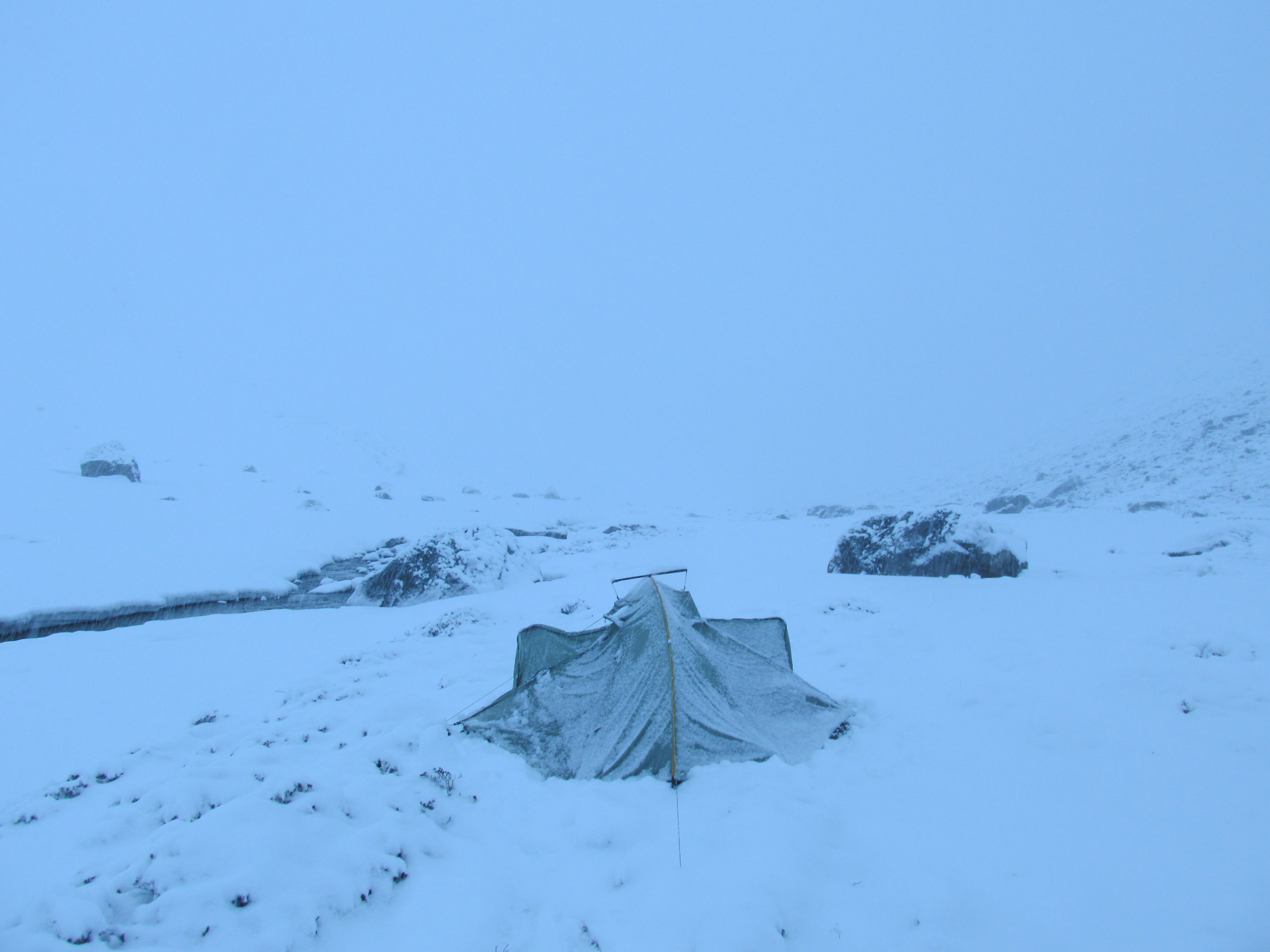
When the snow became knee deep we halted and camped. We intended to perform our usual trick of waiting for it to freeze over at night. I put the pegs of the tent into the wet snow. It did not really do much, but when it would freeze it might.
Day 27
I woke at 4 am. It stormed like crazy outside. Truly like crazy. I was afraid our tent would tear apart. Funny enough the pegs held as the snow was completely frozen over. After a while the inevitable however happened and the rope holding the tent to the peg tear. The snow blew inside. I quickly grabbed the rope by hand and held it. We started to prepare ourselves to go. Taking turns holding the tent in place.
The sky was completely clear that day. We had not seen it that clear till now. We climbed up over the steep and ice snow till Molun pokhari. The lake itself was not visible as it was completely covered with snow.

We passed the lake and ascended further. It was a good thing that the snow held us in most places, otherwise this would have been hell. (which of course it later in the day became).
On the plateau behind Molun Pokhari we had a great view over the ranges south of us. We turned west to ascend to the pass. The snow started to weaken and we had to wade through knee to hip deep snow.

Once on the pass itself we had an epic view over mount Makalu. The mountain seemed so close, but it would be several days more hiking.
Behind the pass it is tempting te start descending. I however knew this to be wrong and held altitude. We climbed the ridge north of us and descended to Kalo pokhari (lake). This lake was covered in snow and we could walk straight over it.
We descended rapidly through the deep snow. The snow only stopped just a about 200 meters above the valley floor. We were out of this world happy once our feet touched the green grass again.
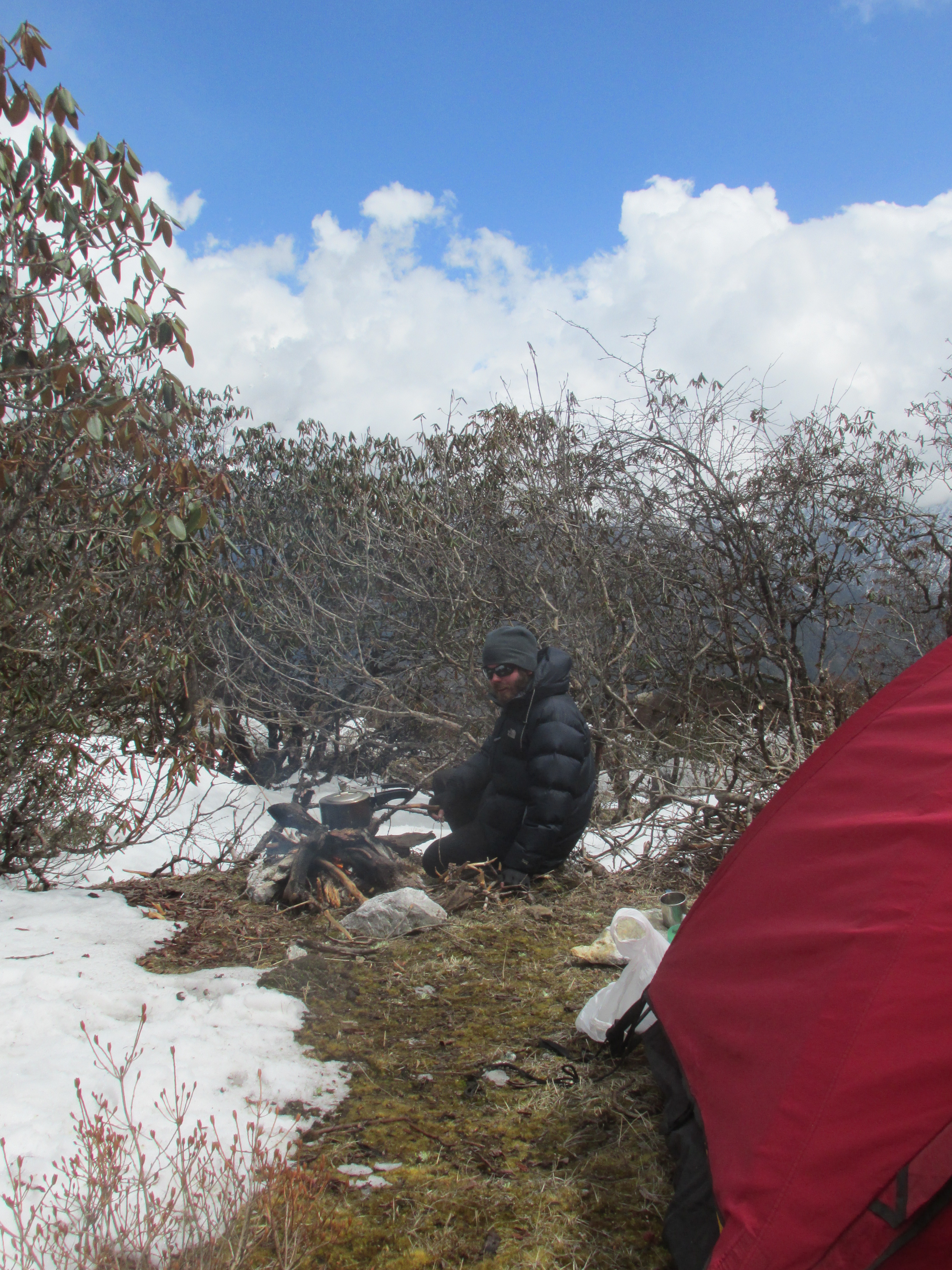
We pitched our tents as the snow hiking had exhausted us. We cooked on wood in order to safe fuel. Or to be more precise we cooked on bamboo. This wood type has the nice property of burning regardless how wet it is. It burns very hot, but very quick as well.

Day 28
We followed the broad and easy trail down valley. It took us along through dense bamboo and Rhododendron forests. The quietness of this remote hidden valley was impressive.
After an hour and a half, we stood on the trail around 100 meters above the first side river. We needed to cross this river, but the trail pushed us up the side river, ever further ascending. After some time there was no doubt about it, this trail would take us to the Chiranchoma la towards Tibet and had no intention of crossing the river any time soon. We went back and descended to the river cross country.
Once down at the river Wico started cooking and I went off the try and find a trail heading further down valley again. I crossed the river and luckily quickly located a small but clear trail heading south. Quite a relief, as heading back via Molun pokhari would have been an enourmous pain.

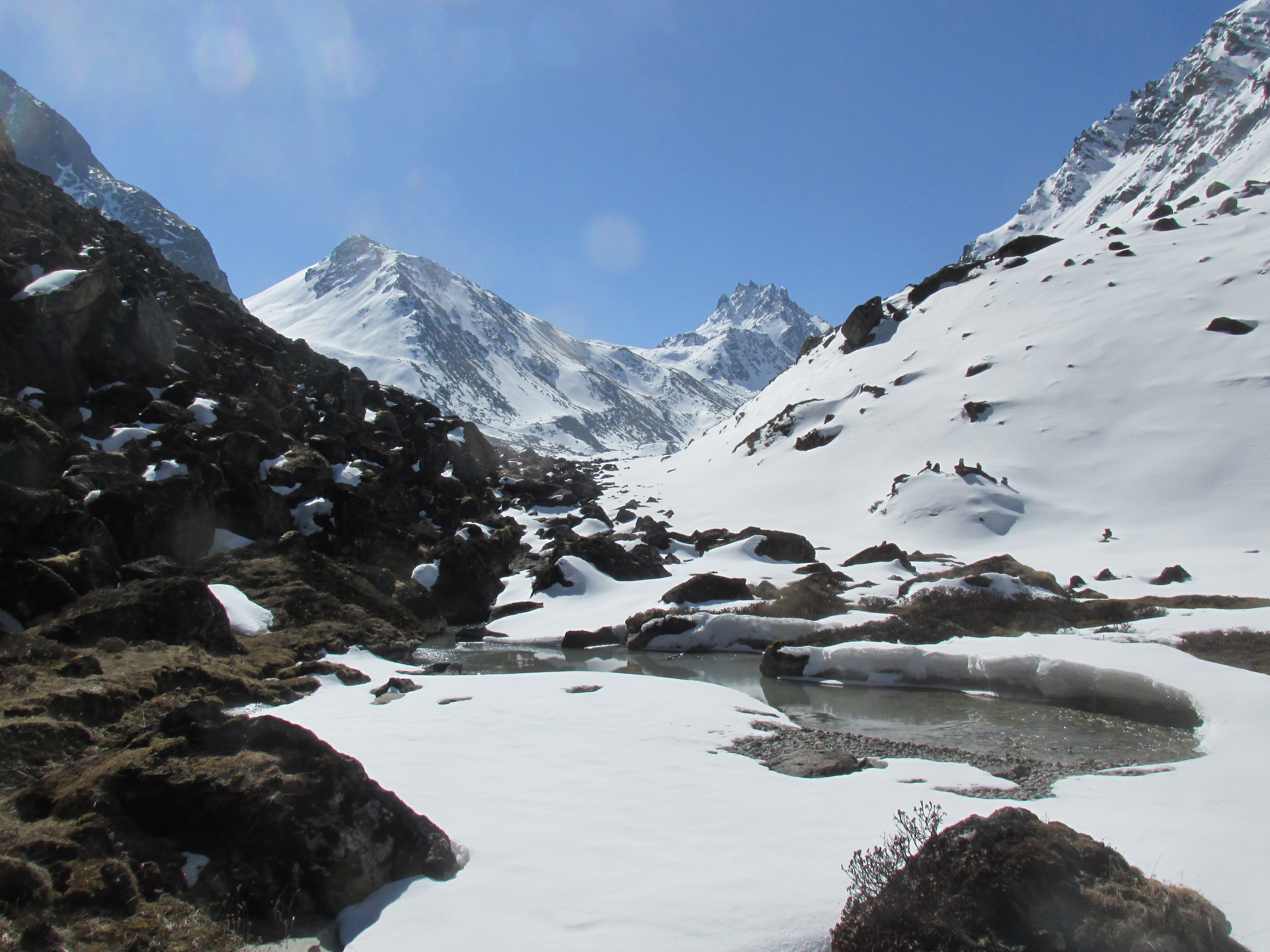
We followed the tiny trail south and were glad when we found our very first stone man. After about two hours we came to the Sadim khole. We crossed it and followed it up stream. I knew that a cave not much further up would signal the start of our ascent.
Most people camp at this cave, but we decided to hike a bit further. There would probably once again be a lot of snow up there and it was best to camp as close to the snow line as possible, granting us the opportunity of an early crossing.
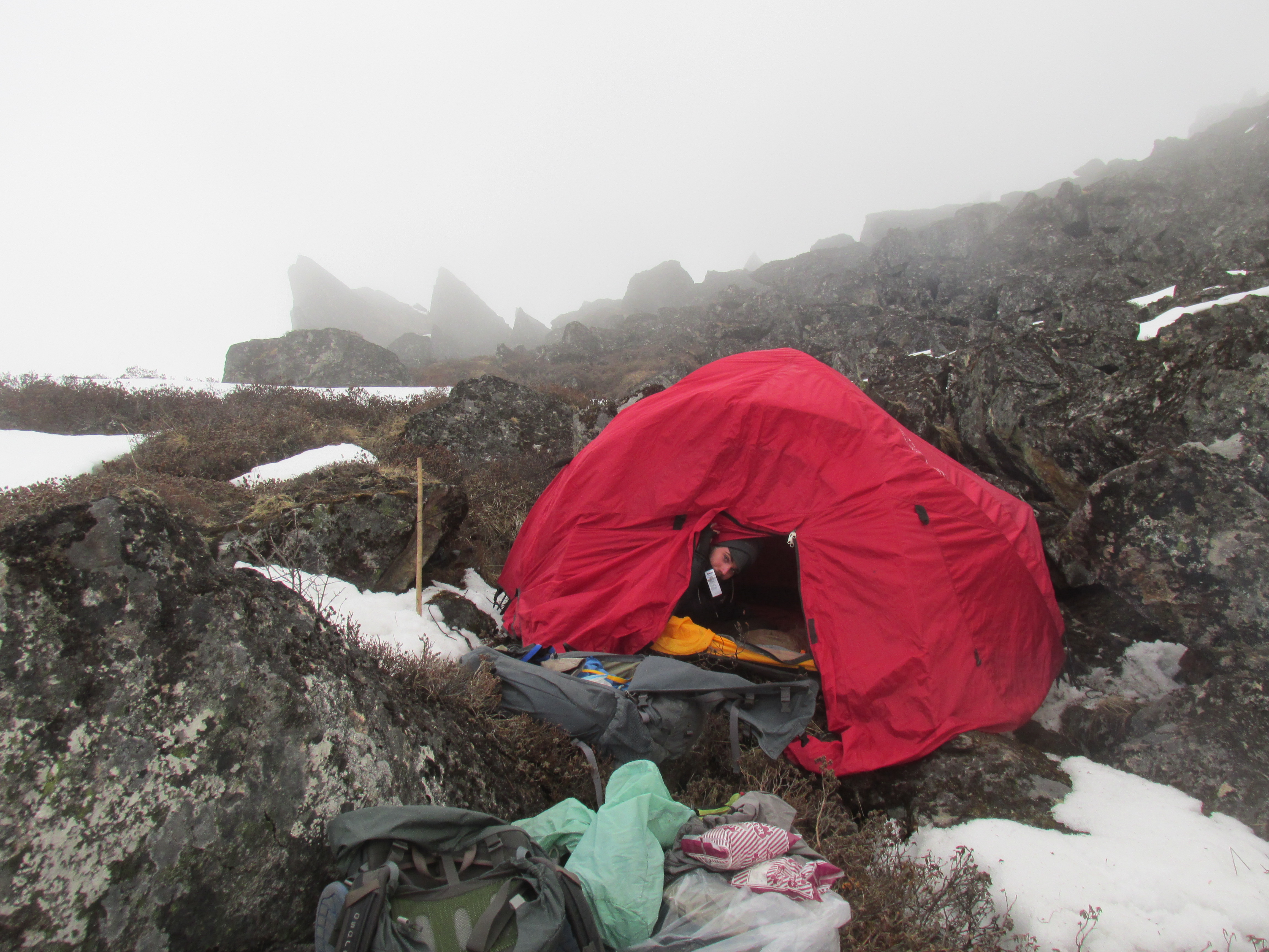
We hiked steep up the glacier like snowfield and after a while set up camp on the slope next to it. This was the steepest camping spot I ever slept. We both hang against the canvas all night.

Day 29
We started early, but the snow had not frozen over that night. This made the quite steep ascent very heavy. For every 40 centimeters I stepped up I slipped 30 centimeters back.
Further on the slope flattened and the snow began to hold. The way to the pass now lay open.
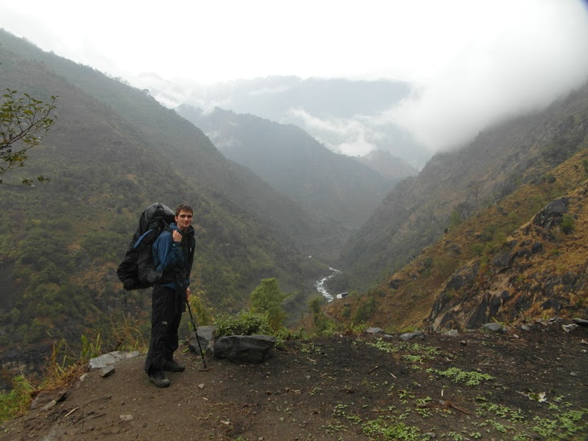
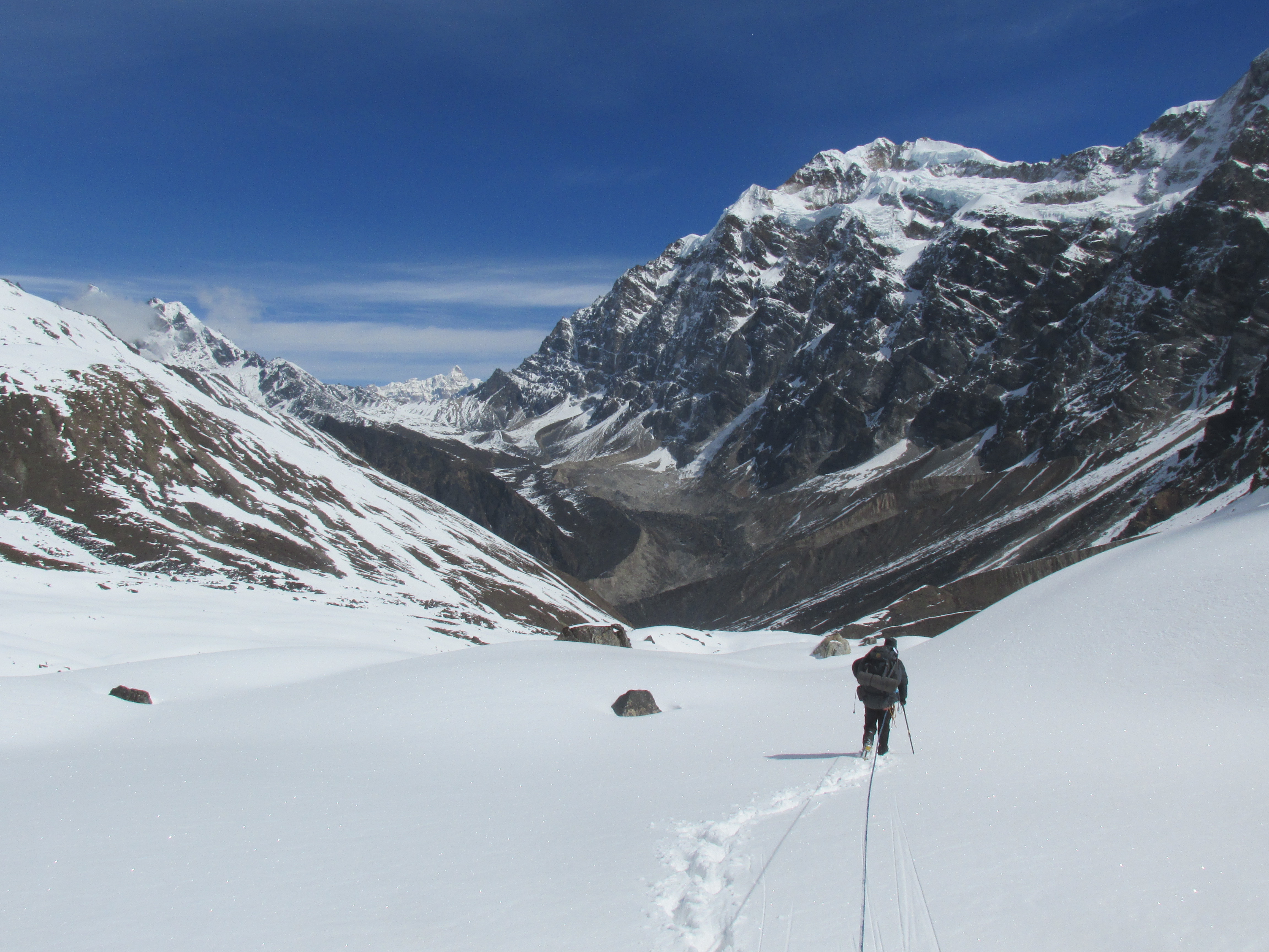
Once on the pass we could see the Barun river way below us. The valley walls were extremely steep, we would have to hike another 10 kilometers to the west before descending.
I did not clearly remember these next 5 kilometers, I only knew that there were a lot of rather steep ups and downs in it. The next 5 kilometers would turn out to be way tougher than I had ever thought.

I had hoped for a trail here, but that lay covered under a meter of snow, so I had only my GPS to go on. Once we had crossed the pass it became apparent that we had to cross an even higher and steeper pass. The steep snowy pass was looked pretty threatening. To make mater even worse a thick mist rolled in obscuring our view completely.
We hiked up the pass, which turned out to be better than it looked. After the pass came a very small traverse of a very steep slope. This was dangerous, I was close to slipping one tie, which might have very well meant the end of me. Once across the steep traverse we looked down to Kari pokhari (lake) or at least the pile of snow that it lay under. This was a warm welcome as we now knew that we were still on the right track. We descended down and climbed up again over the next pass.

I tried to remember how many passes there were before we could finally descend into the Barun valley. Was this the last one? We were getting tired and our food was running low. I did not know how much more snow beating we could take.
Once above the lake we came to a larger flat area. We camped here. Our sight was below zero. Hopefully we would have better weather in the morning.
In the evening the weather cleared up a little, just a little. I could see what I believed to be the next pass. It was not much further up. Hopefully we could start descending once we were there.
Day 30
In the morning it was still cloudy, but we could at least see for a bit. We headed towards the supposed pass. The snow had frozen over, but was not strong enough to hold us. This was even worse than weak snow. Each time we had to lift ourselves up only to fall through again.
We did not need to ascend far and we quickly made it to the pass. The pass was marked by a pile of stones. Good news, we were still on the right track. The steepness of the descend however surprised me. Did we really need to descent here?
On top of that the hill on the other side seemed pretty high and snowy. Did we need to climb that one as well? Did it ever stop? Were we not just to descent down to the Barun valley here? It did not look too steep anymore.
My GPS indicated that we had to continue further, but my (wishful) thinking lead me to believe that we had to start descending here.
We roped up and climbed down. It was very steep but not as bad as we had thought. Once down the GPS clearly wanted us to head further west. This meant crossing the high ridge north of us. I could see no easy way through and the snow lay once again thick. We were tired and the last thing that we were waiting for was another steep ascent through snow.
The poor weather and my fatigue lead me to the worst misjudgment in my life. I decided to just descent where towards the Barun valley immediately. Maybe the GPS was wrong and it looked descendable. The map indicated a trail trough the valley floor so we were to meet up with it at some point.
The first part of the descend was not too bad. We needed to be careful not to get stuck in the shrubberies, otherwise it was fine.

Soon after the valley wall however grew steeper and steeper. We should have returned, but we were tired and had no food left. We followed the water wherever we could as the terrain was a little less overgrown there. I was very nervous on the way at each new viewpoint I prayed that our way would not be blocked by vertical cliffs.
At some point the terrain was to steep to climb down. We had to abseil. There was no officially no way back. The terrain got even steeper. Wico slipped and rolled down, I could just barely stop him by jumping on him.
The slope kept going relentlessly down and I kept my fingers crossed the entire way. In the evening we finally got sight of the Barun river. To my disappointment there was no trail to be seen. That fucking map…
The absence of a trail worried me enormously. The valley was steep and there were no river banks. I estimated it would be another 3 kilometers till the main trail to the Makalu base camp would begin. A lot could happen in 3 kilometers. If the river would enter a gorge, we would be in deep shit.
I would have loved to continue, but it was getting dark and we pitched our tent. Wico had fallen into the stream and all his stuff was soaking wet. We had to share my sleeping bag and sleep in wet clothes. Luckily we had descended 1200 meters and would it be a warm night.
We ate 500 grams of sugar for dinner. The only food now remaining were two packages of biscuits.
Day 31
I was way to stressed out that night to sleep and was glad when morning broke.
We rose and packed up Wico’s now 5 kilogram weighing sleeping bag. The first part of hiking up valley was very tough. We constantly had to climb up and down steep sections and beat bush after bush. In an hour we had only covered 300 meters.
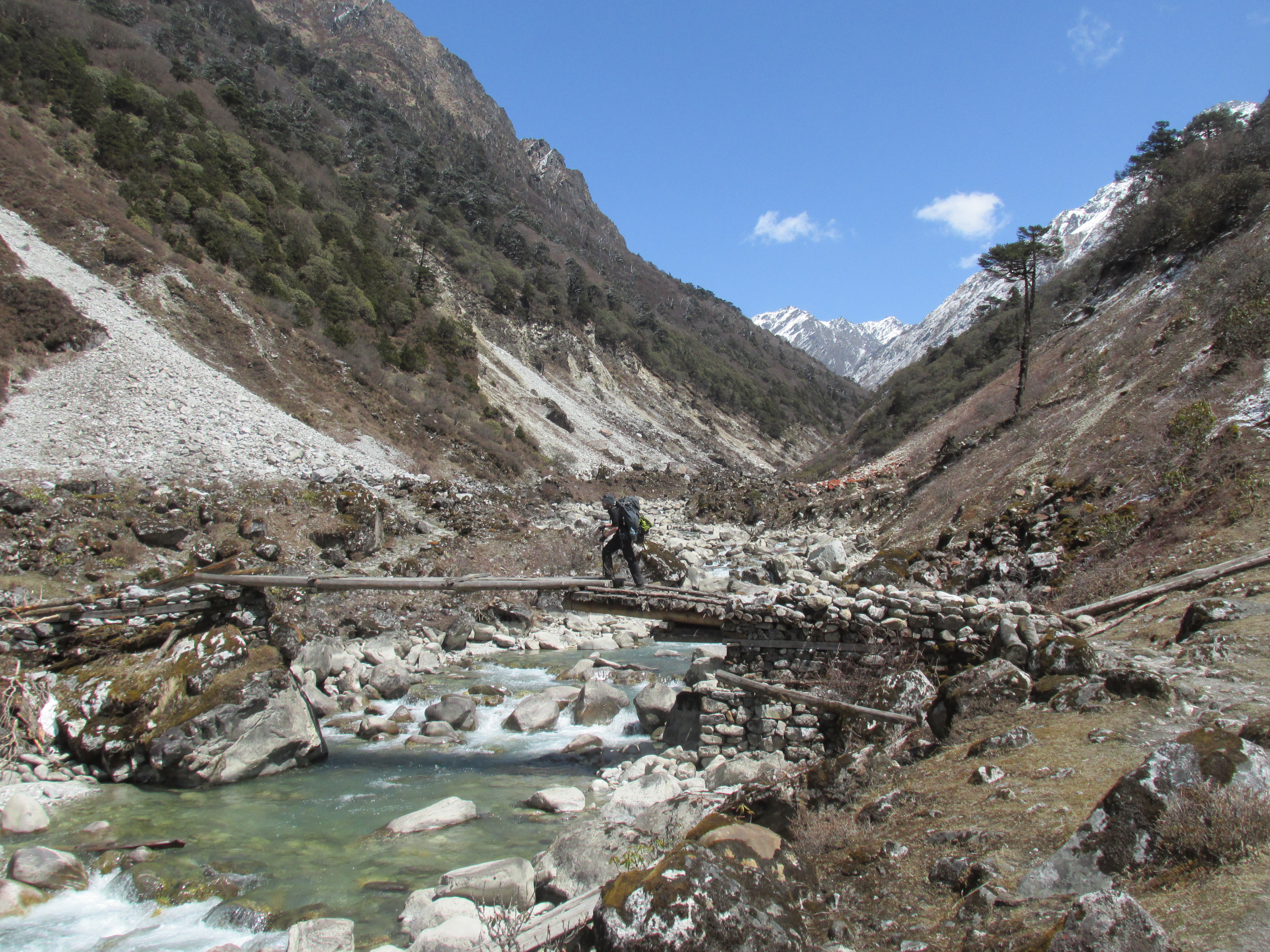
Well at least we were not completely stuck yet. I climbed another steep section with Wico right behind me. When I was on top I could not believe my eyes. As far as I could see there was a large boulder and gravel filled river bank.
That was easy hiking! We now went rapidly and after about an hour we caught sight of the actual main trail. Wico and me fell in each others arms. We had made it! The trail was on the other side of the Barun river. We walked further up river to find a bridge. At some point we met a Nepalese guy hiking up valley as well. We waved at him and asked how we could get across. He said there was a bridge about 4 kilometers further up.
That was pretty far for off trail hiking. We had completely had it and just crossed the river where we stood. It was still morning and the river was rather broad, so we could make it, and we did.
We hiked with the Nepalese guy up trail till the first hut we encountered. This was Nehe kharka. It was not an official lodge, but we could stay overnight. We layed down on the floor and fell asleep. We woke for dinner and fell asleep again.
Day 32
In the morning everything hurt. I could not close my hands as I had little wounds everywhere and my legs felt like they each weigh a hundred kilograms.
Our stuff had dried a little, but Wico’s sleeping back would remain moist for the rest of the holiday.
Yangle kharka was just 2 hours further. It could not be close enough.

Yangle kharka is a small lodge town situated in the shadows of the impressive granite rock faces rising up over a thousand meters right west of it.
It was cold and windy, the rest of the day we spent under the blankets, still recovering from the last few days.
We had changed our plans a little we would not try to head to the Kadum la over the very remote route starting from Nehe kharka. With our current condition and all the snow, that was simply not going to work. Instead we would climb over the frequented Shipton pass and hike through populated area to the village Saasima. From here we would enter the wilderness again and hike directly towards the Kadum la.
Day 33
The way to the base camp was easy. For the first time in over three weeks we were following a main tourist trail again. The weather was poor, but the frozen forests and enormous cliffs rather enchanting.
Mist kept rolling in and out for the entire day. What was it with the weather? The amounts of old winter snow, snowfall and mist did not make sense. This was a completely abnormal weather pattern.

Just before the start of the glacier I thought I felt myself becoming unwell and dizzy all of a sudden. It was however not me but the entire world was shaking. Everywhere around us we heard rocks and snow falling. At the moment we had thick mist, so we could only hear the violence of nature around us. We counted our blessings that we were save in the middle of a broad valley.
We continued over the boulders of the Barun glacier till we made it to the base camp. It was a buzzy place with many climbing expeditions. The toilet building had collapsed due to the earthquake, but there was no human damage. All climbing expeditions were doing fine.
We could not see Makalu or any other mountains through the mist, maybe tomorrow.
Day 34
In the morning our host called me from outside. Makalu is visible he said. I immediately rose. I knew by now how fast clouds could roll in. I made my photos and shook Wico out of bed. A good thing as just 15 minutes later everything was covered in thick mist once more.

We went back towards Yangle kharka. The clouds broke up one more time to show mount Makalu after which it was gone for probably the rest of the day. I heard there had been many trekkers that had not even seen the mountain.
On the way back the aftermath of the earthquake was still visible. Many avalanches and rockfalls were still going on.

Somehow, in spite of all terror we had seen just now and in the last week, we still intended to cross the Kadum la and Mera la. This meant that we needed to hurry a little so we decided to head to the base of the pass instead of staying overnight in Yangle kharka.
The climb up to the Shipton pass base camp is straightforward and a bit boring. We climbed through the woods in the evening and just before it getting dark we reached the small stone hut that functioned as lodge.
Day 34
The trail up to the pass was, as usual covered in deep snow. Now however the there was a well trodden track over it. A good thing as the weather, never failing to disappoint, had once again granted us with thick mist. This was truly an extraordinary poor spring to trek in…

Due to the weather there was not much to see on the pass. The only fun thing was sliding down the steep south side of the pass. The rest of the day we spent descending all the way down to Tashigaon.

Tashigaon was the first major settlement since Hongon and the first time since then that I could wear a T-shirt as well. It was nice to be in the hills again.
We informed about the way to Balakharka en route to Saaisma. There turned out to be a small hill pas (deurali) over the green ridge behind the village.
Day 36
We hike over a small trail straight up the hill ridge behind the village. On the way we met many shepherds which we kept asking for directions, which they only vaguely gave us.

It took way longer than we had expected, but we made it to Balakharka. An older man took us in with the family. We got some great popcorn and of curse dal bhat. It was a very pleasant evening with the family. We shared photos and even some basic stories.
They had a daughter that had studied and now worked in the US.

Day 37
In the morning the family had called their American relative. I got her on the phone and she begged me not to go to the Mera la. It was very dangerous there right now. We should not go back into the mountains, the avalanche and rockfall danger was extreme. It was only now getting through to me that the earthquake had been a mere local event, but truly world news.
That sounded serious. I called my parents to get a second opinion. It turned out that the earthquake had been all over the news and they had heard all about it. It was indeed a large scale disaster and people were actively being repatriated from the country.
OK, that was it, it was clearly not meant to be. We counted our blessings and successes and decided to head back to Kathmandu.

We thanked and said farewell to the family and slowly went on our way.
Just 4 hours later we paused. Wico was a bit tired, since we now had all the time in the world we took once again another home stay. The village was happy to see us and hoped more tourists would come their way in the future.
Day 38
In principle we could make it to the end of our trek Num today. But our legs were really not what they had been at the start of this endeavor and it was unlikely that we would.
On the way we tried to reach the Dutch consulate a few times to ask whether we could indeed be repatriated. We did not succeed. We could reach our tour operator, who had currently fled Kathmandu.
We descended all the way down the Arun valley to the Arun river. It was pretty hot here. It felt like we were walking in the jungles of Vietnam. There where many straw villages and even some banana trees.
We took another homestay where we gave away our last food and kerosene supplies.

Day 39
Today would be the very last day of our trek. A good thing as our legs could probably not take us much further.

To reach Num, the endpoint of our trek we needed to climb 900 meters up out of the Arun valley. It took us forever. We had to rest every 15 minutes in order to regain the strength in our legs. We really experienced that it was ‘the deepest valley in Nepal’.

It went unbelievable slow, but we made it to Num. We shook hands, we had completed this prestiges trek without any support and in the most difficult of circumstances.
I bought a Khukhuri as souvenir and started scouting for a jeep that could take us to Tumlingtar from where we could hop on a bus to Kathmandu.
We met two Americans with a Nepalese team. They had made it across the Lumbasamba as well and had in fact followed the trail we had struck about a week earlier. They had also intend to make it to the Makalu, but their guide had found the route that we had taken too risky. Instead they had tried to hike across the valley floor. They had found, just as we had that the trail was not there and were forced to return. The trail was apparently still under construction, sigh.
We took a jeep to Tumlingtar that same day and stayed overnight there.
Day 40 and 41
From Tumlingtar we took the bus to Basantapur from where we took the nigh bus to Kathandu On the way we enjoyed all the great and cheap food we could lay our hands on. I did not let a single stop go by without hopping off to buy chips, bananas and what not.
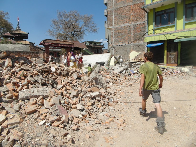
On our return to Kathmandu we saw the seriousness of the earthquake. Many building had collapsed and many places were still without electricity. The buzzy Thamel district where you normally could eat anything was quiet and offered little more than dal bhat.
We were repatriated by a Dutch military aircraft. It was the very last repatriation flight that also took out the rescue workers. We were just in time, otherwise we would have had to wait for our regular flight way later.