

August 2015
Dunnai – Jang la – Phujchal la – Thakur – Chentung la – Dhorpatan – Jaljala la – Muni – Dhaulagiri base camp – French pass – Dhampus peak – Marpha
After my trek through Dolpo I met up with my friend Dennis and continue across the wild hills of Dhorpatan and around Dhaulagiri. It is rather unconventional to combine the Dhorpatan with the Daulagire circuit trek, but it does make sense. The treks really do complement one another. One being a long distance trek through the middle hills, the other one taking you high up in the Himalaya on the most varied short distance trek in the world.
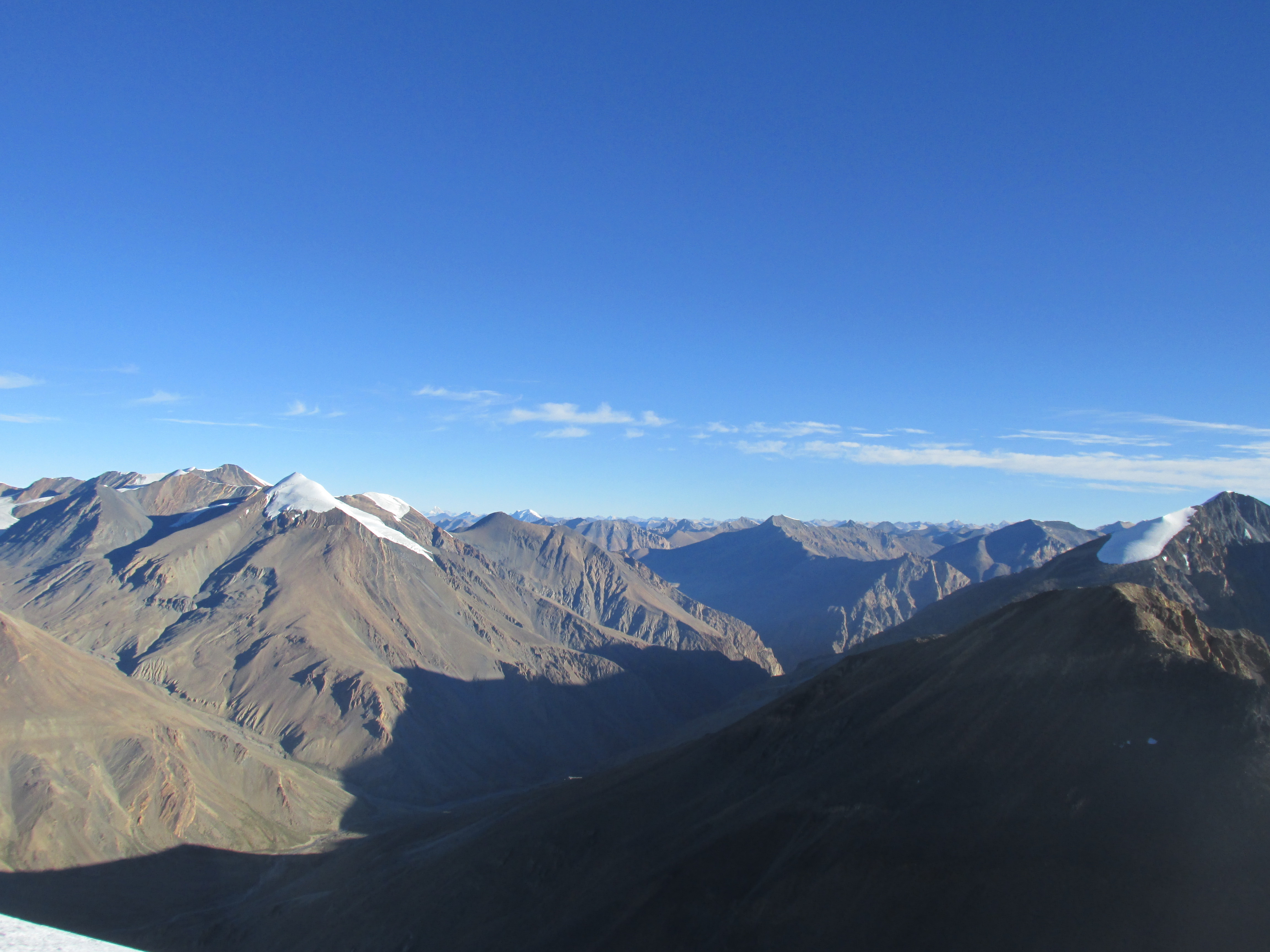
Dhorpatan is a sparsely inhabited area in the middle hills. No snowy peaks, but the vast tundra and silent forests, with only an occasional wooden village make up for it. By times you have a view over the Dhaulagiri range in the far distance giving you a sense of what is to come.
The Dhaulagiri circuit is one of the most epic and varied treks in Nepal. It is one of the shortest treks around, but somehow it manages to get you through rural lands, dense forests, alpine meadows, along steep cliffs, over a glacier, across two high passes and into the arid arid Tibetan mountains in the span of just 60km. On top of this all it includes the possibility to climb a 6000 meter high peak overlooking the Dhaulagiri, Annapruna and Manaslu, and Dolpo ranges.
This area borders the popular central Himalaya granting the scenery of the classical Himalaya, but with the off the beaten track sense of west Nepal.

Packing list
In summer you can complete the trek through Dhorpatan without tent or food. It is just about possible to stay overnight in the summer camps on the way. It is best to bring a tent though. For the Dhaulagiri circuit you will need to be self sufficient from on the Dhaulagiri base camp. The Dhaulagiri circuit is the only 8000 meters peak trek in Nepal that is still a camping trek.
In summer you can leave technical equipment behind. In spring and autumn, depending on circumstances, an ice axe and crampons might be useful at the Dhaulagiri.
Season
April to May and October to November are the classical periods to be out here. I did this trek in late August and must say that I enjoyed very favourable circumstances. We had clear skies in the morning and evening (usually not during the day), pleasant temperatures and no snow. Maybe it was sheer luck, but it might be that this area lies further in rain shadow than most people think. An extra advantage of summer is that you have all the trails for yourself.
The remoteness of the trail makes trekking in winter rather unwise.
Around October the Dhaulagiri circuit might become more crowded. In spring winter snow may make the going tough.
How to get there
The trek starts from the Juphal airstrip. There is no road leading here yet. Maybe in a few years the road from Jumla to here will be completed, but till then you will need to fly in from Nepalgunj. There is a daily flight leaving in the morning.
Nepalgunj can be reached from Kathmandu either by night bus or morning plane. Both options do not connect with the morning flight so you will need to stay overnight in Nepalgunj.
The trek ends in Marpha. You can take a bus from here to Pokhara. This will only take you about 3 hours.
Day 1
I had already trekked for a month with my sister through Mugu and Dolpo when I met my friend Dennis at the Juphal airstrip. He had been delayed for three days in a row in the dirty city of Nepalgunj, so was glad to finally be here.
In the morning my sister flew out (without any delay, the lucky bastard) and Dennis and I went on our way.
We took a jeep to Dunnai, the administrative capital of Dolpo. We had to transit on the way duet to an absent bridge, but got there fast enough. Dunnai is a large town, with a bank, hotel and everything. We bought some supplies here. There would be no villages on the way for a few days in Dhorpatan.
After lunch we hike further east. The road abruptly terminated and became a large trail. After half an hour we began a steep ascend. From here it would be 2500 meters up to the Purbang la. Our final destination for today however was a small village about 600 meters further up.
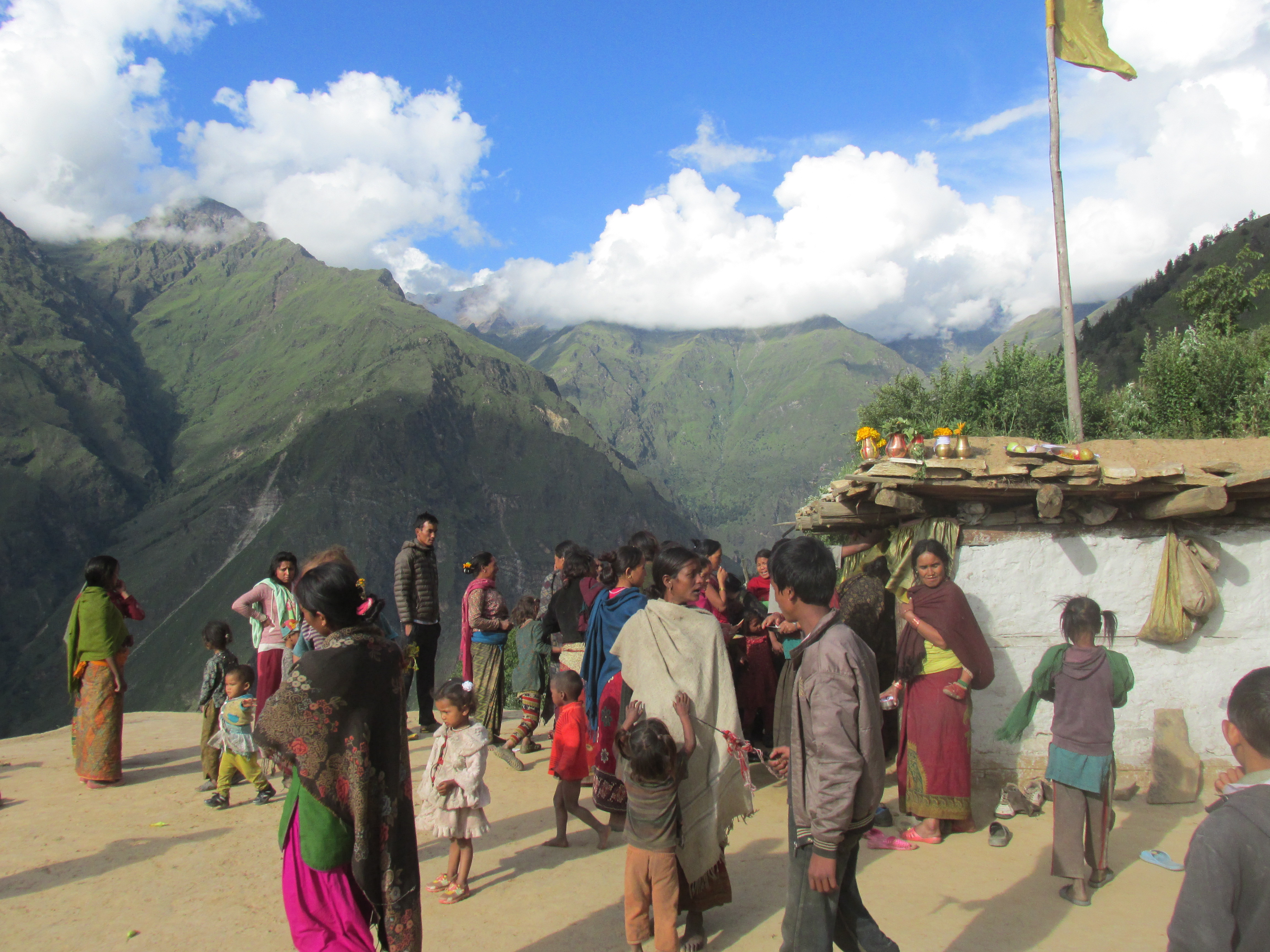
It was bloody hot and we were thirsty in no time. We immediately cired for ‘Pani’ when we arrived in the village. It was a rather large Hindu settlement. It was not hard to get a home stay. There was some kind of small festival going on that evening. I joined in and brought some symbolic sacrifices of my own for which I got some kind of blessing in return.
Day 2
Today we would camp on the base of the Purbang la. It was not far, but it was quite a climb. Most of the way went through lush forests. At the end the forests opened up and made way for rock filled meadows. There were some shepherds around, but we decided to camp. We wanted to camp as high as we could so that Dennis could acclimatize.

Day 3
The weather was poor, most of the day our sight was restricted to a couple of hundred meters. After over a month of trekking in rain shadow the monsoon started to kick in. It was an easy climb up the Purbang la. Behind the pass lay some larch stretches of relatively flat and grassy land.
There were quite a lot of shepherds out here. We waited out a little of rain with one of them.

After a slow descend we began a slow ascend to the ext pass. We camped on top of it. It was not a real mountain pass, but more the saddle of a broad grassy hill. There even came a group of horses to check out our tent. I stuck my ice axe into the hill next of our camp in the hope it would function as a lightning rod.
While I was cooking our dal bhat the clouds moved up and we could see the mountain around. The morning and evening breaking of the clouds would be a pattern that we would see the rest of our trek. No matter how cloudy the day, mornings and evenings were almost always clear.
Day 4
The weather was a lot better today. We climbed a little further up and made a steep descend to a river below.

We followed the valley down and climbed up through the forests towards Dhule. We were glad to leave the grasslands behind. It had not really been all to inspiring hiking there. The track leading up to Dhule was as muddy as you find them. The cattle had the rain had a rather devastating effect on the trail. At some point we tiptoed on the edge of the trail trying to avoid sinking ankle deep into the mud. The mist was setting in again. We kept altitude for a while till we arrived in Dhule, a very small wooden settlement servicing many of the people traveling to and from Dolpo. There was a modest tea house in town where we could stay overnight.
Dhorpatan had the name of being extremely remote. Lonely Planet writes that one needs to be self reliant here for the duration of 9 days. This is absolute nonsense, you can buy all the food you wish for in the villages on the way, due to the many Shepperd camps, one does not even need any supplies when trekking in summer.
Day 5
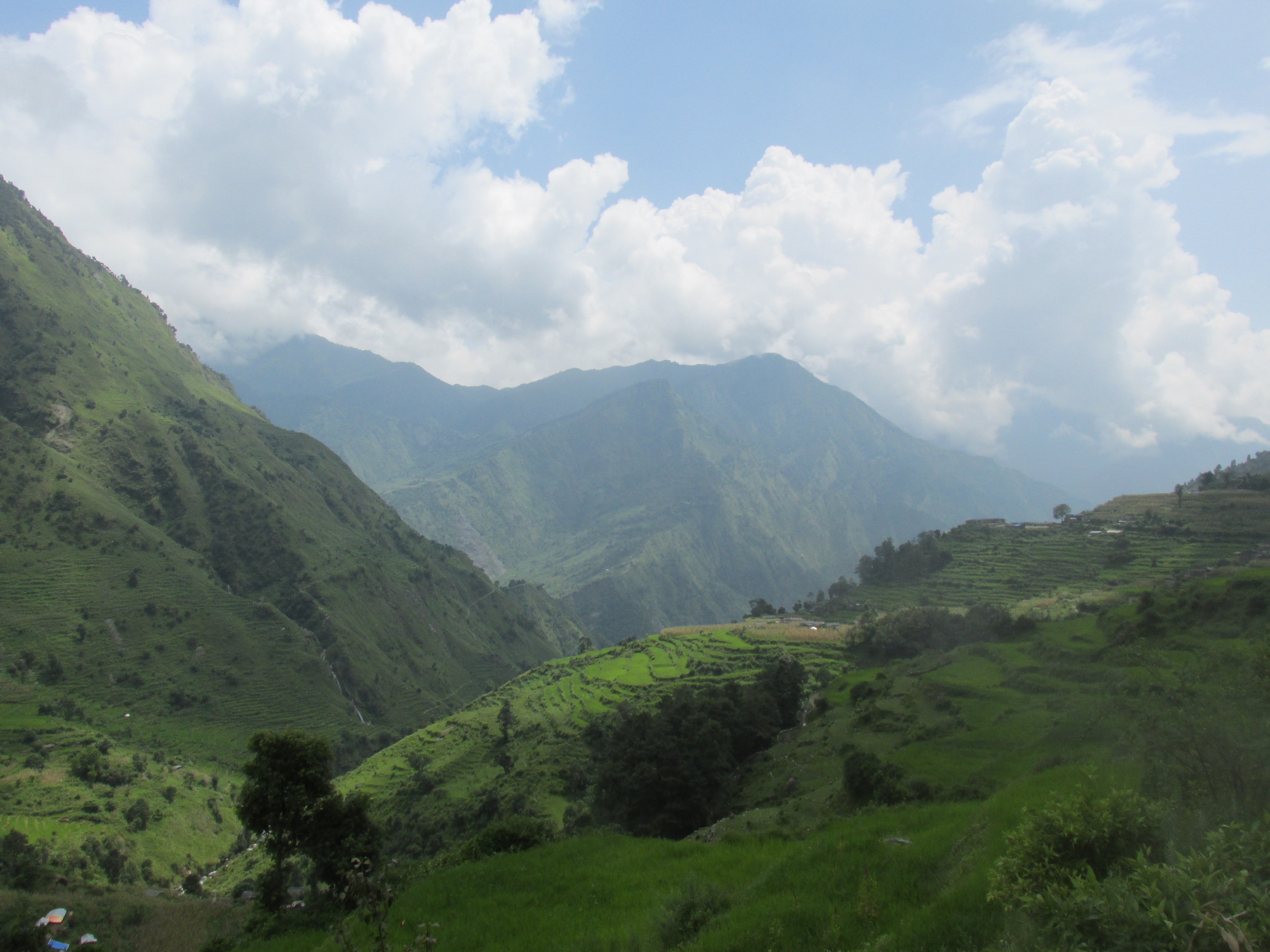
Morning was crystal clear and we could see the Dhaulagiri range in the distance east of us. It would take another weak for us to reach there. We were eager to get there and planned to hike as far as we could this day.

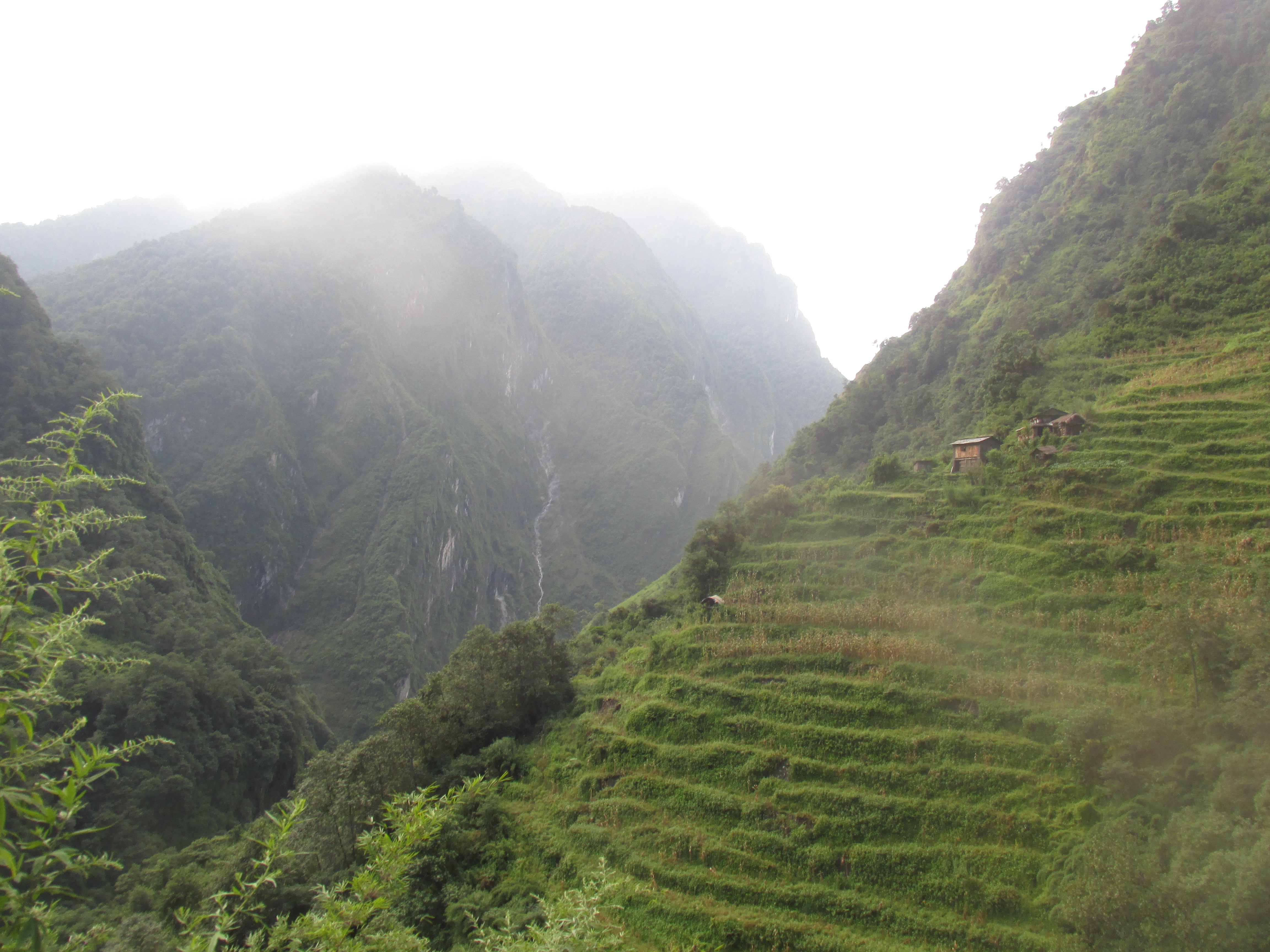
South of Dhule we entered the more inhabited and forested part of Dhorpatan. We had to descent and ascend again in two consecutive valleys. Along the way we had some nice views over the steep hills and encountered some cozy small settlements. Nothing exceeding 10 houses. It is quite a mystery to me why this place is so sparsely inhabited.

After our first climb up we followed the hill ridge for a while. We had lunch on a scenically located village Hukal on top of this ridge. We were tempted to stay overnight here, but remembered our pledge to get to the Dhaulagiri as fast as we could.
It was still a long way down and up again to the village at the base of the Phagune la. Or well village, it is just three farmhouses and some some small pastures. It was already getting dark when we entered the small teahouse.
Day 6
We rose early and quickly climbed up to the Phagune la. We wanted to see the Dhaulagiri range from up there and by now knew that it would probably cloud up before 8 am. And indeed we made it to the top just before the clouds rolled in.
Hopefully the weather would keep this pattern when we were at the Dhaulagiri. The occasional clear skies are not a given thing in the monsoon. I was very happy to get them now, but I also had the (irrational) feeling that we were ‘waisting’ the good weather here in Dhorpatan, where I wanted the clear skies at the Dhaulagiri.

On our descent to Dhorpatan (not the reserve of the village itself) it got misty as usual. Dhorpatan is a very large village in a broad valley. Dhorpatan is cut in two by a large river. Funny even though it was quite a serious river, nobody had seen to take the effort of building a bridge yet. On the other side of the river we could see a jeep track connecting this place with Burtibang.
We tried to get lunch or find a hotel, but were met with indifference. To top it off a bunch of kids started to throw rocks at us. Dhorpatan was by far the rudest place in the Himalaya I had seen thus far.
We hiked further east and took a hotel about half an hour further in Syalpakhe.
Day 7
It was a long and boring hike east over the valley floor and up to the Jalja la. The pass was only 3400 meters high and was nothing more than a grassy pasture bellow the tree line. By the time we got here it was already 2 pm, which meant clouds.

From the pass we hiked steep down a large paved trail. We asked for a home stay at the very first farmhouse we came by. With 18 kilometers birds flight it had been an easy but long day.
Day 8
The villages grew larger as we came further down valley.We could already see the side valley we would need to hike up further down.
We started to ask around for kerosene. Nobody seemed to have it and everyone instructed us to hike all the way to the road at Darbang. Until all of a sudden somebody said, sure and sold us a few bottles from he had lying around. Very strange how people do not seem to know what their neighbours concern themselves with. Makes me think of home.
Soon after we had to descend into the valley in order to reach the side valley heading north. Once down it was a tough 400 meters up through the summer heat to reach the large village Moreni.
Moreni was the first overnight place located on the Dhaulagiri circuit and they were clearly more used to accommodating tourists around here. Our host spoke English so he could help us with the last preparations. He told us that the lodge at the Dhaulagiri base camp had opened so we could postpone buying supplies till then. He also informed us that we were the first to trek here since the earthquake in the autumn of 2015. In spring nobody had been able to complete the circuit due to excessive ice and snow.
Day 9
The first day following the ‘official’ Dhaulagiri circuit itinerary and the weather seemed to be on our side. We could see the snowy peaks in the distance, the scene with the village in the foreground was splendid.

As we hiked down the mountain quickly got out of sight. For the next few days we would follow this steep narrow valley up. It was hot and the trail rater exposed. We dipped our hats in every waterfall we passed.
Boghara is the last village and not much more than a dozen of wooden houses. There is a nice lodge here where we stayed overnight. For dinner we got the biggest load of potatoes I had ever seen.
Day 10
We were no closely monitoring the weather patterns, we came to the point that it mattered. Of course we hoped for good views at the Dhaulagiri base camp, French pass and above all Dhampus peak. The morning did not look good though. It was the first cloudy morning of the entire trek.
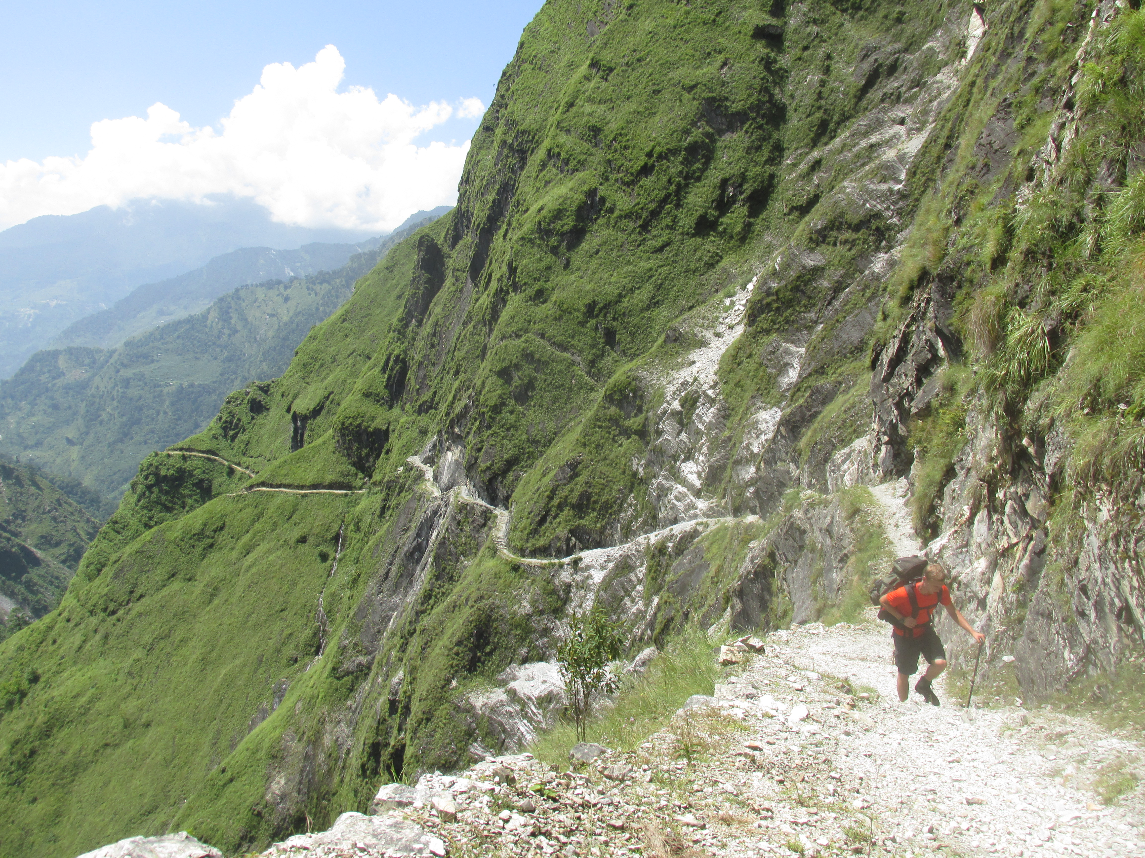
As we left the last village Boghara behind we entered the densely forested parts of the valley. For the rest of the day we hiked through dense bamboo and countless streams. It was as moist as could be. At the end of the day we each had picked up a few leeches. By times the trail had washed away due to landslides. We had to be careful at these points not to follow a quasi trail.

Around the afternoon we got to Dobhan. A former yak pasture, but now a tourist lodge. We informed whether the lodge at the Dhaulagiri base camp was opened, our host told us it was. We postponed buying supplies even further. She also warned us that the trail further on had been washed away by a landslide, so we would need to do some jiggling.
Day 11
The first part of the day lead through dense bamboo forest again. As we had been told we soon hid the point where had been washed away. The entire part of the hill had collapsed so we had to make find some other route. We descended to the riverbanks and when that did not work anymore we followed a small trail that had been cut out through the bamboo. It took us quite a while. Once across we met the trail building team working on building a new route.

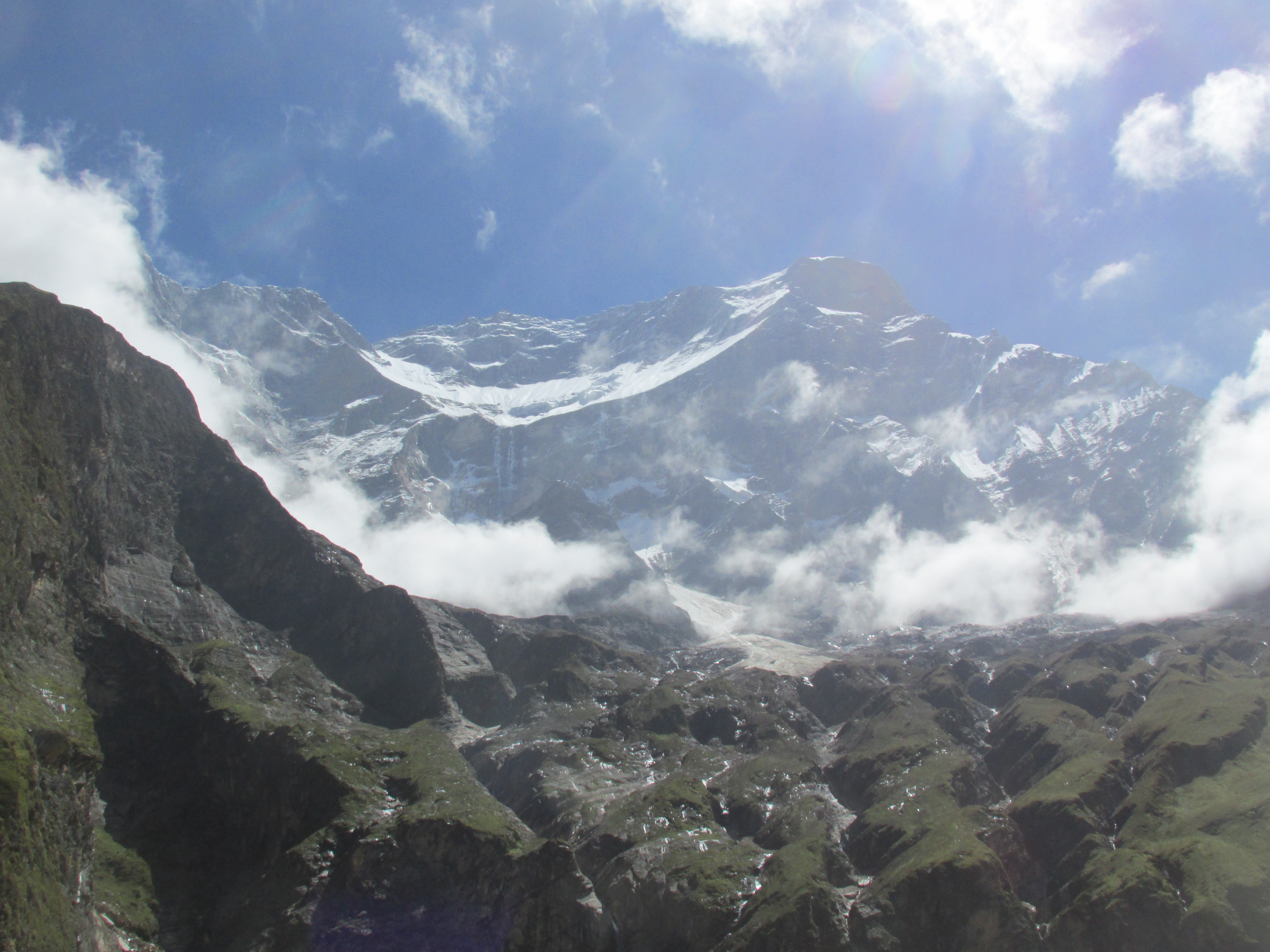
Quickly after we met the trail building team the forest grew sparser. We could see the Dhaulagiri through the trees. The weather had been great all day long granting us impressive views over the eastern cliffs of mount Dhaulagiri. The Italian base camp itself lies just above the tree line as is located right at the foot of these steep cliffs. Looking up to the Dhaulagiri from here has something unworldly. Most section were so steep that there was not a drop of snow on them.

Unfortunately the lodge at the Italian base camp was abandoned. We waited around for an hour, but there seemed to be no movement. As we had no supplies we would need to return. Sigh, we should not have gambled on the very very last place where we could buy food. Luckily there was a trail building team about 2 hours back and did we not have to return to Dobhan which would have been more like 5 hours.
We returned and stayed overnight in one of the tents of the building team. They were very much willing to sell us some rice, potatoes and dal for on the way.
Day 12
We retraced our steps to the Italian base camp.
The Italian base camp is the last place with in season facilities and the route immediately got vague after it. We wandered across the moraine filled glacier coming from the Dhaulagiri. The spot where you have to climb down to it and back up again are not really defined.
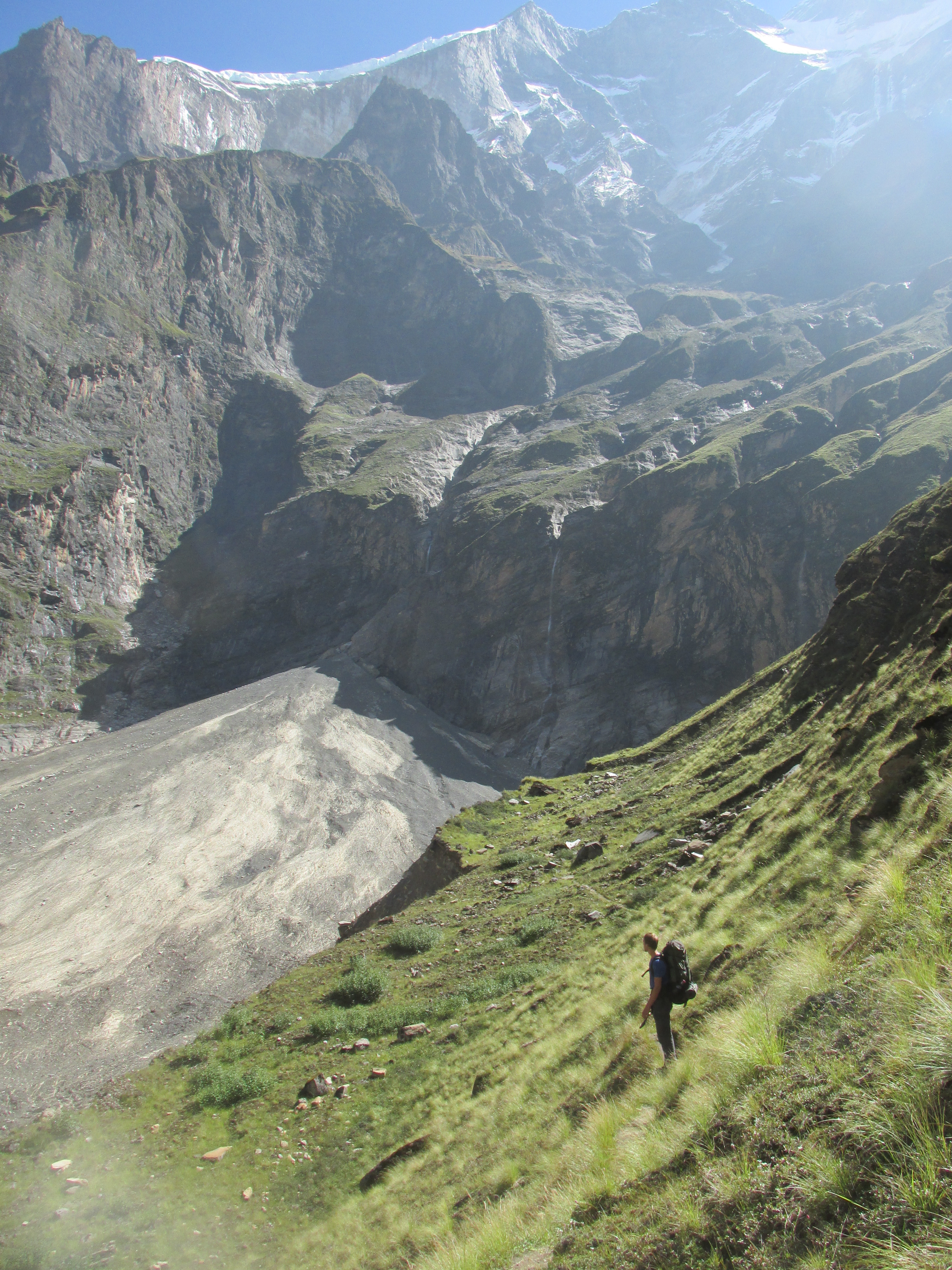
After the glacier we followed the grassy meadows up. The valley narrowed and we had to hike between two rock faces that are infamous for tumbling stones. The stories about the dangers of this place seem to be a bit over the top. You can easily stay clear of the rock faces and it is not like there is constant rockfall or anything.
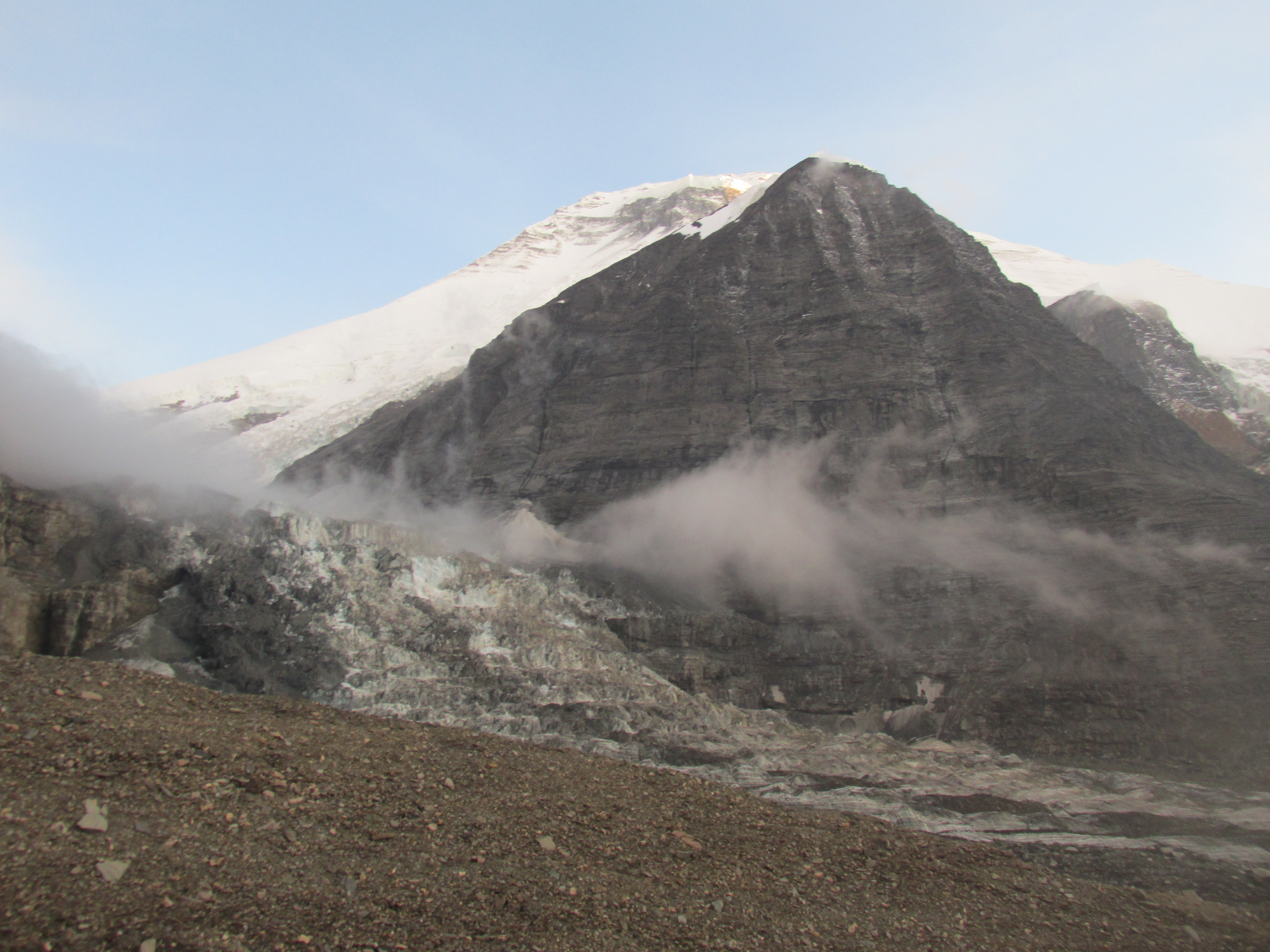
In the upper part of the valley begins the main glacier flowing from the Dhaulagiri. The glacier terminates abruptly and is hard to ascend. Due the steepness there is no moraine cover, it would have been possible, but rather difficult had we not brought our crampons.

Once on the glacier we were in a bumpy rock dessert with on both sides high cliffs from which waterfalls pored down. It was already getting lat and we pitched our tent (which was quite a challenge on these moraines). The waterfalls around mad it seem like it drizzled for the rest of the day and night.
Day 13
It was unfortunately very misty in the morning. Maybe we would get an evening clear up than. The glacier was a little rough by times. Once we made the mistake of following the outside bend of the glacier. A dumb mistake. The outside bend is way more stretched out causing some crevices that blocked our way.
Just before reaching the base camp the glacier turned white and icy. There is no house or other structure at the base camp but the enormous amount of garbage made it plenty clear that we were there. The snowstorm of last autumn and the earthquake of last spring had probably caused a lot of hasty retreats. The complete camps of some expeditions still lay around. Medicine, food, tents everything was lying around.
We scavenged some nice stuff, some high quality pins for my tent, sandals and some chairs to sit around on. Dennis proposed to take a chair with us to put on the Dhampus peak as a joke. I was tempted, but decided not too, I personally hate messy mountaintops.
It was still very misty and we could only guess the location of mount Dhaulagiri. However, one hour before sunrise all clouds suddenly disappeared granting us an unobstructed view over the Dhaulagiri. The mountain looked like a completely different one than from the Italian base camp. The hour after sunrise and before sundown were the magic hours of the day. No matter how bad things were during the night and day, all clouds could suddenly disappear at these moments.
Day 14
I looked outside my tent. Yeah… The weather was not going anywhere today. A shame as French pass should hold a nice view over the Dhaulagiri. We left the glacier and climbed steep up along the waterfall leading up valley. After this waterfall the terrain flattened out leaving a super easy ascend to the pass itself. But like really super easy. It was a broad gravel slope on a very modest angle.
To our surprise and delight the clouds started to retreat down valley. We could get a good view of the top of Dhaulagiri. Once again it looked like a completely different mountain from this new angle.

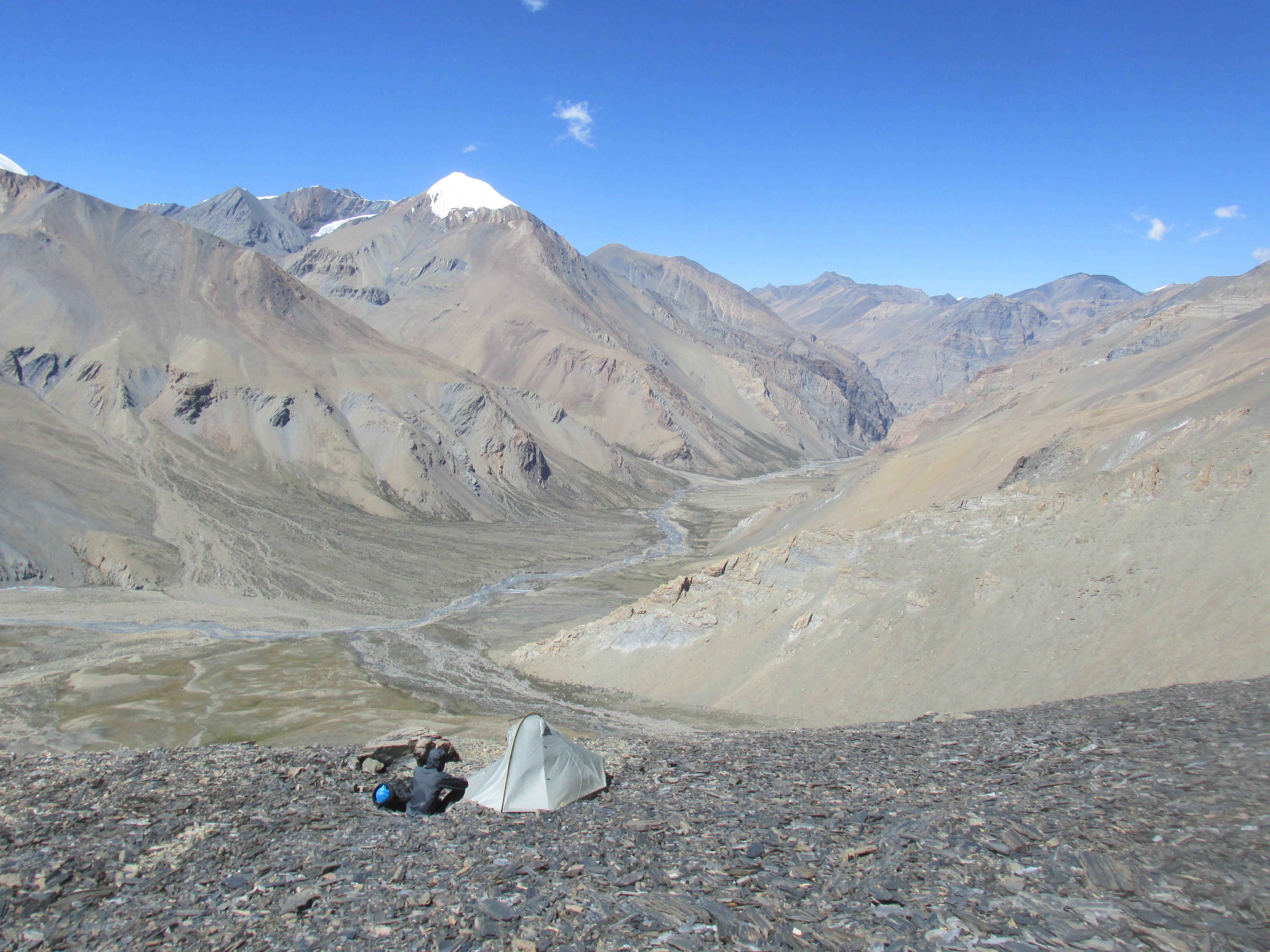
On the other side of the French pass lay the hidden valley. A large flat area at around 5100 meters just 200 meters below the pass. On both sides of the hidden valley a few steep snowy peaks rise up. The valley is part of Dolpo, which reflects on the landscape. If one looks north from French pass, you are lead to believe in the Tibetan plains, where on the other hand if one looks south you see classical Himalayan scenery.

We hiked the insanely easy route down to the valley floor where we made camp. It was an awesome place to camp here in this strange hidden valley. We identified Dhampus peak a little south of us. The climb seemed reasonable, but not trivial. On the weather part there seemed to be good news. The hidden valley seemed to have a non monsoon climate, there was barely any cloud cover.
Day 15
The hidden valley has a name of being immensely cold. Even in the end of August it lived up to this name. I felt cold at night for the very first time during my holiday. In the morning our tent as well as the entire valley was frozen over. Glad I wasn’t here in October.
The weather was good in the morning only some superficial clouds leaked over the French pass. We decided to walk back to the French pass in the hope to enjoy an unobstructed view. We hiked up during sunrise. Once on top it was clouded. But… During the morning magic hour it got fully clear in just 15 minutes.
We were to make base camp in order to climb Dhampus peak tomorrow early in the morning. The section through the hidden valley was mind blowingly easy. I do not think I have ever been able to walk straight for this long in Nepal before.

We climbed the hill that was Dhampus pass and started to circle around the Dhampus peak right north of it. We intended to climb the mountain from the northern side. The hike went along loose gravel. We pitched near a small snowfield from which we could melt snow to drink and cook with.
The weather was great and we had high expectation of tomorrows climb. I could not wait for the climb. We would leave at 3 am. If everything went swiftly we could reach the top at around 6 am, with good chances of nice weather. We camped at 5500 meters so it was only another 550 meters up.
Day 16
I woke around midnight and could not fall asleep again. It was too cold and I was too excited. I lay awake for about an hour. Dennis turned out to be awake as well. Both not able and willing to sleep any longer, we just decided to start climbing up. We ate a few biscuits and went on our way at 2 am.
We circled further around the gravel mountain side climbing up very gradually. Once we met a large snowfield we knew we had made it to the northern side. From here we needed to climb straight up to the ridge. There was some 45 degrees rock we needed to climb here. We had to wait for 40 minutes in order to get some extra light.
Once the daylight started to arrive we climbed the rock. After this we came to a steep icefield of about 45 degrees as well. We clipped on our crampons and made it to the ridge. From the ridge it was an ‘easy’ hike to the top itself.

We arrived just after sunrise. We could not have hoped for better circumstances. We had an unobstructed view west over the Annapurna all the way to the Manaslu massif, north all over the Dolpo range and south over the Dhaulagiri massif. This must be the best view I have ever had in my life. There was some cloud cover in the valley way bellow that made the mountain peaks look like floating islands. The view over the literately countless peaks of the Dolpo range was unparalleled. On top of it all we could see three 8000 meters high peaks.


We descended back to our camp. We packed up and decided to try and make it down all the way to Marpha at the Annarpuna circuit. This would mean an absolute descend of 3350 meters, a new record.
From Dhampus pass we had to descend 200 meters where after we had to keep altitude for a long time, knocking down way more ups and downs than we had hopped for. By the time we could start descending for real we had almost completed a full circuit around the Dhampus peak now firmly above us.
When the descend started, it started big time. It was a merciless 2200 meters down to the village Marpha which we could already see. Once down there Dennis knees were worn out and even I could feel them a little. (Usually I never feel descending in my knees)
Marpha was a completely different world. For 2 months I had trekked through the remote parts of western Nepal, having only very little facilities and having met only one single other group of tourists. Now all of a sudden I stood next to what may very well be the most popular trail in Nepal. There were hotels, tourists, menus, wifi and a large road with plenty of traffic on it. Quite a shock. We took the first hotel we could find, ordered apple pie and sent a long overdue email to our parents.
From this point we took the bus to Muktinath, where we continued trekking over the Annapurna circuit. But after all I had seen thus far, the Annapurna turned out to be a complete disappointment.
