

August 2014
Holi – Bara Banghal – Thamsar pass – Rajghunda – Biling
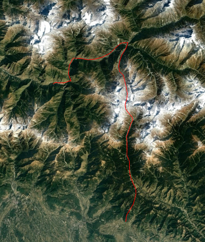
This trek takes place in the Dhauladar, a far outskirt of the far western Himalaya. South of this range start the Indian plains. North lies the tucked away Chamba valley system, a true trekkers paradise. Though nothing here is alpine wise extremely spectacular, the general ambiance of the lush valleys and sharp peaks are downright enchanting. There are many hidden villages only reachable by trekking and unfrequented passes used by many generations of Gadi’s (shepherds) waiting to be discovered by the curious trekker.
I settled on crossing the Thamsar pass. From the roadhead at Nayagroam we would hike for a few days through a narrow gorge to the large village Bara Banghal. From here we would turn south and head for the Indian mainland over the mildly glaciated Thamsar pass. A long day through the green hills would bring us to Bir Khas.
Despite of the natural and cultural attractions of this trek it it lacks famous highlights and for that reason is rarely undertaken by tourists.
Packing list
Technical gear is absolutely not called for. If you are fast you can do the entire trek on a home stay basis, making use of the summer camp right south of the Thamsar pass. This would mean crossing the Thamsar pass in one single day from Bara Banghal. In case you are not in for this very long day you better take a tent. North of the Thasar pass usually dwell a few shepherds by whom you can stay overnight. You cannot count on this though.
Season
The Thamsar pass is rather accesible and can be crossed relatively early and late in the season. Generally you can trek here from March to November. The months June to September are easiest. The area is shielded from the worst parts of the monsoon, making trekking in summer a nice experience.
Alternatives
The kahameni pass east of the Bara Banghal leading to Manali is a nice alternative. It is in difficulty very comparable to the Thamsar pass itself.
There is also the Nikora pass right north of Bara Banghal connecting Bara Banghal to Kugti. This would allow for a trek consecutively over the Kugti, Nikora and Thamsar pass, which might very well be the ultimate trek through Chamba.
How to reach there
The trek starts form Nayagroam. Getting here is quite a hassle. If you are on the bus either from Dharmasala to Bharmour or the other way around you can hop off in Khara Mukh. From here you can take a taxi or bus to Nayagroam.
The trek ends in Bir Khas, a famous para gliding place. From this, large and noisy city you can easily hop in a bus to Dharmsala.
Dharmsala itself is easy to reach form Delhi, with multiple buses and planes each day.
Day 1
After having had lunch and having waited out the toughest afternnoon we left Nayagroam. There was a hydropower plant under construction, so the first hour went through highly uninspiring construction area.
Once we left the building site behind the surroundings changed rather abruptly. We followed a small trail up valley through the grassy and steep valley. We came across a few cable cars which you could use to cross the river. A funny alternative for a bridge.
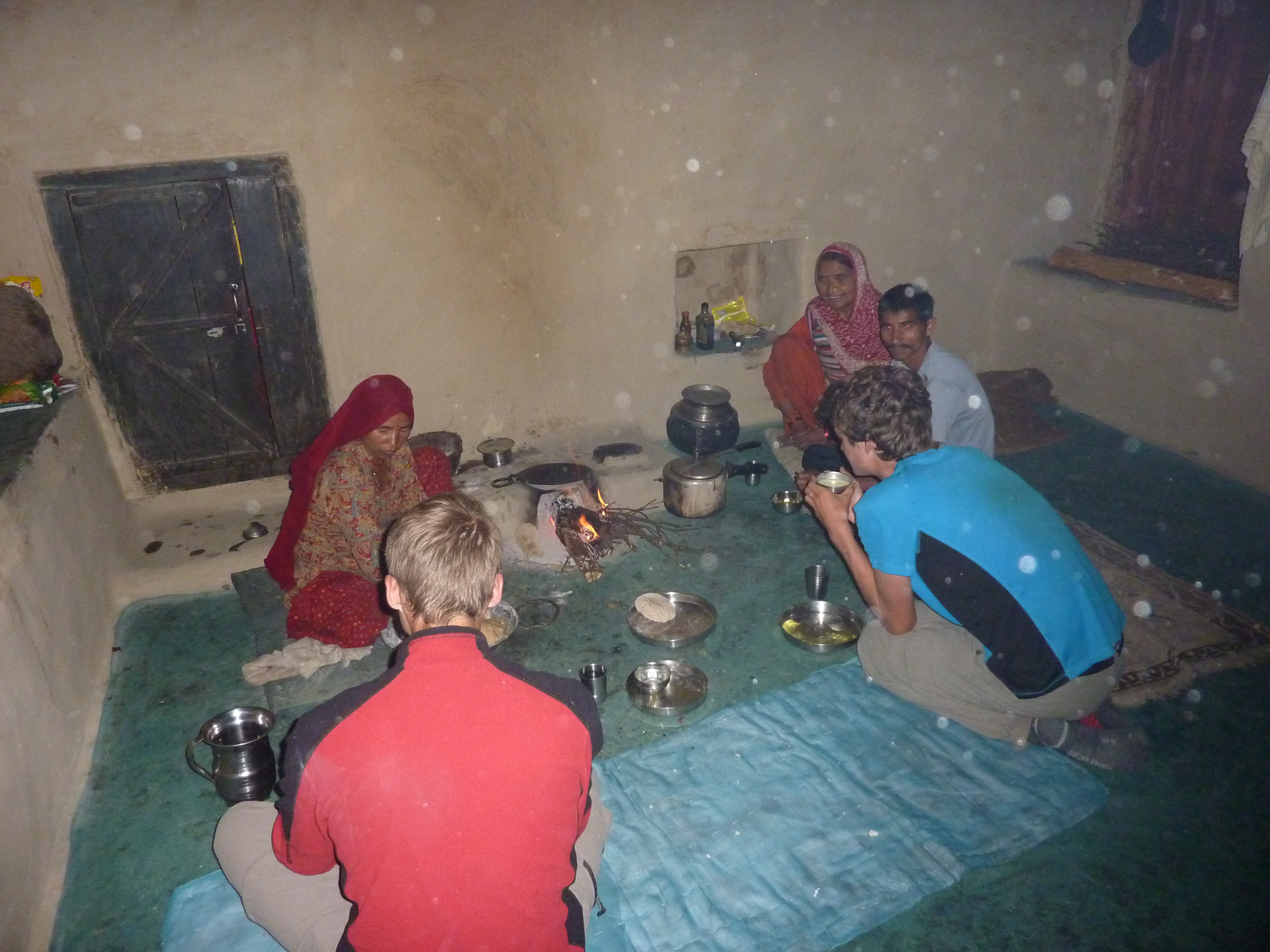
There had been no villages along the way and it was already getting a little dark when we finally got sight of the village where we wanted to stay overnight. It lay on a rocky hill about 150 meters above the river. I was slow climbing up, so Ava and Dennis had already arranged a home stay once I was up there. We stayed overnight with a friendly woman and her grown son, who made us dinner.
Day 2
The idea was to push to Bara Banghal today. The last section of the route to Bara Banghal has the reputation of being rather steep and dangerous. For now however we could simply follow a broad trail that kept altitude rather well.
The morning started out pretty clouded, but later in the day the sun broke through. Around noon we hiked right below a small settlement. They started yelling and waving that we needed to come up. We did and it turned out that we were following a not yet finished trail that was being carved out through the valley floor. In a few years this trail would make the current, more dangerous trail obsolete.
The villagers proposed we would stay with them for the day. We were not in a hurry so we figured, why not? The rest of the day we lingered around in the sun. People seemed to think we had some kind of medical background as they came to us with all kinds of physical problems, for which I could give not much more than paracetamol.
Day 3
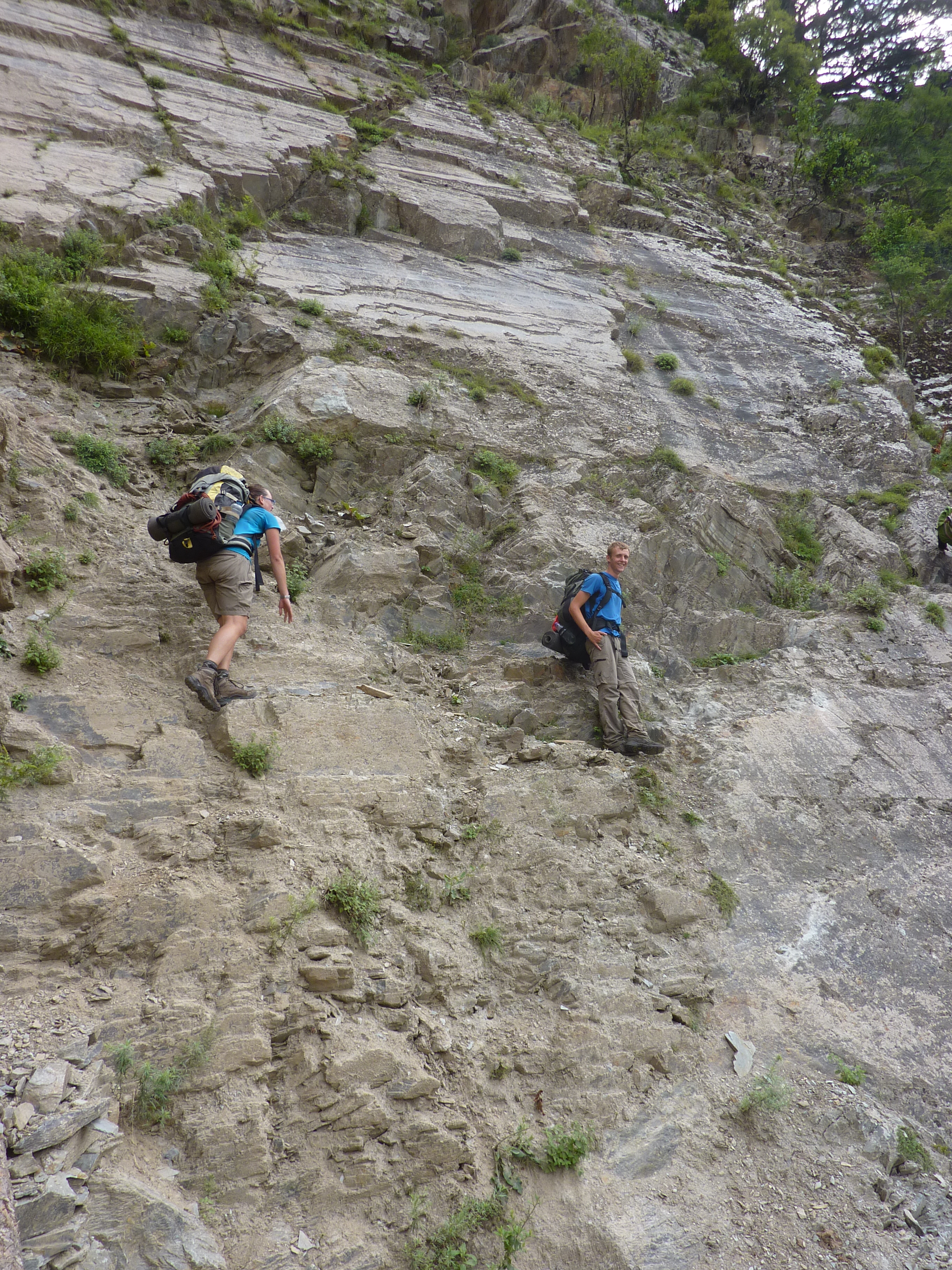
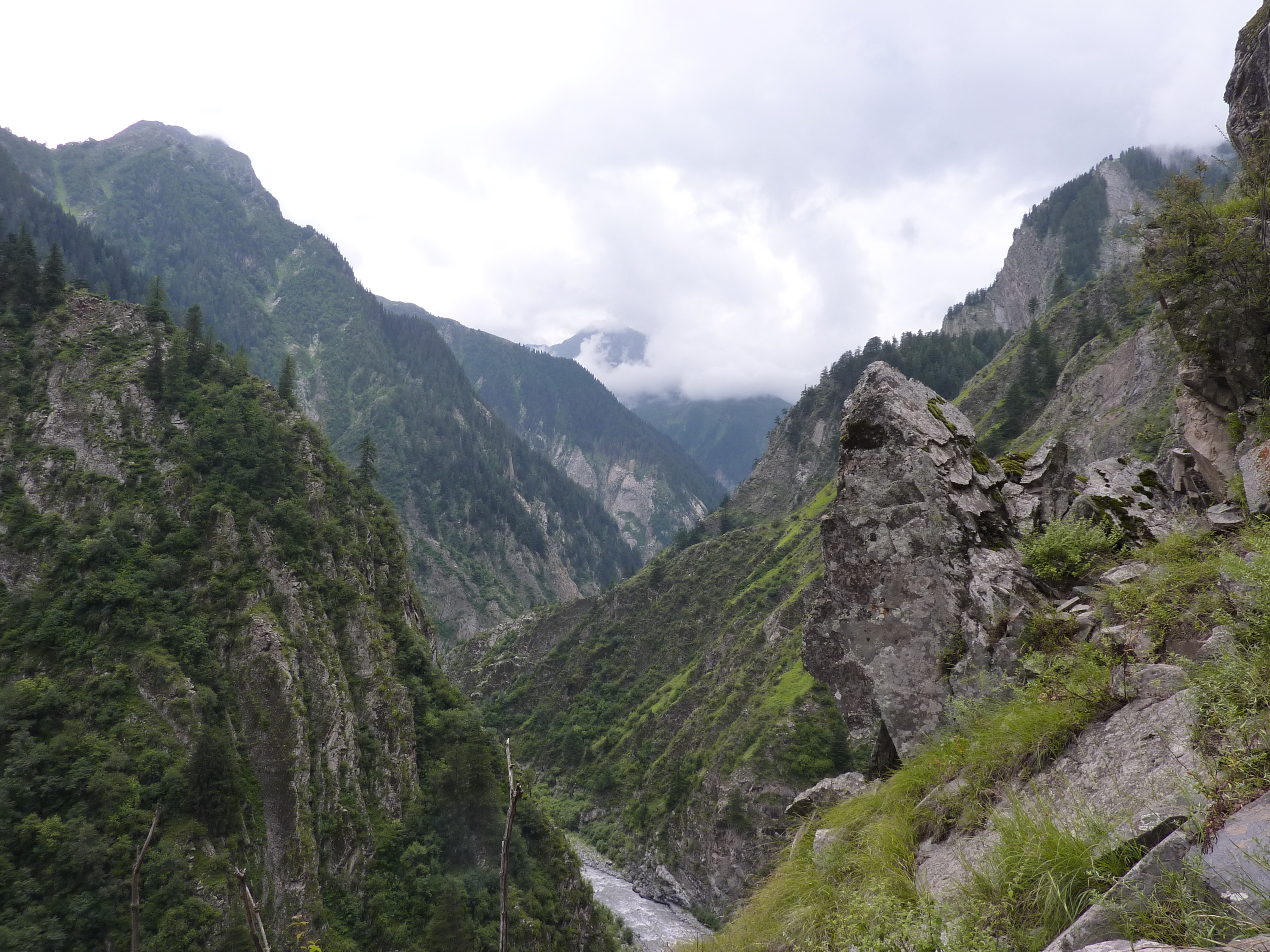
Today would be the day we would reach the treacherous parts of the valley. Many places on the Internet warn for this particular spot. As it is a route frequented by locals it would probably not live up to it’s name.
It was Indian independence day and many of the people with whom we had stayed over were coming over to Bara Banghal to celebrate. They gave us a lot of unwanted micro-advise on the route.
There were many ups and downs to bypass the steepest cliffs and even than the train was less than a foot wide. The rock was however solid, making it way safer than it looked. Then Indians walking with us asked whether we were scared, no we were not.
The ups and downs kept coming, but the valley sides were way more reasonable. Bara Banghal was not much further.
Just before getting there we caught rain. The first real rain during the day we had seen for about a month in India.
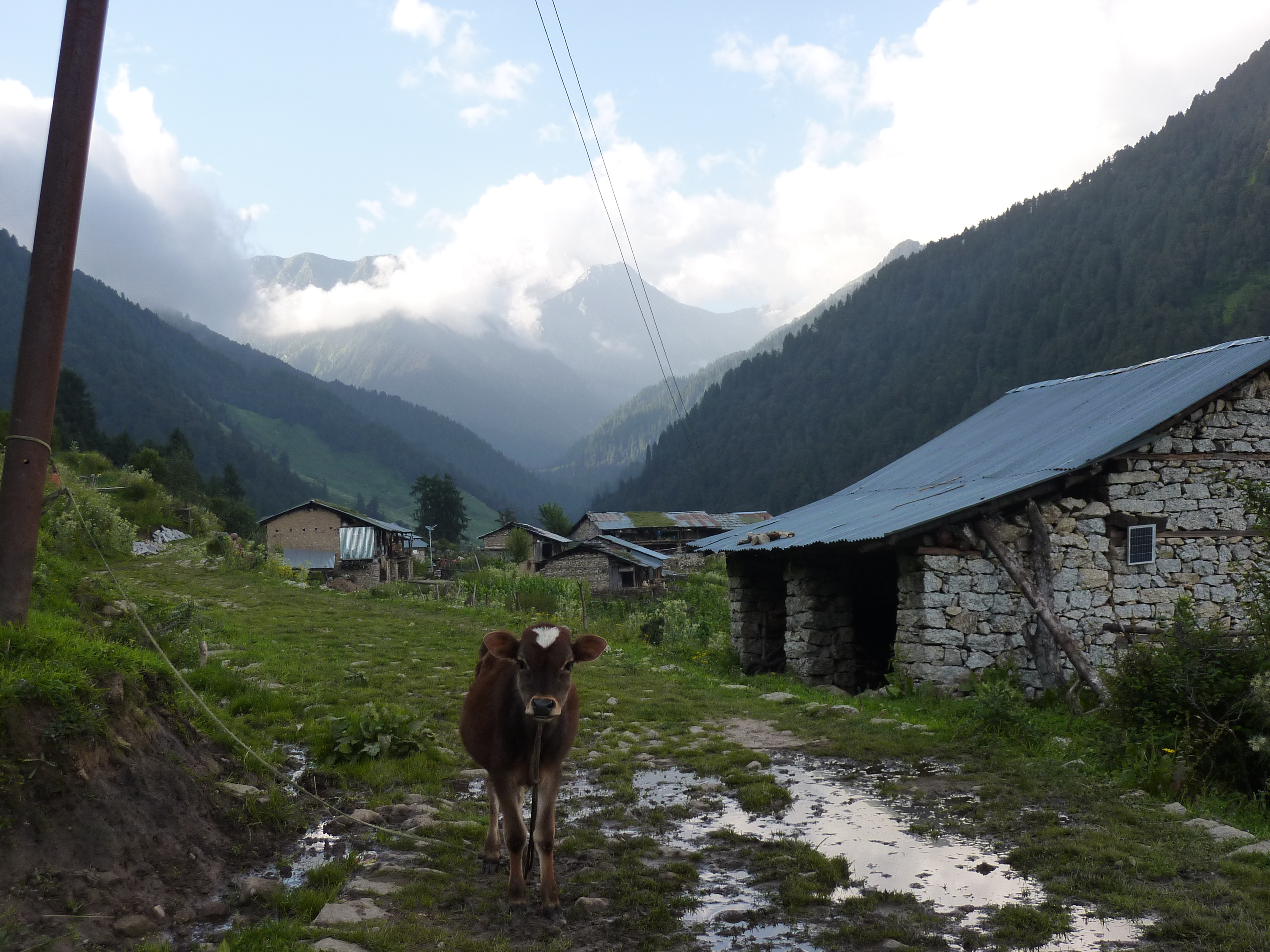
Bara Banghal is a large village of some, say, 300 houses. Tucked away behind high passes this large enclave of civilization has something mystical hanging over it. There is a rest house in which we could stay overnight, an older man however insisted that we had to stay overnight with them. We came with him it turned out that his wife was rather, ehm, drunk. She kept pushing for our intention in the annoying way that only drunk people can. In no time we were back in the nice an quiet rest house. They were disappointed to see us leave, but this behavior could go on all night.
I cooked some rice and dal in front of the rest house. I had not yet mastered the art of cooking dal bhat and the dish was, let’s say, chewy. Fortunately, a bunch of veterinarians, traveling to seek shepherds in need of their assistance came by and invited us over for dinner, so we had got some descent food anyway.
It was a nice evening in which we under more debated the school system of India with them and the local schoolmaster and mayor.
Day 4
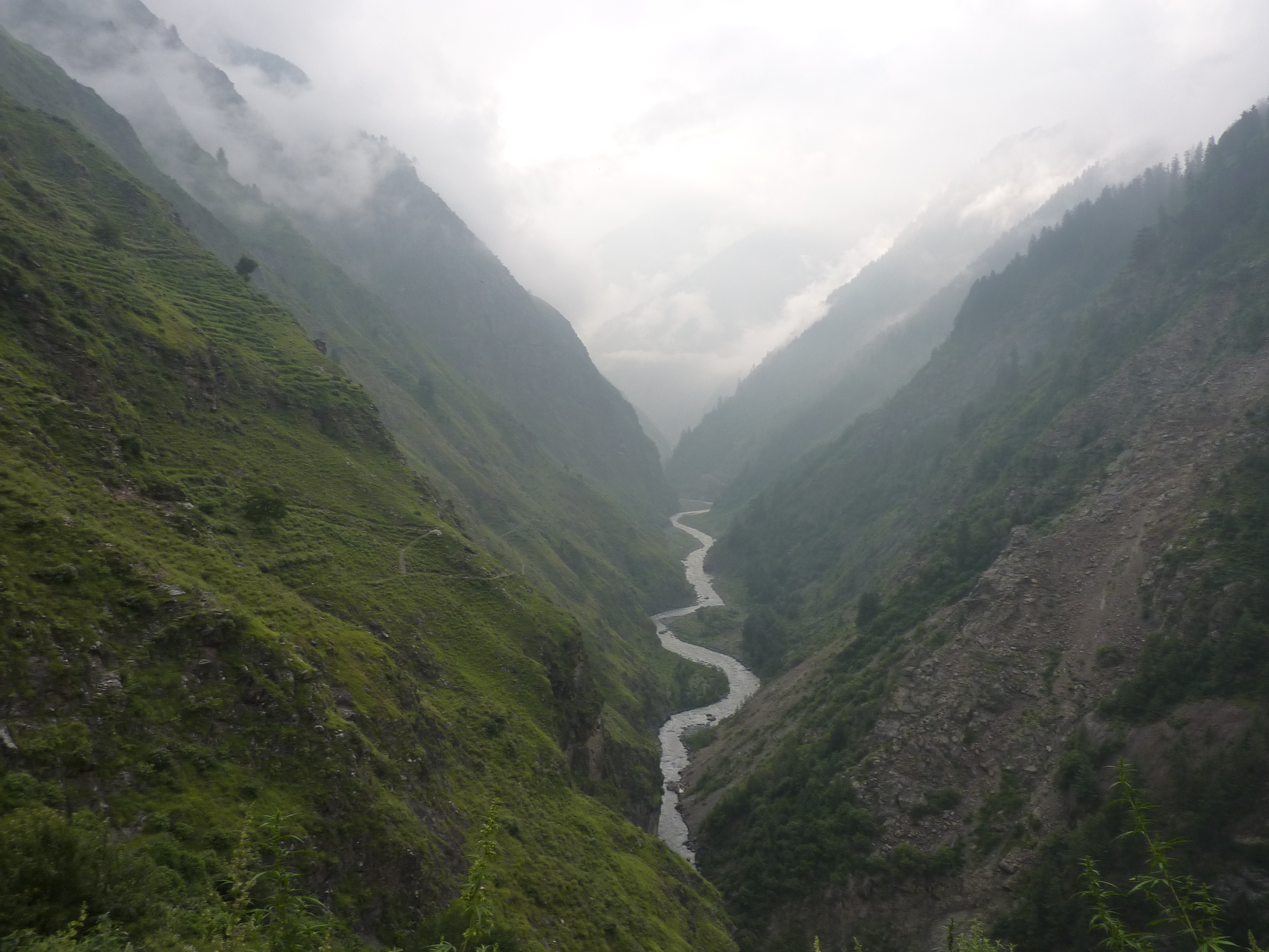
Distance wise it would be a short day. Were it not for the 2000 meters we needed to climb up it would have been an easy day. In just 6 kilometers birds flight we climbed out of the green valley all the way to the start of the moraines of the pass.
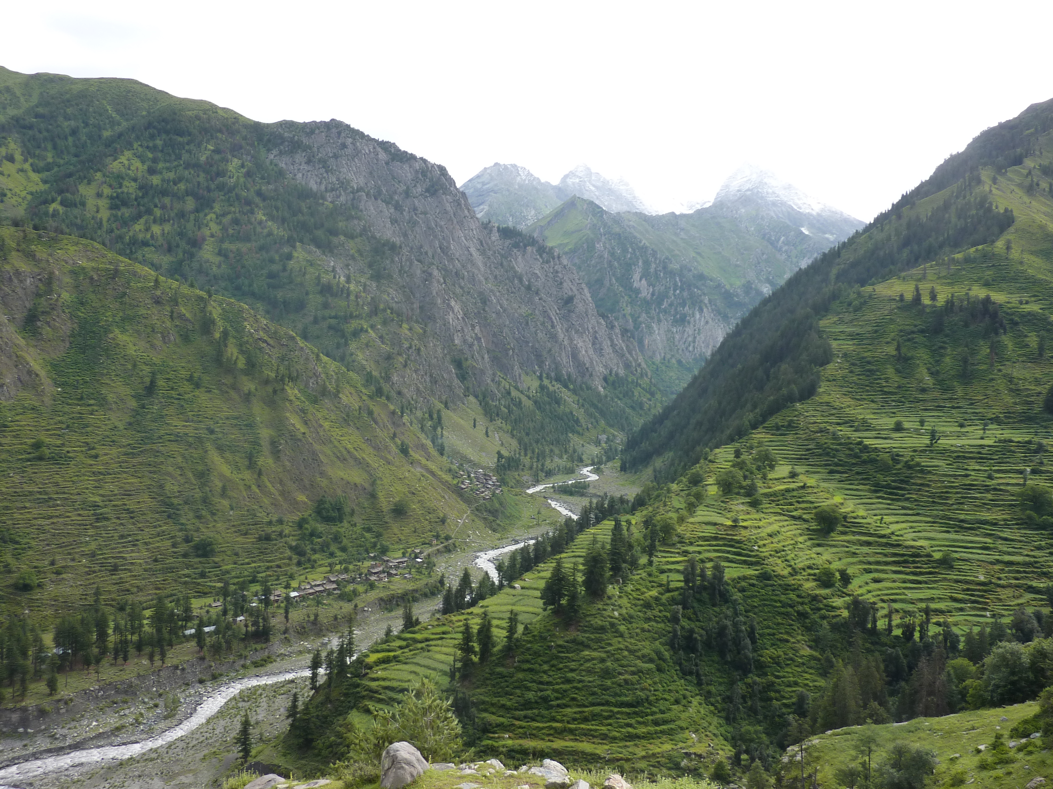
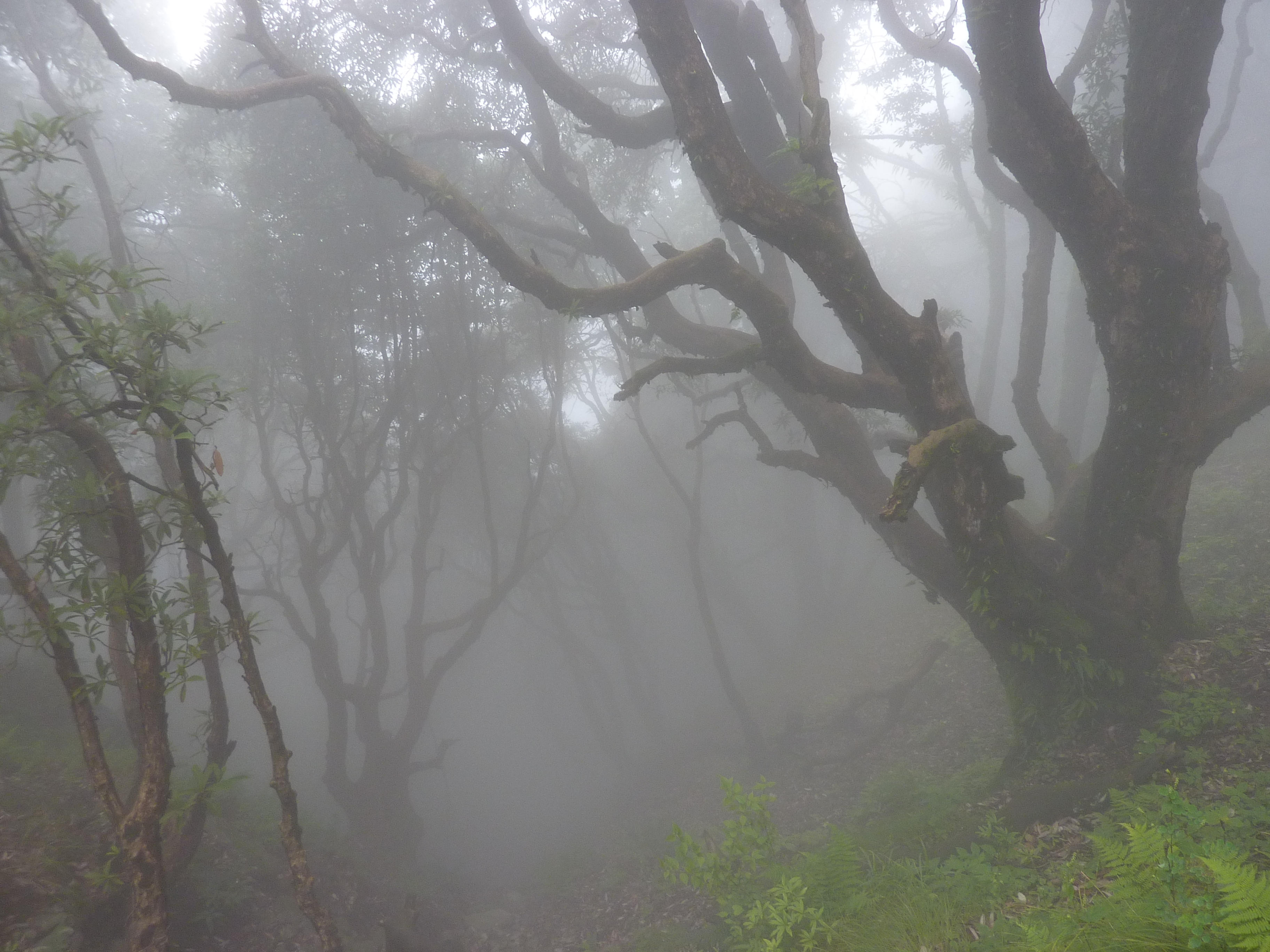
The first part of the climb lead steep up through the sparse forest. Looking back we had a nice overview of the hidden village Bara Banghal. As we climbed higher up the higher peaks of the Manimahesh range, including the Maniahesh itself started to show. The sharp peaks, steep valley sides and pristine forest made it in this unknown spot in the Himalaya provided a sight which, though not spectacular, one I will never forget.
The great weather of the morning faded away as the afternoon clouds started running in. Just before the start of the moraines we came upon a small stone hut, where we met a Gadi with his flock. He warmed up some chiapattis for us and we pitched our tents next to is hut. He had obviously not much to do so he just stood around observing our every move.
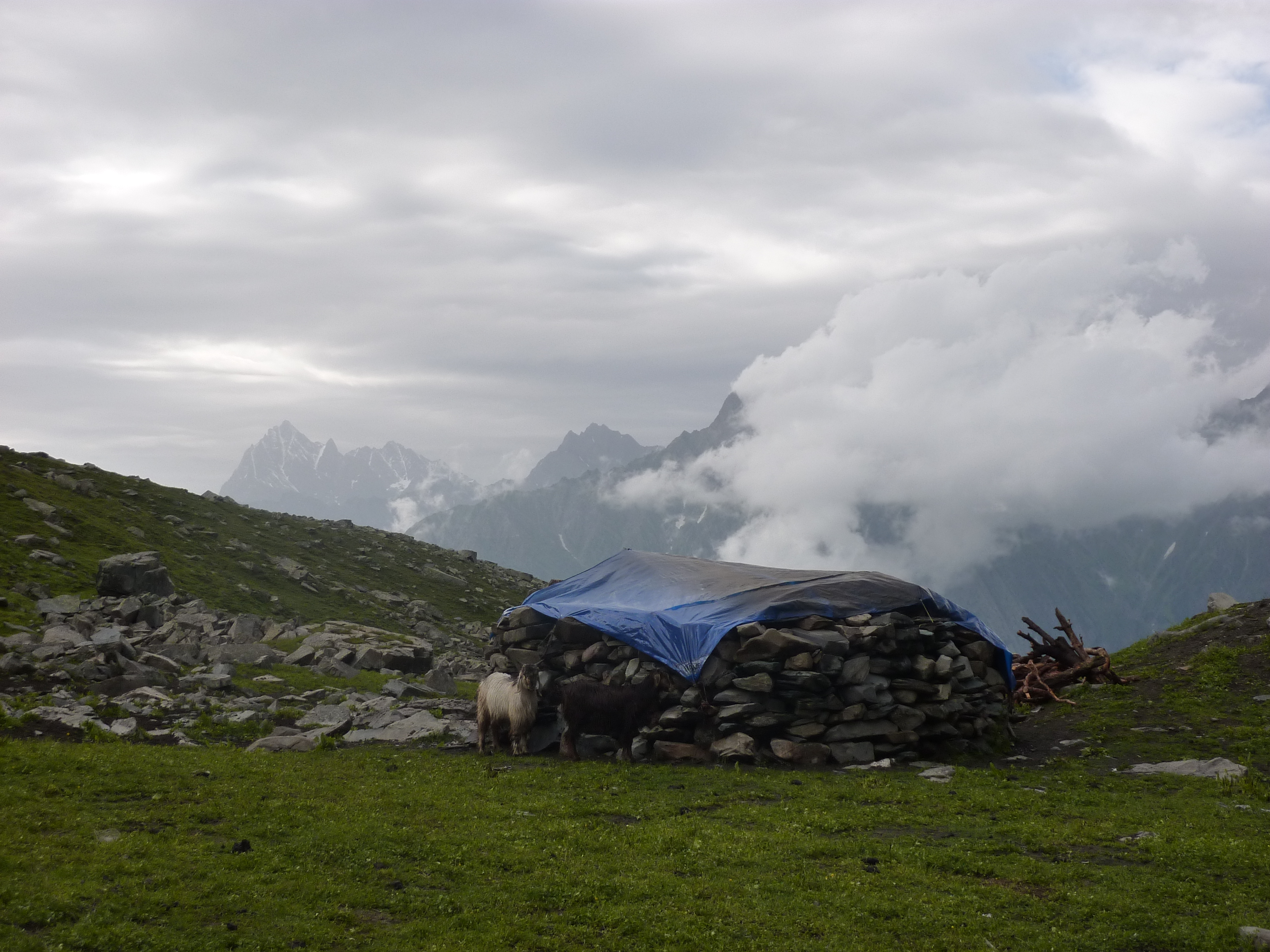
The floor of the hut lay a little under ground, but the roof was still not more than a meter high. The wind blew through the walls, this was probably not a fun place to stay overnight on the edges of the season…
Day 5
We had camped on one of the very last pastures so the climb over the moraines started fist thing in the morning. We had left early, we hoped to beat the afternoon clouds and get a glimpse of the Indian plateau that should stretch out south of us. This would be a symbolic moment. After having trekked through the Himalayan mountains we were finally about to cross the very last ridge and see the wide Indian plains.
The climb till the foot of the pass was easy. The last stretch went over a small glacier leading to the pass.
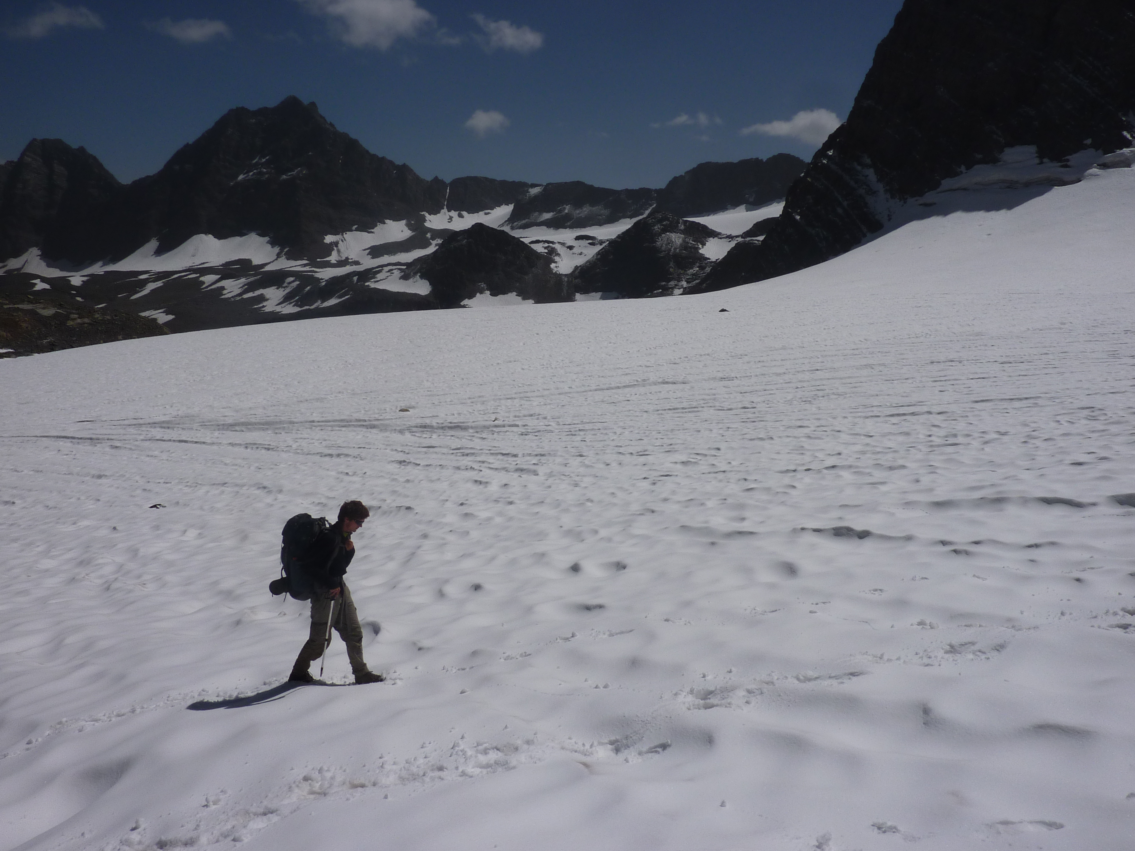
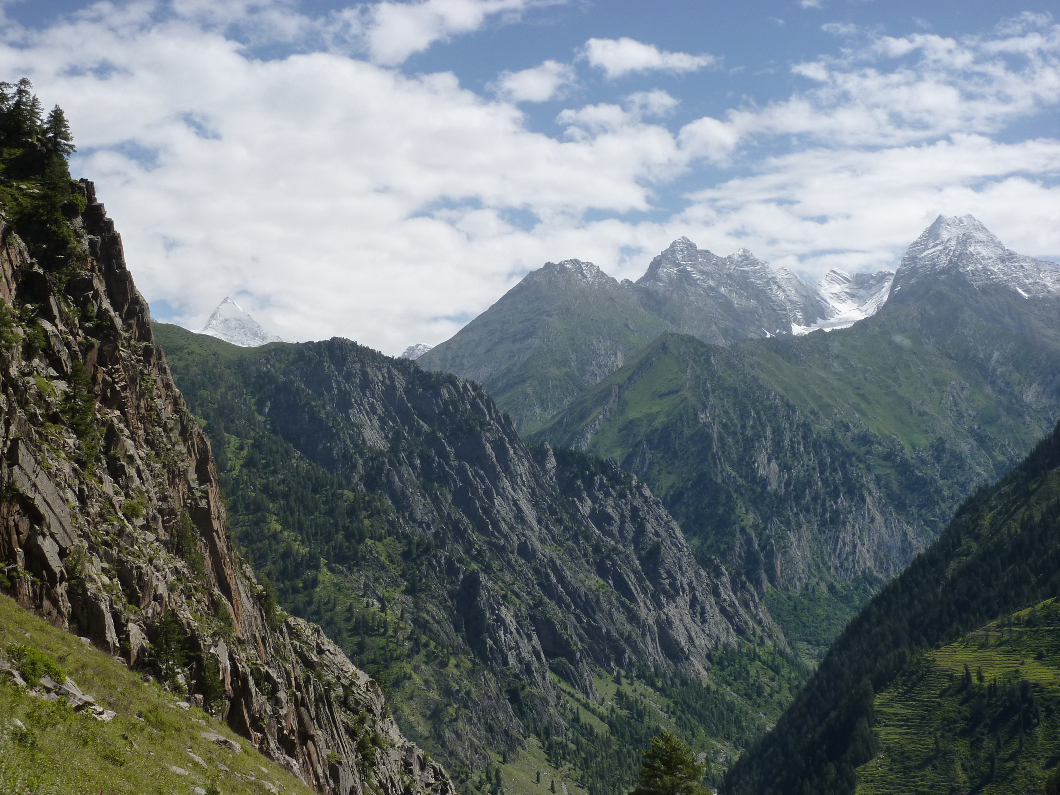
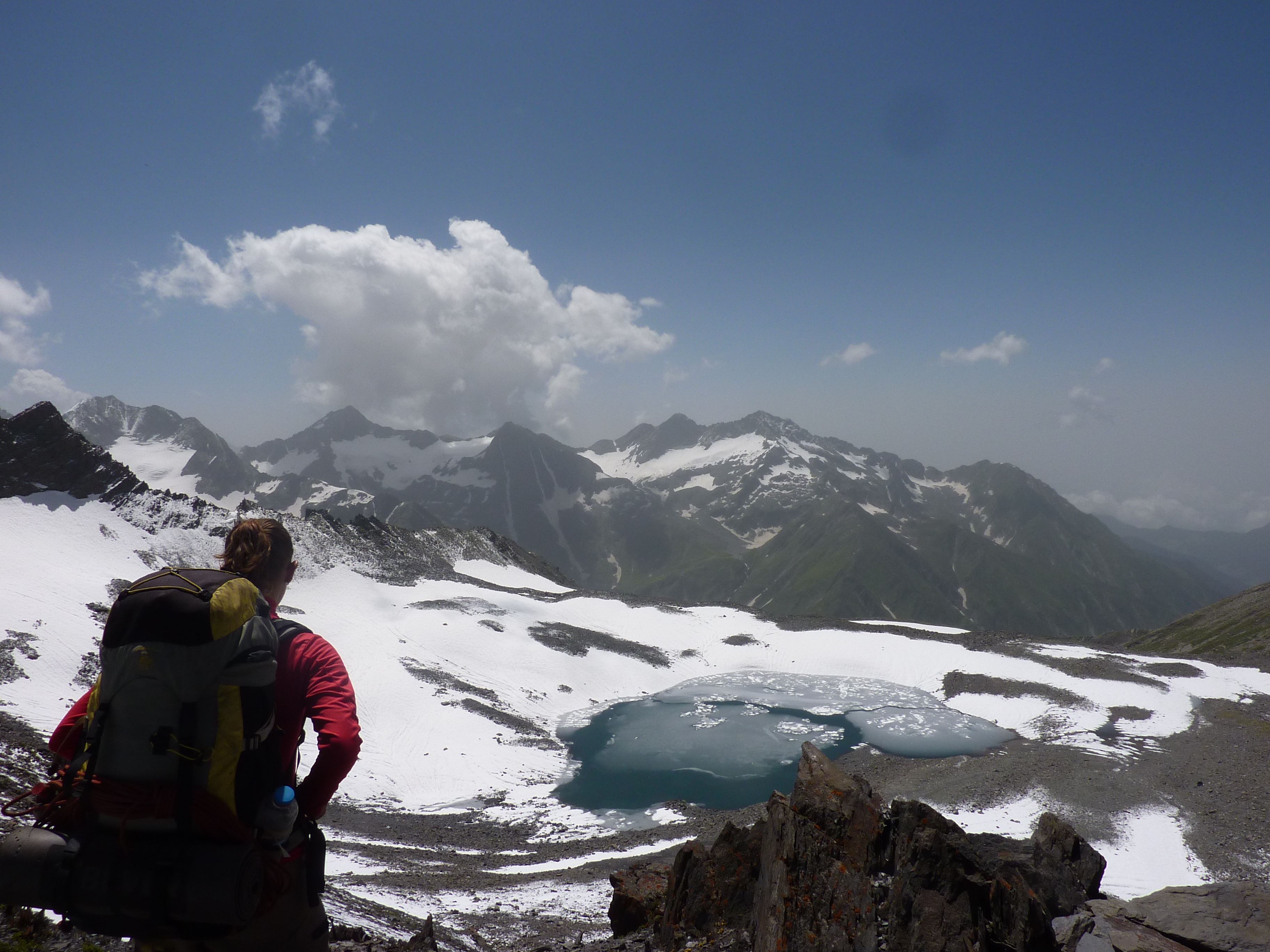
On the climb we met a local crossing in the same direction. He did not seem to fully trust the glacier and was obviously waiting to cross together with us. The view from the pass was rather nice. The Indian plains in the far south however were covered in a gray monsoon haze, so the beautiful Chamba mountain would have to do.
The first part of the descend over the moraines was very gradual, after that came a knee breaking descend over some pastures. Down below we arrived in a small summer camp with two large tents. The tents turned out to be hotels, as we were not at all pressed for time we decided to stay overnight. A fellow guest turned out not to be a local but an Indian man from a town nearby that came here for the clean air. The man spoke a little English so we had some possibilities for simple conversation that evening. The dogs were also nice company. They were hid however, so whenever I picked up a stick to play fetch, they ran for it.
Day 6
We woke rather late and left even later. Our host had a little bit too much to drink that evening and we had to wait a while till we could pay our bill. One of the dogs followed us for the first half hour till the point that I really worried whether he would be able to find his way back.
There were many large remaining ice fields that formed natural bridges. Apparently this area was snowy and shady enough for snow to persist around the year. Thanks to the dog we could easily find the trail after having hiked a few hundred meters over the ice.
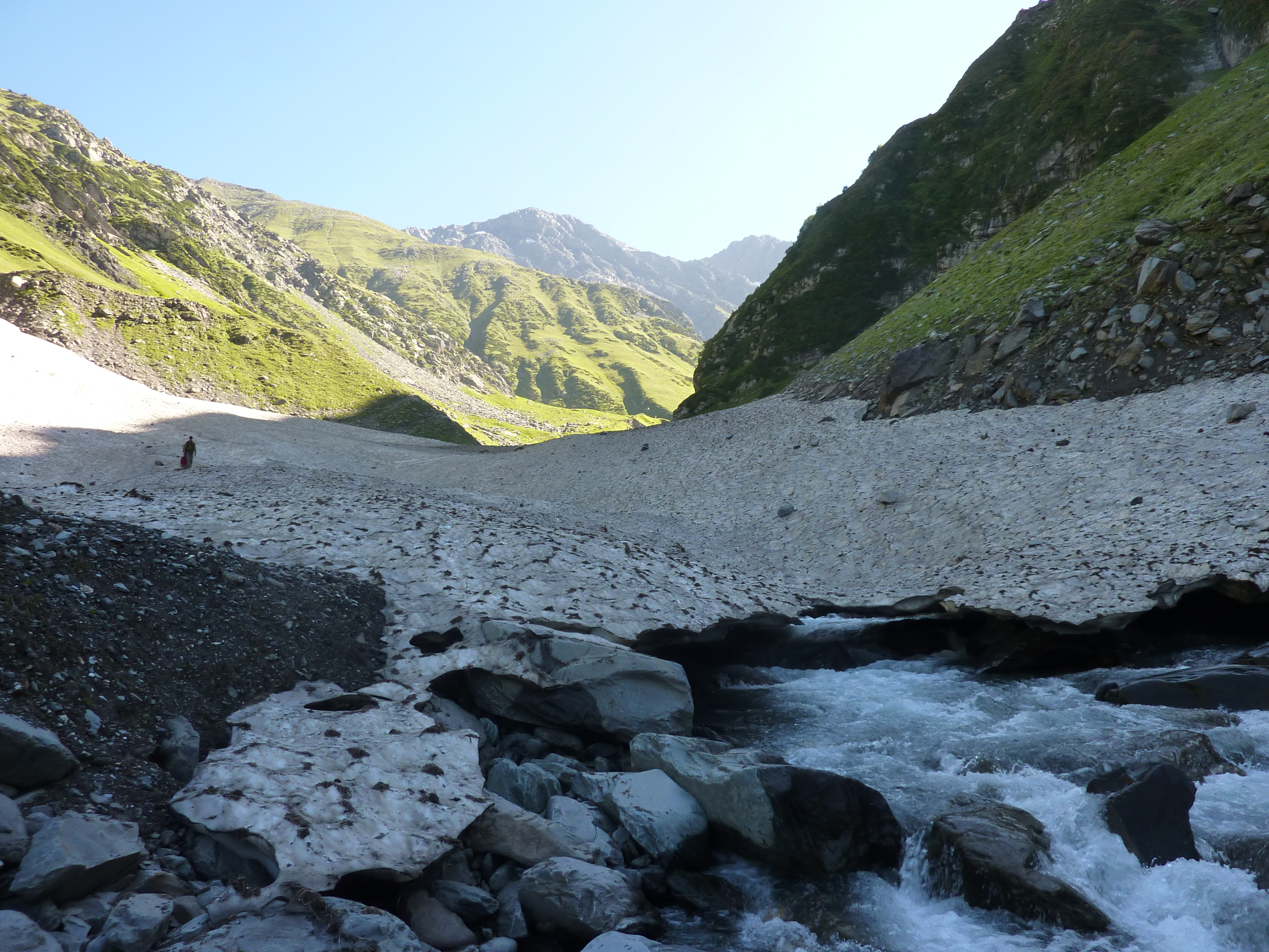
When the snowfields stopped our dog and guide left us to head back home. We continued down valley and soon after we found ourselves in lush pine forest. The nature was rather tame here and somewhere I expected to find a small park bench for hikers to sit on. The route was easy, but long, it was already getting evening when we arrived in the first village.
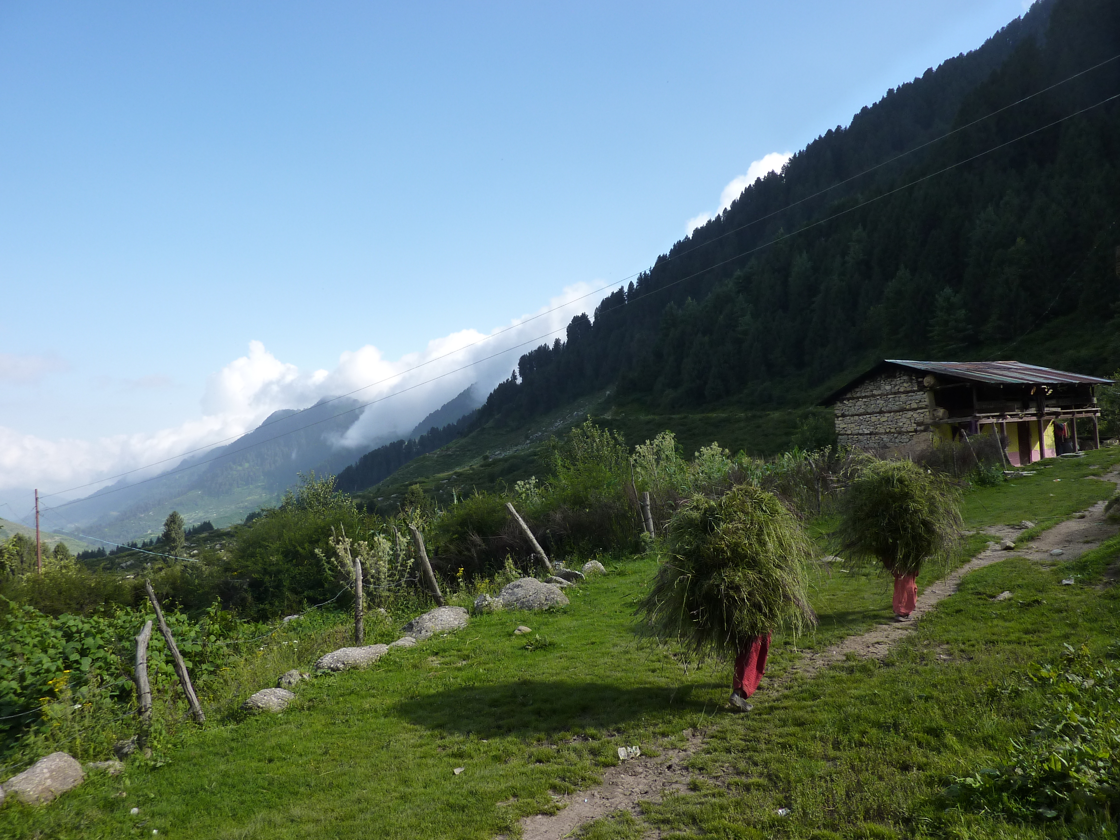
It was a nice classic farming village just an hour walking from the nearest road. The farms were full of crop it had been a while since we had seen the abundance. We could stay overnight in the attic of an older man running a shop.
This would be the last night on our almost 45 day hike all the way from Ladakh to here. That as well as the greenery and weather made it a perfect evening. We talked about our travels while eating biscuits on the balcony. This was a trek neither of us would ever forget.
Day 7
We decided to go to the road head of Billing as this would be the shortest way to reach Dharmsala. Billing was a parawgliding spot on the other side of the hill ridge right east of us. We once again left early in the hope to spot some of the Indian plains for the sake of their symbolic value. However once a top of the hill ridge we walked straight into a wall of clouds. This small hill formed the border between the rainy plains and more moderate Chamba climate.
The evening before we had seen constant clouds leaking over, it was also in line with what we had seen from the Thamsar pass. All in all we suspected that this was normal.
We descended through the clouds down to Billing. It was off peak season and Billing was almost completely deserted. There was no transportation. We descended the remaining 1000 meters to Chaugang. We could drop straight down a small trail every once in a while crossing the nice sealed road leading up to Billing.
Chaugang itself was a rather dirty town, but had all the shops and restaurants one could wish for after a long trek.
