

April 2016
Gokuleshwar – Ghunsa – Api Himal base camp – Ghunsa – Pathar Rashi Bhanjyang – Dubai Bhanjyang – Hartai Lagna – Saingoan – Urai Lek – Yansi Gompa – Simikot
This spring I was to visit, what felt to me like the forgotten and unexplored corner of Nepal. I do not use the term unexplored lightly. A google search on terms as Kanda valley or Urai lek barely returned anything and the trekking agencies in Kathmandu do not seem to be interested in the region. It is nevertheless a wonderful and varied alpine region with many cozy villages and rough nature simply waiting there to be discovered. The most amazing thing about this route was that it lead through Tibet for about three days. This fulfilled my dream of crossing the Himalaya from Nepal into Tibet.
Another nice additional feature of this area is that it is completely unrestricted and free to travel! A rarity for such a remote and untraveled region in the Himalaya.
My plan was to visit the Api himal base camp and from there trek eastwards across three minor passes to the Kanda valley. I had learnt about this part of the route through a specialized Dutch trekking agency called htwandelreizen and it had taken me a while to reconstruct the actual coordinates of the route from the description they had posted on their website.
Once in the Kanda valley I would not return south, but instead try to traverse the Api Saipal range to the Humla valley. An endeavor that has, to my knowledge, not been tried by a foreigner before. I had set my eyes on an unnamed pass nearby Saipal himal crossing over to Yansi gompa. Once there, I however, got the advice to cross via the Urai lek instead. I took this advice even though it meant a border crossing.

Packing list
When you are here in April and May there are many Nepalese out on the trail in search of the Yansi gompa. This means that it is easy to eat with the locals on even the most remote sections of the trail. Only in Tibet you will be fully on your own. Do not get me wrong you still should be self reliant, but in practice there is quite some support along the way. I guess that there will be some shepherds in these valleys in summer as well. In autumn the trails are likely to be deserted.
There is no need of bringing any technical gear.
Only take a small tent as you can usually stay with the locals.
Season
In principle this trek can be done whenever there are no snow blocks, which is usually from mid March to mid December. However, since there is a shady border crossing on the way one cannot trek here whenever there is a chance of meeting border patrol. From July to August the Urai Lek somethimes opens for trade and meeting border patrol is not unlikely. Summer can therefore best be avoided. Early spring or late autumn are probably the best times to be out here.
How to get there
The starting point of the trek is Latinat at the end of the jeepable road a little north of Gokuleshwar. To reach here one can take the bus from Kathmandu to Dhadeldura. From here you can hop on the bus towards Darchula taking you past Gokuleshwar. From Gokuleshwar there are multiple jeeps each day driving up and down the valley. Just drive till the road ends and start hiking.
It takes less time to get out here than you might expect. Leaving on the night bus from Kathmandu you reach Dhadeldura the next afternoon. If you take the morning bus you will be in Gokuleshwar around noon after which you have plenty of time to take a jeep till the trail head.
One can also fly to Nepalgunj and take the bus to Dhadeldura from there. This is however more costly and does, in my opinion, not really make getting to Latinat much quicker or easier. There are no regular flights to Gokuleshwar, but one can charter.
The trek ends in Simikot. This town is still not connected by any road so flying is, aside from a 6 day trek to Jumla your only option. There are daily flights to Nepalgunj. From Nepalgunj you can return to Kathmandu either by night bus or morning flight.
Day 1
Getting here had gone way more smoothly than anticipated. We had reached this utmost corner of Nepal in just two days time without any delay. We had stayed overnight in a small local hotel that lay at the end of the road.
We woke up early due to the rather unsubtle rising of the other guests, but as we were not in a hurry continued to sleep till 8.
In the morning the large school grounds on the other side of the river got crowded with children doing their usual singing morning routines. Ava and I were not in a hurry and took our time for breakfast. We also needed some time for it as the fried pink donuts like sweet cakes we got were hard to digest.
At around 9 am we got on our way and followed the broad trail up, this section was in principle still jeep-able. There were many small villages on the way, this trek is one of the best treks to observe Nepalese rural life. It was hot as hell and we drank a lot from the streams along the way.
After half an hour we got to a police post where we needed to register. They made no fuss of us being unchaperoned by a guide. Good!
After a while the slopes of the Chamalya valley grew quite steep and the trail was often carved out in the rocks. Not much further we got to the side valley that we would hike up on our return to reach the Kanda valley.
At this point we crossed a bridge and started to climb up for 300 steep meters. Once on top we had a nice view of the entire valley north of us. The sky was rather hazy, otherwise we might have been able to see some snowy peaks from here.
Once on top we were pretty tired, luckily the next village, Ghusa, was nearby. We crashed in the local teahouse where we could sleep on attic floor.
Day 2
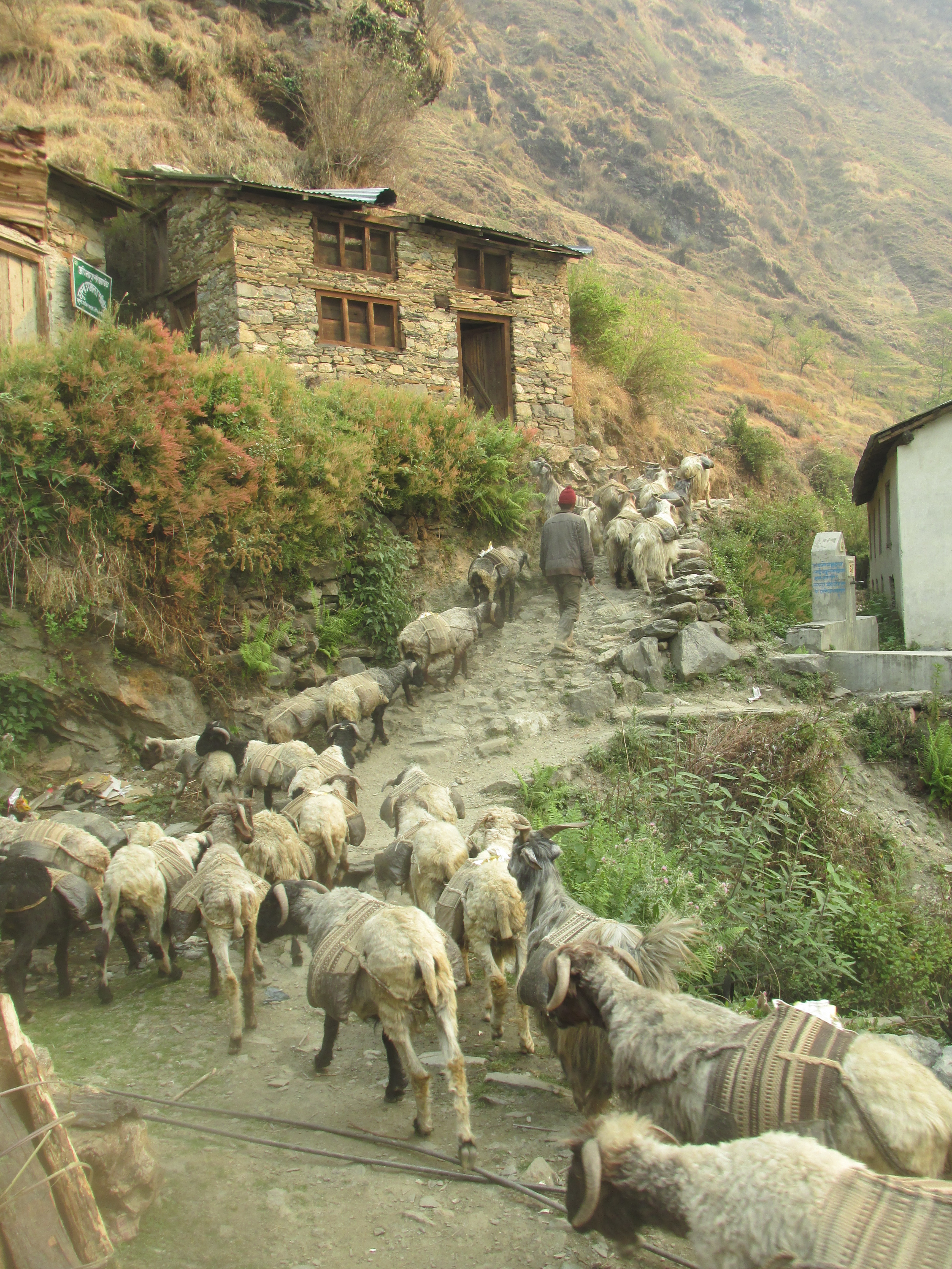
In the morning a large group of goats passed in front of our hotel. They wore backpacks allowing them to carry weight. I had never before seen goats used as a beast of burden.
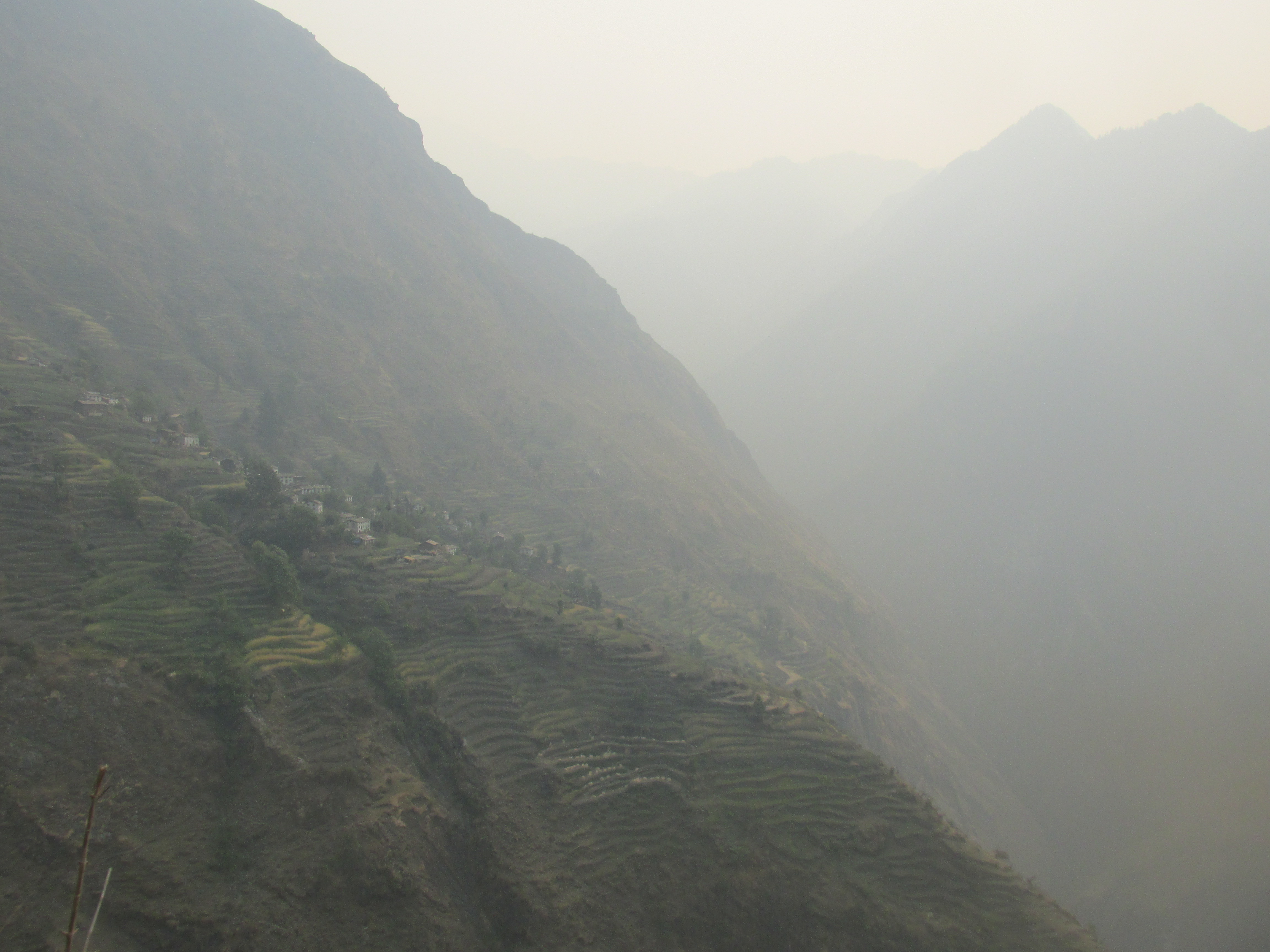
The rest of the day we followed the trail up and down high above the river avoiding the steepest sections. There were many colorful villages on the way and farming terraces decorating the valley sides. Everyone was very curious as to where we were going and what our business here was.
In the afternoon the trail descended towards the river. A bit further up lay Kayekot, the very last village of the valley. Here we wanted to stay overnight and buy a few supplies to make it to the base camp of Api himal.

The people in Kayekot were however rather apathetic and seemed to indicate that no food was available. I argued for a long time, but they hold firm, there was no food here. I could not believe that, I hiked back the way I came for about 30 minutes bought supplies and brought it to Kayekot.
When I returned they all of a sudden got the point and prepared the food that I had brought with me. It turned out that Kayekot was just their workplace and that they lived and kept their food in the village 10 minutes uphill, leading to our almost one hour long misunderstanding. We could sleep in some kind of barn on poles, which we called our ‘tree house’.
Day 3
We rose early in the morning, as we would try to make it to the base camp in one day. From the locals we had heard time estimates ranging from 5 hours till 20 hours so we had no idea how long it would take us. It was about 12 kilometers birds flight away and 1700 meters up, so how bad could it be?
We were on our feet on 5:30 and on our way at 5:45. Our host escorted us a bit up the trail after which we went our separate ways. The trail was remarkably good and we could hike quickly up through the thick woods. This was not going to take 20 hours that was for sure.
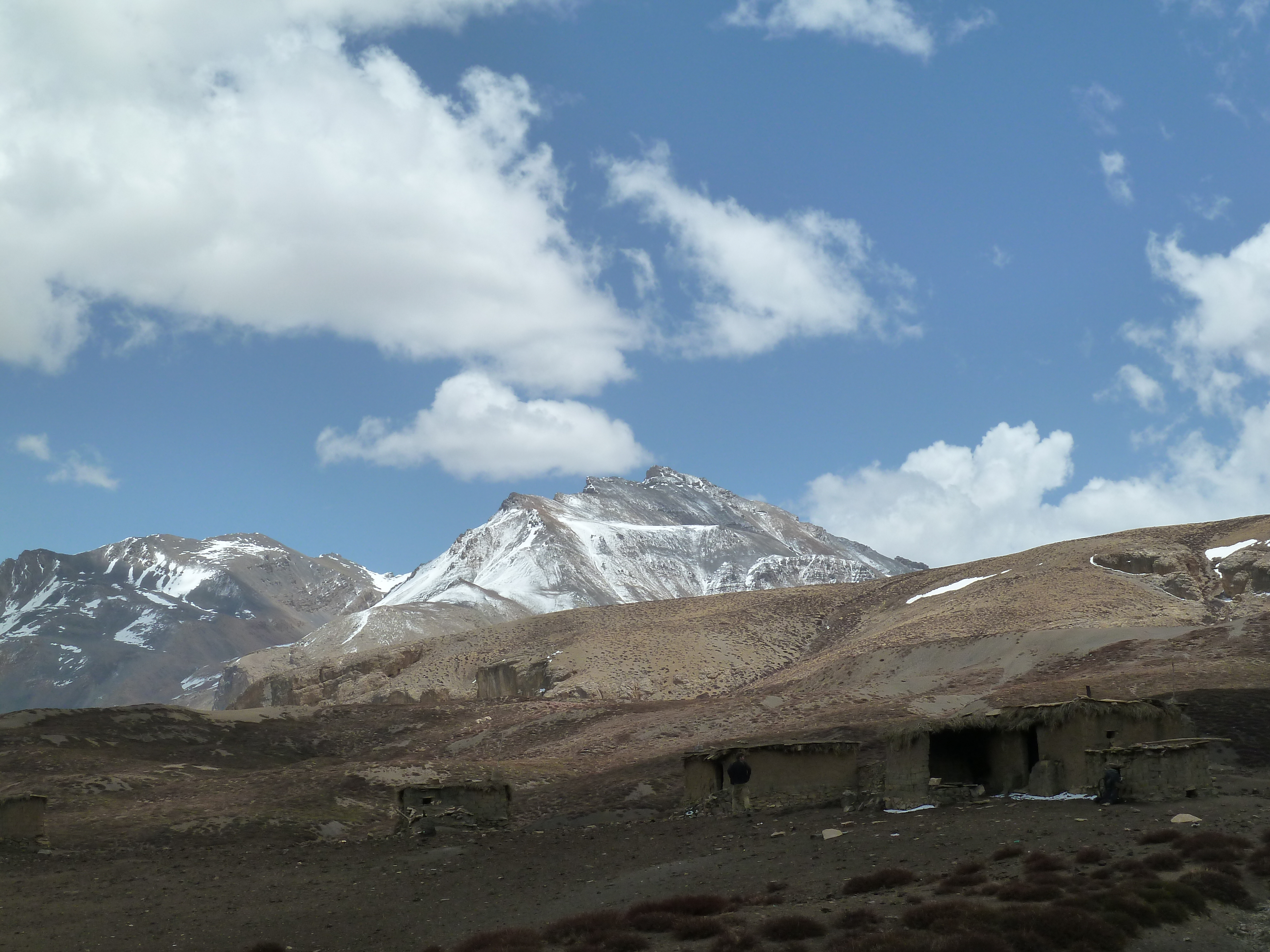
Once we got close to the base camp the forest grew thinner and we could see some of the higher mountains around. Just before reaching the base camp the trail rapidly climbs out of the forest. Once on top we found ourselves on an enormously large grassy plain surrounded by a cirque of snowy peaks rising straight up from the flat valley floor.
It was quite hazy and Api himal itself was hidden in the clouds, so we hoped for improving weather tomorrow.
To pass the time and fill our stomachs I experimented with making some outdoor popcorn. Not easy without oil it turned out…
Day 4
In the night I became sick and had to leave the tent several times. Each time in another direction to make sure I would not meet what I had left behind the time before.
When we woke all clouds had cleared and we could make our photos of mount Api and all other peaks.

After having elaborately photographed each and every mountain we returned to Kayekhot. I still did not feel well, but as it was all down hill, so I could manage.
We reached Kayekhot around 2 pm. They now knew what we wanted and we got food and shelter without any hassle this time. In fact our host, a funny old teethless guy, had transformed into a real hotel manager. He immediately started cooking and cleaning our ‘tree house’. If this trek one day makes it to the tourist radar he is going to get rich.
I spent the rest of the day sleeping away my illness. I did not wake for dinner and slept from 4 pm to 6 am the next day, probably setting some sort of record.
Day 5
In the morning I felt well again and we returned the way we came all the way till Ghusa. Here we hiked straight down all the way to the river, where we needed to climb back up all this way up again. As per usual Ava lacked behind in the descent where I lacked behind in the ascend.

We followed the side valley that merged here with the Chamalya. The trail went up and down, but this side valley was way more modest than the Chamalya itself. Rather broad and most of the time you could hike next to the river.
We once again could sleep on someones attic. They really have something with attics in this place… Our host ran a little shop where we bought our supplies for the crossing to the Kanda valley. We had to cross three passes to reach there and did not expect to find anything in between. With this in mind we took no half measures and bought for about a week worth of food.
Day 6
The weather was really smiling upon us this trek. The skies were once again crystal clear. The only thing we could complain about was the constant haziness. It seemed like there was a constant dust in the air.
The valley floor got flatter and flatter, making the going ever easier. On the way we crossed many stone settlements and farms. It would not be long till we would get to the last one. The valley started to open up and we could see the first snowy peaks in the distance again. The farms with the peaks in the backdrop formed gave a true Nepali ambiance.
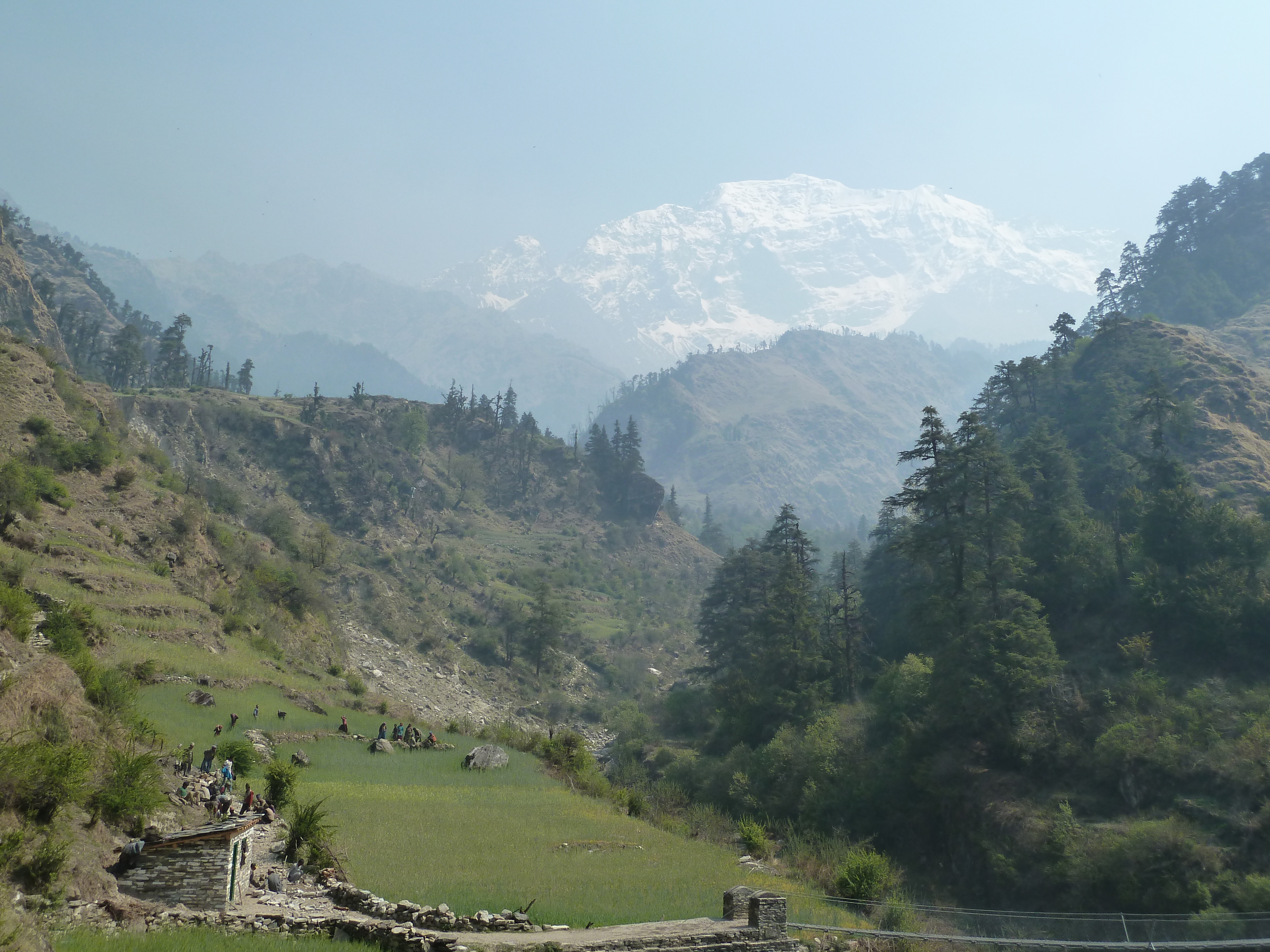
The last settlement lay on the point that the valley splits up into two parts. Once there we decided to get one las dal bhat dish before venturing out in the wilderness. After this we took the norther valley and hiked along an easy trail further east.
After a while we stumbled on a trail building team, where after the trail became nothing more than a small route. The route terminated at the end of the valley after which we had to start climbing steep up towards the pass. There was no trail visible anymore. The first part of the climb went through steep gravel and boulders where after we got some more solid soil grassy ground under our feet.
We did not pitch our tents on the steep slopes instead we used some plastic foil that we found lying around an pimped an overhanging rock into our new home. From our sleeping spot we had a nice view over the mountains around and could already see the snowy pass right east of us.

Day 7
It was an easy climb up to the Dubar pass. First through the grass thereafter over firm snow. Once on top of the pass we could see a large glacier north of us and tomorrows pass, the Pubar pass in the snowy mountains east of us.

The descent of the pass was way more snowy than the ascent and we could slide down from time to time. Due to the snow there was no way of knowing whether we were on the right track. The descent was very steep by times making us doubt whether we had chosen an efficient way down. The snow stopped and we followed an even steeper gully down to the valley. At each turn we prayed that we would not run into a non traversable cliff.
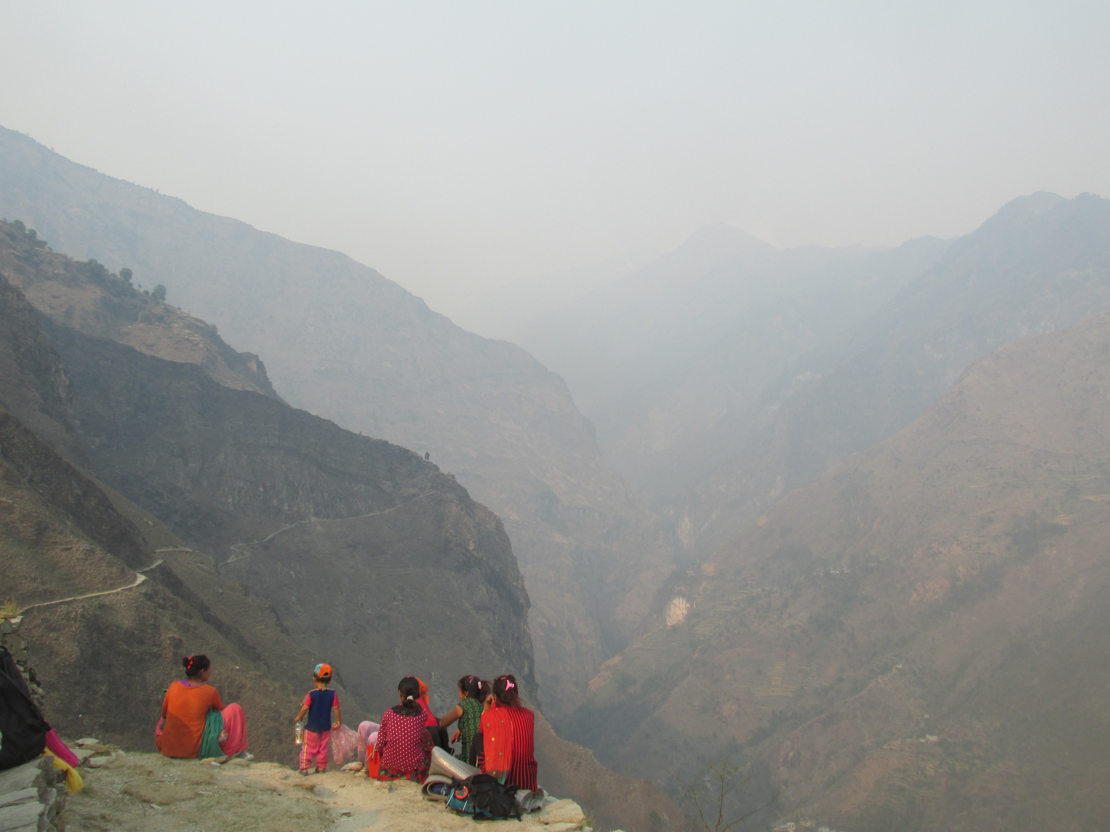
We made all the way down to the river and walked a little bit down stream. We saw to our surprise a couple of folk and tents further down valley. We went to check it out. It was a large group of Nepalese looking for Yasir gompa. An mold infected cocooned insect that one can find in the ground. They could trade these Yasir gompas with the Chinese for 500 rupees. A price so high that it was apparently worth coming here with the entire family.
I wanted to see such a Yasir gompa, but they had not yet found any as they just arrived. I tried to help them find any, but as I had no idea what I was looking for it did not help much. After a while someone from another tent showed me one. I bought it for 500 rupees as a souvenir.

We stayed and eat with the Yasir gompa seekers. I cried the entire night due to the relentless smoke of the fire made in the chimney-less tent.
Day 8
The Pubar pass looked pretty snowy so we started as early as possible to ensure ourselves of firm snow. It was a pleasant climb up with nice views of the peaks north in the valley. On top of the pass we thought to see a snow leopard, but when we studied the pictures back home it turned out to be just a fox…
On the other side of the pass was free of snow. other side of the pass was free of snow. The valley on this side was rather broad and had only a few modest peaks around it. We gradually descended down valley till we came to a large tented camp. We had expected these valleys to be completely abandoned, so we were very surprised to see these Yasir gompa seeker almost all around the place. Mid April to May turned out to be the season in which everyone came up here.
We walked passed the camp and a little further we came to a very large flat area in which there were even larger camps. The camps were so large that they made us think of large refugee camps.
We followed the river ever further down. At the point that the valley become forested it turned its orientation from east-west to north-south.
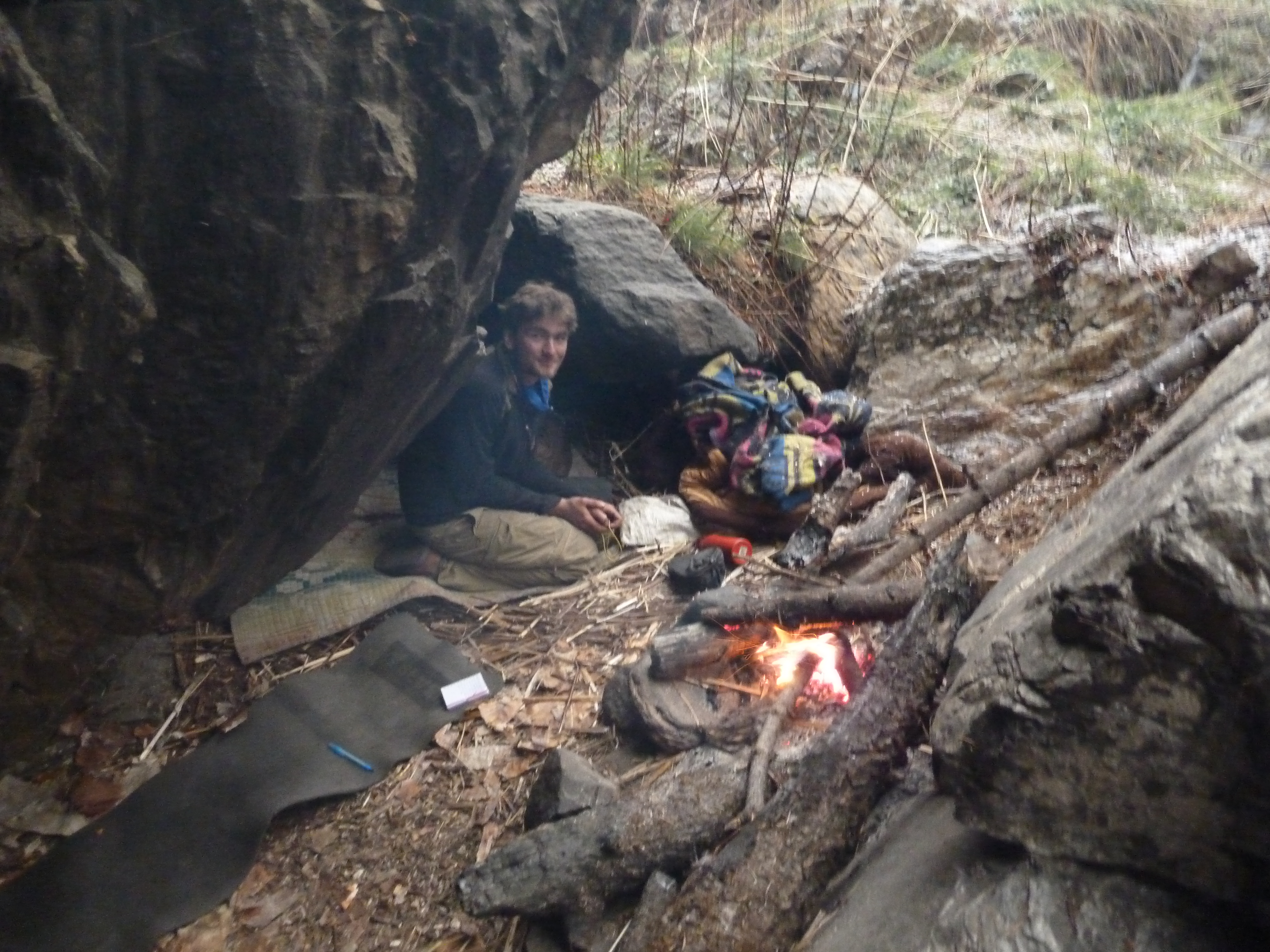
For the very fist time during our trek het weather was turning poor. We waited out a little bit of rain while having lunch in a cave. A little further my GPS indicated that we had to start ascending the last pass. There was no trail to be seen. A few shepherds that happened to be around however assured us this was the way up, so we just started to follow the side stream up. After a while a very faint trail became apparent which we started to follow up.
The weather was worsening, without question in would soon start to poor. We tried our best to find a cave in which we could sleep, it took us a while but we could find it in a lightly overhanging cliff. We collected wood and made ourselves comfortable. Just in time as it hailed heavily for over an hour after that. Tucked away and with a fire burning we were comfortable though.
Day 9
Today, if all went well, we could reach the Kanda valley. We followed the stream uphill. The faint trail was soon gone and we just ploughed through the high grass and boulder filled river banks.
After a while the stream vanished under a steep boulder field filling the gully leading up. We climbed it up till we reached, yes, yet another camp with Yasir gompa seekers. Wow, these mountains were crowded!
We said hello, but did not linger too long. It was clouding up and we wanted to see some of the view the pass had to offer. The pass was just one kilometer further. We hiked as fast as we could, but right at the moment we got on top the clouds rolled in and obstructed our view to both sides. We decided to head back to the camp and try it again tomorrow.
The route to the Kanda vally would lead over a ridge for over 3 kilometers before starting the descent to the Kanda valey itself. In nice weather this should be very beautiful. So maybe if we sleep tonight with the Yasir gompa seekers we could cross tomorrow in better circumstances.
We returned and made ourselves comfortable with the Nepalese folk, who were happy to accommodate us. The rest of the day we spent doing absolutely nothing.
Day 10
Our strategy of waiting the weather out had backfired. The weather was even worse than it had been yesterday. Waiting another day was not a possibility. My brain could not survive another day of pointlessly hanging around.
We climbed the pass and followed the ridge. Even in this clouded weather it was a nice experience. The weather made the route hard to find and we needed to be careful not to follow one of the many side ridges.
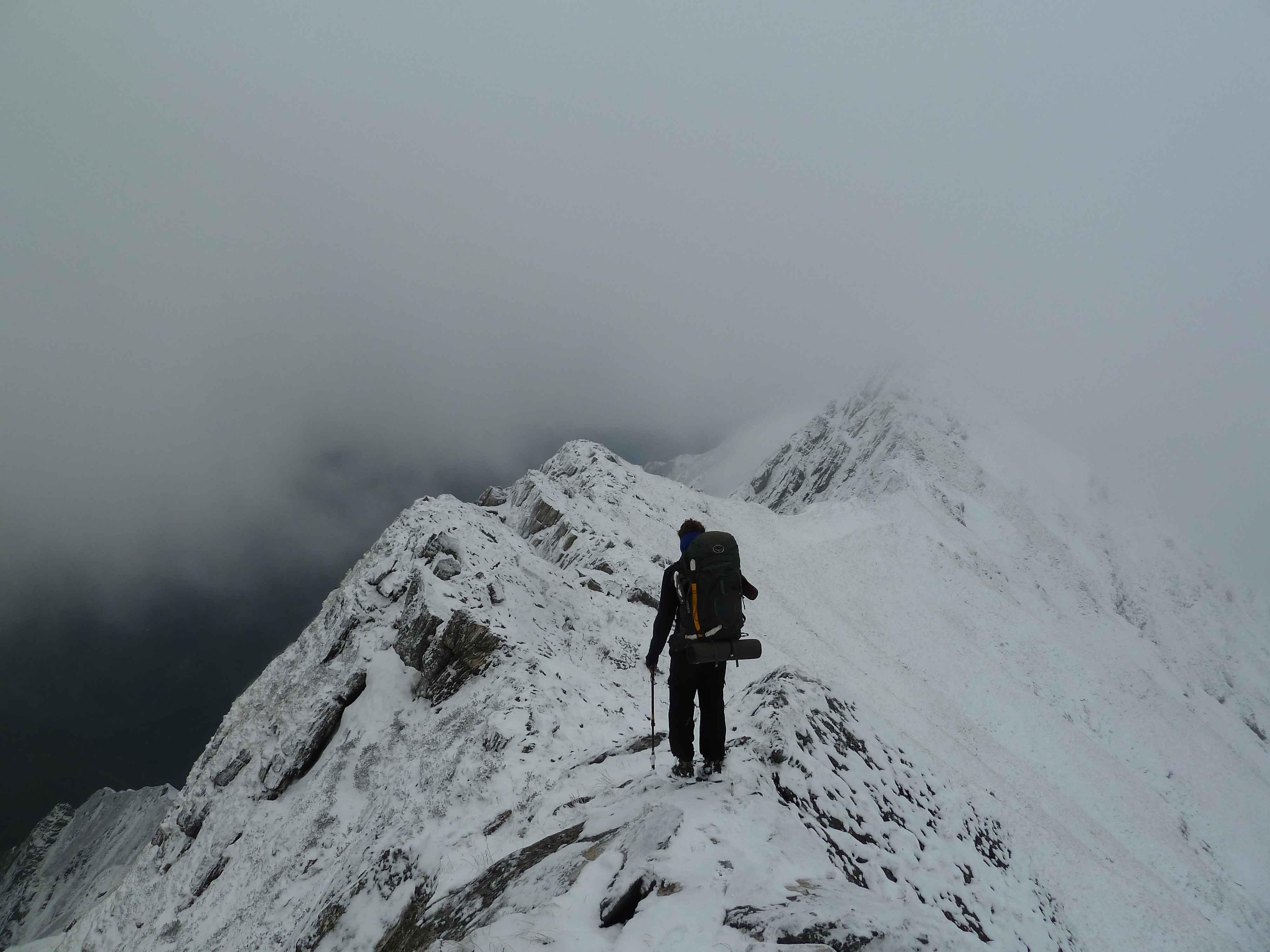
We hiked further and further through the mist. The sharp ridge turned into a broader hill ridge. There were many small ups and downs. After a while my GPS indicated we had to start descending.
Blindly trusting our GPS we hiked down. Visibility was poor. It started to hail heavily and wind was sweeping in. The weather made being here rather threatening. There was no sign of a trail, but it I kept my confidence as it all looked like I had expected.
We followed the side ridge down. At some point the ridge became to sharp and we had to diverge from the top a little. We though to hear human voices north of us. We halted and looked. Was there something. No it probably was the wind. We hiked down further. The terrain became more challenging, but no trail was to be seen.
Just when I started to get worried we got sight of a large trail not far from us. We climbed steep down to it. We made it. The trail was over 2 meters wide and obviously pushed for the valley floor. This could not go wrong.
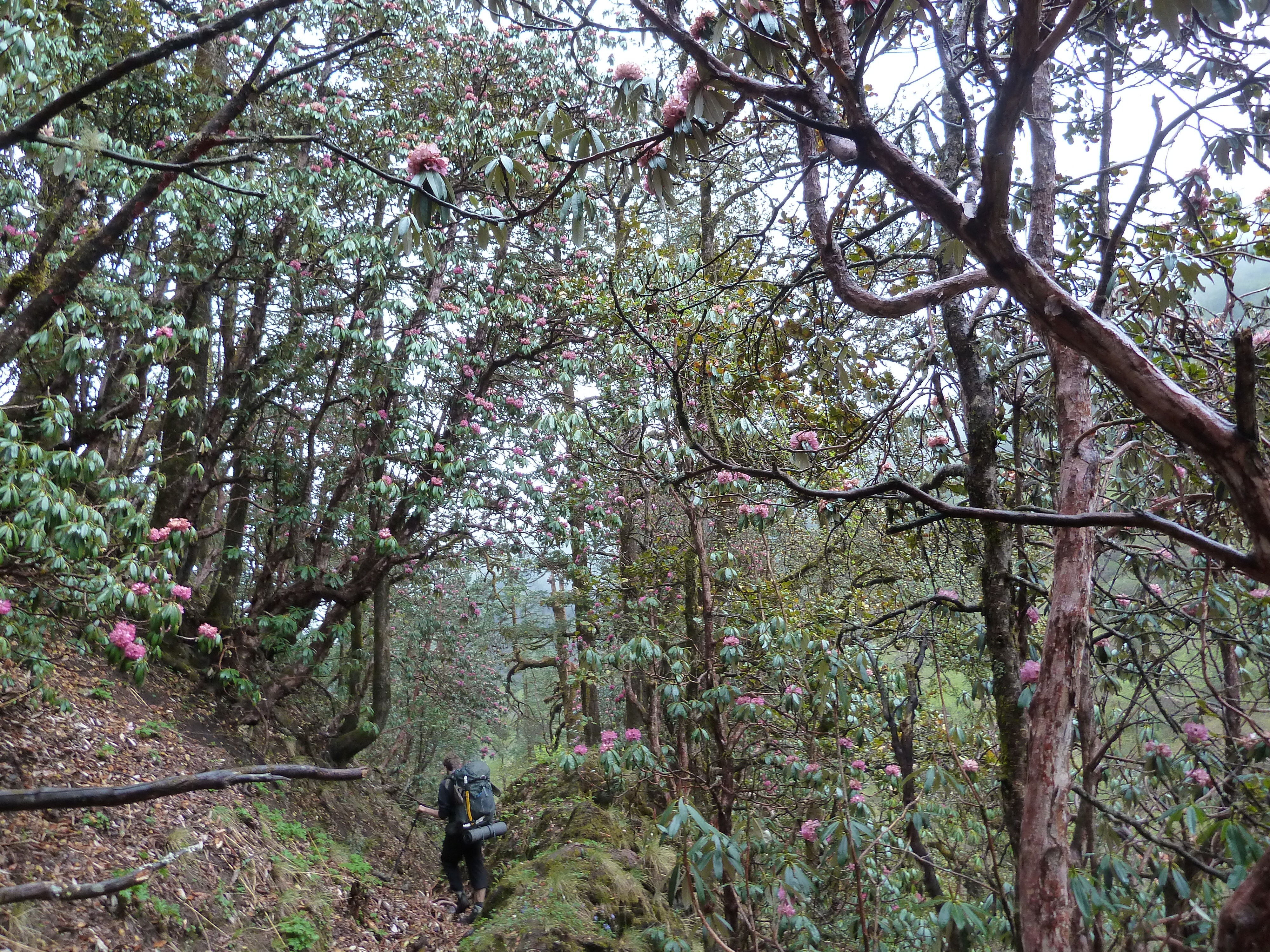
It was a long descent through beautiful and varied forest. There were many flowers on the way and even the weather cleared up for a bit. When looking back up towards the ridge it still looked pretty gray though.
Once down at the river we immediately stumbled on the first village. We were greeted as welcome guests got a room and dal bhat. The dal bhat was so salty that I could barely swallow it. I was very hungry, but simply could not eat it.
Our host told us that we could reach Yansi gompa in about 5 days, my own estimate had been 6, so we bought food for about 8 to make sure.

Day 11
For breakfast we got served our unfinished dal bhat of yesterday. Sigh, not what I had hoped for. We each ate two bites of that salty shit, drank a liter of water and went on our way.
We followed the river up, but we soon needed to return as we had missed the bridge we were supposed to cross. We passed the police post who asked where we were going. Since the Hula district is technically off limits for independent trekkers I just pointed vaguely north and gestured we would return again. They let us go without any further problems.

The trail was broad and easy. It was the trade route over the Urai lek with Tibet so it would stay like this for another two hours or so till the point where we needed to follow a side valley straight north.
We met an old lady on the trail who we asked for her opinion about the way to Yansi Gompa. She said that we had to hike over the Urai lek via Tibet. This would involve crossing the border, something we did not intend to. I wanted to follow this side valley and cross to Yansi gompa there.
At the point where we met the side valley I wanted to follow stood a few large tents in which shops were hosted. We had lunch there. One of the guests was a middle aged man who spoke rather good English. He told us that my plan to cross over to Yansi gompa was technically possible, but that the shrubberies were dense and the way very difficult. The route over the Urai lek would be way easier. He recommended to hike via Tibet. The Chinese police usually allowed Nepalese to travel via this route and there was no border police at this time of year in that region anyway.
I knew from experience that hiking across glaciers or steep rock is hard but manageable, but that hiking trough dense shrubs was an absolute nightmare. I therefore decided to take his advice and go via Tibet. I had not planned this route so we would hike in the dark. He said that it was easy to find though. Besides crossing the Nepalese-Tibetan border on foot had been a life long dream that I could finally fullfill now.
We hiked further. In the evening we found yet another large tent with a shop in it. We stayed overnight here. I could not quite figure out what everyone was doing up here in the mountains right now. In summer the border and with that the trade route over the Urai lek would open, but till than why would you be up here?

In the evening we played some card games with the other Nepalese guests (again what are they doing here?) This entire trek was way less remote than I had thought. Till now we only had needed to camp at the Api himal base camp.
Day 12
The trail was still a hiking highway. It was a popular trading route so we expected this would probably remain the case. Our aim was to get as close to the pass a possible today.
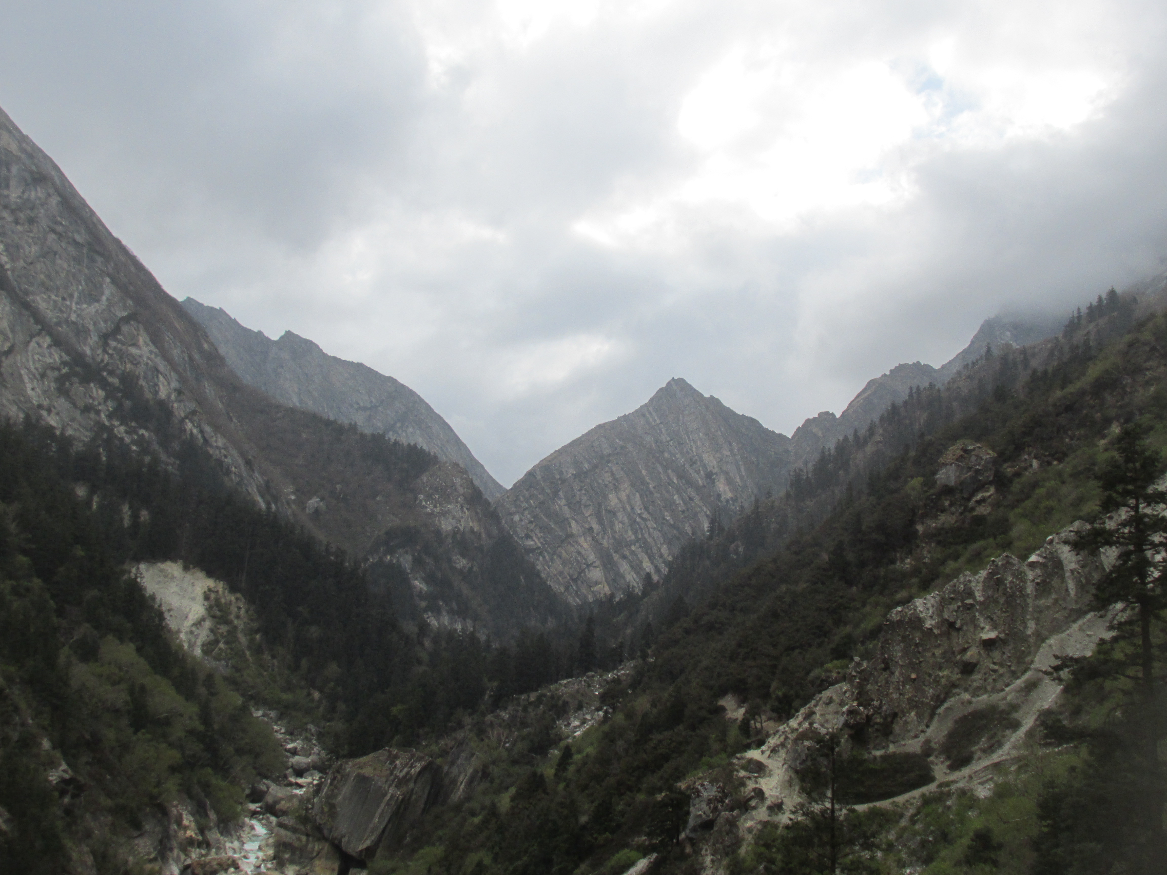
We crossed yet another tented camp whereafter the trail terminated in a gorge. It seemed we just had to follow the broad gravel filled river banks here.

After a while a trail started to ascend up. We doubted what to do. Ava climbed up the trail and I kept following the riverbed guessing we would meet up further on. Ava’s route turned out to climb up for over 200 meters to bypass the cliffs of the gorge. My route went through the gorge over the river banks and through the river. At some point the river dissapeared under a snow field which I crossed. Hiking in a gorge is always kind of a risk as the way can terminate at any point without you seeing in tcoming. So when I got the chance I climbed out of the gorge and met the trail again. Ava arrived shortly after. The view to the south was very nice.

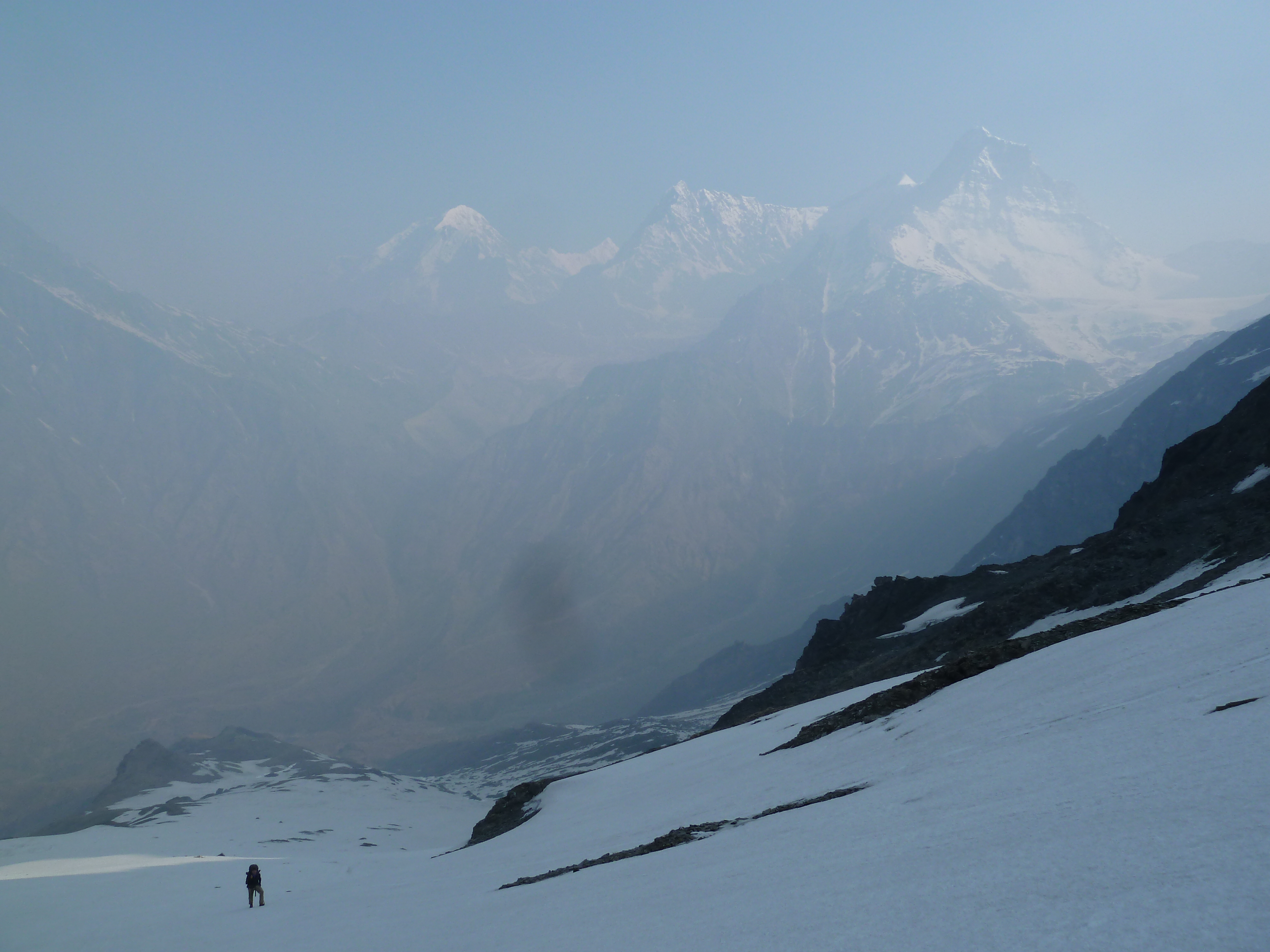
The change in landscape was amazing. The alpine mountains had made way for the brown mountains we all now from the typical Tibetan landscapes. To call the mountains brown is to sell them short. There were many shades of brown and when the sun shone on the slopes the colours were simply amazing.

In the evening the trail split up in a trail following the right and one folling the left valley flank. I did not know which one would be best, but I saw two Nepalese hiking on the other side of the river. I went towards them to inform. They said that the route to Humla over the Urail lek was extremally difficult and that it all lay under a thick layer of snow now. That was not what I had been expecting. I had assumed based on the stories I heard thusfar that the route we were following would continue all the way over the Urai lek and later split up into one route heading for Humla and one to Burang in Tibet. The two young Nepalese guys however told us that it was way to tough to find if you did not already know the way.
One of the fellows, Santi Lama lived in Humla and had taken the route 5 times now. I aksed him if he could guide us. He agreed. His friend was however greedy. He had never done the route, but wanted to join as well and wanted us to pay each of them 1000 euros. That was ridiculous I would not pay for more than one guide. Besides my tent did not even fit four people. Three people was already pushing to, acutally over, the limit. We finaly agreed that I would pay 800 euros for him to get us across. This was way too much, but I really wanted to complete this trek over the Urai lek and did not care to much about the 500 euros we would each lose on this deal. We had both spent under 60 euros till now, so even after paying this it would all have been redicilously cheap holiday. He claimed he had to travel all the way back here as well. That would be over a week of traveling, so I could see some reason in the amount. It was still way too much though.

They agreed to the deal. They went to their camp and only the guy who actually knew the way returned to our tent. We shared the tent with the three of us that night. Amazingly enough this worked out.
Day 13
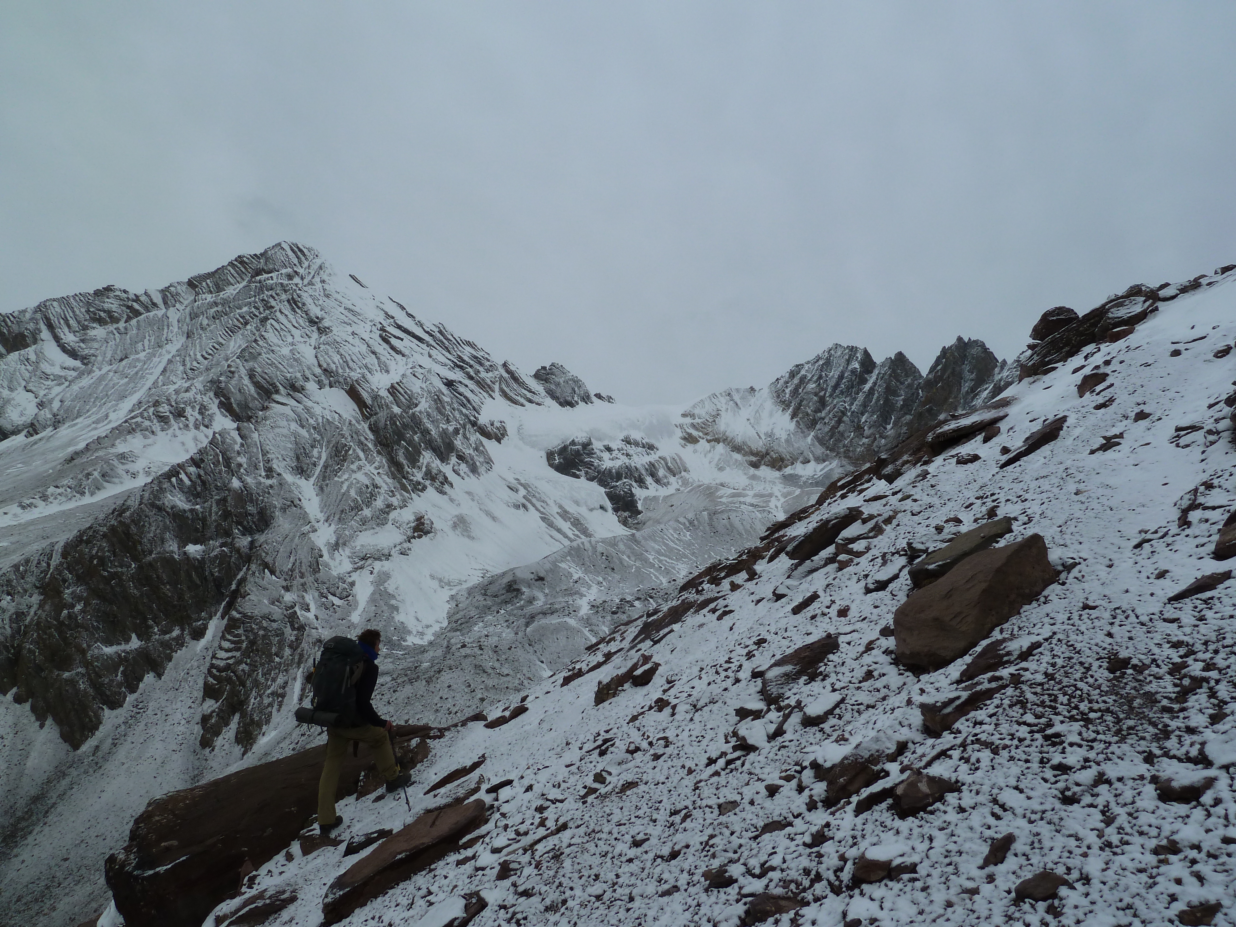
We started at first light. We left the grass pastures behind and climbed steep up some boulders to get to a large gravel filled plain surrounded by razor sharp peaks. It was a nice climb up.
We crossed the plain and started to climb up the semi steep gravel slopes towards the pass. It had snowed a little in the light adding a little powder on all the gray tops There was nothing visible resembling a trail, but the terrain made it pretty clear what direction one probably needs to follow.
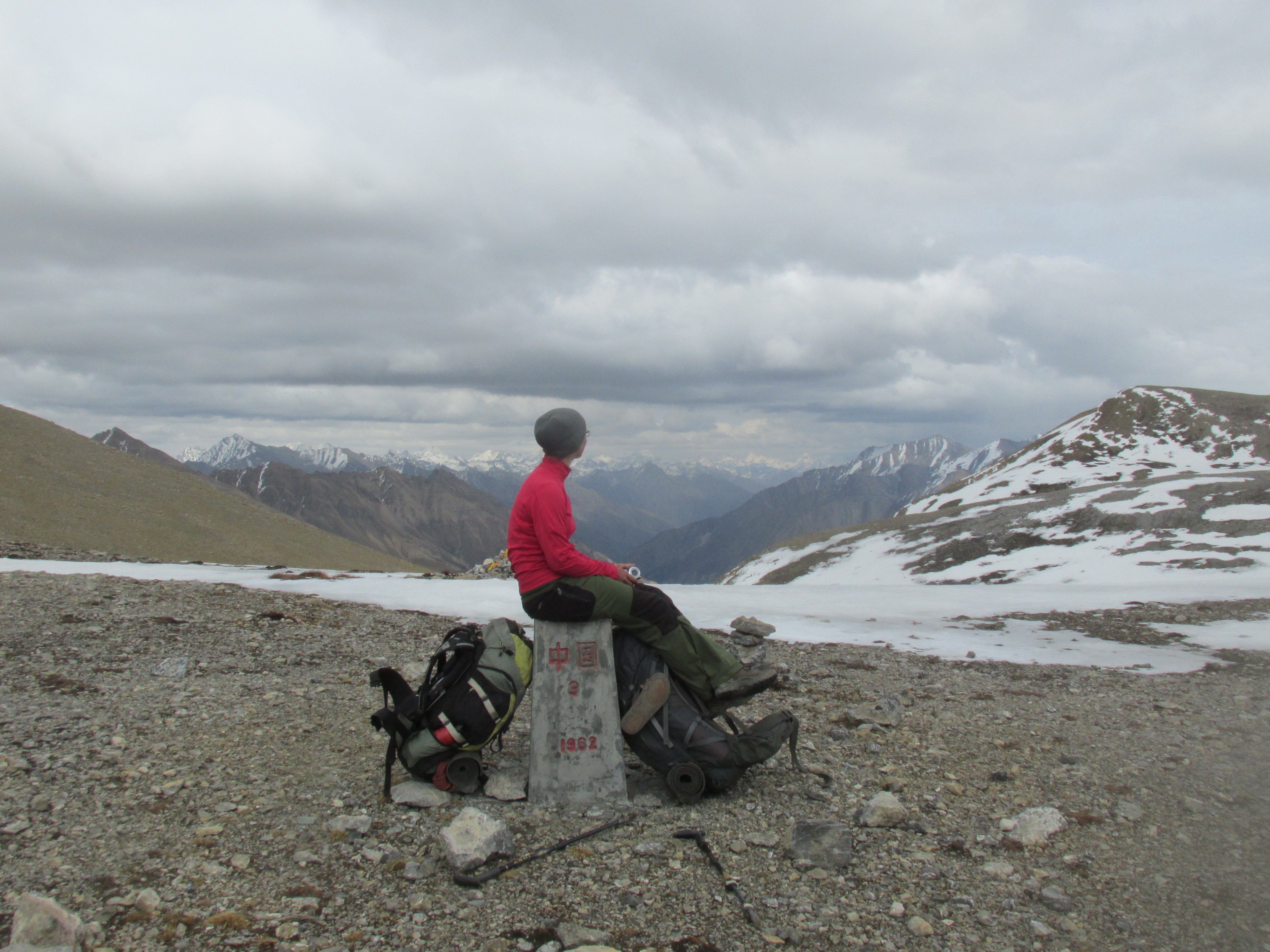
Just before the pass the terrain flattens out. We crossed a few patches of snow and made it to the pass. We had a great view towards the Tibetan mountain in the north. The pass was marked by a border stone showing Chinese signs. Yep, we made it into Tibet no doubt. We mad our photos and our guide Santi Lama, hung up some prayer flags.
I saw that our Santi Lama had largely exaggerated the situation, there was not much snow cover in the valley below and we could probably easily catch up with the trail here. I told him that I would pay him 200 euros and that he could return back to his friend. He told me that he rather went with us as he wanted to go back to his home nearby Simikot. I agreed, but told him that he would not get paid more.

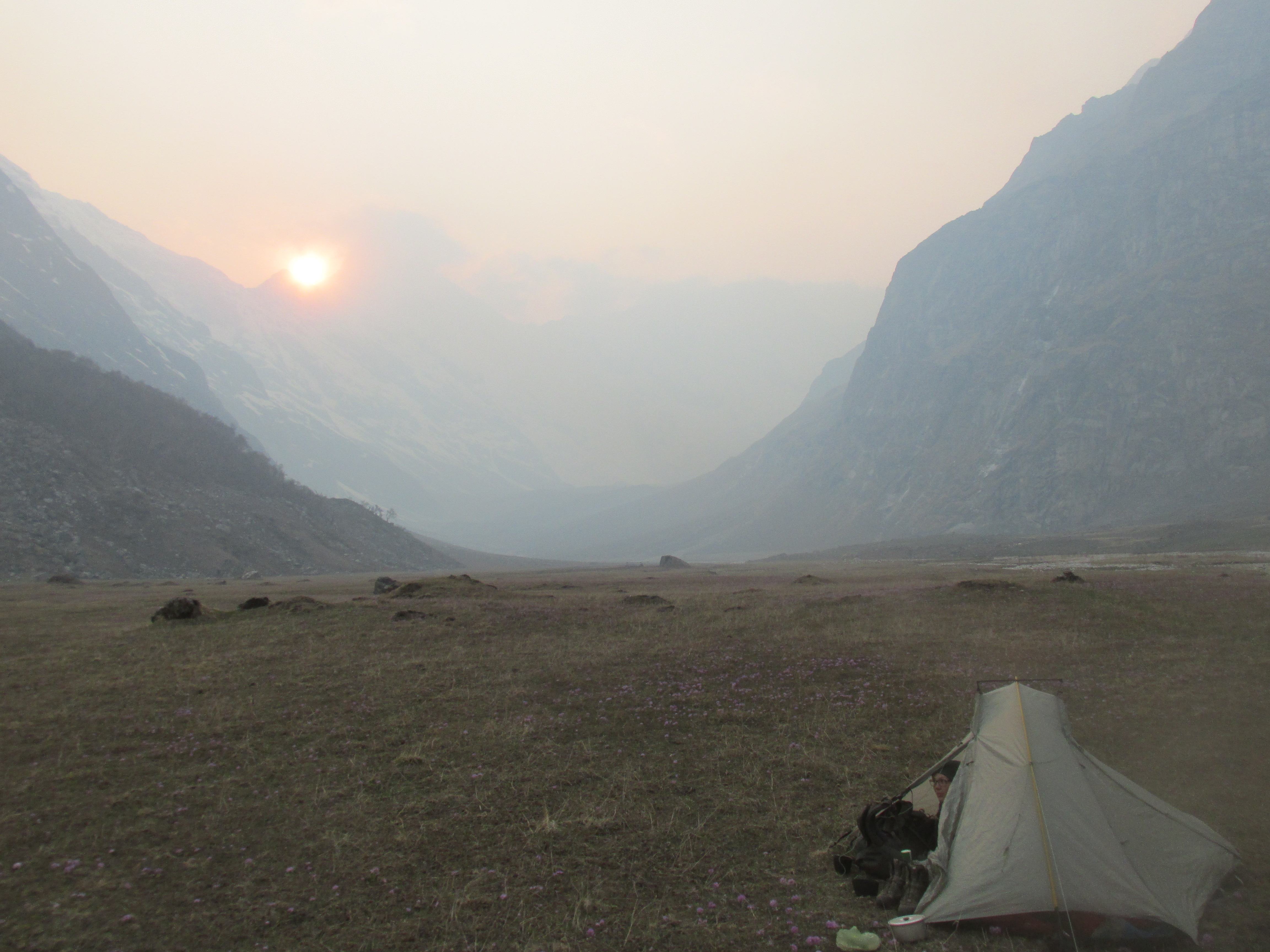
We hiked down the steep snowy slope to make it to the flat valley floor. We set up camp. The surrounding colourful mountain were beautiful. I was happy, crossing the Himalaya from Nepal to Tibet could be crossed off my bucket list!
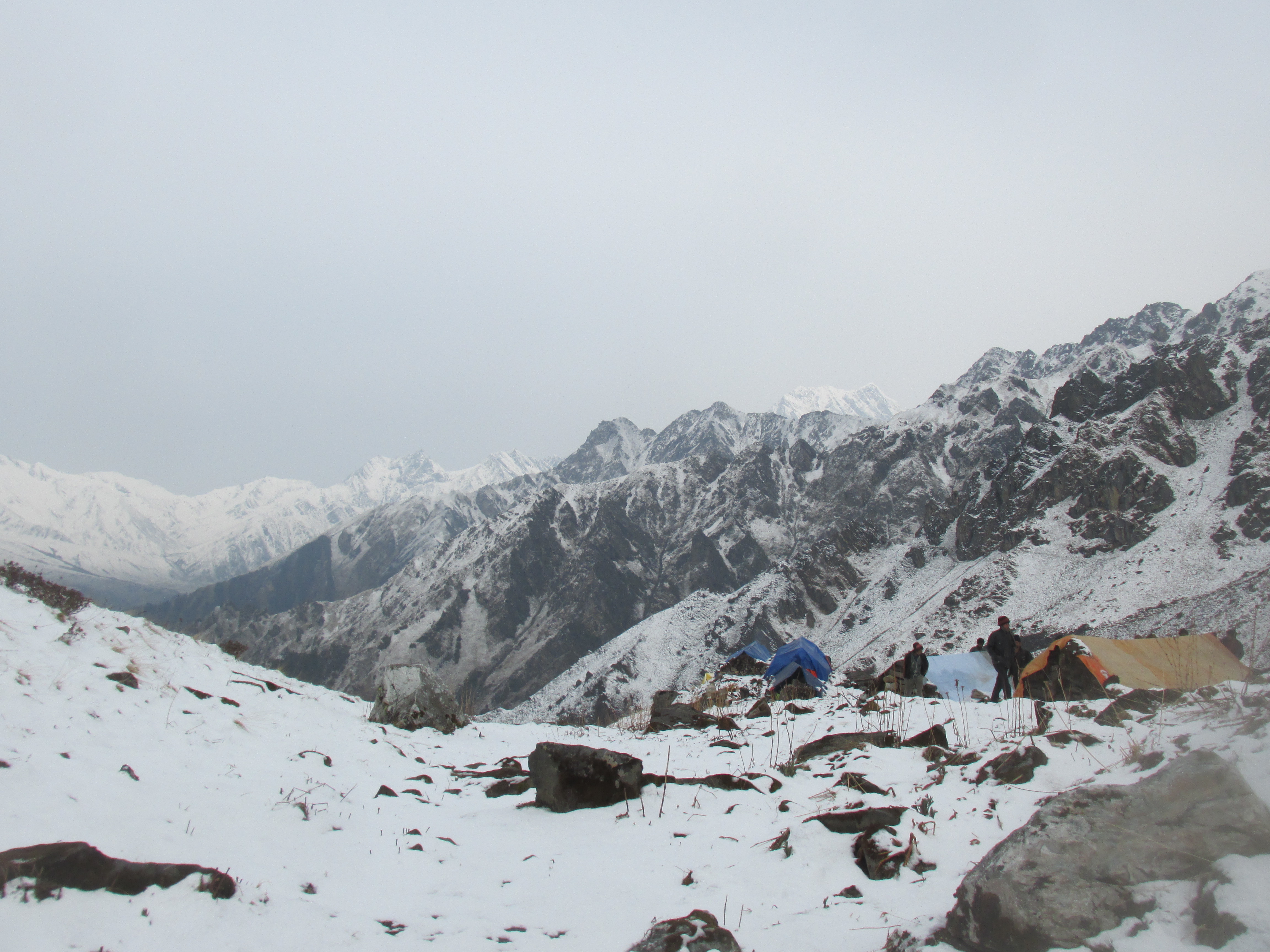
Day 14
It snowed a little during the night, we were with three people in a small two person tent and Ava had fallen ill. On the bright side the weather had cleared up and sun shone on the mountains.

We hiked down quickly picking up a large trail. This was the most enjoyable day of the entire trip. The weather, the mountains around and the fact that we had made it into Tibet made this day unbeatable.
After a while Santi Lama indicated that we had to divert from the main trail and start hiking up a gully climbing the steep valley side. This was rather surprising as there was not much indicating a route here. I knew we had to start climbing up somewhere, but here, I did not see that coming.
We needed the help of our hands on the slippery and loose boulder climb. Ava was still sick so we could not push to hard. When the gully terminated we arrived at a large plateau. From here we could see the open and barren landscape of the Tibetan plateau towards the north.
A little further we came across a few stone shacks. We decided to stay there for the night. This way we would not need to share the tent again. If we made a long day tomorrow, we might be able to reach Yansi gompa.
It was still early in the afternoon so we could explore the area around. Ava discovered many interesting fossils. When we left in the next morning we had 10 kilograms worth of fossils in our backpack… I spent the rest of the afternoon trying to break open an interesting looking rock, hoping to find something interesting inside of it. I heated and threw the stone several times till it finally broke open. Of course there was nothing to see though.
In the evening a discussion broke out between us and Santi Lama. He still wanted a thousand euros. The argument became rather heated, but in the end he settled for 300 euros (which is still not bad for three days work). It turned out that him and his friend had not been able to find Yasir gompa anyway and had charged us all the money they had hoped to make finding Yasir gompa which they had divided between themselves.
Day 15
We let Santi Lama head out before us, we did not want to travel further with him after yesterday’s events. He left grumpy, but when we went on our way we saw he had written ‘good bye’ in the snow.

We climbed up to the ridge. Once on top I was surprised to see that I did not look down into Nepal just yet. Instead We looked over another barren and deserted valley, nothing like knew the Nepalese side should look like. Apparently we needed to descent into this valley and cross the ridge on the other side as well. Having a closer there seemed to be a logical location for a pass in the mountains west of us. Maybe this was the Chima la that we were looking for.
We climbed over the ridge for a while to find a way down. After some time we found a place where we could just about descent. The steep loose boulders were a little dangerous and I doubt whether this was the most efficient way. But it was possible no problem.
Once all the way down we found a few stone piles indicating that yak herders probably came up here in summer. Good we were apparently still on the right track. It was an easy climb up to the pass, the only complication was Ava’s stomach pain.
On the pass itself there was another border stone. We were happy to see it. There had been no trail and this was our first hint since we started climbing up that we were going in the right direction.
We had a nice view over the Himalayas north of the Humla valley. The descent seemed pretty straightforward. We congratulated one another with making it back to Nepalese territory.
We pitched our tent 500 meters further, just below the pass.
Day 16
We followed the stream down. After while we could make out a faint trail that we kept following. The trail slowly but steadily grew more trodden and in about 4 hours we arrived in Yansi gompa.
Yansi gompa is a small monastery run by one family. We were invited in and got tea and some lunch. It were nice folk who proudly showed us pictures of their trip to Moscow to some kind of Buddhist convention.

We had loved to stay here, but our time in Nepal was running out and we really needed to continue. Today we had to make it to Yari so that we could take a jeep to Simikot next morning.
On the way to Yari we met the father of the monk who had welcomed us in Yansi gompa. I knew this as I recognized him from the photos. He, obviously drunk, greeted us jovially and wanted us to come with him. He was sad to hear that we already had dropped by.

We hike across a few more villages to Yari, where we hid the road. It quickly became apparent that the road did not yet go all the way to Simikot and that nothing drove over it. Truly nothing, I could not believe this at first, but I indeed have not seen a single vehicle the entire way nor any tire track for that matter. It seemed like we needed to hike the 40 kilometers birds flight all the way to Simikot tomorrow. That was pretty steep for one day, but due to lack of time we did not have much choice…
It was already late in the afternoon, but we continued to Tumkot in order to make tomorrow a bit more feasible. In Tumkot we could get a homestay. My GPS still measured 32 kilometers to Simikot. We would leave tomorrow at first light and need to hike without stopping.
Day 17
We were on our feet at 5:45 am and left without having breakfast. I prepared for the longest day of my life. In the first hour we came across a military post in which we needed to fill in some papers. They did not seem to care that we were in restricted area without permit or guide. They said there was no way we could reach Simikot by the evening. Well I was determined to prove them wrong.
We continued, I hummed Billy Joels ‘Downeaster Alexea’ in my head prepared to hike till I dropped. There were a few ups and downs, but generally the trail was easy. The Humla valley is relatively densely populated, the next village is never more than 20 minutes away.
Latere in the morning we started to meet a lot of tourist groups. It turned out that a festival was going on at mount Kalaish in Tibet, drawing a lot of foreigners. Most of them had been hiking for three or even four days now.

At the Salli khola we had to climb up 2 hundred meters, the first actual climb. On top it became quite clear that we would probably going to make it to Simikot today and we granted us 15 minutes to quickly stuff away some dhal bhat.
A little later our former guide caught up with us. We exchanged some dirty looks and went our separate ways. We came to yet another army outpost, they did ask for permits, but dropped the issue when I indicated that we came from the Api himal region and not from mount Kalaish.
In the evening we started our ascend to Simikot about 500 meters up. Half way up we halted and stayed overnight in a hotel. We could finish tomorrow and take the morning flight. It was 18:15 when we stopped hiking. 12 hours of non stop hiking, actually not even that bad.
Day 18
We finished our climb up. It was clouded so it could very well be that no planes would leave. We had only one spare day left, so we could not suffer to much weather delays. It turned out that you could not obtain money in Simikot so we were lucky to have just enough to pay for our air tickets. Like really just enough, we were left with only 100 rupees (about 10 dollars).
The morning flight got canceled due to cloud cover. Maybe they would leave in the afternoon. Hopefully they would as aside from having no time we also had no money left to stick around. We left the airport and explored the town for a bit.
A Nepalese guide came up to us and said we could join the helicopter flight of his Indian to Nepalgunj for the same price as we had paid for the regular airfare to Nepalgunj. That was a very good deal. For a regular flight the airfare of 200 dollars was insanely high, but for a heli flight that was pretty cheap.

It was an awesome heli flight of almost 2 hours over the middle hills of Nepal. A perfect end of our trek.
