

August 2015
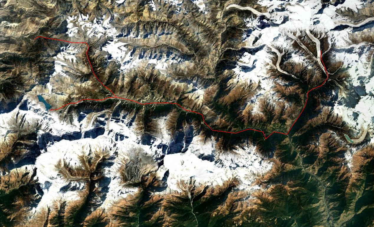
Muktinath – Thorung la – Manang – Tilicho lake – Dharapani – Bimthang – Dharapani
The Annapurna circuit would be the last section of my 2 month long trek through west Nepal. We came here all the way from Mugu through Dolpo, Dhorpatan and around Dhaulagiri. By the time I arrived in the region my threshold of what I deemed ‘impressive’ was so high that I was rather underwhelmed by this trek. As a matter of fact I could not see for the life of me what people liked about this trek. The the side trips to Tilicho lake and Bimthang, which don’t lay on the main route were ironically the saving graces of this trek. But even if I take these side trips into account the Annapurna circuit easily ranks as my least favorite trek of all time by quite some margin.
The Annapurna mountains lay right north of Pokhara. You can already see the mighty Annapurna, Dhaulagiri and Manaslu from the city itself. The great thing of these three mountains is that they lie fully within the Nepalese borders and can therefore easily be circumnavigated. This feature of being able to really trek around an 8000 meter peak is in my opinion the main reason why to choose this area for your trek.
The Annapurna region forms the most classical trekking destination of Nepal, only recently the Everest base camp has become more popular than this circuit hike. The popularity has taken it’s toll on the place. The trails are packed and you can trek in unsurpassed luxury the entire way. The jeep track on the western side of Thorung la is nowadays built all the way to Muktinath . On the eastern side it is built all the way to Manang. This means that there is only 2 days of roadless trekking left… If you were to ask me this really seals it’s faith as a trek of the past. If you are reading this and considering the Annapurna circuit, I would highly recommend you to consider the Manaslu circuit instead, which feels like what the Annapurna circuit must have felt like 20 years ago. (The same reason why I would recommend people to consider Kanchenjunga instead of Everest)
Season
The Thorung la can get occasionally snow blocked from the end of December till the end of February. Since there is no way around this pass trekking in winter is a little risky. Having that said it is usually possible to complete the circuit even in January.
Monsoon sees poor skies on the eastern side of the trek, but as you are compensated with few crowds and booming nature this should still be a very serious option.
Spring and Autumn are the most attractive months. Crowds peak in October and April, so try to stay a bit more at the edges of the season.
Packing list
As long as you have cash you should be fine. As far as 5000m+ treks go this is as accessible as it gets.
Alternatives
You should definitely add some side treks to this circuit. Tilicho lake, Bimthang and the Naar Phu valley are the best add-ons. For the latter one you will however need a permit. If you want to spice up your trek around the Annapurna consider trekking over the Mesakanto pass, Naar pass or even Saribung.
How to get there
As the roads nowadays go deep up into the mountains, there are numerous points where you can start or stop.
On the eastern side of the trek there are many buses each day connecting Besisahar with Kathmandu and Pokhara. FromBesisahare you can take a jeep to Chame or even all the way to Manang.
On the wester side Beni is the most commonly used hub. Here to there are many busses each day heading both Kathmandu and Pokhara. From Beni there are many busses heading up to Muktinath.
Day 1
Lazy asses that we are, we of course drove all the way up to Muktinath. I must admit that after having hiked for over 30 days, driving was a nice experience for a change. I would complete this trek with my companion Dennis who had already accompanied me on the way from Dolpo to here. As two hardened trekkers who had already traversed the remote regions of west Nepal we were somewhat ‘overqualified’ for this trek.
Muktinath was a nice mountain town with excellent facilities, I almost felt sorry having to leave it behind that morning.

We followed the jeep track up till it finally terminated somewhere on the slopes. Not much longer or the road will be actually on the pass itself… We trekked in the opposite to the conventional direction and many people wandered why we were heading up. This confusion would haunt us for the rest of the trip.
As we went further up the clouds started to roll in, so much for the view… I already started to hate this trek…
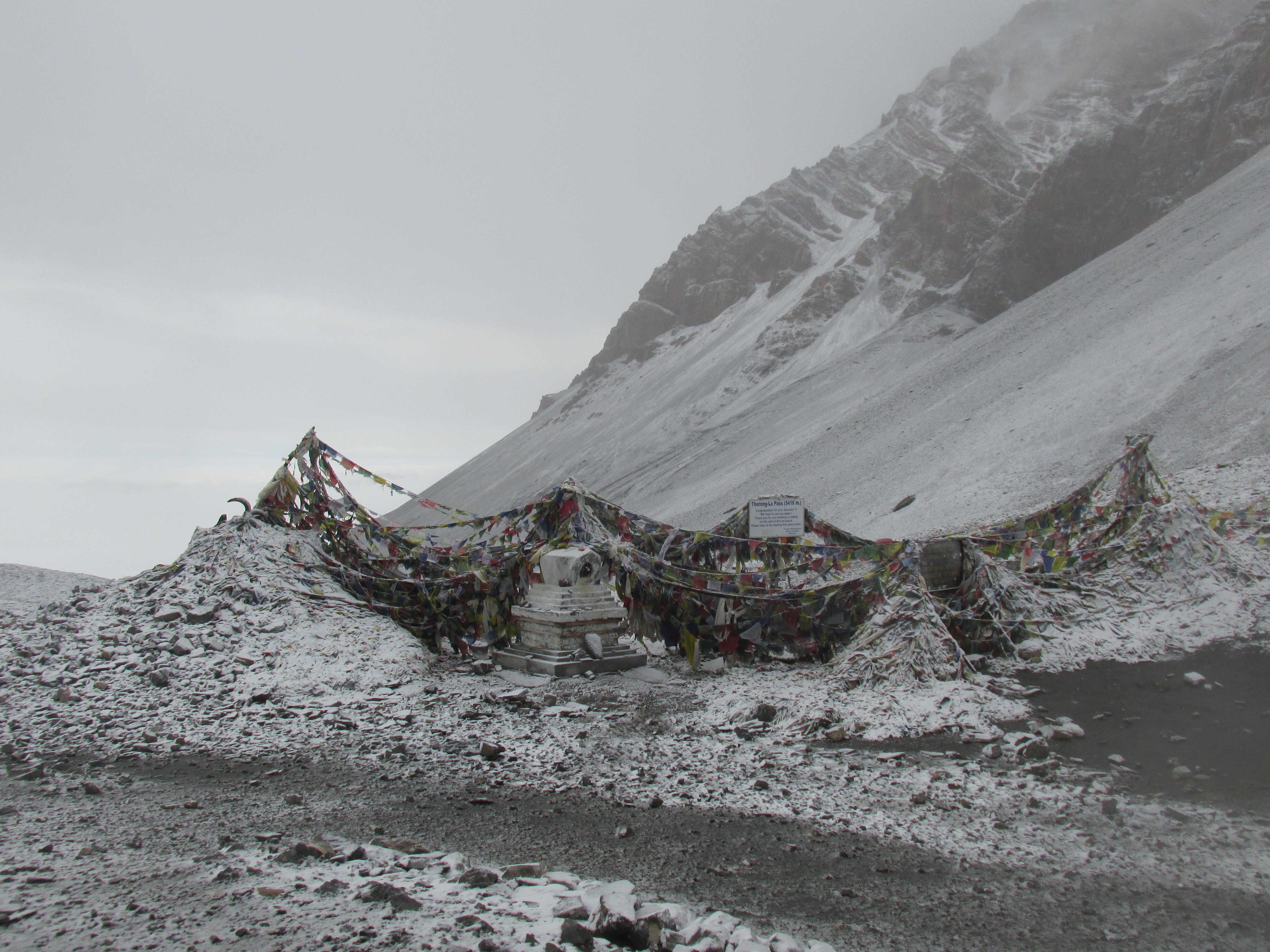
We decided to sleep in the small teashop on top of the pass, who knew, maybe the weather would improve. (It didn’t)
The rest of the day we spent hanging around in the windy shack. Our warden was very keen on selling us tea, no wonder I found out later. The tea was about the price of a portion Dal bhat.
There we sat on a windy pass in the mist with annoying fellow trekkers making pictures on the pass and overpriced tea. Luckily some army folk cam in later that day to ease the boredom. They would climb the Thorung peak right south of us tomorrow as a training exercise.
Day 2
The weather sucked. Nothing but mist, we could barely make out the army folk climbing the Thorung peak. By the looks of it they had somewhat overstated their aim of climbing the peak itself, we saw many groups already returning after having it made to the shoulder. Tsss what a weak sauce Dennis said.
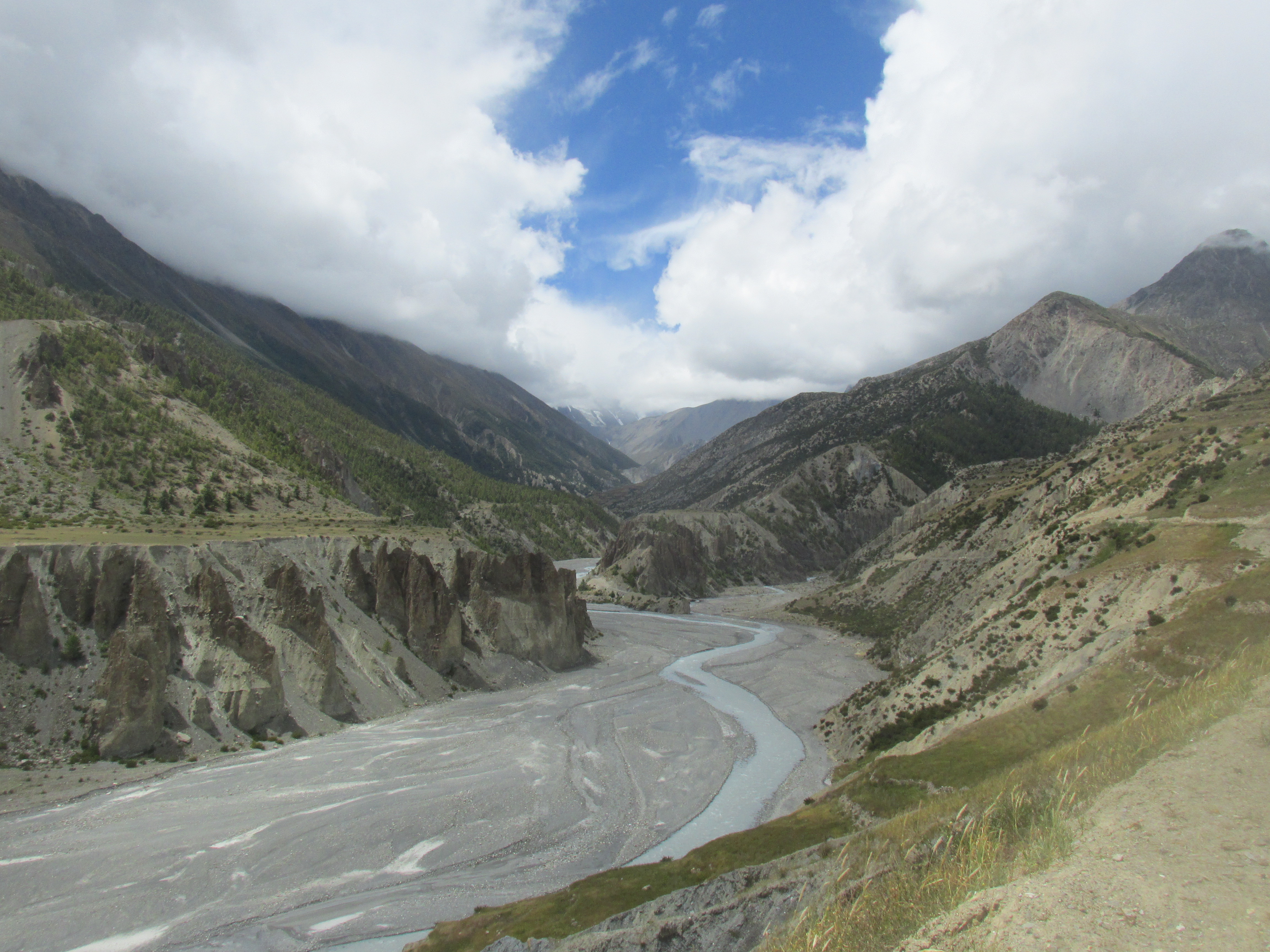
The meteo did not improve much and we did not see much of the mountains. Only gray somber moraine. In Thorun phedi we took a small break for an apple pie after which we continued our way furhter through the rather depressing weather and surroundings. So far the Annapurna circuit had failed to make much of an impression.
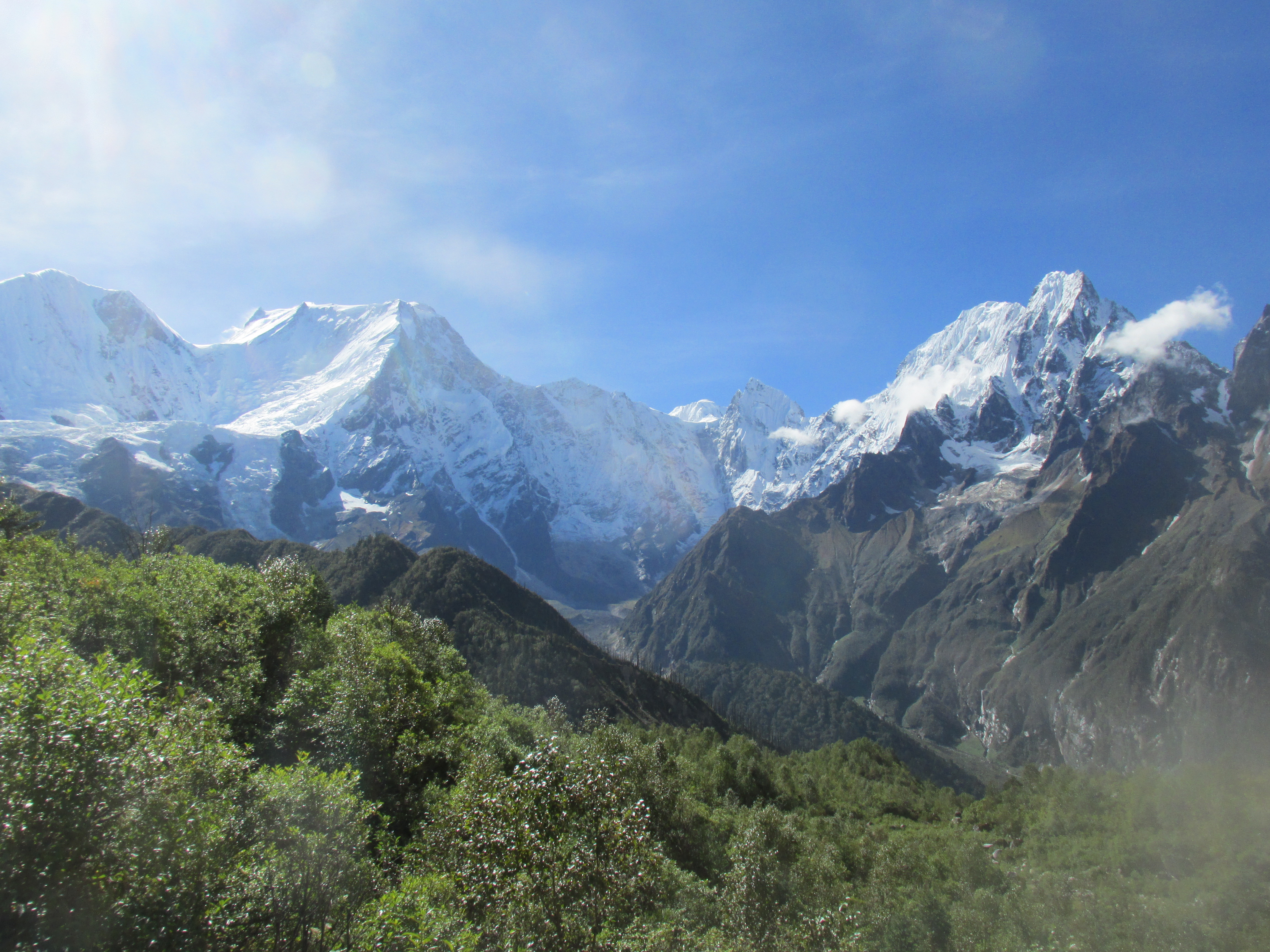
Once we get close to Manang things started to look a bit more cheery. Some sun lighted our way and the mountains became more colourfull. The Annapurna glaciers south of us made the scene around Manang complete.
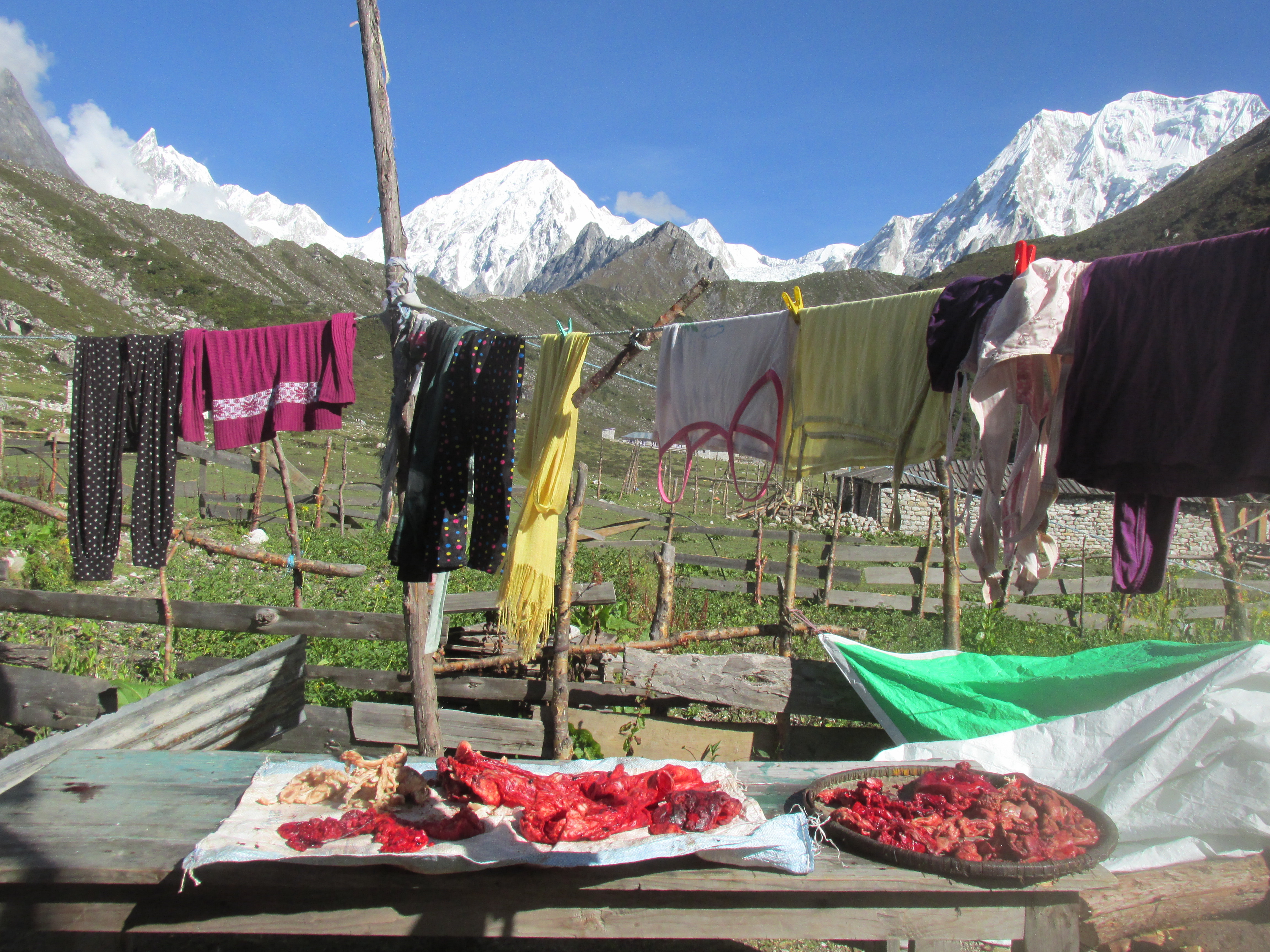
Manag itself was a large town with many lodges. We stayed in a rather small and quiet one all the way west of town. As we walked in the opposite direction the first lodge we stumbled upon was always the quietest instead of busiest. The food was rather cheap and we ate what we could.
Day 3
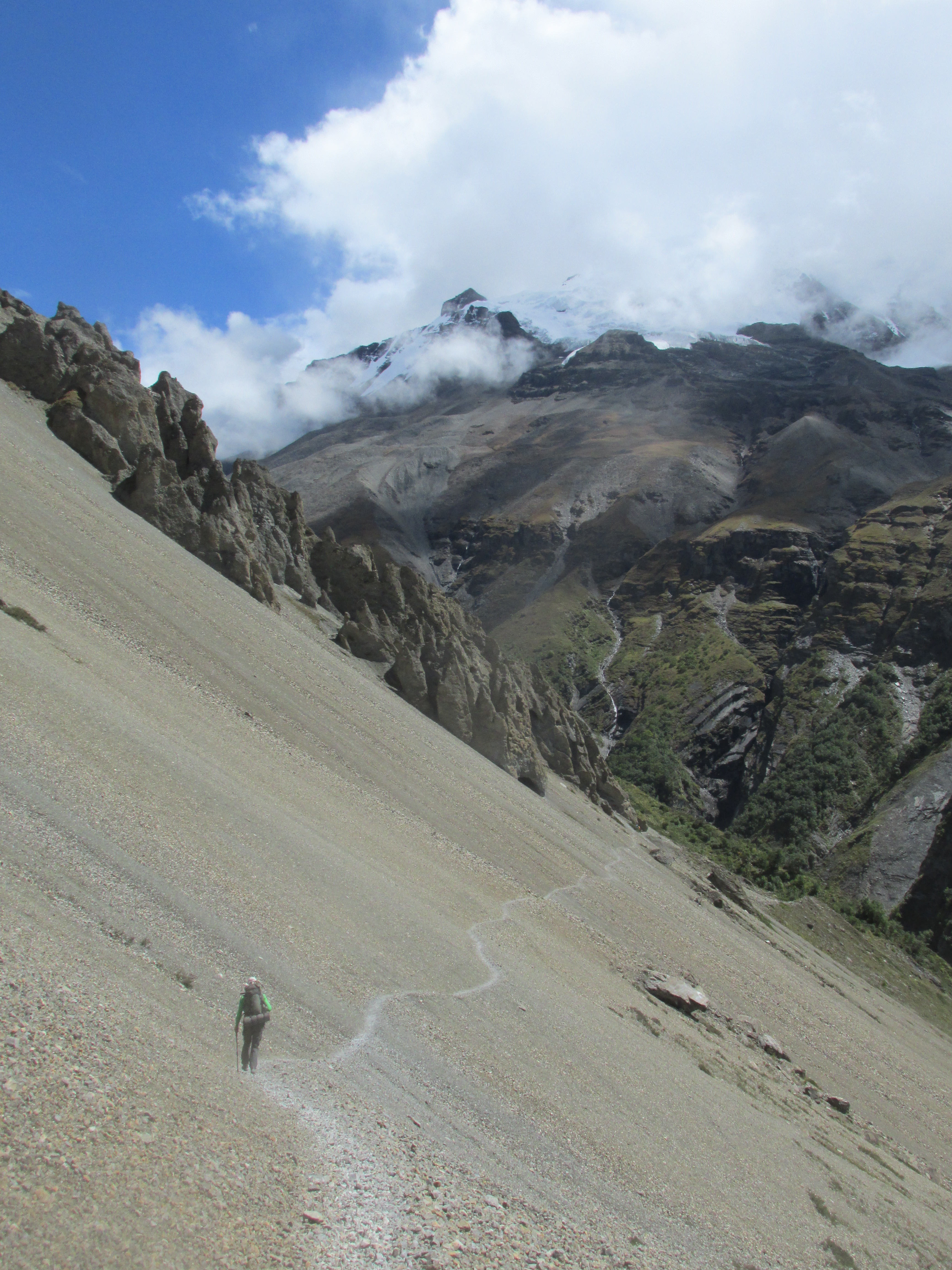
A long day all the way up to Tilicho lake. The first part of the way went over a small dirt track that turned into a trail after the last village. The weather was very reasonable and we had some nice views over the Annapurna massif with it’s many glaciers.
After having climbed Dhampus peak about a week earlier we had developed a taste for ascending some other easy trekking peaks. We had set our minds on climbing a peak somewhere north of the lake and therefore were keen on reaching the lake that same day. If the weather was in our favour we could climb early next morning.
In Tilicho base camp we took a long lunch break and chatted for a bit with a family of Chechs who I quikcly befriended. They were impressed by our trek and had some stories to tell themselves as well. Their father had been in Nepal many times before, but till now never had dared to attempt any off the beaten track routes. We exchanged a lot of information and experiences as well as our home contacts.
Late in the afternoon we continued our way up to the lake. We could now be ceratain we did not have to wait too long in front of our tent for the night to fall…
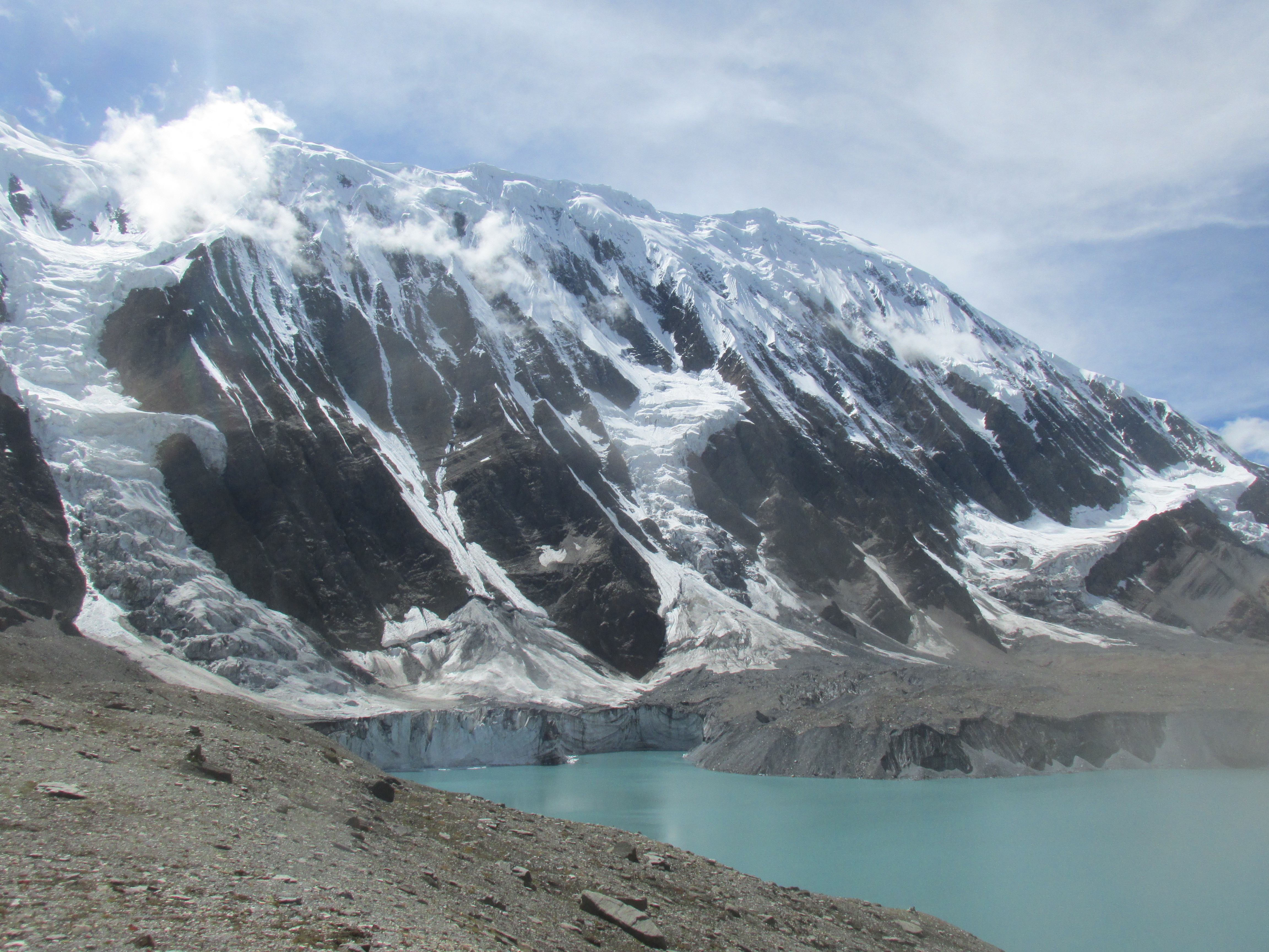
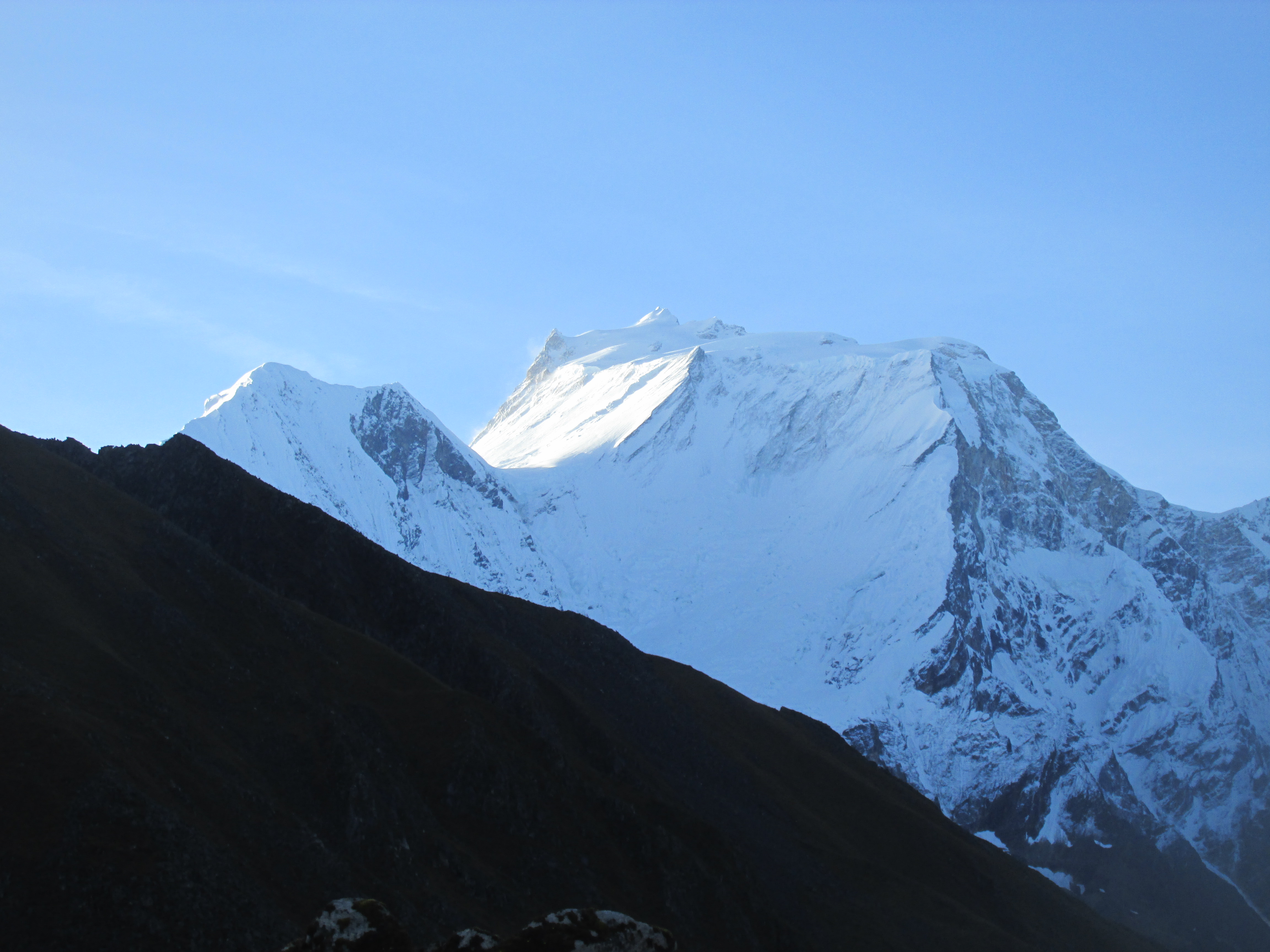
Tilicho lake was a rather impressive view and the glaciers to it’s south were highly active, you never needed to wait long for the next alarming sound. We made our photos and set up camp north of the lake nearby the mountain we would attempt to climb. The weather was instable, it was fifty fifty chance of us being able to climb the next day.
Day 4
Bummer, the weather sucked big time. We nevertheless started hiking in the direction of our peak. Clouds however kept roling in and withing 30 minutes we were retracing our steps through thick mist. It was just not meant to be. I was not sad, Dhampus peak had been an amazing climb already and I had over 40 days of 5 star trekking to look back on.
We hiked back in the way we came and arrived in our old lodge at around 3 pm. Lazy as we were we immediately started to hunt for a car that could take us to Chame the next day. From there on we could spent our last days of our trek hiking to Bimthang on the Manaslu circuit. By now I had spent enough time on this blody circuit to understand you should try to spent as much time as you could not on the circuit itself…
Day 5
No luck with the car… If we were serious on incorporating Bimthang in our trip we really needed to cheat with some motorized transport. We decided to set out on foot and try to hitch a ride whenever we had the chance. A solid plan.
We said goodby to the glacier around Manang and started to hike on high speed down the broad road downvalley. We waved to passing motorcycles to cheat little parts of the way. Dennis and I decided to split up and rendezvous in Chame in order to increase our chances of obtaining rides.
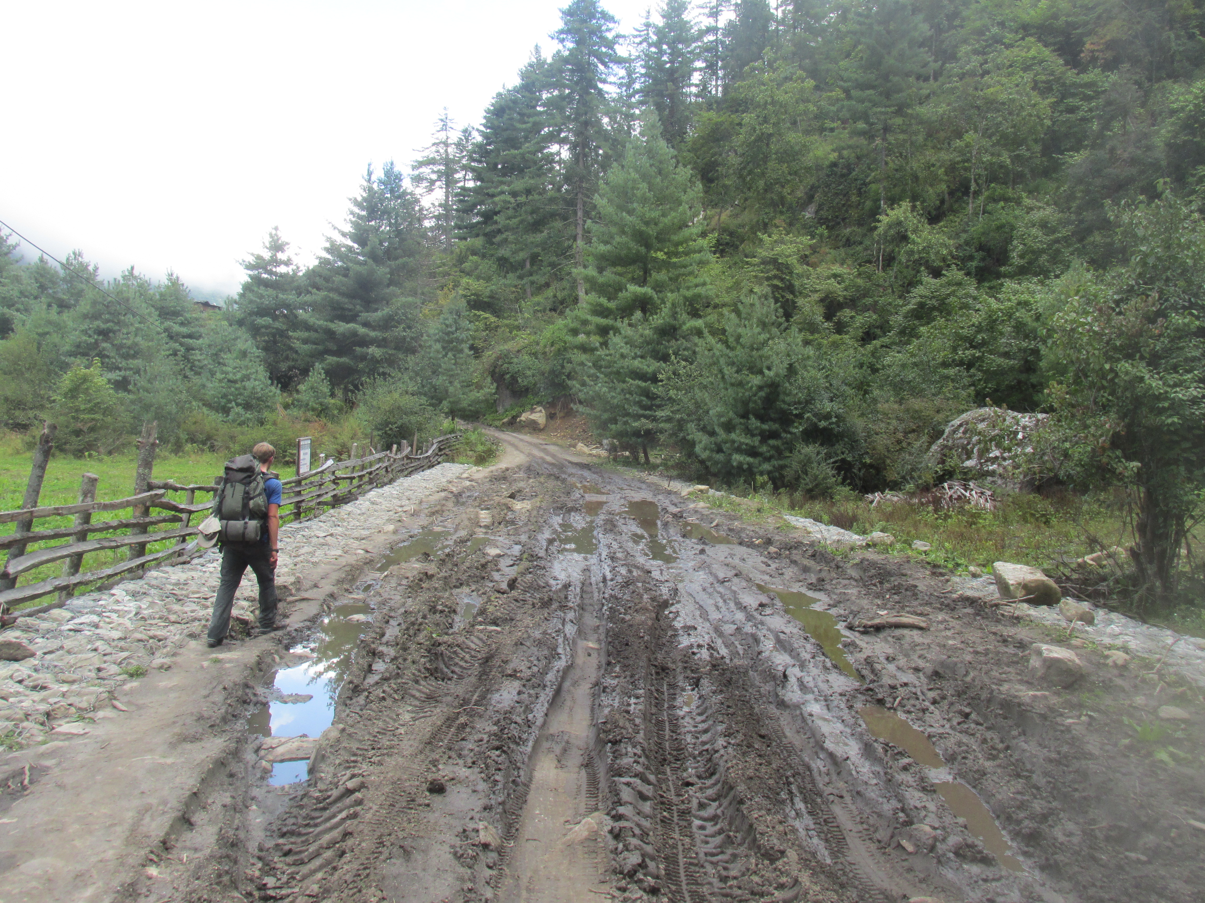
It was not needed not long after a jeep picked us both up and drove us all the way to Chame from where we hiked the last section to Koto. I did not regret our motorized cheat. The scenery was not all that great and the muddy road and ugly painted lodges really broke whatever mood was left.
Koto is a small village in this steep section of the valley and is surrounded by dense forest. We had a friendly chat with the school teacher who was so kind to pay for my tea. He however did not realize that his 5 rupees did not cover the tourist price leaving met with a 100 – 5 = 95 rupees bill. (Which is yes indeed exactly the amount that they charged me upon departure, hahaha)
We left our camping gear in Koto in order to travel light to Bimthang the next day. It was getting tight. We had to go up there tomorrow, return the next day and make sure we got back in Kathmandu that same night in order to catch our plane the day after. We could not suffer to many delays if we wanted to keep this tight itinerary. And that in a country notorious for unforeseen delays… We went regardlessly, I wanted to see the Manaslu. There did need something to make this trek worth our while.
Day 6
We left at 5 am and hiked without any breaks. It would be 1700 meters up and 16 kilometers birds flight. In other words a long day.
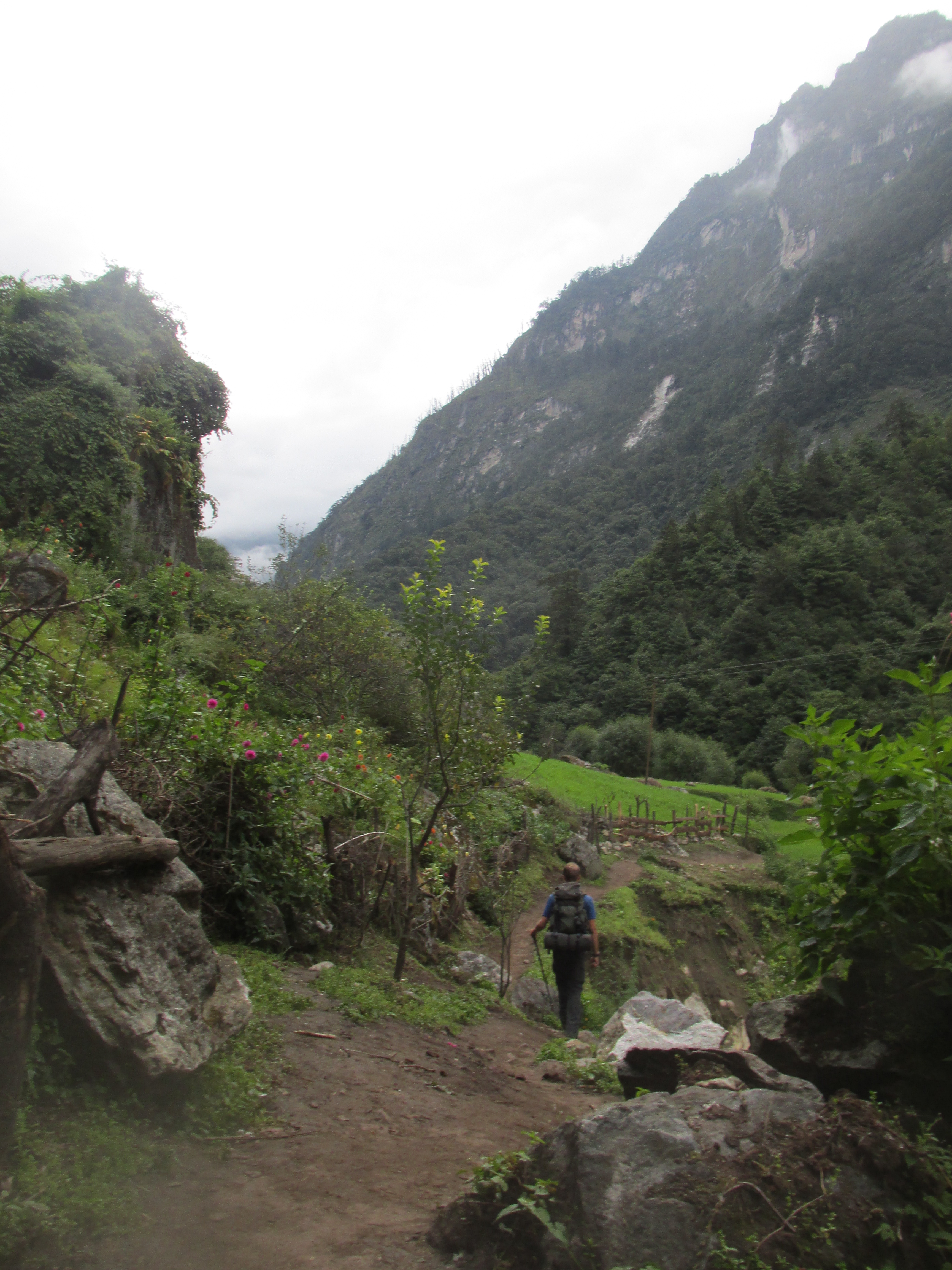
The first part of the way went through rather uninspiring forest and a bunch of larger settlements. Only just before Bimthang things started to get a bit more interesting.
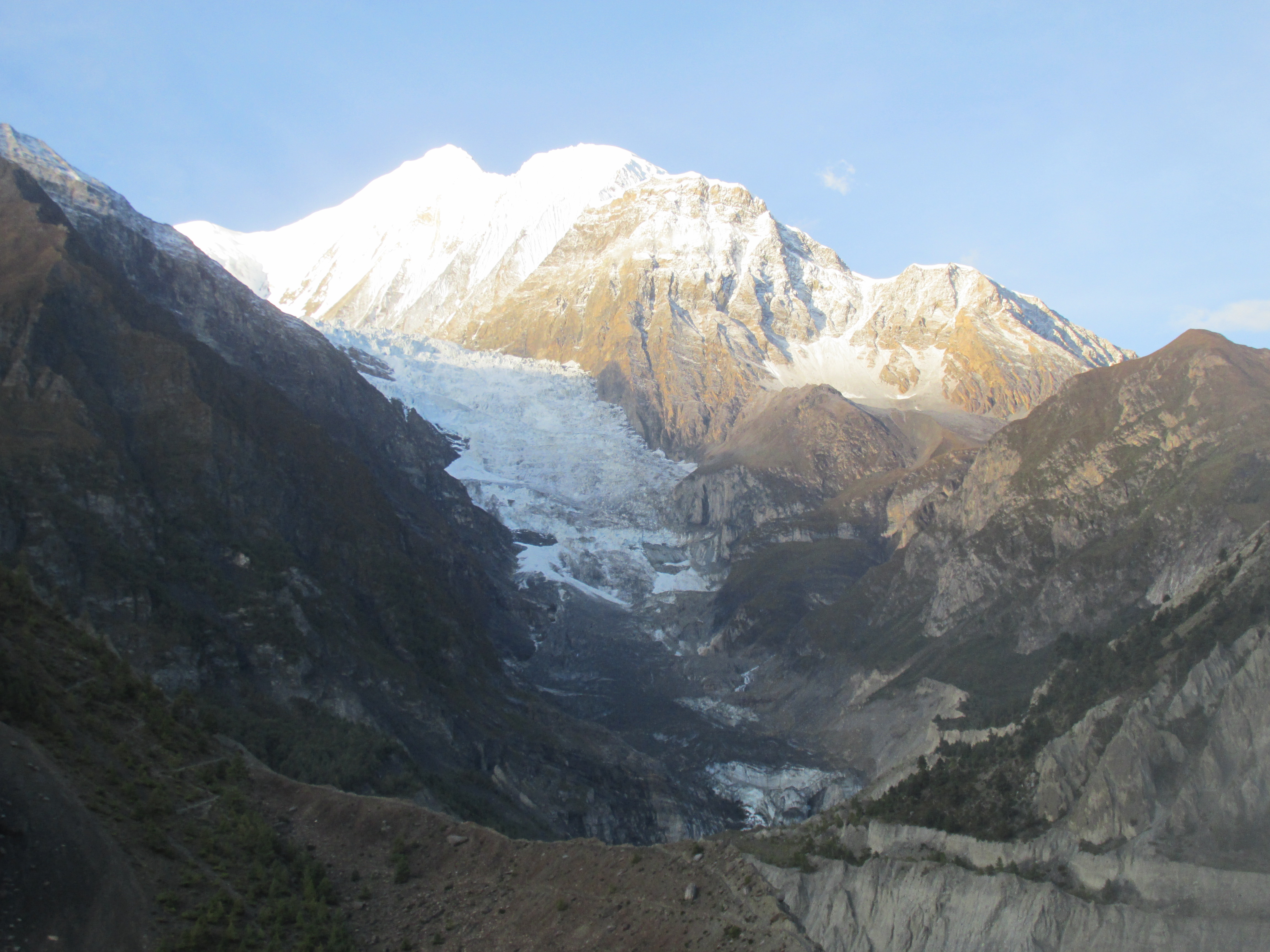
The weather was poor however and we could not see much of the mountains around. Sigh, did we come all this way just to gaze into the mist for 24hours? I went to bed in the hope that things would clear up while I was not looking. The trick worked, when I woke it was already dark, but the sky was crystal clear. The view towards Manaslu was amazing. This enormous flat topped mountain really dominated it’s surroundings. North of us there were many lower but very rough and sharp peaks that we could admire. If the weather would cooperate for a change we would could hike to Ponkar tal and enjoy the view from there tomorrow.
Day 7
Well what do you know. The weather did not suck. We knew how quick thing could deteriorate and immediately went on our way to Ponkar lake. Great I could get my pictures of the Manaslu range! It had been worth the effort. Not only the Manaslu massif south of us but also the wild mountains rising up behind the Bimthang glacier north of us made it all worth our while.
After having soaked in the scenery from Ponkar lake we returned to Bimthang where we ate breakfast.
In contrast to tradition the weather did not cloud up and the sun still shone when we strated hiking back. We kept seeing the snowy peak through the trees as we slowly descended through the forests. This was the ideal farewell.
Further down the feeling of high altitude quickly vanished. It became hot and misty again. We stayed over in the same lodge where we had left our stuff. Tomorrow we would find a jeep and drive back to Bhulbhule. This all went far from effortless. The strikes due to the new constitution were still going on and delayed for twelve hours, we caught our flight with ease however.
